Toronto's waterfront stretches along the northern shore of Lake Ontario, forming a broad public corridor of parks, cultural venues, cycling trails, and redeveloped public spaces between Dowling Avenue in the west and Coxwell Avenue in the east. It is one of North America’s largest ongoing urban waterfront revitalization projects, and the most accessible stretch of the city for first-time visitors arriving via Union Station.
Toronto's waterfront is the city's front porch on Lake Ontario, a place where the dense downtown grid opens up into wide sky, public plazas, and the slow movement of lake freighters on the horizon. It rewards slow walking, rewards coming back at different times of day, and connects more of the city than its compact footprint suggests.
Orientation
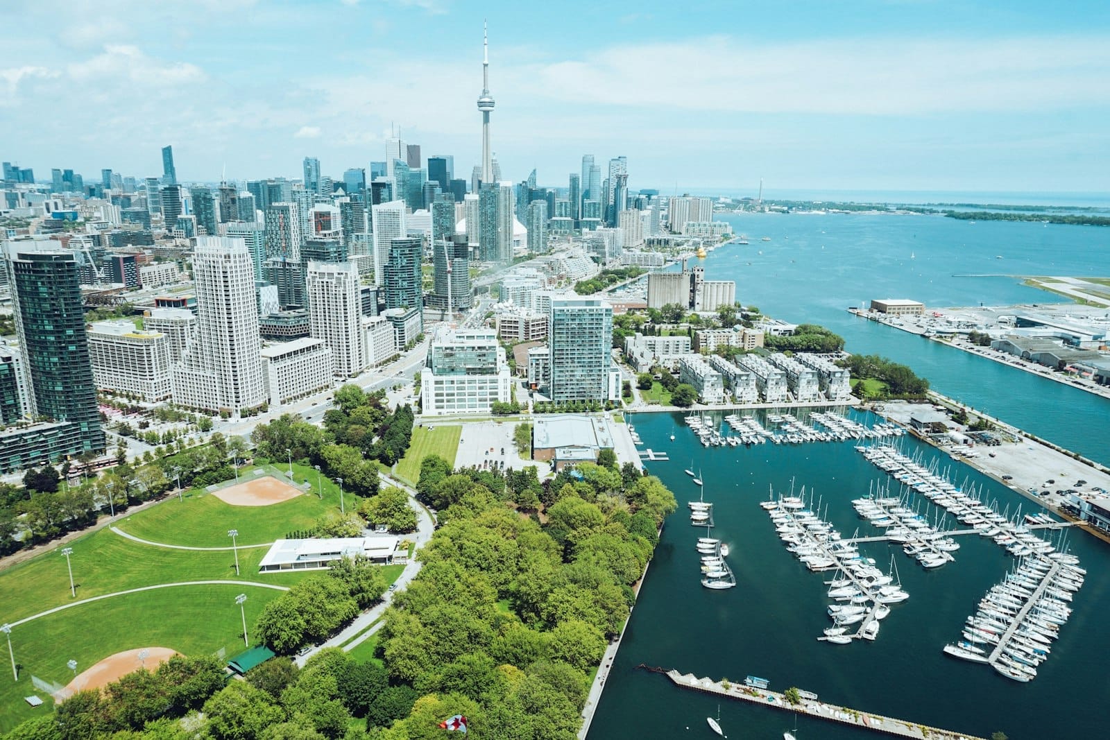
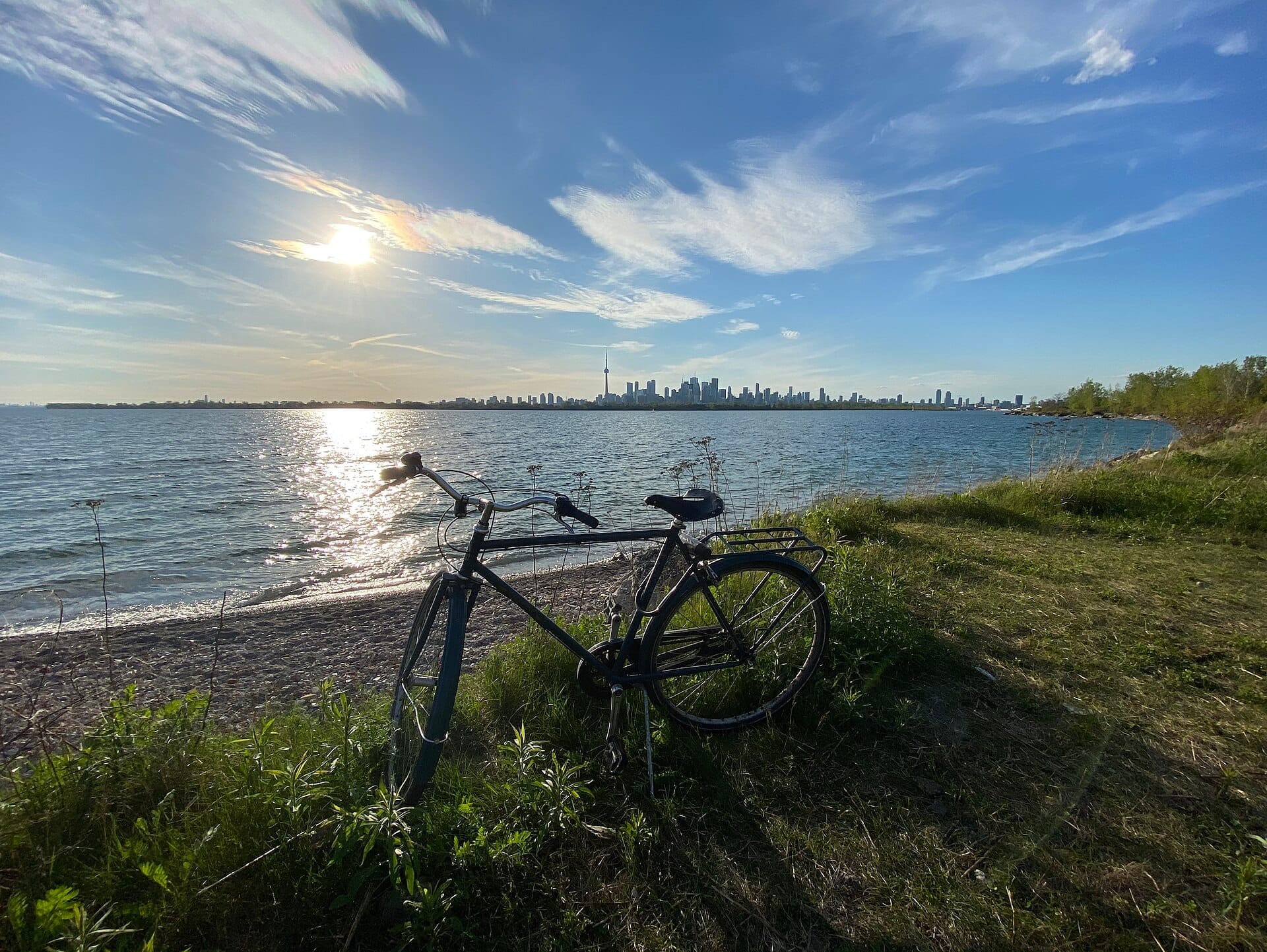
The Toronto waterfront runs along the northwestern shore of Lake Ontario, the same Great Lake that defines the southern edge of Toronto. In practical terms, the central waterfront corridor extends from Exhibition Place in the west to Parliament Street in the east, with Lake Ontario forming the southern boundary and the elevated rail corridor (along Front Street and the Gardiner Expressway) forming the northern edge. Waterfront Toronto, the tri-government agency overseeing revitalization, defines the broader project area as approximately 800 hectares across this shoreline.
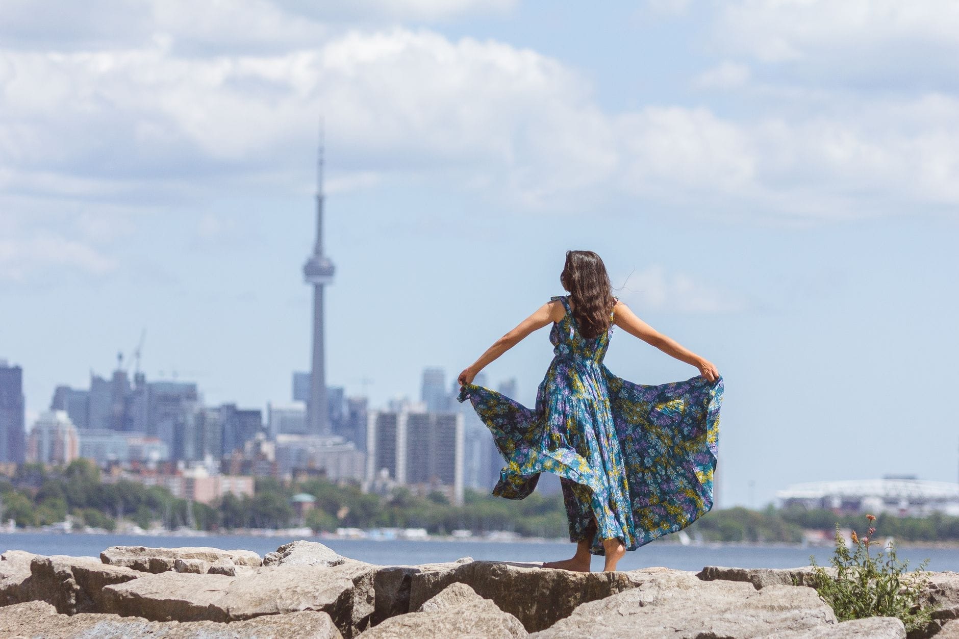
The neighborhood most visitors associate with the waterfront is Harbourfront, which sits directly south of the Financial District and is reachable on foot from Union Station in about 10 to 15 minutes walking due south on Bay Street or Rees Street. The CN Tower and Rogers Centre stand as hard-to-miss vertical markers at the western edge of the core, anchoring what becomes a continuous public realm when you walk south from them toward the lake. Further west, Ontario Place and Exhibition Place sit at the edge of the waterfront's built fabric, while the eastern end near Parliament Street transitions toward the Distillery District and Corktown Common.
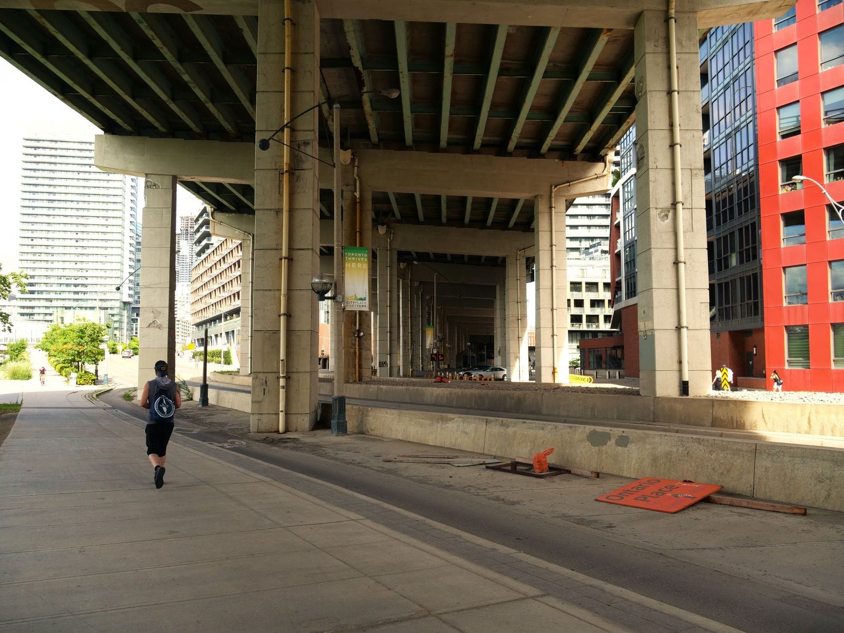
One geographic reality that catches first-time visitors off guard: Toronto's waterfront does not feel like a beachfront city at street level, partly because the Gardiner Expressway elevated highway creates a physical and visual break between downtown and the lake. Once you cross under it and reach Queens Quay West, the atmosphere shifts dramatically. The water is visible, the streets widen, and the scale of Harbourfront Centre and the surrounding public spaces becomes clear. Understanding this transition helps you plan your approach.
Character & Atmosphere
Mornings on the waterfront are quiet by downtown standards. By 7am, the Martin Goodman Trail is already carrying a steady stream of cyclists and joggers moving in both directions along the lake. The light off the water at this hour is sharp and flat, giving Sugar Beach and the Sherbourne Common a clean, almost empty quality. The smell is genuinely lakefront: water, faint traces of diesel from the ferry terminals, occasionally fresh fish when the wind comes off the water. This is when the waterfront feels most like a working port city rather than a leisure zone.
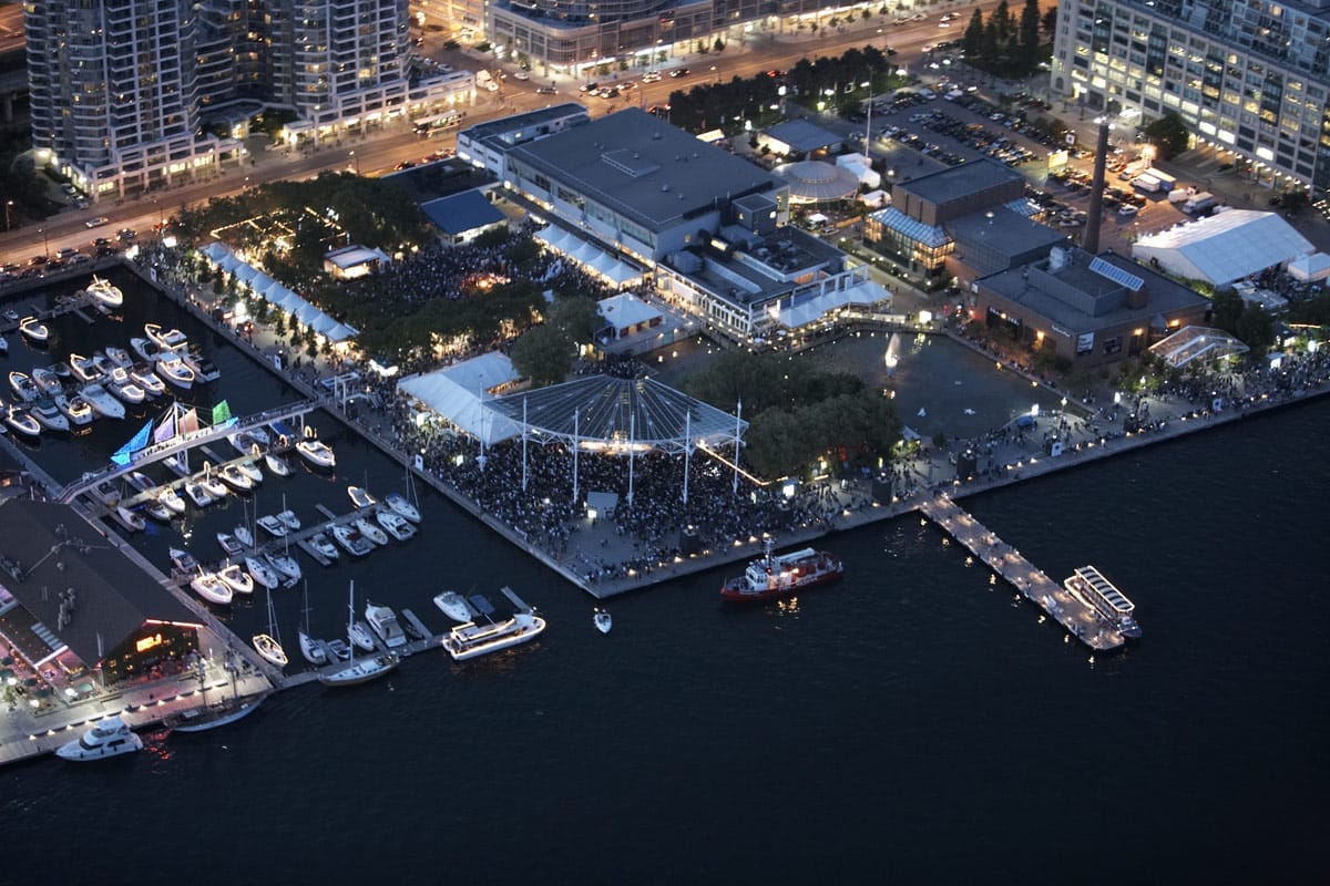
By midday in summer, the tone shifts entirely. The ferry docks at the foot of Bay Street fill with lines of visitors heading to the Toronto Islands. Queens Quay West sees pedestrian traffic that rivals some stretches of Yonge Street. The outdoor spaces at Harbourfront Centre host programming, vendors, and in peak season, a level of foot traffic that makes moving quickly difficult and makes sitting on a bench and watching people far more rewarding. The pink granite boulders at Sugar Beach become a landmark in their own right, occupied by people eating lunch from nearby takeout spots.
After dark, the waterfront has a different texture depending on which section you're in. The area immediately around Harbourfront Centre stays animated on summer evenings when there are performances or events. The stretch toward the western end near Ontario Place gets quieter and darker, and while it is not unsafe, it is also not the kind of nighttime scene that generates its own energy. Visitors looking for bars and late-night activity would be better served heading north into the Entertainment District along King Street West, then returning to the waterfront in daylight.
ℹ️ Good to know
The waterfront changes character dramatically by season. In winter, Queens Quay and the outdoor plazas are often quieter, and some outdoor venues close. The upside is that indoor attractions like Harbourfront Centre's galleries and performance spaces remain open, and the views across the frozen or slushy lake have their own appeal. In summer, particularly July and August, the area near the ferry docks can be genuinely crowded on weekends.
What to See & Do
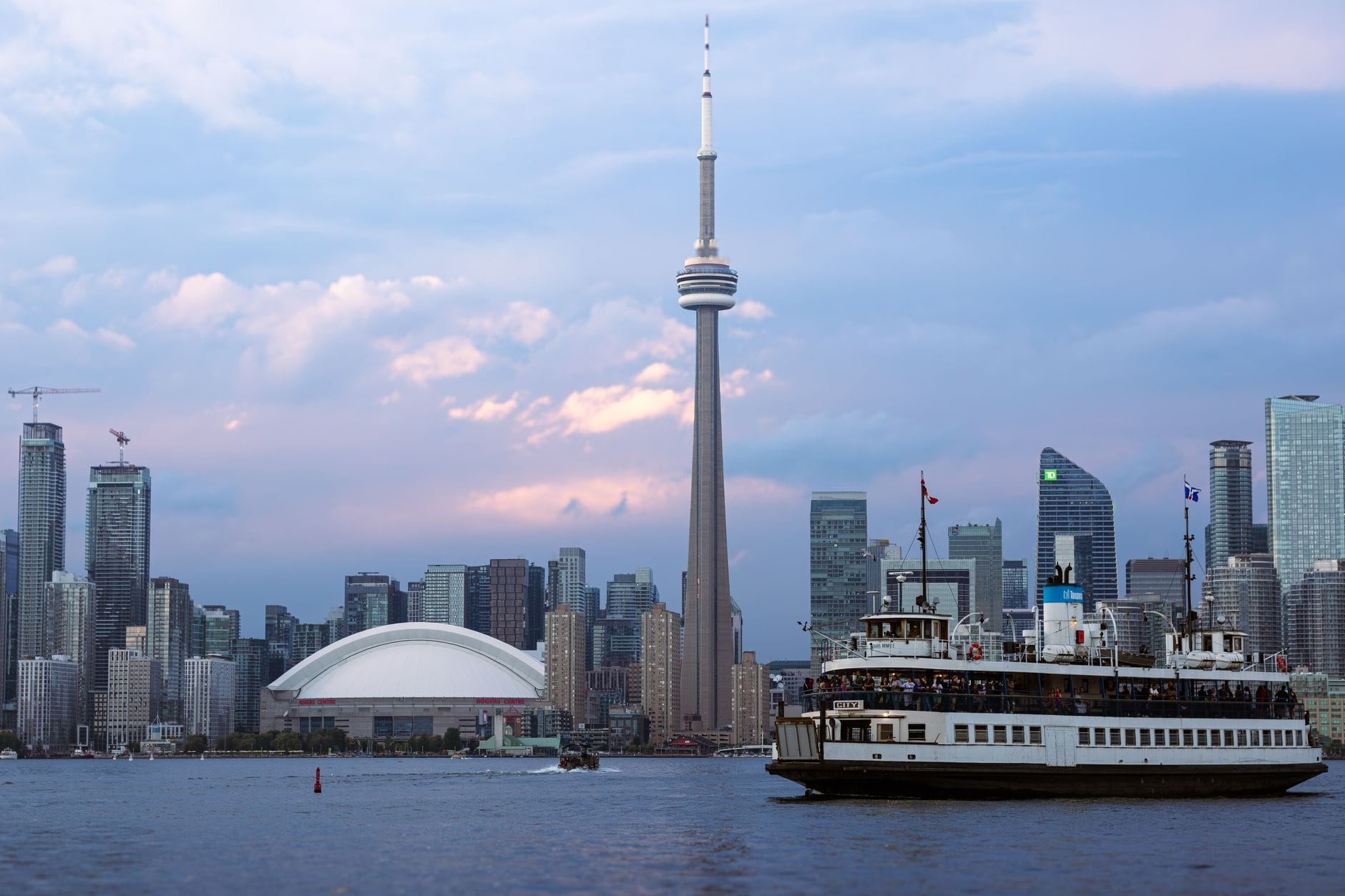
The single most-used function of the waterfront for visitors is as the departure point for the Toronto Islands ferry. The Jack Layton Ferry Terminal sits at the foot of Bay Street, and ferries run to Centre Island, Ward's Island, and Hanlan's Point. The crossing takes about 15 minutes and gives you a view of the downtown skyline from the water that no rooftop observation deck can replicate. If visiting in summer, book or arrive early: the ferry queues on warm weekend afternoons can mean a wait of 30 to 45 minutes.
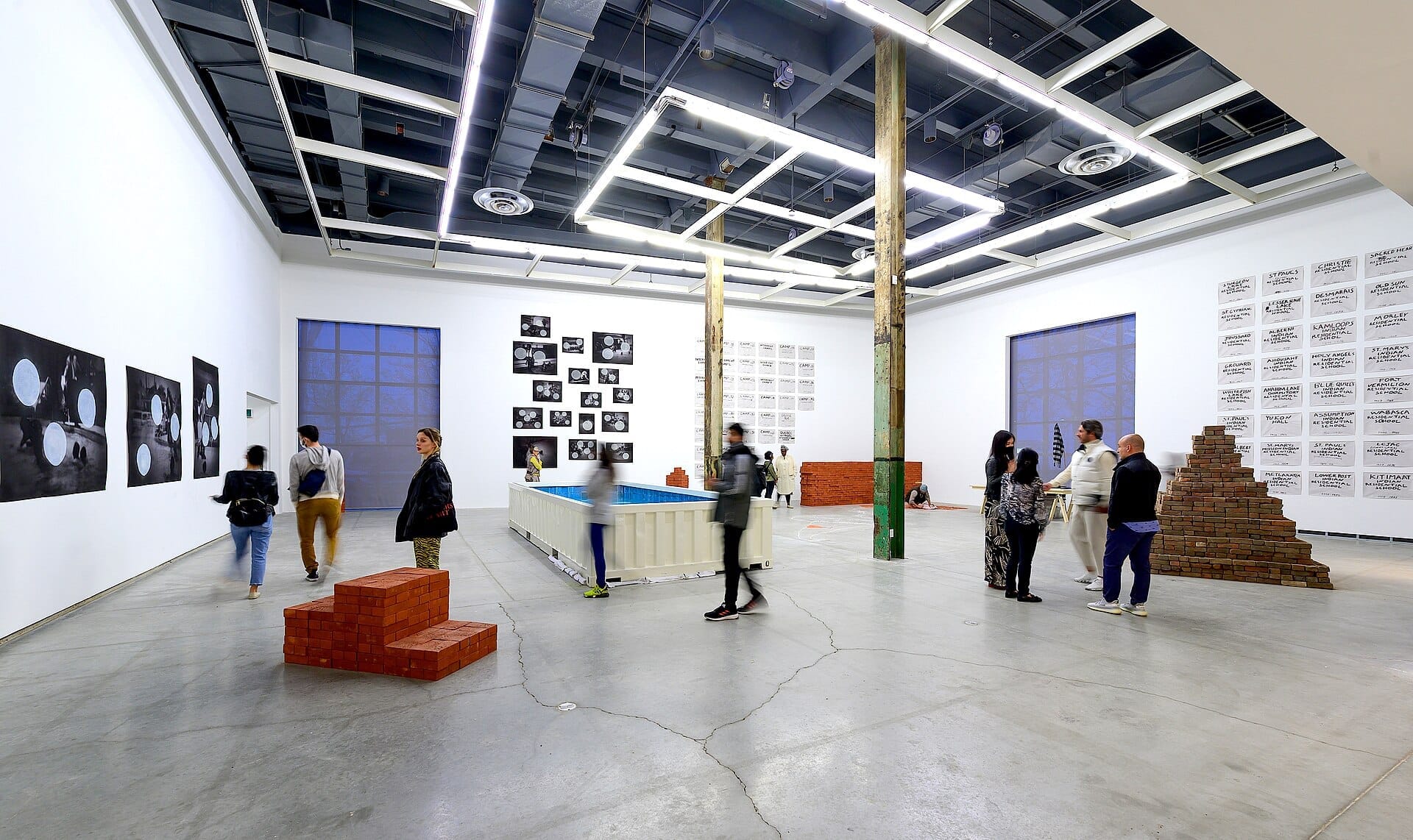
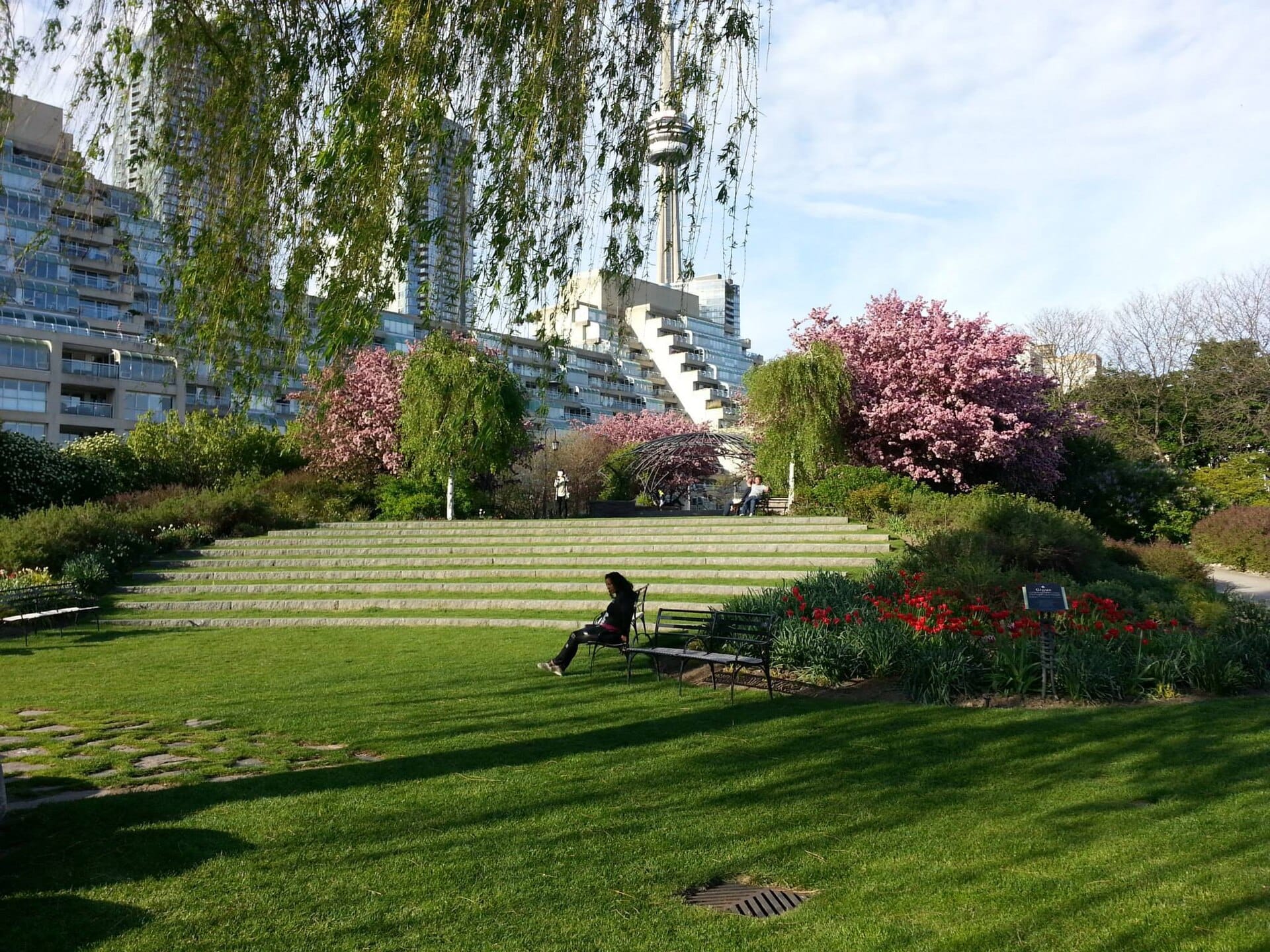
Harbourfront Centre is the cultural anchor of the neighborhood, running year-round programming that includes visual arts exhibitions, literary events, craft markets, and outdoor concerts from its waterside campus on Queens Quay West. The Power Plant Contemporary Art Gallery, located within the Harbourfront Centre complex, is one of Canada's leading public galleries for contemporary art. Admission to The Power Plant is free on select days and draws serious art audiences from across the city.
Walking west along Queens Quay, the Martin Goodman Trail provides continuous cycling and walking access along the waterfront for roughly 56 kilometres across the city. On the waterfront itself, the paved trail is well-maintained and wide enough to accommodate both cyclists and pedestrians without much conflict, though peak summer weekends push that tolerance. Rental bikes and e-bikes are available near the Harbourfront Centre area.
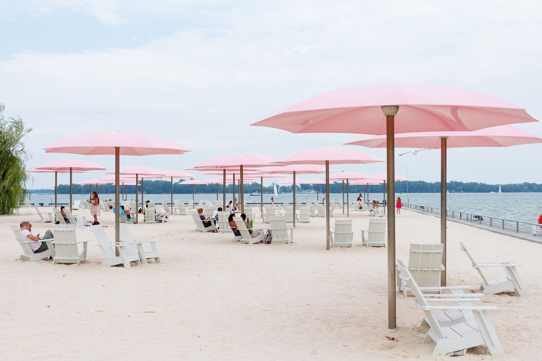
For a broader sense of Toronto's waterfront at scale, Toronto harbour boat cruises depart from various points along Queens Quay and offer views of the skyline, the islands, and the industrial port to the east. The CN Tower is visible from nearly every point on the waterfront and remains the easiest orientation marker in the city. Just north of the lake, Sugar Beach is a small urban beach park with sand, Muskoka chairs, and a popular wading area for children, sitting directly across from the old Redpath Sugar Refinery, which gives the park its name.
Jack Layton Ferry Terminal (Bay Street at Queens Quay): ferries to the Toronto Islands
The Power Plant Contemporary Art Gallery: serious contemporary art in an industrial heritage building
Martin Goodman Trail: lakefront cycling and walking route
Sugar Beach: small urban beach park with sand and Muskoka chairs
Toronto Harbour boat cruises: skyline and island views from the water
The Bentway: linear public arts and events space under the Gardiner Expressway at Fort York
One overlooked draw is The Bentway, a public space that runs beneath the Gardiner Expressway near Fort York Boulevard. It hosts an outdoor skating trail in winter and a varied program of markets, performances, and film screenings in warmer months. It is not the most obvious destination, but it is a genuinely creative use of infrastructure that says something real about how the city is rethinking its waterfront edge.
Eating & Drinking
The food scene directly on the waterfront is functional more than exceptional. Queens Quay West has a cluster of restaurants, cafes, and takeout spots aimed at the tourist and office-lunch crowd. Prices are generally mid-range to high, and the quality is inconsistent. That said, there are reliable options for waterside dining, particularly at the Harbourfront Centre complex, where a cafe overlooks the water and the outdoor terrace is one of the better places in the city to eat with a lake view.
For a better range of food options, walk 10 minutes north to the St. Lawrence Market, which operates on the eastern edge of the Old Town neighborhood. The North Market building runs a weekend farmers market, and the South Market has two floors of food vendors including charcuterie, cheese, produce, baked goods, and prepared foods. This is where local Torontonians shop and eat on weekend mornings, and the peameal bacon sandwich is the closest thing the city has to an iconic street food.
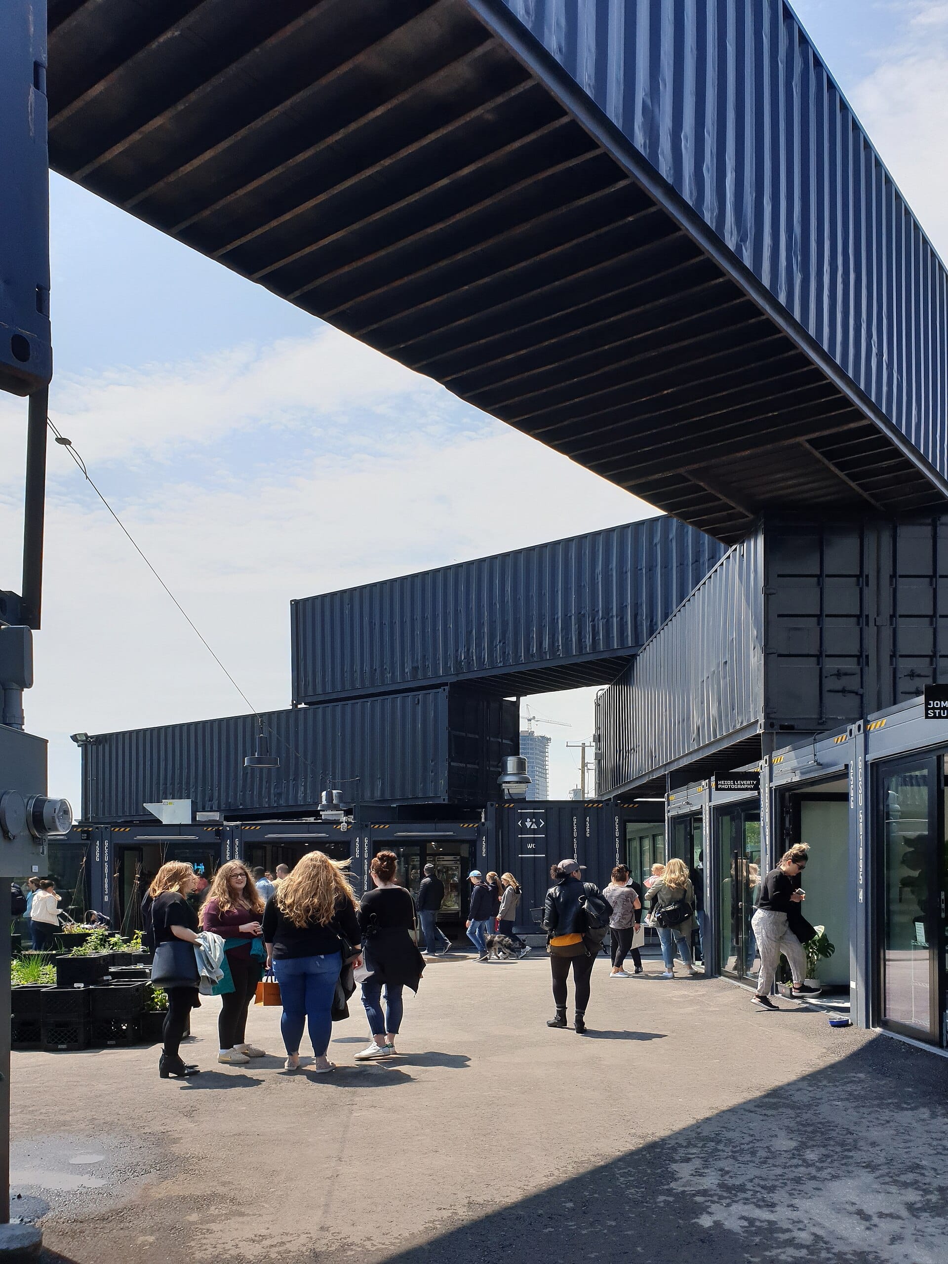
The Stackt Market on Bathurst Street, a short walk or streetcar ride west of Harbourfront, occupies a shipping container market format and has rotating food and drink vendors alongside retail. It skews younger and more casual than the established waterfront dining options and is worth knowing about if you're moving west along the waterfront toward Bathurst.
💡 Local tip
If you are visiting the waterfront in summer and want to eat on the water, consider picking up food from St. Lawrence Market or a nearby cafe and bringing it to the Adirondack chairs at Sugar Beach or the public lawns at Harbourfront Centre. This is a common local strategy and significantly better value than the tourist-facing restaurant strip on Queens Quay.
Getting There & Around
The most direct transit connection to the waterfront is from Union Station, which sits about 10 to 15 minutes on foot from the lake. Union Station is served by the TTC subway (Lines 1 and 2), GO Transit regional rail, and the UP Express airport rail link to Pearson International Airport. From Union Station, walk south on Bay Street, cross under the Gardiner Expressway, and you arrive at Queens Quay West and the central waterfront.
The TTC's 509 and 510 streetcar routes run along Queens Quay West, connecting the Harbourfront area to Union Station and continuing west toward Exhibition Place. The 511 Bathurst streetcar provides a north-south connection at the western end of the waterfront. Streetcar stops are at street level and clearly signed. PRESTO cards, the regional transit payment card, can be loaded and tapped at all TTC stops. Single-ride fares can be paid with cash on buses (exact change) or by PRESTO tap.
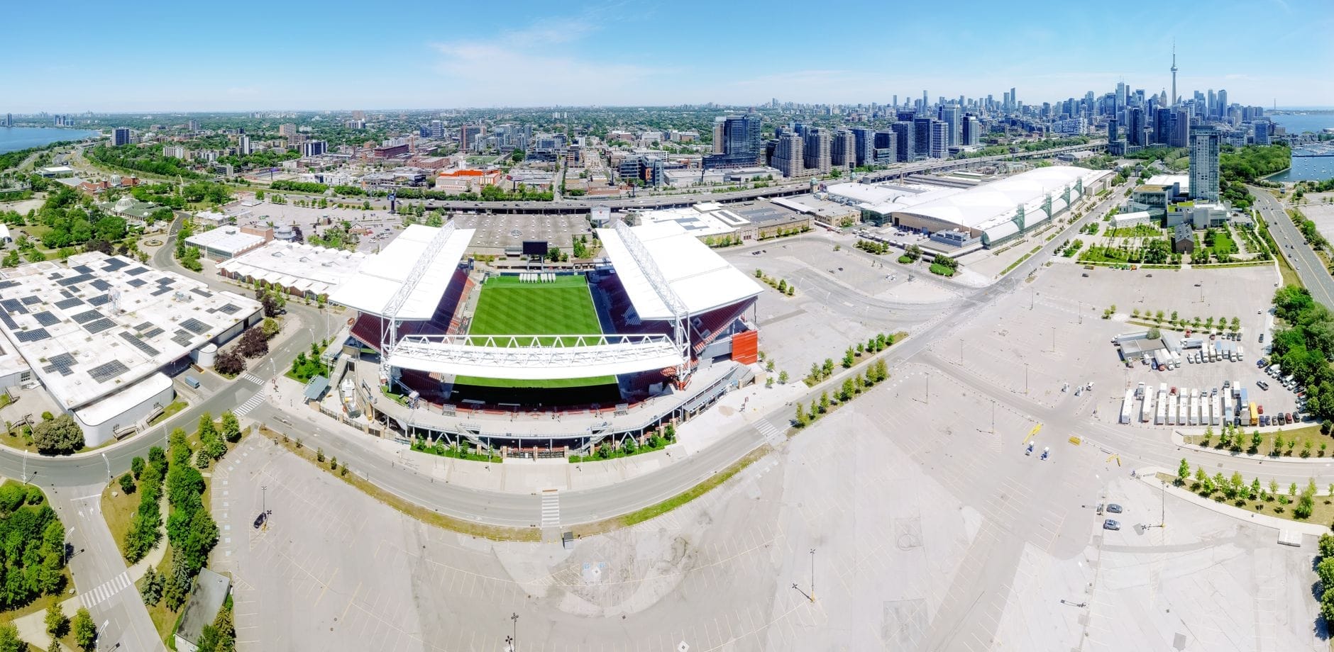
Cycling is a genuinely practical option along the waterfront itself. The Martin Goodman Trail provides separated cycling from the vehicular traffic on Lake Shore Boulevard West, and bike rental services operate near Harbourfront Centre in summer months. Ride-hailing services including Uber and Lyft operate throughout Toronto and can be useful for reaching parts of the waterfront that are further from subway access, such as the Exhibition Place end. Note that during major events at Scotiabank Arena or Rogers Centre, which sit just north of the waterfront, vehicle traffic on Lake Shore Boulevard can be very slow.
⚠️ What to skip
The Gardiner Expressway creates a significant pedestrian barrier between the downtown core and the waterfront. There are designated crossings, but jaywalking is common and the on-ramps and off-ramps create traffic conflict points. Use marked pedestrian crossings, particularly when traveling with children.
Where to Stay
There are hotels directly on or adjacent to the waterfront, particularly along Queens Quay West and on the western edge near Rees Street. These tend to be mid-range to upscale in price point, and they offer lake views that justify the premium in warmer months. The tradeoff is that this part of the city is relatively quiet at night and somewhat isolated from the restaurant and bar density of King Street West or Queen Street West.
For most visitors, staying slightly north of the waterfront in the Financial District, near Union Station, or in the Entertainment District provides better transit access and more nighttime activity within walking distance, while still keeping the waterfront as a 10 to 15 minute walk. The full guide to where to stay in Toronto breaks down all major neighborhoods by traveler type and budget.
Families with young children may find waterfront hotels particularly convenient, as Sugar Beach, the ferry terminal, and the outdoor spaces at Harbourfront Centre are all easily walkable without navigating busy intersections. For couples or solo travelers focused on food, nightlife, or arts, staying on the waterfront itself is less efficient than a more central base.
Practical Notes
The waterfront is at its best from late May through early October. The outdoor programming at Harbourfront Centre, ferry services to the islands, bike rentals, and the beach parks all operate seasonally. In winter, the outdoor rink at Harbourfront Centre and the skating trail at The Bentway offer reasons to visit even in cold weather. For guidance on timing, see the best time to visit Toronto and the Toronto in summer guide for seasonal specifics.
The waterfront is one of the more accessible parts of the city in terms of physical terrain: it is flat, paved, and well-signed. The main sensory challenge in summer is wind off the lake, which can make the exposed plazas feel cooler than the surrounding city on days when it's already mild. Bring a layer. For longer explorations of Toronto's lakefront beyond the central waterfront, the complete Toronto waterfront guide covers the full extent of the lakeshore including eastern beaches and the western trail system.
TL;DR
The Toronto waterfront runs along Lake Ontario from Exhibition Place in the west to Parliament Street in the east, with Harbourfront Centre as its cultural and social anchor.
Best visited from late May through early October when outdoor programming, ferry services, bike rentals, and beach parks are operating.
Union Station is the main transit hub, with the waterfront a 10-15 minute walk south; TTC streetcars on Queens Quay West provide direct waterfront access.
Ideal for families, cyclists, island-day-trippers, and anyone wanting lake views; less suited to travelers whose priority is nightlife or a wide range of restaurants within walking distance.
Honest caveat: the Gardiner Expressway creates a physical barrier that makes the waterfront feel more separate from downtown than the map distance suggests — plan your route on foot before you arrive.
Three days is enough time to cover the best of Toronto's downtown core, historic districts, waterfront, and cultural institutions — if you plan smartly. This itinerary is built around the TTC subway and streetcar network, so you never need a rental car. Expect a mix of landmark sights, neighbourhood wandering, and genuine local texture.
Toronto punches well above its weight for museum culture. Whether you're drawn to ancient civilisations, contemporary art, or the history of hockey, this guide covers the best museums in Toronto across every interest and budget.
Toronto has over 1,500 parks and more than 8,000 hectares of green space, from sweeping urban forests and lakefront trails to formal gardens and island beaches. This guide covers the best of them, organised by type and neighbourhood, so you can find exactly the kind of outdoor escape you're looking for.
Toronto has four genuinely distinct seasons, and the best time to visit depends entirely on what you want from the trip. This guide breaks down weather, crowds, pricing, and events month by month so you can make an informed decision.
Toronto's skyline is one of the most dramatic in North America, dominated by the CN Tower and framed by Lake Ontario. This guide covers the best vantage points in the city, from high-rise observation decks and waterfront parks to island ferry crossings and hilltop lookouts.
Toronto sits at the centre of one of Canada's richest regions for day-tripping. Within two hours in any direction you'll find roaring waterfalls, wine country, historic theatre towns, wilderness beaches, and mountain resorts. This guide covers the top day trips from Toronto, with practical details on how to get there and what to do once you arrive.
Toronto is a surprisingly generous city for budget travellers. From free museum evenings and sprawling parks to street art laneways and historic neighbourhoods, here are the best free things to do in Toronto across every season.
Toronto's transit network spans the TTC subway, streetcars, GO Transit regional rail, the UP Express airport link, ferries, and bike share. This guide breaks down every option with fares, routes, timings, and practical advice on what actually works for visitors.
Toronto is one of the safest major cities in North America, but that doesn't mean risk-free. This guide breaks down real crime patterns, which areas to be aware of, seasonal hazards, and the practical precautions that actually make a difference for visitors.
Toronto sits on the northwestern shore of Lake Ontario, the easternmost and smallest of the Great Lakes by surface area. From the Toronto Islands and the Martin Goodman Trail to the towering Scarborough Bluffs, this guide covers every major way to experience the lake — with seasonal advice, transit details, and honest assessments of what's worth your time.
Toronto is Canada's largest city and one of North America's most genuinely diverse destinations. This guide covers the best things to do in Toronto across every budget, season, and interest — with honest assessments, current prices, and practical logistics.
Five days in Toronto is enough time to cover the iconic landmarks, dig into the city's diverse neighbourhoods, and still squeeze in a day trip to Niagara Falls. This itinerary is structured for efficiency without sacrificing depth, whether you're arriving at Pearson Airport or Billy Bishop.
Everything you need to navigate Toronto Pearson International Airport (YYZ), from terminal layouts and airside connections to the fastest and cheapest ways into downtown Toronto. Covers the UP Express, taxis, ride-hailing, public transit, and key practical details for first-timers and connecting passengers.
Toronto's skyline tells a 200-year story in brick, glass, and concrete. This guide covers the city's most architecturally significant buildings across every era, from Victorian flatirons and Beaux-Arts civic halls to Gehry-designed galleries and record-breaking towers, with practical visiting tips for each.
Toronto Caribbean Carnival, still widely known as Caribana, draws over a million visitors to the city each summer for more than a week of soca music, steelpan competitions, costumed masquerade, and street food. This guide covers everything: dates, the Grand Parade route, ticket prices, what to skip, and how to plan your visit like someone who has been before.
Toronto's sakura season is spectacular but brutally short. This guide covers the exact bloom window, the best viewing locations beyond High Park, how to get there without a car, and what the City's official trackers actually tell you in real time.
Toronto's food scene is one of North America's most diverse, shaped by over 200 ethnic communities and anchored by legendary markets, neighbourhood food districts, and a Michelin Guide earned in 2022. This guide breaks down what to eat, where to eat it, and how to navigate the city's culinary landscape like a local.
Toronto's food market scene ranges from a historic 200-year-old market hall to shipping-container villages and neighbourhood farmers' markets. This guide covers the best places to browse, graze, and stock up across the city.
Toronto delivers a surprising range of romantic experiences, from skyline dining and waterfront ferry rides to candlelit heritage districts and world-class performing arts. This guide breaks down the best date ideas by season, budget, and vibe, with honest assessments of what's worth the effort.
Summer turns Toronto into one of North America's most active outdoor cities. From June jazz on Bloor Street to Caribbean Carnival floats and lakefront beaches with lifeguards on duty until Labour Day, this guide covers every major event, the best swimming spots, and the practical logistics to make the most of the season.
Toronto winters are cold, but the city leans into the season rather than shutting down. From free outdoor skating rinks under the Gardiner Expressway to the glittering Distillery District Christmas Market, this guide covers every practical detail you need to enjoy Toronto from late November through March.
The Toronto International Film Festival is one of the world's most accessible and influential film events, open to the public every September. This guide covers dates, ticket prices, venues, logistics, and how to get the most out of your visit.
The Toronto Islands are a chain of 15 car-free islands just a short ferry ride from downtown, offering beaches, cycling trails, skyline views, and a rare slice of calm in the middle of a major city. This guide covers ferry logistics, the best spots on each island, seasonal realities, and the common mistakes first-time visitors make.
Toronto's upscale travel scene goes well beyond five-star hotels. This guide covers the best luxury hotels in downtown Toronto and Yorkville, premium dining, exclusive experiences, and practical logistics for high-end visitors to Canada's largest city.
Toronto is one of the most diverse cities in the world, with roughly half its population born outside Canada. This guide covers the key ethnic districts, what makes each distinct, how to get there, and what to prioritize on a visit.
Niagara Falls sits about 136 km from downtown Toronto, making it the most popular day trip from the city. This guide covers every transport option, realistic costs, seasonal timing advice, and practical tips on what is worth your time once you arrive.
Toronto nightlife runs deeper than most visitors expect. From the dense bar corridor along King West to indie live music rooms on Queen West and all-night clubs in the Entertainment District, this guide breaks down where to go, what to spend, and how to plan your night like a local.
Nuit Blanche Toronto is a free, city-run all-night contemporary art festival that transforms public spaces across Toronto from dusk to dawn each October. This guide covers the event's history, logistics, what to expect on the night, and how to make the most of 12 hours of outdoor art.
Toronto is Canada's largest city and one of North America's most expensive destinations — but with the right approach, you can experience it without draining your wallet. This guide covers free attractions, affordable transit, budget eats, and the smartest times to visit to keep costs low.
Toronto's PATH is the world's largest underground pedestrian network, stretching more than 30 km through the heart of downtown. This guide covers how to navigate it without getting lost, which routes to use, when it's open, and what to realistically expect from the experience.
Toronto's ravine system is one of the largest urban greenspace networks in North America, threading through neighbourhoods most visitors never see. This guide covers the best trails, how to reach them by transit, what conditions to expect by season, and how to string routes together for a full day outdoors.
Toronto's shopping scene spans luxury boutiques in Yorkville, 230-plus retailers at the Eaton Centre, historic indoor markets, and independent street strips that reward slow browsing. This guide breaks down every major option by category, with transit directions, honest assessments, and seasonal tips.
Toronto is one of North America's most practical cities for solo travel, with an extensive transit network, walkable districts, and a concentration of world-class attractions in the downtown core. This guide covers everything from airport arrivals and neighbourhood logistics to safety realities and the best solo-friendly experiences across Canada's largest city.
Toronto rewards walkers. From the Victorian laneways of the Distillery District to the lakefront trail and Kensington Market's chaotic grid, the city's best stories are told on foot. This guide covers the top guided walking tours, free tip-based options, City-published self-guided routes, and the neighbourhoods worth exploring on your own schedule.
Toronto's waterfront runs approximately 37 kilometres along Lake Ontario, from Etobicoke in the west to the Rouge River in the east. This guide covers the best things to do, how to get around, seasonal conditions, and which parts of the lakeshore are actually worth your time.
From shark tunnels at Ripley's Aquarium to free ferry rides and dinosaur bones at the ROM, Toronto delivers serious options for families with children of all ages. This guide covers the top attractions, practical logistics, honest pricing, and seasonal advice to help you plan a trip that actually works.
Toronto has dozens of distinct neighbourhoods, and choosing the right one to stay in makes a real difference to your trip. This guide breaks down the best areas by location, price range, transit access, and atmosphere — so you can book with confidence.