Toronto's PATH Underground City: How to Navigate It
Toronto's PATH is the world's largest underground pedestrian network, stretching more than 30 km through the heart of downtown. This guide covers how to navigate it without getting lost, which routes to use, when it's open, and what to realistically expect from the experience.
Plan and book this trip
Tools from our partner Travelpayouts help you compare flights and hotels. If you book through them, we may earn a commission at no extra cost to you.
Flights
Hotels map
TL;DR
- The PATH spans more than 30 km and connects more than 75 buildings in downtown Toronto — it is free to use and requires no tickets or passes.
- It is not a single tunnel or mall: it is a network of corridors, elevated walkways, and underground passages across multiple private and public buildings.
- The PATH is most valuable in winter, heavy rain, or extreme cold — it lets you move across downtown Toronto without stepping outside.
- Navigation is genuinely confusing — signage is inconsistent, and different buildings have different access hours. Download a map before you go.
- There are roughly 1,200 shops, restaurants, and services inside the network, though quality varies significantly.
What the PATH Actually Is (and What It Isn't)
The PATH is Toronto's downtown pedestrian network, officially described by the City of Toronto as a major walkway system linking transit hubs, office towers, hotels, retail spaces, and public buildings. At more than 30 km in total length and approximately 4 million square feet of retail space, it is consistently cited as the world's largest underground pedestrian network. But that label requires some unpacking.
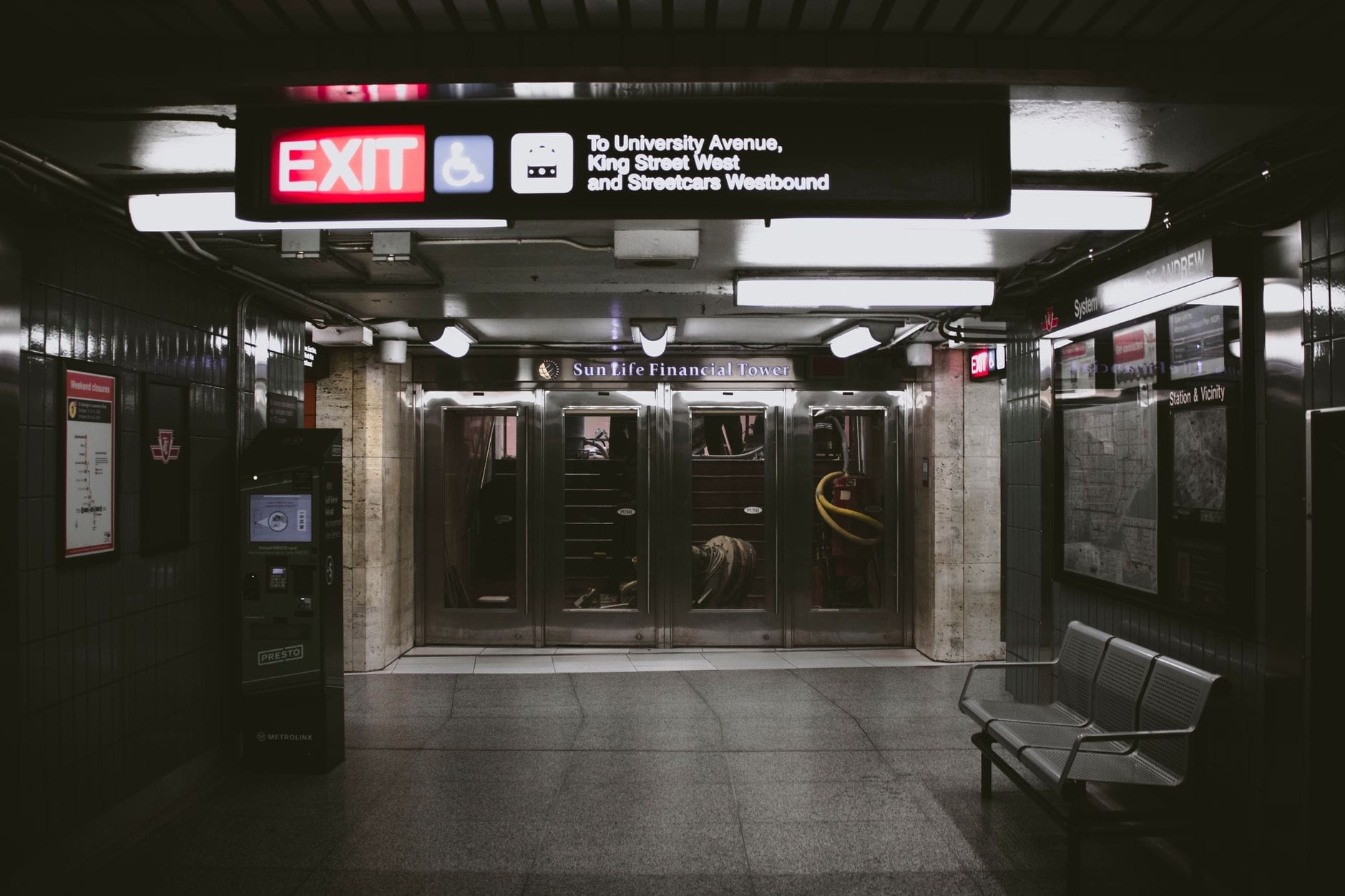
First, it is not entirely underground. The system includes underground tunnels, above-grade enclosed walkways, and at-grade connections inside buildings. The name 'underground city' is a loose shorthand. Second, it is not a single managed facility with uniform hours and one operator. The PATH threads through dozens of privately owned buildings, each with its own access rules. A corridor that is open at 7am on a weekday may be locked on a Sunday morning. Third, it is not a tourist attraction in the traditional sense — it is primarily a commuter and worker infrastructure, used by more than 200,000 people on a typical business day who work in the Financial District.
ℹ️ Good to know
The PATH name is written in all capitals and was originally derived from a directional colour-coding system used in signage: P (red) for south, A (blue) for west, T (yellow) for north, H (orange) for east.
The Network Layout: Key Hubs and Corridors
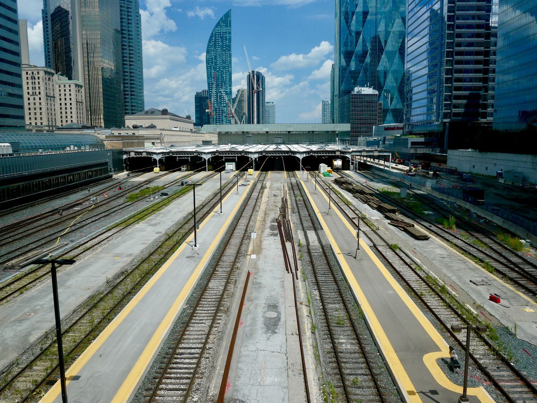
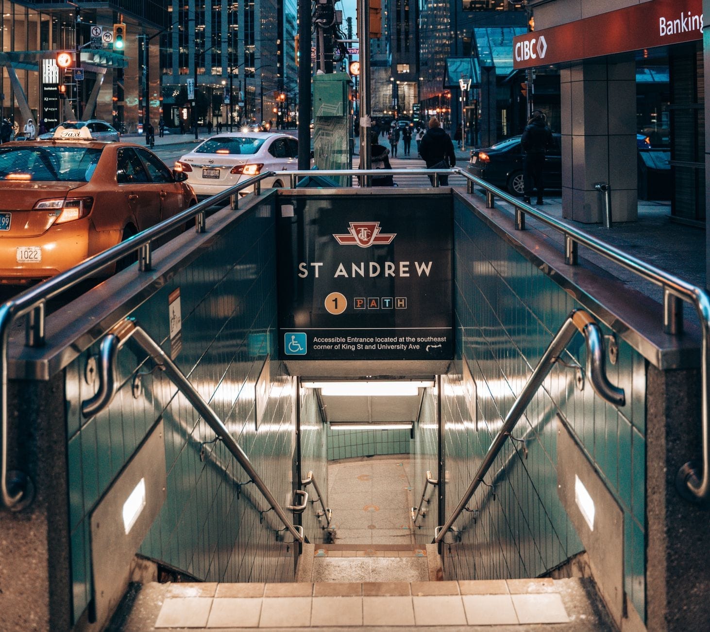
The PATH radiates out from Union Station, which is the logical anchor for any visit. From Union Station, the network extends north through the Financial District toward Dundas Street, west toward the Entertainment District, and north toward the Yonge–Dundas corridor. Major hubs include the Royal Bank Plaza, Brookfield Place, TD Centre, First Canadian Place, Eaton Centre, and the PATH underground city connections into the TTC subway system at multiple stations.
For visitors, the most practical stretches are: Union Station north to Queen Street (useful for reaching the financial core and shopping), and the east-west corridor connecting the Entertainment District near Scotiabank Arena to Yonge Street. These routes cover the areas where most visitor-facing hotels, restaurants, and destinations cluster.
- Union Station The southern anchor and primary entry point. Connects to GO Transit, TTC Lines 1 and 2, and UP Express to Pearson Airport. Highest foot traffic on the entire network.
- Brookfield Place One of the most architecturally impressive passages in the PATH, featuring a soaring glass atrium. Between Union Station and the TD Centre cluster. Worth walking through even if it is not on your direct route.
- First Canadian Place Near King and Bay, the tallest building in Canada by floor count. A major interchange point connecting north-south and east-west corridors.
- Toronto Eaton Centre The northern terminus for most visitors. Connects the PATH to Yonge-Dundas Square and the Queen and Dundas subway stations. Technically a mall connection rather than a purpose-built PATH corridor.
- Scotiabank Arena / Rogers Centre connections West end of the network, useful on event nights. Access can be restricted during games — check before navigating this way post-event.
How to Navigate Without Getting Lost
Honest assessment: the PATH is notorious for confusing first-time visitors. Signage exists but is inconsistent in placement and size, and because the system passes through dozens of separate buildings, visual continuity breaks constantly. You will walk through a food court, turn a corner, find yourself in a bank lobby, and then re-enter a tunnel. This is normal. The trick is to treat landmarks (specific buildings, food courts, subway entrances) as waypoints rather than following any single corridor.
💡 Local tip
Download the City of Toronto's official PATH map as a PDF before your trip, or use Google Maps on a mobile device — it now has reasonably accurate indoor mapping for the PATH. Cell service varies by section, so having an offline copy of the map is practical. The colour-coded directional signs (north = yellow, south = red, east = orange, west = blue) help once you learn the system, though this legacy scheme has been updated in parts of the network, so do not rely on them alone.
On weekdays between 7am and 6pm, the PATH is at its most navigable because most building connections are open and food court spaces serve as obvious landmarks. Outside those hours, particularly on weekends, many building corridors close their internal access doors. The underground sections that run directly between major transit stations tend to stay accessible later, but the retail-heavy stretches through office towers often shut down by 6-7pm on weekdays and significantly earlier on weekends. Plan accordingly if you are navigating after work hours or on a Sunday.
⚠️ What to skip
Do not assume any PATH route is available 24/7. Access hours depend on the buildings you pass through, not a central schedule. If you are navigating to catch a GO Train at Union Station early on a Sunday morning, test your route the evening before or use street-level walking as a backup.
When the PATH Is Worth Using (and When It Isn't)
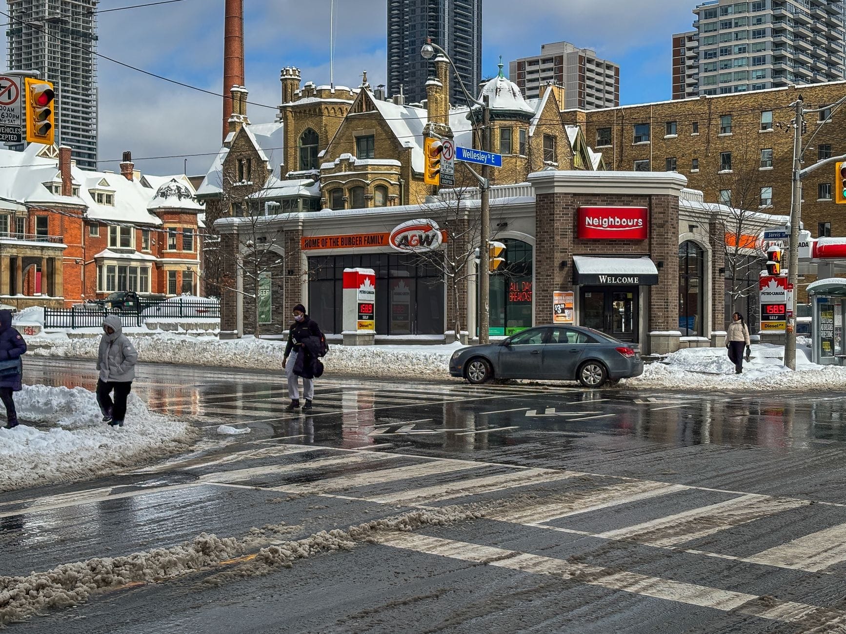
The PATH earns its reputation in Toronto winters, which run from roughly December through March. With temperatures often dropping below -10°C (14°F) and wind chill making it feel far colder, the ability to walk 20 minutes between buildings without a coat is genuinely useful. It also matters during rain and the muggy heat of July and August, when staying climate-controlled beats sweating through a city block. If you are commuting between Union Station and a Financial District hotel or office, the PATH is the obvious choice year-round.
However, if you are trying to explore the city or get a sense of Toronto's street character, the PATH actively works against you. You miss the architecture, the street life, and the neighbourhood transitions that make Toronto's walking tours worthwhile. King Street, Bay Street, and Front Street in the Financial District have genuine visual interest at street level. Use the PATH as a utility tool, not a sightseeing route.
- Use PATH: commuting between Union Station and a downtown hotel in January
- Use PATH: avoiding heavy rain while moving between meetings in the Financial District
- Use PATH: accessing Scotiabank Arena or Rogers Centre from Union Station on event nights
- Skip PATH: exploring Queen Street West, Kensington Market, or the Distillery District — none connect to the network
- Skip PATH: weekend sightseeing when building corridors restrict access and the retail is mostly closed
- Skip PATH: if you want to see the city — street level shows you far more
Shopping, Food, and Services Inside the PATH
The City of Toronto and urban-planning sources cite roughly 1,200 restaurants, shops, and services within the PATH network. That number is accurate but worth contextualizing. The majority of the retail skews toward weekday office workers: coffee chains, grab-and-go lunch counters, pharmacies, dry cleaners, bank branches, and fast-casual food courts. You will find every major Canadian coffee chain represented multiple times, along with sandwich and sushi counters, and several full-service sit-down restaurants in the more prestigious buildings.
For visitors looking for distinctive food experiences, the PATH food courts are convenient but not destination-worthy. They are practical for a quick and affordable lunch on a cold day — most counters in the food courts run around $12–18 CAD per person for a full meal. For something worth sitting down for, the restaurants inside Brookfield Place and the Financial District towers are a step above, catering to the corporate lunch crowd with prices to match ($20-40 CAD for a main). If you want genuine Toronto food culture, you need to go above ground — check the Toronto food guide for neighbourhood-level recommendations.
Practical Tips Before You Go
The PATH is free to walk — no ticket, no Presto card, no admission. You only pay if you buy something from the shops or food outlets inside, or if you are continuing onto the TTC or GO Transit from a connected station. For broader context on getting around Toronto, transit fares and passes are separate from PATH access entirely.
Accessibility is generally good on the main corridors, with elevators at most major transit connections, but the patchwork nature of the network means some older building segments have stairs without lift alternatives. If accessibility is a priority, pre-check the City of Toronto's official PATH map, which notes accessibility points. Restrooms are available in food courts and building lobbies, but not uniformly throughout — Union Station has reliable public facilities. For planning a broader trip downtown, the 3 days in Toronto itinerary puts the PATH in context with street-level attractions.
✨ Pro tip
If you are staying at a hotel connected directly to the PATH (several major downtown hotels are, including properties near Union Station and in the Financial District), ask the front desk for a printed PATH map with your specific building's entry points marked. Hotel concierges in connected properties give this advice routinely and can save you significant confusion on your first transit to the station.
- Entry is free — no registration, ticket, or transit pass needed just to walk the PATH
- Main corridor hours: many sections are accessible roughly 6am to midnight on weekdays, with reduced access on weekends — always verify specific building sections
- Cell service is patchy in deeper sections — download an offline map before entering
- Wear layers: underground sections are climate-controlled but temperatures vary between buildings
- The directional colour code (N=yellow, S=red, E=orange, W=blue) helps but is not foolproof — landmarks work better for orientation
- The PATH does not extend to neighbourhoods like Kensington Market or the Distillery District, and has only limited connections east of Yonge Street north of Union
FAQ
Is the PATH in Toronto free to use?
Yes, completely free. The PATH is a public pedestrian walkway, not a ticketed attraction. You only spend money if you choose to eat or shop inside. Connecting onto TTC subway or GO Transit from a linked station requires a separate fare, but walking the PATH itself costs nothing.
Is Toronto's PATH open 24 hours?
No. The PATH is not a 24-hour network. Many sections are accessible from around 6am to midnight on weekdays, but hours vary significantly by building. Retail-heavy corridors through office towers often close by 6-7pm on weekdays and can be largely inaccessible on weekends. Union Station connections tend to have the longest access windows due to transit demand. Always verify your specific route if you are travelling early or late.
How do I navigate the PATH without getting lost?
Download the City of Toronto's official PATH map in advance, or use Google Maps with indoor navigation enabled. The in-network signage uses a colour-coded directional system (north=yellow, south=red, east=orange, west=blue), which helps once you understand it, but is inconsistently placed. On a first visit, using major landmarks — Union Station, Brookfield Place, First Canadian Place, the Eaton Centre — as waypoints is more reliable than following signage alone.
Does the PATH connect to major Toronto attractions?
It connects to some. Scotiabank Arena, the CF Toronto Eaton Centre, and Union Station are all on the network, while Rogers Centre is nearby but not directly on the PATH. However, many of the city's most-visited spots — CN Tower (adjacent but not directly connected), the Distillery District, Kensington Market, the Art Gallery of Ontario, and Casa Loma — are not part of the PATH system and require street-level travel.
Is Toronto a city, and is it the capital of Ontario?
Yes, Toronto is a city — officially the City of Toronto. It is not the capital of Ontario (that is Ottawa), but it is Canada's most populous city, with a city proper population of approximately 2.79 million (2021 census) and a metropolitan area of over 6 million.