Toronto Ravines & Hiking Trails: A Nature Lover's Complete Guide
Toronto's ravine system is one of the largest urban greenspace networks in North America, threading through neighbourhoods most visitors never see. This guide covers the best trails, how to reach them by transit, what conditions to expect by season, and how to string routes together for a full day outdoors.
Plan and book this trip
Tools from our partner Travelpayouts help you compare flights and hotels. If you book through them, we may earn a commission at no extra cost to you.
Flights
Hotels map
TL;DR
- Toronto's ravines form a free, publicly accessible trail network winding through the entire city — no admission fees, no booking required.
- Trail difficulty ranges from easy paved paths to uneven dirt tracks through mature forest; not all sections are accessible or stroller-friendly.
- Most popular routes are reachable by TTC subway or bus — see our guide to getting around Toronto for transit basics.
- Spring and fall offer the best conditions; summer is fine but humid, and winter trails can be icy and unmarked.
- The ravines are an interconnected system, not isolated parks — with planning, you can link multiple trails into a half-day or full-day route across different neighbourhoods.
Why Toronto Has One of the World's Great Urban Trail Networks
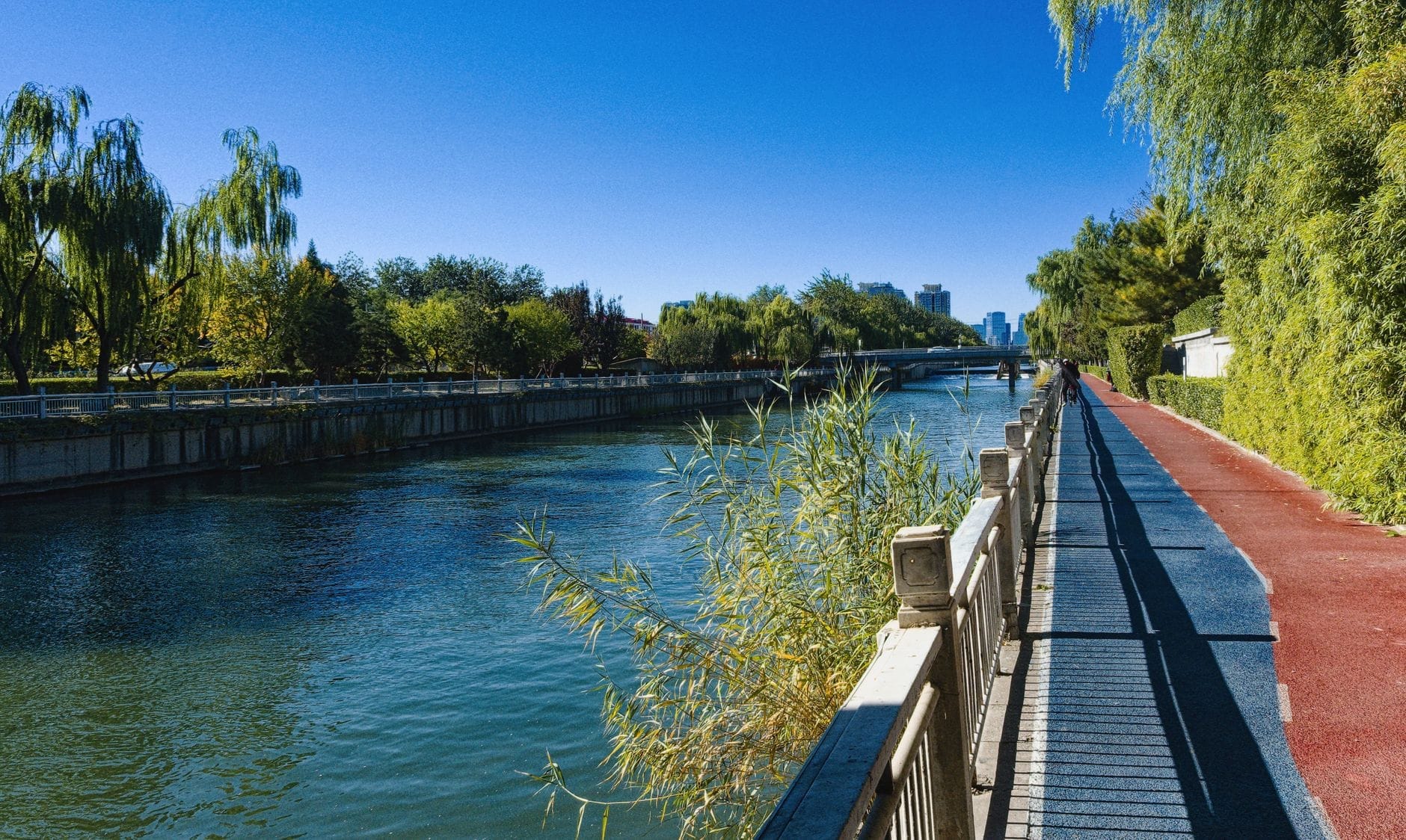
Toronto sits on the northwestern shore of Lake Ontario at an elevation ranging from roughly 75 m near the waterfront to over 200 m in the north. That topographic variation, carved by glacial meltwater over thousands of years, produced a network of river valleys and ravines that cut through the urban grid from the lake's edge all the way to the city's northern boundary. Today, these ravines cover around 11,000 hectares of natural area within city limits — a figure the City of Toronto uses when describing the ravines as among the largest urban greenspace systems in North America.
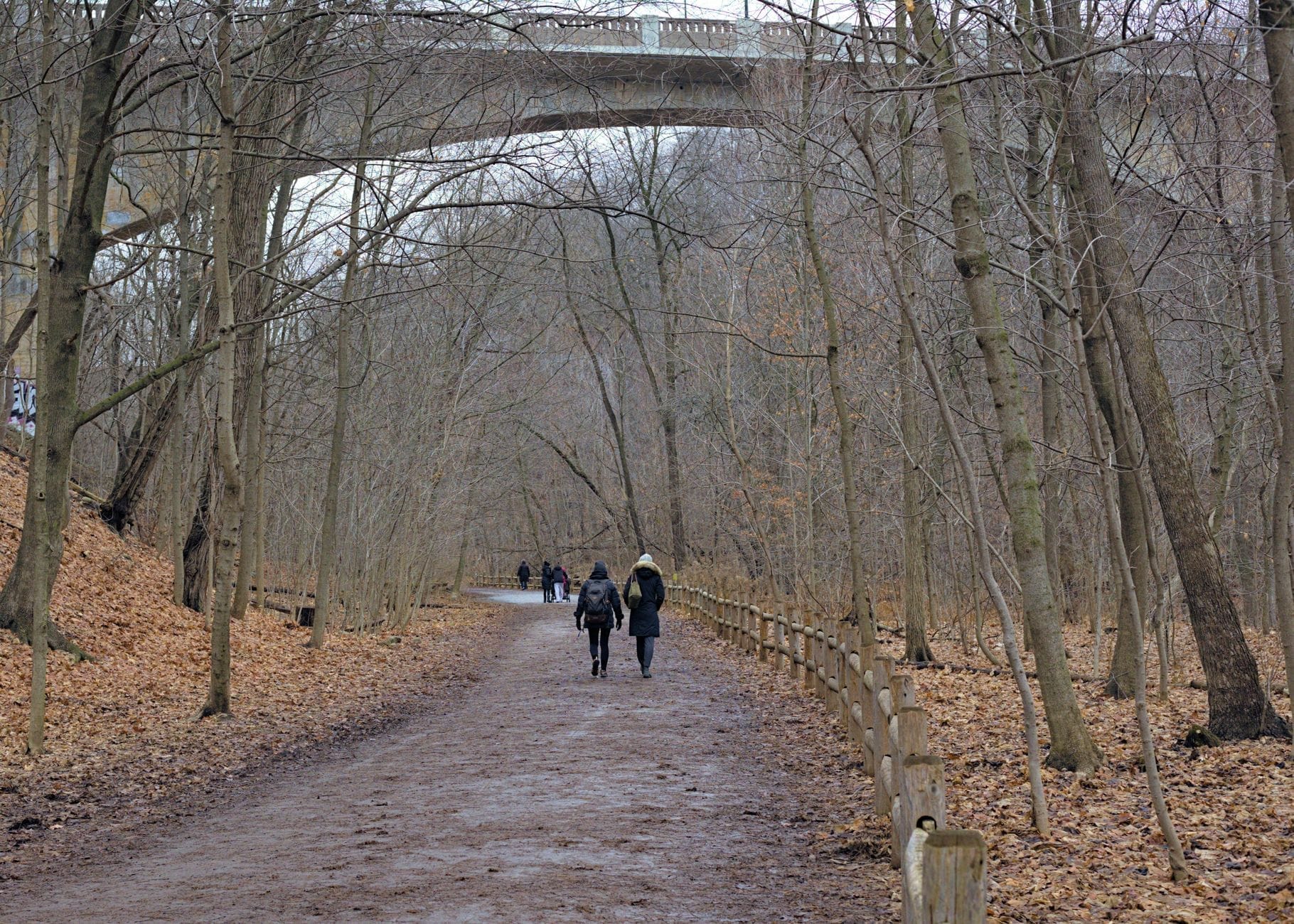
The practical result for hikers and walkers is remarkable: you can drop off a busy commercial street into a wooded valley, follow a trail for several kilometres through mature forest, cross under highway overpasses, and emerge in a completely different neighbourhood — all without paying an entry fee or leaving city limits. The ravines are not manicured parks. Many sections feel genuinely wild, with coyotes, foxes, and dozens of migratory bird species recorded annually. That ecological character is part of what makes them worth exploring, but it also means conditions vary considerably depending on the trail, the season, and recent weather.
ℹ️ Good to know
All ravine trails and natural parklands described here are free to access. The City of Toronto's Ravines, Trails & Natural Parklands page is the official starting point for maps and route information.
The Best Ravine Trails in Toronto, Ranked by What You're Looking For

The trail options across the ravine system range from a quick 20-minute forest walk to a full-day route linking multiple valleys. Here are the strongest options across different categories. For context on how these fit into broader outdoor options, the best parks in Toronto guide covers additional green spaces beyond the ravine network.
- Edwards Gardens / Wilket Creek Trail (4.5 km) One of the most complete ravine experiences in the city. The route starts at Edwards Gardens in North York, a formal garden with easy parking and transit access, then follows Wilket Creek south through increasingly wild terrain. The full out-and-back covers around 4.5 km and passes through mature forest with occasional boardwalk sections. Suitable for most fitness levels; some uneven ground in the lower sections.
- Moore Park Ravine (approximately 6 km loop) A largely flat loop through one of Toronto's older ravine corridors, connecting the Beltline Trail with the Don Valley system. Mostly dirt and compacted gravel, with tree canopy throughout. Popular with dog walkers and runners. Access from Mount Pleasant Cemetery or Summerhill station (TTC Line 1) makes this one of the most transit-convenient options in midtown.
- Taylor Creek Trail (3 km through the core section) Follows Taylor Creek through mature forest and open river corridor in East York. The main trail is relatively flat and well-maintained, making it accessible for beginners and families. Wildlife sightings — particularly birds — are common. Connects at its western end with the Lower Don Trail, which eventually links to the waterfront.
- Beltline Trail to St. Clair (2+ km) A converted rail corridor that follows the old Belt Line Railway route through midtown ravine country. Paved in sections and unpaved in others, with consistent tree cover and occasional views into the ravine below. A good option for cyclists as well as walkers. The route from Beltline to St. Clair is a manageable 2+ km one-way.
- Glen Stewart Ravine (Beach neighbourhood) A short but genuinely forested walk in the east end, tucked between Kingston Road and the Beaches neighbourhood. Wooden boardwalks and stairs navigate the steep-sided ravine. Easy enough for families and older walkers if they take it slowly, though the steps can be slippery after rain. A 20-minute detour if you're already visiting the Beaches.
- Alexander Muir Memorial Gardens to Bayview/Eglinton (2+ km) A quieter midtown ravine route that links the formal Alexander Muir gardens with the Bayview and Eglinton area. Good autumn foliage. Less trafficked than the Beltline or Don Valley routes, which makes it appealing if you prefer a less busy experience.
⚠️ What to skip
Not all ravine trails are paved or universally accessible. Many popular sections include steep wooden stairs, rooted dirt paths, muddy creek crossings, and narrow single-track segments. Check trail conditions before visiting with a stroller, wheelchair, or mobility limitations. The City of Toronto's parks pages note accessibility levels for individual trails.
Getting to the Ravines: Transit, Parking, and Access Points
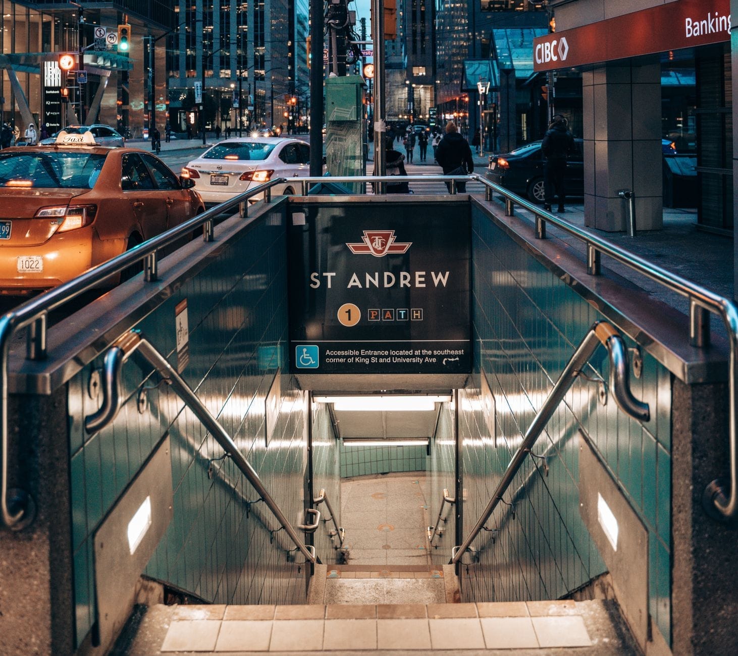
One underappreciated advantage of Toronto's ravine network is that many entry points sit within a short walk of TTC stations. This matters practically: you can take the subway to a trailhead, walk several kilometres through the ravine, and exit at a different neighbourhood to catch a bus or streetcar home — without retracing your steps. This linear hiking pattern is easier in Toronto's ravines than in almost any other major city.
- Moore Park Ravine: Summerhill station (Line 1 Yonge-University) is the closest subway access point, roughly 10 minutes on foot to the main trailhead.
- Beltline Trail: Accessible from Davisville station (Line 1) via a short walk north through the residential streets.
- Edwards Gardens / Wilket Creek: Served by TTC bus routes connecting to Lawrence or Eglinton stations; check the TTC trip planner for current routes as schedules update.
- Taylor Creek Trail: Bus connections from Main Street station (Line 2 Bloor-Danforth) provide reasonable access to the eastern end.
- Glen Stewart Ravine: Reachable by TTC bus along Kingston Road from the Beaches; no direct subway access but straightforward if you're already in the east end.
Street parking exists near some trailheads, but it's inconsistent and fills quickly on weekends between late spring and early fall. If you're driving, arrive before 9 am on weekends or target less popular access points. The Edwards Gardens parking lot is one of the more reliable options but can fill by mid-morning on a sunny Saturday.
Seasonal Conditions: When to Go and What to Expect
Toronto's humid continental climate means the ravines look and feel dramatically different across the four seasons. Each has real merits and real drawbacks.
- Spring (March–May) The ravines come alive with migratory birds, wildflower blooms, and fresh canopy growth. However, the snowmelt and April rains turn many dirt paths into mud. Late April through May offers the best combination of mild temperatures (averaging around 10–13°C by May) and drying trails. Expect wet feet on any unpaved section in early spring.
- Summer (June–August) Full canopy cover keeps the ravines noticeably cooler than street level — often 3–5°C lower on hot days. July averages around 22°C but can hit 32°C with high humidity. The tree cover makes summer hiking more comfortable than you'd expect, but the main trails get busy on weekends. Mosquitoes and other insects are present near creek corridors, particularly in June and early July.
- Autumn (September–November) The strongest season for visual appeal. Maples, oaks, and sumac turn the ravine walls into a dense wash of orange, red, and gold, typically peaking in mid-to-late October. Temperatures are mild (September averages around 18°C) and the trails dry out after the summer humidity. This is when the ravines attract the most attention from photographers and casual walkers.
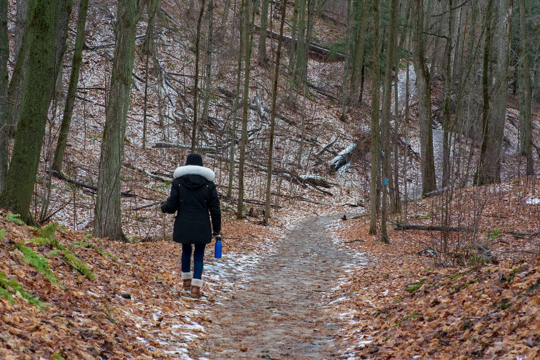
- Winter (December–February) January averages around -3.7°C in Toronto, with lows reaching -7°C or colder during cold snaps. The ravines are less maintained in winter — ice on wooden boardwalks, unmarked trail conditions, and limited lighting make some sections genuinely hazardous. That said, a fresh snowfall transforms the landscape, and cross-country skiers and snowshoers use wider corridors. Microspikes or traction devices are useful for the steeper sections.
✨ Pro tip
For the best of both visual drama and comfortable trail conditions, target the last two weeks of October. The fall colour peaks across most ravines during this window, temperatures sit in the 8–15°C range, and the trails are typically dry enough for easy footing. Weekday mornings in this period offer the trails largely to yourself.
Linking Ravine Routes with Broader Toronto Exploration
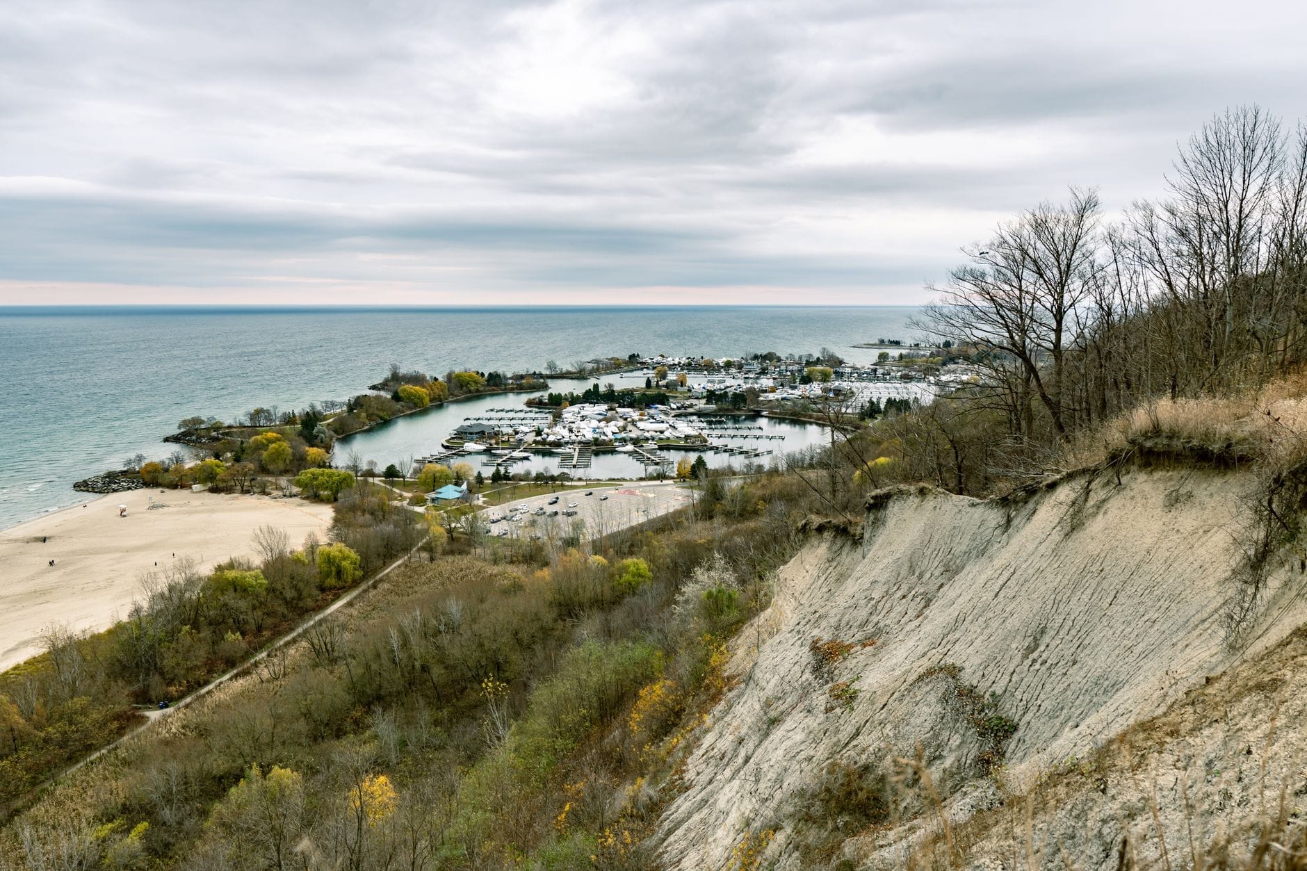
The ravines don't exist in isolation — they connect to some of Toronto's most interesting neighbourhoods and other natural destinations. The Lower Don Trail, for example, runs all the way from the northern ravine system to the Martin Goodman Trail along the waterfront, making it possible to walk or cycle from deep midtown forest to the lake's edge. This north-south corridor is one of the city's great overlooked routes.
On the east end, the Taylor Creek Trail connects westward into the Don Valley system, which in turn links to the Evergreen Brick Works — a converted industrial site with weekend farmers' markets, mountain bike trails, and event programming. Combining a Taylor Creek walk with a visit to Brick Works makes for a full half-day itinerary that covers natural terrain and urban culture in a single loop.
In the west end, the Humber River corridor connects ravine trails to Humber Bay Park and the waterfront, passing through some of the city's quieter parkland. If you're spending several days in the city, a multi-day plan that integrates ravine walks with neighbourhood visits is very achievable. The 3-day Toronto itinerary includes suggestions for working natural spaces into a broader city visit.
For visitors interested in the wider natural landscape beyond city limits, Rouge National Urban Park, in Scarborough, offers more rugged hiking terrain within Toronto's eastern boundary — it's the largest urban national park in North America and a genuine step up in trail wildness compared to the inner-city ravines.
Practical Tips Before You Go
Toronto's ravines are free and open year-round, but a few practical points will make the difference between a good outing and a frustrating one. First, download an offline map before you enter. Cell service drops in several ravine corridors, and the trail markings in some sections are minimal. The City of Toronto's parks website hosts trail maps, and apps like AllTrails have community-verified route data for the major corridors.
- Footwear: Trail runners or light hiking shoes are adequate for most routes in dry conditions. In spring or after rain, waterproof footwear matters on dirt sections.
- Water: Carry your own. There are no reliable water fountains on most ravine trails, especially outside of adjacent park facilities.
- Dogs: Welcome on most ravine trails but must be leashed in designated areas. Check the City of Toronto's off-leash dog area map for specific zones.
- Wildlife: Coyotes are present across the ravine system. They rarely approach humans but do not feed them and keep dogs leashed, particularly at dawn and dusk.
- Waste: Carry out what you carry in. Bins are rare on trail sections away from formal park entrances.
- Safety: Stick to marked trails after dark. The ravines are not policed as actively as street-level parks, and lighting is absent on most trail sections.
If you want to combine ravine exploration with other outdoor activity, the Toronto waterfront guide covers the lakefront trail system that connects to several ravine exits in the south. For a broader overview of outdoor and nature options in the city, the free things to do in Toronto guide includes additional ravine and parkland suggestions at no cost.
💡 Local tip
The City of Toronto's 311 service (call 311 within Toronto) can provide current information on trail closures due to flooding, storm damage, or maintenance. After major rainstorms, some low-lying sections of the Don Valley and Taylor Creek corridors are temporarily closed for safety. Check before heading out if there's been significant rainfall in the previous 48 hours.
FAQ
Are Toronto's ravine trails free to use?
Yes. All ravine trails maintained by the City of Toronto are free and publicly accessible. There are no entry fees, permits, or booking requirements for recreational walking or hiking.
What is the easiest ravine trail in Toronto for beginners or families?
Glen Stewart Ravine in the Beaches neighbourhood is often recommended for beginners due to its short length and well-maintained boardwalks. Taylor Creek Trail is another good option, with a flat, wide path and reliable footing in dry conditions. Both are suitable for older children.
Can you hike Toronto's ravines in winter?
You can, but conditions vary considerably. Wooden boardwalks and stairs ice over quickly after freezing rain or snowmelt, and trail markings are less visible under snow. For winter visits, traction devices like microspikes are worth packing, and sticking to wider, flatter corridors like the Beltline Trail reduces risk on icy sections.
How do I get to Toronto's ravine trails without a car?
Most major ravine trailheads are reachable by TTC subway or bus. Moore Park Ravine is accessible from Summerhill station on Line 1, the Beltline Trail from Davisville station, and Edwards Gardens by bus connections from Eglinton station. Using the TTC trip planner with the specific park name as your destination will show current routes and travel times.
Are there any risks hiking in Toronto's ravines?
The main practical risks are slippery conditions after rain or in winter, uneven terrain on unpaved sections, and trail closures after flooding. Wildlife encounters, primarily coyotes, are possible but rarely problematic. Hiking alone in remote ravine sections after dark is not recommended. Carry a fully charged phone and download offline maps before you lose cell coverage.