Toronto Waterfront: The Complete Guide to the Lakeshore
Toronto's waterfront runs approximately 37 kilometres along Lake Ontario, from Etobicoke in the west to the Rouge River in the east. This guide covers the best things to do, how to get around, seasonal conditions, and which parts of the lakeshore are actually worth your time.
Plan and book this trip
Tools from our partner Travelpayouts help you compare flights and hotels. If you book through them, we may earn a commission at no extra cost to you.
Flights
Hotels map
TL;DR
- Toronto's lakeshore stretches approximately 37 km along Lake Ontario — far beyond the central Harbourfront hub most visitors know.
- The Martin Goodman Trail connects the entire waterfront by foot and bike; pair it with the Toronto Islands for a full day out.
- TTC streetcars 509 and 510 are the fastest way downtown to Queens Quay; ferries to the Islands run from Jack Layton Ferry Terminal year-round (reduced schedule in winter).
- Summer (June to September) is peak season for festivals, paddling, and beach visits; late May and September offer good weather with smaller crowds.
- Most waterfront parks and trails are free; key paid attractions include the Ripley's Aquarium of Canada and boat cruise operators along the harbour.
Understanding the Waterfront: More Than Just Harbourfront
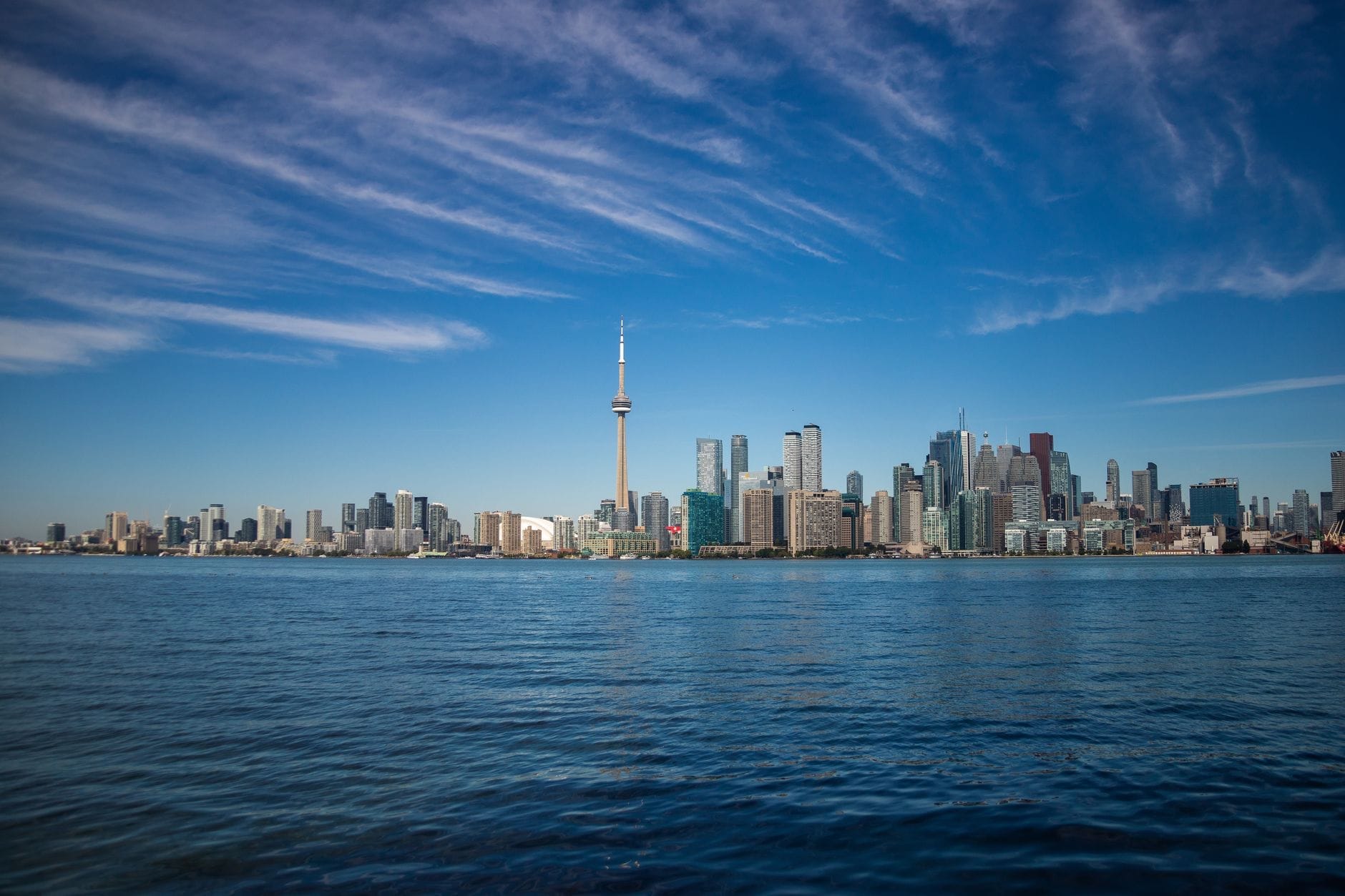
Most visitors hear 'Toronto waterfront' and picture the stretch of Queens Quay West between the CN Tower and Harbourfront Centre. That area is real and worthwhile, but it represents only a small fraction of the full lakeshore. The City of Toronto's waterfront corridor officially spans approximately 37 kilometres, from Long Branch and Etobicoke Creek in the west to Port Union and the Rouge River in the east. Each section has a distinct character, and treating the whole thing as interchangeable will cause you to miss some genuinely interesting areas.
The central waterfront (Harbourfront to the Distillery District area) is the most developed and tourist-facing zone, with the ferry terminal, Harbourfront Centre's arts campus, Sugar Beach, and direct sightlines to the CN Tower. Moving west, the lakeshore shifts toward residential parks, Humber Bay, and the Humber Arch Bridge. Moving east past the Port Lands (currently undergoing a major Waterfront Toronto revitalization project), you reach Beaches neighbourhood, Bluffer's Park, and eventually the Scarborough Bluffs. Planning and coordination across the whole corridor sits with Waterfront Toronto, a tri-government agency established specifically for this revitalization mandate.
ℹ️ Good to know
Waterfront Toronto is an ongoing, decades-long revitalization effort. Expect active construction zones, particularly around the Port Lands and East Harbourfront. Some access points and trail connections in these areas are periodically modified — check Waterfront Toronto's project updates before visiting the eastern sections.
Central Waterfront: What to Do Between Union Station and the Ferry Terminal
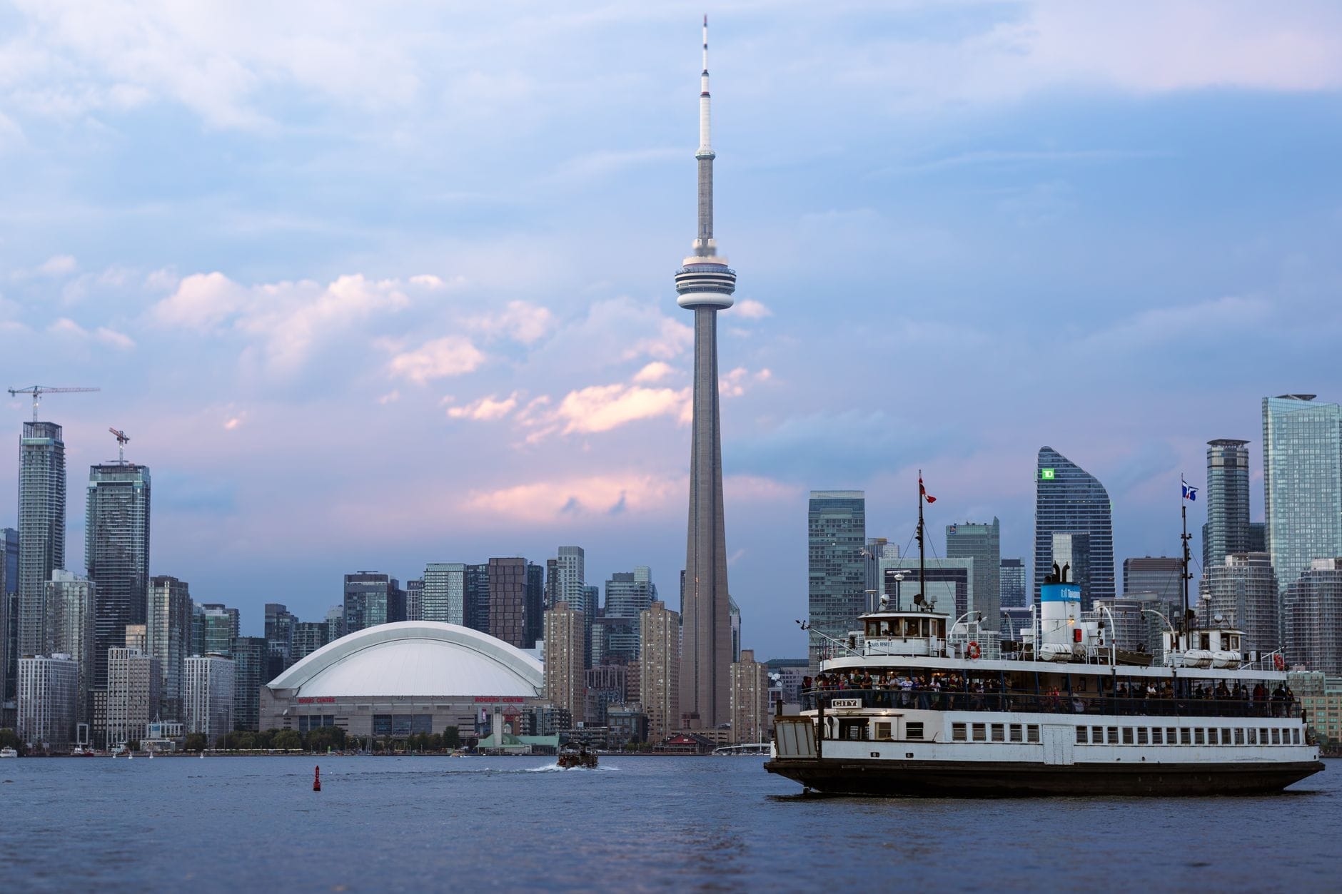
The central waterfront is anchored by the Jack Layton Ferry Terminal, your departure point for the Toronto Islands. The ferry runs to three destinations: Centre Island (families and picnic grounds), Ward's Island (residential, quieter), and Hanlan's Point (clothing-optional beach, good cycling). Ferries are operated by the City of Toronto; round-trip fares apply and online ticketing is recommended in summer when queues can stretch 45 minutes or more. The terminal is a 10-minute walk southwest of Union Station, or take the 509 or 510 streetcar from Union Station's streetcar loop.
Just west of the ferry terminal, Harbourfront Centre operates as an arts and culture campus with galleries, performance spaces, craft studios, and a lakeside stage. Programming runs year-round — summer weekends often feature free outdoor concerts and craft markets — but the real draw is simply having green space and lake views in a downtown context. Admission to the grounds is free; ticketed performances vary by event.
- Toronto Music Garden A free public garden west of Harbourfront, designed in collaboration with cellist Yo-Yo Ma. Each section reflects a movement of Bach's first cello suite. Free summer concert series runs Thursday evenings and Sunday afternoons (check schedule).
- Sugar Beach A small urban beach with pink umbrellas and a splash pad, directly east of Jarvis Street. More design statement than swimming beach — the water quality here is fine but the beach itself is narrow. Good for a break with kids.
- Ripley's Aquarium of Canada One of the largest aquariums in Canada, located at the base of the CN Tower. Genuinely impressive shark tunnel and jellyfish gallery. Paid admission; advance online booking saves time. Plan 2-3 hours.
- Harbour Boat Cruises Multiple operators run 1-2 hour sightseeing cruises from the central waterfront, taking you past the Islands and under the CN Tower from the water. Prices and schedules vary by operator; most run May through October.
⚠️ What to skip
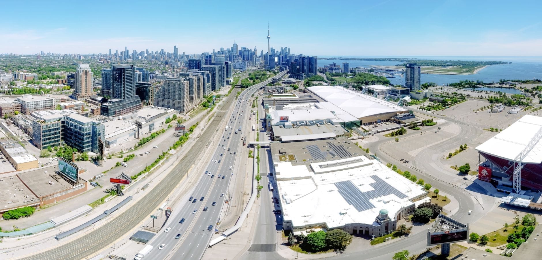
The waterfront strip immediately south of Rogers Centre and the CN Tower fills with large crowds before Blue Jays or TFC games. If you're not attending a game, avoid the area 90 minutes before first pitch or kick-off, particularly on summer weekends. The streets become gridlocked and even walking gets slow.
The Martin Goodman Trail: Cycling and Walking the Full Lakeshore

The Martin Goodman Trail is the continuous multi-use path that runs along the waterfront for approximately 37 kilometres, connecting the Humber River in the west with the Scarborough Bluffs in the east. It's the spine of the entire lakeshore experience. On foot or by bike, this trail lets you move between otherwise disconnected waterfront sections without using roads.
The most scenic and popular section runs from the Humber Bay Arch Bridge east through the central waterfront to Woodbine Beach. This roughly 15-kilometre stretch passes through several distinct parks with unobstructed lake views, picnic areas, and relatively flat terrain. Rental bikes are available through the city's Bike Share Toronto network, with docking stations scattered along the waterfront route — a practical option if you're staying downtown and want to cover ground without bringing your own bike.
Cyclists should note the trail surface and width varies significantly. The central sections near Harbourfront are well-maintained and wide enough to handle high-volume summer weekends. Eastern sections toward the Scarborough Bluffs become narrower and less polished but also less crowded. If you're doing a long ride, check the Toronto and Region Conservation Authority (TRCA) trail map before setting out, as some segments have closures related to Port Lands construction.
✨ Pro tip
For the best unobstructed lake views with minimal crowds, ride or walk the trail section through Humber Bay Park East and West (west end) on a weekday morning. The Humber Bay Arch Bridge itself is a photographic standpoint for the downtown skyline across the water — better skyline framing than from the central waterfront, where you're too close to the base of the towers.
East vs. West Waterfront: Choosing Your Route
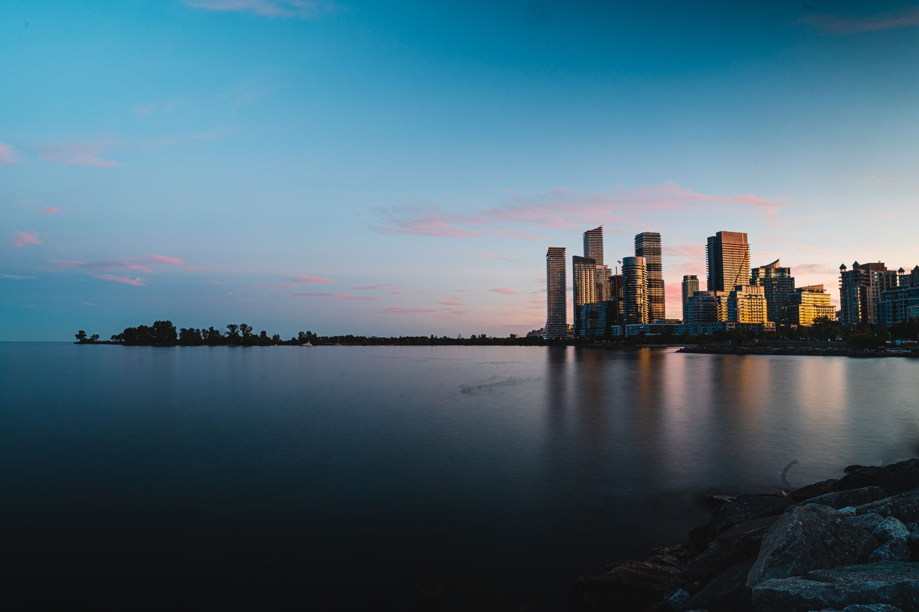
The western waterfront between the Humber River and downtown rewards visitors who want parks over tourist infrastructure. Humber Bay Park offers wide open green space, butterfly habitat, and some of the best skyline views in the city — particularly at dusk. The Humber Bay Arch Bridge has become a notable landmark in its own right. This area is primarily used by locals for cycling, running, and dog walking, which keeps the atmosphere noticeably more relaxed than central Harbourfront on a weekend.
The eastern waterfront has two distinct appeals: the Beaches neighbourhood (Queen Street East, around Woodbine Beach) and the dramatic geology of the Scarborough Bluffs. Woodbine Beach is one of Toronto's most popular swimming beaches, with a boardwalk, volleyball courts, and actual sand depth. The water quality is monitored by the City and posted daily at toronto.ca — check before swimming, as heavy rainfall events can trigger temporary closures. Further east, Bluffer's Park Beach sits at the base of the Scarborough Bluffs, dramatic clay cliffs that rise up to 91 metres above Lake Ontario. Access requires a car or a bus-plus-walk combination; the beach itself is quieter than Woodbine but the scenery is worth the extra effort.
- West waterfront (Humber Bay area): best for cycling, skyline photography, and quiet park time. Minimal tourist infrastructure. Reach by TTC bus to Humber Bay or bike via Martin Goodman Trail.
- Central waterfront (Harbourfront to Distillery): best for first-time visitors, families, and anyone wanting ferry access to the Islands. Highest concentration of food, events, and attractions within walking distance.
- East waterfront (Beaches to Bluffs): best for swimming, local neighbourhood atmosphere, and dramatic natural scenery. Requires more travel time from downtown — budget 30-45 minutes each way by transit.
Getting to the Waterfront: Transit, Ferries, and On-the-Ground Logistics
From Union Station, TTC streetcar routes 509 (Harbourfront) and 510 (Spadina) both run south along Queens Quay West, stopping at Harbourfront Centre, the ferry terminal, and several points along the central waterfront. The 509 loops through the Exhibition Place area as well. Fares follow standard TTC pricing, paid by Presto card or cash. The ride from Union Station to the ferry terminal takes about 8-12 minutes.
For the Toronto Islands, City of Toronto ferries depart from Jack Layton Ferry Terminal (at the foot of Bay Street). Online ticketing is strongly recommended in summer — the terminal website allows you to book a specific departure time, which helps reduce waiting. The ferry ride to Centre Island takes about 15 minutes; Ward's Island is about 15 minutes. Water taxis also operate seasonally from the central waterfront and offer a faster, on-demand alternative to the ferry, though at higher cost.
If you're coming from outside Toronto via Pearson Airport, the most direct route to the waterfront is the UP Express train to Union Station (approximately 25 minutes, runs frequently), then the 509/510 streetcar south. Total door-to-waterfront time from Pearson is typically 45-55 minutes. See our full Toronto airport transport guide for fare details and current options.
Seasonal Conditions: When to Visit and What Changes
The waterfront is technically accessible year-round, but the experience shifts dramatically by season. Toronto's climate is humid continental: summers are warm and humid (July averages around 22°C, with highs often hitting 28-30°C), winters are cold (January averages around -3.7°C, with wind chill making lake-facing areas feel significantly colder). The lake itself moderates temperatures slightly compared to inland areas, but it also generates strong winds — factor that in for cycling or any time on the water.
June through September is when the waterfront operates at full capacity: Harbourfront Centre runs its outdoor festival and concert series seasonally, boat cruise operators are active, paddling rentals are open, the Islands beaches are swimmable, and every patio along Queens Quay is packed. July and August bring the highest crowds; weekend afternoons at central Harbourfront can feel genuinely congested around the ferry terminal. Late May and September are the most practical compromise: weather is warm enough for outdoor activity, crowds drop, and accommodation prices typically ease.
Winter on the waterfront is underrated for a different reason: it's quiet, the lake views are unobstructed, and on clear days the frozen lakefront creates a distinct atmosphere you won't find in summer. The Martin Goodman Trail stays open year-round (snow clearing varies by section). The ferry to the Islands operates year-round on a reduced schedule, primarily serving Ward's Island residents. Most outdoor café seating disappears by mid-October. For a full breakdown of what's open in cold months, see our Toronto in winter guide.
- June to September Peak season. All operators, festivals, beach swimming, full ferry schedule. Book Islands ferry tickets online in advance on weekends.
- May and October Shoulder season. Good weather for cycling and walking. Most attractions open. Far fewer crowds on weekdays. Some paddling operators may not be running yet or may have closed for the season.
- November to March Quieter waterfront. Trail accessible but dress for wind chill near the lake. Ferry schedule reduced. Most outdoor programming paused. Nathan Phillips Square ice rink opens in December — combine with a waterfront walk for a full downtown winter day.
- Spring (March to May) Variable. Cherry blossom season along the waterfront parks (usually late April) brings temporary crowds. Water temperatures too cold for swimming.
💡 Local tip
Toronto's waterfront gets significant wind off Lake Ontario year-round. In summer, this makes it noticeably cooler than inland neighbourhoods on hot days — bring a light layer even in July if you're spending the evening on the water. In winter, the wind chill factor along the open lakeshore can be severe; add 5-8°C to whatever your cold weather tolerance normally requires.
Beyond the Obvious: Waterfront Spots Worth Seeking Out
The Bentway, an urban park and trail built under the Gardiner Expressway between Strachan Avenue and Bathurst Street, is one of the more interesting recent additions to the waterfront-adjacent area. It connects the central waterfront to Fort York and hosts events, skating in winter, and public art year-round. Not technically on the water's edge, but within 5 minutes' walk of the lakeshore. Pairing it with a visit to Fort York makes sense — the fort itself is an undervisited piece of Toronto history (the original town was founded partly to defend this location) and sits right at the waterfront edge.
Tommy Thompson Park, on the Leslie Street Spit east of the Port Lands, is a notable urban nature experience in North America. It's a man-made peninsula extending 5 kilometres into Lake Ontario, built from construction rubble and landfill, now colonized by one of the largest double-crested cormorant colonies in the world. The park is only accessible on weekends and holidays (open dawn to dusk, free). It's run by the TRCA, not the city parks system. Birding here is genuinely excellent. See our guide to the Lake Ontario waterfront for more context on the natural areas east of downtown.
FAQ
Is the Toronto waterfront worth visiting in winter?
Yes, with adjusted expectations. The trail stays open, the views of the frozen lake are striking on clear days, and the lack of crowds makes the central waterfront feel entirely different from summer. The Islands ferry runs year-round on a reduced schedule. Most outdoor programming and paddle rentals close by October, but Harbourfront Centre's indoor spaces stay active. Dress warmly — wind chill off the lake is significant.
How long does it take to walk the full waterfront?
Walking the full 46 kilometres of the Toronto lakeshore in one go would take a full day or more and isn't practical without a plan. A realistic central waterfront walk from the Humber Bay Arch Bridge to Woodbine Beach covers roughly 15 km and takes about 3-4 hours at a relaxed pace. Most visitors focus on a 2-3 km stretch around Harbourfront, which is comfortable in 90 minutes.
How do I get to the Toronto Islands from the waterfront?
Ferries depart from Jack Layton Ferry Terminal at the foot of Bay Street in downtown Toronto. The City of Toronto operates the service; round-trip fares apply for adults and children. In summer, book tickets online in advance, especially for weekends — walk-up queues can mean missing several sailings. The 509 and 510 TTC streetcars stop close to the terminal from Union Station.
Are there good beaches on the Toronto waterfront?
Yes, several. Woodbine Beach and Kew-Balmy Beach in the east end are the most popular and swimmable; water quality is monitored daily and posted online by the City of Toronto. Bluffer's Park Beach at the foot of the Scarborough Bluffs is less crowded but requires more effort to reach. On the Islands, Centre Island and Hanlan's Point both have beaches. The centrally located Sugar Beach near Harbourfront is more of an urban design feature — it's not really a swimming beach.
What are the best things to do on the Toronto waterfront this weekend?
In summer: take the ferry to the Islands, rent a bike and ride the Martin Goodman Trail, catch an outdoor event at Harbourfront Centre, and watch the sunset from Humber Bay Park. Year-round: the aquarium, boat cruises, and a walk along Queens Quay are reliable options. Check Harbourfront Centre's events calendar for free programming, which changes weekly. If you want a structured starting point, the central stretch between Union Station and Harbourfront Centre packs the most variety into the smallest area.