Lake Ontario Near Toronto: What to See, Do & Know
Toronto sits on the northwestern shore of Lake Ontario, the easternmost and smallest of the Great Lakes by surface area. From the Toronto Islands and the Martin Goodman Trail to the towering Scarborough Bluffs, this guide covers every major way to experience the lake — with seasonal advice, transit details, and honest assessments of what's worth your time.
Plan and book this trip
Tools from our partner Travelpayouts help you compare flights and hotels. If you book through them, we may earn a commission at no extra cost to you.
Flights
Hotels map
TL;DR
- Toronto is the largest city on Lake Ontario's shores and the capital city of Ontario, Canada — the lake defines the city's entire southern edge.
- The Toronto Islands are the top summer destination on the lake — ferry access from downtown takes under 15 minutes, but queues get long on weekends.
- The Scarborough Bluffs stretch 15 km along the eastern lakeshore and reward visitors who make the trek east.
- Lake Ontario is the smallest Great Lake by surface area but the second deepest, reaching about 244 m (802 ft) at its deepest point.
- Summer (June to August) is peak season for the waterfront; May and September offer similar access with far smaller crowds.
Lake Ontario and Toronto: The Geographic Basics
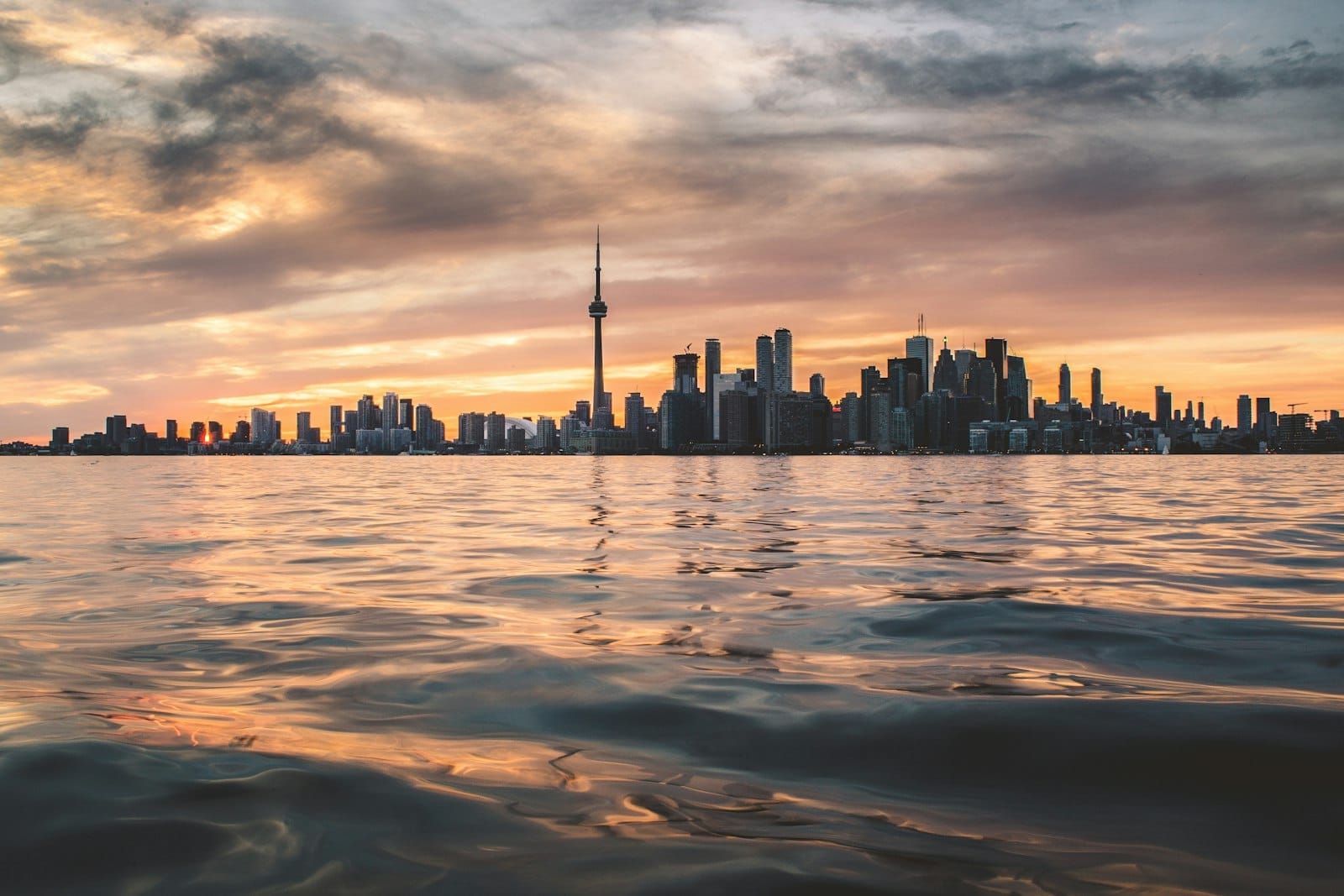
Lake Ontario is the easternmost of the five Great Lakes, and Toronto occupies its northwestern shore at approximately 43.65° N, 79.38° W. The lake is the smallest of the Great Lakes by surface area but the second deepest, with a maximum depth of around 244 m (802 ft). It drains eastward into the St. Lawrence River — not directly to the ocean, as many visitors assume. Toronto's downtown elevation near the lake sits at around 76 m above sea level, and the waterfront runs roughly from the Humber River in the west to the Don River in the east, with the Toronto Islands visible just offshore.
Toronto is the largest city on Lake Ontario and the capital city of Ontario, Canada. With a city proper population of approximately 2.79 million (2021 census) and a metro area of about 6.7 million depending on how you measure it, the lake's influence on city life is significant but often underappreciated by visitors focused on the downtown core. The lake moderates temperatures somewhat, making the lakefront slightly warmer in winter and cooler in summer than neighborhoods a few kilometers north.
ℹ️ Good to know
Lake Ontario is often mistaken for the largest Great Lake. It is actually the smallest by surface area. Lake Superior holds that title. Lake Ontario is, however, the second deepest Great Lake after Lake Superior.
The Toronto Waterfront: Where the City Meets the Lake
The redeveloped waterfront between the Humber and Don rivers is Toronto's most accessible stretch of Lake Ontario. Key destinations include Harbourfront Centre, a year-round arts and cultural venue right on the water, and Sugar Beach, an urban beach park east of downtown with pink umbrellas and a view of the lake. Neither is a natural swimming beach, but both are worth a walk on any visit to the waterfront.
For active visitors, the Martin Goodman Trail runs 56 km along the lakeshore from Etobicoke in the west to Scarborough in the east, connecting parks, beaches, and neighborhoods the entire way. Cyclists and joggers use it year-round, though it gets crowded between Harbourfront and Humber Bay on summer weekends. The section near Humber Bay Arch Bridge in the west offers some of the best unobstructed views of the downtown skyline reflected over the lake.
- Harbourfront Centre Free public space with galleries, skating in winter, concerts in summer, and consistent programming from spring through fall. Located at 235 Queens Quay West.
- Sugar Beach & Sherbourne Common Adjacent lakefront parks with seating, water features, and direct lake views. Good for a midday break — no swimming, but pleasant.
- HTO Park West Sandy urban beach near Spadina and Queens Quay. No swimming permitted, but sunbathing is popular and the views are excellent.
- Humber Bay Park East and West Quieter lakeshore parks with boat launches, cycling access, and panoramic views of the skyline. Easier to visit by bike than transit.
- Toronto Music Garden Designed in collaboration with cellist Yo-Yo Ma, this lakeside garden near Bathurst Quay is free to enter and hosts summer concerts.
⚠️ What to skip
Swimming at the central waterfront parks (HTO Park, Sugar Beach, Sherbourne Common) is generally not permitted. Toronto's supervised swimming beaches are at Woodbine Beach, Cherry Beach, and on the Toronto Islands. Always check Toronto Public Health water quality advisories before swimming — bacterial counts can spike after heavy rainfall due to stormwater runoff.
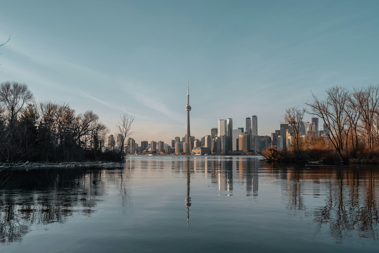
Toronto Islands: The Best Way to Be on Lake Ontario
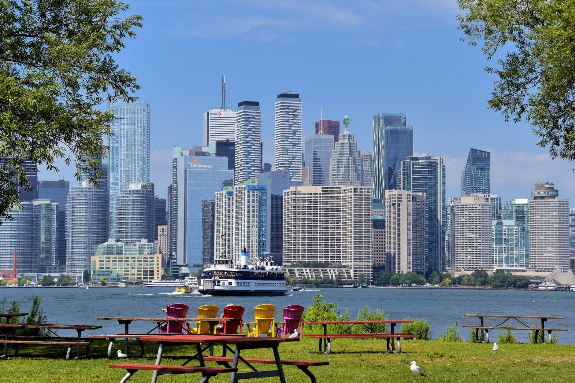
The Toronto Islands are a chain of small islands roughly 1.5 km offshore from downtown, and they offer the most complete lake experience available in the city. Three ferry routes operate from the Jack Layton Ferry Terminal at the foot of Bay Street: Centre Island (the busiest, serving the amusement park and main beaches), Hanlan's Point (western end, quieter, with a clothing-optional beach), and Ward's Island (eastern end, small residential community, best for walking).
Centre Island is the right choice for families visiting with children, given the proximity to the amusement rides and picnic areas. Ward's Island suits anyone who wants a genuine escape — the ferry takes about 15 minutes, the island has a small café, and the views of the skyline from the southern beach are among the best in the city. Hanlan's Point is the quietest of the three landing points and has the best natural swimming beach on the system, though the clothing-optional section isn't suitable for all visitors.
Ferry lineups on summer weekends can reach 60 to 90 minutes at Centre Island. The practical solution is to arrive before 10 am or take a weekday trip. Alternatively, the Ward's Island or Hanlan's Point ferries typically have much shorter waits. Bring cash or a card — ferry tickets are purchased at the terminal. The return ferry runs until late evening in summer. In winter, ferry service is reduced significantly and Centre Island closes, but Ward's Island remains accessible as a year-round residential community.
Scarborough Bluffs: Lake Ontario's Most Dramatic Scenery
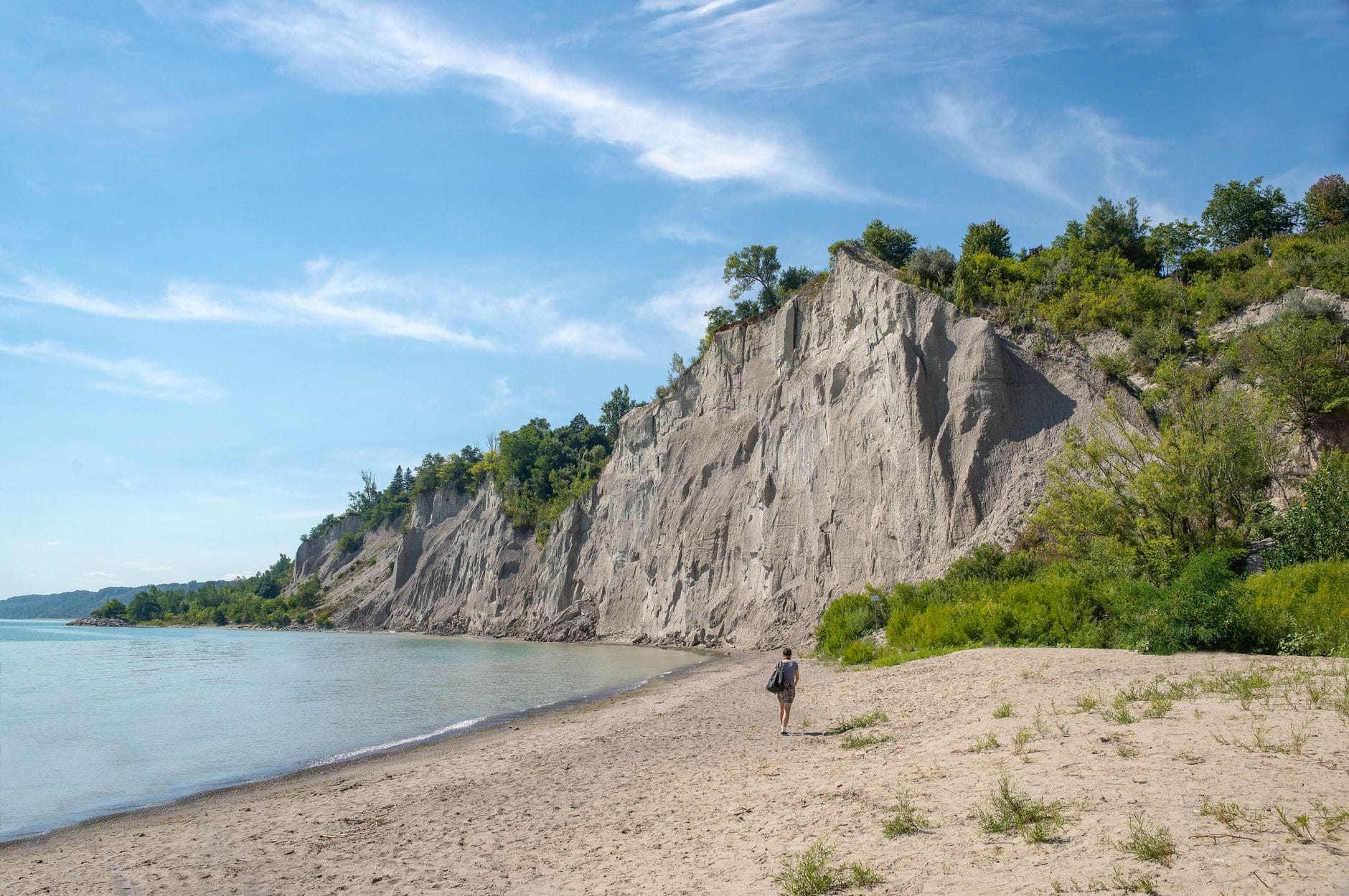
The Scarborough Bluffs are the most geologically striking feature on the entire Canadian shore of Lake Ontario. The cliffs stretch approximately 15 km along the eastern waterfront and rise to about 90 m above the shoreline at their highest point. They formed from glacial sediment deposited after the last ice age and continue to erode, which is why some viewpoints close periodically for safety reviews.
Getting here requires planning. The Bluffs are not walkable from downtown — they sit roughly 20 km east of Union Station. Options include driving (parking is available at Bluffer's Park and Scarborough Bluffs Park), taking the TTC to Scarborough and walking, or cycling the Martin Goodman Trail east, though the trail does not run directly below the cliffs. Bluffer's Park at the base of the Bluffs has a marina, a beach, and direct water access. The upper parks offer the cliff-top views that most photos show. Doing both requires either a car or a full day of transit and walking.
✨ Pro tip
For the classic Scarborough Bluffs photo, go to Scarborough Bluffs Park (upper, cliff-top level) and walk to the eastern viewpoint overlooking Bluffer's Park beach below. Visit on a weekday in late spring or early fall for the clearest lake views and manageable crowds. The walk from the upper park to the waterfront park is not direct — they require separate transit or parking.
Beaches on Lake Ontario Near Toronto
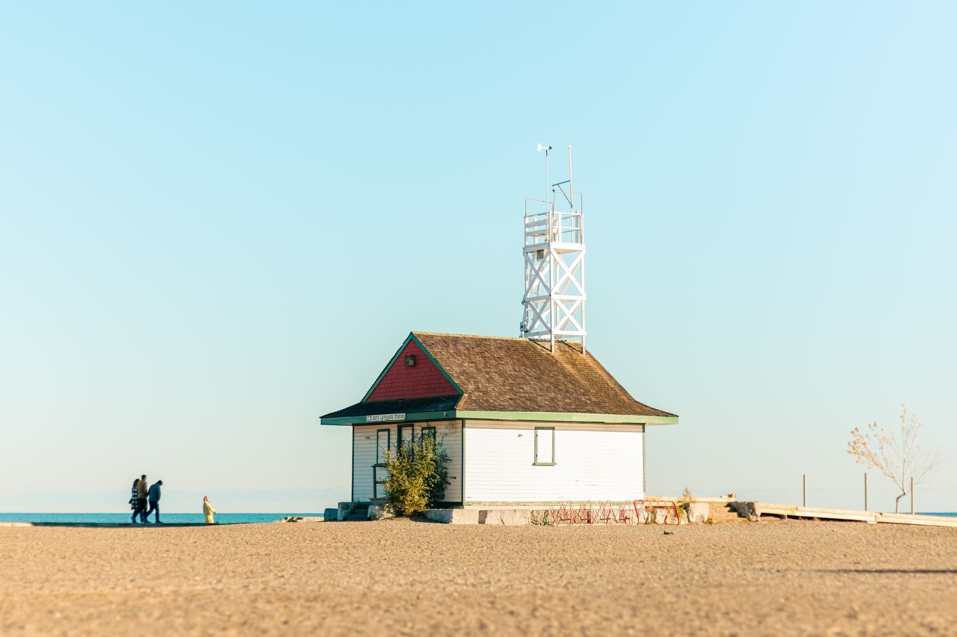
Woodbine Beach in the east end is Toronto's largest and most popular sandy beach on Lake Ontario. It runs alongside Ashbridges Bay and includes a volleyball area, a splash pad, and the Beach neighbourhood just to the north. Water quality here is generally good outside of post-storm periods. The beach is served by the 501 Queen streetcar, making it one of the easier beaches to reach by transit from downtown.
- Woodbine Beach Toronto's main city beach. Large, sandy, supervised in summer, and accessible by streetcar. Water quality is regularly monitored and posted by Toronto Public Health.
- Cherry Beach Located in the Port Lands area, quieter than Woodbine. Popular with windsurfers and dog walkers. Limited transit access — easier by bike or car.
- Centre Island Beach Accessible only by ferry. Good family beach with calmer access from the islands' interior paths. Gets crowded mid-summer.
- Hanlan's Point Beach The least crowded supervised beach in the Toronto system. Western tip of Toronto Islands. Includes a designated clothing-optional section.
- Bluffer's Park Beach At the base of the Scarborough Bluffs. Small beach but dramatic cliff backdrop makes it distinctive. Accessed from Brimley Road South.
Seasonal Guide: When to Visit Lake Ontario's Toronto Shoreline

Toronto has a humid continental climate with four distinct seasons, and your experience of Lake Ontario shifts considerably depending on when you visit. Summer (June to August) is peak season: the ferry to the islands runs frequently, the beaches are supervised, and waterfront events fill the calendar. July daytime highs average around 26 to 27 degrees Celsius, with humidity making it feel warmer. The tradeoff is crowds, especially on the Toronto Islands, and water quality advisories after heavy rains.
Late spring (May to early June) and early fall (September to mid-October) are the strongest alternatives. Temperatures are comfortable — May averages around 13 degrees Celsius, September around 17 degrees — lineups at the ferry are shorter, and the waterfront parks are less packed. The cherry blossoms at High Park bloom in late April to early May, making the broader spring visit particularly rewarding. For winter, the waterfront is quiet but the Martin Goodman Trail remains accessible, Harbourfront Centre runs its outdoor skating rink, and the views of ice forming at the lake's edge in January and February are genuinely striking.
For a broader seasonal planning view, the best time to visit Toronto guide covers event calendars, weather tradeoffs, and pricing across the full year. If you are focused specifically on the waterfront and outdoor activities, target May, June, or September for the best balance of conditions and access.
💡 Local tip
Toronto's lake breezes can make the waterfront noticeably cooler than the rest of the city, even in July. Bring a light layer for evenings on the islands or along the harbour — the temperature drop after sunset near the water can catch visitors off guard.
Getting to the Lake: Transit, Parking, and Practical Logistics

The central waterfront is easy to reach by transit. From Union Station, the 509 Harbourfront and 510 Spadina streetcars run down to Queens Quay, which forms the primary east-west spine of the waterfront. The Jack Layton Ferry Terminal for the Toronto Islands is a short walk west along Queens Quay from the streetcar stop. For Woodbine Beach in the east end, the 501 Queen streetcar runs the full length of Queen Street and connects to the beach neighbourhood. Cycling is often the fastest way to cover the full waterfront — the Martin Goodman Trail is well-maintained and bike rentals are available near the waterfront in summer.
Reaching the Scarborough Bluffs and eastern beaches by transit requires more planning. The TTC does not drop you at the base of the Bluffs directly — expect a walk of 20 to 30 minutes from the nearest bus route. Driving and using the Bluffer's Park parking lot is more practical for most visitors. For the broader Toronto transit network, the guide to getting around Toronto covers TTC routes, GO Transit options, and tips for navigating the city efficiently.
FAQ
Is Toronto on Lake Ontario?
Yes. Toronto is located on the northwestern shore of Lake Ontario, the easternmost of the five Great Lakes. The lake forms the entire southern boundary of the city.
Is Toronto the capital of Ontario?
No. Ottawa is the capital of Ontario. Toronto is the province's largest city and Canada's most populous city, with approximately 2.79 million residents in the city proper as of the 2021 census.
Can you swim in Lake Ontario near Toronto?
Yes, at designated supervised beaches. Woodbine Beach, Cherry Beach, and the Toronto Islands beaches are the main options. Swimming is not permitted at the central waterfront parks like HTO Park or Sugar Beach. Toronto Public Health posts daily water quality advisories — check before swimming, especially after heavy rainfall.
How do you get to the Toronto Islands on Lake Ontario?
By ferry from the Jack Layton Ferry Terminal at the foot of Bay Street, south of Union Station. Three routes serve Centre Island, Ward's Island, and Hanlan's Point. The trip takes about 12 to 15 minutes. On summer weekends, arrive early to avoid long queues at the Centre Island dock — the Ward's Island and Hanlan's Point ferries typically have shorter waits.
What is the closest Great Lake to Toronto?
Lake Ontario is not just the closest — it is the lake Toronto sits directly on. The city's southern boundary is Lake Ontario's shoreline. Lake Erie, the next closest Great Lake, is roughly 130 km to the south and accessible via a day trip to Niagara or the Erie shore.