Lands End is San Francisco's wildest coastal edge, a rocky, wind-scoured stretch of the Golden Gate National Recreation Area where forested cliffs drop toward the Pacific and shipwreck ruins lie just offshore. Part natural preserve, part open-air history lesson, it rewards walkers willing to trade urban convenience for raw scenery.
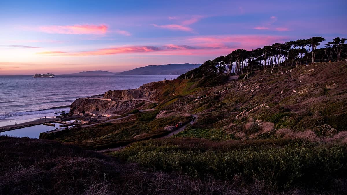
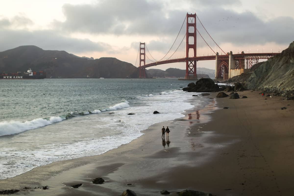
Perched at the northwestern tip of San Francisco, Lands End is where the city runs out of road and the Pacific takes over. Clifftop trails wind through cypress groves above crashing surf, ruins of the old Sutro Baths sit at the waterline, and on clear days the Golden Gate Bridge frames itself perfectly at Mile Rock Overlook. It is one of the few places in San Francisco where the landscape, not the skyline, sets the mood.
Orientation: Where Lands End Sits in San Francisco
Lands End occupies the far northwestern corner of the San Francisco peninsula, at the mouth of the Golden Gate where the bay meets the open Pacific. It is part of the Golden Gate National Recreation Area, the same federal park system that covers Crissy Field, the Marin Headlands, and Muir Woods. The area is bounded to the south and east by Lincoln Park and the Fort Miley Military Reservation, and its main approach roads are Point Lobos Avenue to the west and El Camino del Mar to the east, the latter curving toward the Legion of Honor museum on the bluff above.
Most visitors enter from one of two directions. The western entrance, at the Merrie Way parking lot off Point Lobos Avenue, puts you immediately beside the Sutro Baths ruins and the Lands End Lookout visitor center. The eastern access, reached by driving out Geary Boulevard and turning onto 33rd or 34th Avenue before picking up El Camino del Mar, deposits you near the trail's quieter, more forested end close to the Legion of Honor. The two trailheads are roughly 1.5 miles apart along the main coastal path, making a one-way walk with a return shuttle or rideshare a practical option.
Neighboring areas worth understanding: the Richmond District sits to the south, its grid of avenues providing the main residential approach. The Outer Richmond's commercial strip along Balboa Street and Clement Street is only a short drive inland. To the northwest, across the water, lie the Presidio and the southern anchorage of the Golden Gate Bridge. Lands End itself has no residents and no commercial street life. It is a park, full stop, and visitors should plan accordingly.
Character and Atmosphere: What This Place Actually Feels Like
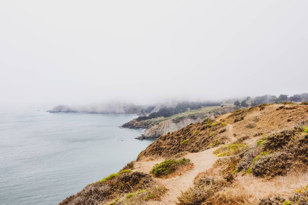
Step onto the Lands End Coastal Trail at 7am on a weekday and the city disappears faster than you would expect. The trail runs through a dense corridor of Monterey cypress, their trunks salt-twisted and dramatic, and the sound of traffic from Geary Boulevard fades within a few hundred yards. What replaces it is wind, surf, and the occasional foghorn. The light at this hour is flat and grey for much of the year, the marine layer sitting low over the water, burning off by mid-morning in summer and autumn.
By mid-morning on weekends, the western end near Sutro Baths fills up noticeably. Families, joggers, photographers with tripods, and dog walkers all converge around the ruins and the lookout terrace. The trail itself rarely feels crowded because it spreads foot traffic over nearly two miles of coastline, but the viewpoint platforms at Mile Rock Overlook can get tight, especially when the Golden Gate Bridge is visible. Weekday mornings and late afternoons are considerably quieter.
After dark, the atmosphere shifts entirely. The park has no lighting beyond the visitor center area, and the cliffside trail is genuinely dark and uneven after sunset. The rocks below can be heard but not seen. This is not a place for an evening stroll unless you know it well and carry a light. The western end, near the parking lot at Merrie Way, stays slightly busier into the evening in summer because people linger for sunset, but the trail itself should be avoided at night.
⚠️ What to skip
The cliffs at Lands End are active and unstable. The National Park Service explicitly asks visitors to stay on designated trails and away from the cliff edges. Each year people are injured or require rescue after straying onto the bluffs. The trail surfaces can also be slick when fog rolls in, even in summer. Wear shoes with grip, not sandals.
The weather here deserves its own mention. San Francisco's climate is classified as a warm-summer Mediterranean type, and the city is heavily influenced by the Pacific marine layer. At Lands End, which sits directly on the exposed northwestern edge of the peninsula, that translates to wind almost every afternoon, frequent fog in June and July, and temperatures that rarely climb above the mid-60s Fahrenheit even in high summer. September and October are typically the warmest and clearest months, when the marine layer retreats and the bridge views are at their most reliable. Bring a layer regardless of what the inland forecast says.
What to See and Do
The main attraction is the Lands End Coastal Trail itself, a roughly 3.4-mile round trip from the western trailhead to the eastern end and back. The trail is well-maintained packed gravel for most of its length, though some sections involve wooden steps and short climbs. At Mile Rock Overlook, about halfway along heading east, you get the view that appears on most San Francisco postcards: the Golden Gate Bridge framed between rocky headlands, with the Marin Headlands rising behind it. On a clear morning this viewpoint is extraordinary. The offshore rocks at this point are also where several historic shipwrecks occurred, and at low tide you can sometimes make out the broken remains of the ship Ohioan, grounded in 1937.
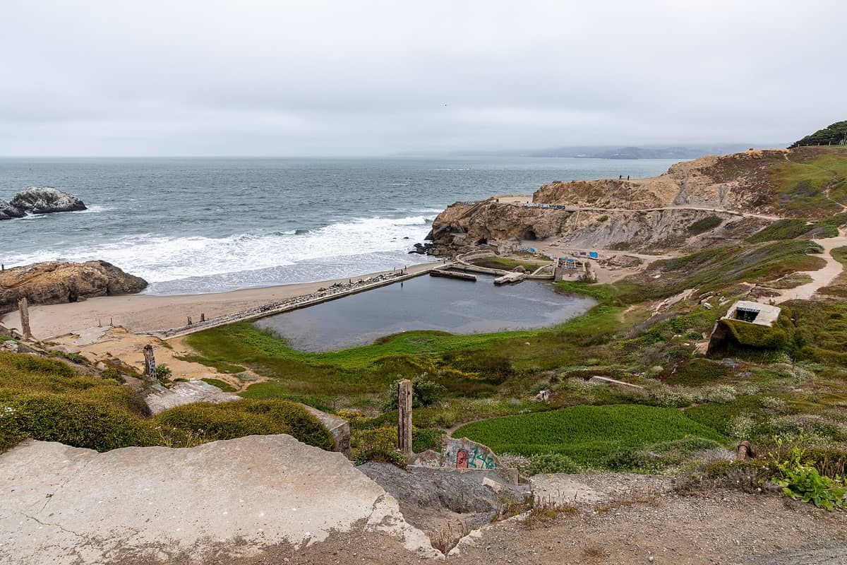
At the western end of the trail, the Sutro Baths ruins are one of San Francisco's most compelling historic sites. Built in 1896 by Adolph Sutro, the baths were once the largest indoor swimming complex in the world, holding over a million gallons of seawater in six pools beneath a massive glass roof. The complex burned in 1966 during demolition work and was never rebuilt. What remains today are the concrete foundations and tank walls, sitting at sea level in a small cove, half-filled with water and colonized by coastal plants. At high tide the waves wash into the ruins directly. The scale of what existed here only becomes clear when you read the interpretive panels and then look back at the foundations.
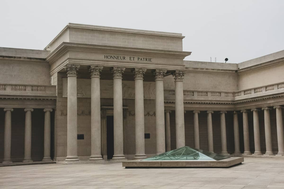
Just uphill from the Sutro Baths, the Lands End Lookout visitor center occupies the old Casino building, a National Park Service facility with exhibits on the area's natural and cultural history, a bookshop, and restrooms. It is the only indoor amenity at Lands End. The adjacent terrace provides a clear sightline to the Golden Gate Bridge and out toward the Marin Headlands, making it a reasonable alternative to the more demanding trail walk for visitors with limited mobility. Nearby, the Legion of Honor museum sits at the eastern edge of Lincoln Park on the bluff above the trail's far end. The building itself is a Beaux-Arts replica of the Palais de la Légion d'Honneur in Paris, and the view from the museum's terrace toward the Golden Gate Bridge and bay is one of the best elevated perspectives in the city.
Lands End Coastal Trail: 3.4-mile round trip, moderate difficulty, packed gravel with some steps
Mile Rock Overlook: best spot for Golden Gate Bridge views from the trail
Sutro Baths ruins: free to explore, interpretive panels on site, most dramatic at high tide or after rain
Lands End Lookout visitor center: NPS exhibits, bookshop, restrooms, open daily 9am–5pm
Legion of Honor museum: fine arts collection and exceptional terrace views, ticketed entry
Eagle's Point Labyrinth: a stone labyrinth laid into a clifftop clearing by a local artist, visible from the trail
💡 Local tip
The stone labyrinth at Eagle's Point is easy to miss. About 0.4 miles east of the visitor center along the coastal trail, a short spur leads to a clearing with views down the coast and a large circular labyrinth made from found stones. It has been rebuilt multiple times by volunteers after storm damage. Worth the detour.
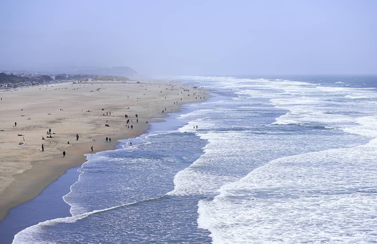
For walkers interested in extending their day, the western end of Lands End connects naturally to the broader San Francisco hiking network. From the Sutro Baths you can walk a few blocks south along Point Lobos Avenue to reach Ocean Beach, the long flat strand that extends several miles south toward Fort Funston. Heading east along El Camino del Mar after the trail ends brings you into Lincoln Park itself, a public golf course and open green space that feels surprisingly pastoral given its urban surroundings.
Eating and Drinking Near Lands End
Lands End has no restaurants, cafes, or food vendors within the park itself, with the exception of the small Lands End Lookout cafe inside the visitor center, which serves coffee, pastries, and light snacks. Hours vary seasonally, so do not plan a full meal around it. Bring water and food if you are spending more than an hour on the trail.
The closest proper food options are a short drive or bus ride inland along Geary Boulevard in the Outer Richmond District. This stretch, particularly around 6th to 12th Avenues, is one of San Francisco's most reliable corridors for unpretentious, affordable dining. The neighborhood has a strong concentration of Southeast Asian, Chinese, Korean, and Russian restaurants reflecting the Richmond's diverse demographics. Clement Street, two blocks north of Geary between roughly 2nd and 12th Avenues, is the strip locals actually use, with bakeries, dim sum spots, Vietnamese pho houses, and grocery stores.
If you are pairing a Lands End visit with the Legion of Honor, note that the museum has its own cafe with indoor seating and views from the terrace. For a broader picture of where and what to eat across the city, the San Francisco food guide covers neighborhood by neighborhood options in detail.
ℹ️ Good to know
There are no water fountains on the trail itself. The visitor center has a water filling station. Carry at least 16 oz of water per person, more in warmer months or if you plan to extend your walk toward Ocean Beach.
Getting There and Around
Lands End has no BART or Muni Metro station. The most straightforward public transit option is the Muni 38R/38 Geary bus, which runs from the Transbay Transit Center downtown along Geary Boulevard all the way to the coast. Get off near 48th Avenue and Point Lobos Avenue, a short walk from the Merrie Way parking lot and visitor center. The 38-Geary is a frequent, reliable line and the journey from Union Square takes roughly 35 to 45 minutes depending on traffic. Verify current schedules and fares with SFMTA before travel, as these are subject to change.
By car, the standard approach from central San Francisco is Geary Boulevard westbound to Point Lobos Avenue, which curves north into the Merrie Way parking lot. This lot fills quickly on sunny weekends after 9am. Street parking on Point Lobos Avenue and the surrounding residential blocks is an alternative but can require a 10 to 15 minute walk. A second small parking area sits off El Camino del Mar near the eastern trailhead, providing access to the Legion of Honor and quieter sections of the trail.
Rideshare services including Uber and Lyft operate throughout San Francisco and can drop you at the visitor center. Given the distance from the city center and the absence of local transit options for the return trip if you are tired, having a rideshare app installed is genuinely useful here. For a full overview of transit options across the city, see the San Francisco transit guide.
Cycling to Lands End is possible via the network of protected lanes and paths through the Richmond District and along the park roads. The approach along Balboa Street or through Lincoln Park is manageable for most riders. There is bike parking near the visitor center. The trail itself is not open to cycling.
Where to Stay
There are no hotels within Lands End itself, which is a national recreation area with no accommodation. The closest hotel options are in the Outer Richmond District, a quiet residential neighborhood about 10 to 20 minutes on foot or a few minutes by bus from the Merrie Way trailhead. Richmond District lodging tends to be smaller boutique hotels and independent guesthouses, notably less expensive than Union Square or Fisherman's Wharf, and the neighborhood has a calm, residential character with good local restaurants.
Staying in the Richmond District suits travelers who prioritize proximity to Golden Gate Park, Ocean Beach, and the western parks over easy access to downtown museums or the Ferry Building. The 38-Geary bus connects Richmond hotels to the Financial District in about 30 minutes. For a complete comparison of accommodation zones across the city, the San Francisco accommodation guide covers each neighborhood's trade-offs in detail.
Travelers visiting Lands End as a day trip from a downtown or Union Square hotel will find it perfectly manageable. The 38-Geary bus runs directly, or a rideshare takes under 20 minutes outside rush hour. There is no strong reason to relocate your base for a single Lands End visit unless you plan multiple days of western San Francisco exploration combining the park, Golden Gate Park, and the coast.
Practical Notes and Honest Drawbacks
Lands End is not for every visitor. If your time in San Francisco is limited to two or three days and you have not yet seen the core city attractions, the neighborhood offers little urban culture, nightlife, shopping, or food. It is a park. Its value is entirely in the landscape, the trail, the ruins, and the views. For travelers who have already seen Fisherman's Wharf, crossed the Golden Gate, and walked through the Mission, Lands End offers something genuinely different: a stretch of coastline that feels remote and ecologically alive despite being within city limits.
The combination of Lands End, the Sutro Baths, and the Legion of Honor fills a comfortable half-day. Pair it with Golden Gate Park to the south for a full day on the city's western edge without returning downtown. The park's de Young Museum and California Academy of Sciences are roughly 20 minutes by car or bus from Merrie Way, making a logical same-day extension.
Visitors with a broader interest in San Francisco's natural landscape and coastal access should also consider the city's wider hiking options, which extend from Lands End south along Ocean Beach and north across the Golden Gate to the Marin Headlands and beyond.
TL;DR
Lands End is a clifftop coastal park in the Golden Gate National Recreation Area at San Francisco's northwest tip, featuring the Sutro Baths ruins, the Lands End Coastal Trail, and clear-day views of the Golden Gate Bridge.
Best visited on a clear morning or in September and October, when fog is less frequent and temperatures are at their most comfortable.
No food or water on the trail itself. Bring supplies. The visitor center cafe has limited options.
Ideal for hikers, history enthusiasts, photographers, and anyone wanting genuine coastal scenery within the city. Not suited to travelers focused on nightlife, dining, or urban culture.
Combine with the Legion of Honor museum and Golden Gate Park for a full day on San Francisco's western edge without needing to return downtown.
San Francisco's beaches are unlike anywhere else in California. Cold water, dramatic fog, and powerful Pacific surf define the city's coastline, but the scenery is extraordinary. This guide covers the best beaches in San Francisco for sunset walks, surfing, coastal hikes, and day trips beyond the city.
San Francisco packs an unusually deep museum scene for a city of its size. This guide covers the city's finest institutions across art, science, history, and culture, with practical tips on pricing, free days, and how to plan your visit.
San Francisco's climate defies expectations. Summer is foggy and cool, fall is surprisingly warm, and winter can be a genuine bargain. This guide breaks down every season so you can pick the right time for your trip, your budget, and your tolerance for Karl the Fog.
San Francisco is one of the most visually dramatic cities in America, built on hills that frame the bay, the bridges, and the Pacific at every turn. This guide covers the best viewpoints in the city and beyond, from free hilltop parks to lesser-known coastal perches that most visitors never find.
San Francisco sits at the gateway to one of the most varied day-trip landscapes in America. Within two hours you can be walking among thousand-year-old redwoods, tasting Cabernet in Napa, hiking coastal bluffs in Point Reyes, or exploring a former federal prison on a rocky bay island.
San Francisco is one of America's most spectacular cities, and you don't need a big budget to experience it. From iconic bridges and coastal trails to free museum days and world-class public art, this guide covers the best free things to do in San Francisco.
From BART airport transfers to cable car fares, this guide covers every way to get around San Francisco — with practical advice on what's worth it, what to skip, and how to navigate the city like someone who actually lives there.
San Francisco offers a deep luxury travel scene for a city of its size. This guide covers where to stay, what to eat, which experiences justify the price, and how to time your visit to get the best value on high-end accommodations.
San Francisco International Airport sits 13-15 miles south of downtown, and getting into the city is straightforward once you know your options. This guide breaks down every transport method from SFO, including real costs, travel times, and the mistakes most first-timers make.
San Francisco's built environment spans Victorian row houses, Edwardian flats, Beaux-Arts civic monuments, and bold modernist towers. This guide breaks down the key styles, landmark buildings, and best neighborhoods to explore on foot, with practical advice for architecture walks in any season.
San Francisco's cable car system is one of the most recognizable transit networks in the world — and also one of the most misunderstood. This guide covers all three operating lines, how fares and passes work, the best times to ride, and clear guidance on avoiding the worst queues.
San Francisco's ferry network spans two separate operators, multiple terminals, and fares that vary by route and payment method. This guide breaks down every major route, current pricing, and how to avoid the most common mistakes first-time riders make.
San Francisco packs an enormous amount into 47 square miles of land. This guide covers everything a first-time visitor needs to know: how to arrive, where to stay, what to prioritize, and the common mistakes that waste time and money.
San Francisco Fleet Week is one of the largest free public events in the United States, drawing hundreds of thousands of visitors to the Bay waterfront each October. This guide covers the Blue Angels air show schedule, the best free viewing spots, ship tour logistics, VIP ticket options, and practical advice for navigating the crowds.
San Francisco is one of California's most naturally romantic cities. Bay views, foggy evenings, world-class food, and historic neighborhoods create an atmosphere that pairs well with almost any travel style. This guide covers where to go, what to spend, when to visit, and how to make the most of a couples trip to the City and County of San Francisco.
At 1,017 acres, Golden Gate Park is one of the great urban parks in the United States, and most visitors only scratch the surface. This guide covers the top attractions, practical logistics, seasonal timing, and the spots worth seeking out beyond the obvious.
San Francisco rewards the curious. Beyond the Golden Gate Bridge and Alcatraz, the city hides mosaic staircases, acoustic sculptures, Victorian cemeteries, and rooftop gardens that most visitors never find. This guide points you to the spots locals actually love.
San Francisco is one of America's most walkable cities, but its hiking scene goes far beyond neighborhood strolls. These trails deliver coastal cliffs, forested ridgelines, panoramic summits, and wild Pacific shorelines all within city limits or a short drive away.
San Francisco in summer is nothing like a Southern California beach vacation. Expect cool temperatures in the mid-60s°F, morning fog that can linger well past noon, and a packed event calendar from June through August. This guide breaks down exactly what you'll encounter and how to prepare.
Three days is enough to hit San Francisco's iconic landmarks, explore distinct neighborhoods, and get a real feel for the city. This itinerary routes each day logically so you spend less time in transit and more time actually experiencing the city.
The Mission burrito is not just a meal. It is a San Francisco institution with a disputed origin, a precise construction method, and a handful of taquerias that have been perfecting it for decades. This guide covers the history, the key ingredients, where to find the best version, and what separates the real thing from a pale imitation.
Muir Woods National Monument sits just 12-17 miles north of San Francisco, protecting one of the last old-growth coast redwood stands in the Bay Area. This guide covers everything you need to plan a successful day trip: mandatory reservations, transport options, trail choices, seasonal timing, and the common mistakes that catch first-time visitors off guard.
Napa Valley sits just 50-60 miles north of San Francisco, making it one of the Bay Area's most rewarding day trips. This guide covers every logistic: how to get there, what tastings cost, when to book, and how to pace a single day without burning out before the third pour.
San Francisco packs an extraordinary range of distinct neighborhoods into just 47 square miles of land. From the foggy avenues of the Outer Sunset to the sunny slopes of the Mission, this guide breaks down what each district is actually like, who it suits, and how to navigate between them.
San Francisco's nightlife runs deeper than most visitors expect. This guide breaks down the best neighborhoods for a night out, what to expect at live music venues, how late things actually run, and which parts of the city suit your style — from craft cocktail bars to late-night dance floors.
San Francisco has a reputation for draining wallets, but that reputation is only partly deserved. With the right approach to accommodation, transport, food, and attractions, a solo traveler can get by on $110–$160 per day without missing the city's best experiences. This guide breaks down exactly where your money goes and where you can cut back.
Twenty-four hours in San Francisco is enough to walk an iconic bridge, eat world-class food, explore historic neighborhoods, and watch the sun set over the Pacific. This itinerary is built around geography so you spend less time in transit and more time actually experiencing the city.
San Francisco is one of America's most rewarding cities to visit, but it rewards prepared travelers. This guide covers the real safety picture: car break-ins, petty theft hotspots, neighborhoods to navigate carefully, and practical strategies to keep your trip trouble-free.
San Francisco's shopping scene spans far more than one famous square. This guide breaks down every major retail district, from luxury flagships around Union Square to independent boutiques in Hayes Valley, vintage shops on Haight Street, and specialty food at the Ferry Building, with practical advice on getting there, what to expect, and where to skip.
The San Francisco to Los Angeles corridor is one of the most-traveled routes in the United States, with options ranging from a 90-minute flight to a two-day Pacific Coast Highway road trip. This guide breaks down every realistic method by cost, time, and comfort so you can choose the right one for your trip.
San Francisco is one of the world's great walking cities, built for exploration on foot. These 20 self-guided stops span the city's most rewarding routes, from waterfront promenades and Victorian hilltops to mural-filled alleys and coastal cliffs.
Forty-eight hours is enough time to hit San Francisco's greatest hits and still feel like you've gone beyond the surface. This guide covers the essential waterfront, neighborhoods, parks, and cultural stops to build a memorable weekend in one of America's most compelling cities.
San Francisco is one of the most family-friendly cities in the United States, with world-class science museums, free outdoor spaces, bay cruises, and a compact layout that keeps logistics manageable. This guide covers the best attractions for children, how to save on tickets, when to visit, and how to get around without a car.
San Francisco packs an extraordinary range of experiences into about 47 square miles of land. From the Golden Gate Bridge and Alcatraz to neighborhood walks through Chinatown and the Mission, this guide covers the top things to do in San Francisco with clear, practical detail to help you spend your time well.
San Francisco has one of the most serious food cultures in the United States, with about 30 Michelin-starred restaurants according to the 2026 Michelin Guide, roughly 4,400 restaurants packed into about 47 square miles, and an obsessive commitment to local, seasonal ingredients. This guide covers the iconic dishes, the neighborhoods where each food culture lives, what things actually cost, and where visitors consistently go wrong.
Choosing where to stay in San Francisco shapes your entire trip. This guide breaks down the city's most practical neighborhoods by price, transit access, safety, and atmosphere, so you can book with confidence rather than guesswork.