Best Hikes in San Francisco: Coastal Trails, City Peaks & Wild Escapes
San Francisco is one of America's most walkable cities, but its hiking scene goes far beyond neighborhood strolls. These trails deliver coastal cliffs, forested ridgelines, panoramic summits, and wild Pacific shorelines all within city limits or a short drive away.
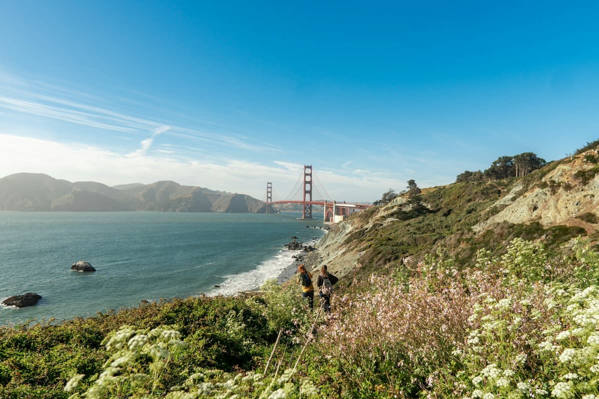
Plan and book this trip
Tools from our partner Travelpayouts help you compare flights and hotels. If you book through them, we may earn a commission at no extra cost to you.
Flights
Hotels map
San Francisco packs a remarkable range of terrain into 46.9 square miles of land. On any given morning you can walk windswept coastal bluffs, climb forested hills above the fog, or trace the edge of a bay with bridge views at every turn. Most city trails are free and accessible year-round, though the western and coastal routes can be significantly cooler and windier than you expect, so layers are non-negotiable even in summer. For a deeper look at planning your time, see our first-time visitor guide and our dedicated Golden Gate Park guide for the trails that wind through that enormous green space. Whether you have two hours or a full day, the hikes below range from short urban stair walks to serious coastal routes with significant elevation.
💡 Local tip
September and October are the best months for San Francisco hiking: warmer, clearer, and far less foggy than June through August. Always bring a wind layer for coastal and hilltop trails regardless of the forecast.
Coastal & Cliffside Trails
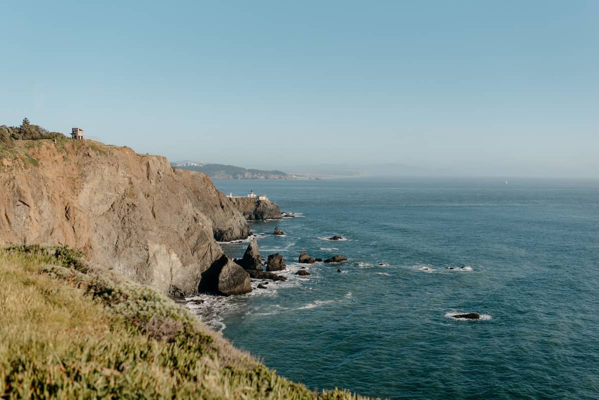
San Francisco's western and northern edges are defined by dramatic coastal geography: crumbling cliffs, cypress forests, shipwreck ruins, and unobstructed views of the Golden Gate. These trails sit within the Golden Gate National Recreation Area and are among the most scenically rewarding in the entire Bay Area. The Lands End area alone offers multiple distinct routes that can be combined into a longer half-day outing.
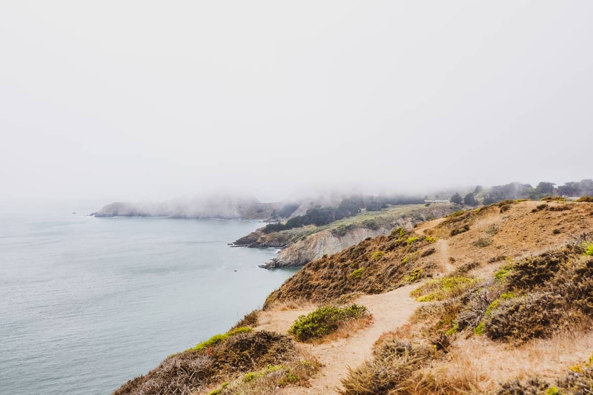
1. Walk the Dramatic Cliffs of Lands End Coastal Trail
A 3.4-mile trail through cypress groves and along rugged cliffs at San Francisco's western tip. At low tide, look for shipwreck remains in the surf. The Golden Gate views from the upper trail sections are exceptional. Allow 2 hours round-trip.
Explore1. Walk the Dramatic Cliffs of Lands End Coastal Trail
A 3.4-mile trail through cypress groves and along rugged cliffs at San Francisco's western tip. At low tide, look for shipwreck remains in the surf. The Golden Gate views from the upper trail sections are exceptional. Allow 2 hours round-trip.
Explore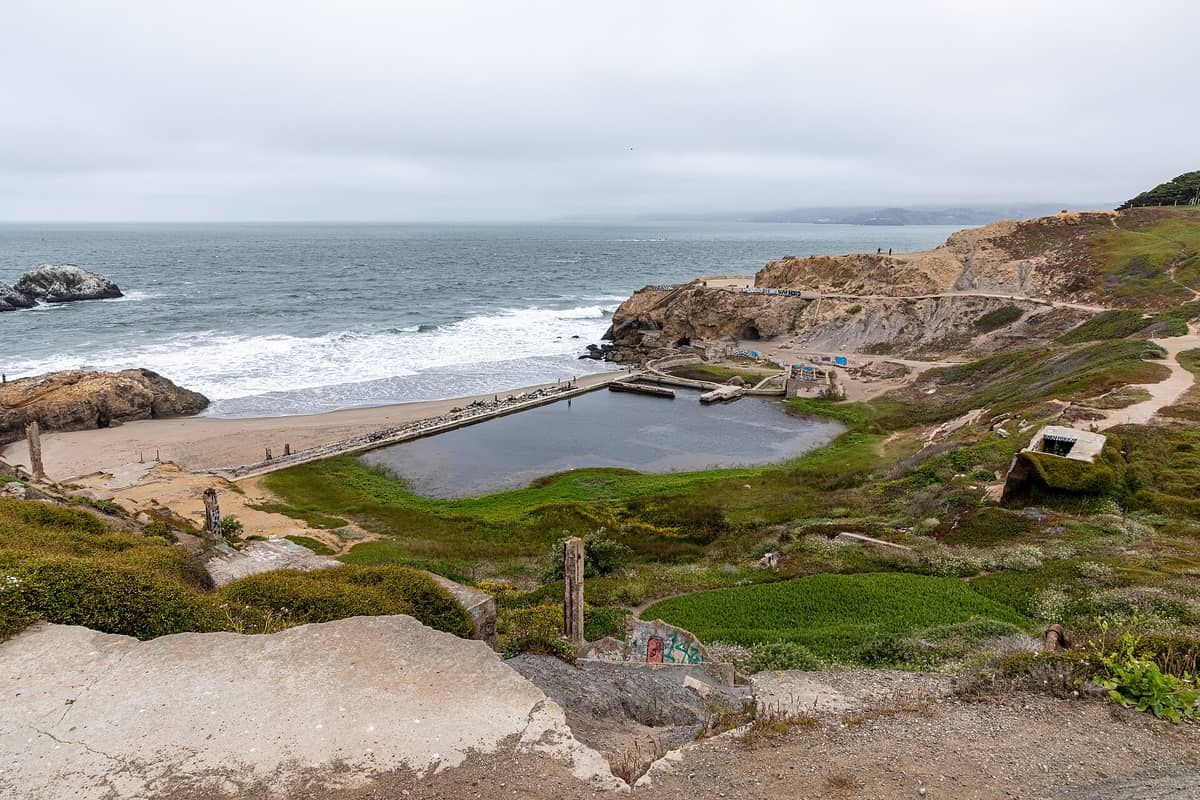
2. Explore the Eerie Ruins at Sutro Baths
The concrete ruins of an 1896 ocean swimming complex cling to the rocks at Lands End, filling with seawater at high tide. Combine with the coastal trail for a natural loop, then descend the staircase into the ruins for close-up exploration.
Explore2. Explore the Eerie Ruins at Sutro Baths
The concrete ruins of an 1896 ocean swimming complex cling to the rocks at Lands End, filling with seawater at high tide. Combine with the coastal trail for a natural loop, then descend the staircase into the ruins for close-up exploration.
Explore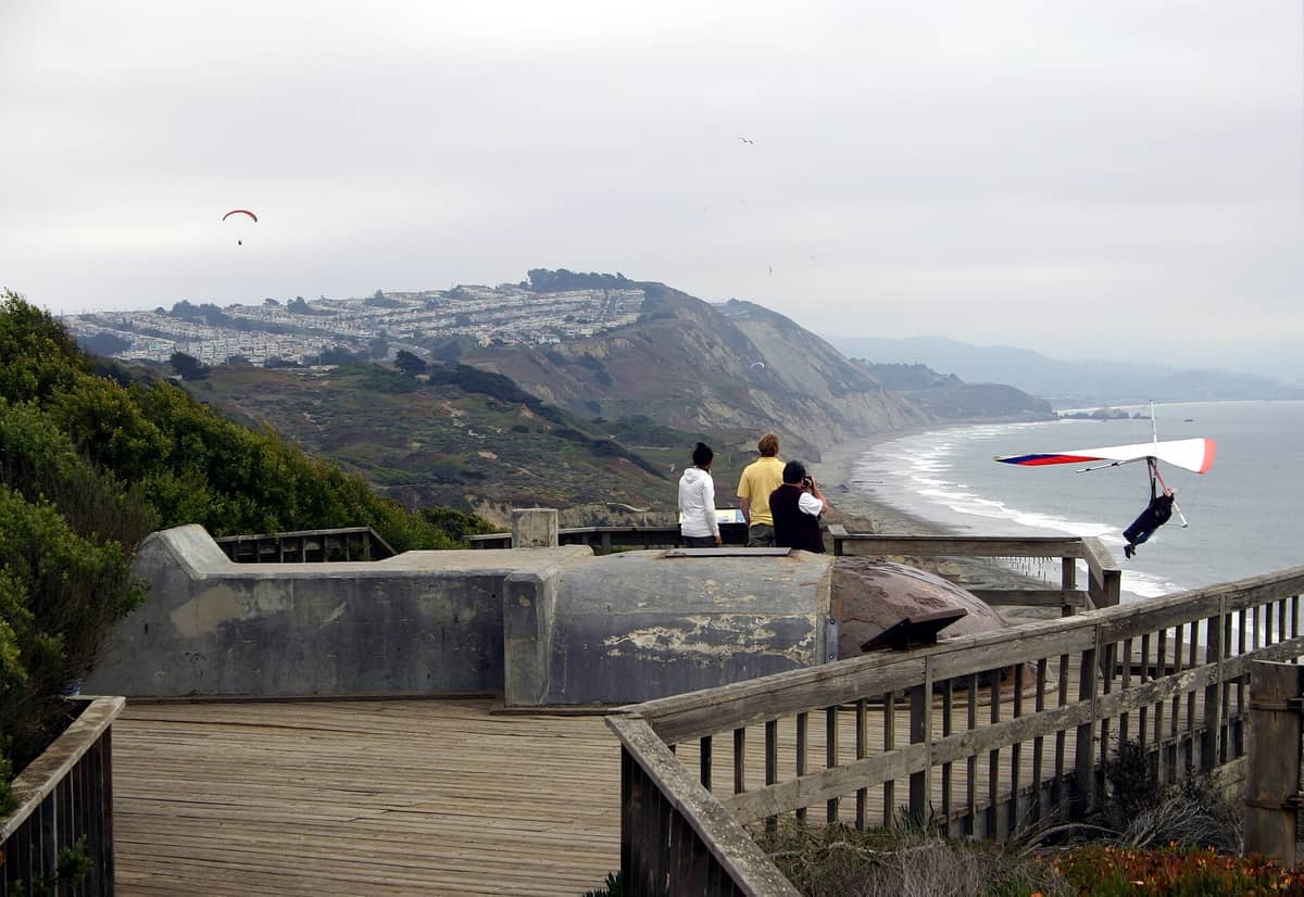
3. Hike the Windswept Bluffs at Fort Funston
Clifftop trails above the Pacific at San Francisco's southern end offer sweeping ocean views and a raw, windswept atmosphere unlike the city's more manicured parks. Watch hang gliders launch from the bluff edge. Trails range from 1 to 4 miles.
Explore3. Hike the Windswept Bluffs at Fort Funston
Clifftop trails above the Pacific at San Francisco's southern end offer sweeping ocean views and a raw, windswept atmosphere unlike the city's more manicured parks. Watch hang gliders launch from the bluff edge. Trails range from 1 to 4 miles.
Explore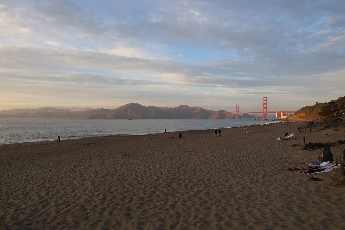
4. Hike to Baker Beach for Golden Gate Bridge Views
A short but rewarding walk through the Presidio's coastal forest leads to this mile-long sandy beach directly beneath the Golden Gate Bridge. The northern end of the beach delivers the closest bridge views accessible on foot without crossing it.
Explore4. Hike to Baker Beach for Golden Gate Bridge Views
A short but rewarding walk through the Presidio's coastal forest leads to this mile-long sandy beach directly beneath the Golden Gate Bridge. The northern end of the beach delivers the closest bridge views accessible on foot without crossing it.
Explore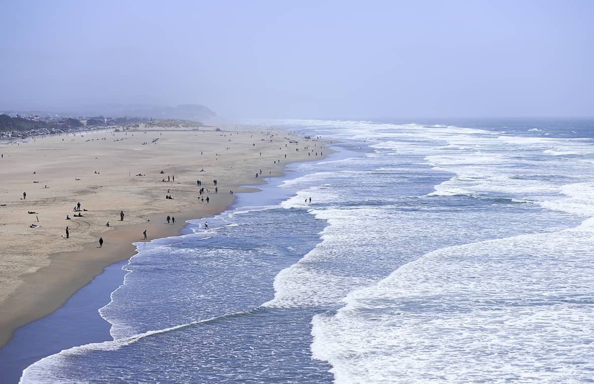
5. Walk the Wild Pacific Shoreline at Ocean Beach
San Francisco's 3.5-mile Pacific coastline is a legitimate hiking route for those who want wind, surf, and wide open skies. Walk north to south from Cliff House to Fort Funston for a sustained coastal outing with no pavement underfoot.
Explore5. Walk the Wild Pacific Shoreline at Ocean Beach
San Francisco's 3.5-mile Pacific coastline is a legitimate hiking route for those who want wind, surf, and wide open skies. Walk north to south from Cliff House to Fort Funston for a sustained coastal outing with no pavement underfoot.
ExploreHilltop Summits & Panoramic Views
San Francisco's famous hills are not just scenery, they are genuine hikes with real elevation gain. The city has 43 named hills, and several offer trails rather than just sidewalks to the top. For the best overall vantage points across the city, our best views in San Francisco guide covers these summits in detail alongside rooftop and waterfront alternatives.
6. Summit Twin Peaks for 360-Degree City Views
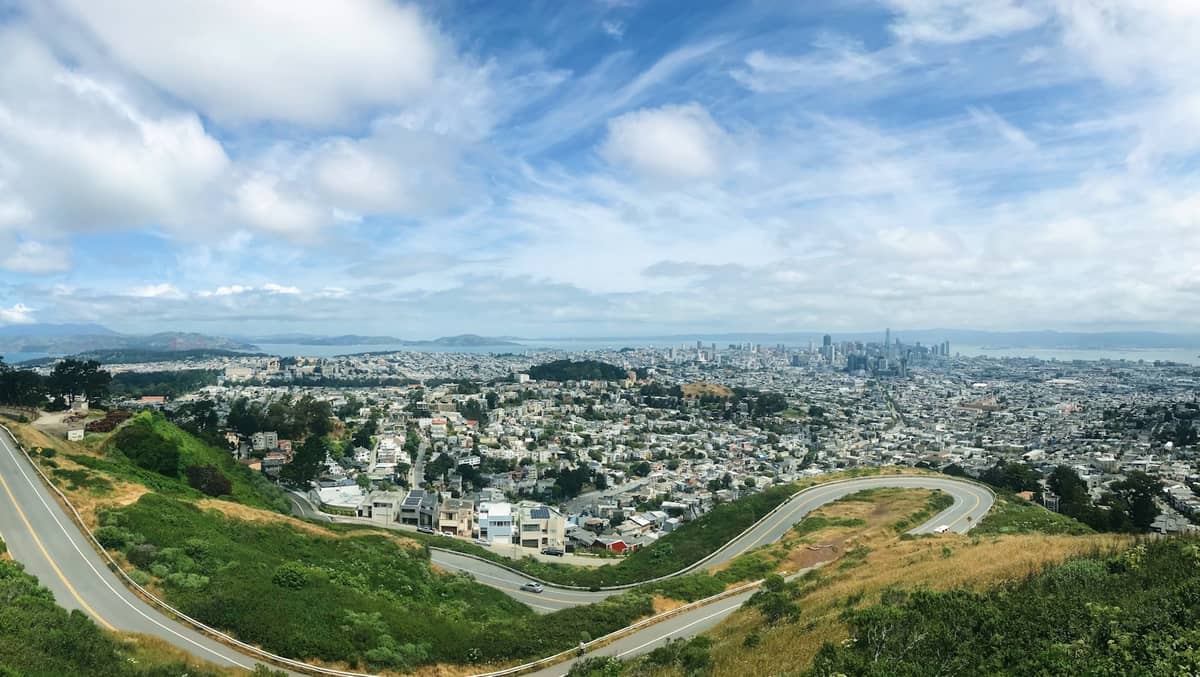
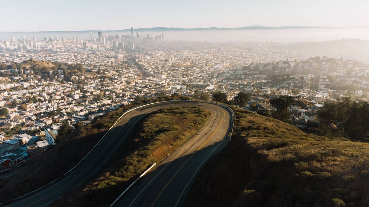
At 922 feet, these twin hills at the city's geographic center give unobstructed 360-degree views of San Francisco, the bay, both bridges, and the surrounding hills. A short but steep trail from the road makes this a genuine hike with a spectacular payoff.
Explore6. Summit Twin Peaks for 360-Degree City Views
At 922 feet, these twin hills at the city's geographic center give unobstructed 360-degree views of San Francisco, the bay, both bridges, and the surrounding hills. A short but steep trail from the road makes this a genuine hike with a spectacular payoff.
Explore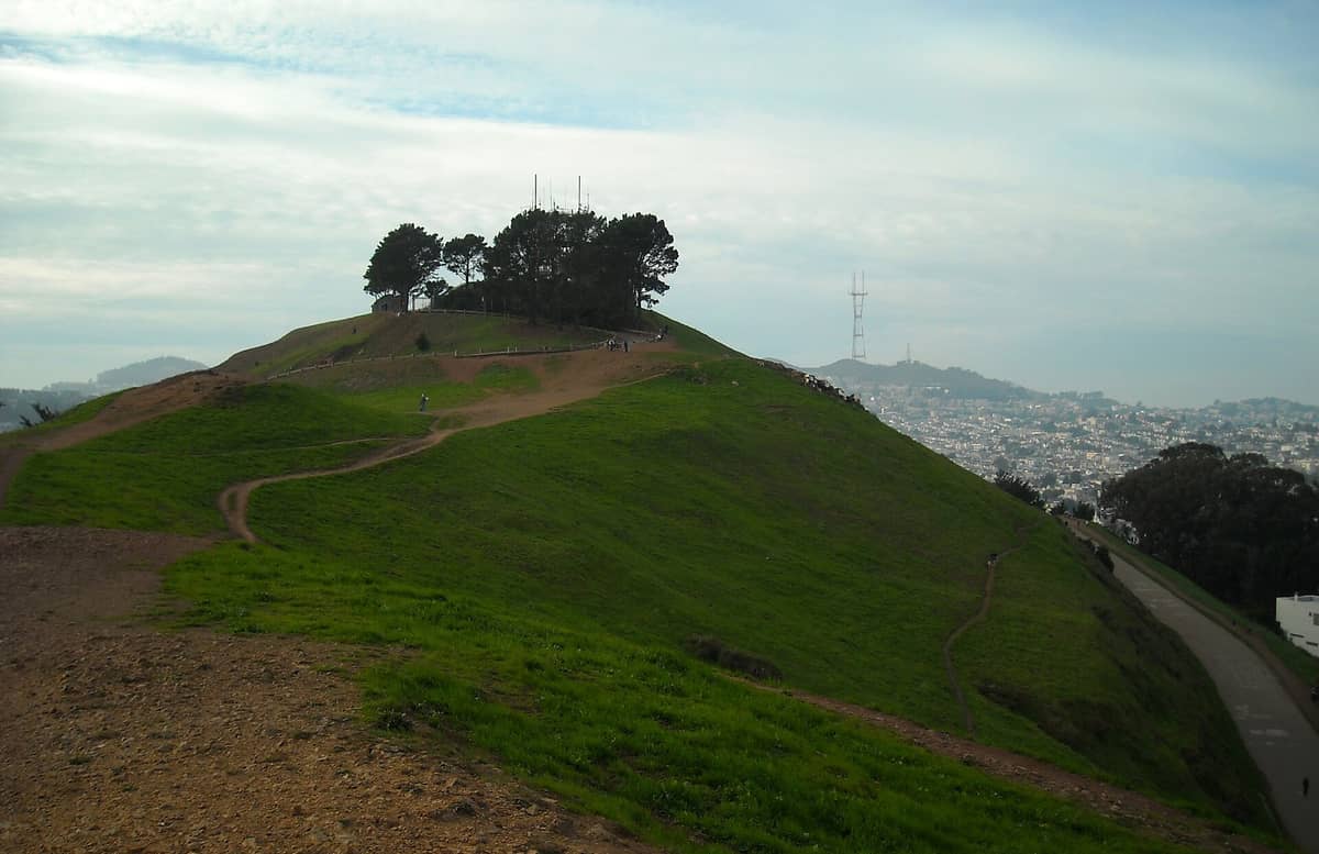
7. Climb Bernal Heights for Intimate City Panoramas
Bernal Heights offers some of the most personal and unobstructed city views in San Francisco from trails that wind through open grassland. The summit loop takes under an hour and rewards with clear sightlines from the bay to the Pacific. Dog-friendly throughout.
Explore7. Climb Bernal Heights for Intimate City Panoramas
Bernal Heights offers some of the most personal and unobstructed city views in San Francisco from trails that wind through open grassland. The summit loop takes under an hour and rewards with clear sightlines from the bay to the Pacific. Dog-friendly throughout.
Explore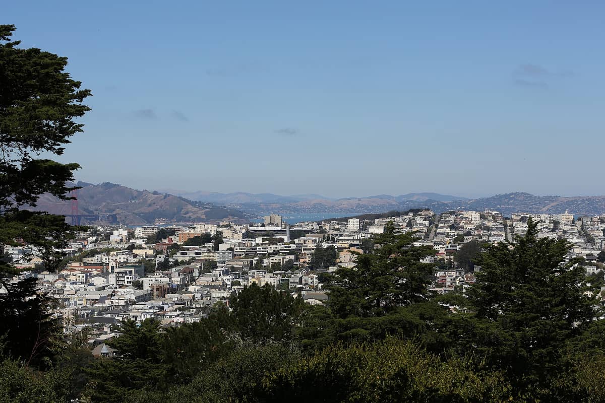
8. Trek Through Buena Vista Park's Forested Summit
San Francisco's oldest park is more forest than lawn, with winding dirt trails through eucalyptus and redwood up to a hilltop clearing above Haight-Ashbury. Views of the Golden Gate emerge through the canopy. The park has a genuinely wild character for central SF.
Explore8. Trek Through Buena Vista Park's Forested Summit
San Francisco's oldest park is more forest than lawn, with winding dirt trails through eucalyptus and redwood up to a hilltop clearing above Haight-Ashbury. Views of the Golden Gate emerge through the canopy. The park has a genuinely wild character for central SF.
Explore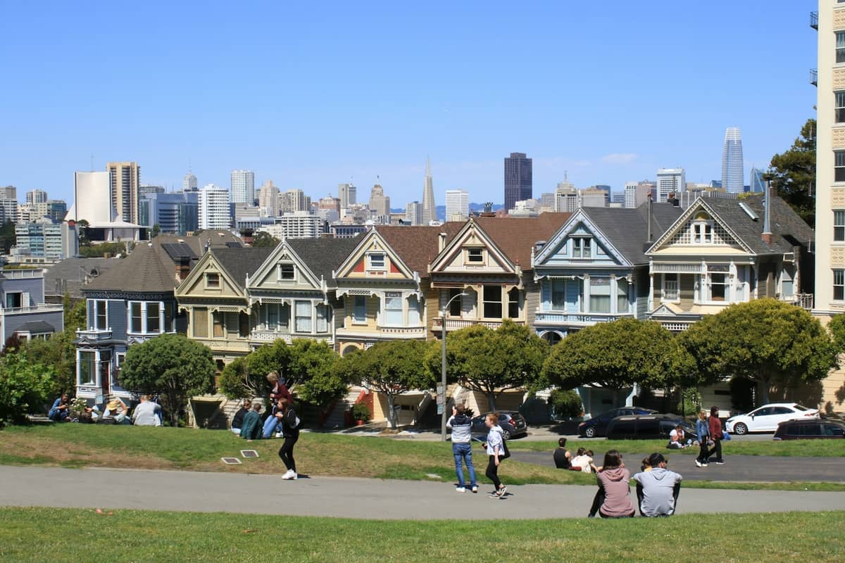
9. Hike Up Alamo Square for Painted Ladies Views
The grassy hillside climb to Alamo Square's upper lawn rewards with the classic Painted Ladies and downtown skyline view. It is a short but steep ascent from the Steiner Street base, best in morning light when the Victorian facades glow and the hilltop is quiet.
Explore9. Hike Up Alamo Square for Painted Ladies Views
The grassy hillside climb to Alamo Square's upper lawn rewards with the classic Painted Ladies and downtown skyline view. It is a short but steep ascent from the Steiner Street base, best in morning light when the Victorian facades glow and the hilltop is quiet.
ExploreStaircase Walks & Urban Trails
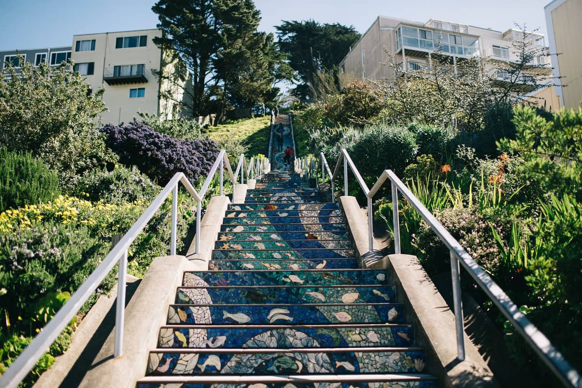
San Francisco has over 600 public staircases, and some of the city's best urban hiking connects them into routes that climb through secret gardens, wild parrots, and Victorian streetscapes. These walks are short in distance but significant in elevation gain and character. Pair several together for a satisfying half-day route through North Beach or the western neighborhoods.
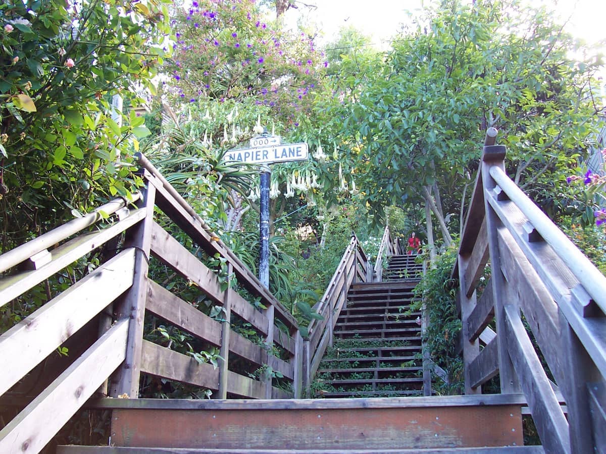
10. Descend the Magical Filbert Steps on Telegraph Hill
This wooden staircase down Telegraph Hill's eastern face passes through lush private gardens, Victorian cottages clinging to the cliff, and wild parrots nesting in the trees. Best walked top-down from Coit Tower after climbing the hill first. Allow 30-45 minutes.
Explore10. Descend the Magical Filbert Steps on Telegraph Hill
This wooden staircase down Telegraph Hill's eastern face passes through lush private gardens, Victorian cottages clinging to the cliff, and wild parrots nesting in the trees. Best walked top-down from Coit Tower after climbing the hill first. Allow 30-45 minutes.
Explore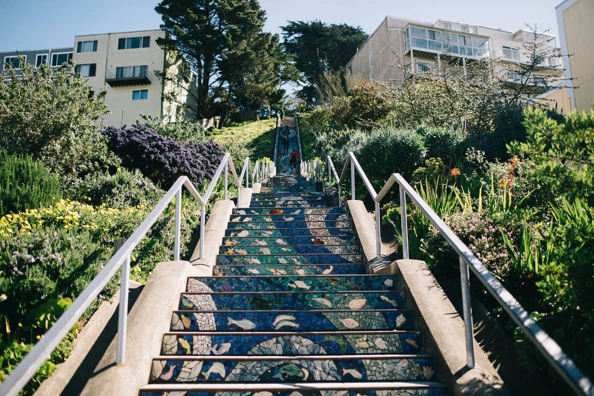
11. Climb the 16th Avenue Tiled Steps Mosaic Staircase
163 steps covered in hand-crafted ceramic tiles depicting an ocean-to-sky nature scene in the Inner Sunset. Climb to the grassy hilltop above for sweeping westward views toward the Pacific. The round trip, including the hilltop, takes about 30 minutes.
Explore11. Climb the 16th Avenue Tiled Steps Mosaic Staircase
163 steps covered in hand-crafted ceramic tiles depicting an ocean-to-sky nature scene in the Inner Sunset. Climb to the grassy hilltop above for sweeping westward views toward the Pacific. The round trip, including the hilltop, takes about 30 minutes.
Explore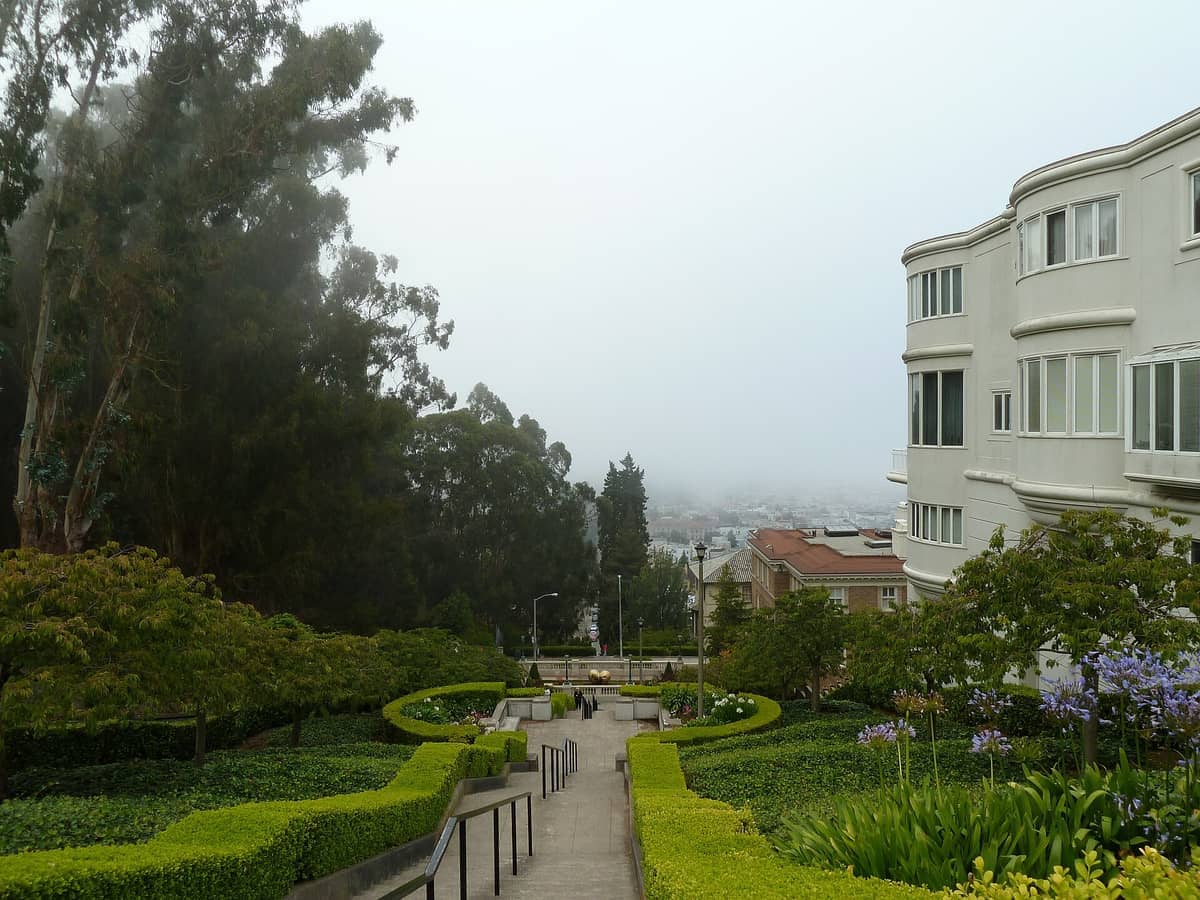
12. Walk the Elegant Lyon Street Steps Through Pacific Heights
Stone steps descend from Broadway through one of San Francisco's grandest residential corridors, framed by manicured gardens and mansion frontages. Views of the Presidio and bay appear at each landing. Combine with a Presidio walk for a longer outing.
Explore12. Walk the Elegant Lyon Street Steps Through Pacific Heights
Stone steps descend from Broadway through one of San Francisco's grandest residential corridors, framed by manicured gardens and mansion frontages. Views of the Presidio and bay appear at each landing. Combine with a Presidio walk for a longer outing.
Explore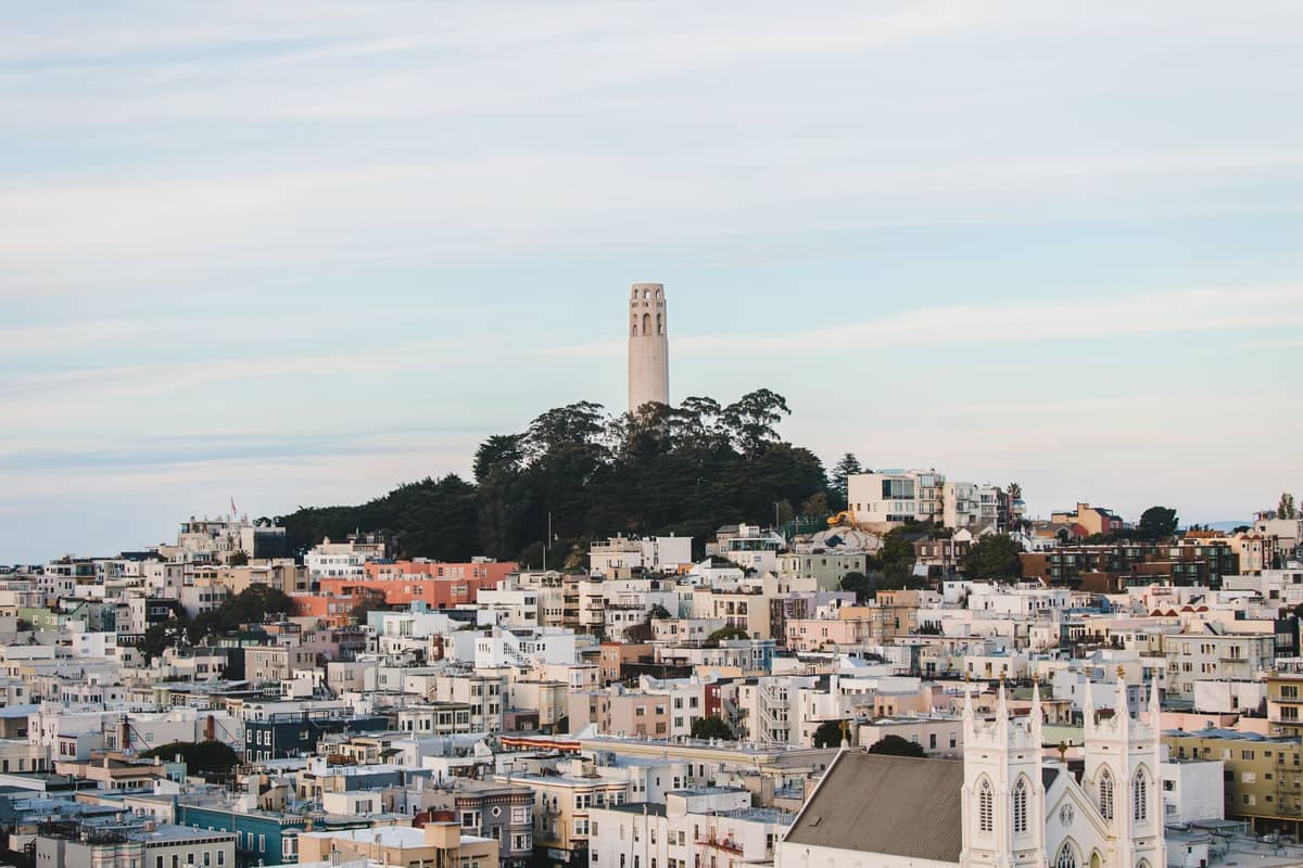
13. Hike Up Telegraph Hill to Coit Tower
The steep climb to Telegraph Hill's summit earns you 360-degree bay views and the WPA murals inside Coit Tower. Take the Greenwich Steps up and the Filbert Steps down for a classic loop through wild parrots and hillside gardens. The climb takes about 20 minutes.
Explore13. Hike Up Telegraph Hill to Coit Tower
The steep climb to Telegraph Hill's summit earns you 360-degree bay views and the WPA murals inside Coit Tower. Take the Greenwich Steps up and the Filbert Steps down for a classic loop through wild parrots and hillside gardens. The climb takes about 20 minutes.
ExplorePresidio & Golden Gate Bridge Trails
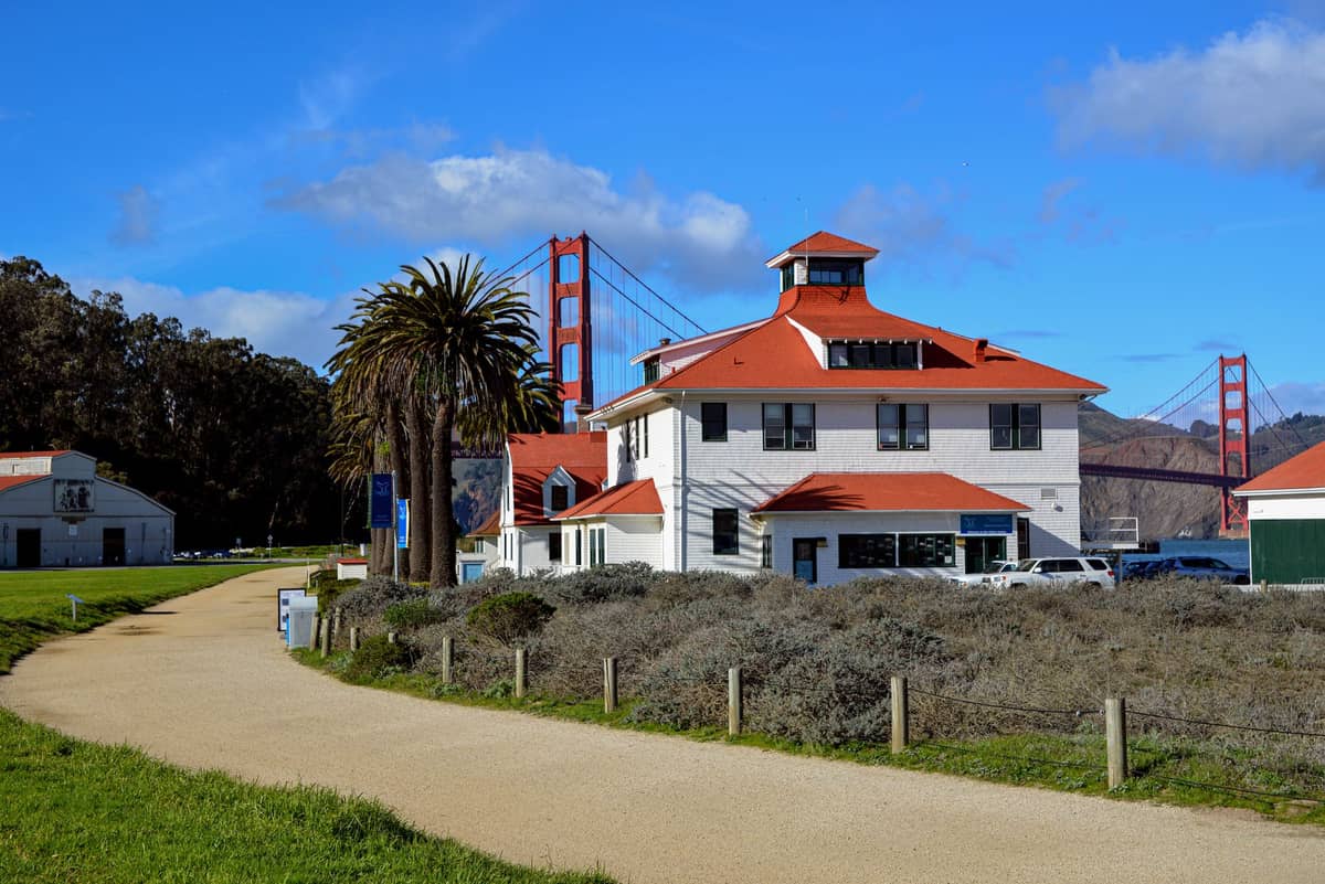
The Presidio is San Francisco's most underrated hiking destination, roughly 1,500-acre national park within the city limits with forests, coastal bluffs, historic batteries, and some of the best Golden Gate Bridge access anywhere. The Presidio trail network connects seamlessly to Baker Beach, Crissy Field, and the bridge itself, making it easy to build a 4-8 mile loop without retracing your steps.
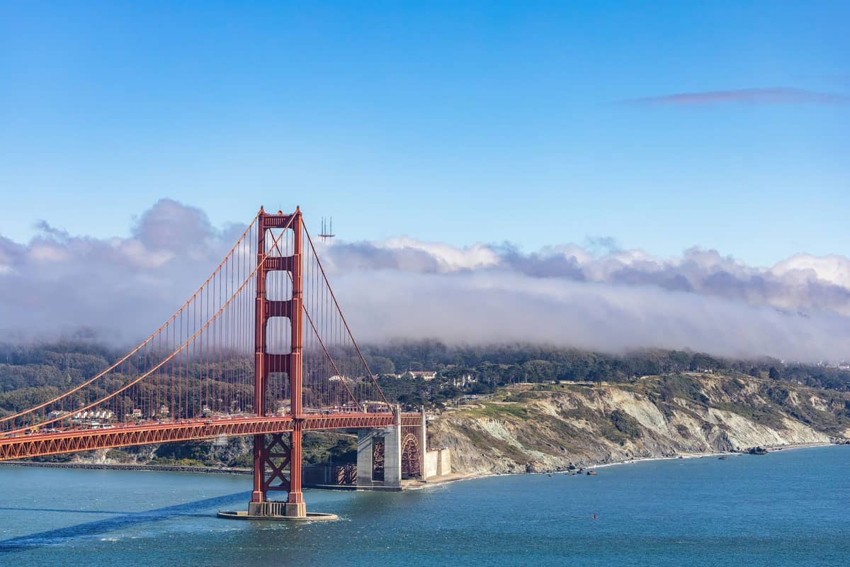
14. Walk Across the Golden Gate Bridge on Its Pedestrian Path
The 1.7-mile bridge walk is one of the world's great pedestrian experiences, with Bay, Marin Headlands, and city views from the 746-foot towers. Start from the south plaza, walk to the Marin side and back. Allow 90 minutes and bring wind protection.
Explore14. Walk Across the Golden Gate Bridge on Its Pedestrian Path
The 1.7-mile bridge walk is one of the world's great pedestrian experiences, with Bay, Marin Headlands, and city views from the 746-foot towers. Start from the south plaza, walk to the Marin side and back. Allow 90 minutes and bring wind protection.
Explore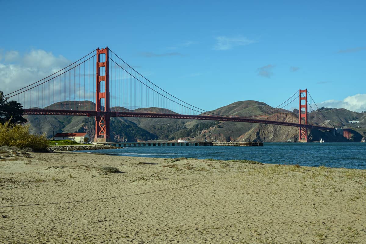
15. Stroll the Restored Wetlands of Crissy Field
A 2-mile waterfront promenade along a restored tidal marsh between the Marina and Fort Point, with Golden Gate Bridge views building with every step westward. Flat and family-friendly, it connects to the bridge trail and the Warming Hut cafe at the western end.
Explore15. Stroll the Restored Wetlands of Crissy Field
A 2-mile waterfront promenade along a restored tidal marsh between the Marina and Fort Point, with Golden Gate Bridge views building with every step westward. Flat and family-friendly, it connects to the bridge trail and the Warming Hut cafe at the western end.
Explore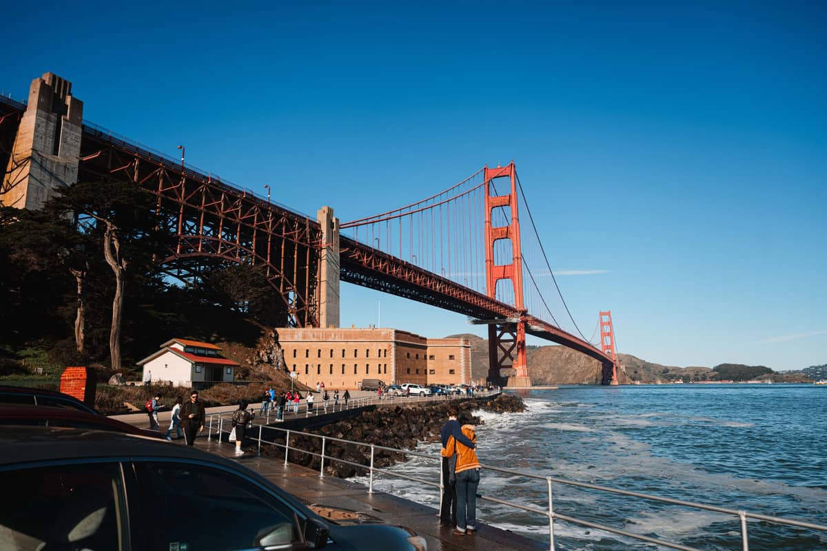
16. Hike to Fort Point for Views Directly Below the Bridge
A Presidio trail leads to this Civil War fort directly beneath the Golden Gate Bridge's south anchorage. The approach through Battery East Trail delivers unbeatable low-angle bridge views. The fort itself is free to enter and adds substantial historical depth to the walk.
Explore16. Hike to Fort Point for Views Directly Below the Bridge
A Presidio trail leads to this Civil War fort directly beneath the Golden Gate Bridge's south anchorage. The approach through Battery East Trail delivers unbeatable low-angle bridge views. The fort itself is free to enter and adds substantial historical depth to the walk.
ExploreDay Hikes Beyond the City
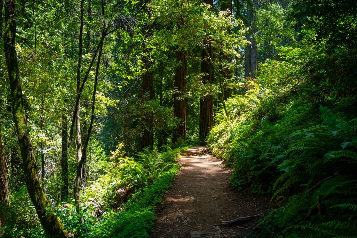
Some of California's finest hiking is within an hour of San Francisco, and these destinations are worth building a dedicated day around. Our day trips from San Francisco guide covers transport logistics for reaching them, and our Muir Woods guide has everything you need for the redwood forest visit specifically.
17. Hike the Marin Headlands for the Best Bridge Views in the Bay Area
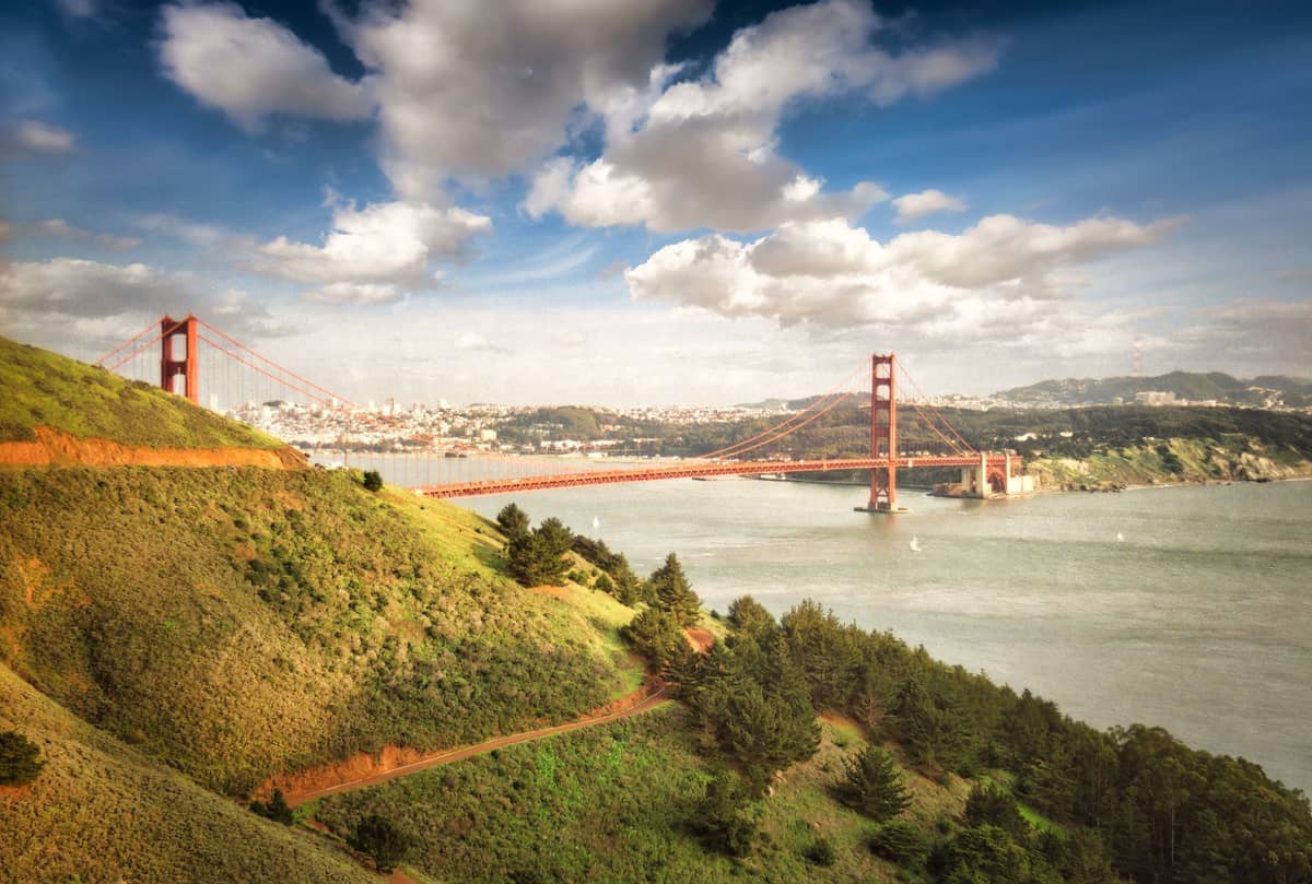
Battery Spencer and Hawk Hill, just across the Golden Gate Bridge, deliver the most dramatic above-level views of the bridge and San Francisco skyline. Trails range from short battery walks to longer coastal loops. Drive or cycle across the bridge to access them.
Explore17. Hike the Marin Headlands for the Best Bridge Views in the Bay Area
Battery Spencer and Hawk Hill, just across the Golden Gate Bridge, deliver the most dramatic above-level views of the bridge and San Francisco skyline. Trails range from short battery walks to longer coastal loops. Drive or cycle across the bridge to access them.
Explore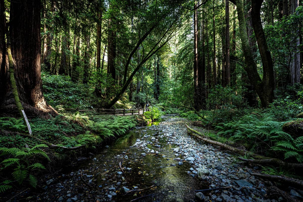
18. Walk Among Ancient Redwoods at Muir Woods
Old-growth coastal redwoods up to 258 feet tall and 1,000 years old line the canyon floor trails at Muir Woods, just 12 miles north of San Francisco. The Cathedral Grove loop takes 45-60 minutes; longer ridge trails climb into Mount Tamalpais State Park above.
Explore18. Walk Among Ancient Redwoods at Muir Woods
Old-growth coastal redwoods up to 258 feet tall and 1,000 years old line the canyon floor trails at Muir Woods, just 12 miles north of San Francisco. The Cathedral Grove loop takes 45-60 minutes; longer ridge trails climb into Mount Tamalpais State Park above.
Explore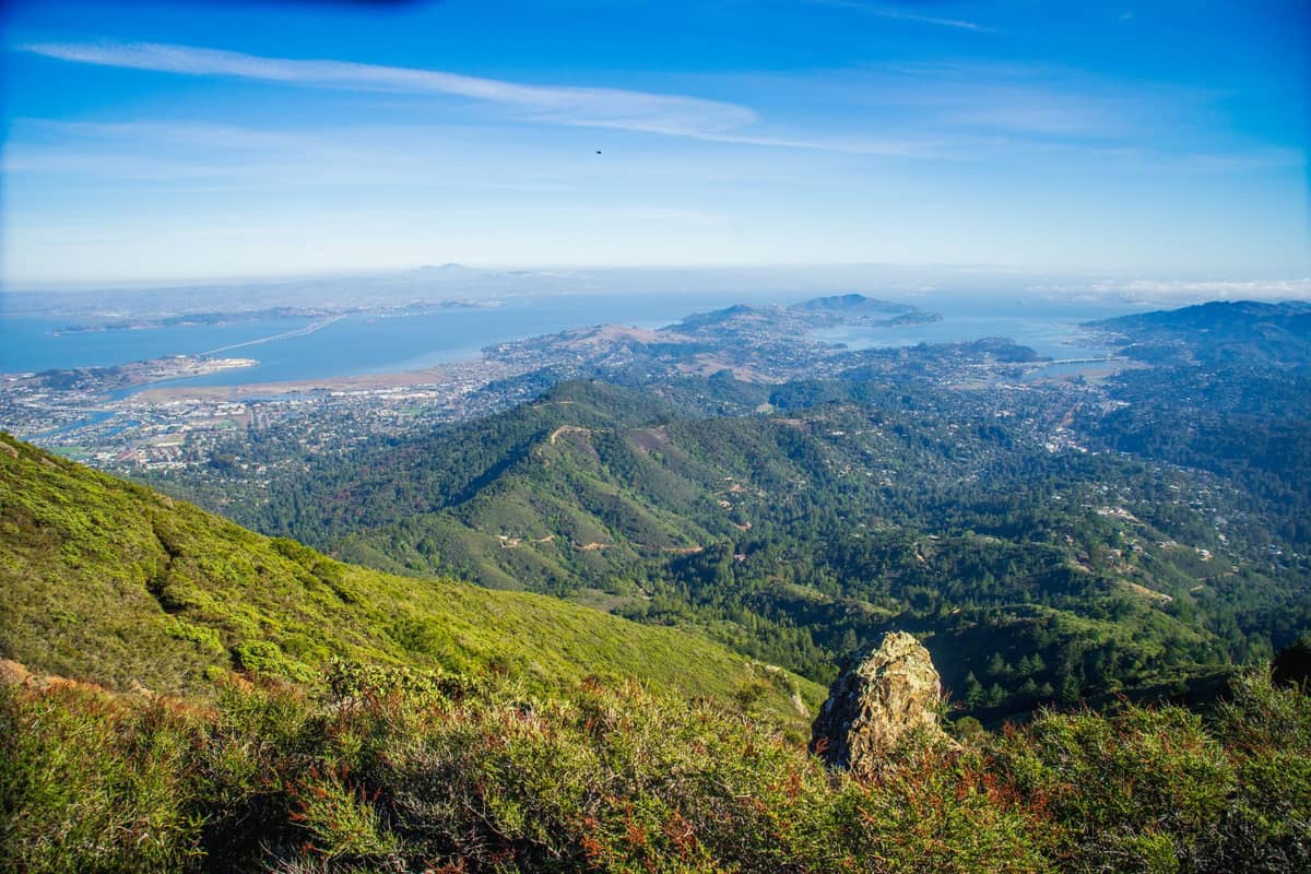
19. Summit Mount Tamalpais for Bay Area-Wide Panoramas
At 2,571 feet, Mount Tamalpais towers above the Marin Peninsula with views spanning San Francisco, the bay, and the Pacific. The East Peak fire road is the most direct summit route; the Steep Ravine Trail through redwood canyon is the most scenic approach from below.
Explore19. Summit Mount Tamalpais for Bay Area-Wide Panoramas
At 2,571 feet, Mount Tamalpais towers above the Marin Peninsula with views spanning San Francisco, the bay, and the Pacific. The East Peak fire road is the most direct summit route; the Steep Ravine Trail through redwood canyon is the most scenic approach from below.
Explore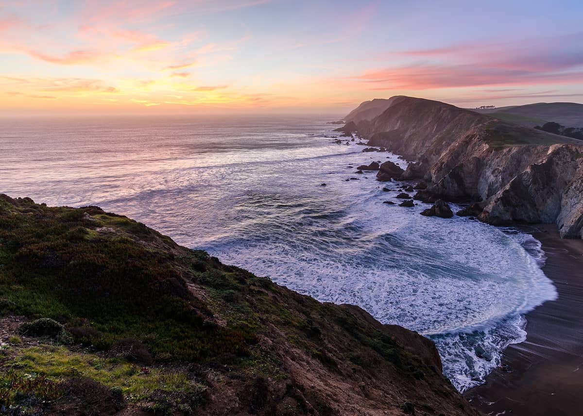
20. Hike the Dramatic Cliffs of Point Reyes National Seashore
A 71,000-acre wilderness an hour north of San Francisco offers coastal bluffs, tule elk herds, a historic lighthouse, and some of the best hiking in Northern California. The Tomales Point Trail through elk territory is the standout route. Advance reservations may be required for some areas.
Explore20. Hike the Dramatic Cliffs of Point Reyes National Seashore
A 71,000-acre wilderness an hour north of San Francisco offers coastal bluffs, tule elk herds, a historic lighthouse, and some of the best hiking in Northern California. The Tomales Point Trail through elk territory is the standout route. Advance reservations may be required for some areas.
Explore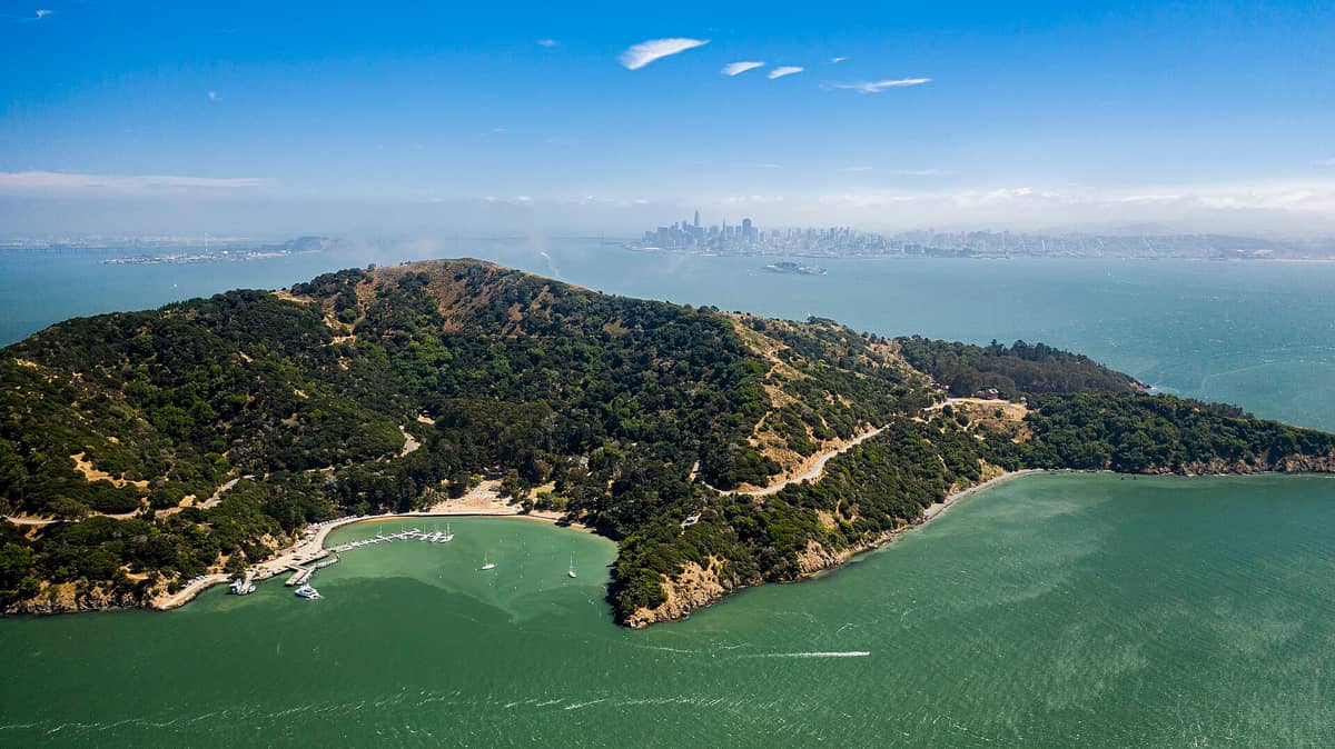
21. Hike Angel Island's Perimeter for 360-Degree Bay Views
The 5-mile perimeter road around the bay's largest natural island circles through military ruins, a historic immigration station, and continuous views of San Francisco, Marin, and the East Bay. Take the ferry from Pier 41; the full loop takes 3-4 hours at a walking pace.
Explore21. Hike Angel Island's Perimeter for 360-Degree Bay Views
The 5-mile perimeter road around the bay's largest natural island circles through military ruins, a historic immigration station, and continuous views of San Francisco, Marin, and the East Bay. Take the ferry from Pier 41; the full loop takes 3-4 hours at a walking pace.
Explore✨ Pro tip
For Muir Woods, advance timed-entry parking or shuttle reservations are required and sell out weeks ahead, especially on weekends. Book via GoMuirWoods.com before your trip.
FAQ
Are San Francisco hikes free?
Most city trails and hilltop parks are completely free, including Lands End, Twin Peaks, Bernal Heights, and the Presidio trail network. Some day-trip destinations charge fees: Muir Woods requires both a timed-entry parking or shuttle reservation and an entrance fee ($15 per person ages 16+), and Angel Island charges a ferry fare. Always check the relevant park website before visiting as fees and reservation requirements change.
What should I wear hiking in San Francisco?
Always bring a wind-resistant layer regardless of the season. Coastal and hilltop trails can be 10-15 degrees colder and significantly windier than downtown, especially in summer when the marine layer is heaviest. Trail runners or sturdy walking shoes are sufficient for most city hikes; proper hiking boots are recommended for Mount Tamalpais and Point Reyes.
What is the best time of year to hike in San Francisco?
September and October offer the warmest, clearest conditions with minimal fog. June, July, and August are peak tourist months but often the foggiest, particularly on western-facing coastal trails. Winter hikes (November through March) can be beautiful on clear days but bring rain gear. Spring trails are green and wildflower-covered but can be muddy after rain.
Can I hike from downtown San Francisco to the Golden Gate Bridge?
Yes. A popular route runs from Fisherman's Wharf along the Crissy Field promenade through the Presidio to Fort Point, then up to the bridge plaza: roughly 4 miles one way with minimal elevation gain until the final climb to the bridge. Allow 2-3 hours. Return by bus or retrace the route.
How do I get to Muir Woods and Marin Headlands without a car?
The Marin Headlands are accessible by cycling across the Golden Gate Bridge or by the Marin Headlands Shuttle (check current seasonal schedules at the Golden Gate National Recreation Area website). Muir Woods has dedicated seasonal shuttles from regional ferry terminals (including Sausalito and Larkspur) to the monument; advance reservations are required and parking without a reservation is not permitted on busy days.