Self-Guided Walking Routes in Buenos Aires: The Complete Neighborhood-by-Neighborhood Guide
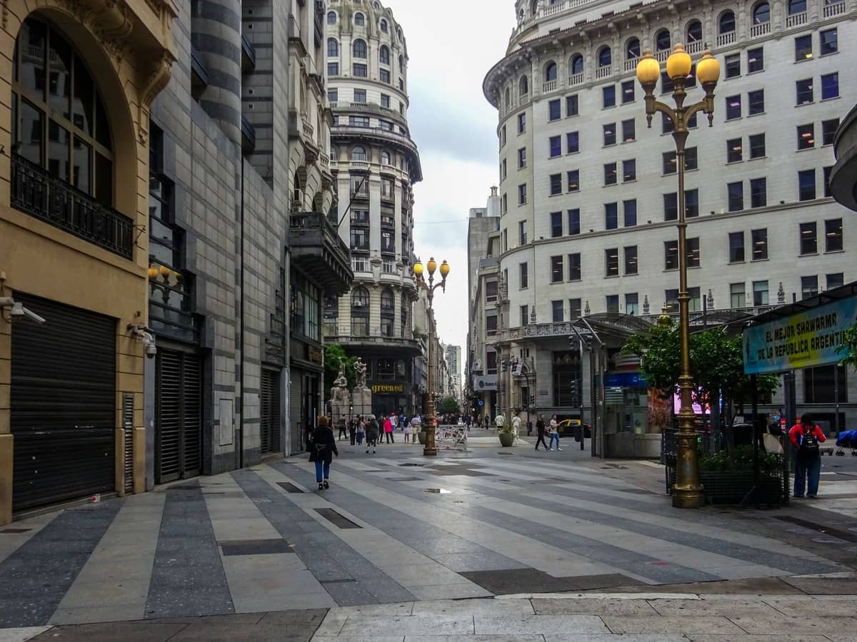
Buenos Aires is one of the great walking cities of South America, with distinct neighborhoods close enough to link on foot and rich enough to fill a full day each. This guide breaks down the best self-guided walking routes by barrio, with practical details on duration, what to prioritize, when to go, and where to be careful.
Tickets & tours
Live prices and dates from our booking partner. If you book, we may earn a commission at no extra cost to you.
TL;DR
- Self-guided walking routes in Buenos Aires are free to follow; the city's official tourism site publishes downloadable maps and themed itineraries for neighborhoods including Recoleta, San Telmo, La Boca, and Palermo.
- Spring (September to November) and autumn (March to May) offer the most comfortable walking temperatures, around 13 to 26°C, with lower humidity than summer.
- Each major barrio takes 1 to 3 hours to cover on foot; a full cross-city circuit linking San Telmo, Recoleta, and Palermo is best split across two days.
- La Boca is safe near Caminito but not for wandering off the tourist circuit; this guide flags which streets to avoid.
- Free tip-based walking tours run daily and are useful as a template for building your own route, but self-guided itineraries cost nothing beyond transport and optional entry fees.
Why Buenos Aires Works So Well for Walking
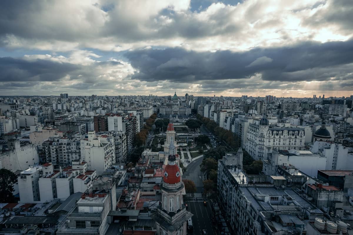
The Ciudad Autónoma de Buenos Aires covers around 203 km², but its tourist core is compact and logically organized. Most major attractions cluster in a band running from La Boca in the south through San Telmo, Microcentro, Puerto Madero, Recoleta, and up into Palermo in the north. The Subte (metro) and an extensive colectivo (bus) network mean you can drop into a neighborhood, walk it thoroughly, then ride to the next one without backtracking. That combination of walkable barrios and reliable public transit is what makes self-guided exploration so practical here.
The city's official tourism portal (turismo.buenosaires.gob.ar) publishes free themed itineraries and downloadable maps designed specifically for independent walkers. Physical copies of maps like The Golden Map are available at city tourism kiosks and most hotel front desks. For those who prefer their phone, GPS-enabled audio walk apps provide offline routes covering several barrios. None of these require a booking or a fee. You can also cross-reference the main Buenos Aires things-to-do guide to decide which sights to anchor each route around.
💡 Local tip
Load the official BA tourism itineraries onto your phone before you leave your accommodation. Data connections in some older neighborhoods can be patchy, and having maps cached offline saves time at street corners.
Route 1: Microcentro and the Historic Core (2 to 3 hours)
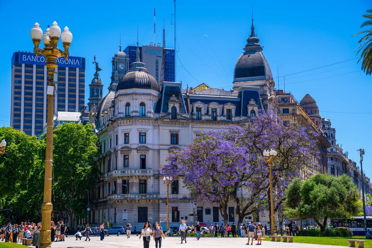
Start at Plaza de Mayo, the political and historical center of the city, flanked by the Casa Rosada and the Cabildo. From there, walk west along Avenida de Mayo toward Congreso. This tree-lined boulevard is one of the finest urban walks in the city, lined with early 20th-century architecture that ranges from Spanish Baroque to Art Nouveau.
Along Avenida de Mayo, duck into the Café Tortoni for a cortado, though skip the tourist-priced food menu and save your appetite. The Palacio Barolo at No. 1370 is worth a glance from the street; its design is based on Dante's Divine Comedy and it was among the tallest buildings in South America when completed in 1923. Continue to the Congreso Nacional and then loop back via the Avenida Corrientes for bookshops, theatres, and pizza by the slice.
⚠️ What to skip
Microcentro is very busy on weekdays between 8:00 and 10:00 and again from 17:00 to 19:00. If you want to walk the main avenues without heavy foot and vehicle traffic, aim for a Saturday morning when offices are closed and the streets feel almost calm.
Route 2: San Telmo to La Boca (2 to 4 hours, with caveats)
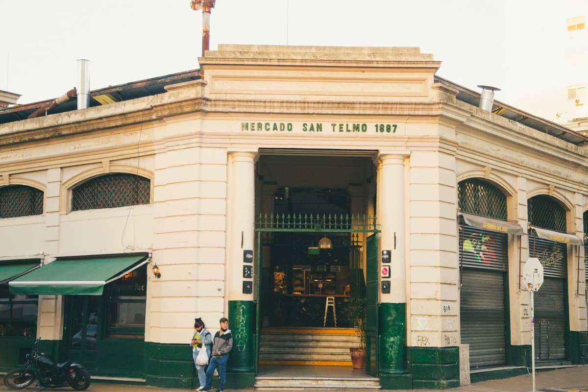
San Telmo is the oldest residential neighborhood in Buenos Aires and the most atmospheric for a slow walking circuit. Begin at Plaza Dorrego, which hosts the famous antiques fair on Sundays from around 10:00 to 17:00. The Mercado de San Telmo on Defensa street is a covered market built in 1897 and still operating; the food stalls inside are a practical lunch stop. The cobbled streets of this barrio reward slow walking: look for the iron balconies, 19th-century facades, and the Russian Orthodox Church tucked between residential blocks.
From San Telmo, it is about a 20-minute walk south to La Boca. The Caminito pedestrian street is the focal point: a short, colorfully painted alley that has become one of the most photographed spots in Argentina. The adjacent Museo Quinquela Martín is genuinely good, housing works by the neighborhood's most famous artist alongside views over the Riachuelo river. The Fundación PROA nearby shows contemporary exhibitions and has a rooftop café worth the entry fee alone.
⚠️ What to skip
La Boca's safe walking zone is essentially Caminito and the few blocks immediately surrounding it. Do not walk toward the Riachuelo docks or into the residential streets east and west of the tourist corridor, especially after 17:00. This is not alarmist; it is the consistent advice of local guides and the city's own tourism safety materials.
Route 3: Recoleta and Nearby Landmarks (2 to 3 hours)
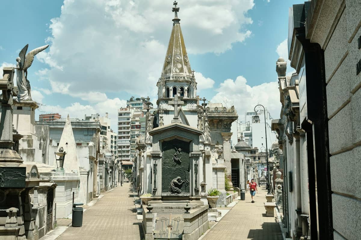
Recoleta sits in the north-central part of the city and is one of the most walkable areas for architecture and culture. The logical anchor is the Recoleta Cemetery, a city within the city: row after row of elaborate mausoleums housing Argentina's political and cultural elite. Entry is free. Immediately next to it, the Basílica Nuestra Señora del Pilar is one of the oldest churches in Buenos Aires, dating to 1732.
From the cemetery, walk east toward the Museo Nacional de Bellas Artes, which has free entry and holds one of the most significant art collections in Latin America, including Impressionist works and an extensive Latin American wing. Continue to the Floralis Genérica, the large metallic flower sculpture in the nearby park, then south toward the Centro Cultural Recoleta for exhibitions and a pleasant outdoor terrace. The whole loop covers roughly 3 km and can be done in two hours at a relaxed pace.
Route 4: Palermo Parks and Palermo Soho (2 to 3 hours)
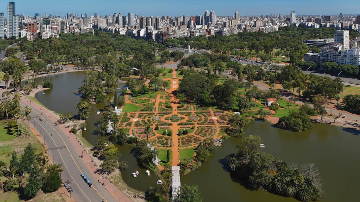
Palermo is Buenos Aires' largest neighborhood and divides naturally into sub-areas. For a walking route, the green zone is the most rewarding: start at the Jardín Botánico Carlos Thays, open most days, and walk north through the Bosques de Palermo parklands toward the Jardín Japonés and the Rosedal rose garden. On weekends, the lakeside paths fill with joggers, cyclists, and families; on weekday mornings before 10:00 they are almost empty.
After the parks, head south into Palermo Soho, centered on Plaza Cortázar (also called Plaza Serrano). The streets here are lined with independent boutiques, cafés, and street art murals. This is a good area for late-afternoon walking when the light is better for photography and the neighborhood's restaurant terraces start opening for dinner. The walk from the Botánico to Plaza Cortázar is about 2 km.
Practical Details: Timing, Weather, and What to Carry
Buenos Aires has a humid subtropical climate with an annual mean of around 18°C. For comfortable walking, the best months are March to May and September to November, when temperatures sit between 13°C and 26°C and humidity is manageable. January and February are hot and humid, with daytime highs regularly reaching 30°C, which makes long street walks genuinely tiring. Winter (June to August) is mild, rarely below 7°C, and the lower rainfall makes it a surprisingly good walking season as long as you carry a layer.
- What to carry on any self-guided walk Offline maps or downloaded city itineraries, a refillable water bottle (tap water is treated and generally fine for most visitors), sun protection for summer and shoulder months, a SUBE card loaded with credit for Subte or bus connections between neighborhoods, and a small daypack to keep hands free.
- Best time of day Start walks between 09:00 and 10:00. Attractions open, streets are active but not yet peak-busy, and you finish before the midday heat in summer. Avoid planning walks entirely around lunch hours (13:00 to 15:00) when many smaller venues close.
- Getting between neighborhoods San Telmo to Recoleta is about 5 km: walkable in under an hour if you are fit, or one Subte connection via Line C. La Boca to Palermo is too far to walk comfortably; take a colectivo or ride-share. Puerto Madero is a 10-minute walk from the Microcentro center.
✨ Pro tip
Sunday morning is the single best time to walk Microcentro and Avenida de Mayo. The commercial district empties of weekday traffic, the light is excellent for photography, and you can reach Plaza de Mayo, the Casa Rosada forecourt, and the Cabildo without crowds. Pair it with a late morning visit to the San Telmo Sunday fair, around a 20-minute walk south.
Free Resources and Apps for Self-Guided Routes
The city's own tourism portal publishes free themed walking itineraries in English and Spanish at turismo.buenosaires.gob.ar, with downloadable PDFs covering Recoleta, Retiro, La Boca street art, and the historic center. These are legitimately well-designed routes, not afterthoughts. For a broader cultural context before you walk, the Buenos Aires architecture guide provides background on the building styles you will encounter across barrios.
- Official BA Tourism itineraries: free downloads at turismo.buenosaires.gob.ar/en, updated periodically
- GPSmyCity: GPS-enabled audio walks for Buenos Aires, usable offline, with routes covering Recoleta, San Telmo, Palermo, and the city center
- The Golden Map: a printed neighborhood map distributed free at city kiosks and hotels, with suggested walking circuits marked
- Free tip-based walking tours (Buenos Aires Free Walks and similar operators): useful as a live orientation before you do the same route solo; tours commonly start around 10:00 to 10:30 and run until early afternoon on most days.
- Google Maps offline: download the Buenos Aires city area before arriving; Street View coverage in most tourist barrios is comprehensive and useful for preview
One note on free walking tours: they are tip-based, not genuinely free. Guides typically expect around USD 10 to 20 or more per person at the end. They are worth considering as a first-day orientation tool, but they should not be confused with self-guided routes that carry no built-in cost. For a deeper look at seeing the city without spending, see the free things to do in Buenos Aires guide.
FAQ
How long does it take to walk across Buenos Aires?
Walking the full north-south length of the tourist core, from La Boca up to Palermo, covers roughly 10 to 12 km and takes around 2.5 to 3 hours at a steady pace with no stops. In practice, nobody does this in one go: the neighborhoods are best explored individually over two or more days, using the Subte or colectivo to connect them.
Are self-guided walking routes in Buenos Aires safe?
Most major tourist routes are safe during daylight hours. Recoleta, Puerto Madero, most of Palermo, and the main San Telmo circuit around Defensa and Plaza Dorrego are consistently rated low-risk. La Boca requires sticking to the Caminito area and not wandering off the tourist circuit, particularly after 17:00. For current neighborhood-specific guidance, see the official Buenos Aires safety advice.
What is the best neighborhood to walk in Buenos Aires?
San Telmo on a Sunday morning is the single most rewarding walk in the city: the antiques fair on Defensa street, the covered Mercado, and the cobbled side streets combine architecture, street life, and local commerce in a compact area. Recoleta is the best choice for architecture and culture. Palermo is best for parks and a more relaxed pace.
Do I need to book self-guided walking tours in advance?
No. Self-guided routes require no booking at all. The city's official itineraries are downloadable for free. The only advance preparation worth doing is loading offline maps and checking opening hours for any museums or attractions you plan to enter along the way, as these change periodically.
What is the best time of year for walking tours in Buenos Aires?
Spring (September to November) and autumn (March to May) offer the most comfortable conditions, with temperatures between 13°C and 26°C and lower humidity than summer. Winter (June to August) is also viable: temperatures rarely drop below 7°C, rainfall is lower than summer, and crowds at major sights thin noticeably. Summer (December to February) is the least comfortable for long walks due to heat and humidity, though early mornings before 09:00 are manageable.
Tickets & tours
Live prices and dates from our booking partner. If you book, we may earn a commission at no extra cost to you.
Planning a trip? Discover personalized activities with the Nomado app.