Hai Van Pass and the northern reaches of Da Nang form one of Central Vietnam's most dramatic corridors, where a winding mountain road climbs to nearly 500 metres above the East Sea. This area is less a neighbourhood to stay in than a landscape to pass through and understand, offering history, scenery, and a genuine sense of transition between the humid north and the sunnier south.
Hai Van Pass is where Da Nang ends and something older begins. Perched at the spine of the Bach Ma mountain range, roughly 20 kilometres north of the city centre, this mountain corridor has served as a natural frontier for centuries, separating kingdoms, climates, and cultures. The road that winds over it remains one of the most compelling drives in Vietnam.
Orientation: Where the City Meets the Mountains
To understand Hai Van Pass, picture Da Nang's urban grid running north until it hits the coast of Lien Chieu District, then abruptly meeting a wall of forested peaks. The Bach Ma mountain range pushes all the way to the sea here, leaving no flat coastal corridor, and forcing the old National Highway 1A to climb over the range rather than skirt around it. The result is a mountain road of about 20 to 21 kilometres that rises to approximately 495 to 500 metres above sea level before descending into Lang Co Bay and Thua Thien Hue Province.
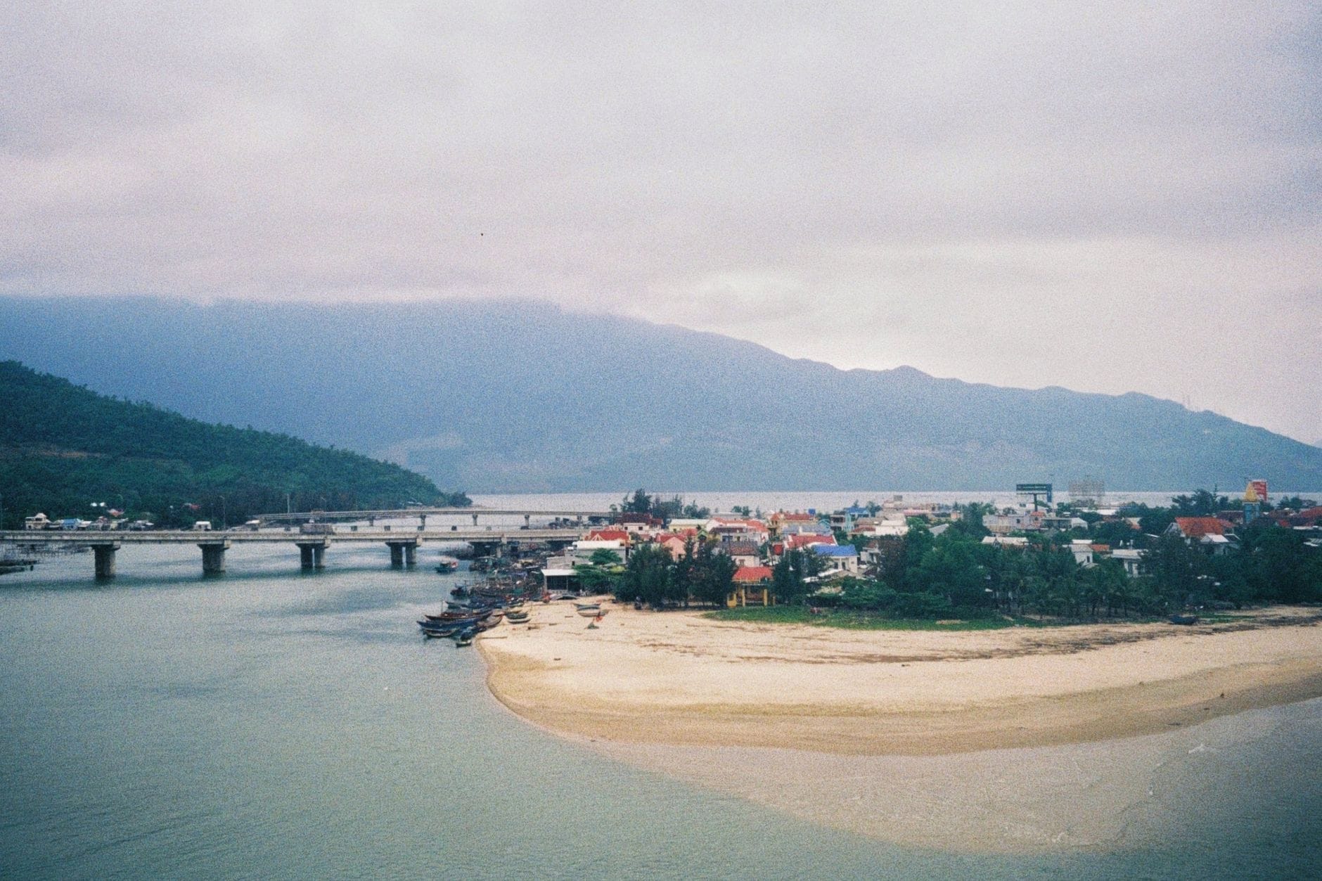
The pass sits about 20 kilometres north of downtown Da Nang (measured from Hai Chau District) and roughly 80 kilometres south of Hue city. On the Da Nang side, the approach begins near the Suoi Luong tourist area in Hoa Hiep Bac Ward, Lien Chieu District. On the northern descent, the road drops toward Lang Co, one of Vietnam's most photogenic lagoon-backed peninsulas. The political boundary between Da Nang City and Thua Thien Hue Province runs across the summit itself.
Within Da Nang's administrative structure, the northern approach falls under Lien Chieu District, the city's most industrial urban district, associated with port logistics and manufacturing. It is distinct in character from the tourist-facing Son Tra Peninsula to the east or the cultural centre around Han River and downtown. Travelers approaching from central Da Nang typically follow Dien Bien Phu road northwest, connecting through Ton Duc Thang and Nguyen Luong Bang before reaching the coastal Nguyen Tat Thanh corridor that runs up through Lien Chieu toward the base of the pass.
Character & Atmosphere: A Road That Changes Around Every Curve
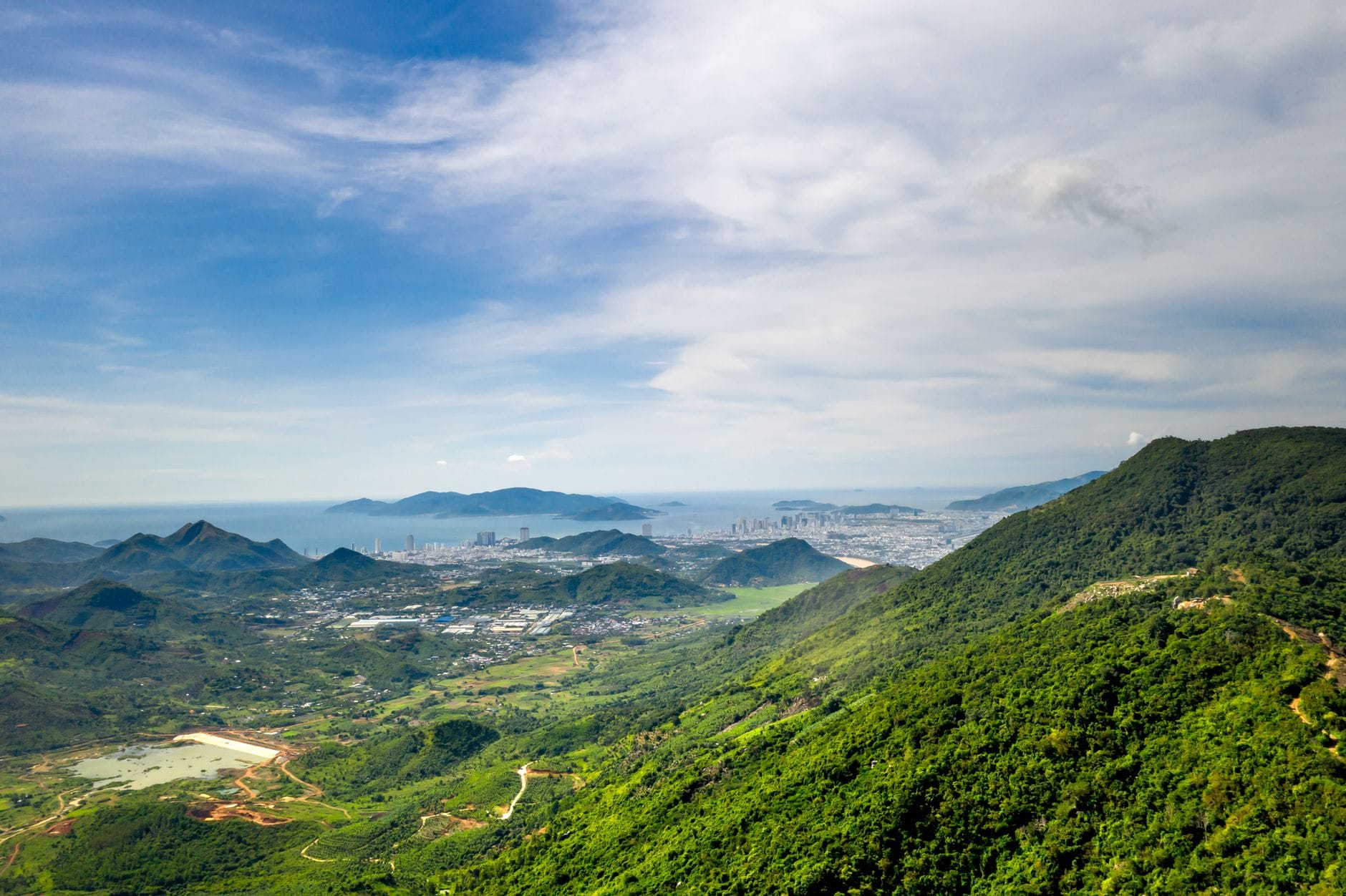
The Hai Van Pass road functions differently at different hours, and understanding this rhythm matters more here than in any conventional neighbourhood. Early morning is the time to be on the road if visibility is your goal. By 6 or 7 a.m., before the heat and haze build, the views from the upper sections are at their clearest: the Da Nang coastline unrolls to the south, the city reduced to a low sweep of white buildings against the blue of the East Sea. The air at the summit carries a coolness that disappears by mid-morning.
By late morning, clouds begin to gather around the peaks, often thickening into the mist that gives the pass its name, Hai Van, meaning 'Ocean Cloud.' This is the pass at its most atmospheric and also its most treacherous. Visibility can drop significantly on the upper sections, and the north and south slopes often have entirely different weather at the same moment. The Da Nang side may be clear and sunny while the Lang Co descent disappears into grey fog. This is not a dramatic anomaly but an almost daily occurrence in certain seasons.
Afternoons are generally hotter and the clouds can either clear or consolidate, depending on the season. Since the completion of the Hai Van Tunnel in 2005, heavy freight and intercity coaches no longer use the old mountain road, which has dramatically changed the character of the pass. What was once a congested and genuinely hazardous trunk road is now primarily used by motorcyclists, private cars on scenic detours, and tourist vehicles. This makes the road quieter and more manageable than it once was, though it is far from empty. Tour groups from Da Nang and Hue converge at the summit around mid-morning and early afternoon, and the fortifications at Hai Van Gate attract steady foot traffic during those hours.
ℹ️ Good to know
The Hai Van Pass road is not a neighbourhood where you browse cafes or sleep in. It is a transit landscape and a destination in its own right, best experienced as a half-day excursion from Da Nang or as part of a longer journey between Da Nang and Hue. Plan accordingly.
What to See & Do: History, Views, and the Road Itself
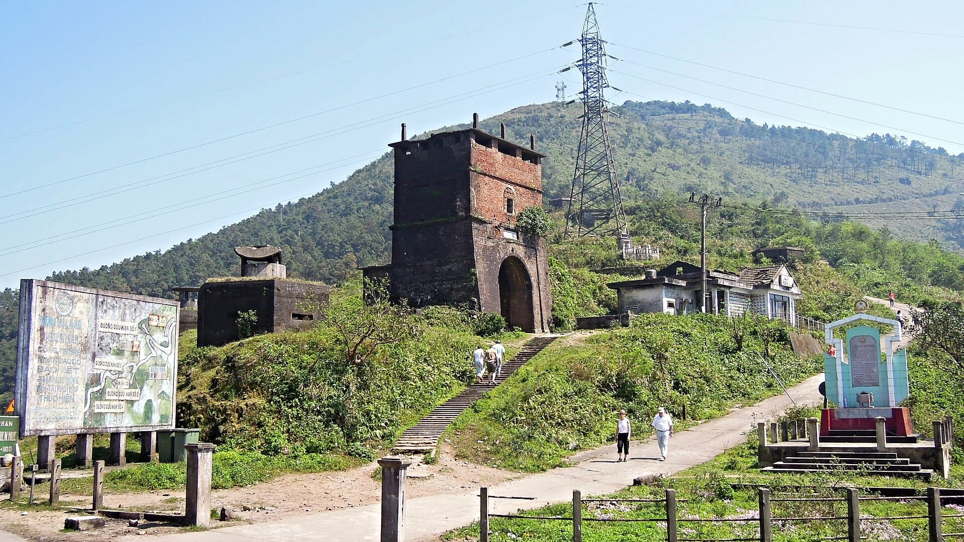
The summit's defining structure is Hai Van Gate (Hai Van Quan), a stone gateway and set of military fortifications that has stood at this strategic point for centuries. The gate originally marked the frontier between the kingdoms of Champa and Dai Viet, and later the boundary between Thuan Hoa to the north and Quang Nam to the south. Later occupiers, including French colonial forces and American military units during the Vietnam War, added concrete bunkers and gun emplacements that remain visible today. The layering of different historical eras on a single hilltop is striking.
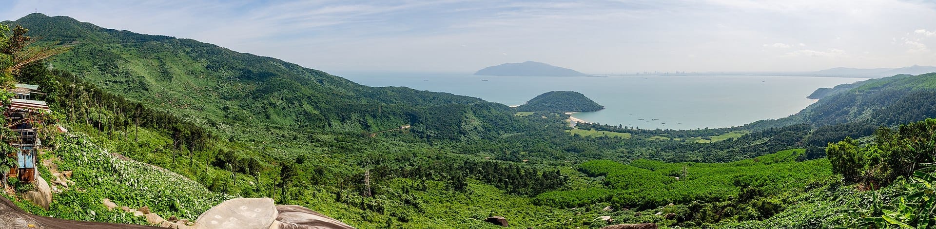
Standing at Hai Van Gate, you look south over Da Nang Bay and, on clear days, can see the curve of the coastline all the way toward the Marble Mountains rising from the coastal plain south of the city. To the north, the descent toward Lang Co Bay is equally spectacular: the lagoon glitters between the mountains and the sea, a thin strip of land separating the two. This is one of the genuinely great viewpoints in Central Vietnam, and it requires no infrastructure beyond the road.
For travelers with more time, the full Hai Van Pass road itself is the activity. Riding the pass by motorbike, whether on your own bike or as part of an Easy Rider tour, gives a calibrated sense of the landscape that no car window replicates. The hairpin bends, the drop in temperature as you climb, the sudden appearance of cloud, and the long views south all accumulate into something that stays with you. This is why the pass featured on Top Gear in 2008 and has attracted motorcycle travelers ever since. That said, the road is genuinely winding and steep, and anyone without solid motorbike experience on mountain roads should opt for a car rather than riding solo.
Hai Van Gate and summit fortifications: walk the bunkers, read the layers of history, photograph the coastal panorama
The full pass drive or ride from Da Nang to Lang Co (or the reverse): plan 45 to 90 minutes including stops
Suoi Luong picnic and eco-tourism area: a shaded stream-fed park at the Da Nang base of the pass, popular with local families on weekends
Lang Co Bay viewpoints on the northern descent: pull over on the way down to photograph the lagoon
⚠️ What to skip
The pass road is winding, narrow in sections, and fog can reduce visibility to near zero at the summit without warning. Motorbike riders should check weather before departing, ride slowly on blind bends, and use headlights throughout. Avoid the road during or immediately after heavy rain, when the surface can be slippery and visibility poor.
The Pass as Geography: A Climatic and Historical Divide
One of the most underappreciated things about Hai Van Pass is what it does to the climate on either side. The Bach Ma range acts as a barrier to the north-east monsoon winds, meaning that Da Nang and the coast to the south experience a relatively shorter and less intense wet season compared to Hue and the northern provinces. When Hue is drenched by prolonged October and November rains, Da Nang often sits in sunshine. The pass is where this meteorological shift happens, and standing at the summit on a day when one slope is grey and the other is blue makes this immediately legible.
Historically, this geography gave the pass outsize strategic significance. It was the southern frontier of the Nguyen lords' domain at Thuan Hoa before unification, a natural defensive line, and a symbolic threshold. The name Hai Van Quan translates roughly as 'Ocean Cloud Pass Gate,' a description of the mist that collects here more than a slogan. The fortifications at the summit were rebuilt and reinforced multiple times over several centuries, which is why the stonework at the gate looks different from the concrete bunkers a few metres away.
Eating & Drinking: Fuel for the Road
There are no restaurants worth a special trip on the pass road itself. At the summit, small vendors sell drinks, snacks, and simple local food to passing travelers and tourists, prices reflecting the captive audience. The quality is basic but the coffee, served in a plastic cup while you look out over Da Nang Bay, is hard to beat on its own terms.
The practical approach is to eat in Da Nang before heading out, or to make the pass part of a point-to-point journey that ends with a proper meal in Lang Co or further north toward Hue. Lang Co has seafood restaurants that specialise in the catch from the adjacent lagoon, particularly shellfish and fresh fish, at prices far lower than equivalent quality in Da Nang's tourist districts. If you are riding north, Lang Co is a natural lunch stop after the descent.
For those using the pass as a day excursion from Da Nang, the city has a strong food scene to return to. The area around An Thuong tourist street and the Han River offers everything from street-food stalls serving mi quang and banh mi to cafe culture detailed in the Da Nang coffee guide. The pass itself is not where you linger over a meal.
Getting There & Around: Navigating North Da Nang
Da Nang has no metro system. Getting to the Hai Van Pass from central Da Nang means a road journey of roughly 35 to 45 minutes under normal traffic conditions, depending on where in the city you start. The most direct urban route follows Dien Bien Phu road northwest, connecting to Ton Duc Thang, then Nguyen Luong Bang, crossing into Lien Chieu District and continuing to the Nguyen Tat Thanh coastal road. From there, National Highway 1A (QL1A) begins its climb. On weekday mornings, Lien Chieu's industrial corridor can be slow through the district centre, so allow extra time.
Ride-hailing apps including Grab are available throughout Da Nang and can take you to the base of the pass or to specific points along the road. Arranging a car tour or Easy Rider motorbike guide is the most common approach for travelers, as it allows flexibility to stop for photographs without navigating traffic. Many operators in Da Nang offer half-day pass excursions. For those doing the Hue to Da Nang or Da Nang to Hue route, read the central Vietnam itinerary for broader route context.
Intercity buses and coaches using the Hai Van Tunnel do not provide meaningful access to the pass road itself. If you want to stop at the summit, you need to be in a private vehicle on the old QL1A rather than in a coach using the tunnel underneath. This is the single most important logistics point: the tunnel and the pass road are parallel routes, and taking the wrong one means missing the experience entirely.
💡 Local tip
Book a motorbike Easy Rider or private car through your accommodation rather than accepting offers from drivers at tourist sites. The difference in price is minor, but the difference in reliability is significant. Specify that you want to travel via the old pass road (duong de o) and not the tunnel.
For a broader picture of how to move around Da Nang city, including to the pass, consult the getting around Da Nang guide. Travelers combining the pass with a visit north to Hue should note that the pass road takes significantly longer than the tunnel route, adding at least an hour to a direct point-to-point journey. The time investment is worth it for the scenery, but not if you have a train or bus to catch.
Where to Stay: Base Camp in Da Nang, Not on the Pass
There is no accommodation infrastructure on Hai Van Pass itself, and the Lien Chieu District approach is an industrial urban area with limited tourism-focused lodging. For the vast majority of travelers, the right base is central Da Nang or My Khe Beach, both of which put the pass within a 30-to-40-minute drive without requiring you to stay somewhere remote.
Those specifically interested in the northern end of the pass corridor can consider Lang Co, which sits just below the northern descent and has resort accommodation at different price points. This is a genuine option for travelers doing the Da Nang to Hue route who want to break the journey. For a full overview of where to sleep in Da Nang city itself, the where to stay in Da Nang guide covers the main districts and beach areas in detail. The My Khe Beach area offers the broadest range of hotels and easiest access to both the pass and the city's other attractions.
Day Trips and Broader Itinerary Context
Hai Van Pass slots naturally into a number of broader itineraries. The most obvious is a one-way journey between Da Nang and Hue, stopping at the summit before continuing north. It also pairs well with a visit to Lang Co Bay on the northern descent, one of Vietnam's most photographed coastal landscapes. Travelers spending more than two days in Da Nang should consider the pass as a half-day commitment on a day when they are not at the beach.
The pass is one of several compelling excursions from the city covered in the day trips from Da Nang guide. If you are planning a three-day visit, the 3 days in Da Nang itinerary offers a structured way to fit the pass alongside the city's beaches, the Marble Mountains, and the Han River.
For travelers driving or riding the full central Vietnam coastal route, the pass is a key milestone on the central Vietnam itinerary. It is also worth checking the best time to visit Da Nang before planning your trip, since weather on the pass varies significantly between seasons and the dry months of April through August offer the most consistently clear views from the summit.
TL;DR
Hai Van Pass is a mountain road and historic summit 20 kilometres north of Da Nang city centre, not a residential neighbourhood. It functions as a scenic excursion, a transit route, and one of Central Vietnam's most significant historical landscapes.
The summit Hai Van Gate is a layered fortification spanning Cham-era boundaries, Nguyen-dynasty walls, French colonial additions, and Vietnam War concrete bunkers. It is genuinely worth stopping for.
The pass creates a real climatic divide: Da Nang's south-facing coast often has different weather from the Lang Co side, and standing at the top makes this physically apparent.
Since the Hai Van Tunnel opened in 2005, the old mountain road carries mainly tourists and motorcyclists. Book a car or motorbike guide specifically for the old pass road, or you will end up in the tunnel and miss the point entirely.
This area suits travelers who are comfortable on winding mountain roads, interested in Vietnamese history beyond the beach, or making the Da Nang to Hue overland journey. It is not for travelers who prefer urban amenities, flat terrain, or a one-stop attraction format.
Three days is exactly enough time to cover Da Nang's best beaches, cultural landmarks, and day trips without rushing. This itinerary breaks it down day by day — with practical logistics, honest crowd and timing advice, and links to deeper guides for every stop.
Ba Na Hills is a high-altitude resort complex sitting at 1,487 metres above sea level, about 25 km southwest of Da Nang. This guide covers everything from ticket prices and cable car logistics to seasonal conditions, crowd patterns, and what the French Village is really like.
Da Nang's climate divides into a sunny dry season and a stormy wet season, but the best time to visit depends on what you want from the trip. This guide breaks down weather patterns, crowd levels, and pricing across every season so you can plan with confidence.
Central Vietnam's Da Nang–Hoi An–Hue corridor packs beaches, UNESCO heritage, and mountain scenery into a compact region. This guide gives you the routes, timings, seasonal advice, and practical details to plan a trip that actually works.
Da Nang International Airport (DAD) is one of the most conveniently located airports in Southeast Asia, sitting roughly 3–5 km from downtown. This guide covers the arrivals process, visa on arrival requirements, every transfer option to the city, and how to reach Hoi An from the airport.
Da Nang sits on roughly 70–75 km of coastline, with a core run of public beaches that rival anything in Southeast Asia. This guide covers every significant beach from Nam O in the north to Non Nuoc in the south, with practical advice on the best swimming seasons, safety, crowd patterns, and how much to budget.
Da Nang's coffee scene runs deeper than beach cafés and tourist menus. This guide covers everything from traditional Vietnamese street coffee to specialty roasters, with real prices, neighborhood breakdowns, and tips on when and where to go.
Da Nang has become one of Southeast Asia's most practical bases for remote workers, with fast fiber internet, low costs, and a beach at the end of the street. This guide covers everything you actually need: realistic budgets, visa rules, the best neighborhoods, coworking options, and the seasonal realities that can make or break a long stay.
The Da Nang International Fireworks Festival is Vietnam's largest pyrotechnic competition, running across multiple nights from late May to mid-July over the Han River. This guide covers tickets, viewing spots, accommodation strategy, and everything else you need to plan your visit.
Da Nang punches well above its weight as a romantic destination. With a scenic riverfront, long stretches of beach, cloud-capped mountains, and easy access to Hoi An, it offers couples genuine variety — whether you want candlelit dinners, spa retreats, or mountain adventures. This guide covers the best romantic experiences in Da Nang, with practical timing, pricing context, and honest takes on what's worth your time.
Da Nang has quietly become one of Southeast Asia's most compelling luxury destinations, offering five-star beachfront resorts, world-class golf, and refined dining at prices that significantly undercut Bali and Phuket. This guide covers where to stay, when to book, what to spend, and how to get the most from a high-end trip to central Vietnam.
Da Nang is better known for its beaches, but the mountains surrounding the city offer some of central Vietnam's most rewarding day trips. This guide covers every major peak, trail, and viewpoint within reach, with practical advice on difficulty, access, and the best time to go.
Da Nang nightlife runs the spectrum from riverfront rooftop bars and late-night expat clubs to grilled seafood markets and the weekly Dragon Bridge fire show. This guide covers every zone, venue type, and practical detail you need to plan your evenings well.
Da Nang has one of the lowest crime rates of any major Vietnamese city, but a handful of persistent scams catch visitors off guard every year. This guide breaks down the real risks, the tourist traps worth avoiding, and the practical steps that keep you safe from arrival to departure.
Da Nang shopping splits neatly into two worlds: lively traditional markets where bargaining is expected, and modern air-conditioned malls with fixed prices. This guide covers the key venues, the best souvenirs, realistic price ranges, and the common mistakes that cost visitors money.
Da Nang's wellness scene spans budget walk-in parlors, boutique treatment centers, and full resort spas open around the clock. This guide breaks down the best options by price tier, location, and treatment type — with practical advice on when to book ahead and what to skip.
The trip from Da Nang to Hoi An is only around 30 km, but with no airport or train station in Hoi An, road is your only option. This guide breaks down every transport choice, with current prices, journey times, and practical advice on which option suits your situation.
Da Nang punches well above its size when it comes to scenery. The city sits between jungle-covered mountains, a long arc of coastline, and a river lined with illuminated bridges — all of which create extraordinary viewpoints at every elevation. This guide covers the best of them, from free hilltop lookouts to ticketed cable-car rides above the clouds.
Da Nang is one of Southeast Asia's most practical destinations for families. Short distances between attractions, calm traffic, wide sandy beaches, and a mix of theme parks, cultural sites, and day trips make it genuinely easy with children in tow. This guide covers when to go, what to skip, and how to make the most of 3-5 days.
Da Nang sits at the centre of one of Southeast Asia's most rewarding travel corridors. Within a two-hour radius you have UNESCO World Heritage sites, a French-colonial hilltop resort, ancient Cham towers, and one of Vietnam's most scenic mountain passes. This guide covers every worthwhile day trip with real distances, 2026 pricing, and straight talk about what is actually worth your time.
Da Nang is one of Vietnam's most navigable cities, with most tourist areas packed into a 5–15 km radius. This guide breaks down every way to get around, from Grab bikes to city buses, with real fare ranges, key routes, and practical advice on what to avoid.
Da Nang sits roughly midway between Hanoi and Ho Chi Minh City, making it one of the easiest destinations in Vietnam to reach. This guide covers every practical option: domestic flights, overnight trains, prices, journey times, and what to know before you book.
Hoi An's Full Moon Lantern Festival happens every lunar month, and Da Nang is the ideal base for a same-day trip. This guide covers exactly how to get there, when to arrive, what things cost, and what no one tells you before you go.
Da Nang sits at the heart of central Vietnam, offering long sandy beaches, world-class day trips, and a food scene that punches well above its weight. Here is everything you need to know to decide whether it belongs on your itinerary.
Da Nang is central Vietnam's most livable city and one of its most rewarding to explore. This guide covers the best things to do in Da Nang across beaches, landmarks, food, day trips, and culture, with practical advice on timing, costs, and what to skip.
Da Nang's food scene runs far deeper than seafood. This guide covers the essential dishes, where to find them, what to pay, and when to show up — written for travelers who want to eat like a local, not a tourist.
Da Nang splits cleanly into three distinct stay zones: the beachside strip around My Khe, the city-centre Han River district, and the secluded Son Tra Peninsula. This guide breaks down each area by price, vibe, and access to attractions so you can choose the right base for your trip.