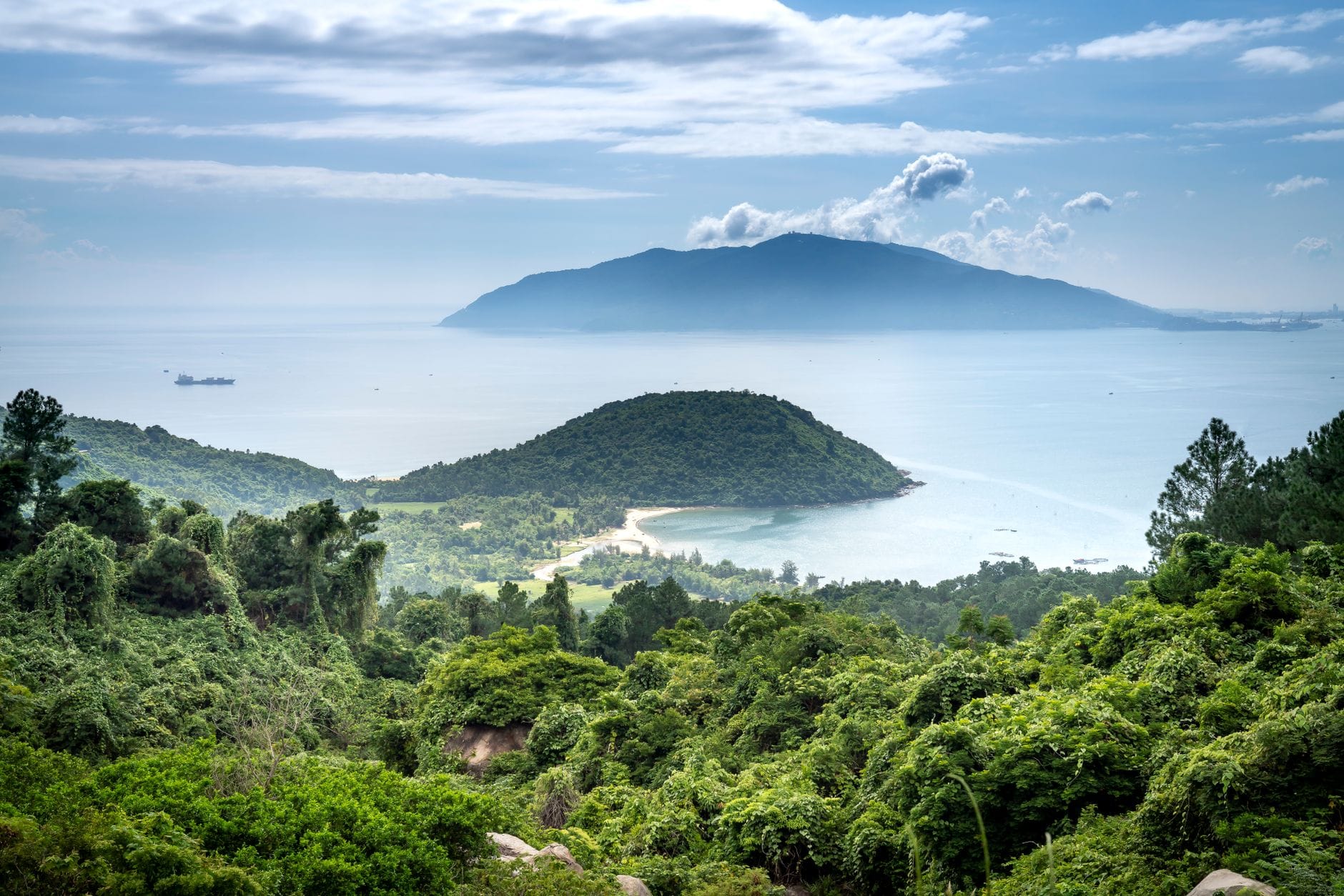
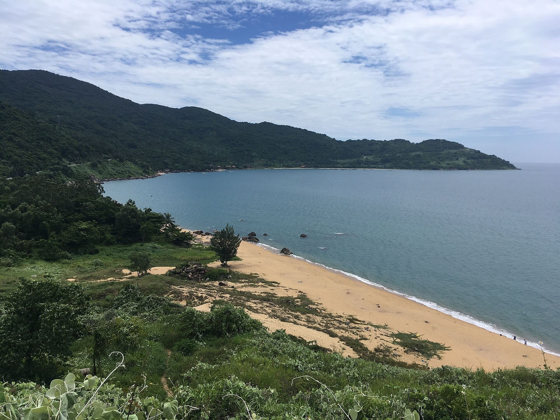
Son Tra Peninsula rises sharply from Da Nang's northeastern edge, combining dense primary rainforest, dramatic coastal cliffs, and one of Vietnam's most striking religious monuments. Known locally as Monkey Mountain, this 4,400-hectare nature reserve sits just 10 km from the city center but feels like a different world entirely.
Son Tra Peninsula is Da Nang's wildest address: a jungle-covered headland jutting into the East Sea where endangered langurs move through the canopy, mountain roads twist to 693-meter viewpoints, and the 67-meter Lady Buddha surveys the entire bay. It is one of the few places in Vietnam where you can watch the sunrise over open ocean, eat banh mi in the city by breakfast, and spot rare primates in primary forest before noon.
Orientation
Son Tra Peninsula (Bán đảo Sơn Trà) occupies the northeastern corner of Da Nang, administratively within Tho Quang Ward, Son Tra District. It covers more than 4,400 hectares of land, stretches roughly 13 to 15 km from base to tip, and has three sides bordered by the East Sea. The fourth side connects to the city's expanding urban fabric, which makes the transition from concrete apartment blocks to old-growth forest genuinely startling. The peninsula forms the northern arm of Da Nang Bay, and from its heights you can see the entire curve of coastline from the city to the Marble Mountains and, on clear days, the faint outline of the Hai Van Pass to the north. Learn more about those coastal landmarks in the Da Nang viewpoints guide.
The main entry point from the city is Hoang Sa Street (Duong Hoang Sa), the coastal road that runs along Da Nang's northern shoreline before climbing into the reserve. From the junction near the Son Tra fishing port, the road forks: one branch leads up the western flank toward Linh Ung Pagoda and Ban Co Peak, the other skirts the eastern coastline past quieter coves. Most visitors approach from the south, entering from the Tien Sa Port area or from the Hoang Sa road, both of which are accessible from the city center in roughly 20 minutes by motorbike or car.
The nearest urban neighborhoods are the beach strip around My Khe to the south and the commercial area of Son Tra District closer to the Han River. The peninsula itself has almost no permanent residential population inside the protected zone, which is unusual for Da Nang and accounts for why the transition from urban noise to forest quiet happens so abruptly.
Character & Atmosphere
Son Tra operates on a completely different rhythm from the rest of Da Nang. The city below wakes up to the clatter of pho stalls and motorbike engines. Up on the peninsula, dawn means birdsong layered over the distant sound of waves, mist pooling in the valleys below the treeline, and if you are on the mountain roads early enough, the almost certain sight of red-shanked douc langurs picking through the canopy in the low orange light. These primates are not shy in the early morning, and the stretch of road approaching Linh Ung Pagoda is one of the more reliable places to see them.
By mid-morning, the pagoda grounds fill with domestic visitors, Buddhist pilgrims, and tour groups arriving by minibus from the city. The atmosphere around Linh Ung shifts from contemplative to social: incense smoke drifts through the banyan trees, vendors sell offerings near the entrance gate, and the terrace below the Lady Buddha statue becomes a steady stream of people posing for photographs with the bay spread out behind them. The forest roads further up toward Ban Co Peak stay quieter throughout the day, mostly used by cyclists, motorbike riders, and the occasional group of hikers.
Afternoons on Son Tra can be punishing in the dry season. The forest provides shade on the mountain roads, but the exposed coastal sections and the pagoda plaza heat up significantly between noon and 3 pm. The light in the late afternoon turns the limestone-grey sea into something closer to silver-green, and the views from the upper roads take on a completely different quality. After 4 pm, the crowds at the pagoda thin out, and this is arguably the best time to walk the grounds without being shoulder to shoulder with other visitors.
After dark, Son Tra is a different proposition. Some upper road sections may be temporarily closed in the evening for safety or wildlife protection, and access rules can change, so check locally before planning a night visit. The lower sections near the peninsula's base and the Son Tra night market area come alive with locals eating seafood and socializing. The mountain itself goes quiet, which is part of the point: the darkness is what keeps it functioning as an ecosystem.
ℹ️ Good to know
Son Tra has been a designated nature reserve since 1977 and contains approximately 4,370 hectares of primary forest. It is classified as one of the most biodiverse areas in central Vietnam, home to 106 bird species, 287 plant species, and 23 reptile species as well as mammal species including the globally endangered red-shanked douc langur.
What to See & Do
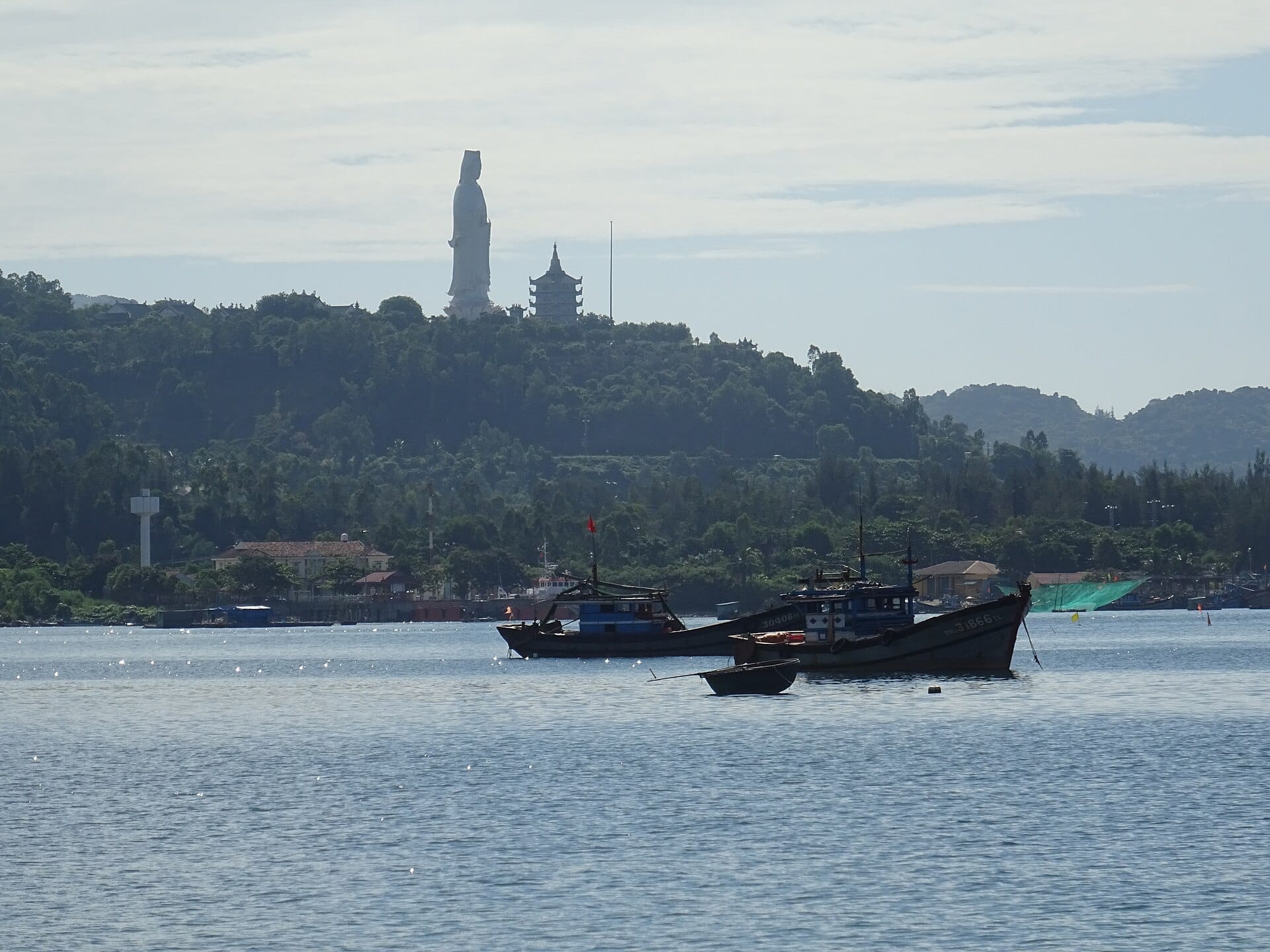
The most visited landmark on the peninsula is Linh Ung Pagoda, though it is worth noting that the Son Tra Linh Ung is distinct from the similarly named pagoda at the Marble Mountains. The Son Tra version is the largest of Da Nang's three Linh Ung pagodas, and it is anchored by the 67-meter Lady Buddha statue (Tuong Phat Ba Quan The Am) that has become one of Da Nang's defining silhouettes when viewed from the bay. Entry to the pagoda grounds is free. The statue itself is hollow and can be entered at the base, where multiple floors contain additional Buddha figures. The terrace surrounding the statue is one of the best vantage points in the city for understanding Da Nang's geography.
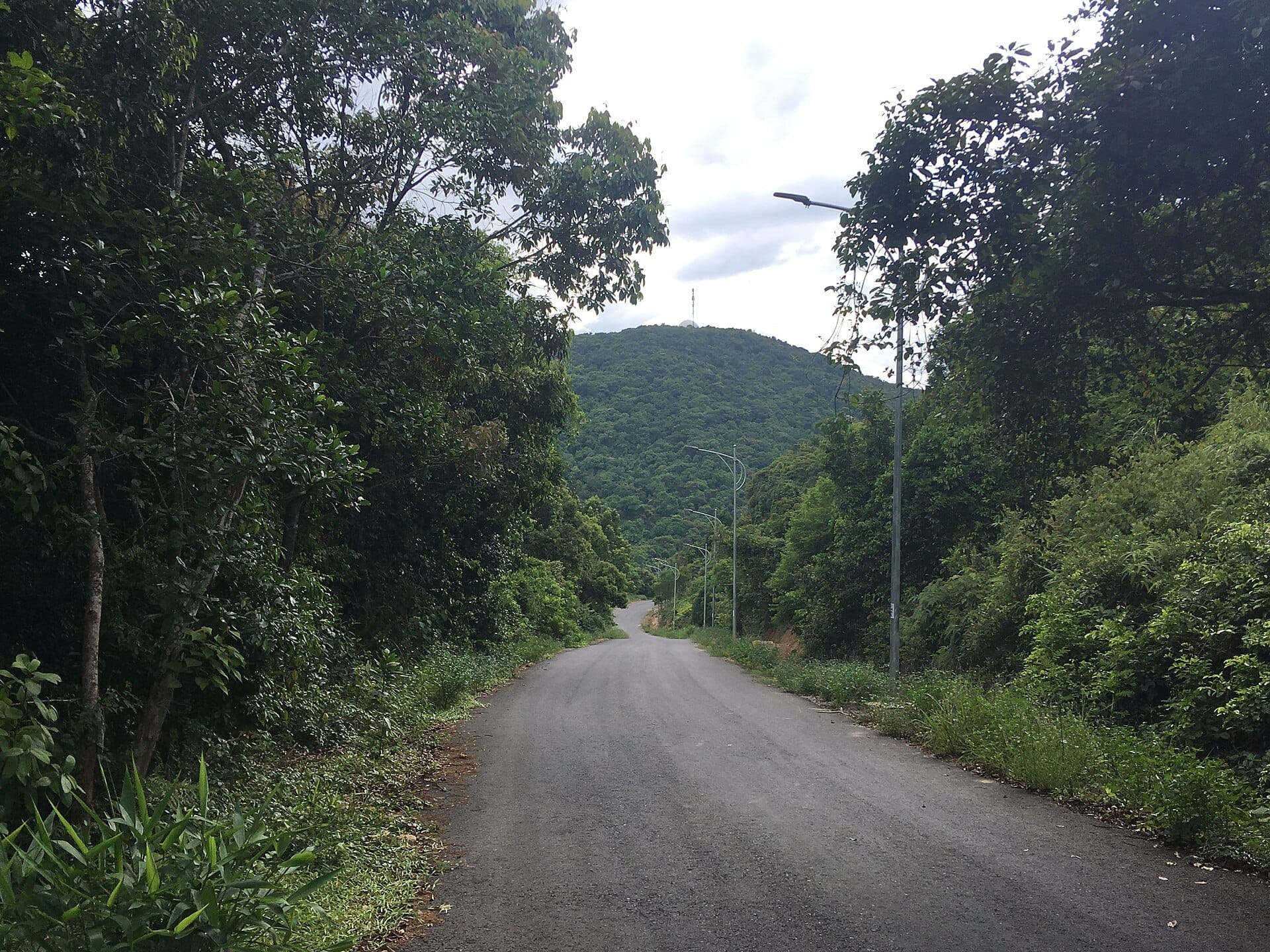
Ban Co Peak, at approximately 693 to 696 meters above sea level, is the highest accessible point on the peninsula. The drive or ride up the switchback road that leads to the summit is an experience in itself: the forest closes in on both sides, the road is steep and narrow, and you will almost certainly encounter douc langurs somewhere along the route. At the top, a small pavilion and the remnants of a wartime radar installation mark the summit. The 360-degree panorama takes in Da Nang Bay, the South China Sea, the distant Hai Van Pass to the north, and the Marble Mountains to the south. For more on the broader mountain landscape around Da Nang, the Da Nang mountains guide covers the full picture.
The Giant Banyan Tree (Cay Da Nghin Nam) is a popular forest stop, a centuries-old specimen with aerial roots spreading across a wide section of the forest floor. It sits along one of the main mountain roads and requires no hiking to reach. The surrounding forest at that elevation feels noticeably cooler than the city below, and the tree itself is striking enough to justify stopping even without any specific interest in botany.
The peninsula's beaches are less developed than My Khe and primarily used by locals. Son Tra's peninsula beaches include several small coves on the eastern and northern coastline that are accessible by road but see far fewer visitors than the main beach strips. The water is generally clear, the sand is coarser, and there are no facilities to speak of, which is either an advantage or a deterrent depending on what you are looking for.
Linh Ung Pagoda and the Lady Buddha statue (free entry, open daily)
Ban Co Peak viewpoint at 693–696 m elevation
Giant Banyan Tree forest stop along the mountain road
Red-shanked douc langur spotting along the upper forest roads (best at dawn)
Quiet cove beaches on the eastern coastline
Wartime radar station ruins near the summit
💡 Local tip
The single best time to spot red-shanked douc langurs is in the first hour after sunrise, particularly along the road section between the Linh Ung Pagoda turnoff and the upper mountain road junction. Arrive before 6:30 am and move slowly. They are often visible in the trees directly above the road.
Eating & Drinking
Son Tra Peninsula has very limited eating options inside the nature reserve itself. There are small stalls near the Linh Ung Pagoda entrance selling drinks, sugarcane juice, corn on the cob, and simple snacks, but nothing resembling a full meal. The upper mountain roads have no food vendors at all. The practical advice is to eat before you go up or to return to the base of the peninsula for food. For a comprehensive overview of what to eat around Da Nang, the Da Nang food guide covers the city's best dishes and where to find them.
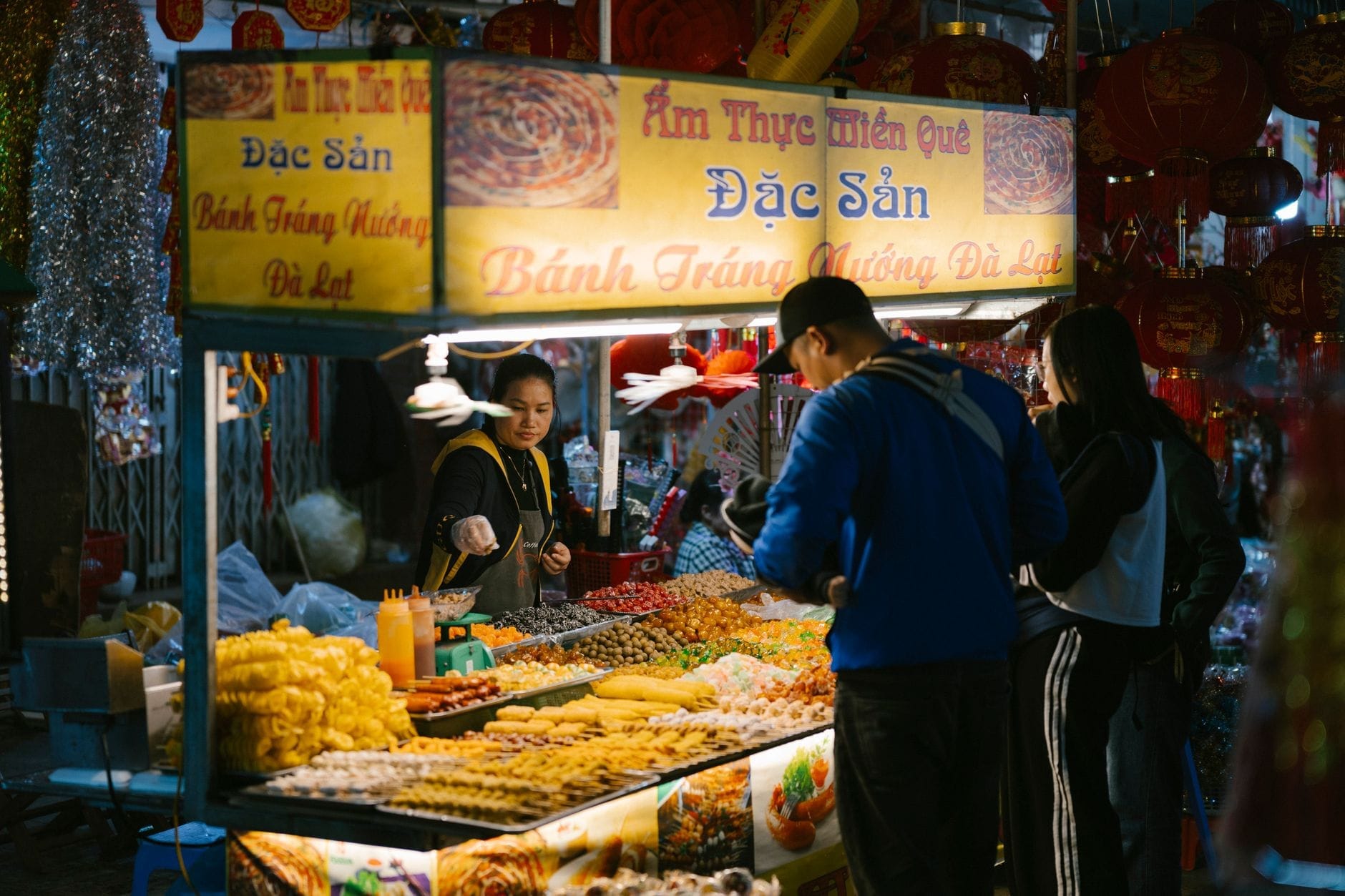
The real eating action on Son Tra happens at the base of the peninsula, around the Son Tra fishing port area and along the roads leading back toward the city. The Son Tra night market is the area's main evening draw: a stretch of outdoor seafood stalls and local food vendors that comes to life after dark. Whole grilled fish, steamed clams, sea urchin, and com ga (chicken rice) are all easy to find here at prices that are substantially lower than the tourist-facing restaurants closer to My Khe Beach. The market runs in the evening and is primarily used by local residents of Son Tra District.
For coffee before a morning drive up the mountain, the road along Hoang Sa Street has several small cafes that open early to catch fishermen and early-rising cyclists. These are simple plastic-chair setups with strong Vietnamese drip coffee and little else, but the sea views from some of them are worth a 20-minute stop before heading up the switchbacks.
Getting There & Around
Da Nang has no metro system and no fixed public bus route that runs on the upper roads inside the Son Tra nature reserve. Getting to and around the peninsula means using a motorbike, a private car, or a taxi. Ride-hailing apps (Grab is the dominant platform in Da Nang) work well for the journey from the city to the pagoda, but drivers are sometimes reluctant to wait for the return journey on the upper roads. If you plan to spend several hours on the mountain, renting a motorbike from the city center gives the most flexibility. For a broader overview of transport options around Da Nang, the getting around Da Nang guide covers the main options in detail.
From My Khe Beach, the drive to Linh Ung Pagoda takes roughly 15 to 20 minutes. From the Han River downtown area, allow 20 to 25 minutes. The Hoang Sa coastal road is the main approach from the south, becoming Truong Sa Street as it curves around the base of the peninsula. The road up to the pagoda is clearly signed from this coastal route. From the pagoda, the mountain road continues upward toward the Giant Banyan Tree and Ban Co Peak, a further 20 to 30 minutes of driving depending on how often you stop.
The mountain roads are paved but steep, narrow in places, and have sharp blind corners. Motorbike riders who are not comfortable with mountain switchbacks should consider going with a driver or joining a guided tour. In wet season, the roads can be slippery with leaf litter and rain runoff, and visibility in cloud or mist can drop quickly at higher elevations.
⚠️ What to skip
Access to some upper mountain roads may be restricted at night or during periods of bad weather, and rules can vary by season and are subject to change. Do not plan on being on the upper mountain roads after dark. The roads have no lighting and wildlife on the road at night is a real hazard. Verify current access rules with your hotel or a local tour operator before visiting.
Where to Stay
There is no accommodation inside the Son Tra nature reserve itself. Visitors base themselves in Da Nang proper and make day trips to the peninsula. The most practical base for exploring Son Tra is the My Khe Beach area, which puts you on the right side of the city and cuts the drive to Linh Ung Pagoda to under 20 minutes. The My Khe Beach area has the widest range of accommodation options, from budget guesthouses near the An Thuong tourist street to mid-range and resort properties right on the beach.
Staying on the Han River downtown side of the city adds roughly 10 minutes to the drive but gives better access to Da Nang's central attractions, restaurants, and the Han Market area. For travelers who want to use Son Tra as one stop among several, the where to stay in Da Nang guide breaks down the city's accommodation zones by traveler type and budget.
Son Tra is not a neighborhood to stay in for its own sake. It is a natural area that rewards early mornings and half-day excursions rather than extended residence. Travelers who plan multiple visits to the peninsula, for wildlife watching at dawn and sunset walks at Linh Ung, will find My Khe Beach the most efficient base.
Practical Considerations
Son Tra Peninsula is one of Da Nang's most rewarding destinations but it requires a bit more planning than a beach visit or a walk along the Han River. Weather is the most significant variable: the peninsula faces the East Sea directly and catches both the wet season rains (peaking roughly September to January in central Vietnam) and occasional typhoon conditions. Son Tra functions as a natural storm barrier for Da Nang, which is a testament to its exposed position. Check the forecast before driving up the mountain. For a full picture of when to visit Da Nang including how seasons affect Son Tra, see the best time to visit Da Nang guide.
Dress respectfully when visiting Linh Ung Pagoda. Shoulders and knees should be covered inside the pagoda grounds. Sarongs are sometimes available to borrow at the entrance if you arrive in beachwear, but it is better to bring appropriate clothing. Footwear that can be easily removed is practical since you will need to remove shoes before entering the main hall.
Son Tra works well as a standalone half-day trip or combined with other sights on the northern side of the city. If you are working through a broader Da Nang itinerary, the 3 days in Da Nang itinerary shows how Son Tra fits alongside the city's other major attractions. Travelers continuing north to Hue can also combine a Son Tra morning with an afternoon drive over the Hai Van Pass, which begins just north of the peninsula.
💡 Local tip
Bring water. There are virtually no vendors on the upper mountain roads and the combination of tropical heat, steep climbs, and forest humidity will exhaust your reserves faster than expected. A minimum of one liter per person is sensible for any excursion above the pagoda level.
TL;DR
Son Tra Peninsula is Da Nang's most significant natural area: a roughly 4,370-hectare primary forest reserve 10 km from the city center, home to endangered red-shanked douc langurs, a 67-meter Lady Buddha statue, and panoramic views from a 693–696-meter peak.
Best visited as a half-day trip or early morning excursion from a My Khe Beach or downtown base. There is no accommodation inside the reserve.
Getting there requires a motorbike, car, or taxi. Ride-hailing apps cover the journey to Linh Ung Pagoda; a rented motorbike gives the most flexibility for exploring the upper roads.
Ideal for wildlife enthusiasts, photographers, cyclists, and anyone who wants a complete contrast to Da Nang's beach and city scene in under 30 minutes.
Not recommended for travelers uncomfortable with steep mountain roads, or those visiting during typhoon season without checking conditions first. The reserve closes to visitors in the evening.
Three days is exactly enough time to cover Da Nang's best beaches, cultural landmarks, and day trips without rushing. This itinerary breaks it down day by day — with practical logistics, honest crowd and timing advice, and links to deeper guides for every stop.
Ba Na Hills is a high-altitude resort complex sitting at 1,487 metres above sea level, about 25 km southwest of Da Nang. This guide covers everything from ticket prices and cable car logistics to seasonal conditions, crowd patterns, and what the French Village is really like.
Da Nang's climate divides into a sunny dry season and a stormy wet season, but the best time to visit depends on what you want from the trip. This guide breaks down weather patterns, crowd levels, and pricing across every season so you can plan with confidence.
Central Vietnam's Da Nang–Hoi An–Hue corridor packs beaches, UNESCO heritage, and mountain scenery into a compact region. This guide gives you the routes, timings, seasonal advice, and practical details to plan a trip that actually works.
Da Nang International Airport (DAD) is one of the most conveniently located airports in Southeast Asia, sitting roughly 3–5 km from downtown. This guide covers the arrivals process, visa on arrival requirements, every transfer option to the city, and how to reach Hoi An from the airport.
Da Nang sits on roughly 70–75 km of coastline, with a core run of public beaches that rival anything in Southeast Asia. This guide covers every significant beach from Nam O in the north to Non Nuoc in the south, with practical advice on the best swimming seasons, safety, crowd patterns, and how much to budget.
Da Nang's coffee scene runs deeper than beach cafés and tourist menus. This guide covers everything from traditional Vietnamese street coffee to specialty roasters, with real prices, neighborhood breakdowns, and tips on when and where to go.
Da Nang has become one of Southeast Asia's most practical bases for remote workers, with fast fiber internet, low costs, and a beach at the end of the street. This guide covers everything you actually need: realistic budgets, visa rules, the best neighborhoods, coworking options, and the seasonal realities that can make or break a long stay.
The Da Nang International Fireworks Festival is Vietnam's largest pyrotechnic competition, running across multiple nights from late May to mid-July over the Han River. This guide covers tickets, viewing spots, accommodation strategy, and everything else you need to plan your visit.
Da Nang punches well above its weight as a romantic destination. With a scenic riverfront, long stretches of beach, cloud-capped mountains, and easy access to Hoi An, it offers couples genuine variety — whether you want candlelit dinners, spa retreats, or mountain adventures. This guide covers the best romantic experiences in Da Nang, with practical timing, pricing context, and honest takes on what's worth your time.
Da Nang has quietly become one of Southeast Asia's most compelling luxury destinations, offering five-star beachfront resorts, world-class golf, and refined dining at prices that significantly undercut Bali and Phuket. This guide covers where to stay, when to book, what to spend, and how to get the most from a high-end trip to central Vietnam.
Da Nang is better known for its beaches, but the mountains surrounding the city offer some of central Vietnam's most rewarding day trips. This guide covers every major peak, trail, and viewpoint within reach, with practical advice on difficulty, access, and the best time to go.
Da Nang nightlife runs the spectrum from riverfront rooftop bars and late-night expat clubs to grilled seafood markets and the weekly Dragon Bridge fire show. This guide covers every zone, venue type, and practical detail you need to plan your evenings well.
Da Nang has one of the lowest crime rates of any major Vietnamese city, but a handful of persistent scams catch visitors off guard every year. This guide breaks down the real risks, the tourist traps worth avoiding, and the practical steps that keep you safe from arrival to departure.
Da Nang shopping splits neatly into two worlds: lively traditional markets where bargaining is expected, and modern air-conditioned malls with fixed prices. This guide covers the key venues, the best souvenirs, realistic price ranges, and the common mistakes that cost visitors money.
Da Nang's wellness scene spans budget walk-in parlors, boutique treatment centers, and full resort spas open around the clock. This guide breaks down the best options by price tier, location, and treatment type — with practical advice on when to book ahead and what to skip.
The trip from Da Nang to Hoi An is only around 30 km, but with no airport or train station in Hoi An, road is your only option. This guide breaks down every transport choice, with current prices, journey times, and practical advice on which option suits your situation.
Da Nang punches well above its size when it comes to scenery. The city sits between jungle-covered mountains, a long arc of coastline, and a river lined with illuminated bridges — all of which create extraordinary viewpoints at every elevation. This guide covers the best of them, from free hilltop lookouts to ticketed cable-car rides above the clouds.
Da Nang is one of Southeast Asia's most practical destinations for families. Short distances between attractions, calm traffic, wide sandy beaches, and a mix of theme parks, cultural sites, and day trips make it genuinely easy with children in tow. This guide covers when to go, what to skip, and how to make the most of 3-5 days.
Da Nang sits at the centre of one of Southeast Asia's most rewarding travel corridors. Within a two-hour radius you have UNESCO World Heritage sites, a French-colonial hilltop resort, ancient Cham towers, and one of Vietnam's most scenic mountain passes. This guide covers every worthwhile day trip with real distances, 2026 pricing, and straight talk about what is actually worth your time.
Da Nang is one of Vietnam's most navigable cities, with most tourist areas packed into a 5–15 km radius. This guide breaks down every way to get around, from Grab bikes to city buses, with real fare ranges, key routes, and practical advice on what to avoid.
Da Nang sits roughly midway between Hanoi and Ho Chi Minh City, making it one of the easiest destinations in Vietnam to reach. This guide covers every practical option: domestic flights, overnight trains, prices, journey times, and what to know before you book.
Hoi An's Full Moon Lantern Festival happens every lunar month, and Da Nang is the ideal base for a same-day trip. This guide covers exactly how to get there, when to arrive, what things cost, and what no one tells you before you go.
Da Nang sits at the heart of central Vietnam, offering long sandy beaches, world-class day trips, and a food scene that punches well above its weight. Here is everything you need to know to decide whether it belongs on your itinerary.
Da Nang is central Vietnam's most livable city and one of its most rewarding to explore. This guide covers the best things to do in Da Nang across beaches, landmarks, food, day trips, and culture, with practical advice on timing, costs, and what to skip.
Da Nang's food scene runs far deeper than seafood. This guide covers the essential dishes, where to find them, what to pay, and when to show up — written for travelers who want to eat like a local, not a tourist.
Da Nang splits cleanly into three distinct stay zones: the beachside strip around My Khe, the city-centre Han River district, and the secluded Son Tra Peninsula. This guide breaks down each area by price, vibe, and access to attractions so you can choose the right base for your trip.