Best Hikes in Gran Canaria: Trails for Every Level
Gran Canaria packs extraordinary hiking variety into 1,560 km². Alpine pine forests, volcanic rock formations, green ravines, and coastal cliffs are all within reach. This guide covers the best trails on the island, from quick walks to full-day mountain routes.
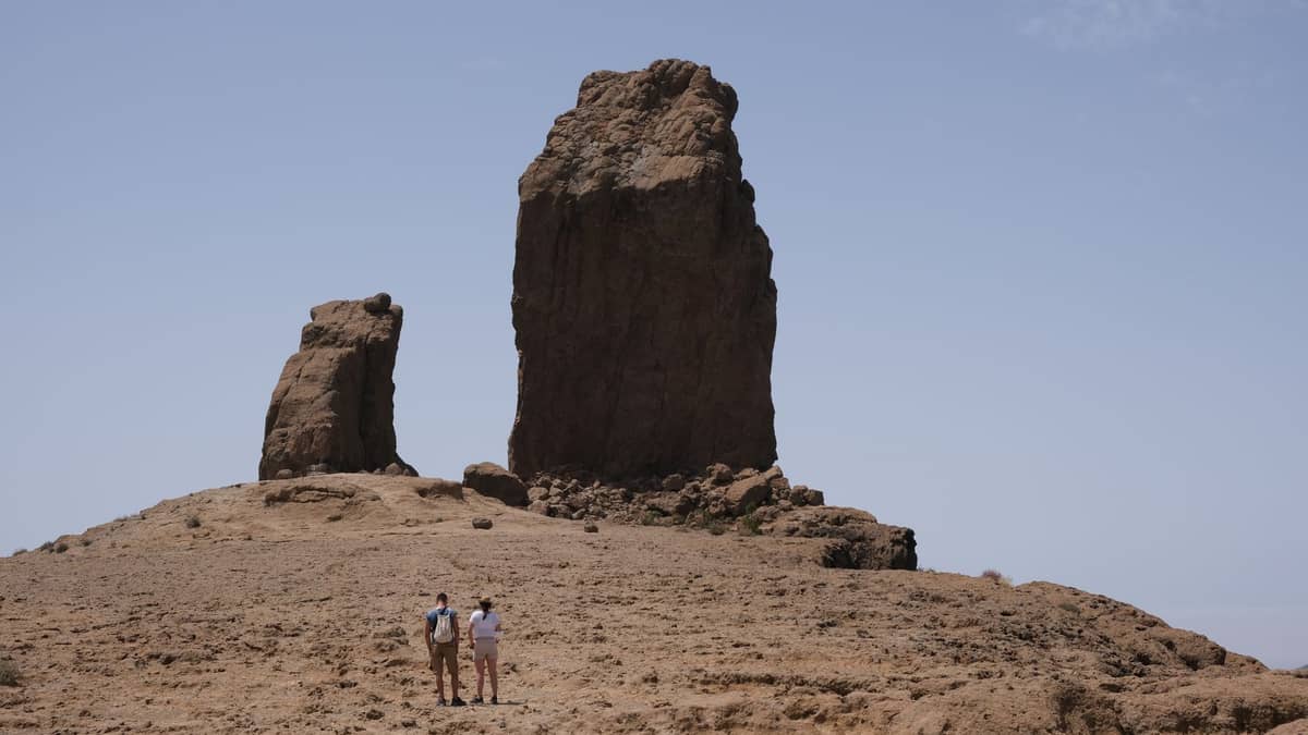
Gran Canaria is sometimes called a 'continent in miniature', and nowhere is that more apparent than on foot. The island's dramatic interior rises from sea level to nearly 1,956 metres, with microclimates that shift from arid south to lush north within a single drive. The best hiking season runs from November through April, when temperatures are cooler and the air clearer, though many trails are perfectly walkable year-round. For planning your trip around the trails, see our guide to the best time to visit Gran Canaria. The mountain heartland centred on Tejeda holds the island's most iconic hikes, while the north and west reward those willing to venture beyond the resort zones. Whether you are based in Las Palmas or the southern resorts, most of these trails are reachable by car, and some by public bus.
✨ Pro tip
For hiking in November–April, carry an extra layer. Temperatures at 1,800+ metres can drop sharply, even when it is warm at the coast. Sun protection is essential year-round at altitude.
Iconic Mountain Hikes
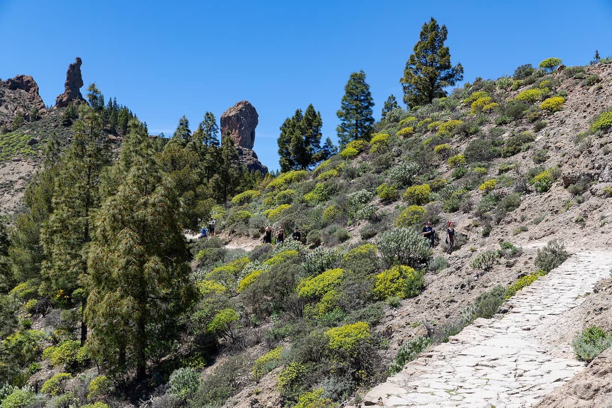
The volcanic heart of Gran Canaria, centred around Tejeda and Cruz de Tejeda, is where the island's most dramatic hiking is concentrated. The landscape here is raw and ancient, shaped by collapsed calderas and towering rock monoliths. These are the trails that define Gran Canaria hiking and should be the priority for anyone with limited time in the interior. The volcanic heart of Gran Canaria, centred around and Cruz de Tejeda, is where the island's most dramatic hiking is concentrated. The landscape here is raw and ancient, shaped by collapsed calderas and towering rock monoliths. These are the trails that define Gran Canaria hiking and should be the priority for anyone with limited time in the interior. Note that Roque Nublo now requires a free advance reservation to access the regulated trail section.
1. Hike to the Base of Gran Canaria's Most Iconic Rock
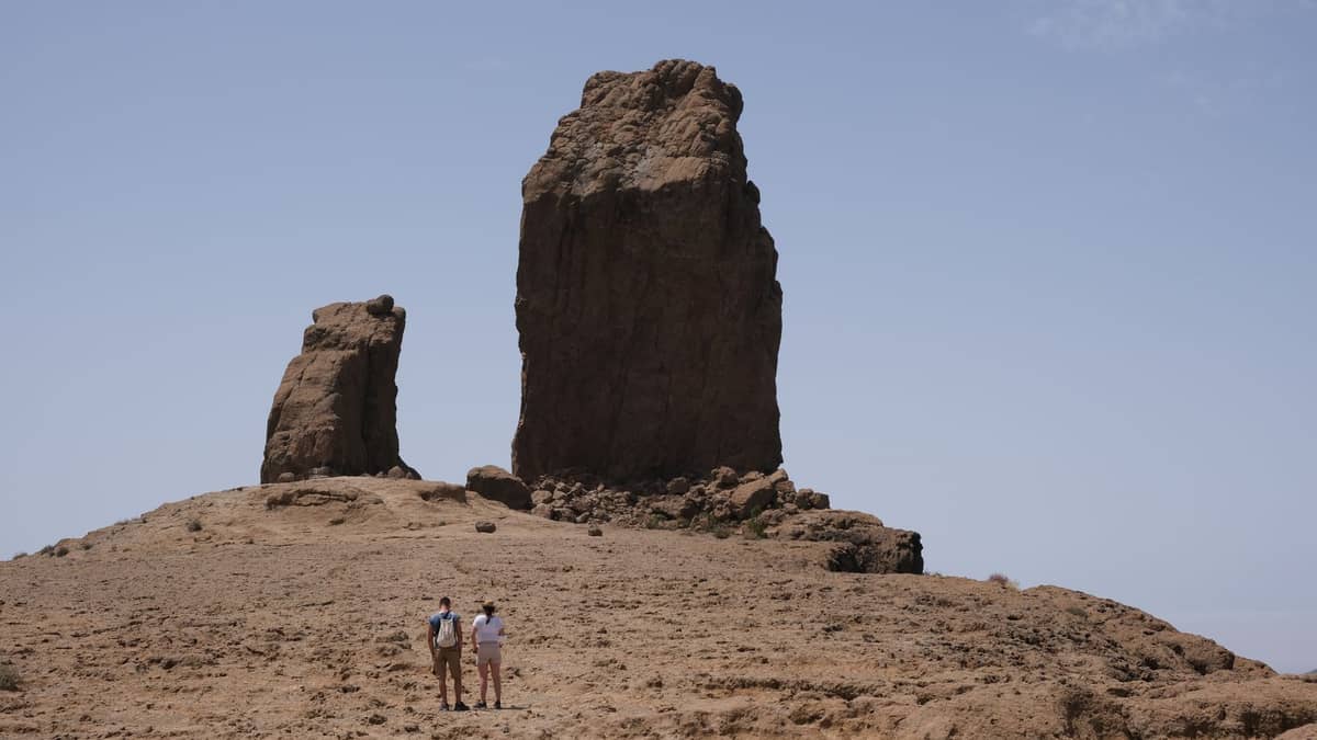
The 3 km round-trip trail from La Goleta to Roque Nublo's base takes 60-75 minutes and rewards with panoramic views including Mount Teide on clear days. A free reservation via grancanariasenderos.com is required. Access is regulated daily 10:00-17:00.
Explore1. Hike to the Base of Gran Canaria's Most Iconic Rock
The 3 km round-trip trail from La Goleta to Roque Nublo's base takes 60-75 minutes and rewards with panoramic views including Mount Teide on clear days. A free reservation via grancanariasenderos.com is required. Access is regulated daily 10:00-17:00.
Explore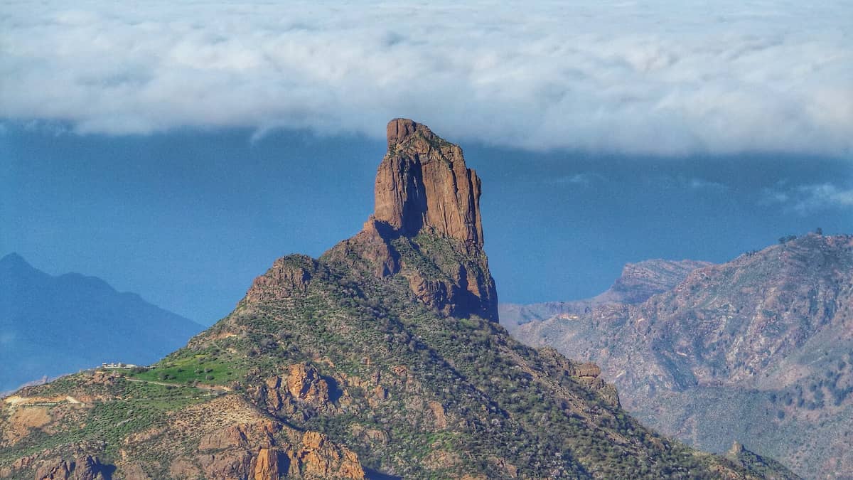
2. Explore a Sacred Guanche Rock Formation Near Tejeda
The trail to Roque Bentayga passes ancient cave dwellings and rock carvings before reaching one of the most dramatically positioned summits in the island interior. Views across the caldera are superb, and the Guanche history adds serious depth to the walk.
Explore2. Explore a Sacred Guanche Rock Formation Near Tejeda
The trail to Roque Bentayga passes ancient cave dwellings and rock carvings before reaching one of the most dramatically positioned summits in the island interior. Views across the caldera are superb, and the Guanche history adds serious depth to the walk.
Explore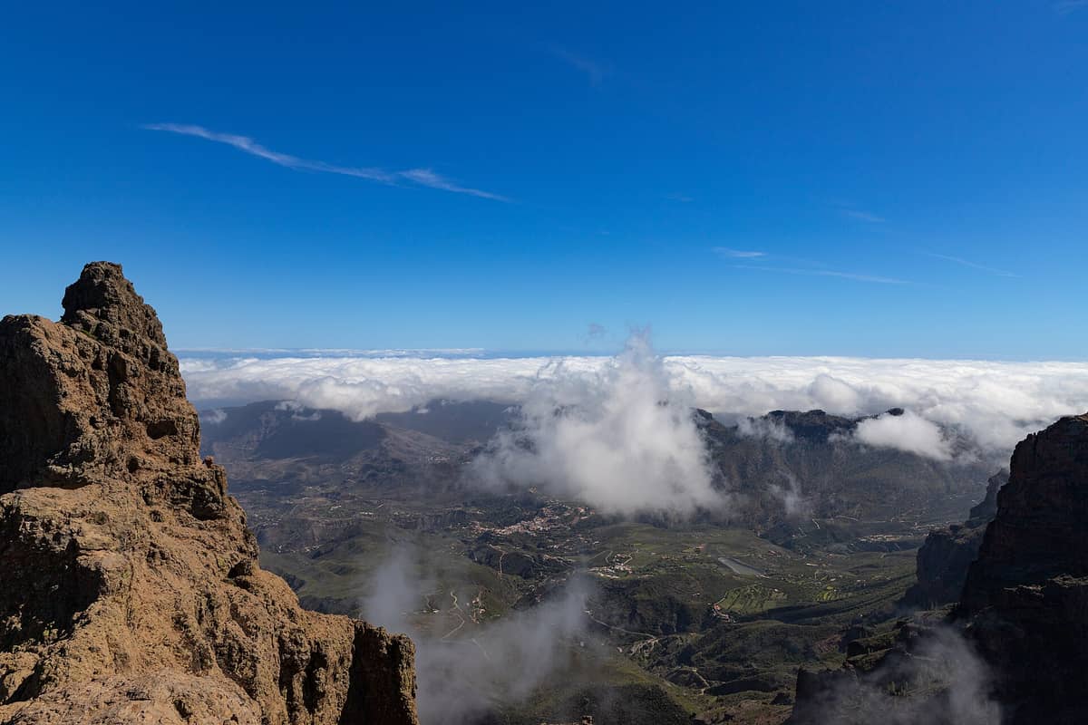
3. Drive and Walk to Gran Canaria's Highest Point
At 1,949 metres, Pico de las Nieves is accessible by road with a short walk to the summit viewpoint. On clear days, you can see Tenerife, Fuerteventura, and Lanzarote. The pine forest drive up is itself spectacular and takes about 40 minutes from Tejeda.
Explore3. Drive and Walk to Gran Canaria's Highest Point
At 1,949 metres, Pico de las Nieves is accessible by road with a short walk to the summit viewpoint. On clear days, you can see Tenerife, Fuerteventura, and Lanzarote. The pine forest drive up is itself spectacular and takes about 40 minutes from Tejeda.
Explore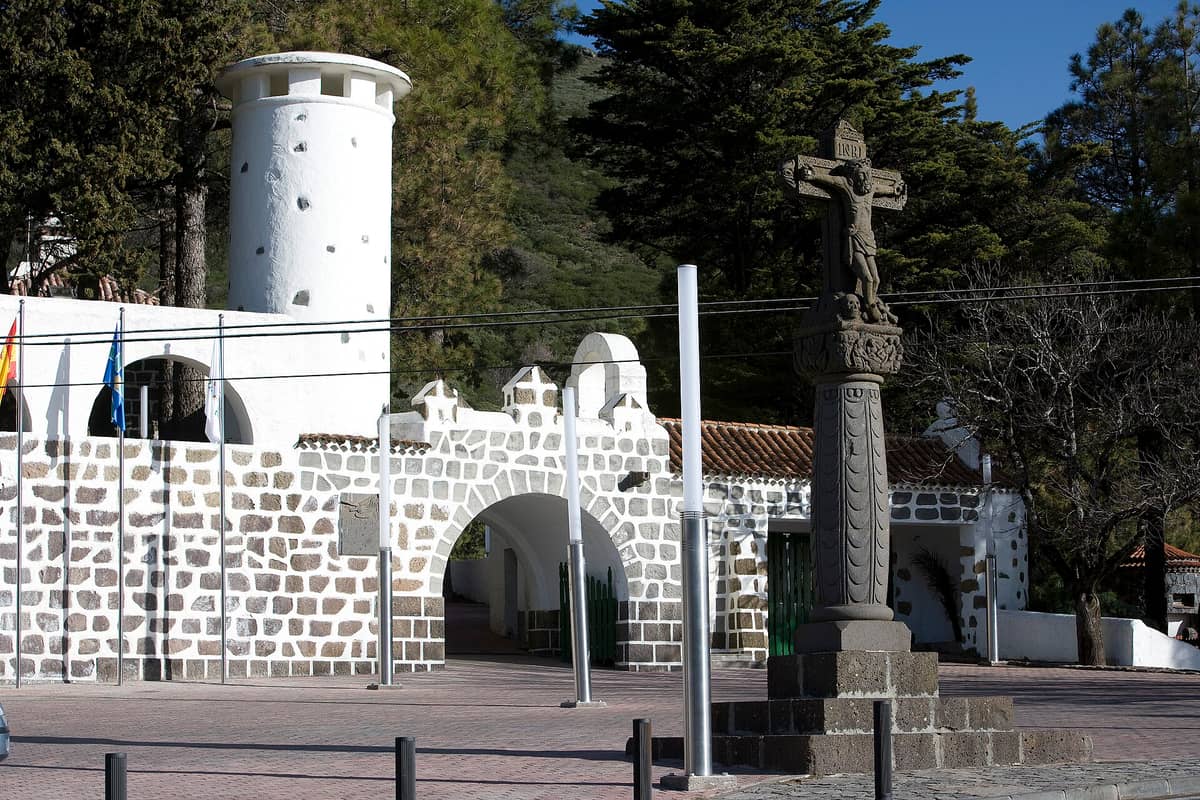
4. Start Your Mountain Walks from the Island's Central Crossroads
The stone cross at Gran Canaria's geographic centre sits at around 1,450 metres and serves as the classic launchpad for walks toward Roque Nublo, Roque Bentayga, and surrounding peaks. The panoramic mountain scenery here is available the moment you step out of the car.
Explore4. Start Your Mountain Walks from the Island's Central Crossroads
The stone cross at Gran Canaria's geographic centre sits at around 1,450 metres and serves as the classic launchpad for walks toward Roque Nublo, Roque Bentayga, and surrounding peaks. The panoramic mountain scenery here is available the moment you step out of the car.
Explore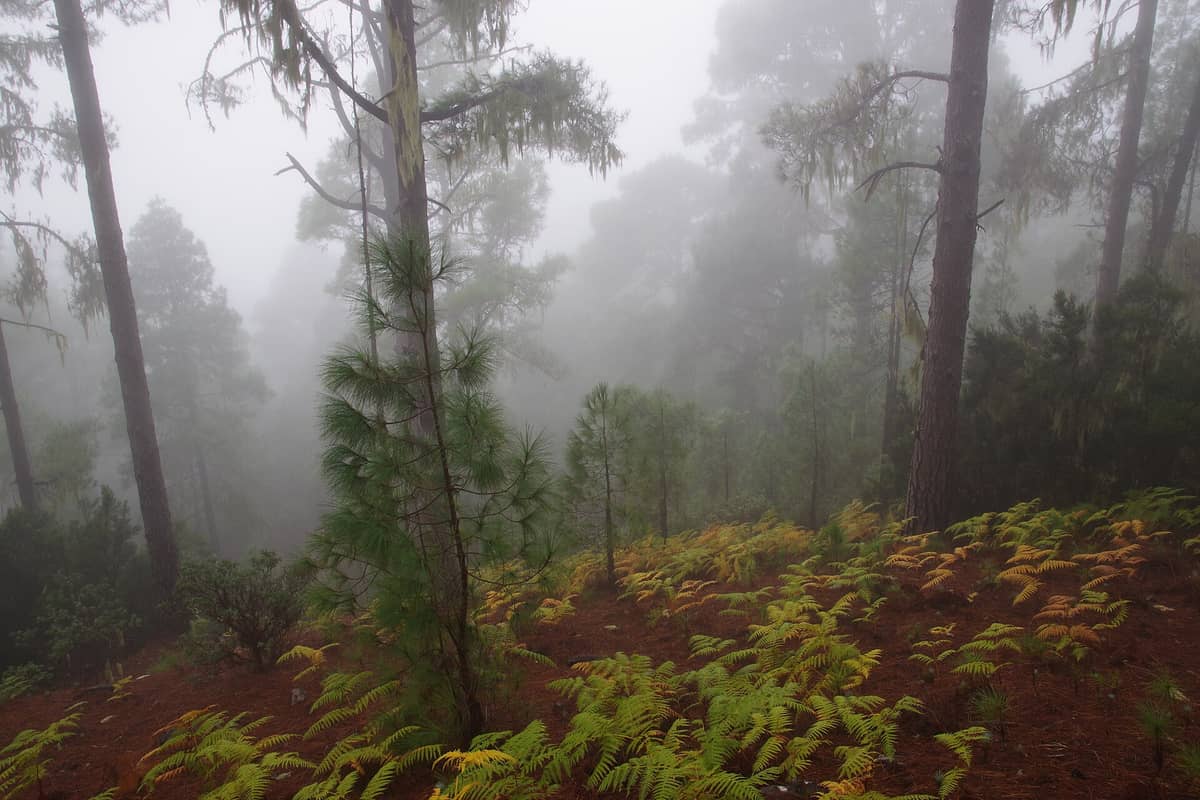
5. Trek Through Gran Canaria's Largest Pine Forest
Tamadaba in the northwest is covered by the island's most extensive Canarian pine forest, with trails that reach the edge of dramatic coastal cliffs hundreds of metres above the Atlantic. It is remote, quiet, and offers some of the most wilderness-like hiking on the island.
Explore5. Trek Through Gran Canaria's Largest Pine Forest
Tamadaba in the northwest is covered by the island's most extensive Canarian pine forest, with trails that reach the edge of dramatic coastal cliffs hundreds of metres above the Atlantic. It is remote, quiet, and offers some of the most wilderness-like hiking on the island.
ExploreRavine & Valley Walks
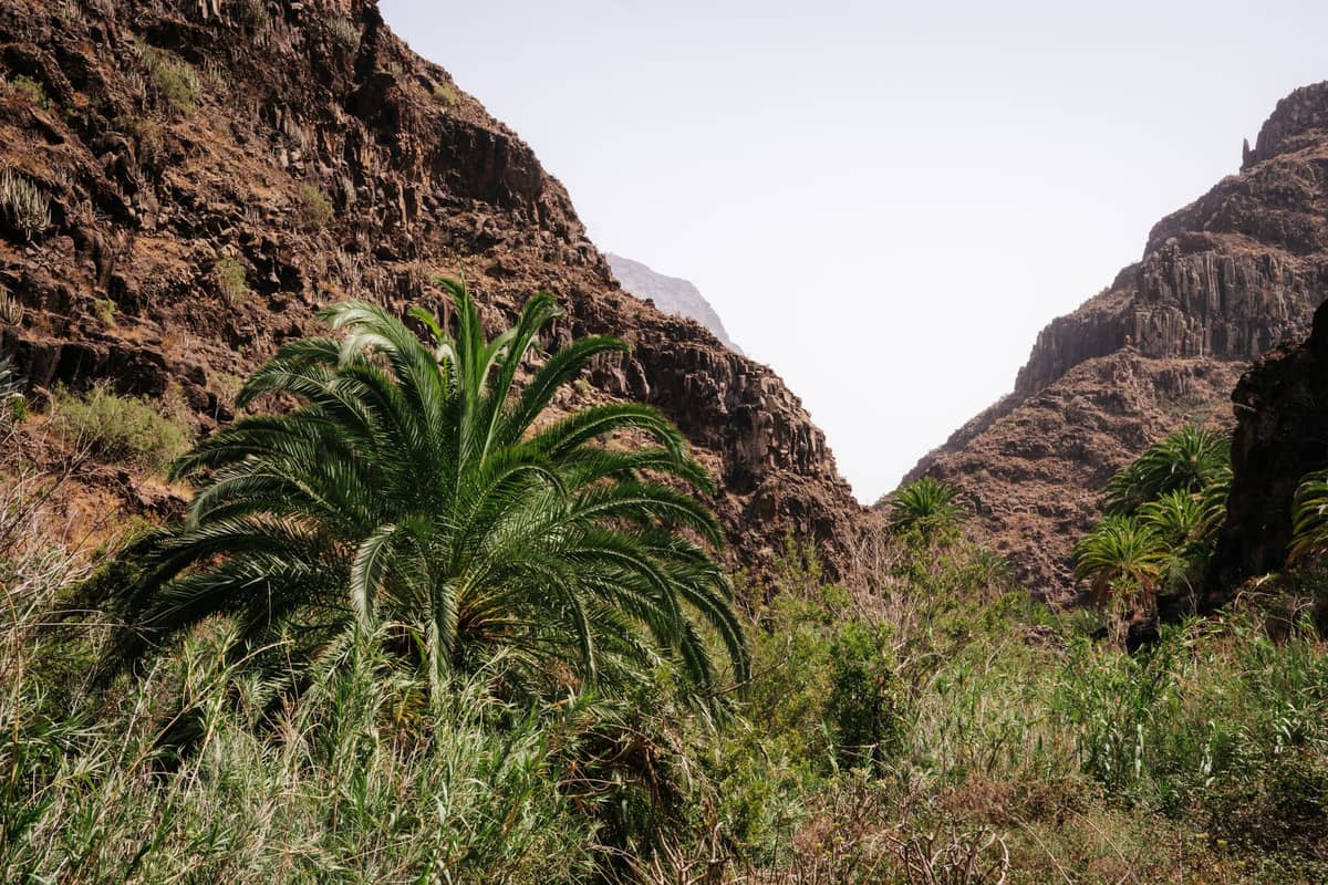
Gran Canaria's barrancos (ravines) carve deep into the island's volcanic rock, creating sheltered corridors of extraordinary biodiversity. These valley walks offer a very different experience from the high mountain trails, with shade, endemic vegetation, and in some cases, the rare sound of running water. They are particularly rewarding between December and April when the greenery is at its most lush. For a wider view of the island's natural highlights, our Gran Canaria hidden gems guide covers several of these lesser-known spots in more detail.
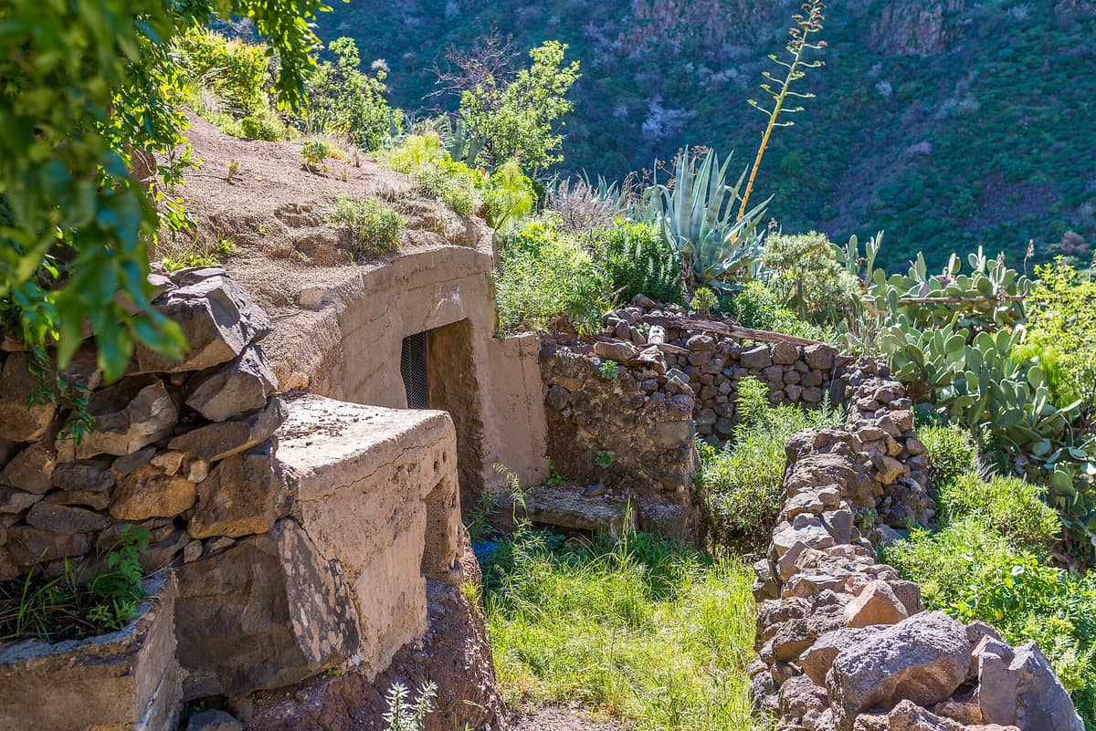
6. Walk a Ravine Lined with Cave Restaurants and Guanche History
Barranco de Guayadeque is one of Gran Canaria's most complete natural experiences: a deep green ravine with cave dwellings, Guanche burial sites, endemic flora, and actual cave restaurants where you can eat inside the rock. Allow at least half a day to do it justice.
Explore6. Walk a Ravine Lined with Cave Restaurants and Guanche History
Barranco de Guayadeque is one of Gran Canaria's most complete natural experiences: a deep green ravine with cave dwellings, Guanche burial sites, endemic flora, and actual cave restaurants where you can eat inside the rock. Allow at least half a day to do it justice.
Explore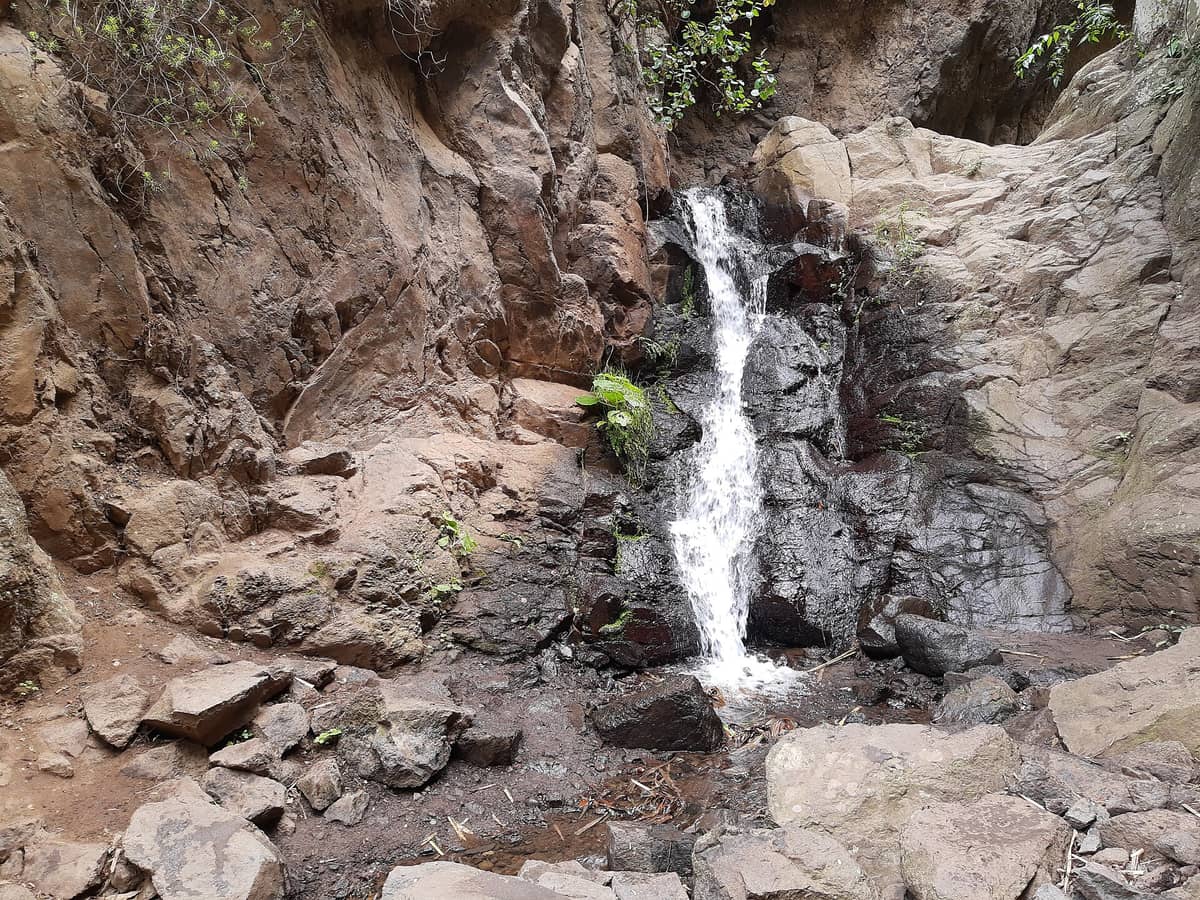
7. Follow Gran Canaria's Rarest Thing: a Year-Round Stream
Barranco de los Cernícalos is one of the only ravines on the island with water flowing all year. The gentle trail passes ferns, willows, and laurel forest before reaching small waterfalls. It is green, quiet, and genuinely surprising for an island with such a dry reputation.
Explore7. Follow Gran Canaria's Rarest Thing: a Year-Round Stream
Barranco de los Cernícalos is one of the only ravines on the island with water flowing all year. The gentle trail passes ferns, willows, and laurel forest before reaching small waterfalls. It is green, quiet, and genuinely surprising for an island with such a dry reputation.
Explore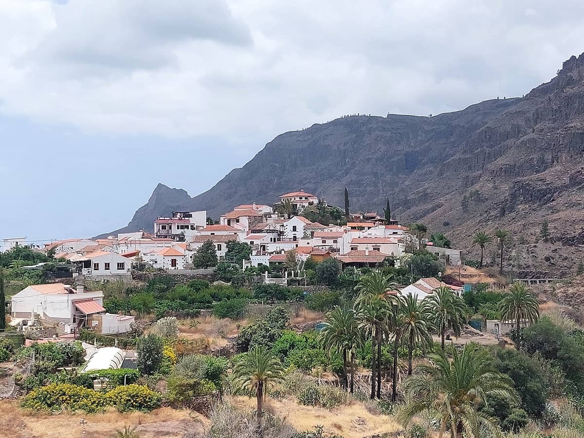
8. Walk into the Palm-Filled Valley Above Fataga Village
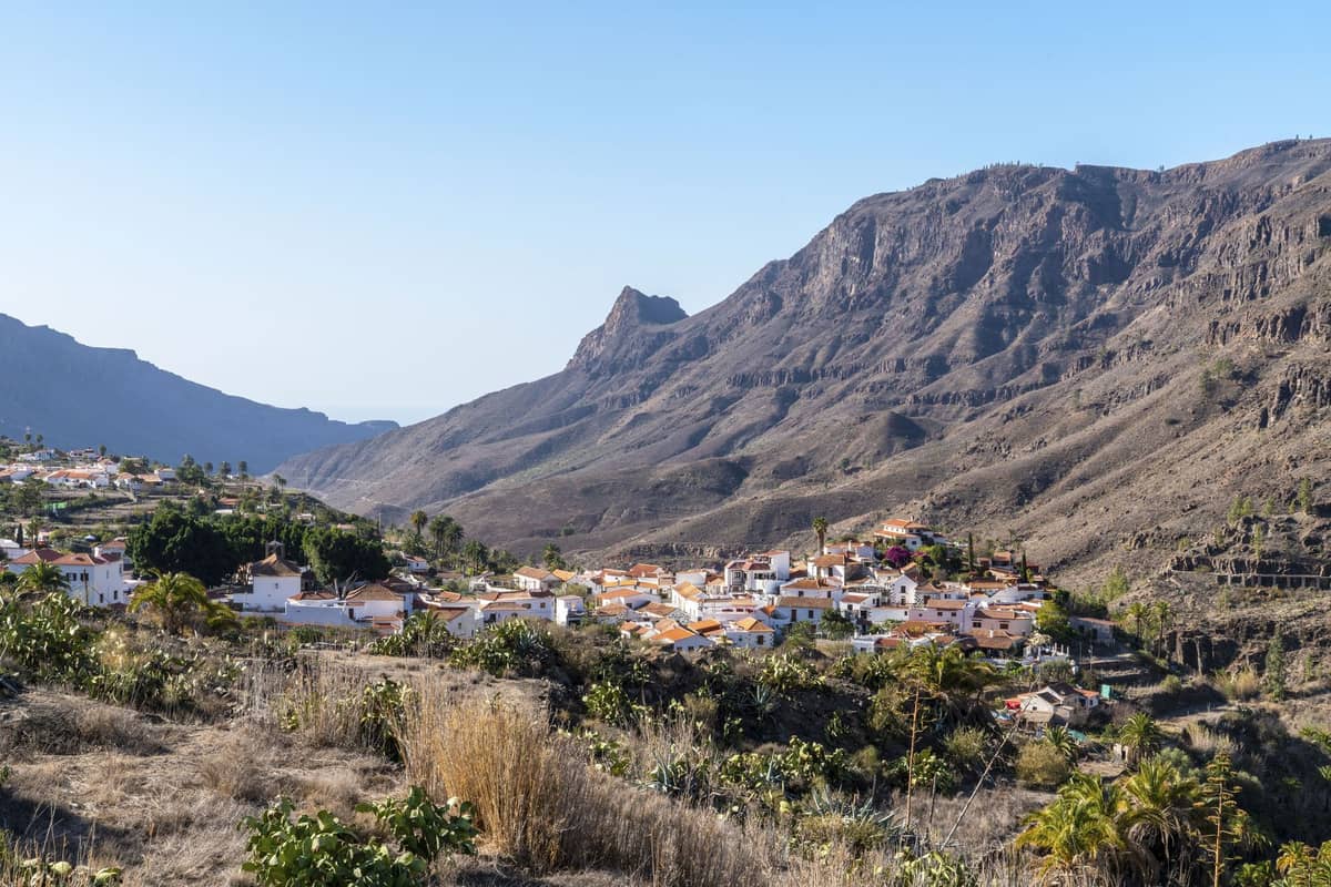
The Fataga valley stretches below one of Gran Canaria's most photogenic white villages, with trails descending through date palms and volcanic rock into a landscape that feels closer to the Sahara than southern Europe. The village itself makes an excellent lunch stop after the walk.
Explore8. Walk into the Palm-Filled Valley Above Fataga Village
The Fataga valley stretches below one of Gran Canaria's most photogenic white villages, with trails descending through date palms and volcanic rock into a landscape that feels closer to the Sahara than southern Europe. The village itself makes an excellent lunch stop after the walk.
Explore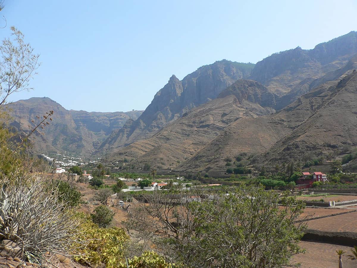
9. Hike Through Europe's Only Coffee-Growing Valley
Valle de Agaete is a strikingly lush corner of the northwest, with terraced slopes of coffee, citrus, and avocado. Foot trails wind through the valley with views up to dramatic cliffs. It is best visited in late August during the coffee harvest, but rewarding any time of year.
Explore9. Hike Through Europe's Only Coffee-Growing Valley
Valle de Agaete is a strikingly lush corner of the northwest, with terraced slopes of coffee, citrus, and avocado. Foot trails wind through the valley with views up to dramatic cliffs. It is best visited in late August during the coffee harvest, but rewarding any time of year.
ExploreVolcanic & Geological Wonders
Gran Canaria's geological story is written in its landscape. Volcanic craters, multicoloured mineral cliffs, and ancient lava formations appear throughout the island, and several of the best hikes are as much about geology as exercise. These routes are accessible to most fitness levels and offer some of the most visually dramatic terrain on the island. If you are planning a driving route to combine these sites, our Gran Canaria road trip guide has practical itinerary suggestions.
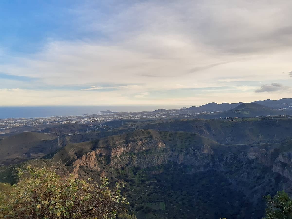
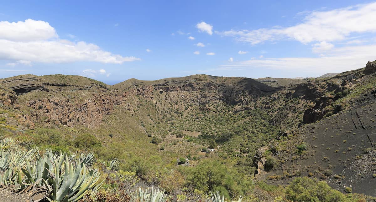
10. Descend into a Perfectly Preserved Volcanic Crater Near Las Palmas
Bandama Caldera sits just 15 minutes from Las Palmas and offers a 200-metre-deep volcanic bowl you can hike into via a trail from the rim. The hilltop viewpoint above adds sweeping views over the wine-growing countryside and the capital. Allow around 2 hours for the full loop.
Explore10. Descend into a Perfectly Preserved Volcanic Crater Near Las Palmas
Bandama Caldera sits just 15 minutes from Las Palmas and offers a 200-metre-deep volcanic bowl you can hike into via a trail from the rim. The hilltop viewpoint above adds sweeping views over the wine-growing countryside and the capital. Allow around 2 hours for the full loop.
Explore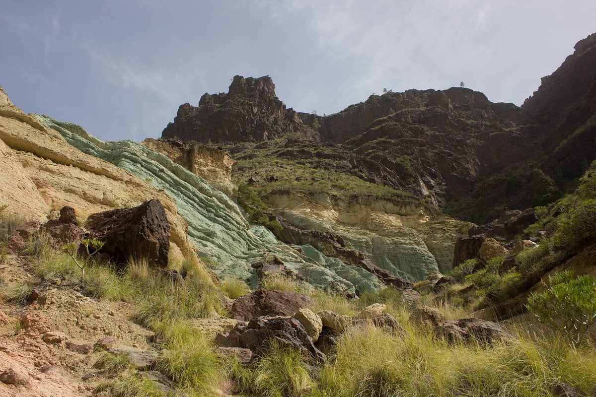
11. See the Multicoloured Mineral Cliffs of the West Coast
Los Azulejos is a cliff face streaked in vivid greens, reds, and yellows by mineral deposits, one of the most striking geological sights in the Canary Islands. It is a roadside stop rather than a trail, but it pairs naturally with walks in the surrounding west coast landscape.
Explore11. See the Multicoloured Mineral Cliffs of the West Coast
Los Azulejos is a cliff face streaked in vivid greens, reds, and yellows by mineral deposits, one of the most striking geological sights in the Canary Islands. It is a roadside stop rather than a trail, but it pairs naturally with walks in the surrounding west coast landscape.
Explore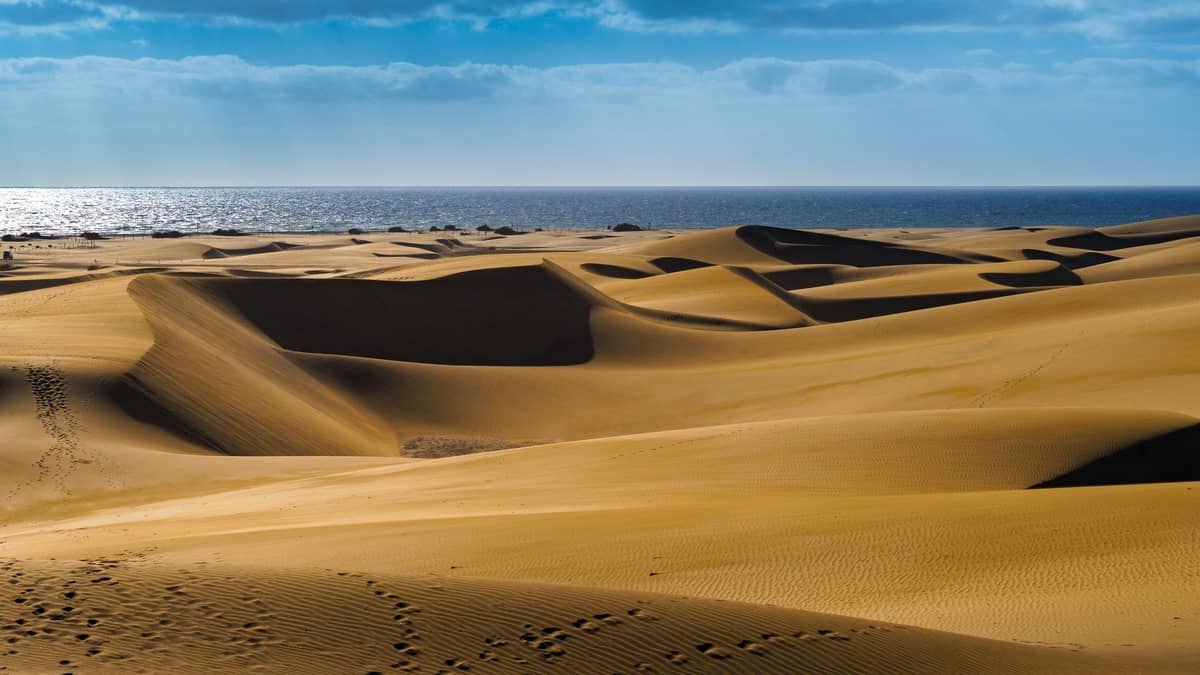
12. Walk Through a Saharan Landscape at the Island's Southern Tip
The Maspalomas Dunes cover over 400 protected hectares and offer a genuinely disorienting walk through golden sand dunes that meet the Atlantic. Sunrise and sunset are the best times. There are no marked trails inside, so navigation by landmark is part of the experience.
Explore12. Walk Through a Saharan Landscape at the Island's Southern Tip
The Maspalomas Dunes cover over 400 protected hectares and offer a genuinely disorienting walk through golden sand dunes that meet the Atlantic. Sunrise and sunset are the best times. There are no marked trails inside, so navigation by landmark is part of the experience.
ExploreCoastal & Cliff Walks
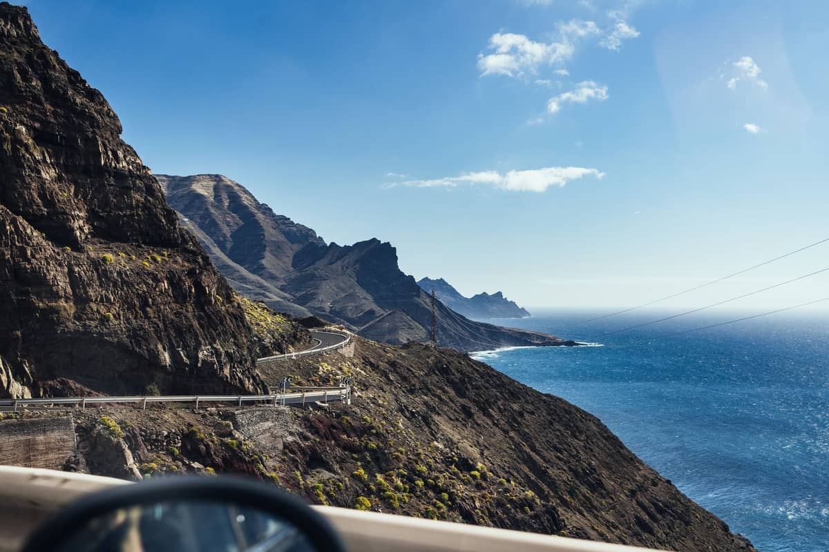
The coastline of Gran Canaria is far more varied than the southern resort zone suggests. The west and north coasts especially offer dramatic cliff scenery, fishing villages, and natural formations that reward walking as much as driving. Several of these routes connect to beaches and pools covered in our guide to natural pools in Gran Canaria.
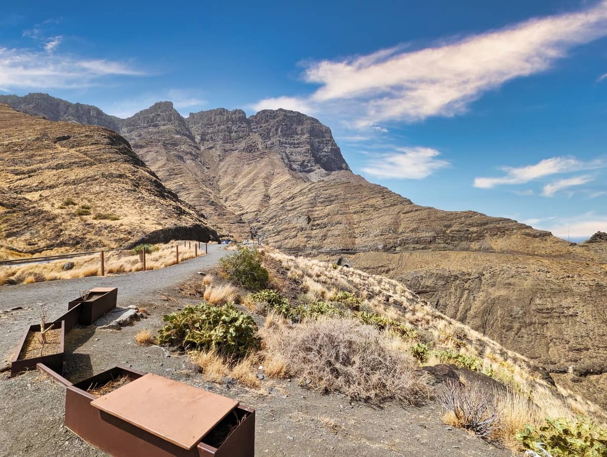
13. Walk the Clifftop Path Above Gran Canaria's Most Dramatic Coastline
Mirador del Balcón sits on the west coast's sea cliffs, with vertiginous drops to the Atlantic below. The viewpoint connects to walking paths along the cliff edge that offer some of the most dramatic coastal scenery on the island. Best visited on a clear morning for maximum visibility.
Explore13. Walk the Clifftop Path Above Gran Canaria's Most Dramatic Coastline
Mirador del Balcón sits on the west coast's sea cliffs, with vertiginous drops to the Atlantic below. The viewpoint connects to walking paths along the cliff edge that offer some of the most dramatic coastal scenery on the island. Best visited on a clear morning for maximum visibility.
Explore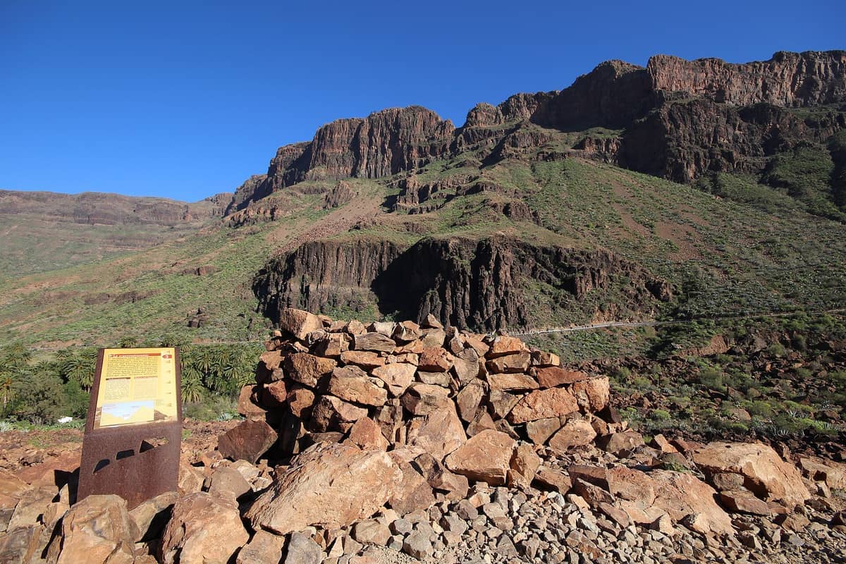
14. Hike to a Haunting Guanche Burial Site Above a Palm Oasis
The Arteara Necropolis sits on a rocky hillside above the lush Fataga valley, reachable via a short but steep trail from the valley floor. Hundreds of ancient stone tombs are scattered across the slope, with the palm oasis below creating a remarkable contrast. Allow 1-2 hours from the valley.
Explore14. Hike to a Haunting Guanche Burial Site Above a Palm Oasis
The Arteara Necropolis sits on a rocky hillside above the lush Fataga valley, reachable via a short but steep trail from the valley floor. Hundreds of ancient stone tombs are scattered across the slope, with the palm oasis below creating a remarkable contrast. Allow 1-2 hours from the valley.
Explore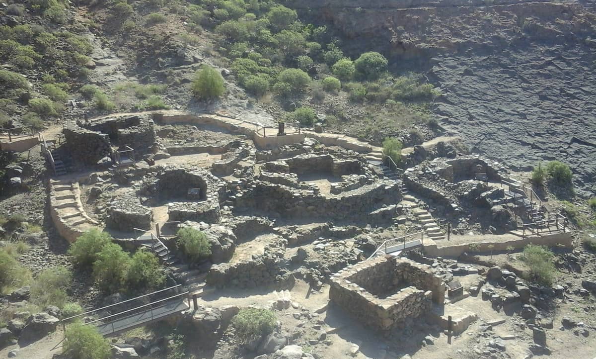
15. Walk a Coastal Headland with Intact Guanche Cave Dwellings
The Tufia headland on the east coast preserves one of Gran Canaria's best Guanche coastal settlements, accessible via a short coastal walk. Cave dwellings and stone structures sit above a small beach, making this one of the few spots where archaeology and coastline combine on foot.
Explore15. Walk a Coastal Headland with Intact Guanche Cave Dwellings
The Tufia headland on the east coast preserves one of Gran Canaria's best Guanche coastal settlements, accessible via a short coastal walk. Cave dwellings and stone structures sit above a small beach, making this one of the few spots where archaeology and coastline combine on foot.
Explore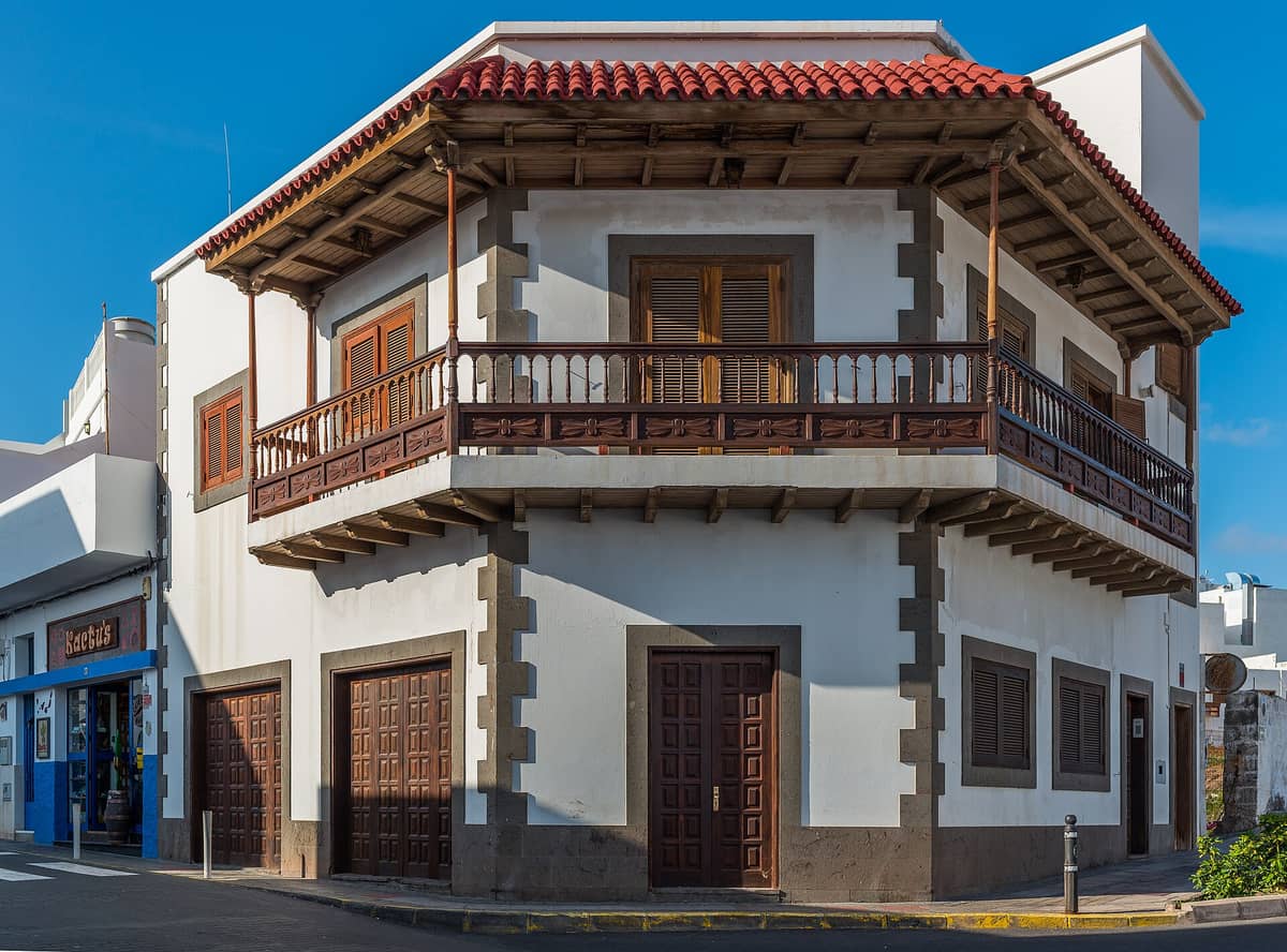
16. Explore the Agaete Cliffs and Rocky Coastline on Foot
Puerto de las Nieves is the starting point for coastal walks along the dramatic northwest cliffs of Gran Canaria. The natural rock pools and clear Atlantic water make it worth lingering, and the seafood restaurants in the village are an excellent reward after any walk in the area.
Explore16. Explore the Agaete Cliffs and Rocky Coastline on Foot
Puerto de las Nieves is the starting point for coastal walks along the dramatic northwest cliffs of Gran Canaria. The natural rock pools and clear Atlantic water make it worth lingering, and the seafood restaurants in the village are an excellent reward after any walk in the area.
ExploreEasy Walks & Nature Strolls
Not every great walk in Gran Canaria requires a mountain. The island has a number of gentler routes through botanical gardens, historic villages, and low-lying nature reserves that are accessible to all fitness levels. These work particularly well as half-day excursions combined with other sightseeing. For more options that do not require hiking boots, see our free things to do in Gran Canaria guide.
17. Stroll Through Spain's Most Important Canarian Plant Collection
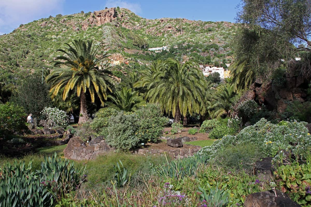
The Jardín Botánico Viera y Clavijo cascades down a ravine on Las Palmas's outskirts, with over 500 endemic species including dragon trees, giant euphorbias, and laurel forest plants. It is a peaceful 1-2 hour walk that doubles as one of the best introductions to the island's unique flora.
Explore17. Stroll Through Spain's Most Important Canarian Plant Collection
The Jardín Botánico Viera y Clavijo cascades down a ravine on Las Palmas's outskirts, with over 500 endemic species including dragon trees, giant euphorbias, and laurel forest plants. It is a peaceful 1-2 hour walk that doubles as one of the best introductions to the island's unique flora.
Explore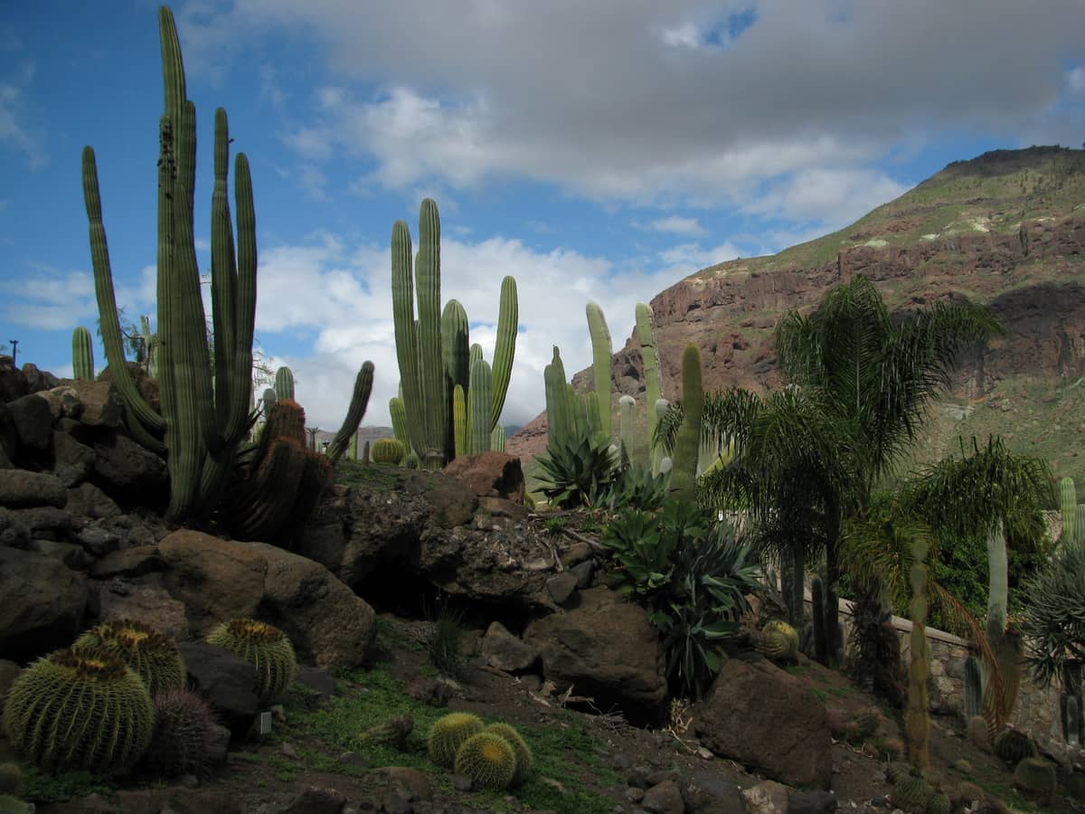
18. Walk Among 10,000 Cacti on the Dramatic West Coast
Cactualdea near La Aldea de San Nicolás is one of Europe's largest cactus gardens, set on terraced hillsides with Atlantic views. Over 10,000 specimens from around the world are arranged across a landscape that blends seamlessly with the surrounding volcanic terrain. Allow 1-1.5 hours.
Explore18. Walk Among 10,000 Cacti on the Dramatic West Coast
Cactualdea near La Aldea de San Nicolás is one of Europe's largest cactus gardens, set on terraced hillsides with Atlantic views. Over 10,000 specimens from around the world are arranged across a landscape that blends seamlessly with the surrounding volcanic terrain. Allow 1-1.5 hours.
Explore💡 Local tip
To hike Roque Nublo, book your free time slot at grancanariasenderos.com before you travel. Slots fill quickly at weekends and during school holidays. Parking is no longer available at the La Goleta trailhead; use the designated car parks in Tejeda and take the Global shuttle to the trail access point.
FAQ
Do I need a permit to hike Roque Nublo?
You need a free reservation to access the regulated S-70 trail at Roque Nublo during operating hours (daily 10:00-17:00). Book in advance at grancanariasenderos.com or reservasroquenublo.com. Entry is free but numbers are capped at around 60 people per hour. Note that climbing the rock itself is prohibited.
When is the best time of year to hike in Gran Canaria?
November through April is generally the best period for hiking, with cooler temperatures and clearer air at altitude. Summer hiking is possible but the sun is intense and heat haze can reduce summit views. For highland trails like Roque Nublo and Pico de las Nieves, start early in any season to avoid midday sun.
Can I reach the hiking trails without a car?
Some trails are reachable by public bus. The Global bus network connects Las Palmas and the south coast to Tejeda and Cruz de Tejeda, the main hub for mountain hikes. However, a hire car gives far greater flexibility, especially for trails in the west and northwest of the island.
What level of fitness do I need for Gran Canaria's best hikes?
Gran Canaria hikes range widely. Gran Canaria hikes range widely. Roque Nublo is rated easy to moderate, with about 180 metres of elevation gain on a 3 km round trip. Tamadaba and longer ridge walks require more stamina. Barranco de los Cernícalos and the Jardín Botánico are suitable for most fitness levels. Proper footwear is recommended on all mountain trails.
Are the hiking trails in Gran Canaria well marked?
Major trails like Roque Nublo and Roque Bentayga are well marked and maintained. Some lesser-used ravine and west coast paths are less clearly signposted. Downloading an offline trail map via apps like Wikiloc or AllTrails before your hike is strongly recommended, especially for routes away from the main mountain area.