Tamadaba Natural Park: Gran Canaria's Ancient Pine Forest
Parque Natural de Tamadaba is Gran Canaria's most significant forested wilderness, a 7,538-hectare protected pine forest draped across the island's rugged northwest. Expect dramatic ridge-top panoramas, silent conifer tracks, and some of the clearest air on the island — all free to enter.
Quick Facts
- Location
- Northwest Gran Canaria, spanning Agaete, Artenara and La Aldea de San Nicolás
- Getting There
- Car strongly recommended. Approach via GC-216 from Artenara or GC-200/GC-700 from Agaete. Limited public bus access — check Global bus schedules locally before relying on them.
- Time Needed
- Half day minimum; full day for hiking and picnicking
- Cost
- Free entry. Camping requires a permit from Cabildo de Gran Canaria (fee may apply). Camping is frequently restricted in summer (often around 1 July–30 September) due to fire risk.
- Best for
- Hikers, nature lovers, photographers, and anyone escaping the coastal resort strip
- Official website
- cabildo.grancanaria.com/tamadaba
What Tamadaba Actually Is
Parque Natural de Tamadaba is the largest continuous pine forest on Gran Canaria, covering 7,538.6 hectares across the island's mountainous northwest. It sits within a triangle formed by the municipalities of Agaete, Artenara, and La Aldea de San Nicolás — an area that most package tourists never reach. The park is classified as a Parque Natural under Canary Islands protected area legislation, a designation that permits recreational and educational use while prioritising conservation.
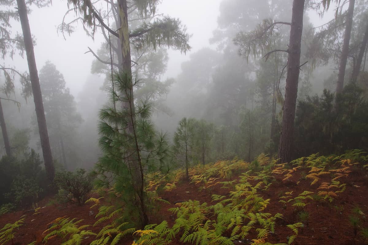
The dominant tree is the Canarian pine (Pinus canariensis), a species that is endemic to the Canary Islands and ecologically remarkable: it can regenerate from its bark after wildfire, with new shoots emerging directly from scorched trunks. Walking through Tamadaba, you pass trees that have survived multiple fire cycles and centuries of Atlantic gales. The forest floor smells of resin and damp earth, and the silence — especially on weekday mornings — is striking after the noise of the coastal resorts.
Tamadaba sits at the western end of Gran Canaria's central mountain spine, not far from the island's highest point. That geography makes it a logical extension of any trip that already takes in Roque Nublo or the ridge village of Tejeda, both of which lie to the east and offer a very different landscape character.
The Experience on the Ground
Arriving by the GC-216 from Artenara, the road descends through progressively denser pine cover until the recreational area appears: a cluster of stone picnic tables, a camping zone, and the start of several marked trails. The air temperature drops noticeably compared to the coast — even in summer, the altitude and tree canopy keep things cool, and a light jacket is rarely wasted. In winter or after rain, low cloud often sits at tree level, turning the forest into something closer to a northern European landscape than a Canary Island one.
The main recreational zone is generally used during daylight hours, with many local sources indicating activity roughly between 09:00 and early evening depending on season, though the natural parkland itself has no gate or barrier. Facilities in the recreational area are simple but complete: picnic benches and stone tables, barbecue grills, toilets, potable water, parking, and signage for trails. There is no visitor centre, no café, and no on-site shop. Bring water and food — the nearest services are in Artenara or Agaete, both at least 20 minutes away by car.
💡 Local tip
Arrive before 10:00 on weekends if you want a picnic table in the shade. By midday in spring and autumn, the recreational area fills with local families, and the quieter forest tracks offer better solitude than the central clearing.
How the Park Changes Through the Day
Early morning is the most rewarding time to be here. Mist sometimes filters through the canopy, and the only sounds are wind through pine needles and the occasional call of a blue chaffinch — a bird species endemic to the Canary Islands and regularly spotted in Tamadaba. Light through the trees at this hour is photogenic in a way that midday sun, which creates harsh shadows on the uneven forest floor, simply is not.
By late morning, the GC-216 sees more traffic and the recreational area becomes social: local families from Artenara and Las Palmas use it as a weekend picnic destination, which gives the place an unhurried, domestic atmosphere rather than a tourist-destination feel. This is not necessarily a drawback. Watching grandparents shuffle between pine trees and children kick footballs on the packed-earth clearing is a reminder that this park belongs to the island's residents first.
Afternoon light from the west can be spectacular, particularly at viewpoints looking toward the Atlantic. On clear days — most common from spring through autumn — you can see the ocean from higher sections of the park. Cloud, when it builds from the northwest, typically arrives in the afternoon and can reduce visibility quickly. If you are hiking to a viewpoint, morning is more reliable for clear sightlines.
Hiking in Tamadaba
The park contains a network of marked trails at varying difficulty levels, ranging from short walks from the recreational area to longer ridge routes that connect with the GC-200 coastal road or the Camino de Santiago de Gran Canaria, a long-distance route that traverses the island's interior. Trail surfaces are generally good but involve exposed roots, uneven rock, and steep gradients in places. Sturdy footwear is essential — sandals or flat trainers are a bad idea, particularly after rain when the red earth becomes slippery.
For context on what hiking in this part of the island involves, the broader hiking in Gran Canaria guide covers trail grades, what to carry, and the best months for altitude walking.
The Canarian government officially limits simultaneous trail use in the Tamadaba pine forest to 200 people per day across its marked routes, with the regulation aimed particularly at organised hiking groups. In practice, casual visitors are not counted, but this limit signals that the authorities actively manage capacity to protect the ecosystem. During school holidays and on sunny winter weekends, the main trails near the recreational area can feel congested close to the access road. Walk 20 minutes further in and the crowds thin considerably.
⚠️ What to skip
Camping in Tamadaba is prohibited between approximately 1 July and 30 September due to the elevated wildfire risk from dry conditions. Outside that period, camping is permitted but requires advance authorisation from the Cabildo de Gran Canaria's environmental department (Servicio de Medio Ambiente). Do not camp without a permit.
Getting There: The Honest Picture
A car is, in practical terms, almost obligatory. The GC-216 from Artenara is the most straightforward approach: it is a winding mountain road and takes concentration, but it is well-surfaced. From Agaete on the coast, the GC-700 and then GC-200 provide an alternative route with impressive coastal cliff views en route. Budget about 1 hour from Las Palmas de Gran Canaria and roughly 1 hour 20 minutes from the south coast resort corridor.
Some travel guides mention bus access via Global line 101 toward El Risco, but this line only serves villages on the park’s edge and does not reach the interior; public transport into the park itself is not straightforward and schedules are limited. If you are planning a trip without a car, check the getting around Gran Canaria guide for current options, and verify schedules directly with Global (the island's interurban bus operator) before committing.
Parking at the recreational area is free but limited to a relatively small number of spaces. On busy weekends, cars overflow onto the road verge. Arriving by 09:30 guarantees a spot; arriving at midday on a sunny Saturday in October does not.
Best Time to Visit and Weather Realities
Tamadaba is genuinely rewarding year-round, but the experience shifts significantly by season. November through April brings the highest probability of cloud, mist, and occasional rain, which make the forest atmospheric but can obscure views and make trails muddier. This window is also the coolest: temperatures at altitude can drop to single figures on winter nights, and daytime highs in the pine zone are typically 5 to 8 degrees lower than on the coast.
May through September offers the most reliable sunshine and the clearest ocean views from the park's western ridges. Summer mornings are the ideal combination: cool air, good light, and sparse weekday crowds. The coastal resorts are at their fullest during July and August, which pushes more visitors toward interior attractions — though Tamadaba still sees far fewer people than famous sites like Roque Bentayga or Cruz de Tejeda. The best time to visit Gran Canaria guide provides a fuller breakdown of seasonal patterns across the island.
One underappreciated feature: Tamadaba sits on the northwest-facing slope of the island's central massif, which means it catches Atlantic moisture year-round. Even in summer, when the south of the island is bone dry, the forest here remains distinctly green. This is not just scenic — it means that wildfire risk, while real enough to justify the summer camping ban, is lower here than in drier inland zones.
Photography and Practical Preparation
For photography, the best light is early morning when sun angles are low and mist adds depth to the tree lines. The park's western viewpoints facing the Atlantic are most compelling in the late afternoon on clear days, when the ocean turns a deep blue-grey. Macro photography of bark textures, pine cones, and ground-level plants rewards patience, especially after rain when the colours saturate.
Bring sunscreen even on overcast days — altitude increases UV exposure — and carry more water than you think you need. The forest provides some shade, but exposed ridge sections can be hot and windy. Mobile signal is weak or absent across much of the park interior, so download offline maps before you leave and do not rely on real-time navigation once inside.
ℹ️ Good to know
Tamadaba is not a suitable destination for visitors with significant mobility impairments. Trails involve uneven terrain, steep gradients, and no paved paths beyond the immediate recreational zone. The picnic area itself is relatively level and accessible by car for those who wish to experience the forest without hiking.
Insider Tips
- The viewpoint at the western edge of the park, looking down toward Agaete and the ocean, is one of the finest on the island and almost never crowded. Reach it by following the trail from the recreational area westward for roughly 40 minutes.
- The Canarian pine's ability to regenerate after fire means you will often see blackened trunks with healthy green crowns — this is normal and is an ecological feature, not evidence of ongoing damage.
- If you are combining Tamadaba with a visit to Agaete, drop down the GC-200 after the park. The road traces the cliff edge above the northwest coast and is one of the most dramatic drives on the island.
- Weekday visits in October or November offer the best overall conditions: the summer crowds are gone, the light is warm, cloud cover is less persistent than in January, and the forest floor is often damp enough to bring out the resin smell most strongly.
- The nearest fuel station is in Agaete. Do not assume you can reach the park and return to Las Palmas on a quarter tank — the mountain roads are longer than they look on a map.
Who Is Tamadaba Natural Park For?
- Hikers wanting altitude trails away from the crowded central peaks
- Nature photographers seeking forest light, endemic birdlife, and Atlantic coastal panoramas
- Families looking for a free, shaded picnic spot with space for children to roam safely
- Travellers on a road trip around the island's interior who want a genuine wilderness stop
- Anyone who has spent several days on Gran Canaria's south coast and wants to see a completely different side of the island
Nearby Attractions
Other things to see while in Tejeda & the Mountain Interior:
- Cruz de Tejeda
Cruz de Tejeda is the symbolic centrepoint of Gran Canaria, a small mountain hamlet at 1,514 metres where a centuries-old stone cross marks the convergence of the island's main interior roads. The views stretch across volcanic peaks, pine-forested ridges, and ancient calderas — and it costs nothing to visit.
- Pico de las Nieves
At 1,949 metres, Pico de las Nieves is traditionally considered the highest point on Gran Canaria, though recent measurements place nearby Morro de la Agujereada slightly higher. It sits on the border between Tejeda and San Bartolomé de Tirajana. The public viewpoint is free, open around the clock, and offers sweeping mountain panoramas that stretch, on clear days, all the way to the Atlantic horizon and neighbouring islands. Getting there requires a car or a combination of mountain buses, but the reward is a perspective on the island that the beach resorts cannot offer.
- Roque Bentayga
Rising to 1,404 metres in the volcanic heart of Gran Canaria, Roque Bentayga is a basaltic rock tower surrounded by pre-Hispanic ceremonial sites and sweeping caldera views. The free interpretation centre and trail to the summit plateau make it one of the island's most rewarding inland excursions within the Risco Caído and the Sacred Mountains of Gran Canaria UNESCO cultural landscape.
- Roque Nublo
Roque Nublo is a volcanic basalt monolith rising from the central highlands of Gran Canaria, one of the most recognizable natural landmarks in the Canary Islands. Visiting the summit via the regulated S-70 trail currently requires advance reservation and a mountain hike, but the panoramic views over the island's interior reward the effort considerably.