Barranco de Guayadeque: Gran Canaria's Most Dramatic Archaeological Ravine
Barranco de Guayadeque is one of Gran Canaria's largest and most significant ravines, combining pre-Hispanic cave settlements, a small interpretation museum, and a striking canyon landscape. The ravine is free to explore, though the visitors centre charges a small fee. It rewards those who go beyond the car park.
Quick Facts
- Location
- Municipalities of Agüimes and Ingenio, east/southeast Gran Canaria
- Getting There
- Global bus lines 21, 27, 35 serve nearby stops; own transport strongly recommended
- Time Needed
- 2–4 hours for a relaxed visit; half a day if hiking deeper into the ravine
- Cost
- Ravine: free. Visitors centre: approx. €5 (adult admission); verify locally
- Best for
- History lovers, hikers, and anyone wanting to see Gran Canaria beyond its beaches
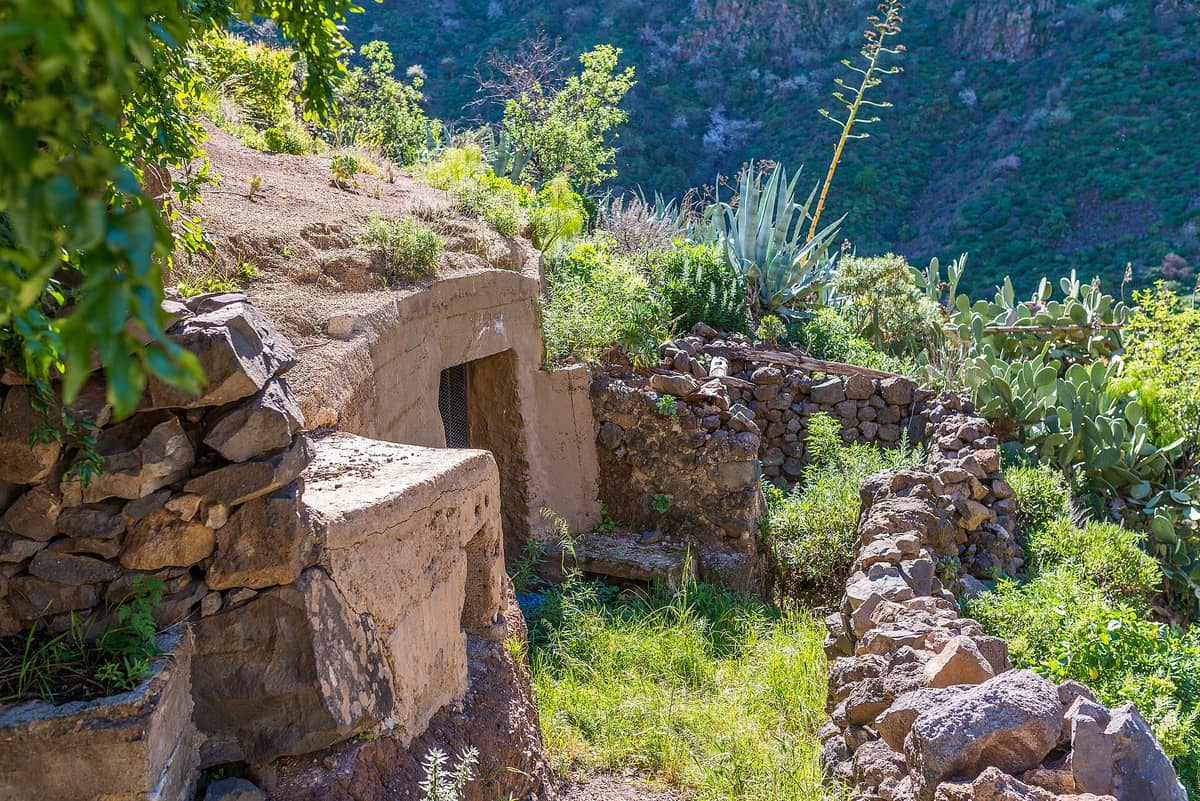
What Is Barranco de Guayadeque?
Barranco de Guayadeque is one of the deepest and most archaeologically rich ravines on Gran Canaria, cutting through the municipalities of Agüimes and Ingenio in the island's east/southeast interior. The name itself comes from the Guanche language of the island's pre-Hispanic inhabitants, and that connection to the ancient past is not just symbolic. Guayadeque was one of the most densely settled areas of the Canarian archipelago before the Spanish conquest in the late 15th century, and the evidence of that occupation is visible everywhere: in the cave mouths dotting the canyon walls, in the troglodyte structures still in use today, and in the archaeological record held at the ravine's interpretation centre.
The ravine stretches for several kilometres, narrowing as it climbs toward the island's central highlands. The road that follows it, the Carretera del Barranco de Guayadeque (GC-103), is the main artery for visitors, passing the interpretation centre before winding deeper into the canyon past cave restaurants and a small chapel carved into the rock. This is not a manicured tourist attraction. The paths are uneven, the signage is sparse in places, and the landscape demands some physical effort. That is precisely what makes it worth the trip.
💡 Local tip
Own transport is strongly recommended. Public bus connections exist but are infrequent, and the deeper sections of the ravine are only accessible by road or on foot. Driving the GC-103 yourself gives you the freedom to stop at viewpoints and trailheads that buses skip entirely.
The Visitors Centre: Where to Start
The Centro de Interpretación del Barranco de Guayadeque sits near the entrance of the ravine and is the logical first stop. It is open Tuesday through Sunday from 09:00 to 17:00 (closed Mondays). Entry fees are currently around €5 for adult admission, with reduced rates for residents, children, and pensioners. These prices date from published municipal sources but should be confirmed on arrival, as they may have been updated.
Inside, the centre traces the Guanche civilisation that populated this ravine for centuries. The Guanches were Berber-origin peoples who arrived on Gran Canaria long before European contact, and Guayadeque was among their most important settlements, used for habitation, burial, and ceremony. The museum presents stone tools, ceramics, and reconstructed domestic scenes in a compact but well-organised space. It is not a grand institution on the scale of the Museo Canario in Las Palmas, but it provides essential context for understanding what you are about to walk through.
For deeper archaeological context before or after your visit, the Museo Canario in Las Palmas holds one of the finest collections of pre-Hispanic Canarian artefacts in the world and complements the interpretation centre well.
Walking Deeper: The Cave Dwellings and Canyon Floor
Past the interpretation centre, the road continues into the ravine proper, and this is where Guayadeque reveals its real character. The canyon walls rise steeply on both sides, the rock shifting in colour from pale ochre to dark volcanic grey depending on the light. In the morning, the east-facing walls are warm and bright while the floor remains in shadow. By early afternoon the light reaches the canyon base, illuminating the scrub vegetation, including tabaibas (endemic Euphorbia species) and the occasional giant Canarian palm.
Cave openings punctuate the cliff faces throughout the ravine. Some are ancient Guanche dwellings or burial sites. Others have been inhabited continuously up to the present day, with modern doors, window frames, and even satellite dishes bolted to the rock. A handful of these cave structures house restaurants, the most notable of which serves traditional Canarian food in a setting that is genuinely unlike anything you will find in the resort towns. Expect papas arrugadas, fresh goat cheese, and locally made mojo sauces. Arrive before 13:00 if you want a table without a long wait.
Further up the road, a small cave church, the Ermita de Guayadeque, is carved directly into the hillside. It is one of several rock chapels that were consecrated after the Spanish conquest, placed deliberately at Guanche sacred sites as a form of spiritual replacement. The chapel is small but atmospheric, particularly in the early morning when it is empty and the light enters obliquely through the single entrance.
ℹ️ Good to know
The cave restaurants in the upper ravine are popular with local families on weekends. If you are visiting on a Saturday or Sunday, expect them to fill up between 13:00 and 15:00. A weekday visit gives you a quieter, more relaxed experience throughout.
Hiking in the Ravine: What to Expect
Guayadeque is a starting or finishing point for several hiking routes that connect the eastern lowlands with the island's central highlands. The terrain shifts quickly from the sun-bleached lower ravine, where the air smells of dry earth and wild herbs, to greener, cooler sections higher up where moisture collects and the vegetation thickens. The paths can be steep, loose underfoot, and unmarked in sections. Sturdy footwear is not optional.
A straightforward option for visitors who want exercise without committing to a multi-hour hike is to follow the ravine road on foot past the interpretation centre and up to the cave restaurants and chapel, then return the same way. This takes roughly 90 minutes at a comfortable pace and involves moderate incline. Those looking for longer routes can pick up trails that lead toward Temisas or connect with the central island path network.
Gran Canaria's interior trail network is extensive. For route planning and difficulty grading beyond Guayadeque itself, the hiking in Gran Canaria guide covers the island's best walking itineraries across all fitness levels.
⚠️ What to skip
If you plan to hike beyond the road's end, bring water, sun protection, and a downloaded offline map. Mobile signal can be weak or absent in the upper sections, and the terrain offers very little shade from late morning onward.
Best Time to Visit and How It Changes Through the Day
The ravine is at its most photogenic in the two hours after sunrise, when low-angle light catches the canyon walls and casts long shadows across the rock faces. At this time there are almost no other visitors, the cave restaurants are closed, and the only sounds are birdsong and the occasional goat. If photography or solitude is your goal, arriving early is worth the inconvenience of an early start from wherever you are staying.
By 11:00 the ravine begins to receive day visitors, and the car park at the interpretation centre fills steadily through the morning. The peak crowd window is roughly 12:00 to 15:00 on weekends, when local families arrive for lunch at the cave restaurants. After 15:00 the crowds thin noticeably, and the late afternoon light, now coming from the west, creates a different quality of illumination on the canyon walls.
In terms of seasons, the ravine is accessible year-round. The November to April window is better for hiking due to cooler temperatures and lower sun intensity, while the summer months can make the canyon floor uncomfortably hot by midday. After heavy winter rain, the ravine sometimes develops small seasonal streams and the vegetation flushes green, which is striking against the usual palette of ochre rock and grey basalt.
For overall planning of when to come to the island, the best time to visit Gran Canaria guide covers seasonal weather patterns, crowd levels, and activity windows across the whole island.
Getting There and Practical Logistics
The interpretation centre's official address is on the GC-103 road in the municipality of Agüimes, eastern Gran Canaria. By car, it is accessible from Agüimes town in around 15–20 minutes, and from Las Palmas de Gran Canaria in approximately 30 to 40 minutes depending on traffic. The drive along the GC-103 itself is part of the experience, following the ravine floor with the canyon walls rising around you.
Public transport options exist but are limited. Global bus lines 21, 27, and 35 serve stops in the Ingenio and Agüimes area with connections toward the ravine, but services are infrequent and do not take you deep into the canyon. Fares typically range from around €1 to €4 depending on your origin point. For most visitors arriving from the southern resorts or Las Palmas, a rental car or organised excursion is a more practical choice.
If you are combining Guayadeque with other interior sites, the Gran Canaria road trip guide maps out efficient routes that connect the ravine with other archaeological and natural landmarks across the island's eastern and central zones.
Parking at the interpretation centre is free and usually sufficient on weekdays. On weekend afternoons in peak season, the car park can fill and visitors park along the road verge. The site itself has toilet facilities at the interpretation centre. There is no ATM nearby, so bring cash if you plan to eat at the cave restaurants, as card acceptance varies.
Accessibility and Who Should Manage Expectations
The interpretation centre building is accessible by road and has standard facilities, but the ravine beyond it is not suitable for pushchairs or wheelchairs. The paths are unpaved, often steep, and the road itself has no pedestrian pavement for much of its length. Visitors with limited mobility can still get significant value from the drive along the GC-103, stopping at pullouts to view the canyon, and visiting the interpretation centre itself.
Those expecting a polished tourist attraction with clear signposting, audio guides, and on-site amenities throughout should adjust expectations. Guayadeque is a working archaeological landscape, not a theme park. Some of the cave dwellings are on private property. The charm is in its rawness, but that rawness is not for everyone. Visitors who need structured, accessible, and comfortable environments may find the experience frustrating rather than rewarding.
Insider Tips
- Drive the full length of the GC-103 rather than stopping at the interpretation centre and turning back. The road continues past the cave restaurants all the way to the upper ravine, and the scenery becomes progressively more dramatic the further you go.
- Weekday mornings between 09:00 and 11:00 are the most peaceful time to visit the interpretation centre. The staff are less busy and have more time to explain the exhibits, which are largely in Spanish without English audio guide.
- The cave restaurants do not always appear in online booking platforms. If you want to eat there, either arrive early and ask to reserve a table for lunch, or call ahead using a number from the Agüimes tourism office at visitaguimes.com.
- Look up at the canyon walls rather than just ahead along the road. Many of the most interesting cave openings are high up and easy to miss if you are focused on the path in front of you.
- Combine the visit with the nearby town of Agüimes, which has a well-preserved historic centre and is only 10 minutes from the ravine entrance. It is a pleasant place for coffee before or after the ravine and gives context to the living community that has coexisted with this landscape for centuries.
Who Is Barranco de Guayadeque For?
- Travellers interested in pre-Hispanic Canarian history and archaeology
- Hikers wanting an accessible but rewarding interior canyon route
- Photographers chasing dramatic rock landscapes in natural morning light
- Visitors on a longer stay who want to move beyond the beach resorts
- Food lovers seeking a genuinely unusual setting for traditional Canarian cuisine
Nearby Attractions
Combine your visit with:
- Arteara Necropolis
The Arteara Necropolis is the most extensive aboriginal cemetery on Gran Canaria, with 809 stone burial mounds spread across 13 hectares inside the dramatic Barranco de Fataga gorge. It offers a rare, unhurried encounter with the island's pre-Hispanic Canarii people, well away from the resort crowds of the south.
- Bandama Caldera & Crater Viewpoint
Rising 574 metres above sea level, the Pico de Bandama offers the most striking volcanic panorama on Gran Canaria. Below stretches the Caldera de Bandama, a crater around 200 metres deep and about 1,000 metres across, formed by one of the island's most recent volcanic episodes. It is free to visit, takes under an hour from Las Palmas, and rewards visitors with views that stretch from the island's green interior to the Atlantic coastline.
- Barranco de los Cernícalos
Barranco de los Cernícalos is a 7 km round-trip ravine hike in central-eastern Gran Canaria where a year-round stream cuts through laurel forest, fern-draped cliffs, and small waterfalls. It is free to enter, requires no booking, and remains genuinely quiet compared to the island's more promoted highland routes.
- Cactualdea Park
Cactualdea Park sits in the remote western municipality of La Aldea de San Nicolás, where an extraordinary collection of cacti and succulents grows against a backdrop of volcanic rock and Atlantic light. It rewards visitors who make the journey with something genuinely unusual: a curated desert landscape that feels nothing like the resort south of the island.