Barranco de los Cernícalos: Gran Canaria's Greenest Ravine Walk
Barranco de los Cernícalos is a 7 km round-trip ravine hike in central-eastern Gran Canaria where a year-round stream cuts through laurel forest, fern-draped cliffs, and small waterfalls. It is free to enter, requires no booking, and remains genuinely quiet compared to the island's more promoted highland routes.
Quick Facts
- Location
- Telde municipality, central-eastern Gran Canaria. Access from Los Arenales del Lomo Magullo via GC-131 / GC-132.
- Getting There
- Car recommended. Follow GC-131 toward Lomo Magullo, then turn onto GC-132 toward Los Arenales / Cernícalos. Limited bus access — verify current Global routes before travelling.
- Time Needed
- 3 to 4 hours for the 7 km round trip (low-medium difficulty, as per Telde tourism). The full ravine runs about 12 km from Caldera de Los Marteles to Tecén.
- Cost
- Free. No admission fee, no booking required.
- Best for
- Hikers who want green scenery, families with older children, nature photographers, and anyone wanting an alternative to the island's crowded summit trails.
What Barranco de los Cernícalos Actually Is
Barranco de los Cernícalos is a deep natural ravine on the eastern flank of Gran Canaria, cutting roughly 12 km from the volcanic crater basin of the Caldera de Los Marteles down toward the coastal town of Tecén in Telde municipality. The section most walkers follow is the lower gorge, accessed from the recreational area at Los Arenales del Lomo Magullo, and forms a 7 km out-and-back route rated low to medium difficulty by Telde municipal tourism (around 4 hours).
What makes this ravine different from most of Gran Canaria's barrancos is simple: water. A permanent stream runs along the valley floor even in dry summer months, fed by the elevated catchment area of the Reserva de Los Marteles, a protected space covering 3,568 hectares above. That constant moisture sustains a corridor of subtropical laurel forest, tree ferns, mosses, and flowering plants that feel closer to a cloud forest than the parched hillsides typical of the island's east coast. The name itself refers to the common kestrel (cernícalo in Spanish), a bird still spotted hunting above the canyon walls.
💡 Local tip
Start early on weekends. By 10am on a Saturday, the car park at Los Arenales fills quickly and the lower trail becomes noticeably more crowded. Aim to arrive by 8:30am or visit on a weekday for a much quieter experience.
The Walk: What You See and When
The trail begins at the Los Arenales recreational area, a shaded picnic zone with basic facilities including benches. The path descends almost immediately into the ravine, and within the first ten minutes the temperature drops noticeably as the canyon walls close in. The sound of the stream — sometimes a trickle, sometimes a proper rush after winter rain — is constant company from this point onward.
Through the first kilometre, the vegetation shifts from scrubby hillside shrubs to proper forest canopy. Ferns spill over the rock faces. The path is mostly flat along the valley floor, crossing the stream on simple stepping stones at several points. Waterproof trail shoes are a sensible choice, particularly between November and March when the water level rises.
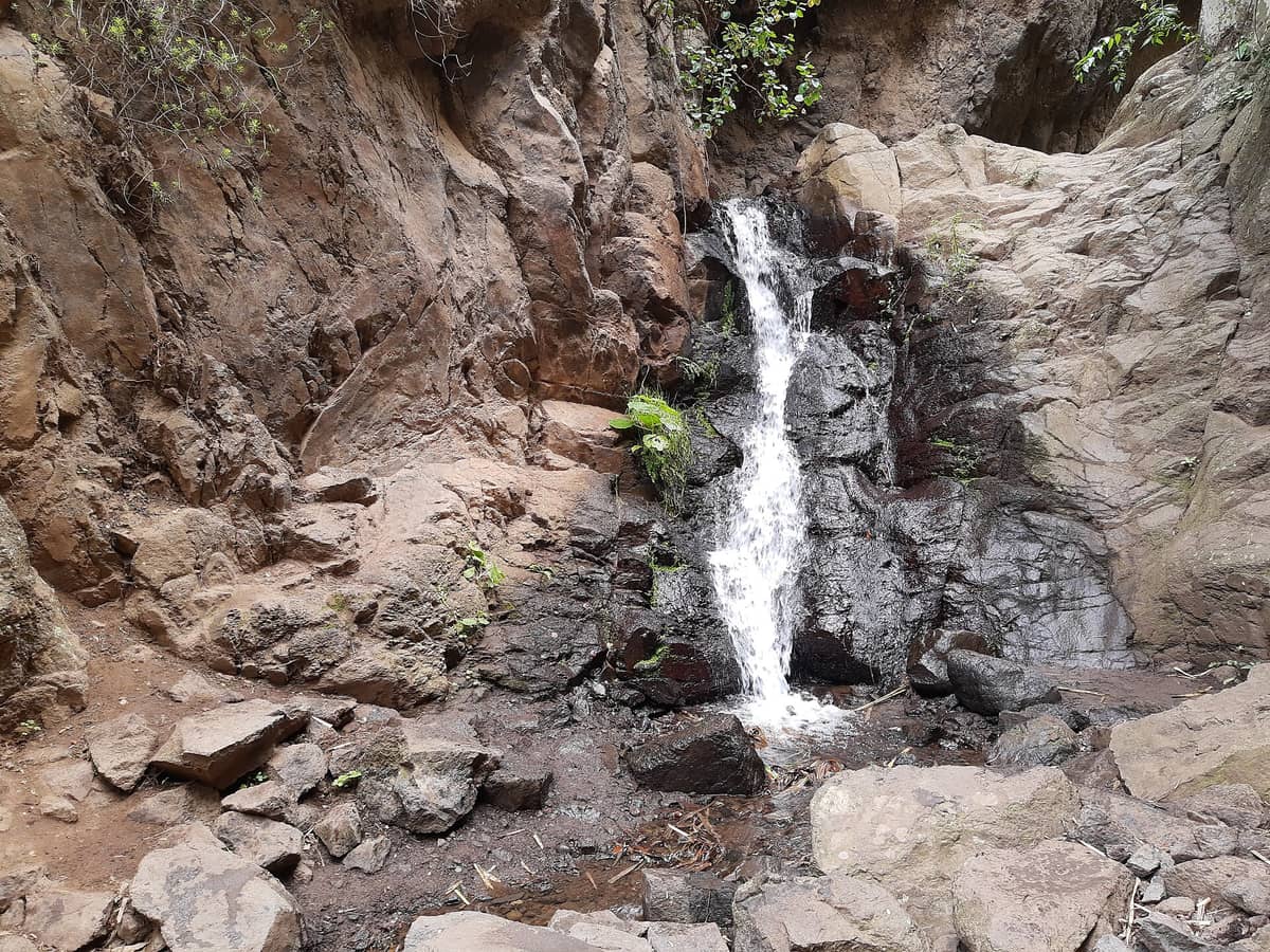
Further into the gorge, the canyon narrows and the light changes quality. Morning visits mean shafts of direct sun hitting the upper canyon walls while the floor stays cool and partially shaded. By midday in summer, the lower sections see more direct light and the temperature rises accordingly — this is when an early start genuinely pays off. The route reaches small cascades at points deeper into the ravine, and these pools are where most walkers choose to stop, eat, and turn back.
In winter and early spring, after significant rainfall, the waterfalls along the ravine run with real volume. The stream crossings require more care during these periods, but the visual reward — a genuinely lush, water-filled gorge on a sun-baked Atlantic island — is considerable. Summer visits are quieter in terms of water flow but still green and pleasant given the forest shade.
Ecology and Protected Status
Barranco de los Cernícalos sits within or adjacent to the Reserva de Los Marteles, one of Gran Canaria's protected natural areas. The ravine ecosystem functions as a refuge for plant species that require consistent moisture, including species of laurel, tree heath (Erica arborea), and native ferns. This type of subtropical laurel forest, known as laurisilva, was once widespread across the Canary Islands and Macaronesia before human settlement reduced it dramatically. Walking through the barranco offers a rare sense of what Gran Canaria's interior valleys looked like before agriculture and urbanisation reshaped them. If you find this kind of endemic vegetation compelling, the island's Jardín Botánico Viera y Clavijo near Las Palmas provides excellent context on Canarian flora.
Wildlife is present but unobtrusive. Kestrels are the headliners, visible above the canyon rim in the early morning. Chaffinches, robins, and Canary Islands chiffchaffs move through the lower canopy. The stream itself supports aquatic invertebrates and occasional frogs. The key rule for wildlife observation is the same as in any sensitive canyon: stay on the path, keep noise low, and move slowly in the first and last sections of the walk.
Practical Walkthrough: Getting There and Starting Out
The most straightforward access is by car. From the GC-1 motorway on the east coast, take the Telde exit and follow signs toward Lomo Magullo via the GC-131. From there, the GC-132 leads directly to the Los Arenales recreational area and its car park. The drive from Las Palmas de Gran Canaria takes approximately 30 to 40 minutes depending on traffic, in line with local route descriptions.
Bus access is limited. Public transport on Gran Canaria is operated by Global (Guaguas Global), and while the network reaches many interior areas, the specific connection to Los Arenales requires checking current timetables on the Global website before your visit. If you are planning a longer day combining this walk with other eastern or central attractions, a rental car opens up significantly more flexibility. The island's guide to getting around Gran Canaria covers transport options in detail.
At the trailhead, a basic information board marks the route. The path is well-worn and generally easy to follow. Navigation is not complex on the main out-and-back route, but the ravine does branch in places — keeping the stream on one side as you ascend is a reliable orientation cue. The trail is not waymarked to the same standard as some of Gran Canaria's official GR routes, so downloading an offline map via Wikiloc or a similar app before setting off is practical advice, not paranoia.
⚠️ What to skip
After heavy rainfall the stream crossings can become difficult without waterproof footwear. The path can also be slippery on wet rock sections. Standard hiking shoes with grip are the minimum; trail runners with some grip will handle the terrain well.
Photography and Sensory Notes
The ravine is photogenic in a specific and understated way. It does not offer panoramic views or dramatic cliffs. What it offers is texture: the deep green of wet moss on dark volcanic rock, the silver thread of moving water over smooth stones, filtered light through overhanging fern fronds. A wide-angle lens or a phone with a good low-light camera captures the atmosphere of the enclosed gorge sections better than a zoom. The most compelling frames are often simple ones: the stream over stepping stones, condensation on leaves, or the canyon walls framed by tree canopy above.
Morning light, particularly in spring and autumn, enters the upper canyon walls at a low angle and creates a warm glow against the green vegetation. The lower forest floor stays cool and diffusely lit throughout the day, which actually works in favour of photography by reducing harsh contrast. This is not a sunset-view location; there is no meaningful vista from the trail floor. Plan for morning or midday light and adjust expectations accordingly.
How This Fits Into a Wider Gran Canaria Itinerary
Barranco de los Cernícalos works well as a morning activity paired with an afternoon in the Telde area or a return to Las Palmas. The ravine sits on the eastern side of the island, which means it pairs logically with other eastern or central-island experiences. From Los Arenales you are within reasonable driving distance of the volcanic landscapes of the Bandama Caldera to the north and the archaeological site at Tufia closer to the coast.
If you are structuring a multi-day itinerary that balances coast and interior, the ravine slots naturally into the same day as Las Palmas cultural attractions. The historic district of Vegueta is under an hour's drive from the trailhead, making a walk-then-city-afternoon combination entirely feasible. For hikers wanting to compare different landscape types, the contrast between this lush ravine and the stark volcanic highlands around Roque Nublo sums up Gran Canaria's microclimate diversity more effectively than any description.
Travellers who will not enjoy this walk: anyone expecting maintained tourist infrastructure, a cafe at the end, or a viewpoint. The ravine is a natural trail with basic facilities only at the start. People with limited mobility will find the stepping stone crossings and uneven path surface challenging. If green forest scenery does not itself motivate a 7 km walk, this is probably not the right attraction.
Insider Tips
- Download an offline map from Wikiloc or AllTrails before you leave mobile signal range. The path branches in a few places and the waymarking is inconsistent beyond the lower section.
- Wear trail shoes or waterproof hiking shoes even in dry months. The stepping stone crossings over the stream are uneven and the rocks close to the water are consistently slippery.
- The picnic tables at Los Arenales recreational area are a genuinely pleasant lunch spot on the return. Bring your own food and water as there are no vendors at or near the trailhead.
- Visit between November and April if you want the waterfalls to be running with meaningful volume. Summer visits are still worthwhile for the forest shade but the water levels are lower.
- The kestrels the ravine is named after are most active in the early morning. Scan the upper canyon walls and thermals above the rim in the first hour after sunrise for the best sightings.
Who Is Barranco de los Cernícalos For?
- Hikers looking for shade, water, and greenery away from Gran Canaria's more crowded highland routes
- Nature photographers interested in intimate forest and stream landscapes rather than panoramic views
- Families with older children who can handle 7 km of uneven path over a half-day
- Travellers combining a Las Palmas city day with an early morning outdoor activity nearby
- Anyone wanting to experience Gran Canaria's laurisilva vegetation without driving to the far northwest
Nearby Attractions
Combine your visit with:
- Arteara Necropolis
The Arteara Necropolis is the most extensive aboriginal cemetery on Gran Canaria, with 809 stone burial mounds spread across 13 hectares inside the dramatic Barranco de Fataga gorge. It offers a rare, unhurried encounter with the island's pre-Hispanic Canarii people, well away from the resort crowds of the south.
- Bandama Caldera & Crater Viewpoint
Rising 574 metres above sea level, the Pico de Bandama offers the most striking volcanic panorama on Gran Canaria. Below stretches the Caldera de Bandama, a crater around 200 metres deep and about 1,000 metres across, formed by one of the island's most recent volcanic episodes. It is free to visit, takes under an hour from Las Palmas, and rewards visitors with views that stretch from the island's green interior to the Atlantic coastline.
- Cactualdea Park
Cactualdea Park sits in the remote western municipality of La Aldea de San Nicolás, where an extraordinary collection of cacti and succulents grows against a backdrop of volcanic rock and Atlantic light. It rewards visitors who make the journey with something genuinely unusual: a curated desert landscape that feels nothing like the resort south of the island.
- Fataga Village
Tucked into the dramatic Barranco de Fataga canyon in southern Gran Canaria, the whitewashed village of Fataga is a free, unhurried stop with real Canarian character. Expect palm-lined lanes, a modest stone church, and views that few visitors from the coastal resorts ever bother to seek out.