Best Hikes and Walks in Auckland: Volcanic Summits, Coastal Trails, and Forest Tracks
Auckland sits on a volcanic field, between two harbours, and beside one of New Zealand's great forested ranges. Whether you want a 30-minute summit stroll or a full-day coastal traverse, the city delivers. These are the walks worth lacing your boots for.
Tickets & tours
Live prices and dates from our booking partner. If you book, we may earn a commission at no extra cost to you.
Few cities reward walkers like Auckland. The isthmus is dotted with volcanic cones offering 360-degree views, the west coast hides waterfalls and lava fields, and the Hauraki Gulf islands add ferry-accessible adventures to the mix. This guide covers the best hikes and walks across the region, from the iconic volcanic cones to the wild tracks of the Waitākere Ranges. For those planning a full trip around Auckland's outdoors, the west coast beaches guide pairs well with several walks listed here. Many of these walks are free, making them ideal for travellers on a budget. Check Auckland Council's website before heading to the Waitākere Ranges, as kauri dieback has caused some track closures, and conditions can change.
Volcanic Summits and City Views
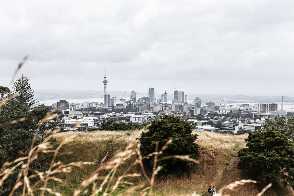
Auckland's volcanic cones are the fastest way to get your bearings in this sprawling city. Most summits take under an hour return, yet deliver genuinely panoramic views. The best views in Auckland are almost always earned on foot, and these are the peaks worth the short climb.
1. Climb Auckland's Highest Volcanic Cone at Mount Eden
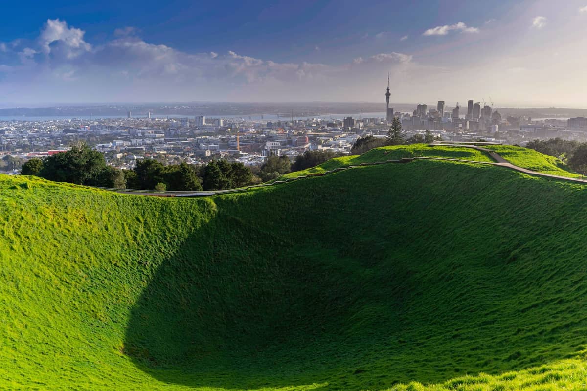
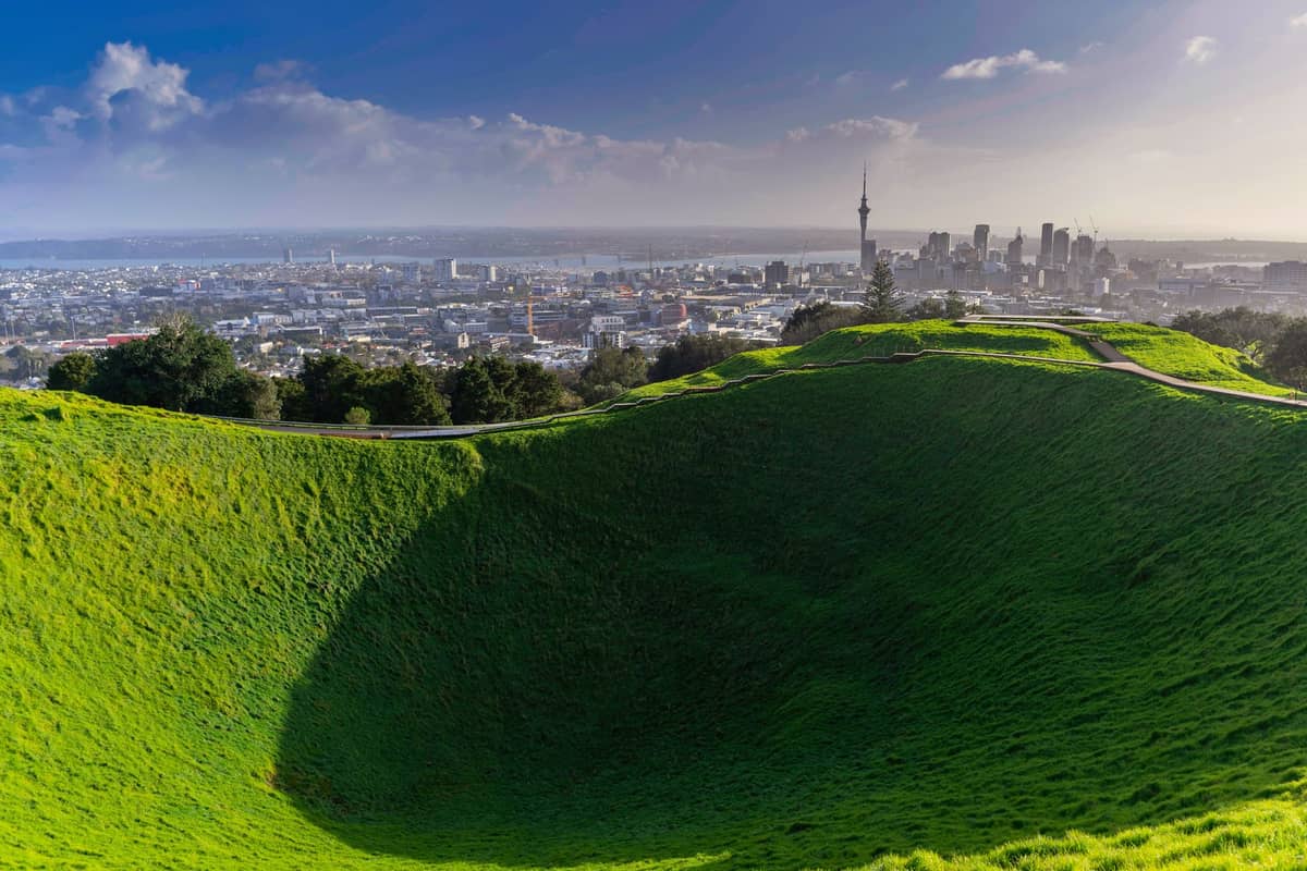
At 196 metres, Maungawhau offers the city's finest 360-degree panorama: both harbours, Rangitoto, and the CBD spread below. The summit crater is a sacred Māori site, so stay on the path. The walk up takes about 20 minutes from the village.
Explore1. Climb Auckland's Highest Volcanic Cone at Mount Eden
At 196 metres, Maungawhau offers the city's finest 360-degree panorama: both harbours, Rangitoto, and the CBD spread below. The summit crater is a sacred Māori site, so stay on the path. The walk up takes about 20 minutes from the village.
Explore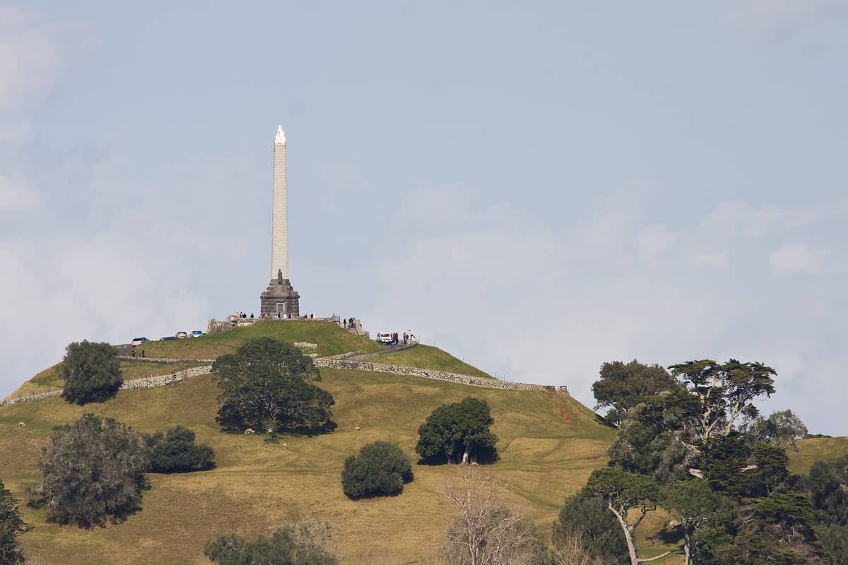
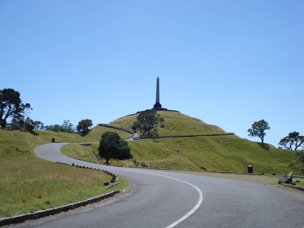
2. Walk the Terraces of One Tree Hill in Cornwall Park
One Tree Hill's grassy slopes still bear the terracing of one of New Zealand's largest historic pā. The walk to the obelisk at the summit takes 20–30 minutes, with Cornwall Park's pohutukawa trees and grazing sheep making the approach as enjoyable as the top.
Explore2. Walk the Terraces of One Tree Hill in Cornwall Park
One Tree Hill's grassy slopes still bear the terracing of one of New Zealand's largest historic pā. The walk to the obelisk at the summit takes 20–30 minutes, with Cornwall Park's pohutukawa trees and grazing sheep making the approach as enjoyable as the top.
Explore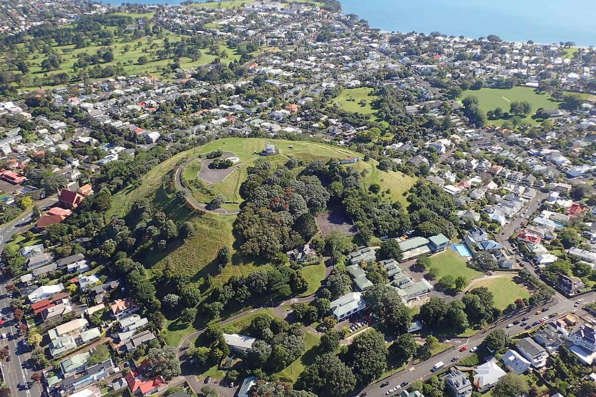
3. Summit Mount Victoria for Harbour Views on a Devonport Day Trip
Combine the Devonport ferry with this short volcanic walk for one of Auckland's best value outings. The summit takes 15 minutes from the village and frames the harbour, CBD skyline, and Rangitoto in a single view. Visit North Head afterwards for more exploring.
Explore3. Summit Mount Victoria for Harbour Views on a Devonport Day Trip
Combine the Devonport ferry with this short volcanic walk for one of Auckland's best value outings. The summit takes 15 minutes from the village and frames the harbour, CBD skyline, and Rangitoto in a single view. Visit North Head afterwards for more exploring.
Explore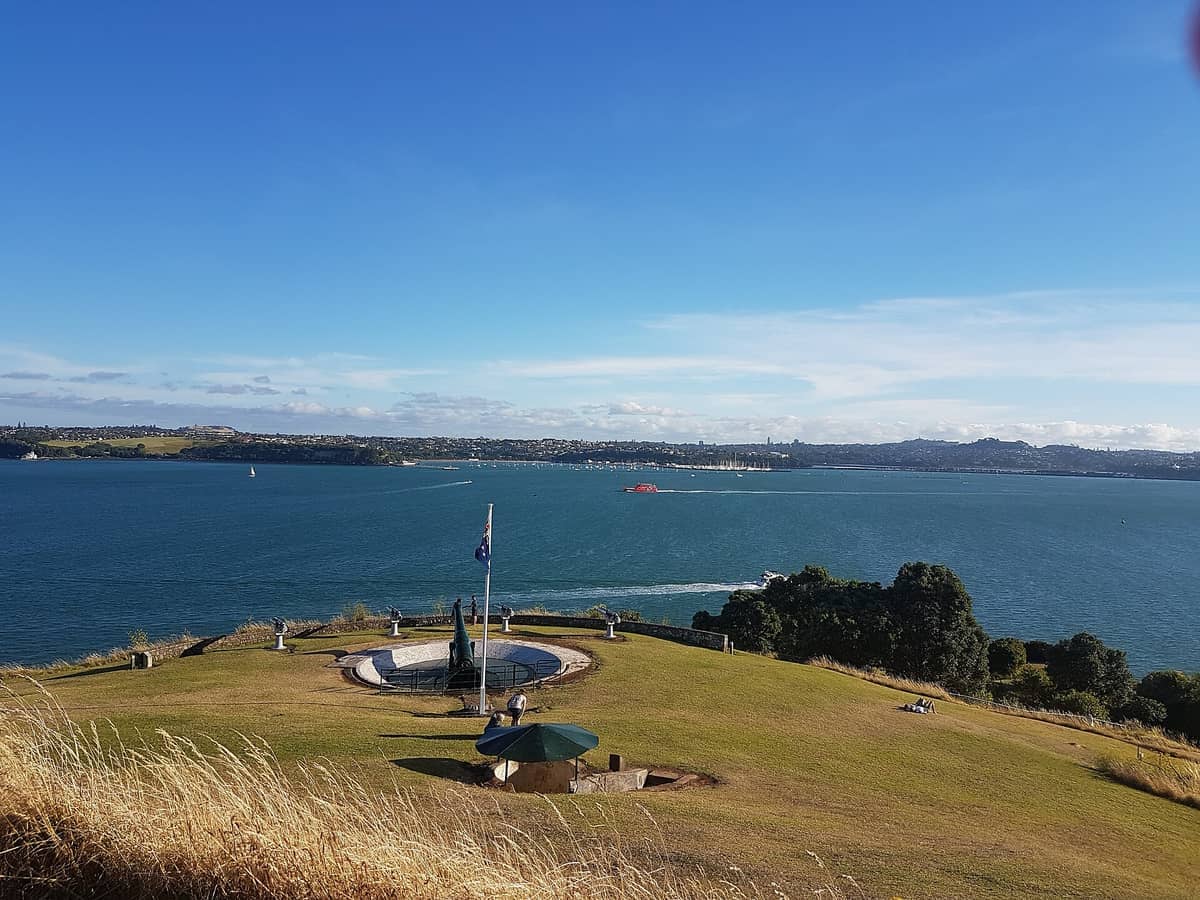
4. Explore Tunnels and Headland Views at North Head
North Head pairs volcanic geology with colonial military history. Tunnels and gun emplacements are open to explore on foot, and the clifftop views of the harbour entrance and Rangitoto are among the best free vantage points in the region. Allow 1–2 hours.
Explore4. Explore Tunnels and Headland Views at North Head
North Head pairs volcanic geology with colonial military history. Tunnels and gun emplacements are open to explore on foot, and the clifftop views of the harbour entrance and Rangitoto are among the best free vantage points in the region. Allow 1–2 hours.
Explore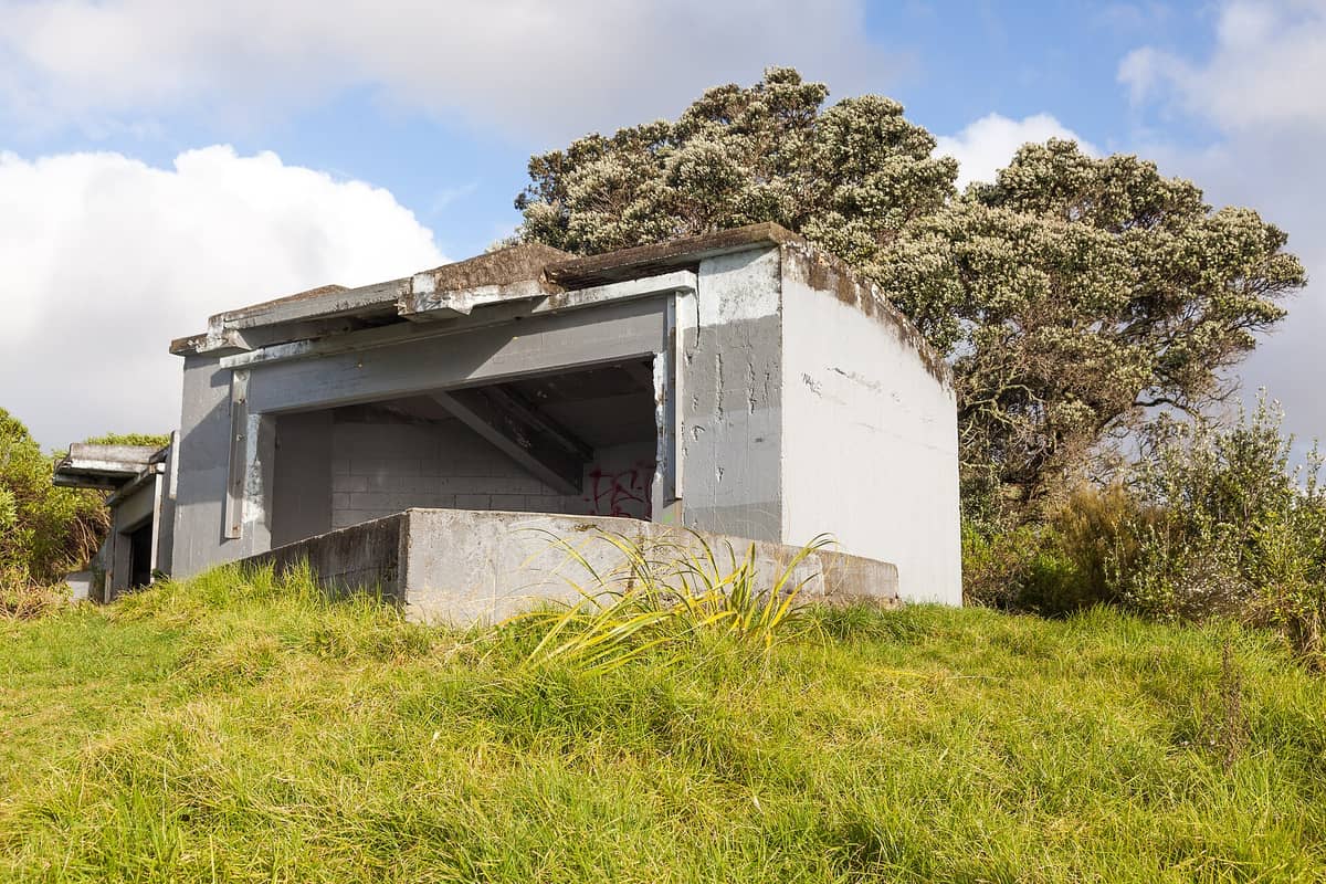
5. Walk Bastion Point for Harbour Views and Māori History
This volcanic headland above Ōrākei delivers sweeping views of the CBD and Waitematā Harbour alongside significant Māori cultural history. The walk around the headland is gentle and takes about 30 minutes. It's accessible by bus from the CBD or on the Tāmaki Drive cycle route.
Explore5. Walk Bastion Point for Harbour Views and Māori History
This volcanic headland above Ōrākei delivers sweeping views of the CBD and Waitematā Harbour alongside significant Māori cultural history. The walk around the headland is gentle and takes about 30 minutes. It's accessible by bus from the CBD or on the Tāmaki Drive cycle route.
ExploreIsland and Gulf Hikes
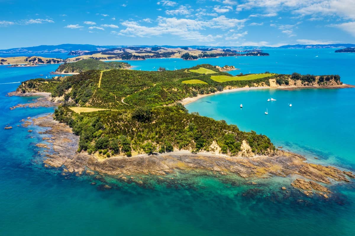
Some of Auckland's most rewarding walks require a ferry. The Hauraki Gulf islands offer predator-free sanctuaries and volcanic terrain that feel genuinely remote despite being under an hour from the city. Plan island hikes for clear days and check ferry timetables in advance.
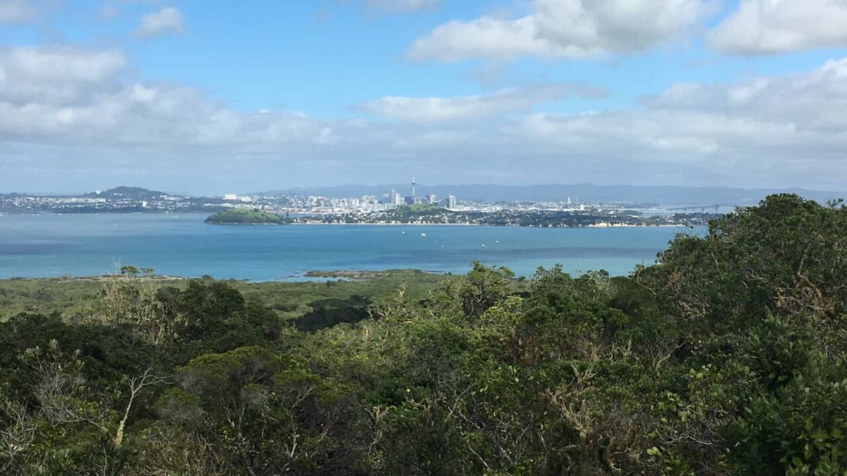
6. Hike the Lava Fields to Rangitoto's Summit
The 2–3 hour return track to Rangitoto's 259-metre summit crosses ancient lava fields through the world's largest pohutukawa forest. The crater-top views of the gulf and city are exceptional. Ferries run from the downtown terminal; take water and sturdy shoes.
Explore6. Hike the Lava Fields to Rangitoto's Summit
The 2–3 hour return track to Rangitoto's 259-metre summit crosses ancient lava fields through the world's largest pohutukawa forest. The crater-top views of the gulf and city are exceptional. Ferries run from the downtown terminal; take water and sturdy shoes.
Explore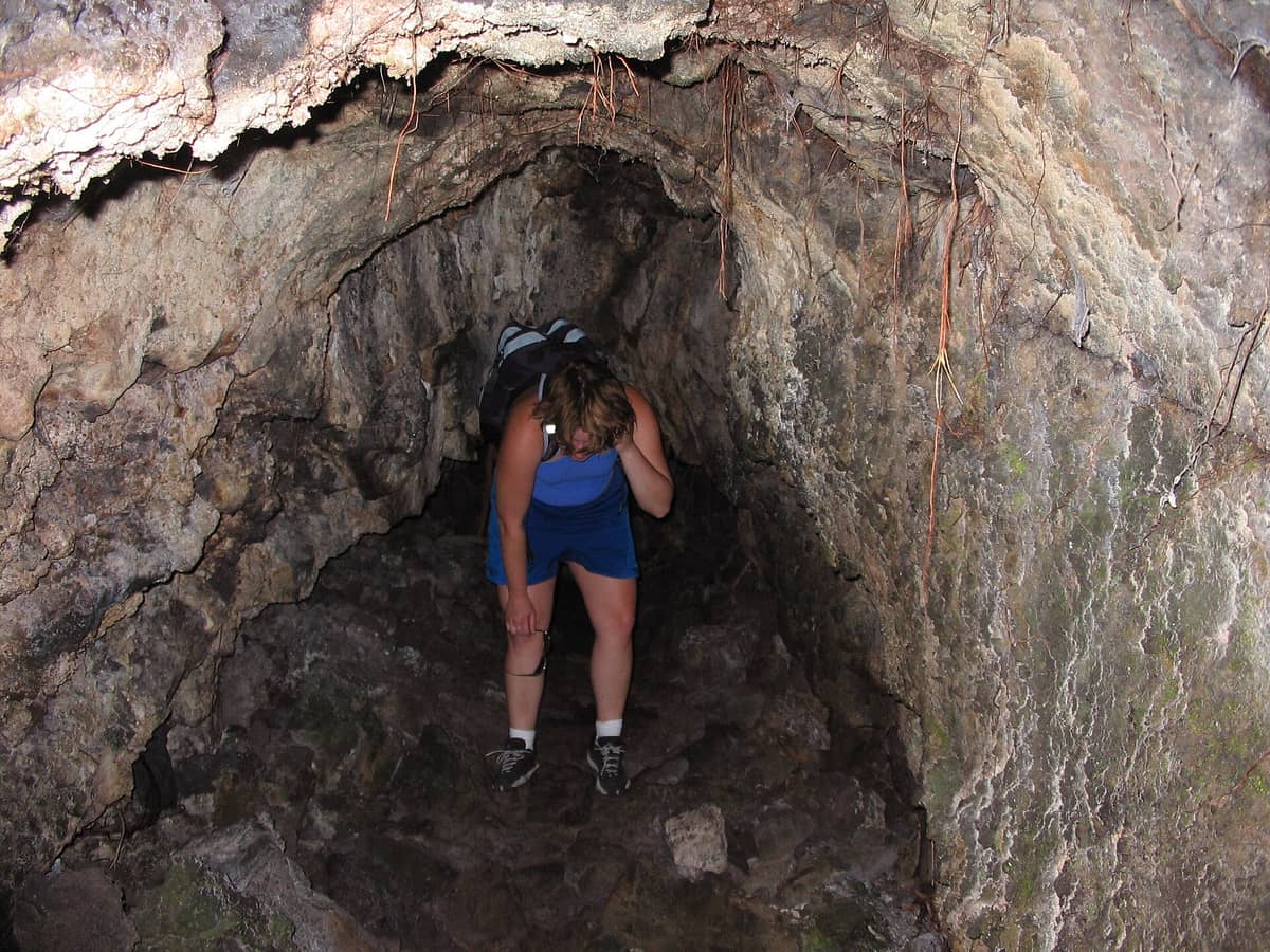
7. Detour into Rangitoto's Lava Caves on the Summit Walk
A short detour from the Rangitoto summit track leads into a network of lava tubes formed 600 years ago during the island's eruption. The caves shelter rare cave wētā and offer a genuinely unusual underground experience. Bring a torch and allow an extra 30 minutes.
Explore7. Detour into Rangitoto's Lava Caves on the Summit Walk
A short detour from the Rangitoto summit track leads into a network of lava tubes formed 600 years ago during the island's eruption. The caves shelter rare cave wētā and offer a genuinely unusual underground experience. Bring a torch and allow an extra 30 minutes.
Explore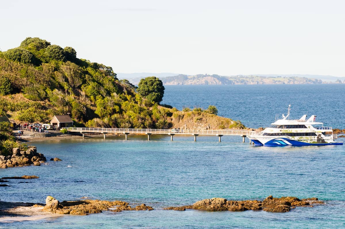
8. Walk an Open Wildlife Sanctuary on Tiritiri Matangi Island
Tiritiri Matangi's walking tracks wind through regenerating forest where takahē, kōkako, and little spotted kiwi move freely. It's one of New Zealand's best chances to see rare birds in the wild. Ferries run from Gulf Harbour and downtown; book ahead in peak season.
Explore8. Walk an Open Wildlife Sanctuary on Tiritiri Matangi Island
Tiritiri Matangi's walking tracks wind through regenerating forest where takahē, kōkako, and little spotted kiwi move freely. It's one of New Zealand's best chances to see rare birds in the wild. Ferries run from Gulf Harbour and downtown; book ahead in peak season.
Explore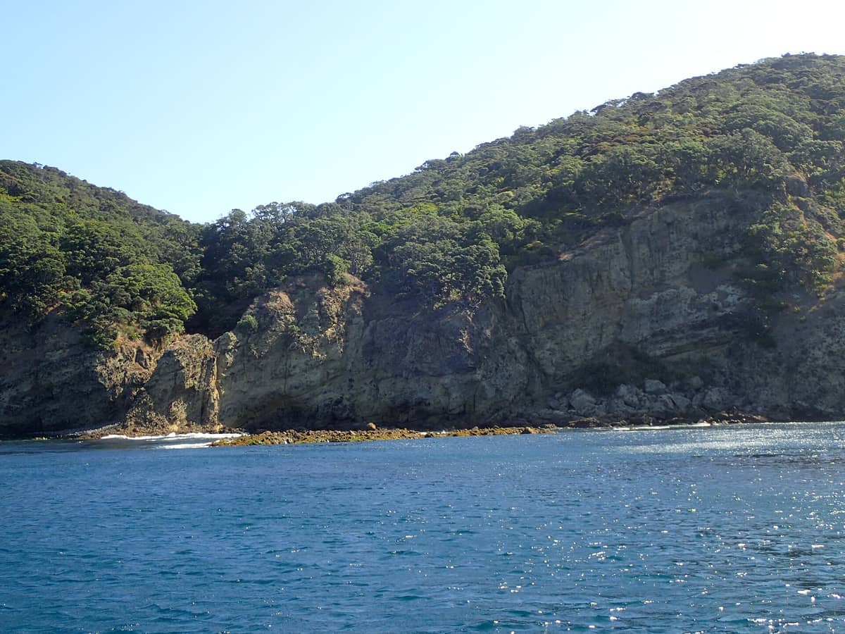
9. Trek the Wilderness Tracks of Great Barrier Island
Great Barrier Island has extensive multi-hour and multi-day walking tracks through forest, to hot springs, and along surf beaches with almost no development. It's a serious walking destination requiring planning, but rewards with genuine isolation just 90km from Auckland.
Explore9. Trek the Wilderness Tracks of Great Barrier Island
Great Barrier Island has extensive multi-hour and multi-day walking tracks through forest, to hot springs, and along surf beaches with almost no development. It's a serious walking destination requiring planning, but rewards with genuine isolation just 90km from Auckland.
ExploreWest Coast Forest and Waterfall Walks
⚠️ What to skip
Some tracks in the Waitākere Ranges remain closed due to kauri dieback disease. Check Auckland Council's current track status before visiting, and always clean footwear and gear at every station you encounter.
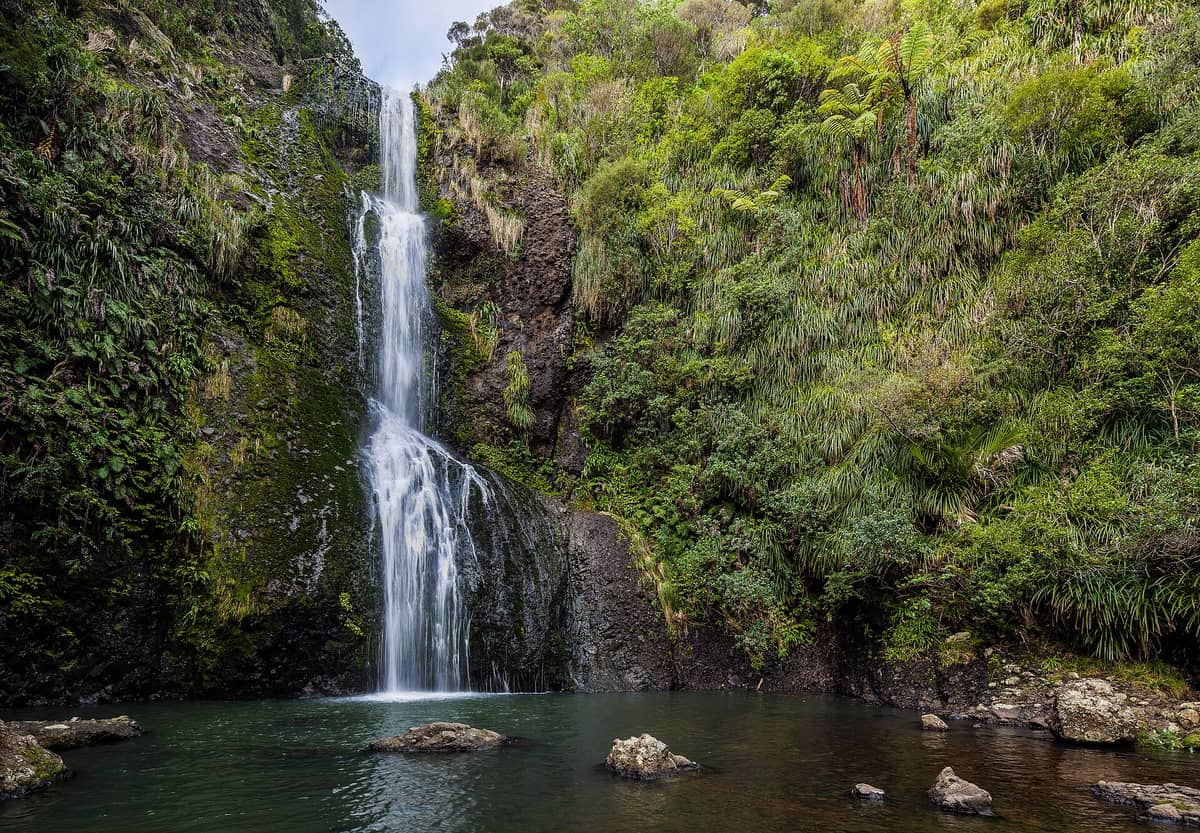
10. Hike to Kitekite Falls Near Piha for a Swimming Hole Reward
A 45-minute walk from Glen Esk Road leads to a three-tiered, 40-metre waterfall with a natural swimming pool at its base. It's one of the most satisfying short hikes accessible from Auckland, and far less crowded than Piha Beach on summer weekends.
Explore10. Hike to Kitekite Falls Near Piha for a Swimming Hole Reward
A 45-minute walk from Glen Esk Road leads to a three-tiered, 40-metre waterfall with a natural swimming pool at its base. It's one of the most satisfying short hikes accessible from Auckland, and far less crowded than Piha Beach on summer weekends.
Explore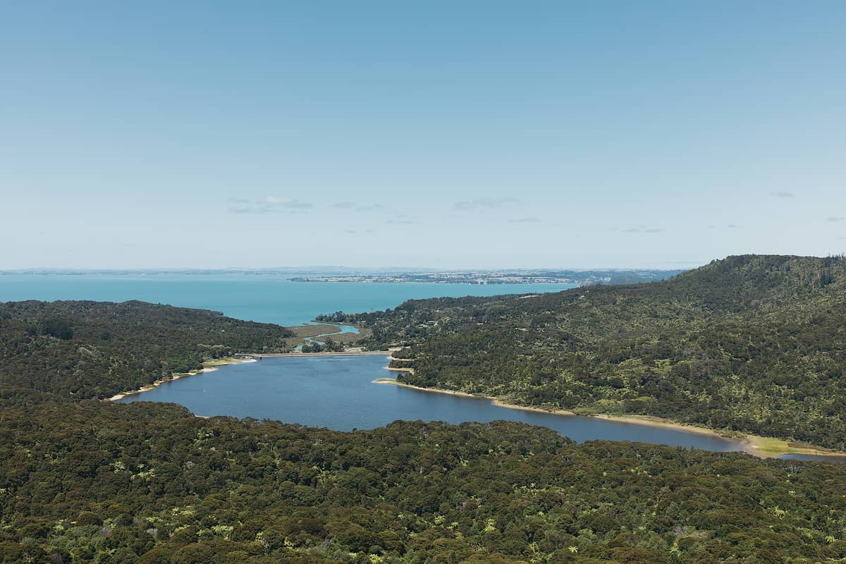
11. Walk the Open Tracks of the Waitākere Ranges Regional Park
Over 250 kilometres of tracks cross this forested park west of Auckland, taking in ancient kauri, waterfalls, and rugged coastal terrain. Check which tracks are currently open before going, as closures exist to protect kauri trees from dieback disease.
Explore11. Walk the Open Tracks of the Waitākere Ranges Regional Park
Over 250 kilometres of tracks cross this forested park west of Auckland, taking in ancient kauri, waterfalls, and rugged coastal terrain. Check which tracks are currently open before going, as closures exist to protect kauri trees from dieback disease.
Explore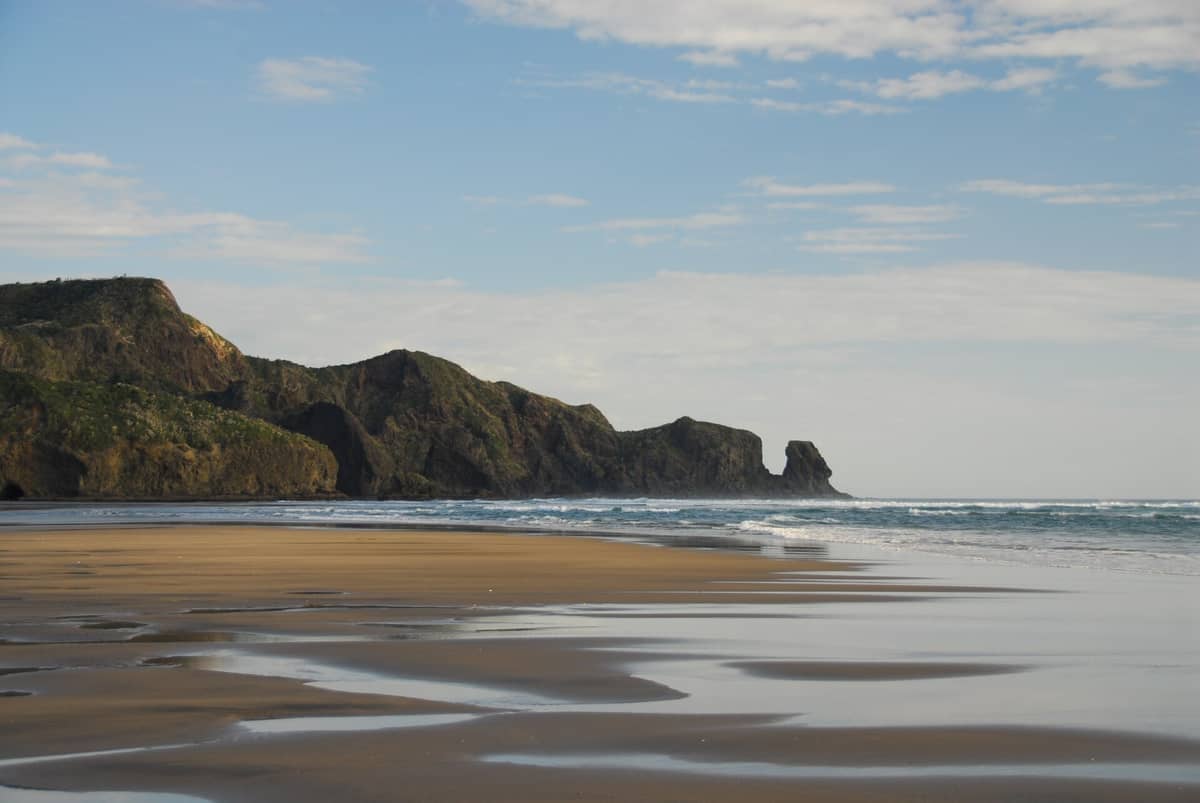
12. Walk the Sand Dunes and Te Henga Walkway at Bethells Beach
Bethells Beach has some of Auckland's most dramatic coastal scenery: black sand, a freshwater lagoon, and dunes backed by the Waitākere Ranges. The Te Henga Walkway starts here for those wanting a longer coastal trail. The drive alone through the ranges is worthwhile.
Explore12. Walk the Sand Dunes and Te Henga Walkway at Bethells Beach
Bethells Beach has some of Auckland's most dramatic coastal scenery: black sand, a freshwater lagoon, and dunes backed by the Waitākere Ranges. The Te Henga Walkway starts here for those wanting a longer coastal trail. The drive alone through the ranges is worthwhile.
Explore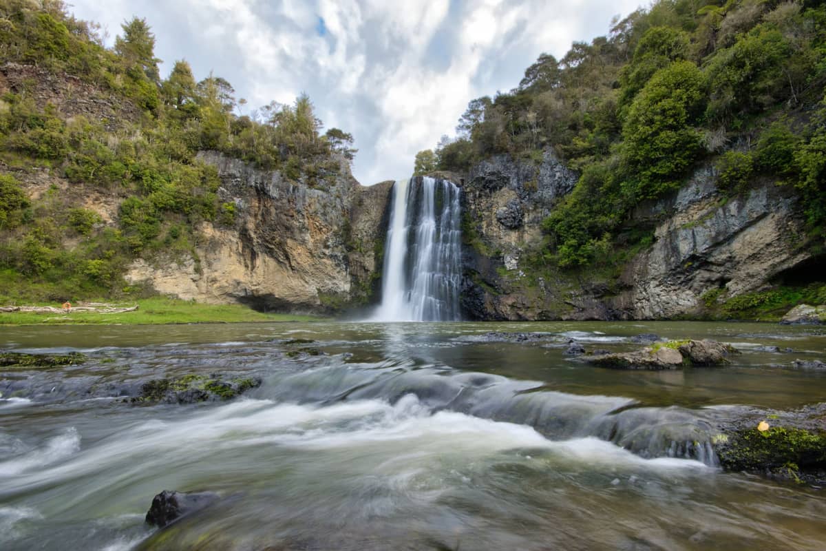
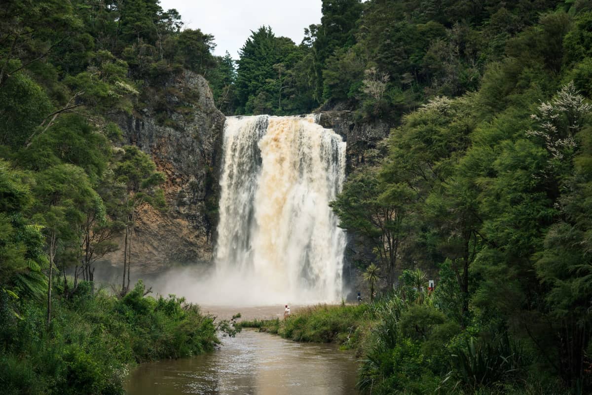
13. Day-Trip to Hunua Falls for a Waterfall Walk South of the City
A short walk from the car park delivers you to a 30-metre waterfall dropping into a swimming hole in the Hunua Ranges south of Auckland. It's far less visited than the west coast alternatives and makes an easy half-day trip for drivers wanting something beyond the obvious.
Explore13. Day-Trip to Hunua Falls for a Waterfall Walk South of the City
A short walk from the car park delivers you to a 30-metre waterfall dropping into a swimming hole in the Hunua Ranges south of Auckland. It's far less visited than the west coast alternatives and makes an easy half-day trip for drivers wanting something beyond the obvious.
ExploreCoastal and Peninsula Walks
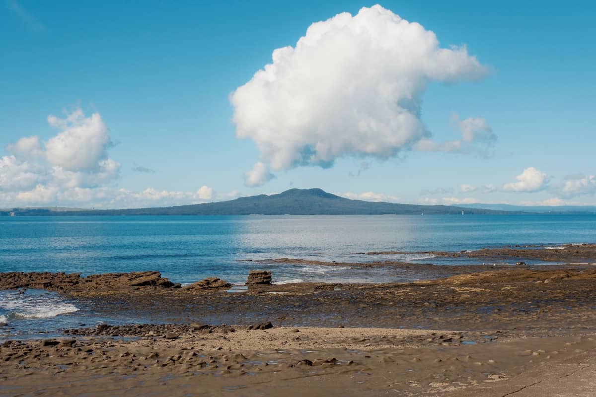
Auckland's coastline stretches across both the Waitematā and Manukau harbours, with regional parks adding long stretches of undeveloped coast within reach of the city. These walks are ideal for combining with a beach day and most require nothing more than comfortable shoes.
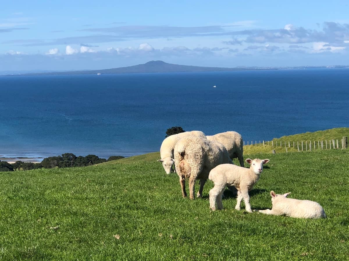
14. Walk the Predator-Free Coast at Shakespear Regional Park
Shakespear's coastal loop tracks wind past pohutukawa-fringed shores with views across the Hauraki Gulf, and the predator-free fence means native birds are unusually visible. Allow 2–3 hours for a full circuit. It sits at the tip of the Whangaparāoa Peninsula, about an hour from the CBD.
Explore14. Walk the Predator-Free Coast at Shakespear Regional Park
Shakespear's coastal loop tracks wind past pohutukawa-fringed shores with views across the Hauraki Gulf, and the predator-free fence means native birds are unusually visible. Allow 2–3 hours for a full circuit. It sits at the tip of the Whangaparāoa Peninsula, about an hour from the CBD.
Explore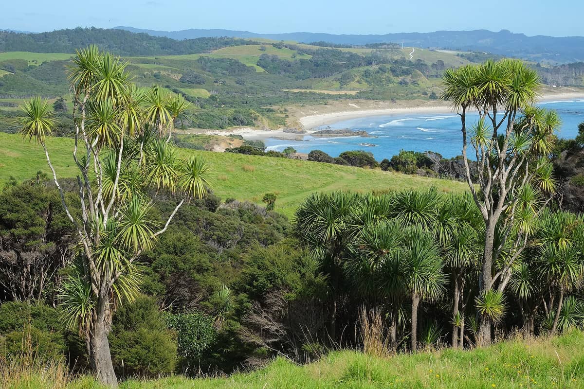
15. Explore Tāwharanui's Beaches and Bush Tracks
Tāwharanui is one of Auckland's best full-day escapes: a predator-free peninsula with a superb sandy beach, coastal walking tracks, and a genuine chance of hearing kiwi at dusk. It's about 90 minutes north of the CBD and worth the drive for serious nature walkers.
Explore15. Explore Tāwharanui's Beaches and Bush Tracks
Tāwharanui is one of Auckland's best full-day escapes: a predator-free peninsula with a superb sandy beach, coastal walking tracks, and a genuine chance of hearing kiwi at dusk. It's about 90 minutes north of the CBD and worth the drive for serious nature walkers.
Explore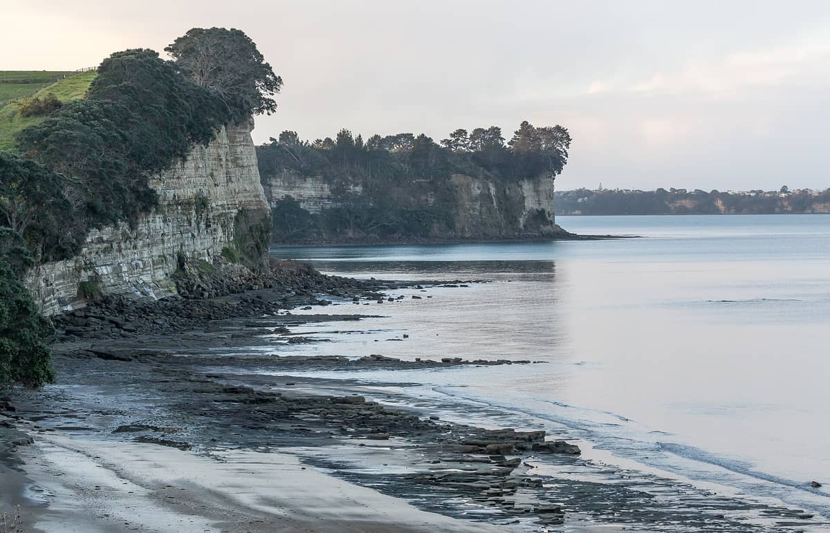
16. Walk the Coastal Tracks at Long Bay Regional Park
Long Bay's coastal walk follows cliffs and farmland above the sea with views north toward the Hauraki Gulf. The return loop from the beach takes 1–2 hours and passes through native coastal bush. It's one of the most accessible regional park walks on the North Shore.
Explore16. Walk the Coastal Tracks at Long Bay Regional Park
Long Bay's coastal walk follows cliffs and farmland above the sea with views north toward the Hauraki Gulf. The return loop from the beach takes 1–2 hours and passes through native coastal bush. It's one of the most accessible regional park walks on the North Shore.
Explore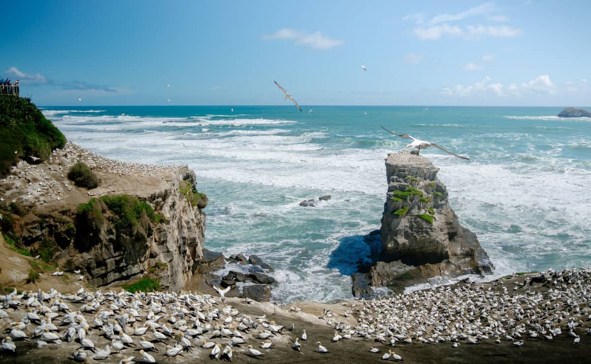
17. Walk the Clifftop Track to Muriwai's Gannet Colony
A short clifftop walk at Muriwai's southern headland puts you within metres of thousands of nesting Australasian gannets from August through March. The viewing platforms are well-positioned and the walk from the car park takes under 10 minutes. Combine with a stroll on Muriwai Beach.
Explore17. Walk the Clifftop Track to Muriwai's Gannet Colony
A short clifftop walk at Muriwai's southern headland puts you within metres of thousands of nesting Australasian gannets from August through March. The viewing platforms are well-positioned and the walk from the car park takes under 10 minutes. Combine with a stroll on Muriwai Beach.
ExploreUrban Walks and City Greenways
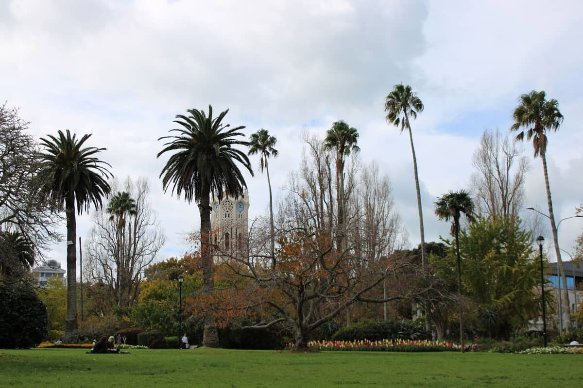
18. Walk Auckland's Isthmus on the Coast to Coast Walkway
This 16-kilometre route links the Waitematā and Manukau harbours, passing through the Domain, Mount Eden, and One Tree Hill. Auckland Council divides it into three sections, so it's easy to walk in stages. It's the single best way to understand Auckland's volcanic and urban geography on foot.
Explore18. Walk Auckland's Isthmus on the Coast to Coast Walkway
This 16-kilometre route links the Waitematā and Manukau harbours, passing through the Domain, Mount Eden, and One Tree Hill. Auckland Council divides it into three sections, so it's easy to walk in stages. It's the single best way to understand Auckland's volcanic and urban geography on foot.
Explore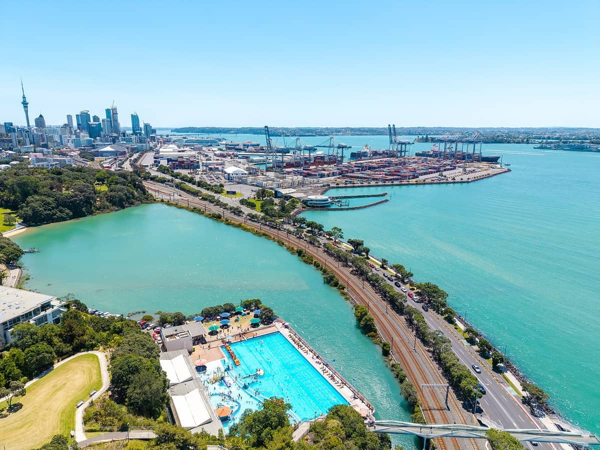
19. Walk or Cycle the Tāmaki Drive Waterfront Route
This flat coastal path runs from the CBD along the harbour foreshore through Mission Bay, Kohimarama, and St Heliers, with harbour and Rangitoto views throughout. It's equally good on foot or by bike, takes about 2 hours to walk one way, and ends at a strip of cafés.
Explore19. Walk or Cycle the Tāmaki Drive Waterfront Route
This flat coastal path runs from the CBD along the harbour foreshore through Mission Bay, Kohimarama, and St Heliers, with harbour and Rangitoto views throughout. It's equally good on foot or by bike, takes about 2 hours to walk one way, and ends at a strip of cafés.
Explore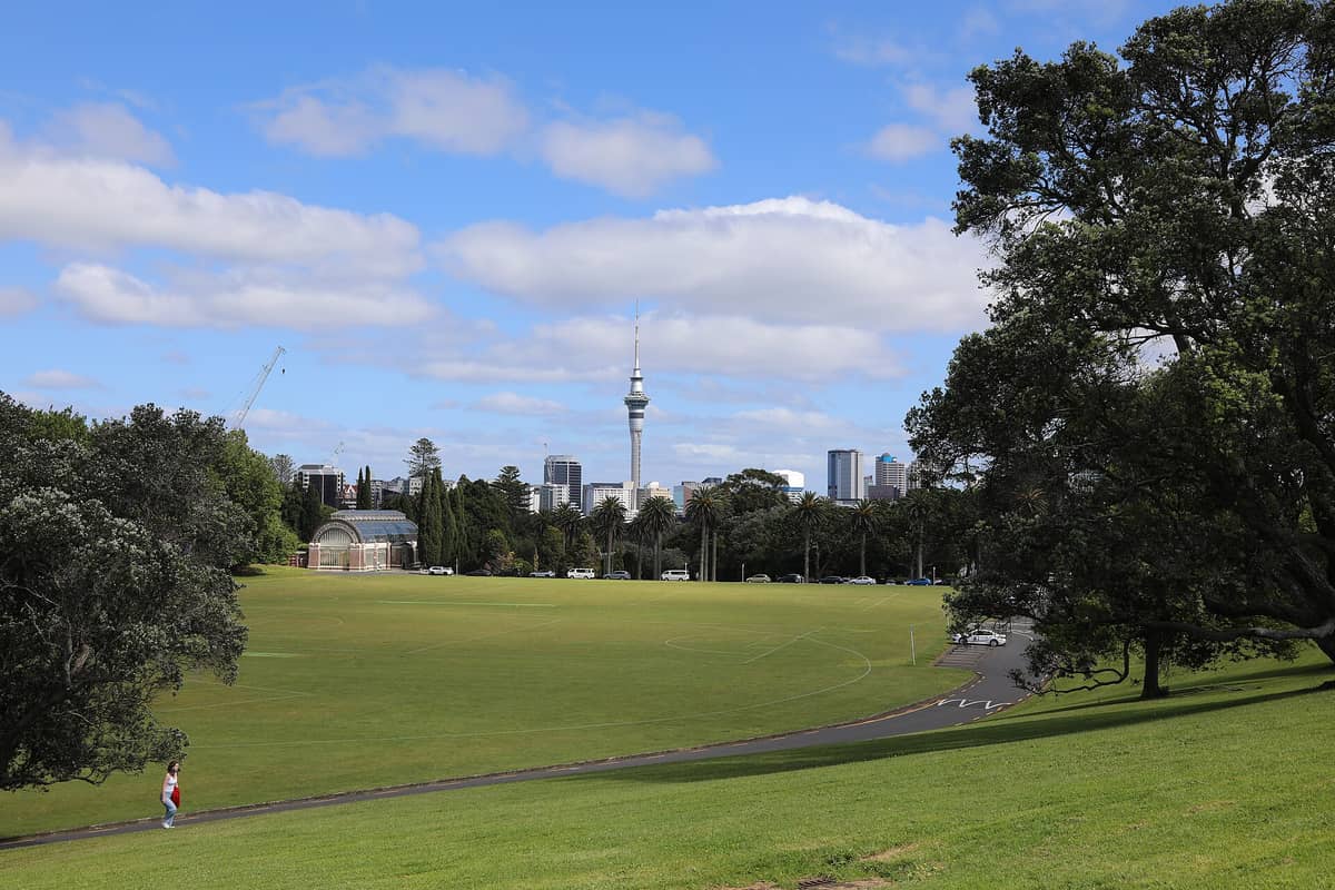
20. Wander Auckland's Oldest Park Through the Domain
The Domain sits in a former volcanic crater and connects Parnell to the CBD through 75 hectares of lawn, duck ponds, and the Victorian Wintergardens. A full circuit takes about an hour and passes the War Memorial Museum. It's the most pleasant green walking route into the city centre.
Explore20. Wander Auckland's Oldest Park Through the Domain
The Domain sits in a former volcanic crater and connects Parnell to the CBD through 75 hectares of lawn, duck ponds, and the Victorian Wintergardens. A full circuit takes about an hour and passes the War Memorial Museum. It's the most pleasant green walking route into the city centre.
Explore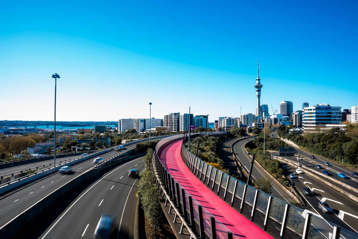
21. Cross the Glowing Lightpath on an Evening City Walk
Te Ara i Whiti is a repurposed motorway off-ramp transformed into a pink-lit walking and cycling path connecting Grafton to the CBD. It takes five minutes to cross but is one of Auckland's most striking pieces of urban infrastructure and earns its place on any evening city walk.
Explore21. Cross the Glowing Lightpath on an Evening City Walk
Te Ara i Whiti is a repurposed motorway off-ramp transformed into a pink-lit walking and cycling path connecting Grafton to the CBD. It takes five minutes to cross but is one of Auckland's most striking pieces of urban infrastructure and earns its place on any evening city walk.
Explore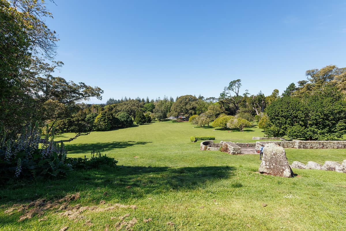
22. Picnic and Walk Through Cornwall Park's Pastoral Landscape
Cornwall Park's 170 hectares of ancient trees, grazing sheep, and open lawns make it Auckland's most relaxed green space for a long walk. The loop from the Huia Lodge visitor centre around the base of One Tree Hill takes about 45 minutes at a gentle pace.
Explore22. Picnic and Walk Through Cornwall Park's Pastoral Landscape
Cornwall Park's 170 hectares of ancient trees, grazing sheep, and open lawns make it Auckland's most relaxed green space for a long walk. The loop from the Huia Lodge visitor centre around the base of One Tree Hill takes about 45 minutes at a gentle pace.
ExploreFAQ
What is the best hike in Auckland for first-time visitors?
Mount Eden (Maungawhau) is the most rewarding introduction: a 20-minute walk from the village to a perfectly preserved volcanic crater with 360-degree city views. The Rangitoto Summit Track is the next step up, requiring a ferry and a 2-hour return hike, but delivers exceptional views of the gulf and city.
Are there any free hikes and walks in Auckland?
Most of Auckland's best walks are free. Volcanic cones including Mount Eden, One Tree Hill, North Head, and Bastion Point cost nothing to visit. The Coast to Coast Walkway, Tāmaki Drive, Auckland Domain, Cornwall Park, and the Waitākere Ranges tracks (where open) are all free. Ferry fares apply for island walks such as Rangitoto and Tiritiri Matangi.
Are walks in the Waitākere Ranges currently open?
Not all tracks are open. Some forested areas remain closed to slow the spread of kauri dieback disease, a serious threat to the kauri trees in the ranges. Check Auckland Council's website for the current track status before visiting, and clean your footwear thoroughly at every cleaning station.
What should I bring on Auckland hikes?
For volcanic cone walks, comfortable shoes and water are sufficient. For longer west coast and island hikes, bring sturdy walking shoes (not sandals), plenty of water, sunscreen, a rain layer, and snacks. Auckland's weather can change quickly. For Waitākere Ranges walks, clean footwear free of soil is essential to protect kauri trees.
Can I do the Rangitoto hike independently without a guided tour?
Yes. Ferries run from the downtown terminal to Rangitoto Island and the summit track is well-marked and straightforward. The return walk to the summit takes about 2–3 hours. Check the ferry timetable before you go to ensure you catch the last boat back, and bring water as food and drinking water are not available on the island.
Tickets & tours
Live prices and dates from our booking partner. If you book, we may earn a commission at no extra cost to you.
Planning a trip? Discover personalized activities with the Nomado app.