Auckland's Volcanic Cones: A Complete Guide to the Tūpuna Maunga
Auckland sits on one of the world's most unusual urban landscapes: a live volcanic field with over 50 cones scattered across the city. This guide covers the most significant maunga, their cultural importance, practical access details, and what to expect when you visit.
Tickets & tours
Live prices and dates from our booking partner. If you book, we may earn a commission at no extra cost to you.
TL;DR
- Auckland's volcanic cones are part of the Auckland's volcanic cones are part of the Auckland Volcanic Field, not a single volcano. There are over 50 volcanic centres spread across the city., not a single volcano. There are over 50 cones spread across the city.
- Fourteen cones are designated Tūpuna Maunga (ancestral mountains) and are co-managed by the Tūpuna Maunga Authority. The most accessible is Maungawhau / Mount Eden, standing 196 metres above the city.
- Entry to all Tūpuna Maunga is free. Gates typically open 7am–8:30pm in summer and 7am–7pm in winter, but hours change with daylight saving — always check before you go.
- Private vehicles are banned on the summit road at Maungawhau. Walk up from the carpark below or take public transport.
- Respect is non-negotiable: stay on formed tracks, do not enter the crater, and treat these sites as the living cultural landscapes they are.
Understanding Auckland's Volcanic Field
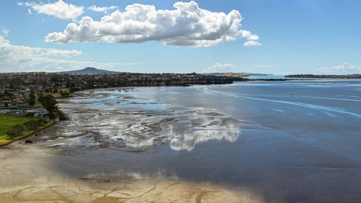
Auckland's volcanic cones are frequently misunderstood by visitors who assume they are looking at a single, long-dormant volcano. In reality, the city is built on the Auckland Volcanic Field, a geologically active zone of more than 50 individual volcanoes that have erupted at different times over roughly 200,000 years. The most recent eruption created Rangitoto Island, which emerged from the Hauraki Gulf only around 600 years ago. Unlike most volcanic regions, where magma rises through a fixed vent, the Auckland Volcanic Field can theoretically produce a new eruption anywhere within its boundaries. The city's emergency management agencies take this seriously, and so should visitors who want to understand what they're standing on.
For Māori, particularly the mana whenua (the iwi with customary authority over this land), the volcanic cones are not scenic viewpoints but ancestral mountains — tūpuna maunga. Each has its own name, whakapapa (genealogy), and history of human settlement. Pā (fortified villages) were built on many of the cones, and the terracing from those settlements is still visible today. The cultural significance of these sites shapes every aspect of how they are managed and accessed — which is why the Tūpuna Maunga Authority, a co-governance body representing mana whenua and Auckland Council, oversees the 14 most significant cones.
ℹ️ Good to know
The 14 Tūpuna Maunga are legally recognised ancestral mountains, vested in the Tūpuna Maunga o Tāmaki Makaurau Authority under a Treaty of Waitangi settlement. This gives mana whenua a formal, equal governance role alongside Auckland Council. When visiting, you are a guest on these ancestral landscapes.
The Most Visited Cones: What to Expect
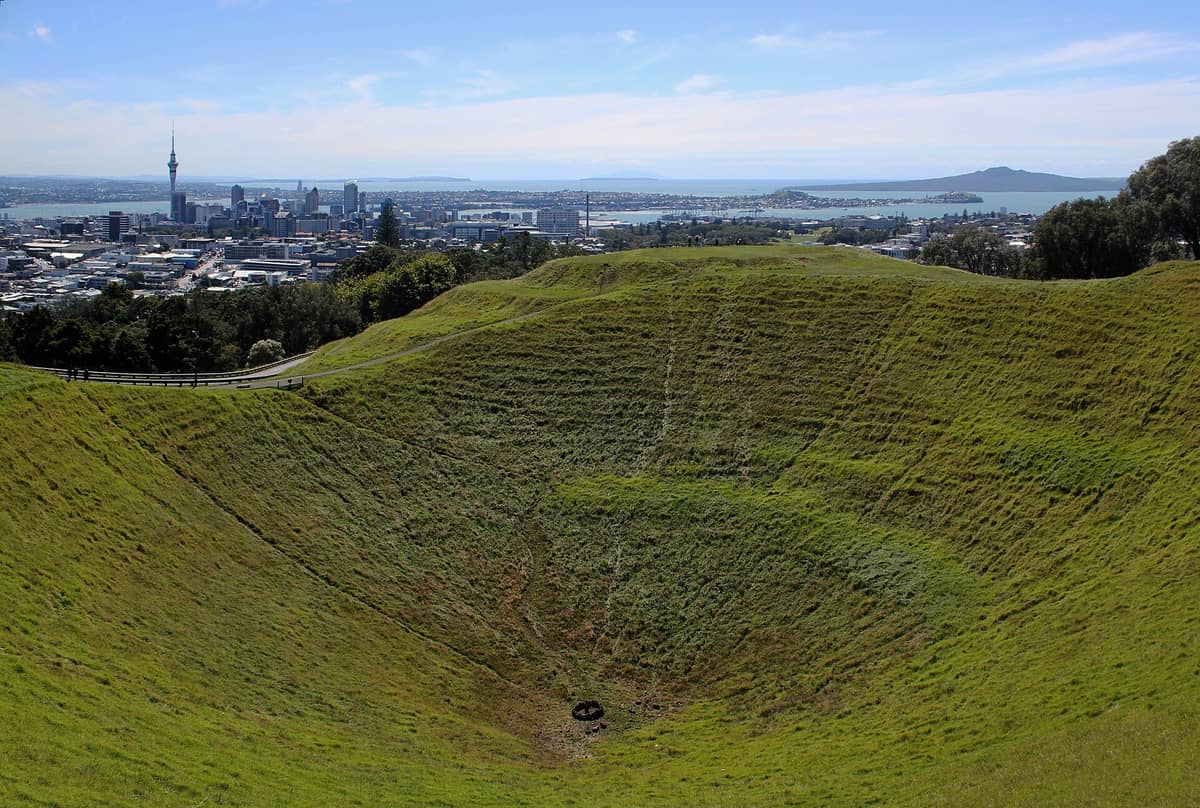
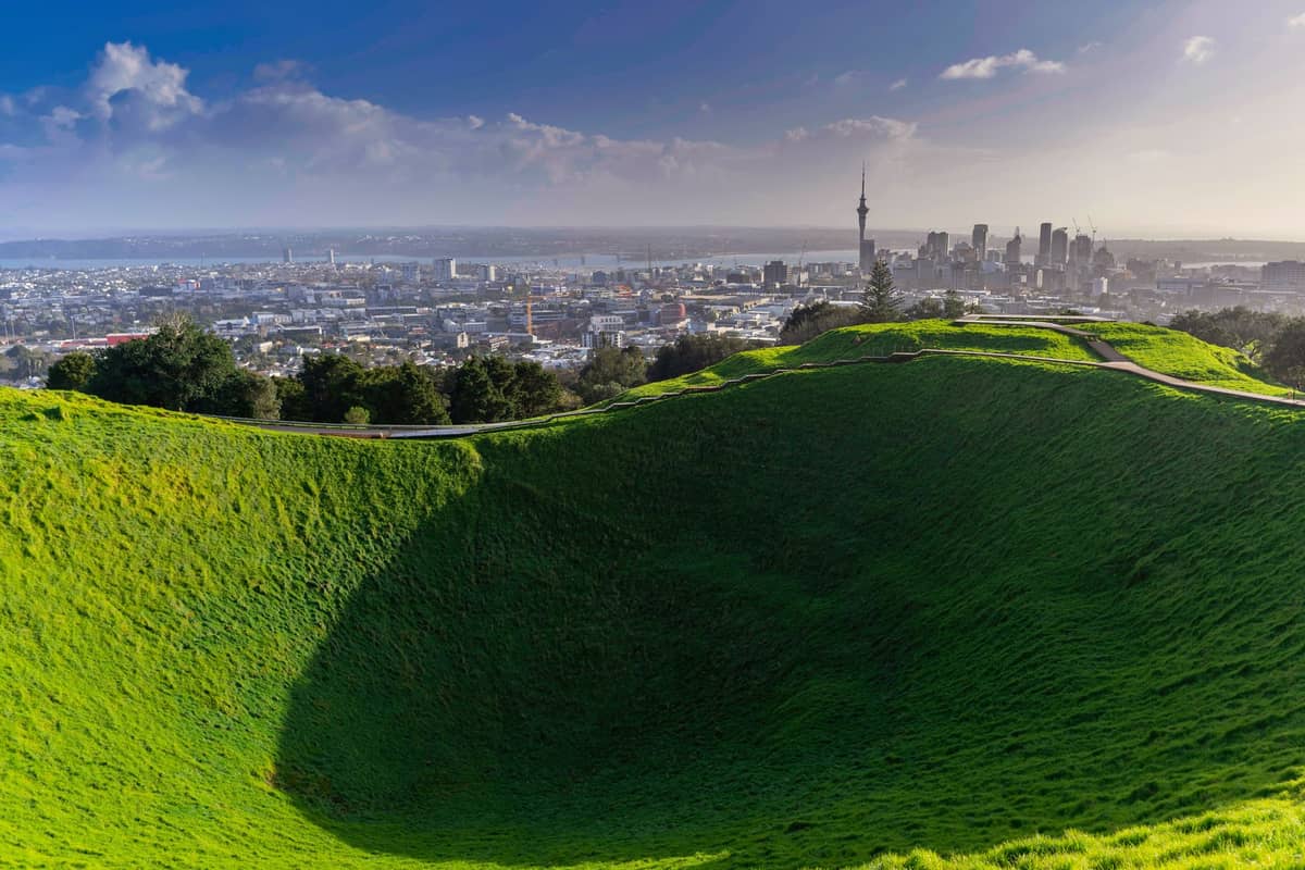
Maungawhau, known in English as Mount Eden, is the highest volcanic cone in the Auckland isthmus at 196 metres. The summit offers a 360-degree view that takes in the city centre, the Waitematā Harbour, the Manukau Harbour to the south, and on clear days the Coromandel Peninsula and the Waitākere Ranges. The crater itself is around 50 metres deep and ringed by a track. Do not descend into it: the crater floor is culturally significant and the descent is prohibited. The summit road is closed to private motor vehicles, which means you walk up from the car parks below. This is a 10–20 minute walk depending on which path you take. Expect significant crowds on weekend mornings, particularly between 9am and noon.
Maungakiekie / One Tree Hill was historically the most heavily settled cone and is arguably the most dramatic in terms of visible Māori earthworks. The terracing, storage pits, and defensive banks are clearly legible from the summit track. The obelisk at the top is a memorial to the Māori people of New Zealand. The surrounding Cornwall Park adds a pastoral dimension — free-roaming sheep on the slopes, mature trees, and a café near the Huia Lodge. The summit is a longer, more gradual walk than Maungawhau and tends to be quieter on weekday mornings.
Takarunga / Mount Victoria and Maungauika / North Head are both in Devonport on the North Shore. They are accessible by the ferry from Auckland's downtown terminal, making them an easy half-day trip. North Head is particularly interesting for its network of military tunnels dug during colonial-era defence works. You can walk through parts of the tunnel system at no cost. The views from both cones take in the harbour entrance and look back directly at the city skyline.
- Maungawhau / Mount Eden 196m. Best city and harbour views. Busiest cone. Vehicle-free summit. 20-minute walk from the road end. Significant crowds on weekends.
- Maungakiekie / One Tree Hill 182m. Best Māori earthworks. Less crowded than Mount Eden. Set within Cornwall Park with cafés and grazing sheep.
- Maungauika / North Head Devonport, reached by ferry. Military tunnels open to explore. Harbour-facing views. Good for a half-day combining the ferry trip with both Devonport cones.
- Ōwairaka / Te Uru Manuka (Mount Albert) 135m. Less known to tourists. Excellent for avoiding crowds. Good 360-degree views with active restoration plantings around the summit.
- Te Tātua-a-Riukiuta / Big King Reserve Auckland Council describes access as difficult. Not recommended for casual visitors. Worth researching before attempting.
- Rangitoto Island The youngest cone in the field, rising 260m from the Hauraki Gulf. Reached by ferry. Unique lava field landscape and the Rangitoto Summit Track.
Access, Hours, and Getting There
All 14 Tūpuna Maunga are free to enter. Gate hours follow a seasonal schedule tied to daylight saving: roughly 7am–8:30pm in summer (when New Zealand Daylight Time is in effect, UTC+13) and 7am–7pm in winter. These hours can change, and specific maunga may have different arrangements or temporary closures for maintenance or cultural events. Always check the Tūpuna Maunga Authority website or the relevant Auckland Council park page before visiting, particularly if you plan an early morning or evening visit.
Public transport is the recommended way to reach most cones. Auckland Transport (AT) runs buses near Maungawhau, Maungakiekie, and most other inner-city cones. Use the AT Journey Planner or AT Mobile app to check current routes and timetables from your location. Contactless debit and credit cards are accepted on buses and trains, as are AT HOP cards. For a broader overview of navigating the city, see the guide to getting around Auckland.
⚠️ What to skip
Private vehicles are not permitted on the summit road at Maungawhau / Mount Eden. Several ride-share services drop visitors at the lower car park, from where it is a 10–20 minute walk. Do not expect to drive to the crater rim — this is a permanent restriction, not a temporary closure.
Rangitoto is a special case. You reach it by ferry from the downtown Auckland terminal, and the crossing takes around 25 minutes. The Rangitoto Summit Track is a 2.5–3 hour return walk over sharp lava fields. Wear proper footwear and bring water. The island also has lava caves worth exploring with a torch. Check the ferry schedule carefully — sailings are not continuous throughout the day, and missing the last ferry back is a genuine problem.
Cultural Protocols and Responsible Visiting
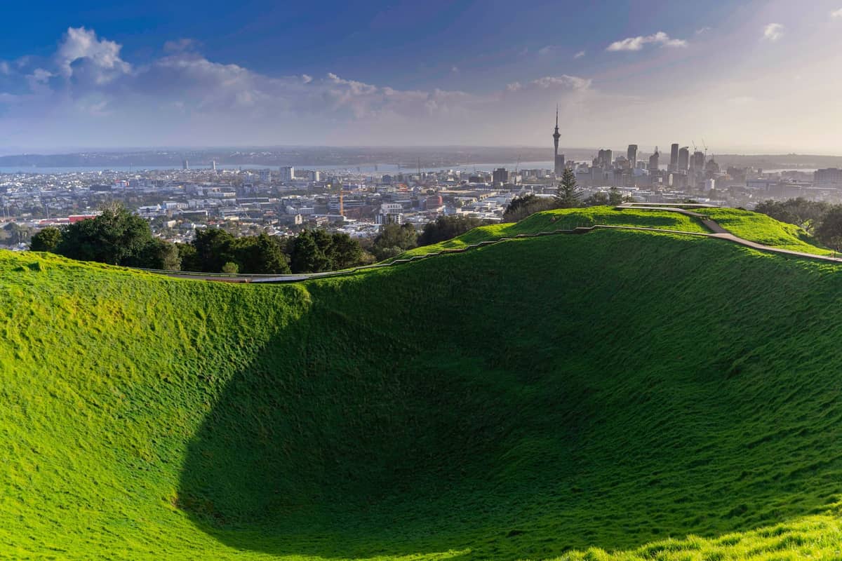
The single most common mistake visitors make on the Tūpuna Maunga is treating the craters as walking routes or attempting to descend into them. This is culturally inappropriate and, at several cones, physically prohibited by fencing and signage. The craters are tapu (sacred) spaces within landscapes that have sustained human communities for centuries. Treating them as photo opportunities or adventure spots misses the point entirely and causes genuine offence.
Stay on formed tracks at all times. The terracing and earthworks visible on most cones are fragile archaeological features that erode quickly under foot traffic. Dogs are restricted or prohibited on many of the maunga, particularly those undergoing ecological restoration. Check individual maunga rules before bringing pets. Picking plants, removing rocks, or leaving rubbish are all prohibited. This applies to everyone, including children.
The ecological restoration work happening across the Tūpuna Maunga is substantial. Volunteer groups and the Tūpuna Maunga Authority are progressively replanting native species and removing invasives. Some areas are fenced off for this reason. What might look like a shortcut across open grass is often a restoration zone. Follow signage, even when it seems overly cautious.
✨ Pro tip
If you want to visit multiple cones in a single day, plan a circuit around the inner southern cones: Maungawhau, then Maungakiekie/One Tree Hill via Cornwall Park. These two are roughly 3.5km apart by road and can be combined on a half-day walk or by bus. Add Ōwairaka / Mount Albert for a third cone if you have the energy — it is significantly quieter and the restoration plantings make it feel different in character.
Seasonal Considerations and Crowd Patterns
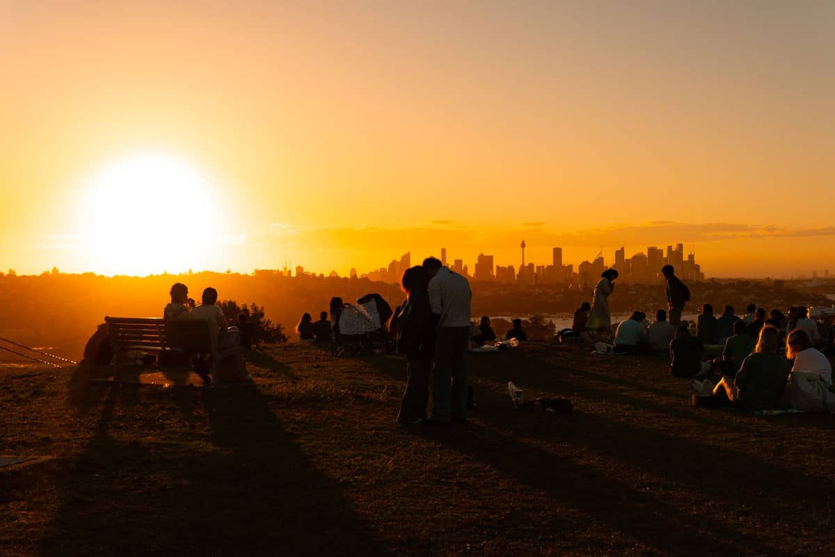
Auckland's temperate maritime climate means the volcanic cones are walkable year-round. Summer (December to February) brings the best visibility for summit views, with daytime temperatures around 20–24°C. This is also when crowds peak, particularly at Maungawhau where weekend mornings between 9am and noon can feel genuinely congested. Arriving before 8am or after 3pm makes a substantial difference. Winter (June to August) brings cooler temperatures of around 11–16°C and more reliable clouds, which can reduce visibility from summits. On the other hand, winter weekday mornings are the quietest time to visit.
Rain is possible in any month, so layer up and check the forecast before heading out. The lava surfaces around Rangitoto become slippery when wet, and the descent from Maungawhau can also be muddy after rain. For a breakdown of what to expect in each season, the best time to visit Auckland guide covers this in detail. If you are combining cone visits with other hikes, check the best hikes in Auckland for routes that connect volcanic landscapes with bush and coastal terrain.
- Arrive before 8am at Maungawhau on weekends to avoid peak crowds and get the summit to yourself
- Winter weekday mornings are the quietest across all cones, with fewer visitors and no school groups
- Gate hours change with daylight saving — confirm hours on the Tūpuna Maunga Authority website before an early morning or evening visit
- Bring water and sunscreen even in mild weather — summit exposure is significant at all cones
- Wear closed shoes with grip. Jandals (flip-flops) are inadequate on lava surfaces and can be dangerous on wet grass slopes
Combining the Cones with Broader Auckland Exploration
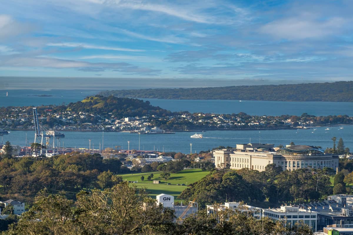
The volcanic cones slot naturally into wider itineraries. Maungawhau is within walking distance of the suburb of Mount Eden, where you'll find good cafés along Dominion Road and Mount Eden Road. Maungakiekie / One Tree Hill connects directly to Cornwall Park, which is worth at least an hour on its own. The Devonport cones pair with the ferry crossing to make a compelling half-day out of the city centre — combine them with the beach at Devonport and a walk along the waterfront.
For visitors on a tighter schedule, the Coast to Coast Walkway connects the Waitemata Harbour to the Manukau Harbour and passes through several volcanic landscapes, including Maungawhau and Maungakiekie. The full route is around 16km, but it can be walked in sections. See the Coast to Coast Walkway page for a full route breakdown. If you are building a multi-day Auckland itinerary, the 3-day Auckland itinerary includes cone visits alongside the city's other highlights.
FAQ
How many volcanic cones are in Auckland?
Auckland's volcanic field contains over 50 individual volcanoes, formed at different times over roughly 200,000 years. Fourteen of these are designated Tūpuna Maunga (ancestral mountains) and are managed by the Tūpuna Maunga Authority. Not all are open to casual visitors — some are on private land or have restricted access.
Is it free to visit Auckland's volcanic cones?
Yes. All 14 Tūpuna Maunga are free to enter. There is no admission charge. The main cost consideration is transport to reach them. Rangitoto Island requires a ferry ticket, which is a separate cost — Yes. All 14 Tūpuna Maunga are free to enter. There is no admission charge. The main cost consideration is transport to reach them. Rangitoto Island requires a ferry ticket, which is a separate cost — check Fullers360 for current fares.
Can you walk into the crater at Mount Eden / Maungawhau?
No. The crater is a culturally significant space and descending into it is prohibited. You can walk around the crater rim on the formed track, but entering the crater floor is not permitted. Signage and fencing make this clear on site.
What is the easiest volcanic cone to visit in Auckland?
Maungawhau / Mount Eden is the most accessible for most visitors, being centrally located and served by public transport. The walk from the road end to the summit takes around 10–20 minutes. For those combining a ferry trip, North Head in Devonport is another straightforward option with the added interest of the military tunnel network.
Are Auckland's volcanoes still active?
The Auckland Volcanic Field is considered geologically active, meaning future eruptions are possible, though there is no prediction of when or where. Emergency management agencies in Auckland have contingency plans for this scenario. Rangitoto Island, the most recent eruption, occurred roughly 600 years ago. The volcanic cones in the city are dormant individual vents, not the source of any future activity.
Tickets & tours
Live prices and dates from our booking partner. If you book, we may earn a commission at no extra cost to you.
Planning a trip? Discover personalized activities with the Nomado app.