The Best Views and Viewpoints in Auckland
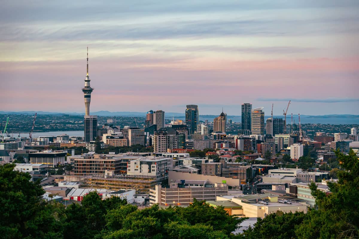
Auckland sits on an isthmus studded with volcanic cones, harbour headlands, and elevated parks, making it one of the world's most view-rich cities. This guide covers the finest viewpoints across the city, from the Sky Tower's observation deck to wild clifftop lookouts, with practical advice on how to reach each one.
Tickets & tours
Live prices and dates from our booking partner. If you book, we may earn a commission at no extra cost to you.
Auckland's geography does most of the work. The city is built across a narrow strip of land between two harbours, with over 50 volcanic cones scattered through its suburbs, meaning a panoramic view is rarely more than a short walk away. Whether you're after the full 360-degree city panorama, a quiet harbour outlook, or a clifftop perspective over the wild Tasman Sea, Auckland delivers. This guide covers the best viewpoints across the region, organised by type. If you're planning your time carefully, pair it with our 3-day Auckland itinerary or browse our full guide to Auckland's volcanic cones for more detail on the summits listed here.
Volcanic Summit Views
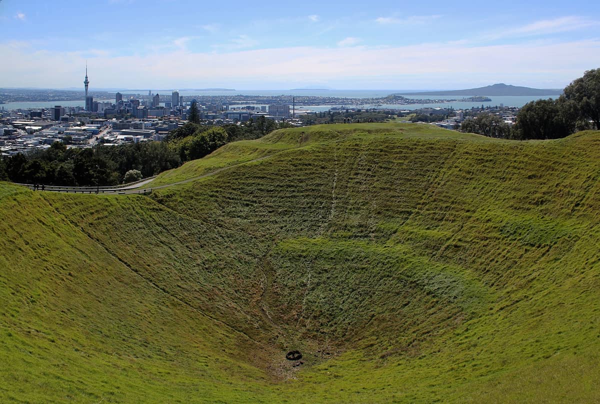
Auckland's volcanic cones are its most distinctive feature, and climbing them remains the most rewarding free thing you can do in the city. Each summit has a different character and a slightly different perspective on the harbour. For a deeper dive into the geology and history, see our dedicated Auckland volcanic cones guide.
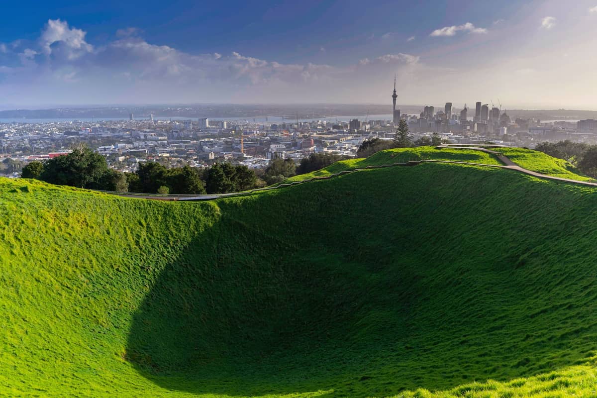
1. Stand Above the City at Mount Eden's Summit Crater
At 196 metres, Maungawhau is Auckland's highest volcanic cone. The 360-degree view takes in both harbours, Rangitoto, and the CBD skyline. Note: private vehicles are banned on the summit road, so walk up from Manukau Road.
Explore1. Stand Above the City at Mount Eden's Summit Crater
At 196 metres, Maungawhau is Auckland's highest volcanic cone. The 360-degree view takes in both harbours, Rangitoto, and the CBD skyline. Note: private vehicles are banned on the summit road, so walk up from Manukau Road.
Explore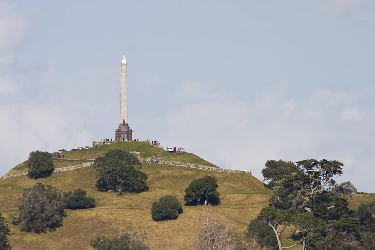
2. Climb One Tree Hill for City-Wide Panoramas
The obelisk-topped summit of Maungakiekie sits at 182 metres and offers sweeping views across south and central Auckland. The terraced hillsides of this former pā give context to the scale of pre-European settlement here.
Explore2. Climb One Tree Hill for City-Wide Panoramas
The obelisk-topped summit of Maungakiekie sits at 182 metres and offers sweeping views across south and central Auckland. The terraced hillsides of this former pā give context to the scale of pre-European settlement here.
Explore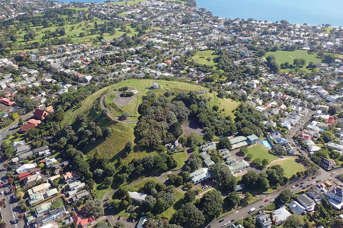
3. Catch the Best CBD Skyline Shot from Mount Victoria, Devonport
This small cone in Devonport village is the ideal spot to photograph the Auckland skyline across the harbour. Take the ferry from downtown, walk up in ten minutes, and stay for the view back across the Waitematā to the Sky Tower.
Explore3. Catch the Best CBD Skyline Shot from Mount Victoria, Devonport
This small cone in Devonport village is the ideal spot to photograph the Auckland skyline across the harbour. Take the ferry from downtown, walk up in ten minutes, and stay for the view back across the Waitematā to the Sky Tower.
Explore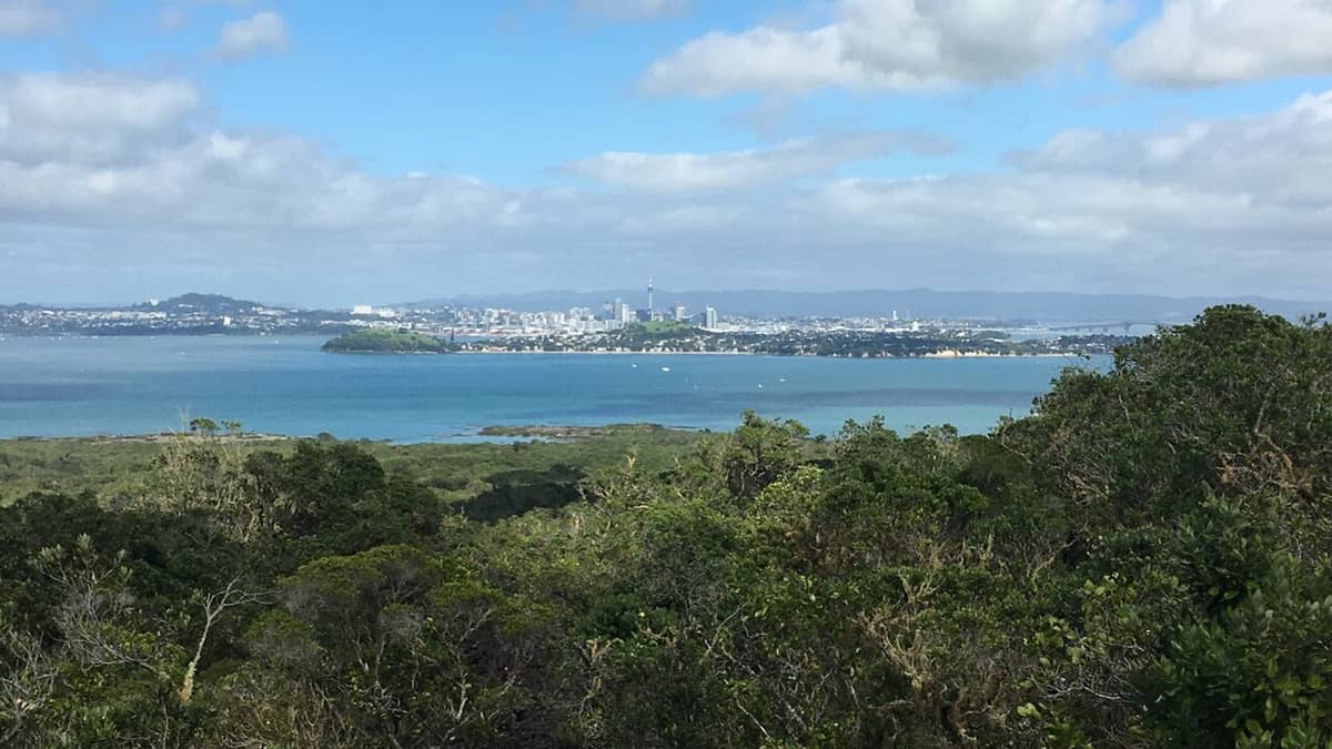
4. Hike to Rangitoto's Summit for Unobstructed Gulf Views
The 259-metre summit of Rangitoto rewards a two-to-three hour return hike with an unbroken panorama of the Hauraki Gulf and Auckland. The ferry from downtown takes about 25 minutes; book ahead as schedules vary by day.
Explore4. Hike to Rangitoto's Summit for Unobstructed Gulf Views
The 259-metre summit of Rangitoto rewards a two-to-three hour return hike with an unbroken panorama of the Hauraki Gulf and Auckland. The ferry from downtown takes about 25 minutes; book ahead as schedules vary by day.
ExploreIconic Structures with Observation Decks
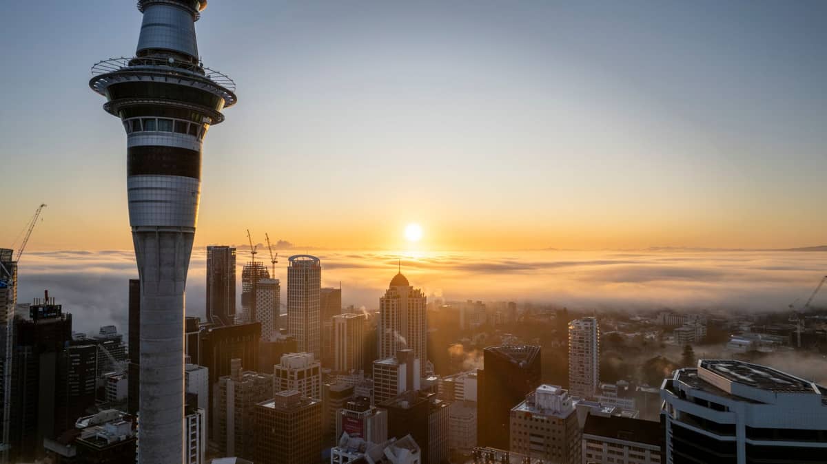
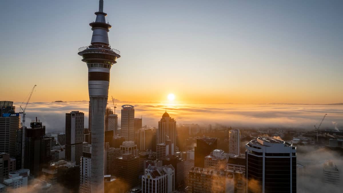
5. See the Full 360-Degree Panorama from the Sky Tower
At 328 metres, the Sky Tower's observation decks give the widest possible view of Auckland. On a clear day you can see the Coromandel Peninsula. Adult admission is around NZ$47; check current hours before visiting as they vary seasonally.
Explore5. See the Full 360-Degree Panorama from the Sky Tower
At 328 metres, the Sky Tower's observation decks give the widest possible view of Auckland. On a clear day you can see the Coromandel Peninsula. Adult admission is around NZ$47; check current hours before visiting as they vary seasonally.
Explore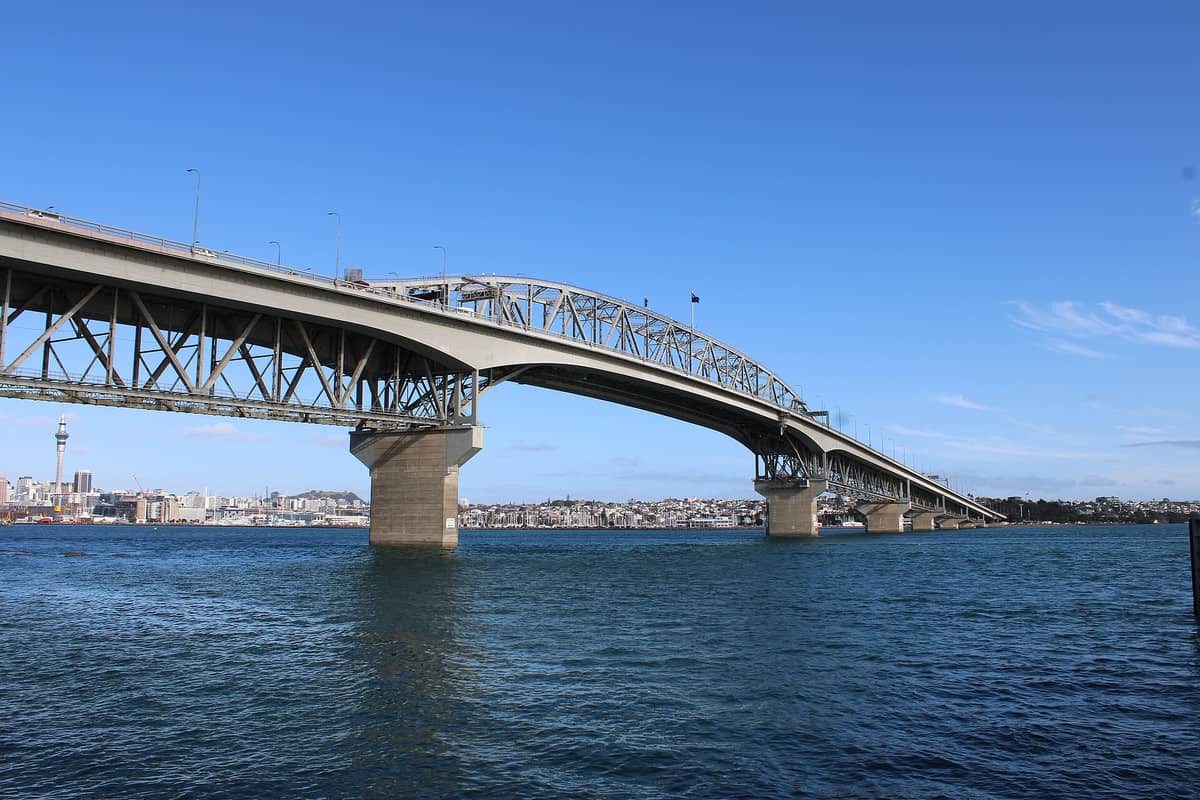
6. Cross Auckland Harbour Bridge on a Guided Climb
The bridge climb gets you above the traffic and out over the Waitematā Harbour for views that are simply unavailable from ground level. The guided experience takes about 1.5 hours and ends with the harbour, gulf, and CBD spread below you.
Explore6. Cross Auckland Harbour Bridge on a Guided Climb
The bridge climb gets you above the traffic and out over the Waitematā Harbour for views that are simply unavailable from ground level. The guided experience takes about 1.5 hours and ends with the harbour, gulf, and CBD spread below you.
ExploreHeadlands and Harbour Viewpoints
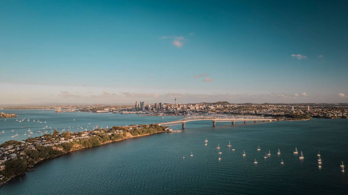
Several of Auckland's finest outlooks are from coastal headlands, where the combination of elevation and waterfront position creates views that no summit in the city can quite match. These spots are free, require minimal effort, and reward you with classic Auckland harbour scenes. The free things to do in Auckland guide includes several of these headlands alongside other no-cost experiences.
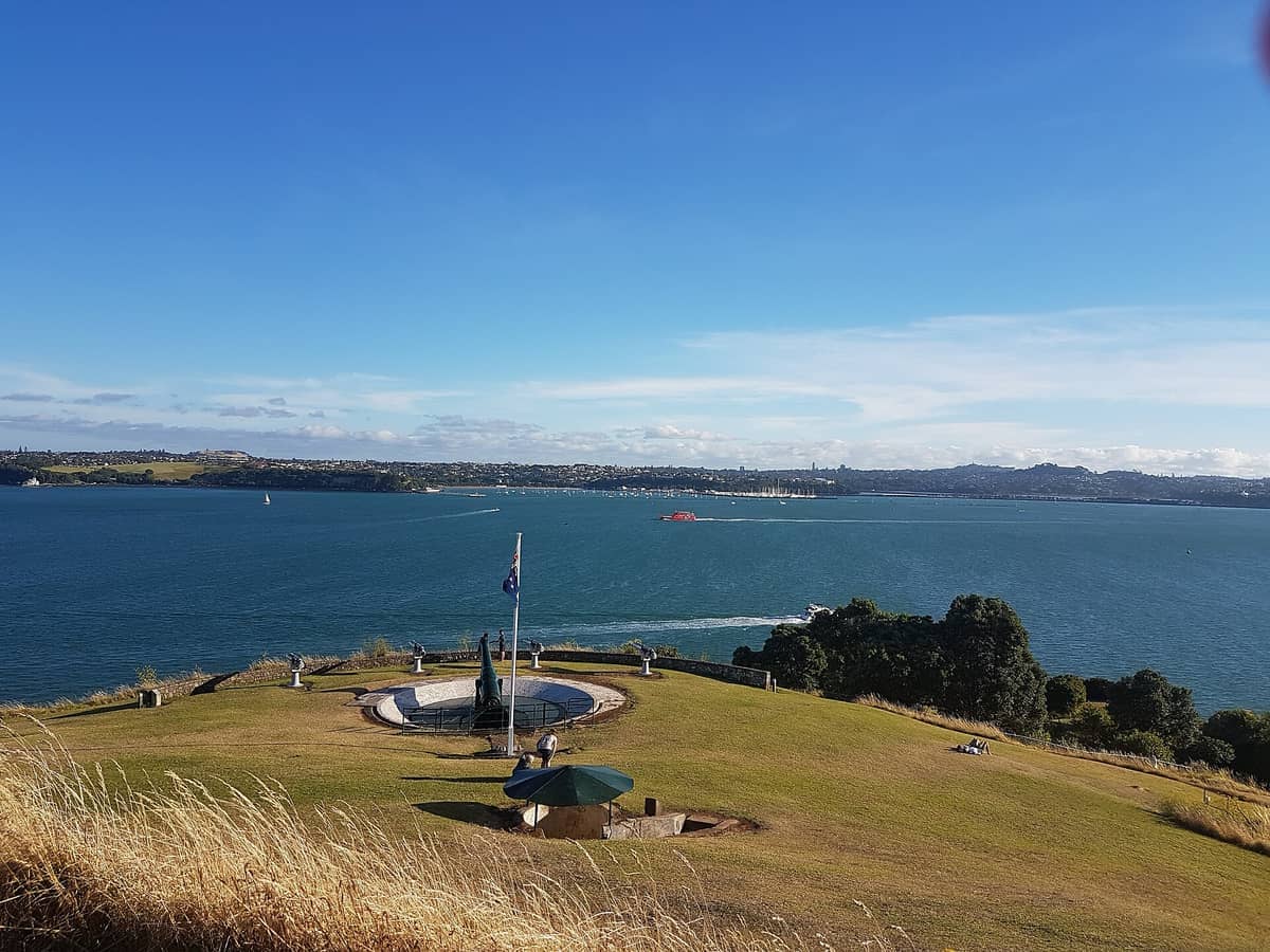
7. Explore North Head's Gun Emplacements and Harbour Views
Perched at the tip of the Devonport peninsula, North Head combines military history with outstanding views of the harbour entrance, Rangitoto, and the CBD. Walk through the clifftop tunnels, then climb to the summit for the full panorama.
Explore7. Explore North Head's Gun Emplacements and Harbour Views
Perched at the tip of the Devonport peninsula, North Head combines military history with outstanding views of the harbour entrance, Rangitoto, and the CBD. Walk through the clifftop tunnels, then climb to the summit for the full panorama.
Explore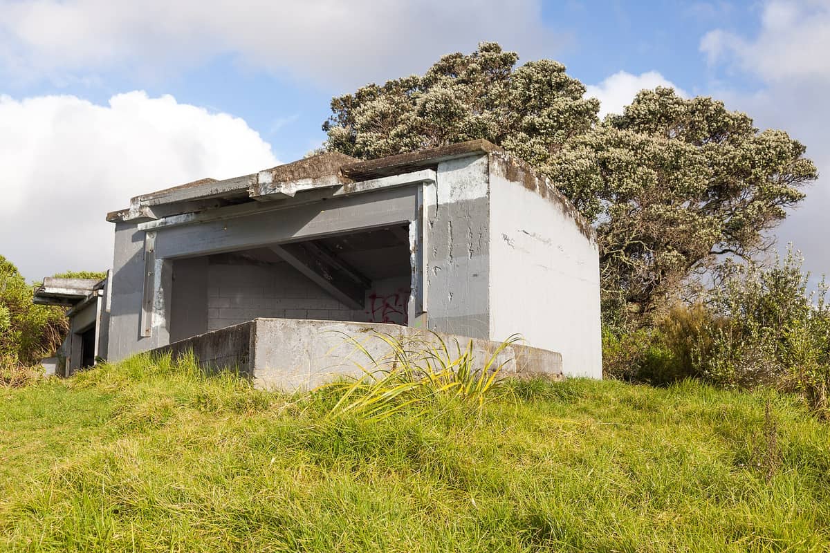
8. Take in Rangitoto and the Harbour from Bastion Point
Takaparawhau sits above Ōrākei with a classic view of Rangitoto framed by the Waitematā Harbour. This headland is also the site of a significant Māori land rights occupation in 1977–78, adding cultural and historical depth to a visit.
Explore8. Take in Rangitoto and the Harbour from Bastion Point
Takaparawhau sits above Ōrākei with a classic view of Rangitoto framed by the Waitematā Harbour. This headland is also the site of a significant Māori land rights occupation in 1977–78, adding cultural and historical depth to a visit.
Explore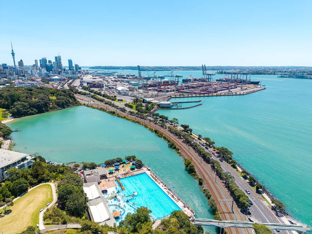
9. Walk or Cycle Tāmaki Drive for Continuous Harbour Views
This scenic coastal road runs from the CBD to St Heliers, hugging the Waitematā Harbour foreshore the entire way. Walking or cycling the full length takes about an hour and gives you uninterrupted views of the gulf, Rangitoto, and the city marina.
Explore9. Walk or Cycle Tāmaki Drive for Continuous Harbour Views
This scenic coastal road runs from the CBD to St Heliers, hugging the Waitematā Harbour foreshore the entire way. Walking or cycling the full length takes about an hour and gives you uninterrupted views of the gulf, Rangitoto, and the city marina.
Explore💡 Local tip
The best light for harbour views is in the morning, when the sun is behind you if you're looking east toward Rangitoto. For CBD skyline shots from Devonport or Bastion Point, the late afternoon and golden hour are ideal.
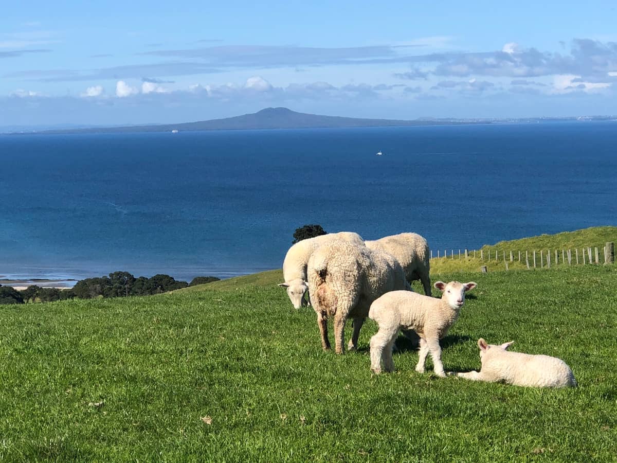
10. Find Hauraki Gulf Vistas at Shakespear Regional Park
The coastal tracks at the tip of the Whangaparāoa Peninsula open up views across the gulf islands that are hard to match anywhere closer to the city. The park is predator-free, so native birdsong accompanies the scenery. Allow a full day.
Explore10. Find Hauraki Gulf Vistas at Shakespear Regional Park
The coastal tracks at the tip of the Whangaparāoa Peninsula open up views across the gulf islands that are hard to match anywhere closer to the city. The park is predator-free, so native birdsong accompanies the scenery. Allow a full day.
ExploreWest Coast and Clifftop Lookouts
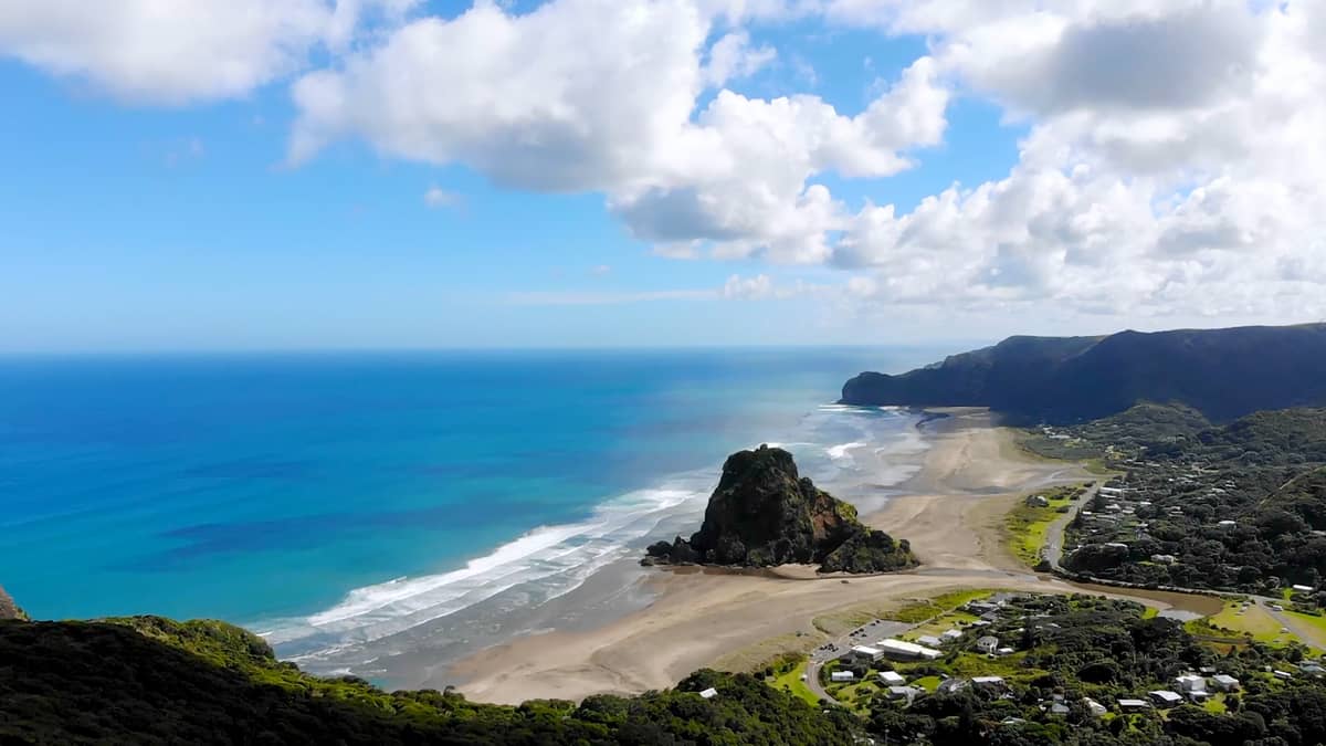
The views on Auckland's west coast are a different proposition entirely: wild Tasman Sea surf, black sand, and clifftop headlands looking out to nothing but ocean. These spots suit those who want drama over harbour polish. Combine a visit with the Auckland west coast beaches guide for a full day out.
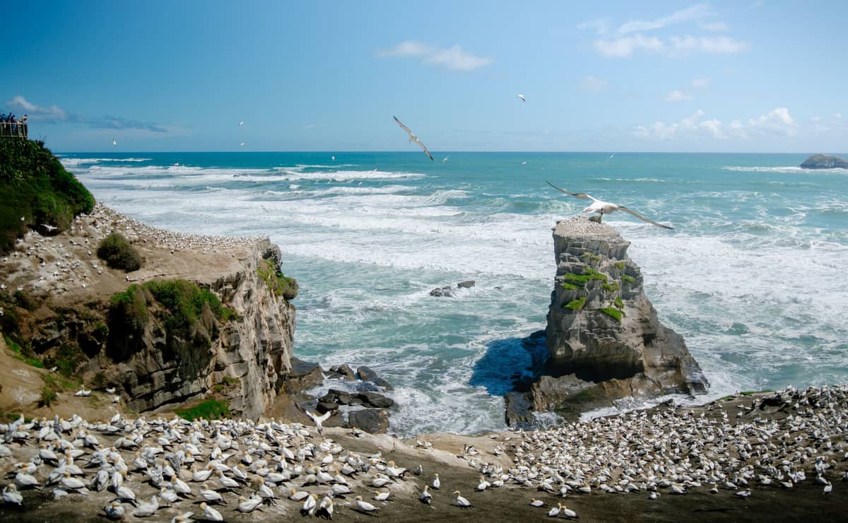
11. Watch Thousands of Gannets from the Muriwai Clifftops
The viewing platforms above Muriwai's gannet colony sit right at the cliff edge, with birds nesting within metres of you and the Tasman Sea crashing below. Nesting season runs August through March, but the clifftop view is impressive year-round.
Explore11. Watch Thousands of Gannets from the Muriwai Clifftops
The viewing platforms above Muriwai's gannet colony sit right at the cliff edge, with birds nesting within metres of you and the Tasman Sea crashing below. Nesting season runs August through March, but the clifftop view is impressive year-round.
Explore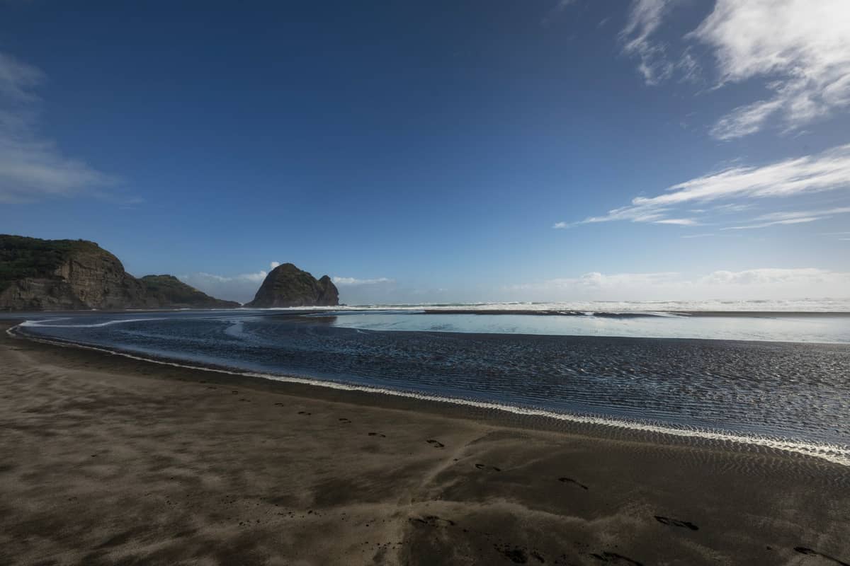
12. Photograph Lion Rock at Piha for a Dramatic West Coast Perspective
Lion Rock rises 101 metres from Piha's black sand and is one of the most photogenic landmarks on Auckland's west coast. The summit track has been closed since storm damage in 2023, so stay on the beach and photograph it from below.
Explore12. Photograph Lion Rock at Piha for a Dramatic West Coast Perspective
Lion Rock rises 101 metres from Piha's black sand and is one of the most photogenic landmarks on Auckland's west coast. The summit track has been closed since storm damage in 2023, so stay on the beach and photograph it from below.
Explore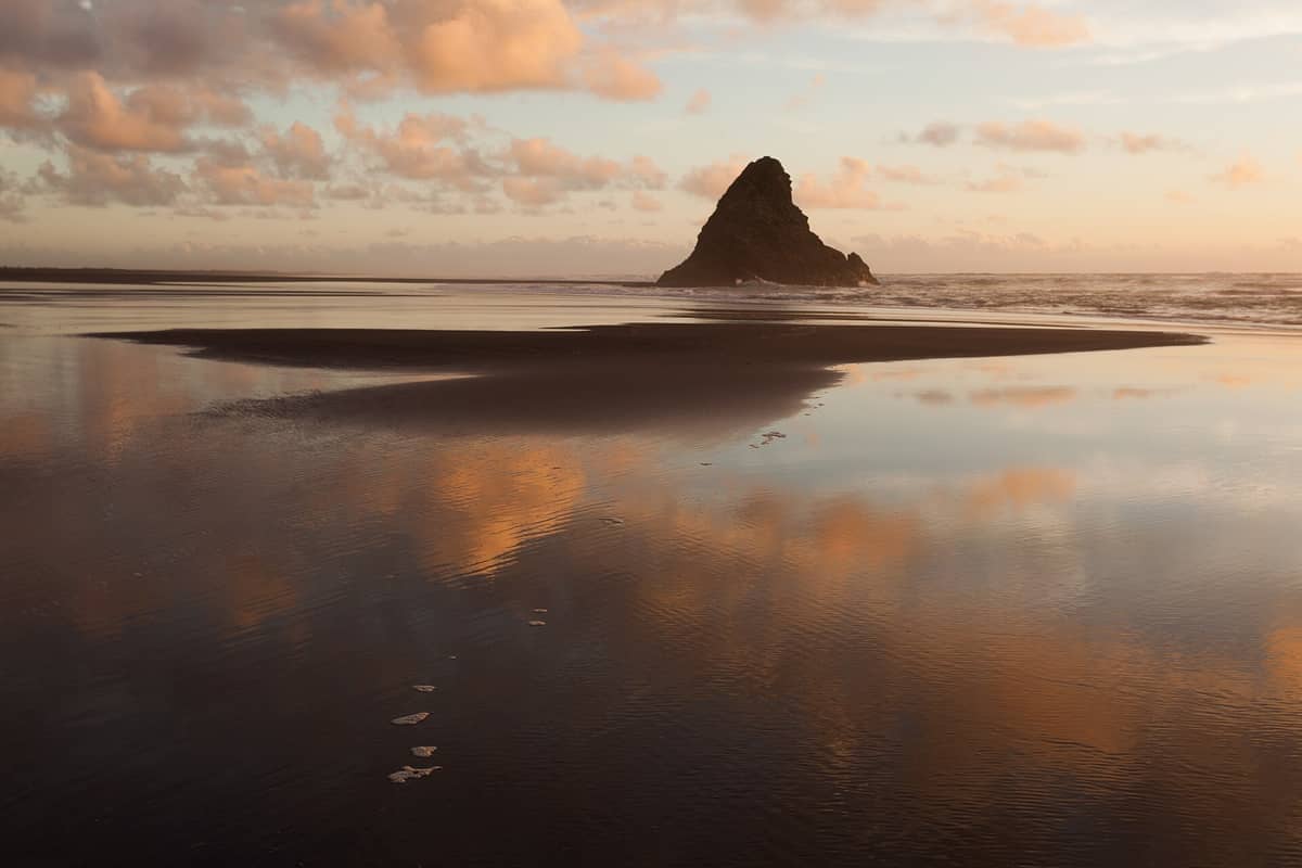
13. See the Karekare Headlands from the Black Sand Below
Karekare's dramatic cliffs and headlands are best appreciated from the beach itself, looking back at the towering coastal escarpment. A short walk to the Karekare Falls adds another dimension to a beach that feels entirely removed from the city.
Explore13. See the Karekare Headlands from the Black Sand Below
Karekare's dramatic cliffs and headlands are best appreciated from the beach itself, looking back at the towering coastal escarpment. A short walk to the Karekare Falls adds another dimension to a beach that feels entirely removed from the city.
Explore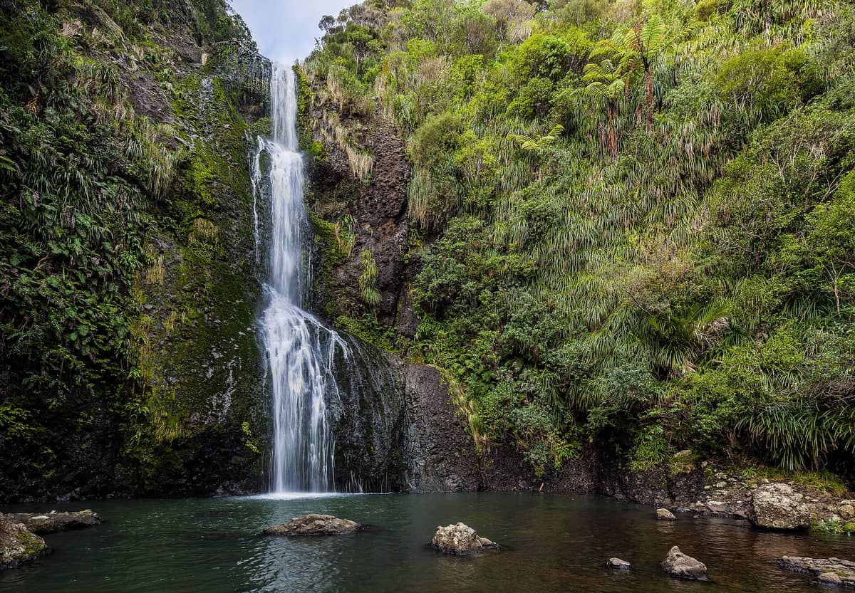
14. Look Up at the Waitākere Ranges Canopy on the Kitekite Track
The 45-minute walk to Kitekite Falls near Piha passes through dense bush, and the falls themselves drop 40 metres in three tiers through a forest amphitheatre. The walk back gives you treetop-level views across the Waitākere ridgeline.
Explore14. Look Up at the Waitākere Ranges Canopy on the Kitekite Track
The 45-minute walk to Kitekite Falls near Piha passes through dense bush, and the falls themselves drop 40 metres in three tiers through a forest amphitheatre. The walk back gives you treetop-level views across the Waitākere ridgeline.
ExploreIsland and Gulf Perspectives
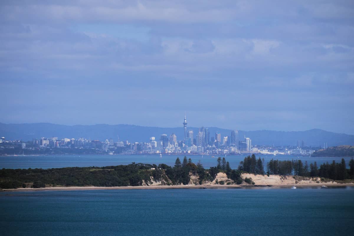
Some of Auckland's finest views are not of the city, but from islands in the Hauraki Gulf, looking back at it. The ferry network makes several of these easily accessible. See the Hauraki Gulf islands guide for ferry routes, timings, and what to expect on each island.
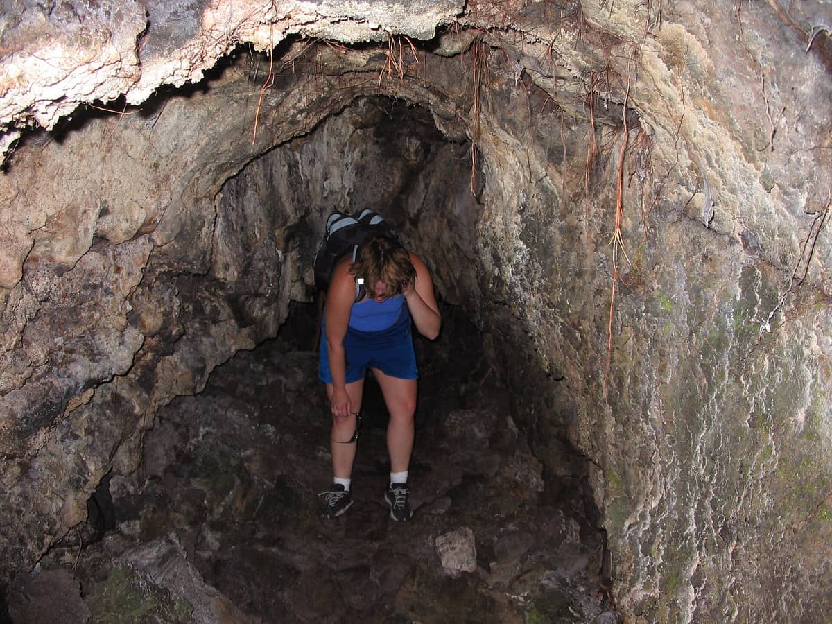
15. Add the Lava Caves to Your Rangitoto Summit Day
A short detour from the main summit track leads into Rangitoto's lava tube network, formed during the island's eruption about 600 years ago. Torch required. Combined with the summit hike, it makes for a full half-day on the island.
Explore15. Add the Lava Caves to Your Rangitoto Summit Day
A short detour from the main summit track leads into Rangitoto's lava tube network, formed during the island's eruption about 600 years ago. Torch required. Combined with the summit hike, it makes for a full half-day on the island.
Explore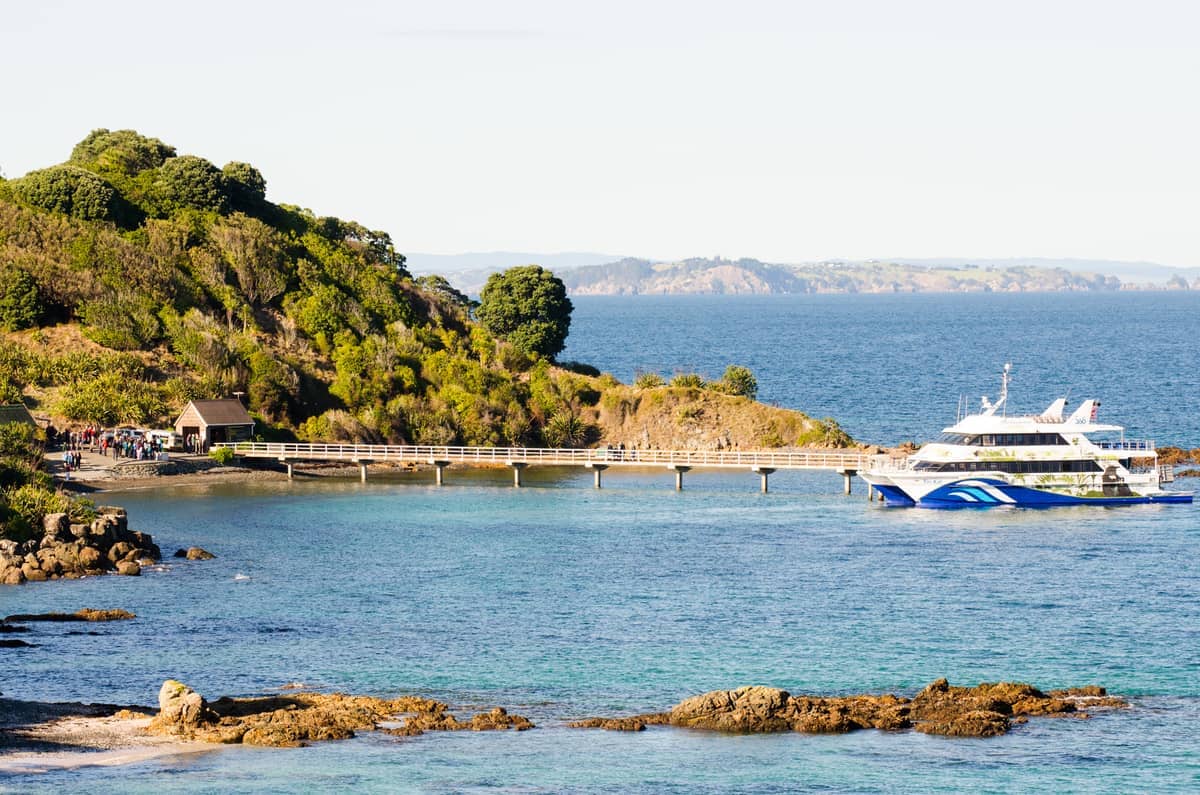
16. Spot Native Birds Against a Backdrop of Gulf Views on Tiritiri Matangi
The lighthouse on Tiritiri Matangi's hilltop gives broad views across the Hauraki Gulf, and the island's open forest means you're watching endangered birds with sea views framing every sighting. Accessible by ferry from downtown Auckland.
Explore16. Spot Native Birds Against a Backdrop of Gulf Views on Tiritiri Matangi
The lighthouse on Tiritiri Matangi's hilltop gives broad views across the Hauraki Gulf, and the island's open forest means you're watching endangered birds with sea views framing every sighting. Accessible by ferry from downtown Auckland.
ExploreUrban Vantage Points and Waterfront Views
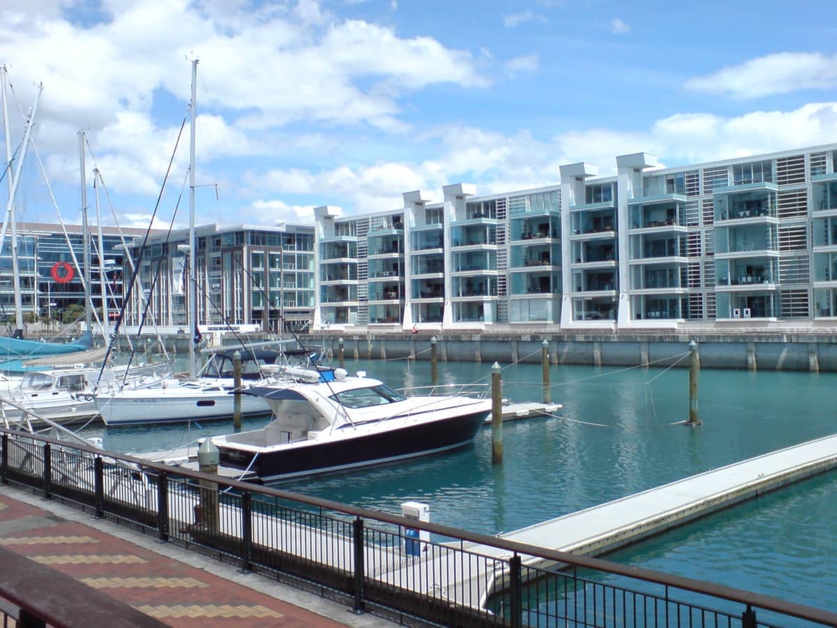
17. Watch Superyachts and the Harbour from Viaduct Harbour
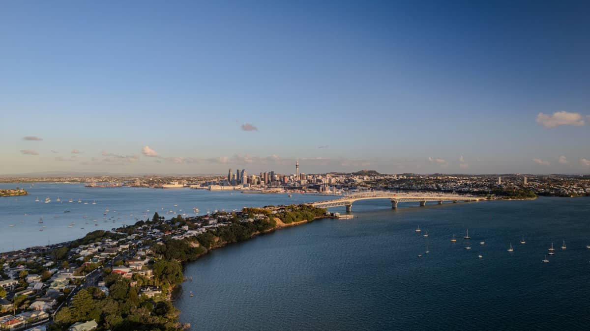
The Viaduct's waterfront promenade sits low and close to the water, giving an intimate view of the Waitematā Harbour, the marina, and the flow of ferries and sailboats. Best at dusk when the CBD towers are illuminated behind the mast lines.
Explore17. Watch Superyachts and the Harbour from Viaduct Harbour
The Viaduct's waterfront promenade sits low and close to the water, giving an intimate view of the Waitematā Harbour, the marina, and the flow of ferries and sailboats. Best at dusk when the CBD towers are illuminated behind the mast lines.
Explore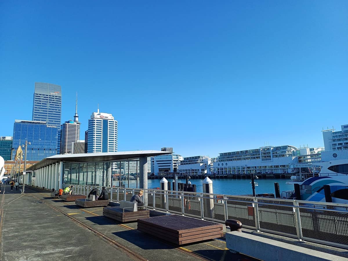
18. Look Back at the Auckland CBD from Queens Wharf
Walking to the end of Queens Wharf puts you out on the water with the full CBD skyline behind you and the Waitematā ahead. It's the best spot on the central waterfront to photograph the Sky Tower rising above the harbour.
Explore18. Look Back at the Auckland CBD from Queens Wharf
Walking to the end of Queens Wharf puts you out on the water with the full CBD skyline behind you and the Waitematā ahead. It's the best spot on the central waterfront to photograph the Sky Tower rising above the harbour.
Explore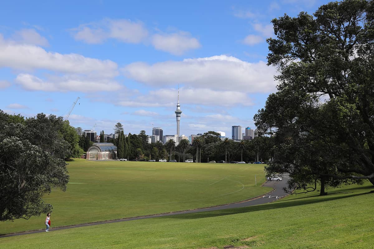
19. Survey the City from the Auckland Domain's Volcanic Rim
The Domain sits in an old volcanic crater, and its grassy flanks give elevated views toward the CBD and the Waitemata Harbour. The museum itself provides a dramatic backdrop. Best in the early morning before the sports fields fill up.
Explore19. Survey the City from the Auckland Domain's Volcanic Rim
The Domain sits in an old volcanic crater, and its grassy flanks give elevated views toward the CBD and the Waitemata Harbour. The museum itself provides a dramatic backdrop. Best in the early morning before the sports fields fill up.
Explore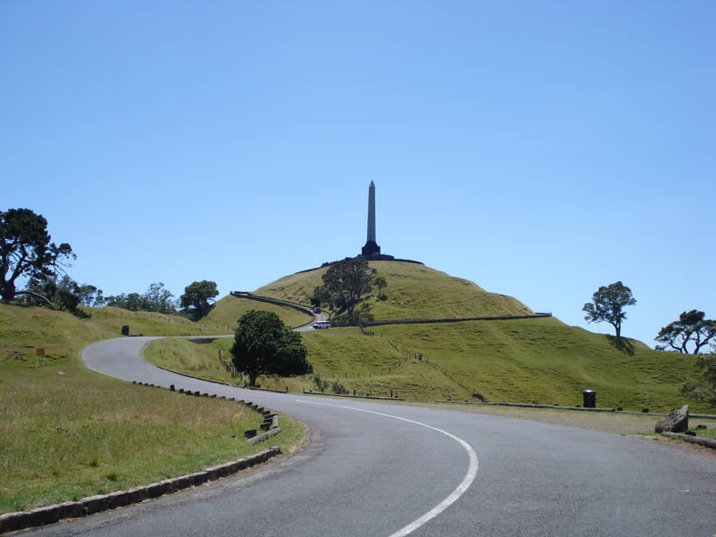
20. Cross the Isthmus on Foot and See Both Harbours
The 16km Coast to Coast Walkway crosses from the Manukau to the Waitematā Harbour, passing over Mount Eden and One Tree Hill. The twin-harbour view from each volcanic cone is the payoff for the effort; allow a full day for the complete route.
Explore20. Cross the Isthmus on Foot and See Both Harbours
The 16km Coast to Coast Walkway crosses from the Manukau to the Waitematā Harbour, passing over Mount Eden and One Tree Hill. The twin-harbour view from each volcanic cone is the payoff for the effort; allow a full day for the complete route.
Explore✨ Pro tip
The Sky Tower and Mount Eden crater are both busiest between 10am and 2pm. Visit either at dawn or in the late evening for fewer crowds and better light conditions, especially in summer when it stays light until 9pm.
FAQ
What is the best free viewpoint in Auckland?
Mount Eden (Maungawhau) is the most rewarding free viewpoint: at 196 metres it's the city's highest volcanic cone, with 360-degree views of both harbours and the CBD. North Head in Devonport is a close second, especially for views of the harbour entrance and Rangitoto. Both cost nothing to visit.
Can you drive to the top of Mount Eden?
No. Private motor vehicles, motorbikes, and scooters have been banned from the summit road since January 2016. You must walk up from the surrounding streets, which takes about 15–20 minutes from the Maungawhau reserve car park on Mountain Road. The gates are open 7am–8:30pm in summer and 7am–7pm in winter.
Is the Sky Tower worth the admission fee?
If 360-degree views and the ability to see Auckland from above 200 metres matter to you, then yes. Adult admission is around NZ$47. The main advantage over the volcanic cones is the higher elevation and the enclosed observation deck, which remains open in rain. Verify current prices and hours at the SkyCity Auckland website before visiting.
How do I get to Rangitoto Island for the summit view?
Fullers360 runs ferries from the downtown Auckland ferry terminal; the crossing takes about 25 minutes. Return adult fares are approximately NZ$63. Ferries do not operate on Christmas Day and timetables vary between weekdays, weekends, and public holidays, so check the Fullers360 timetable and book in advance. Note that AT HOP cards are not accepted on this route.
Which Auckland viewpoint is best for photographing the city skyline?
Mount Victoria in Devonport gives the classic CBD skyline shot across the Waitematā Harbour, with the Sky Tower centred in frame. Take the ferry from downtown Auckland (about 12 minutes), walk up the cone in ten minutes, and shoot in late afternoon when the light falls on the city face. Bastion Point is also strong for this angle and more accessible by car.
Tickets & tours
Live prices and dates from our booking partner. If you book, we may earn a commission at no extra cost to you.
Planning a trip? Discover personalized activities with the Nomado app.