Hiking in Santorini: Best Trails & Routes for Every Level
Santorini rewards hikers with caldera rim panoramas, ancient ruins, volcanic craters, and medieval villages. This guide covers the island's best trails, from the classic Fira–Oia walk to off-the-beaten-path routes most visitors never find.
Plan and book this trip
Tools from our partner Travelpayouts help you compare flights and hotels. If you book through them, we may earn a commission at no extra cost to you.
Flights
Hotels map
Most visitors to Santorini see the island through a restaurant terrace or a taxi window. Hikers see it differently: from cliff-edge paths with unobstructed caldera views, from the summit of an active volcano, from medieval fortresses perched above vineyards. The island is compact enough to cover several trails in a long weekend, yet varied enough to reward repeat visits. The classic 3-day itinerary barely scratches the surface of what's possible on foot. The best trails fall into three categories: the caldera rim routes above the western cliffs, the inland and hilltop hikes through villages and monasteries, and the more adventurous walks to volcanic terrain and remote coastline. Plan for early starts in summer — most trails are fully exposed, and midday heat between June and August can make even a moderate walk genuinely taxing.
💡 Local tip
Start hikes before 9am in summer to beat the heat. Carry at least 1.5 liters of water per person — long stretches of the caldera trail and Ancient Thera have no shade and no water sources between villages.
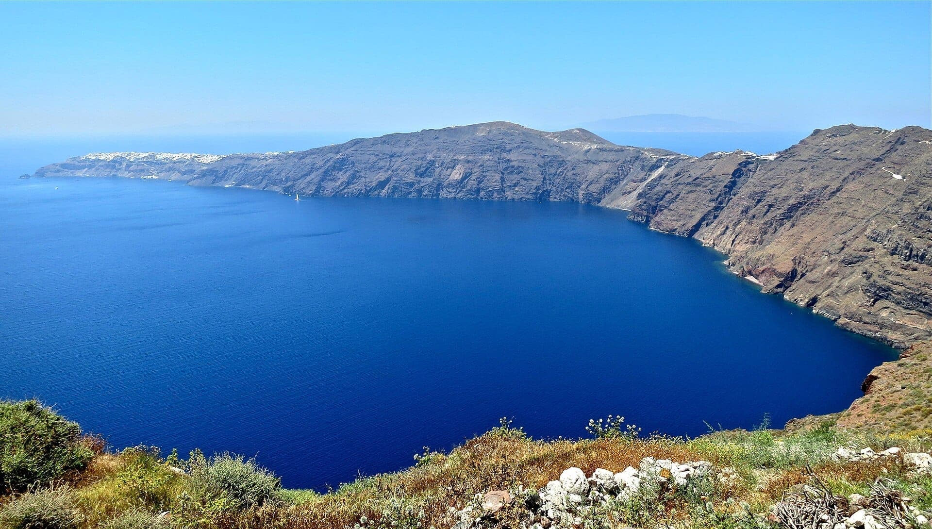
The Caldera Rim: Santorini's Signature Walks

The western edge of Santorini sits atop cliffs that drop up to 300 meters into the caldera, and the walking paths that trace this edge are among the most scenic in the Mediterranean. The best viewpoints on the island are nearly all accessible on foot from these routes. The trail from Fira north to Oia is the island's showpiece, but the shorter sections — Firostefani to Imerovigli, or the Skaros Rock detour — deserve just as much attention and attract a fraction of the crowd.
1. Walk the Full Fira–Oia Caldera Trail
The island's premier hike covers 10km along the caldera rim, passing through Firostefani and Imerovigli before reaching Oia. Allow 3–4 hours. Despite its reputation as an easy walk, uneven surfaces and sustained sun exposure make proper footwear and early starts essential.
Explore1. Walk the Full Fira–Oia Caldera Trail
The island's premier hike covers 10km along the caldera rim, passing through Firostefani and Imerovigli before reaching Oia. Allow 3–4 hours. Despite its reputation as an easy walk, uneven surfaces and sustained sun exposure make proper footwear and early starts essential.
Explore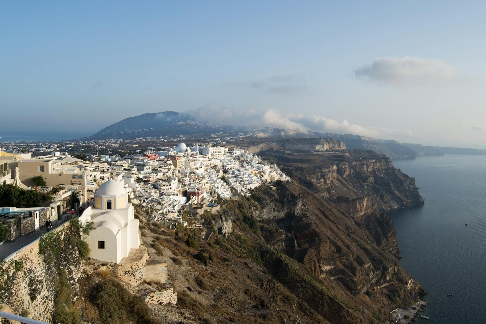
2. Warm Up on the Fira–Firostefani Cliff Path
The short caldera-edge walk from Fira to Firostefani takes 20–30 minutes and offers some of the best close-range caldera views on the island. It's a good standalone walk for those short on time, and the natural starting stretch for the full Fira–Oia trail.
Explore2. Warm Up on the Fira–Firostefani Cliff Path
The short caldera-edge walk from Fira to Firostefani takes 20–30 minutes and offers some of the best close-range caldera views on the island. It's a good standalone walk for those short on time, and the natural starting stretch for the full Fira–Oia trail.
Explore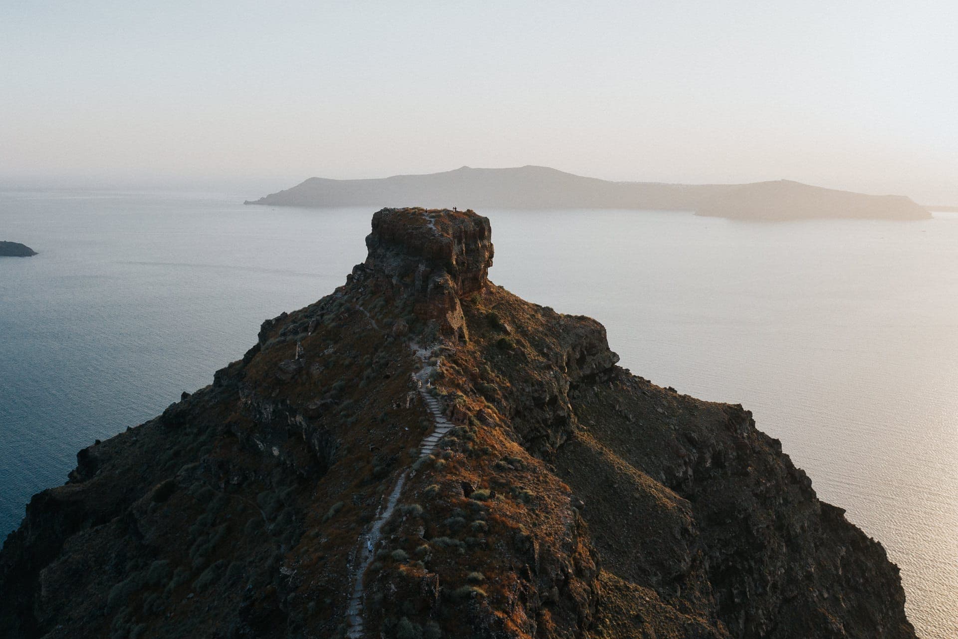
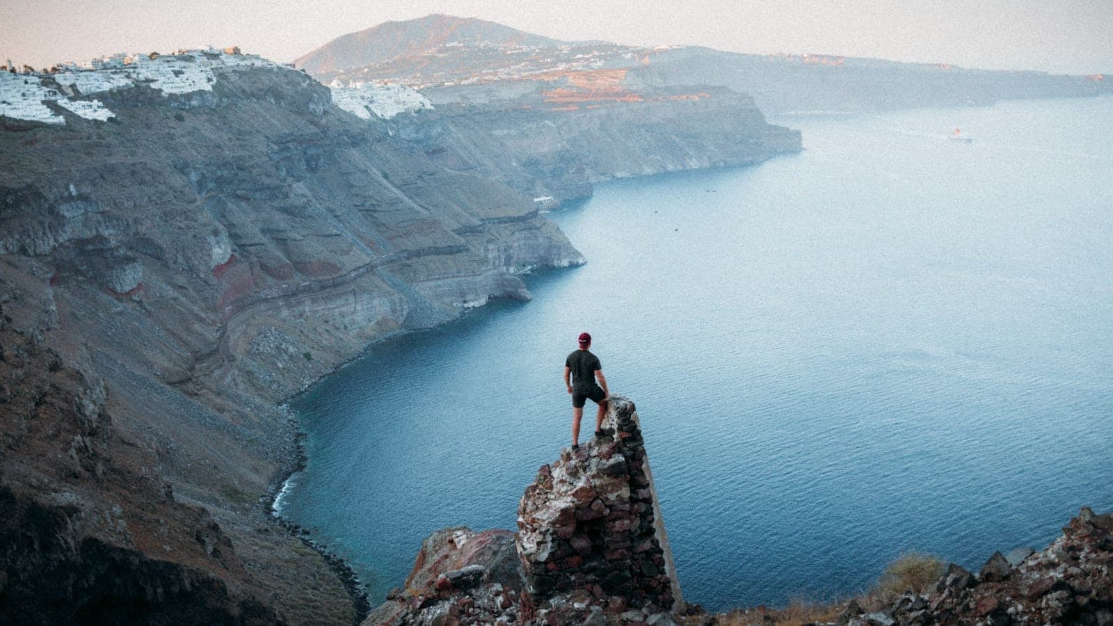
3. Hike Out to Skaros Rock from Imerovigli
This dramatic volcanic promontory juts into the caldera from Imerovigli. The out-and-back trail is roughly 2.8km from Fira and involves steep stair sections, but the summit ruins of the medieval fortress offer some of the most unobstructed caldera panoramas on the island.
Explore3. Hike Out to Skaros Rock from Imerovigli
This dramatic volcanic promontory juts into the caldera from Imerovigli. The out-and-back trail is roughly 2.8km from Fira and involves steep stair sections, but the summit ruins of the medieval fortress offer some of the most unobstructed caldera panoramas on the island.
Explore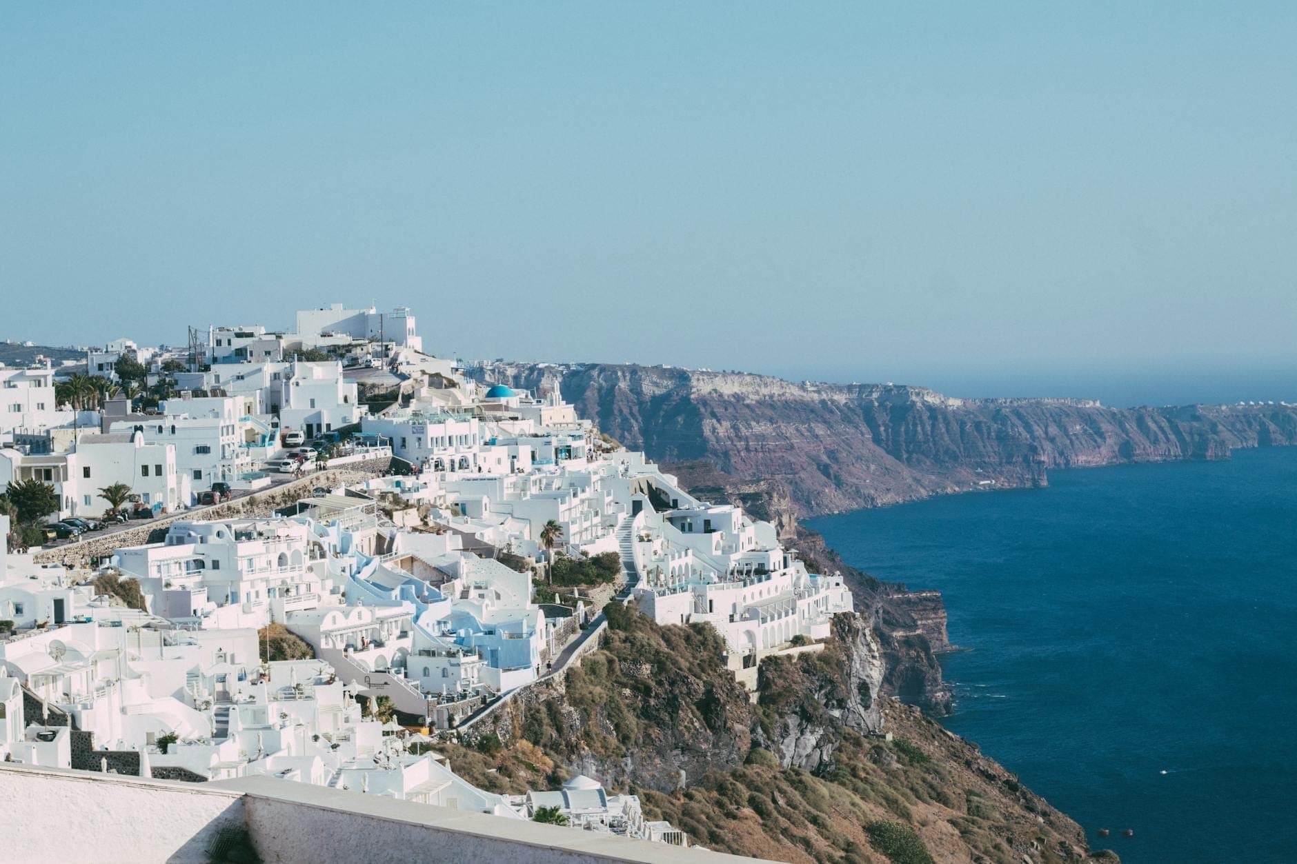
4. Pause at Imerovigli: The Caldera's Highest Village
Sitting at the highest point of the caldera rim, Imerovigli is a natural rest stop on the Fira–Oia trail. The terrace cafes and walking paths here offer the widest caldera panoramas of any village on the rim, with the entire volcanic arc visible on a clear day.
Explore4. Pause at Imerovigli: The Caldera's Highest Village
Sitting at the highest point of the caldera rim, Imerovigli is a natural rest stop on the Fira–Oia trail. The terrace cafes and walking paths here offer the widest caldera panoramas of any village on the rim, with the entire volcanic arc visible on a clear day.
Explore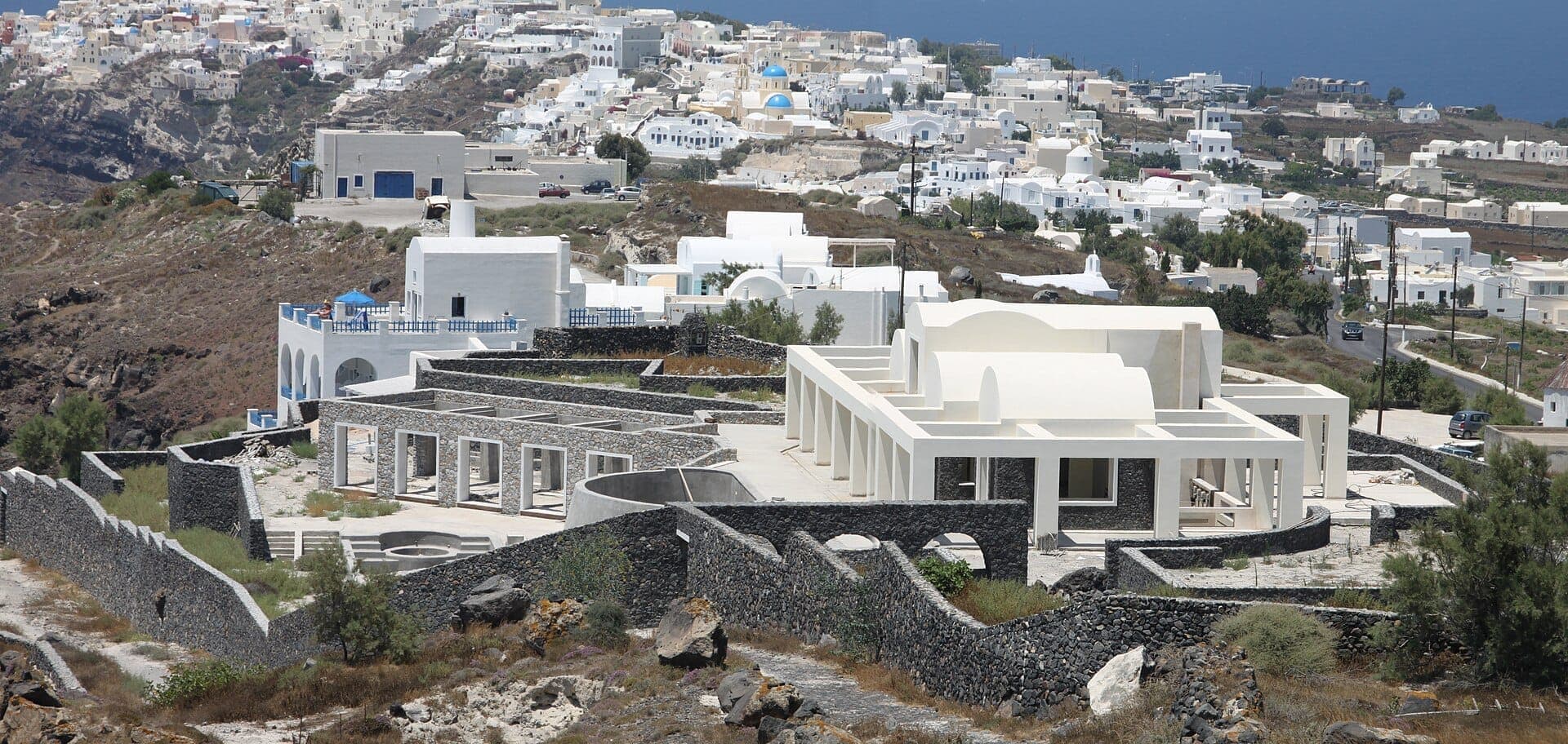
5. Start (or Finish) the Caldera Trail at Finikia
This quiet village just inland from Oia is the official northern trailhead for the Fira–Oia route. Walking through Finikia's whitewashed lanes before or after the main trail adds 20 minutes and a glimpse of a traditional Cycladic village that looks almost nothing like tourist Oia.
Explore5. Start (or Finish) the Caldera Trail at Finikia
This quiet village just inland from Oia is the official northern trailhead for the Fira–Oia route. Walking through Finikia's whitewashed lanes before or after the main trail adds 20 minutes and a glimpse of a traditional Cycladic village that looks almost nothing like tourist Oia.
Explore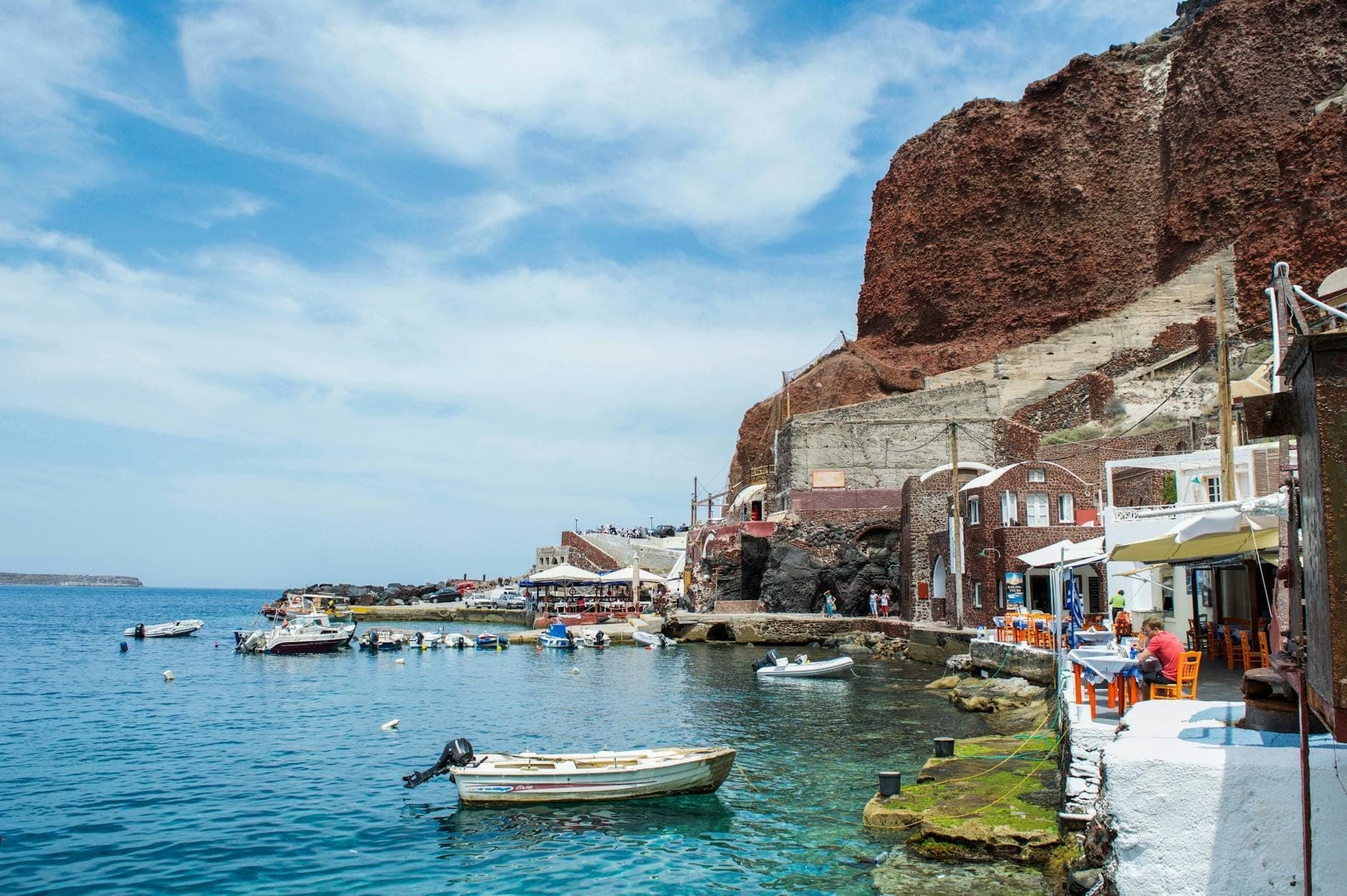
6. Descend the 300 Steps to Ammoudi Bay
The steep stone staircase from Oia down to Ammoudi Bay is a classic add-on to the caldera trail. The descent takes about 15 minutes; the return climb takes 20–25. Reward yourself with a swim off the volcanic boulders and grilled octopus at one of the dockside tavernas.
Explore6. Descend the 300 Steps to Ammoudi Bay
The steep stone staircase from Oia down to Ammoudi Bay is a classic add-on to the caldera trail. The descent takes about 15 minutes; the return climb takes 20–25. Reward yourself with a swim off the volcanic boulders and grilled octopus at one of the dockside tavernas.
ExploreHilltop & Village Hikes: Pyrgos, Monasteries, and Medieval Settlements

Santorini's interior rewards walkers who venture away from the caldera. The hill villages of Pyrgos and the monastery above it offer the island's highest viewpoints and a genuine sense of escape from the crowds. These routes pass through vineyards, dry-stone terraces, and traditional settlements where the architecture shifts from caldera-glamour to fortified medieval practicality.
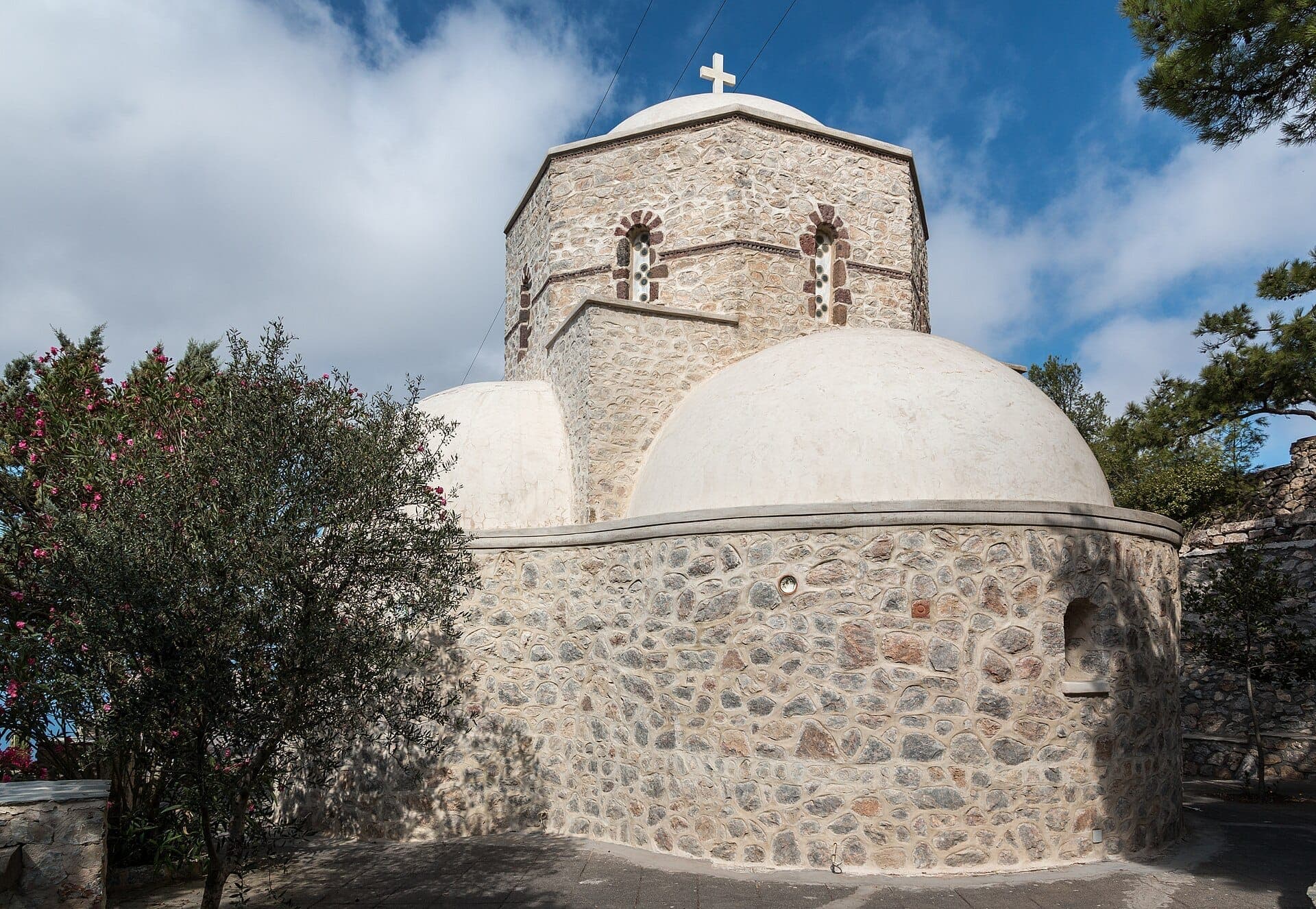
7. Hike to the Island's Highest Point at Profitis Ilias
The trail from Pyrgos to this 18th-century monastery crowns the island's highest peak at 567m. The route is roughly 3.8km through vineyards and open hillside. The summit delivers a 360-degree view covering both coasts, all major villages, and the volcanic islands in the caldera.
Explore7. Hike to the Island's Highest Point at Profitis Ilias
The trail from Pyrgos to this 18th-century monastery crowns the island's highest peak at 567m. The route is roughly 3.8km through vineyards and open hillside. The summit delivers a 360-degree view covering both coasts, all major villages, and the volcanic islands in the caldera.
Explore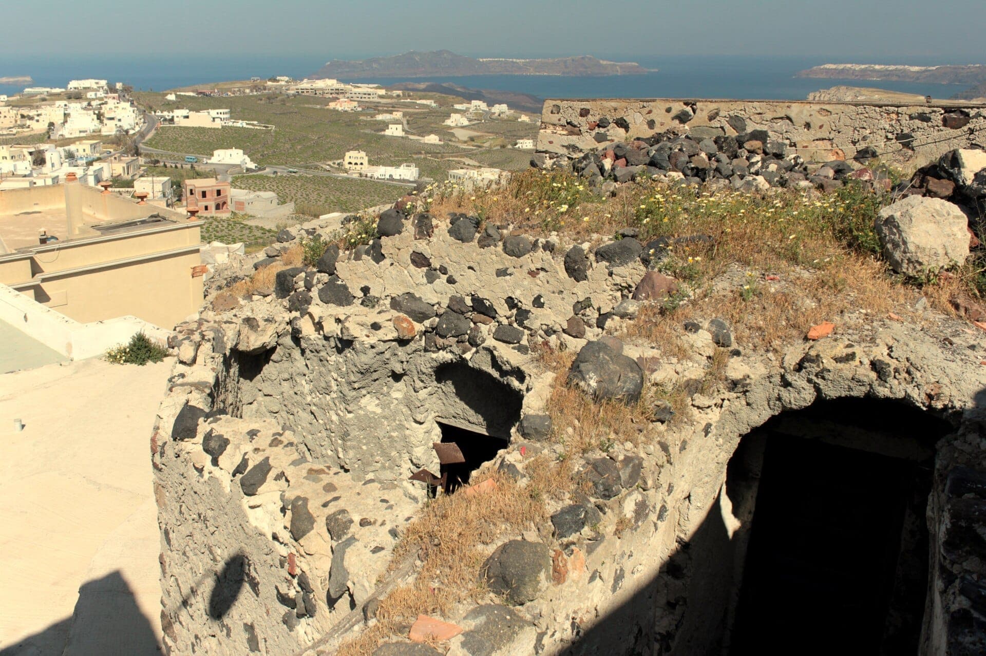
8. Explore the Concentric Lanes of Pyrgos Castle
The Venetian kasteli at the top of Pyrgos is the best-preserved medieval fortress on the island. Walking through its rings of houses and vaulted passageways is a rewarding 30–45 minute exploration, and the summit terrace gives a panorama of the entire island and both coastlines.
Explore8. Explore the Concentric Lanes of Pyrgos Castle
The Venetian kasteli at the top of Pyrgos is the best-preserved medieval fortress on the island. Walking through its rings of houses and vaulted passageways is a rewarding 30–45 minute exploration, and the summit terrace gives a panorama of the entire island and both coastlines.
Explore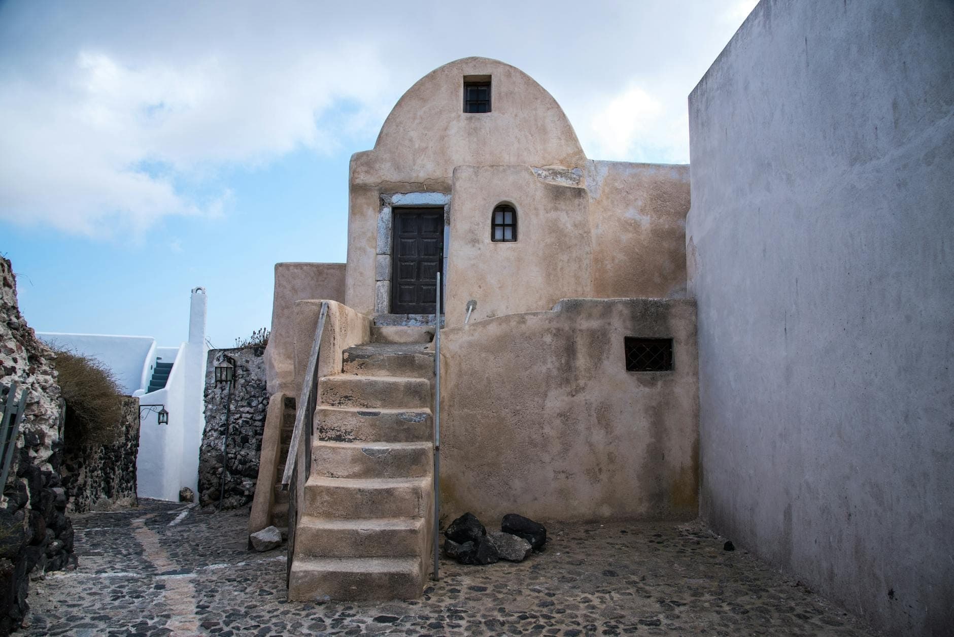
9. Get Lost in Emporio's Labyrinthine Passageways
Santorini's largest inland medieval village sees almost no tourist foot traffic. Its vaulted tunnels, fortified lanes, and Venetian castle make for a fascinating hour of walking. Combine with a bus from Fira for a half-day that feels completely removed from the caldera scene.
Explore9. Get Lost in Emporio's Labyrinthine Passageways
Santorini's largest inland medieval village sees almost no tourist foot traffic. Its vaulted tunnels, fortified lanes, and Venetian castle make for a fascinating hour of walking. Combine with a bus from Fira for a half-day that feels completely removed from the caldera scene.
Explore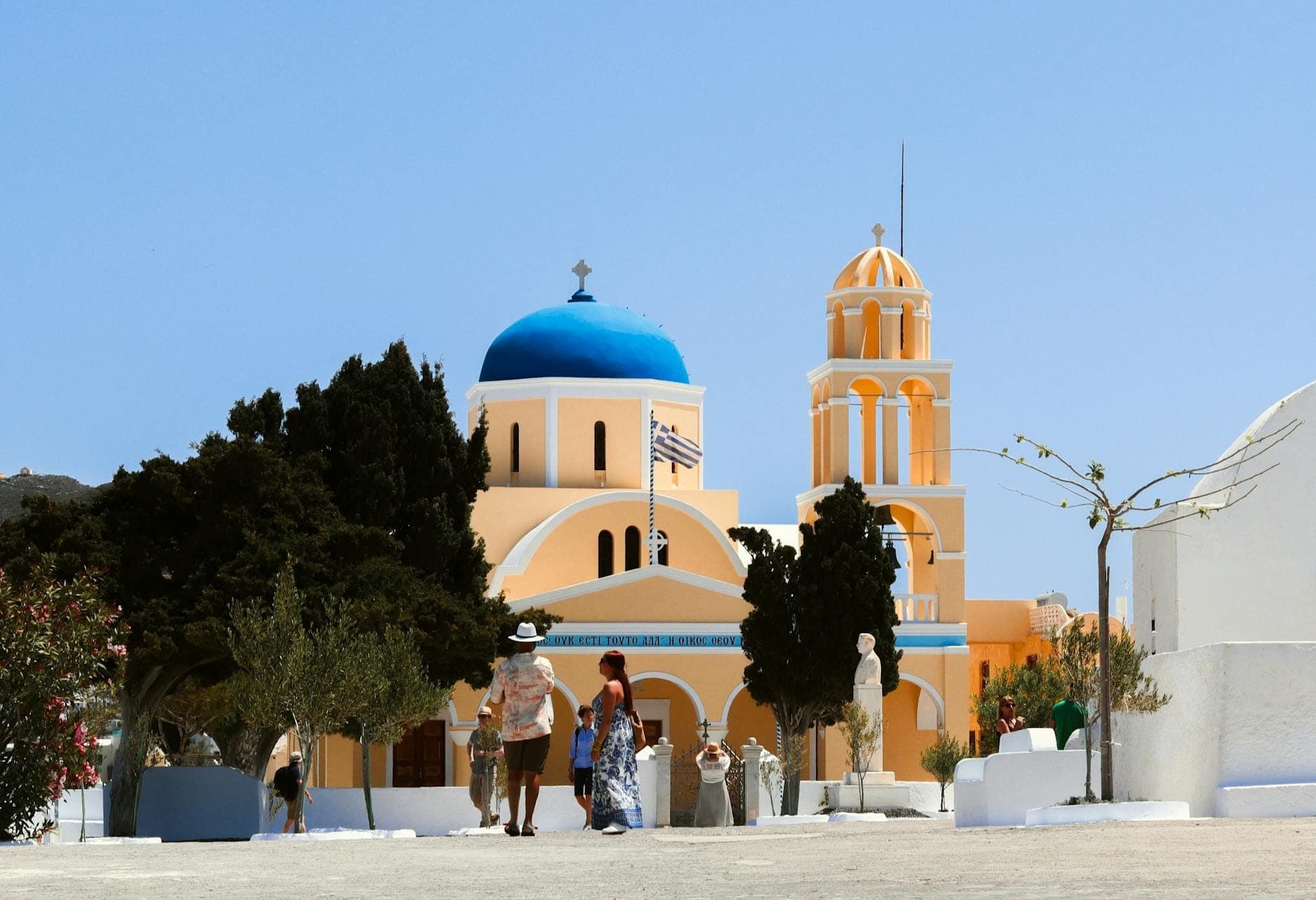
10. Stroll Through Megalochori's Wine-Cave Streets
This beautifully preserved village in the island's interior has elegant bell towers, carved cave entrances to old wine cellars, and a central square framed by bougainvillea. It's a compact but photogenic 30-minute walk, and pairs naturally with a caldera-view winery visit nearby.
Explore10. Stroll Through Megalochori's Wine-Cave Streets
This beautifully preserved village in the island's interior has elegant bell towers, carved cave entrances to old wine cellars, and a central square framed by bougainvillea. It's a compact but photogenic 30-minute walk, and pairs naturally with a caldera-view winery visit nearby.
ExploreVolcanic Terrain: Nea Kameni and the Caldera Islands

No hiking guide to Santorini is complete without the volcano. The caldera islands are accessible by boat tour from the Old Port in Fira or from Ammoudi Bay, and the hike across Nea Kameni is unlike anything else in Greece. For the full context on this extraordinary landscape, the volcano and hot springs guide covers logistics in detail.
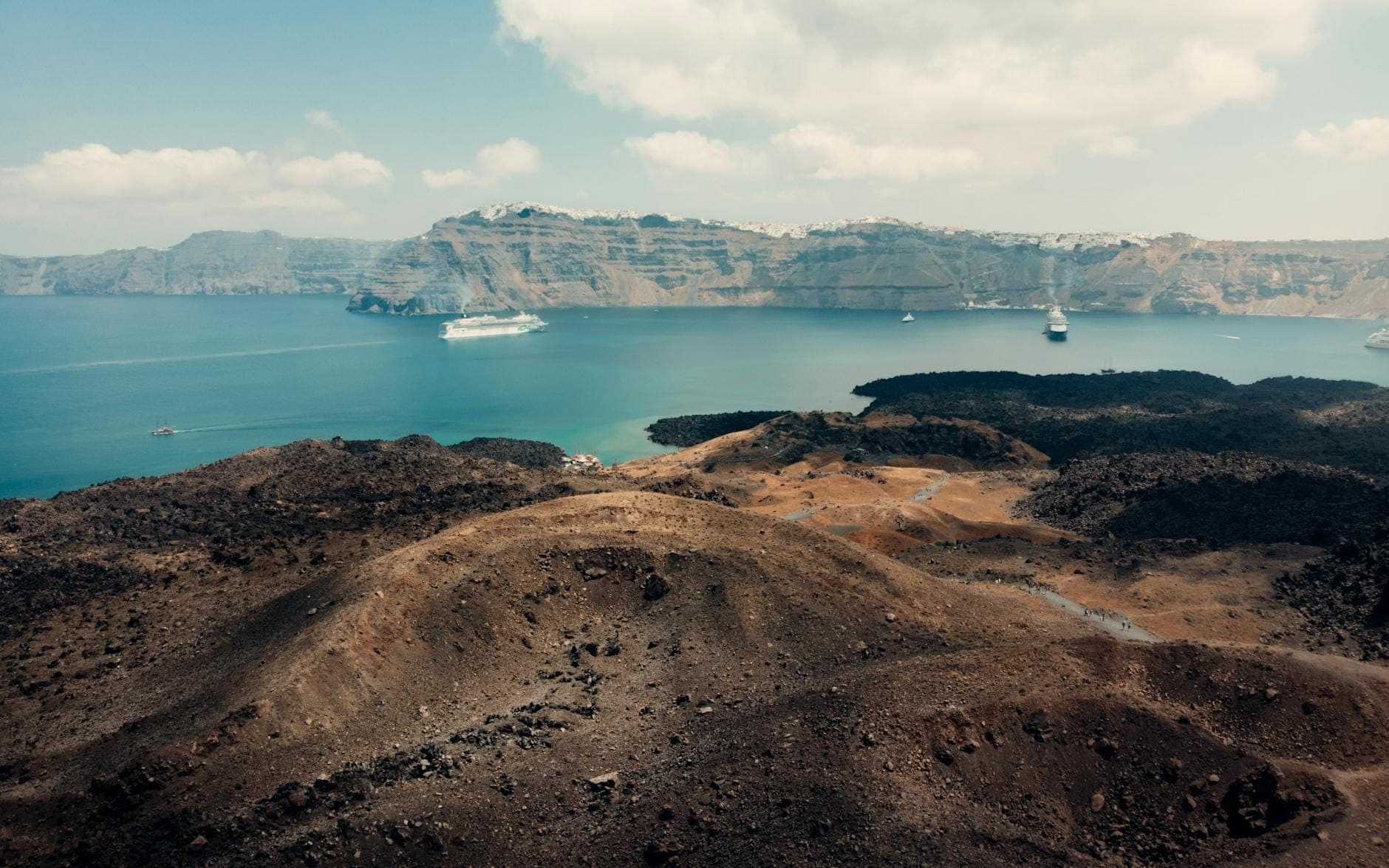
11. Hike Across Hardened Lava to the Active Crater
Nea Kameni's 30-minute crater hike crosses black and rust-colored lava fields to a steaming, sulfurous summit. The island last erupted in 1950 and remains geologically active. Most visitors join a guided boat tour from Fira's Old Port; the hike itself is straightforward but unshaded and hot.
Explore11. Hike Across Hardened Lava to the Active Crater
Nea Kameni's 30-minute crater hike crosses black and rust-colored lava fields to a steaming, sulfurous summit. The island last erupted in 1950 and remains geologically active. Most visitors join a guided boat tour from Fira's Old Port; the hike itself is straightforward but unshaded and hot.
Explore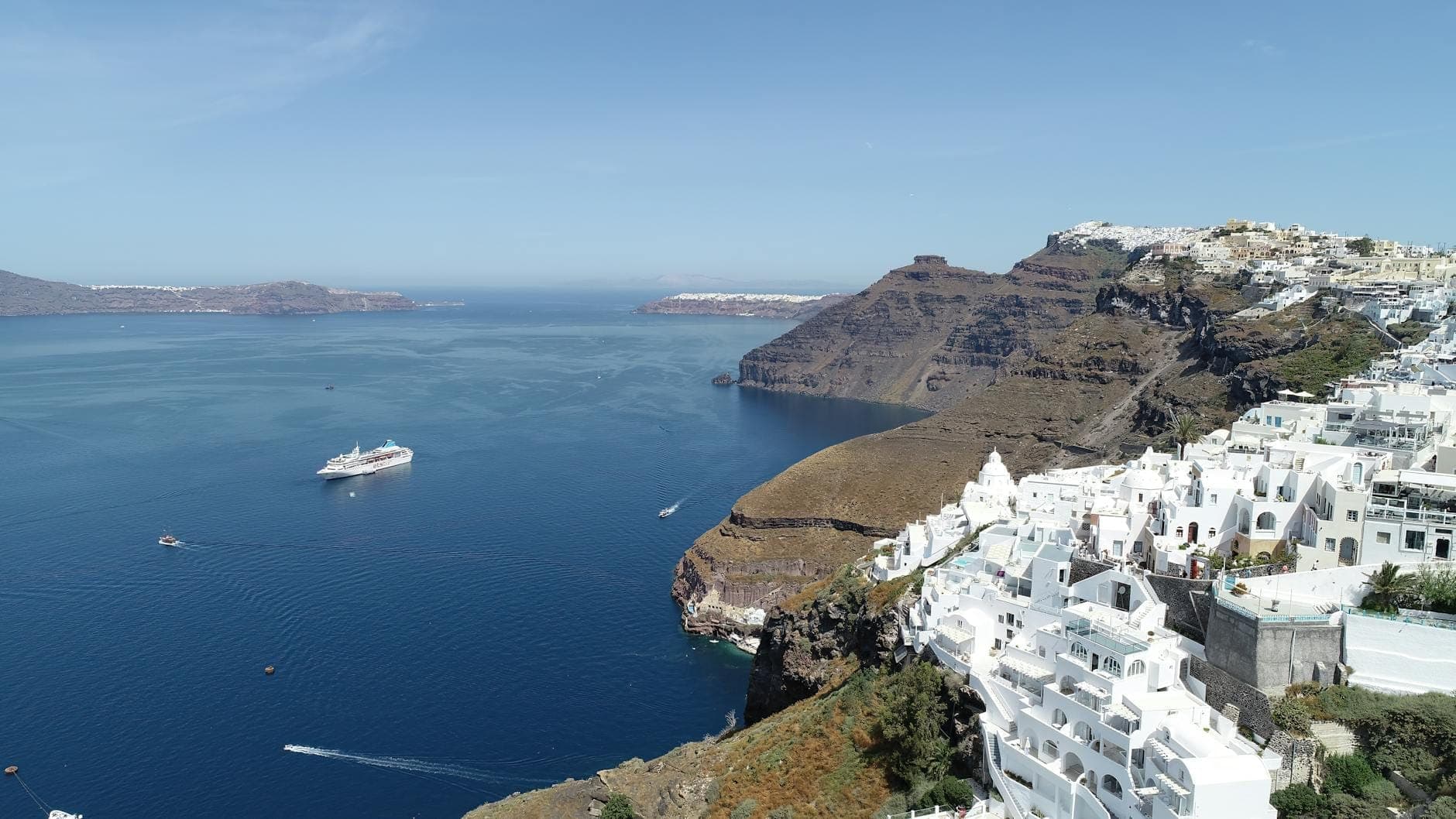
12. Understand the Scale of the Caldera You're Walking Around
The 12km-wide collapsed volcanic crater defines every trail on this list. Seeing it from the rim trails, from the volcano at its center, and from a boat at water level gives a complete picture of the geological event that shaped this island and everything built on it.
Explore12. Understand the Scale of the Caldera You're Walking Around
The 12km-wide collapsed volcanic crater defines every trail on this list. Seeing it from the rim trails, from the volcano at its center, and from a boat at water level gives a complete picture of the geological event that shaped this island and everything built on it.
Explore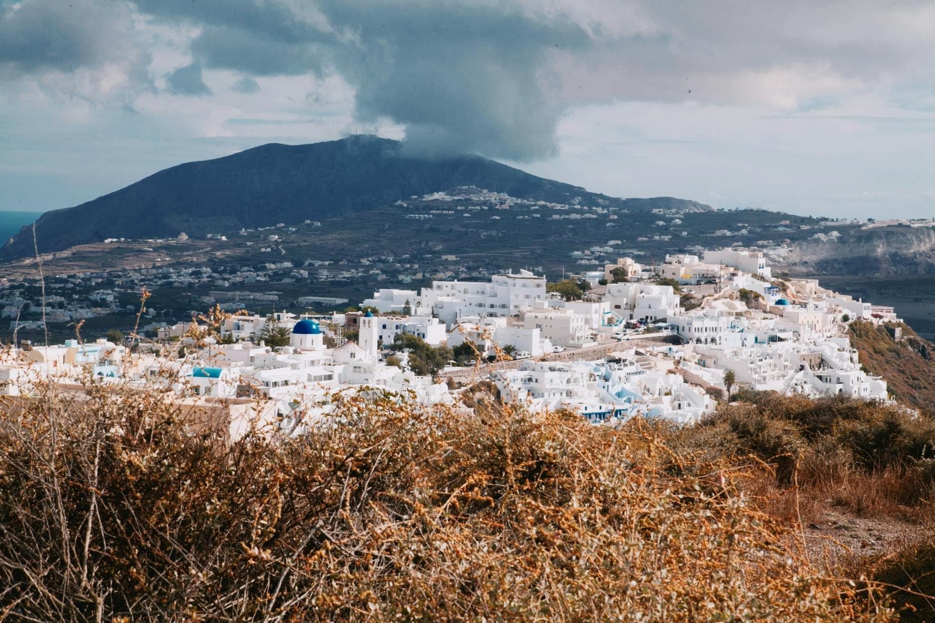
13. Climb 300 Steps to Manolas on the Island of Thirasia
Accessible by ferry, Thirasia's main village sits atop caldera cliffs reached by a steep staircase from the port. The climb takes 15–20 minutes and leads to a handful of tavernas, a quiet church, and views back across the caldera to Santorini that look like a photograph from 50 years ago.
Explore13. Climb 300 Steps to Manolas on the Island of Thirasia
Accessible by ferry, Thirasia's main village sits atop caldera cliffs reached by a steep staircase from the port. The climb takes 15–20 minutes and leads to a handful of tavernas, a quiet church, and views back across the caldera to Santorini that look like a photograph from 50 years ago.
ExploreTrails with Ancient History: Mesa Vouno and Akrotiri

Two of Santorini's most rewarding hikes lead directly to archaeological sites. The route up Mesa Vouno to Ancient Thera connects two of the island's best beaches while passing through 3,000 years of history, and the walks around Akrotiri combine dramatic coastal scenery with the Bronze Age world preserved beneath the volcanic ash. For deeper context on the island's ancient sites, the history and ancient ruins guide is essential reading before you set out.
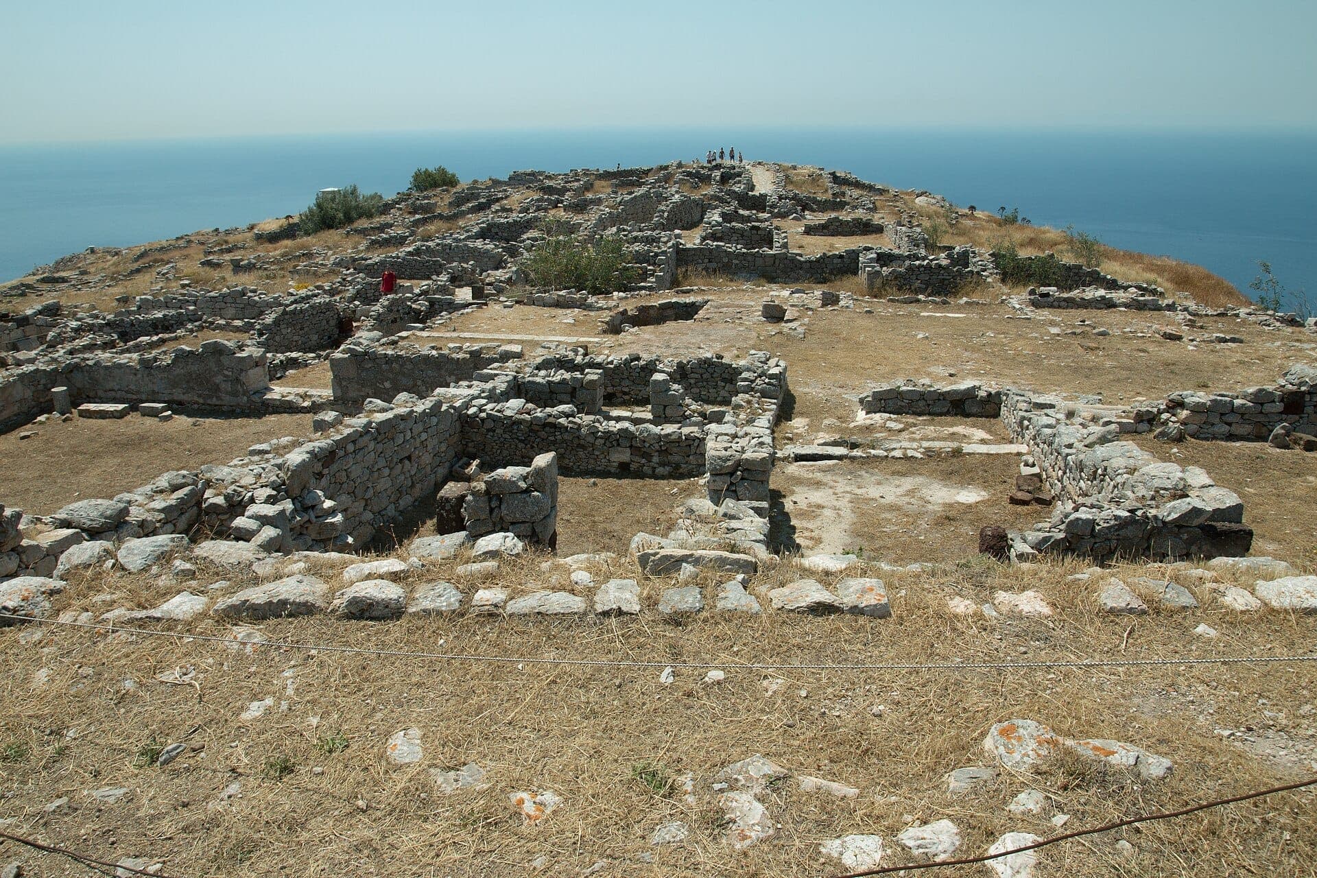
14. Hike Up Mesa Vouno to the Ruins of Ancient Thera
The cobbled trail from Kamari to Ancient Thera climbs a steep ridge with little shade to a Hellenistic city overlooking both coasts. The one-way distance is roughly 4.2km. A point-to-point route from Kamari to Perissa via the ruins takes about 1.5 hours plus site time; check current entry fees before visiting.
Explore14. Hike Up Mesa Vouno to the Ruins of Ancient Thera
The cobbled trail from Kamari to Ancient Thera climbs a steep ridge with little shade to a Hellenistic city overlooking both coasts. The one-way distance is roughly 4.2km. A point-to-point route from Kamari to Perissa via the ruins takes about 1.5 hours plus site time; check current entry fees before visiting.
Explore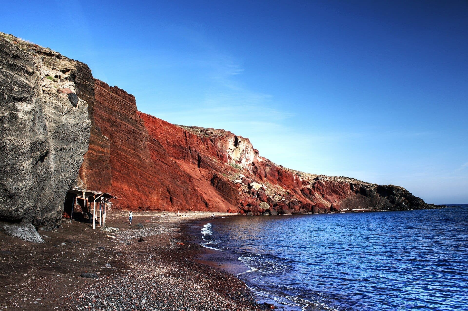
15. Walk the Cliff Path to Red Beach near Akrotiri
The 10-minute trail from the car park to Red Beach follows a narrow cliff path above the sea, with towering red and black volcanic rock rising on one side. It's short but genuinely dramatic. Combine it with White Beach, accessible by water taxi, for a half-day of volcanic coastal walking.
Explore15. Walk the Cliff Path to Red Beach near Akrotiri
The 10-minute trail from the car park to Red Beach follows a narrow cliff path above the sea, with towering red and black volcanic rock rising on one side. It's short but genuinely dramatic. Combine it with White Beach, accessible by water taxi, for a half-day of volcanic coastal walking.
Explore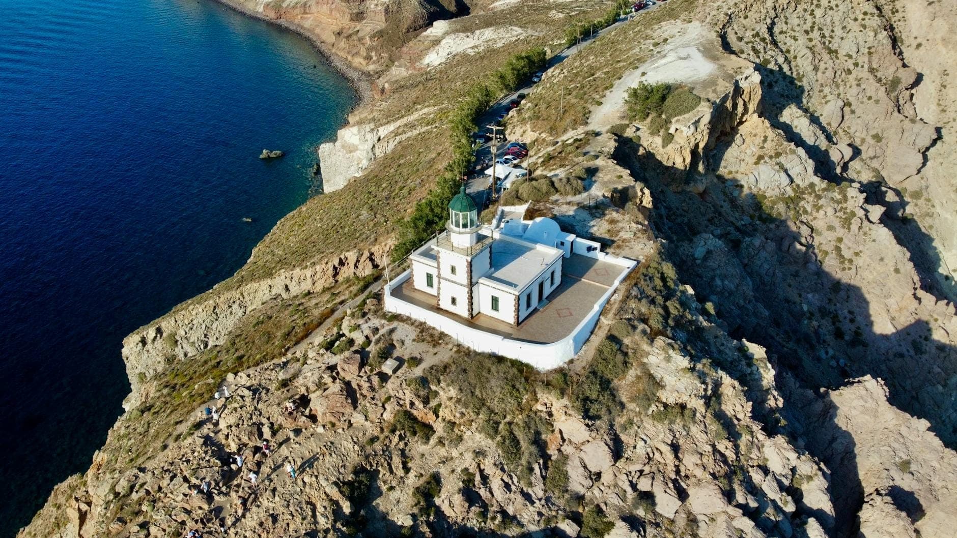
16. Walk to the Akrotiri Lighthouse at the Island's Southern Tip
The 19th-century lighthouse at the island's southernmost point is reachable on foot from the Akrotiri area. The walk passes through open, windswept terrain with caldera entrance views to the west and open Aegean to the east. It's a quieter alternative to Oia for watching the sun set over the sea.
Explore16. Walk to the Akrotiri Lighthouse at the Island's Southern Tip
The 19th-century lighthouse at the island's southernmost point is reachable on foot from the Akrotiri area. The walk passes through open, windswept terrain with caldera entrance views to the west and open Aegean to the east. It's a quieter alternative to Oia for watching the sun set over the sea.
Explore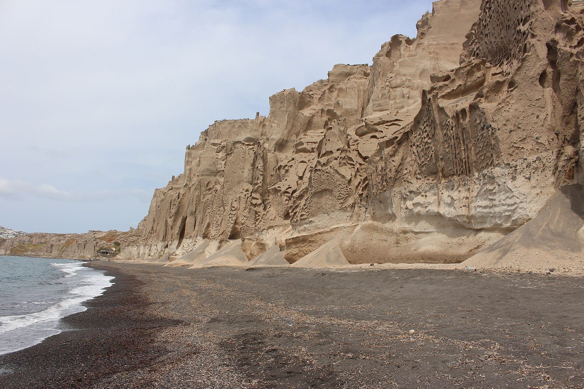
17. Walk the White Pumice Cliffs at Vlychada
The south-coast beach at Vlychada is backed by extraordinary white pumice formations eroded into lunar shapes. The beach itself is long and quiet, and walking the cliff base takes 20–30 minutes. It's one of the most atmospherically strange landscapes on the island and sees relatively few visitors.
Explore17. Walk the White Pumice Cliffs at Vlychada
The south-coast beach at Vlychada is backed by extraordinary white pumice formations eroded into lunar shapes. The beach itself is long and quiet, and walking the cliff base takes 20–30 minutes. It's one of the most atmospherically strange landscapes on the island and sees relatively few visitors.
ExploreSunset Hike Finales: Where to End Your Walk

Timing a hike to end at sunset is one of Santorini's great pleasures. The complete sunset guide covers all the options, but for hikers, the most natural finales are the castle at Oia after the caldera trail, the Skaros Rock saddle above Imerovigli, or the Profitis Ilias summit above Pyrgos. Each offers a fundamentally different perspective on the same event.
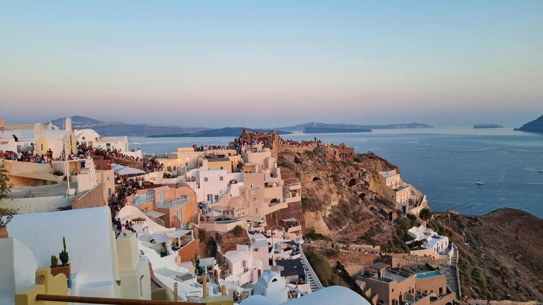
18. Time the Fira–Oia Trail to Arrive at the Castle for Sunset
The Byzantine castle ruins at Oia's northern tip are the natural endpoint of the caldera trail. In peak season, arrive at least an hour early to secure a good position — crowds here are substantial. The payoff is the most celebrated sunset view in the Greek islands, earned on foot.
Explore18. Time the Fira–Oia Trail to Arrive at the Castle for Sunset
The Byzantine castle ruins at Oia's northern tip are the natural endpoint of the caldera trail. In peak season, arrive at least an hour early to secure a good position — crowds here are substantial. The payoff is the most celebrated sunset view in the Greek islands, earned on foot.
Explore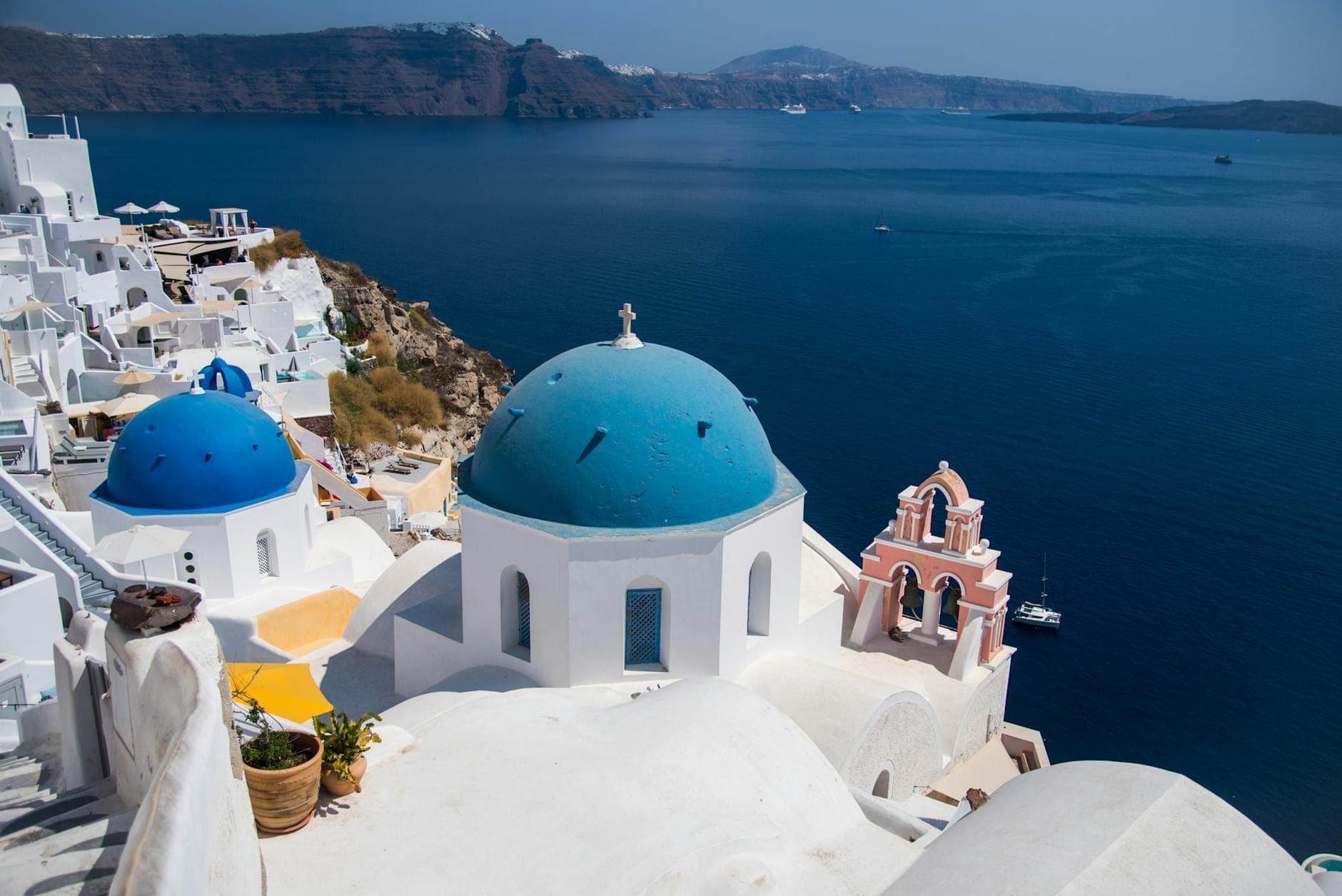
19. Photograph Oia's Blue Domes on the Final Stretch into Town
The iconic triple-domed churches near the Oia castle appear in the final kilometer of the caldera trail. Late afternoon light turns the domes a deeper blue and the whitewash golden. This is the most photographed moment of the hike — slow down and give it the time it deserves.
Explore19. Photograph Oia's Blue Domes on the Final Stretch into Town
The iconic triple-domed churches near the Oia castle appear in the final kilometer of the caldera trail. Late afternoon light turns the domes a deeper blue and the whitewash golden. This is the most photographed moment of the hike — slow down and give it the time it deserves.
ExploreFAQ
How hard is the Fira to Oia hike?
The 10km caldera trail is rated moderate. The path is mostly well-marked with some paved and cobblestone sections, but there are steep stretches near Fira and above Imerovigli, and the entire route is exposed to sun. In summer heat, even fit hikers find it tiring. Allow 3–4 hours and start before 9am.
What footwear do I need for hiking in Santorini?
Trail runners or lightweight hiking shoes are ideal for all main routes. The caldera trail mixes cobblestone, paved path, and dirt track, which can be slippery when wet. Avoid sandals or flip-flops, especially for the Mesa Vouno ascent to Ancient Thera or the Skaros Rock descent.
Can I hike from Kamari to Perissa?
Yes. The route climbs from Kamari up the old cobbled road on Mesa Vouno to Ancient Thera, then descends to Perissa. The point-to-point distance is roughly 2.9km with about 1.5 hours of hiking time, not counting time spent at the archaeological site. Check current opening hours and entry fees before visiting.
What is the best time of year to hike in Santorini?
April, May, September, and October are the best months. Temperatures are comfortable, trails are dry, and daylight hours are long. July and August are possible if you start very early, but midday temperatures on exposed trails can exceed 35°C. Winter hiking is feasible but trails can be slippery and winds strong.
Is the Nea Kameni volcano hike guided or self-guided?
Most visitors access Nea Kameni via organized boat tours that include the volcano hike, typically departing from Fira's Old Port or Ammoudi Bay. You can also take a ferry to the island independently. The hike to the crater is self-guided once on the island and takes about 30 minutes each way.