Best Self-Guided Walking Tours in Kyoto: Routes, Tips & Practical Advice
Kyoto rewards walkers more than almost any city in Japan. This guide breaks down the best self-guided walking routes by district, with timing, admission costs, crowd advice, and clear assessments of what's worth your time and what isn't.
Plan and book this trip
Tools from our partner Travelpayouts help you compare flights and hotels. If you book through them, we may earn a commission at no extra cost to you.
Flights
Hotels map
TL;DR
- Kyoto has no single official walking tour — the city's own tourism materials offer multiple routes ranging from 60 to 120 minutes, and you can combine or customize them freely.
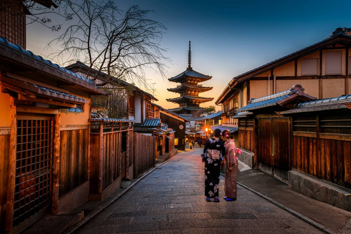
- The most rewarding self-guided walk connects Yasaka Shrinethrough Gion, Maruyama Park, Ninenzaka, and up to Kiyomizu-dera — roughly 3–4 km and 2–3 hours at a relaxed pace.
- Start before 9:00 a.m. in peak seasons (late March to early May, mid-November) to beat the crowds at Ninenzaka and Kiyomizu-dera.
- Most walking routes in Kyoto are free to follow; individual temples and shrines charge separate admission (Kiyomizu-dera: ¥500 for adults).
- Download the official KYOTO MAP for Tourist from the Kyoto Online Tourist Information Center, or pick up a free copy atKyoto Station before you head out.
Why Kyoto Is Built for Walking
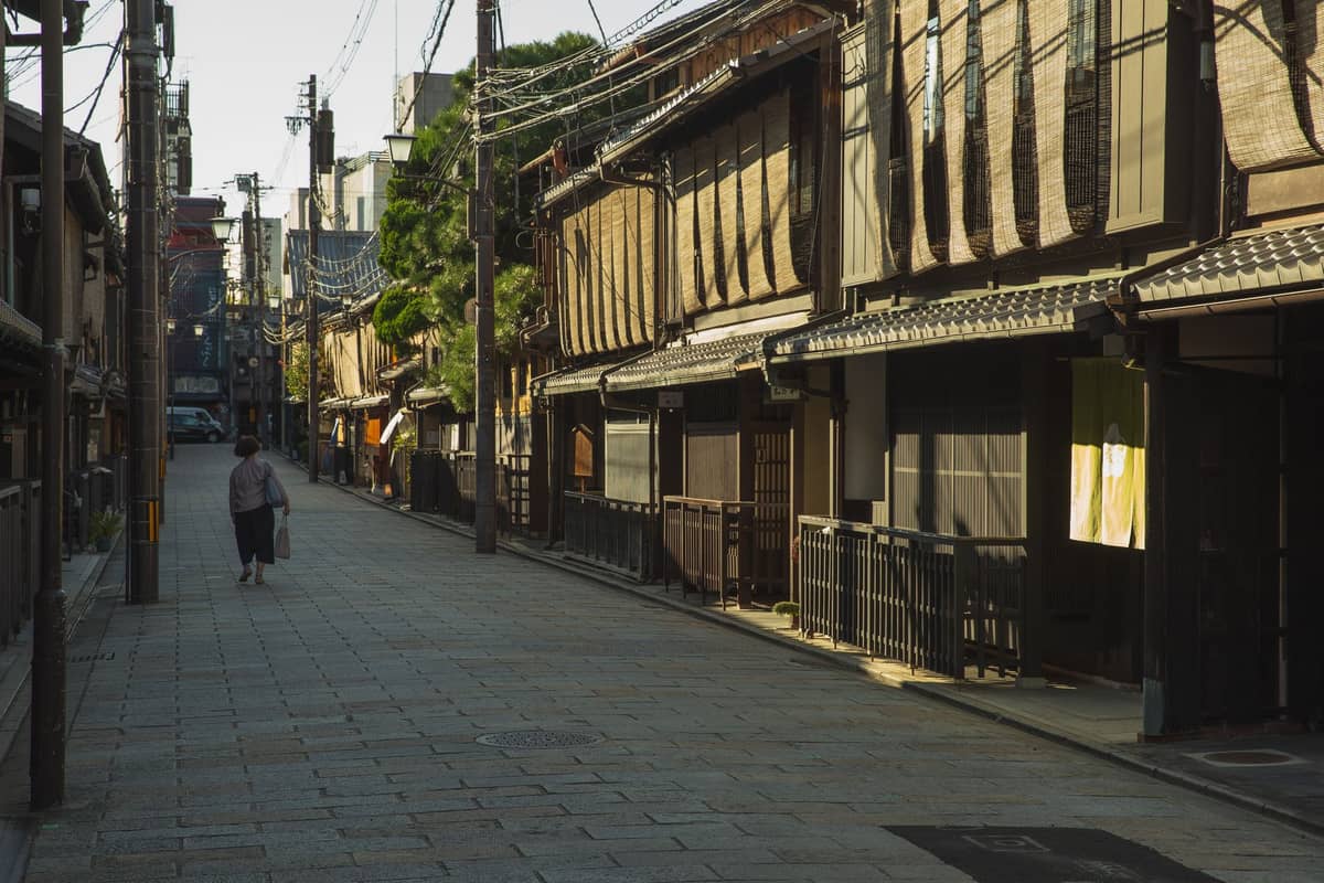
Kyoto's historic core is compact enough to cover on foot, and walking is genuinely the best way to experience it. Buses get congested in peak season, taxis add up fast, and a bicycle, while popular, forces you to lock up constantly. On foot, you can duck into a quiet alley, pause at a small neighborhood shrine, or follow the smell of roasting barley tea into a century-old shop — things no bus route accommodates.
The city sits in a basin at roughly 50 meters above sea level, surrounded by forested mountains on three sides. That geography is part of what makes it walkable: major districts likeHigashiyama, Gion, and Arashiyamaare each cohesive neighborhoods you can move through logically on two feet. Kyoto's official tourism materials recognize this too: the city provides downloadable walking maps, and Keihan Electric Railway publishes 60-, 90-, and 120-minute self-guided routes starting and ending at single stations.
⚠️ What to skip
Summer walking in Kyoto is genuinely grueling. August average highs reach 32–33°C with high humidity, intensified by the basin geography. If you visit July through August, limit your walking to early mornings (before 10:00 a.m.) and late afternoons (after 4:00 p.m.), and plan indoor stops at museums and temple halls during midday.
Route 1: The Higashiyama Heritage Walk
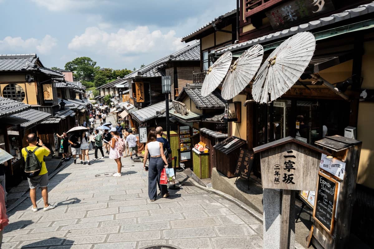
This is Kyoto's most iconic self-guided walking route, and for good reason. It strings together the highest concentration of preserved historic streetscape, major temples, and cultural landmarks in the city — all within a roughly 3–4 km corridor along the eastern foothills.
The logical starting point is Yasaka Shrineat the western end of Shijo-dori, which is free to enter at any hour. From there, walk south throughMaruyama Parkand continue uphill into the stone-paved lanes of Ninenzaka and Sannenzaka — two of the best-preserved pedestrian streets in Japan. These lanes are lined with tea shops, ceramics stores, and small restaurants in restored machiya townhouses. From Sannenzaka, the path climbs toKiyomizu-dera, the route's natural finale.
- Distance Approximately 3–4 km point to point (Yasaka Shrine to Kiyomizu-dera)
- Walking time 2–3 hours at a sightseeing pace, longer if you enter multiple temples
- Kiyomizu-dera admission ¥500 for adults, ¥200 for elementary and junior-high school students; open daily from 6:00 a.m.
- Best start time 7:00–8:30 a.m. in peak season; 9:00–10:00 a.m. is fine in off-peak months
- Special note Kiyomizu-dera holds special night-viewing sessions in spring, summer, and autumn with last entry at 9:00 p.m. — worth checking dates if your visit aligns
One lane that most visitors miss entirely is Ishibe-koji Lane, a short alley between Maruyama Park and Ninenzaka lined with traditional inns and atmospheric lanterns. It runs parallel to the main tourist flow and takes five minutes to walk, but feels like a completely different city. Also worth the short detour:Hanamikoji Streetin Gion, the formal geisha district thoroughfare best seen in early morning before the crowds and cameras arrive.
💡 Local tip
Walk the Higashiyama route south to north (Kiyomizu-dera first, Yasaka Shrine last) if you arrive by bus from Kyoto Station. Bus line 206 drops you near Kiyomizu-dera, and on weekends and holidays you can also use limited express buses EX100/EX101; you finish at Yasaka Shrine, which is a short walk to Gion subway station or the Kawaramachi shopping area for lunch.
Route 2: The Philosopher's Path and Northern Higashiyama
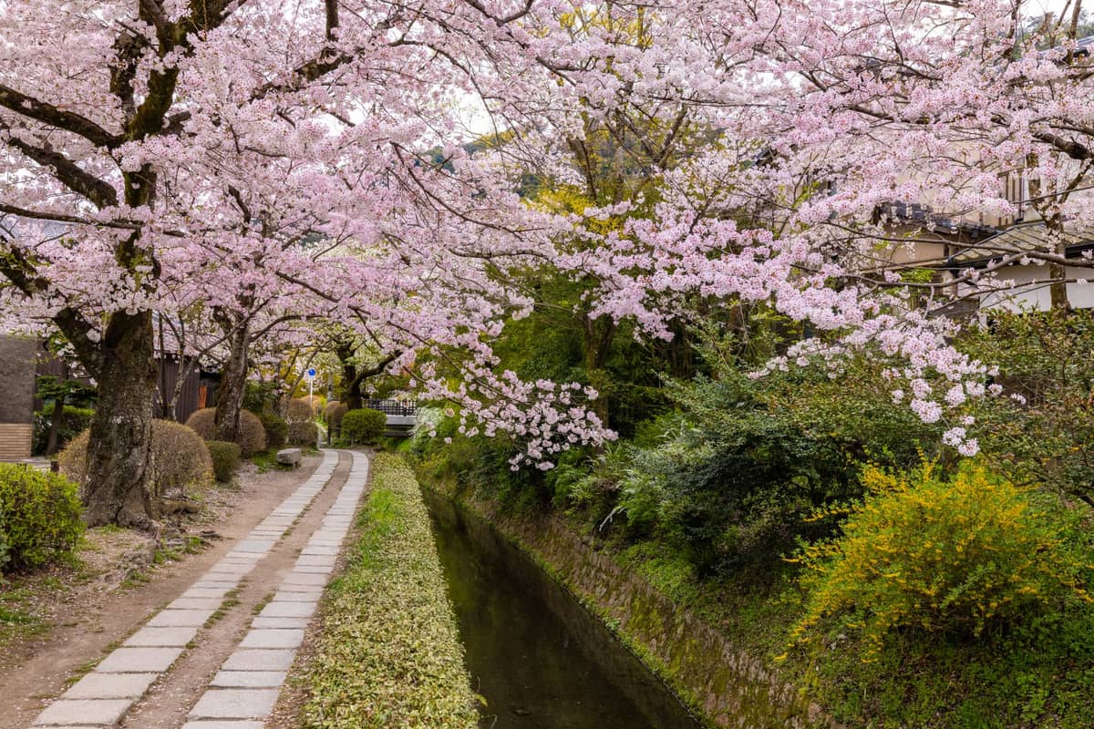
The Philosopher's Pathis a 2 km canal-side footpath connecting Ginkaku-ji (the Silver Pavilion) to the Nanzen-ji area in northern Higashiyama. It's named after the philosopher Nishida Kitaro, who reportedly walked it daily. The path itself is simple: a narrow stone-flagged walkway along a tree-lined canal, with small cafes and galleries tucked along the way.
Start at Ginkaku-ji(Silver Pavilion; admission approximately ¥500 for adults) and walk south along the canal toNanzen-ji. Nanzen-ji's grounds are free to enter, and the aqueduct running through them is one of Kyoto's stranger architectural moments — a Meiji-era red brick structure cutting through a classical Zen garden. Allow 2–3 hours for this route at a comfortable pace, including time inside both temples.
This route is at its best during cherry blossom season (typically late March to early April) when the canal is lined with blooming trees. It's also excellent in November when the maples turn. Avoid midday on weekends in those two periods — the path becomes genuinely congested. Early morning on weekdays is when it most closely resembles what the philosopher actually experienced.
Route 3: Arashiyama Loop
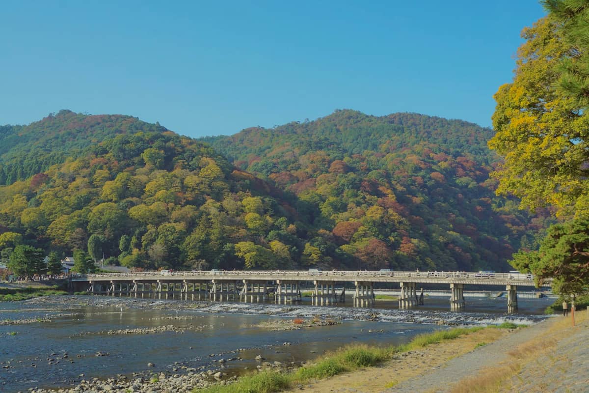
Arashiyama is often treated as a single photo stop at the bamboo grove, but there's enough here for a full half-day walking loop. Start atTogetsukyo Bridgefor the classic view across the Oi River toward the forested mountains, then walk north through the bamboo grove and into the grounds ofTenryu-ji— one of the finest Zen gardens in Japan, with a pond garden that frames the mountains behind it. Tenryu-ji charges garden admission (¥500 for high school age and above), with an additional ¥300 fee to enter the main hall buildings.
From Tenryu-ji, continue north into the quieter lane behind the bamboo grove toward Jojakko-ji and Nison-in — two small temples that receive a fraction of the bamboo grove's visitors but offer as much atmosphere. The bamboo grove itself is about 200 meters long and takes five minutes to walk through, which surprises people who've seen it only in photographs. It's best at opening time (5:00–6:00 a.m. in summer) or under rain, when the color is richer and the crowds thinner. By 10:00 a.m. on any decent day, it's shoulder-to-shoulder.
✨ Pro tip
The Arashiyama Monkey Park (Iwatayama) sits on the hillside above the Oi River and requires a 20-minute uphill walk to reach. The views from the top over Kyoto are genuinely good, and it's one of the few places in the Arashiyama area that thins out by noon. Admission is around ¥550 for adults. Factor in an extra 45–60 minutes if you include it in your loop.
Route 4: Fushimi Inari Trail
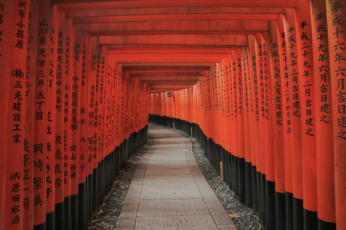
Fushimi Inari Taishais free to enter at any hour and is one of the few major Kyoto attractions that rewards an early start more than almost anywhere else. The main torii gate approach takes about 15–20 minutes to walk. The full trail to the summit of Inari-yama and back is roughly 5 km and takes 2–3 hours depending on pace and stops. Most visitors turn back at Yotsutsuji intersection (about halfway up), where a good panoramic view over the city is the standard reward.
For a deeper look at the full hike, including which sections are quietest and how to navigate the fork in trails, theFushimi Inari hiking guidecovers it in detail. The shrine is located in southern Kyoto in theFushimidistrict, reachable in about 5 minutes by JR Nara Line from Kyoto Station.
Practical Advice for All Routes
No booking or reservation is needed for any of these self-guided walking routes. The routes themselves are public paths and streets. Individual temples and shrines charge their own admission — usually between ¥400 and ¥600 for adults at major sites — but many shrines and some temple grounds are free to enter. Carry cash: smaller shops and some temple ticket windows along walking routes don't always accept cards.
- Wear shoes you can actually walk 5–8 km in. Cobblestones on Ninenzaka and stone paths at Kiyomizu-dera are uneven.
- Bring a lightweight rain layer. Kyoto's weather shifts fast, particularly in June and September.
- Download offline maps before you go — Google Maps and Maps.me both work well offline in Kyoto, and signal can be patchy in the forested hillside areas near Kurama and parts of Arashiyama.
- Tipping is not customary in Japan. If a shop owner goes out of their way to help you, a sincere bow and 'arigatou gozaimasu' is the right response.
- Tap water throughout Kyoto is safe to drink — carry a refillable bottle to avoid the cost and waste of buying bottled water at every stop.
- Temple dress codes are relaxed compared to some other countries, but covering shoulders and knees is appropriate when entering main halls.
Timing matters significantly. Spring and autumnbring the best walking weather (April-May averages 13–24°C; October-November averages 15–24°C) but also peak tourist volumes. Winter is cold (January daytime averages around 5–8°C) but uncrowded, with occasional snow that makes temple gardens and stone paths look extraordinary. Summer is brutal for extended walking unless you start very early.
ℹ️ Good to know
Kyoto's official tourism bureau provides a free downloadable 'KYOTO MAP for Tourist' from the Kyoto Online Tourist Information Center. Keihan Electric Railway also publishes a 'My Route Kyoto Map' with 60-, 90-, and 120-minute self-guided routes beginning and ending at Keihan stations — useful if you're entering the city from Osaka via the Keihan line.
For first-time visitors deciding how to structure multiple days of walking, the3-day Kyoto itinerarymaps out which routes to pair together logically. If you're working with limited time, themain things to do in Kyotoguide helps prioritize by district. Visitors interested specifically in temple etiquette and how to behave respectfully along walking routes should read theKyoto temple etiquette guide before arriving.
FAQ
Do I need to book a Kyoto walking tour in advance?
No booking is required for self-guided walking routes — they follow public streets and paths. Individual temple or shrine admissions are paid at the gate on arrival. If you want a guided walking tour with a local guide through platforms like GuruWalk, those do benefit from advance registration, particularly in peak spring and autumn seasons.
How long does it take to walk from Yasaka Shrine to Kiyomizu-dera?
The direct route takes about 30–40 minutes walking without stops. With time for Maruyama Park, a look at Kodai-ji, and a browse through Ninenzaka and Sannenzaka, plan on 2–3 hours. Add another 30–45 minutes for the Kiyomizu-dera grounds themselves.
Is the Arashiyama bamboo grove worth visiting on a self-guided walk?
Yes, but manage your expectations. The grove is about 200 meters long and takes five minutes to walk through. The crowds from mid-morning onward make photography difficult and the experience rushed. It's worth visiting as part of the broader Arashiyama loop, especially combined with Tenryu-ji's garden, rather than as a standalone destination.
What is the best time of year for walking tours in Kyoto?
October and November offer the most comfortable walking conditions: daytime temperatures around 17–22°C, low humidity, and autumn foliage at major sites. April and early May are equally pleasant weather-wise but more crowded. Summer (July–August) is manageable only with early-morning starts due to heat and humidity. Winter (December–February) is cold but uncrowded, with daytime temperatures around 5–10°C.
Are there free walking routes in Kyoto?
Yes. The walking routes themselves cost nothing to follow — Gion's streets, the Philosopher's Path, the Higashiyama lanes, and the outer grounds of most shrines are all free to walk. Individual temples charge admission (typically ¥500 for adults), and Fushimi Inari Taisha is completely free to enter at any hour.