Best Hikes & Walks Near Brisbane: Trails, Coastal Paths & City Strolls
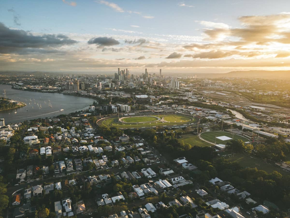
Brisbane delivers more than its size suggests for outdoor walking. Whether you want a quick riverside stroll through the CBD, a serious bushland hike, or a dramatic coastal walk on a nearby island, the city and its surrounds deliver. This guide covers the best hikes and walks near Brisbane, organised by type and difficulty.
Tickets & tours
Live prices and dates from our booking partner. If you book, we may earn a commission at no extra cost to you.
Brisbane sits on the traditional lands of the Turrbal and Jagera peoples, and the landscapes that make it such rewarding walking territory, from forested ridges to tidal wetlands and rocky headlands, reflect that deep connection to Country. You don't need to travel far: some of the best trails are within 15 minutes of the CBD, including the extensive network at Mount Coot-tha, which alone offers over 18.5 km of graded tracks. Further afield, North Stradbroke Island and Moreton Island add spectacular coastal walking to the mix. If you're planning a fuller itinerary, the things to do in Brisbane guide covers the city's broader attractions, and the day trips from Brisbane guide is worth reading before you book any island ferries.
💡 Local tip
Always carry water, wear sun protection, and check Brisbane City Council or Queensland Parks websites for track closures before heading out, especially after heavy rain when creek crossings can become dangerous.
Bushland Hikes Close to the CBD
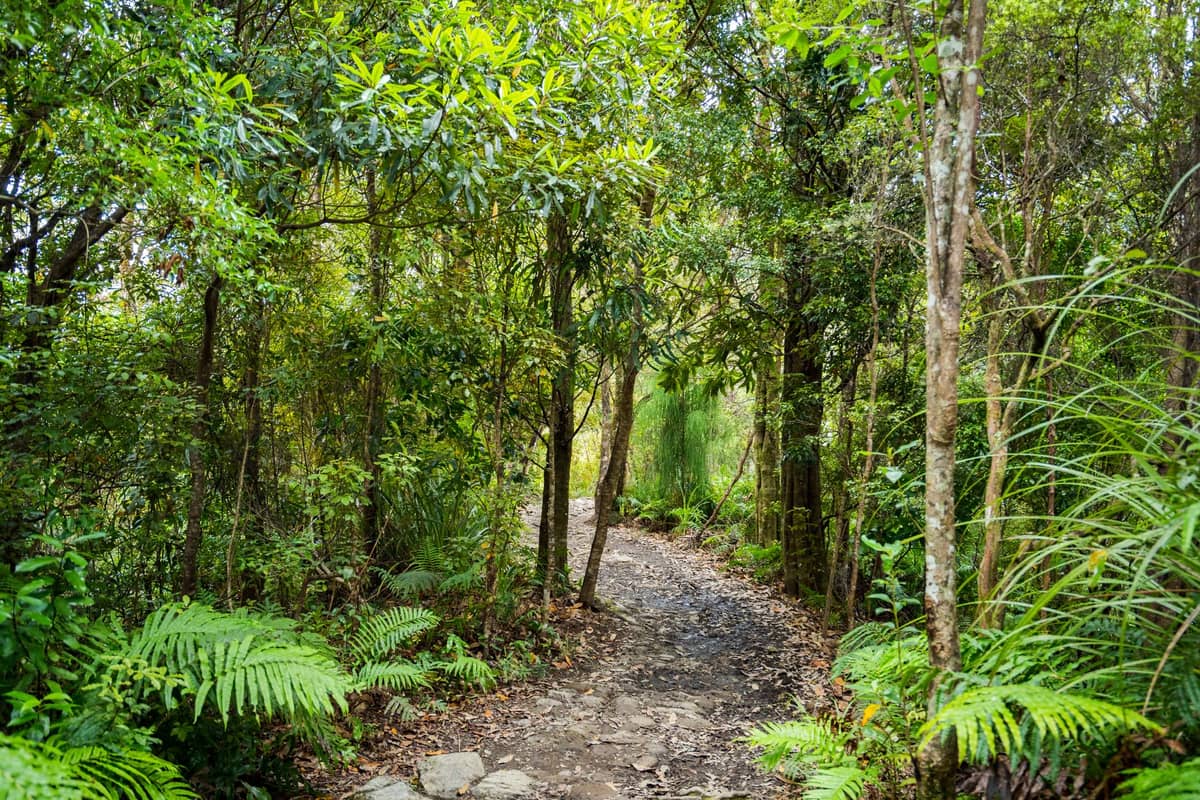
The forested hills west of Brisbane make it one of the few major Australian cities where you can be deep in eucalypt bush within 20 minutes of the city centre. The Mount Coot-tha reserve is the centrepiece, but D'Aguilar and Toohey Forest both offer serious alternatives for those wanting more solitude.
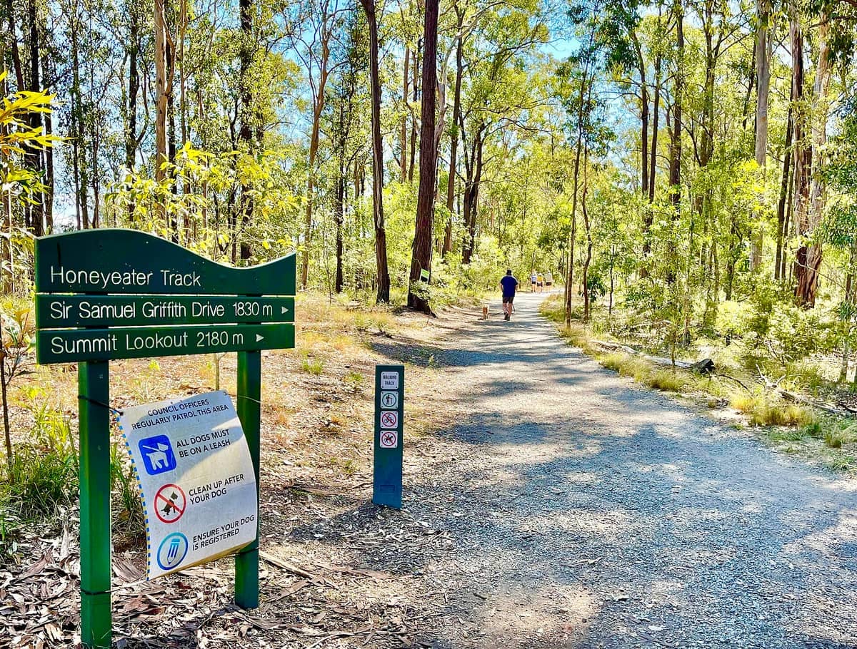
1. Hike the Bush Trails at Mount Coot-tha Forest Reserve
More than 18.5 km of graded tracks through eucalypt forest, with routes to Simpson Falls and J.C. Slaughter Falls. The Summit Track is 1.9 km each way from J.C. Slaughter Falls picnic area. Allow extra time after rain, as creek crossings can become unsafe.
Explore1. Hike the Bush Trails at Mount Coot-tha Forest Reserve
More than 18.5 km of graded tracks through eucalypt forest, with routes to Simpson Falls and J.C. Slaughter Falls. The Summit Track is 1.9 km each way from J.C. Slaughter Falls picnic area. Allow extra time after rain, as creek crossings can become unsafe.
Explore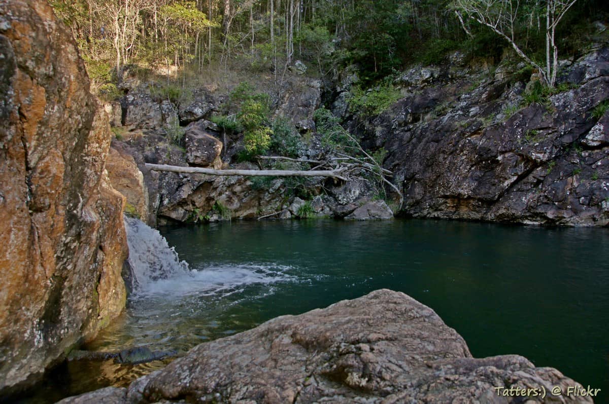
2. Explore D'Aguilar National Park's Rainforest Gullies
Over 36,000 hectares of bushland on Brisbane's doorstep, with trails ranging from easy creek-side walks to full-day hikes through rainforest gullies. Wildlife spotting, including wallabies and echidnas, is common on quieter morning walks.
Explore2. Explore D'Aguilar National Park's Rainforest Gullies
Over 36,000 hectares of bushland on Brisbane's doorstep, with trails ranging from easy creek-side walks to full-day hikes through rainforest gullies. Wildlife spotting, including wallabies and echidnas, is common on quieter morning walks.
Explore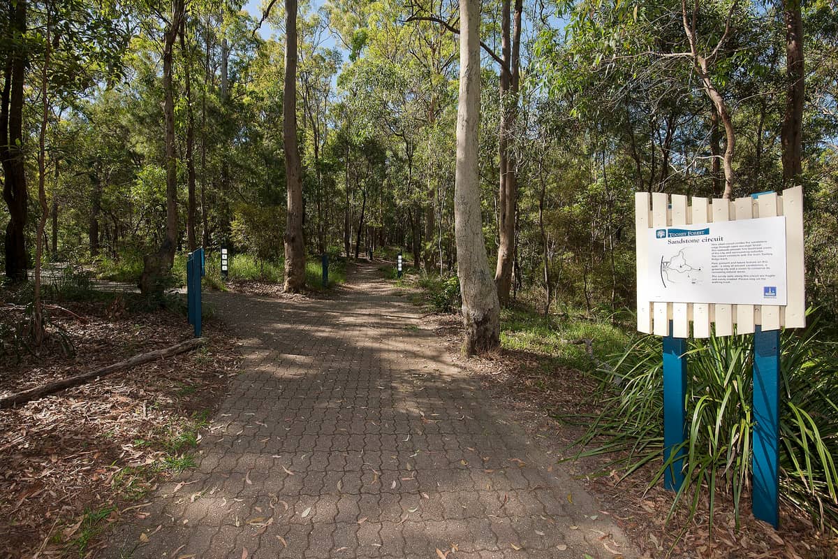
3. Walk the Dry Forest Trails at Toohey Forest Park
A 650-hectare bushland reserve in Brisbane's south, surprisingly wild for a park within city limits. Dry eucalypt forest trails suit walkers and mountain bikers alike. Go early on weekday mornings for the best chance of seeing wildlife and avoiding trail traffic.
Explore3. Walk the Dry Forest Trails at Toohey Forest Park
A 650-hectare bushland reserve in Brisbane's south, surprisingly wild for a park within city limits. Dry eucalypt forest trails suit walkers and mountain bikers alike. Go early on weekday mornings for the best chance of seeing wildlife and avoiding trail traffic.
ExploreScenic Viewpoint Walks

Brisbane's terrain rewards those who earn their views. The best panoramas in the region, from the Glass House Mountains to Moreton Bay, open up from hilltop and headland trails. For a full overview of the city's best vantage points, the best views in Brisbane guide pairs well with this section.

4. Walk to the Mount Coot-tha Lookout for Panoramic City Views
Brisbane's most famous viewpoint, accessible on foot via the Summit Track or by car. On clear days you can see across the city to Moreton Bay and the Glass House Mountains. Sunrise and dusk visits reward walkers with the best light and fewer crowds.
Explore4. Walk to the Mount Coot-tha Lookout for Panoramic City Views
Brisbane's most famous viewpoint, accessible on foot via the Summit Track or by car. On clear days you can see across the city to Moreton Bay and the Glass House Mountains. Sunrise and dusk visits reward walkers with the best light and fewer crowds.
Explore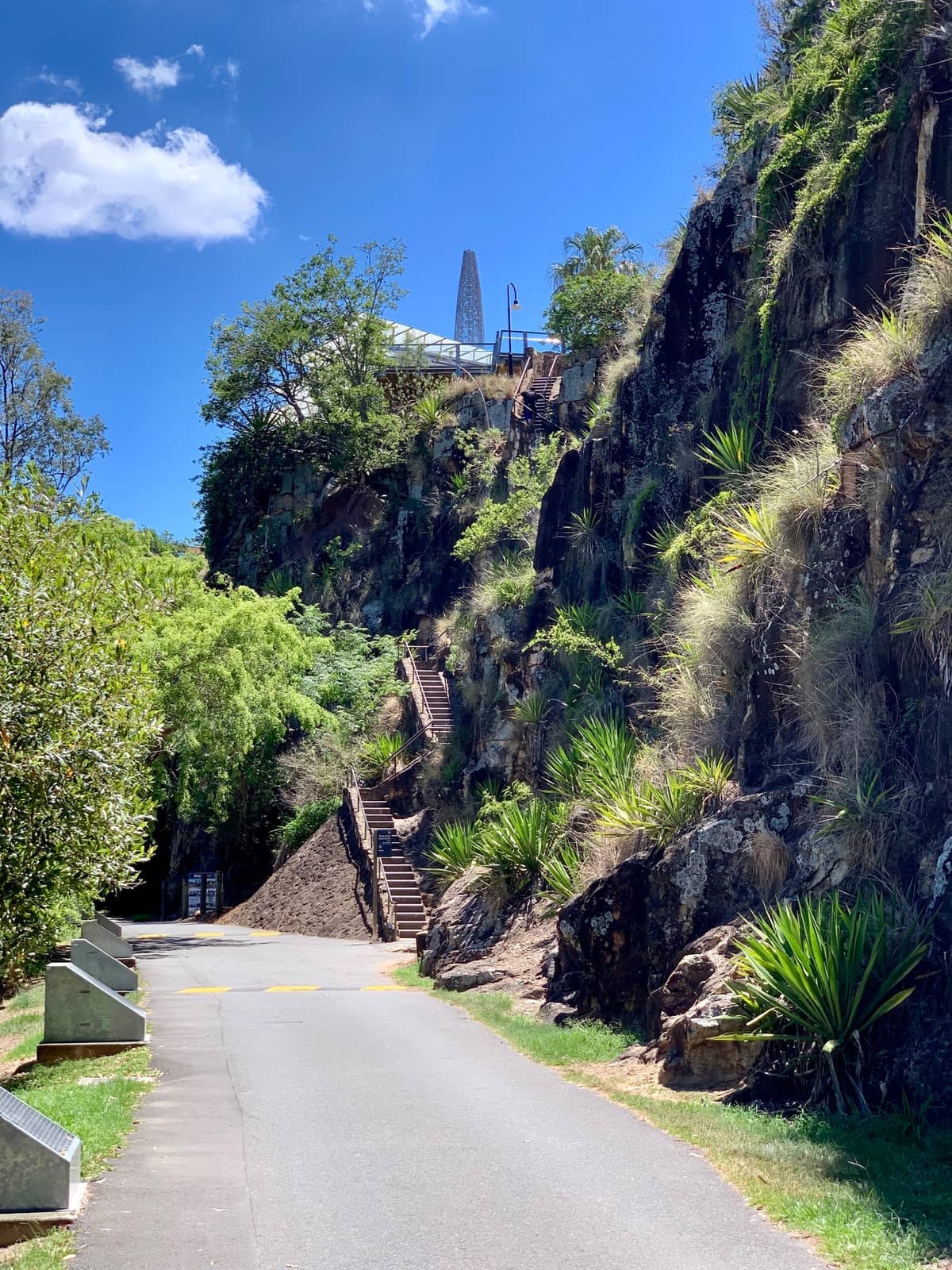
5. Walk the Kangaroo Point Cliffs for CBD Skyline Views
Basalt cliffs rising 20 metres above the Brisbane River deliver one of the city's most dramatic skyline perspectives. The riverside path here connects to the broader South Bank walking loop. Come at dusk when the city lights reflect across the water.
Explore5. Walk the Kangaroo Point Cliffs for CBD Skyline Views
Basalt cliffs rising 20 metres above the Brisbane River deliver one of the city's most dramatic skyline perspectives. The riverside path here connects to the broader South Bank walking loop. Come at dusk when the city lights reflect across the water.
Explore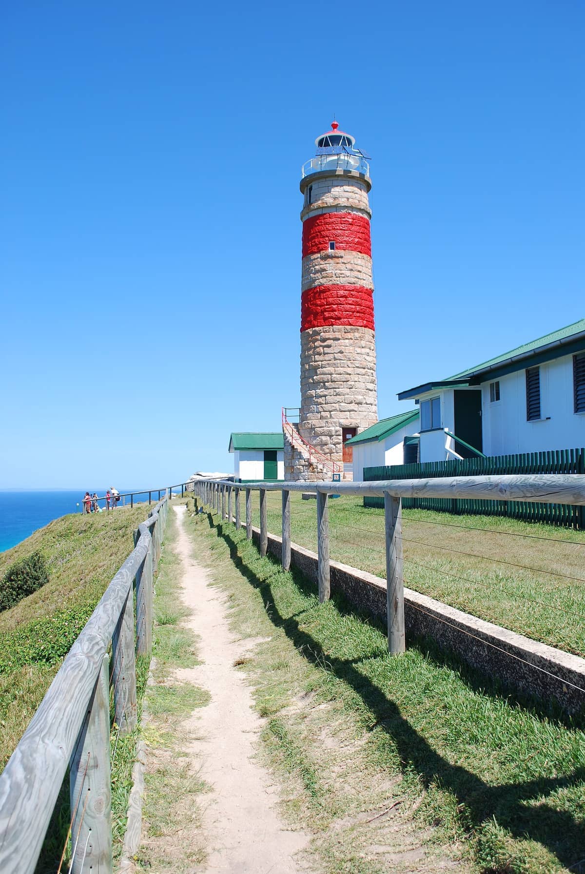
6. Hike to Cape Moreton Lighthouse on Moreton Island
Queensland's oldest lighthouse, built in 1857, sits atop dramatic headland on Moreton Island's northern tip. The walk up from the beach track takes roughly 30-45 minutes and rewards with sweeping ocean views and excellent whale watching from June to November.
Explore6. Hike to Cape Moreton Lighthouse on Moreton Island
Queensland's oldest lighthouse, built in 1857, sits atop dramatic headland on Moreton Island's northern tip. The walk up from the beach track takes roughly 30-45 minutes and rewards with sweeping ocean views and excellent whale watching from June to November.
ExploreIsland & Coastal Walks
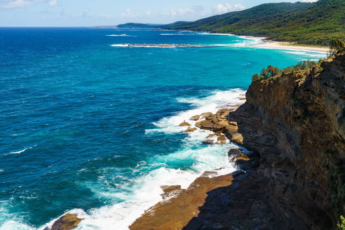
Some of Queensland's finest short walks are a ferry ride from Brisbane. The North Gorge Walk on North Stradbroke Island is genuinely world-class for a coastal trail of its length, and Moreton Island's sand dunes add an otherworldly dimension to any hiking day. Both islands deserve an overnight stay if your schedule allows; see the North Stradbroke Island guide and the Moreton Island day trip guide for logistics.
7. Walk the North Gorge Track at Point Lookout
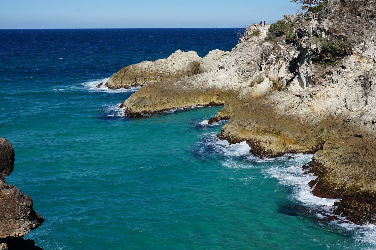
A 1.2 km loop along dramatic headland above sea caves and rock pools at Point Lookout. The clifftop views are exceptional, and this is one of Queensland's best spots for watching humpback whales between June and November. Allow 45 to 60 minutes at a relaxed pace.
Explore7. Walk the North Gorge Track at Point Lookout
A 1.2 km loop along dramatic headland above sea caves and rock pools at Point Lookout. The clifftop views are exceptional, and this is one of Queensland's best spots for watching humpback whales between June and November. Allow 45 to 60 minutes at a relaxed pace.
Explore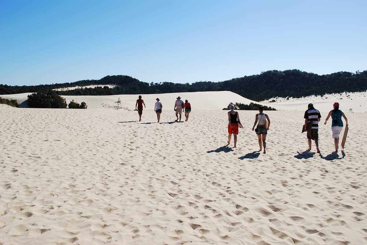
8. Trek the Sand Dunes of Moreton Island's Desert
Moreton Island's inland desert features towering sand dunes you can hike up and sandboard down. It's physically demanding in the heat, so start early and carry plenty of water. The scale of the dunes is genuinely surprising for somewhere so close to Brisbane.
Explore8. Trek the Sand Dunes of Moreton Island's Desert
Moreton Island's inland desert features towering sand dunes you can hike up and sandboard down. It's physically demanding in the heat, so start early and carry plenty of water. The scale of the dunes is genuinely surprising for somewhere so close to Brisbane.
Explore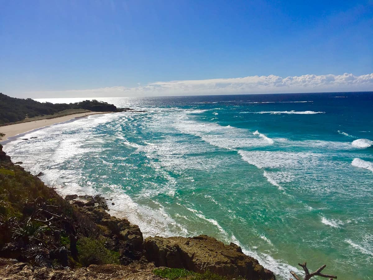
9. Walk the Headland at Cylinder Beach, North Stradbroke
Cylinder Beach anchors a pleasant coastal walk along the Point Lookout foreshore, passing surf breaks and connecting to the North Gorge track. The sheltered beach is patrolled and ideal for a swim before or after the walk. Dolphins are regularly spotted from the headland.
Explore9. Walk the Headland at Cylinder Beach, North Stradbroke
Cylinder Beach anchors a pleasant coastal walk along the Point Lookout foreshore, passing surf breaks and connecting to the North Gorge track. The sheltered beach is patrolled and ideal for a swim before or after the walk. Dolphins are regularly spotted from the headland.
ExploreRiverside & City Walks
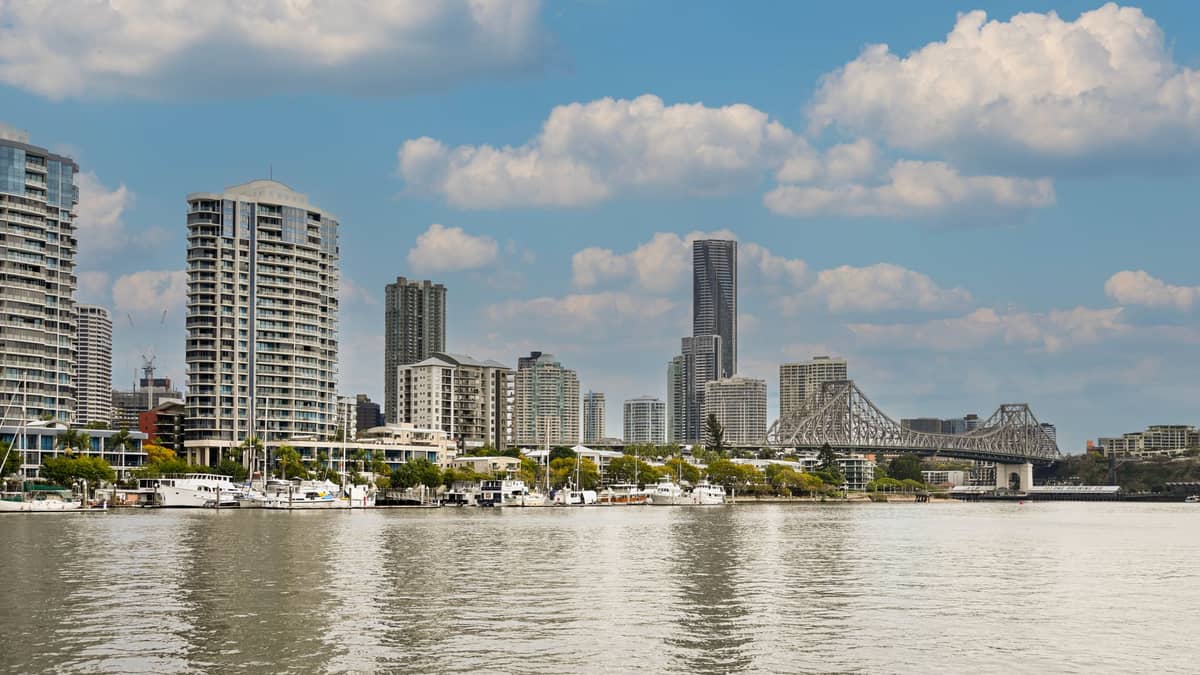
Brisbane's river is the spine of its best urban walking routes. The loop connecting South Bank, the CBD, Kangaroo Point, and New Farm covers several kilometres of largely car-free riverside path and takes in some of the city's most interesting architecture and public spaces. The Brisbane River guide goes deeper on the waterway itself.
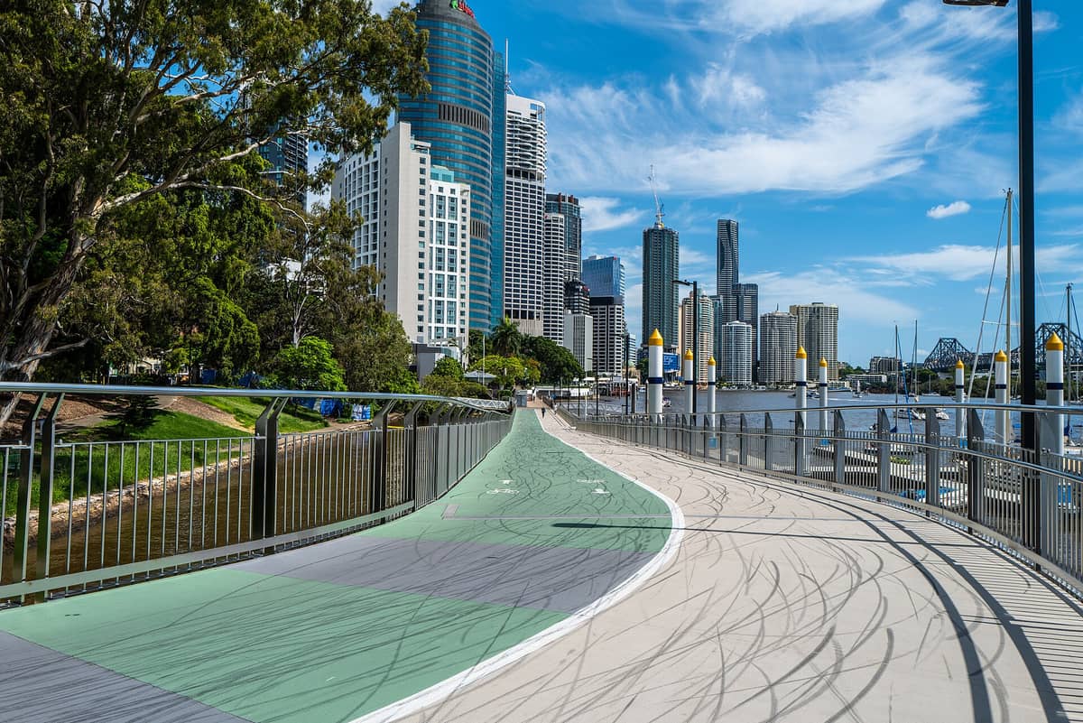
10. Walk the Brisbane Riverwalk from CBD to New Farm
A floating walkway and riverside path connecting the CBD to New Farm Park, with uninterrupted river and Story Bridge views. The full CBD-to-New Farm stretch is about 3.5 km one way. It's equally good at dawn with joggers or at dusk with the city lit up behind you.
Explore10. Walk the Brisbane Riverwalk from CBD to New Farm
A floating walkway and riverside path connecting the CBD to New Farm Park, with uninterrupted river and Story Bridge views. The full CBD-to-New Farm stretch is about 3.5 km one way. It's equally good at dawn with joggers or at dusk with the city lit up behind you.
Explore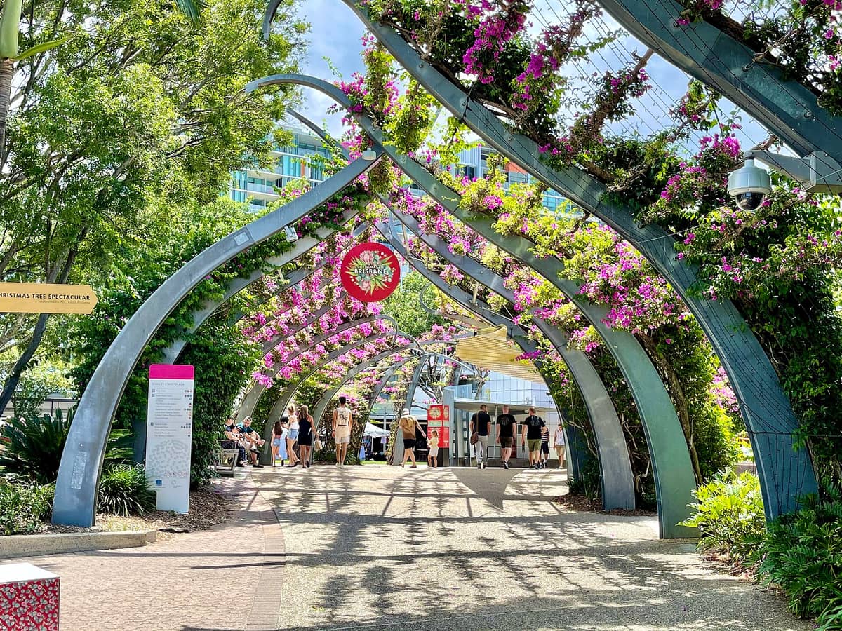
11. Stroll the South Bank Parklands Riverside Promenade
A 17-hectare riverside park with a well-maintained promenade stretching from the Cultural Forecourt to the Maritime Museum. The path passes the Grand Arbour, Streets Beach, and a string of outdoor restaurants. It links naturally to the Kurilpa Bridge and CBD riverside walk.
Explore11. Stroll the South Bank Parklands Riverside Promenade
A 17-hectare riverside park with a well-maintained promenade stretching from the Cultural Forecourt to the Maritime Museum. The path passes the Grand Arbour, Streets Beach, and a string of outdoor restaurants. It links naturally to the Kurilpa Bridge and CBD riverside walk.
Explore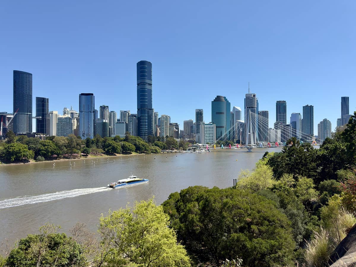
12. Cross the Kangaroo Point Bridge for a Riverside Loop
Brisbane's newest pedestrian bridge makes a satisfying centrepiece for a Kangaroo Point to South Bank riverside loop. The bridge itself offers excellent city and cliff views. Combine it with the cliff path and Story Bridge approach for a varied 4-5 km circuit.
Explore12. Cross the Kangaroo Point Bridge for a Riverside Loop
Brisbane's newest pedestrian bridge makes a satisfying centrepiece for a Kangaroo Point to South Bank riverside loop. The bridge itself offers excellent city and cliff views. Combine it with the cliff path and Story Bridge approach for a varied 4-5 km circuit.
Explore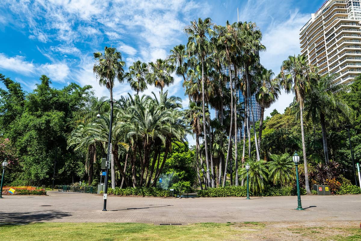
13. Walk the Riverside Paths Through the City Botanic Gardens
Brisbane's oldest park occupies a riverside peninsula at the CBD's southern edge, with shaded paths winding under heritage fig trees. The perimeter riverside walk takes about 30 minutes and connects easily to the Goodwill Bridge and South Bank. Best early on weekday mornings.
Explore13. Walk the Riverside Paths Through the City Botanic Gardens
Brisbane's oldest park occupies a riverside peninsula at the CBD's southern edge, with shaded paths winding under heritage fig trees. The perimeter riverside walk takes about 30 minutes and connects easily to the Goodwill Bridge and South Bank. Best early on weekday mornings.
Explore
14. Walk the Teneriffe Riverfront Heritage Precinct
The converted 19th-century woolstores along the Teneriffe riverfront create one of Brisbane's most atmospheric walking stretches. The riverside path here is quieter than South Bank and gives a genuine sense of the area's industrial past. Connects naturally to New Farm Park nearby.
Explore14. Walk the Teneriffe Riverfront Heritage Precinct
The converted 19th-century woolstores along the Teneriffe riverfront create one of Brisbane's most atmospheric walking stretches. The riverside path here is quieter than South Bank and gives a genuine sense of the area's industrial past. Connects naturally to New Farm Park nearby.
ExploreNature Walks & Wetland Trails
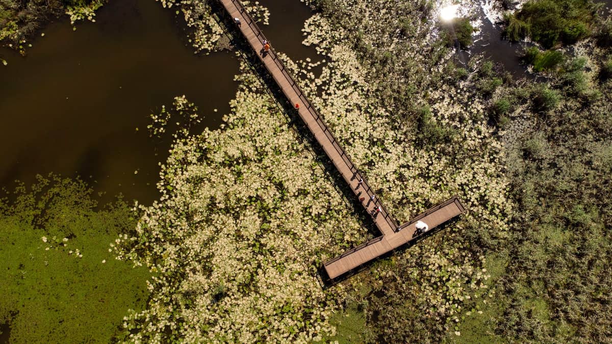
Beyond the forest reserves, Brisbane has an impressive range of wetland and bayside walking environments. These trails tend to attract serious birdwatchers and those wanting a slower, more contemplative outdoor experience than a summit push. For more on Brisbane's wildlife and nature scene, the Brisbane wildlife guide is a useful companion.
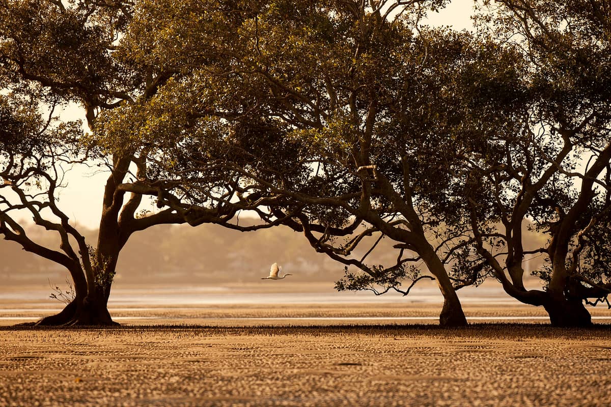
15. Walk the Mangrove Boardwalks at Boondall Wetlands
A significant coastal wetland reserve on Brisbane's northern bayside, with boardwalk trails through mangroves and mudflats. Migratory shorebirds arrive between September and April, making this one of the best birdwatching walks near the city. Free entry and well-maintained paths.
Explore15. Walk the Mangrove Boardwalks at Boondall Wetlands
A significant coastal wetland reserve on Brisbane's northern bayside, with boardwalk trails through mangroves and mudflats. Migratory shorebirds arrive between September and April, making this one of the best birdwatching walks near the city. Free entry and well-maintained paths.
Explore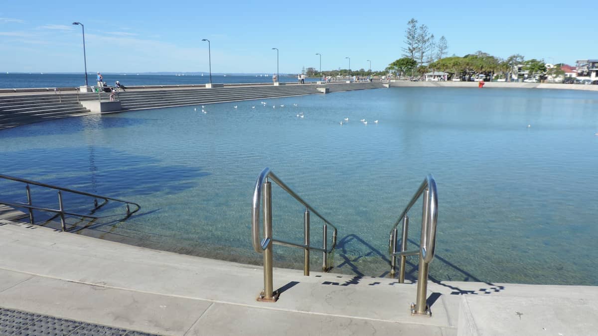
16. Walk the Wynnum Esplanade and Mangrove Boardwalk
A pleasant bayside foreshore walk at Wynnum featuring a mangrove boardwalk, tidal flats, and views across Moreton Bay toward the islands. The free heated wading pool makes this a natural stop for families. The esplanade is flat, sealed, and accessible for all fitness levels.
Explore16. Walk the Wynnum Esplanade and Mangrove Boardwalk
A pleasant bayside foreshore walk at Wynnum featuring a mangrove boardwalk, tidal flats, and views across Moreton Bay toward the islands. The free heated wading pool makes this a natural stop for families. The esplanade is flat, sealed, and accessible for all fitness levels.
Explore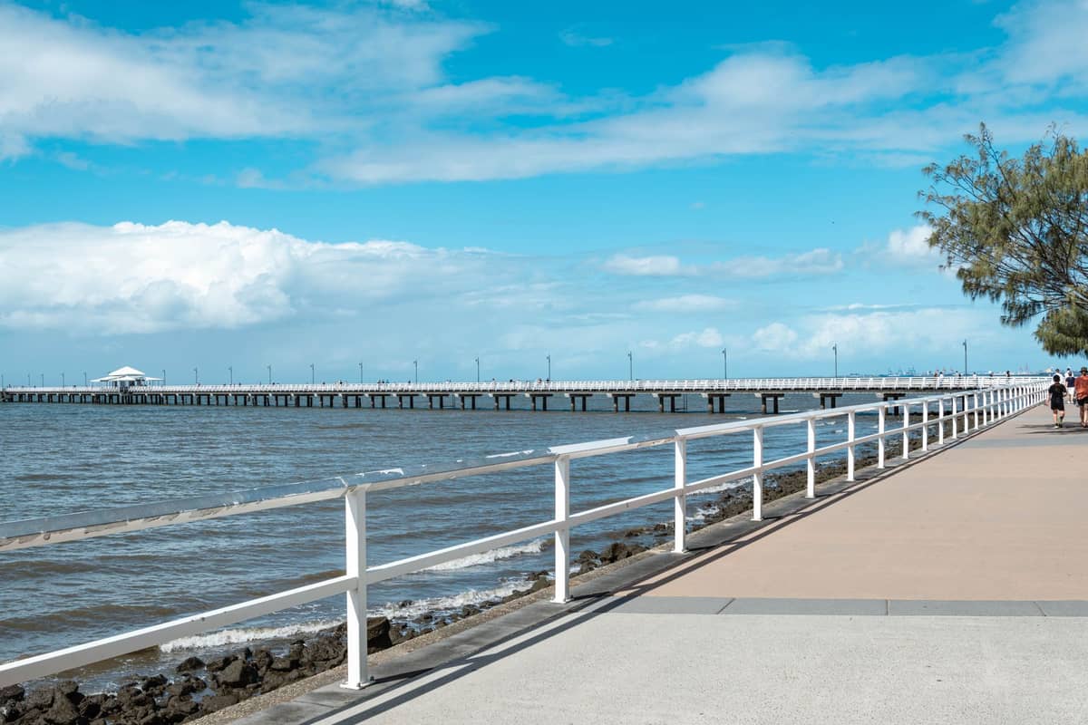
17. Walk Queensland's Historic Shorncliffe Pier at Dusk
One of Queensland's oldest and longest timber piers stretches into Moreton Bay at the bayside suburb of Shorncliffe. The foreshore walk leading to the pier is flat and easy. Evening visits, when the bay turns gold and Moreton Island sits on the horizon, are particularly rewarding.
Explore17. Walk Queensland's Historic Shorncliffe Pier at Dusk
One of Queensland's oldest and longest timber piers stretches into Moreton Bay at the bayside suburb of Shorncliffe. The foreshore walk leading to the pier is flat and easy. Evening visits, when the bay turns gold and Moreton Island sits on the horizon, are particularly rewarding.
Explore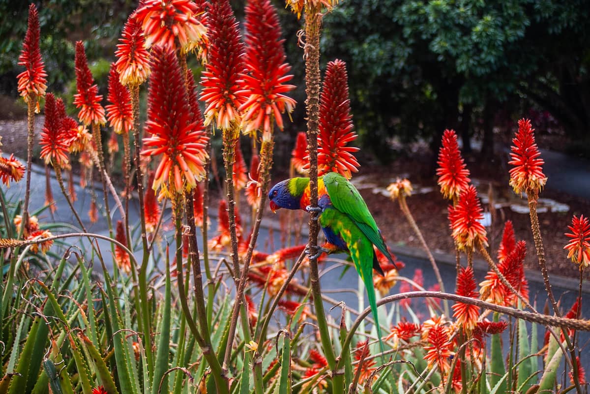
18. Walk the Themed Gardens at Mount Coot-tha Botanic Gardens
A 52-hectare botanic garden at the base of Mount Coot-tha with a network of walking paths through Japanese, arid, and tropical zones. The full garden loop takes around 1.5 hours at a relaxed pace. Free entry and good shade make it ideal for hot-weather walking.
Explore18. Walk the Themed Gardens at Mount Coot-tha Botanic Gardens
A 52-hectare botanic garden at the base of Mount Coot-tha with a network of walking paths through Japanese, arid, and tropical zones. The full garden loop takes around 1.5 hours at a relaxed pace. Free entry and good shade make it ideal for hot-weather walking.
Explore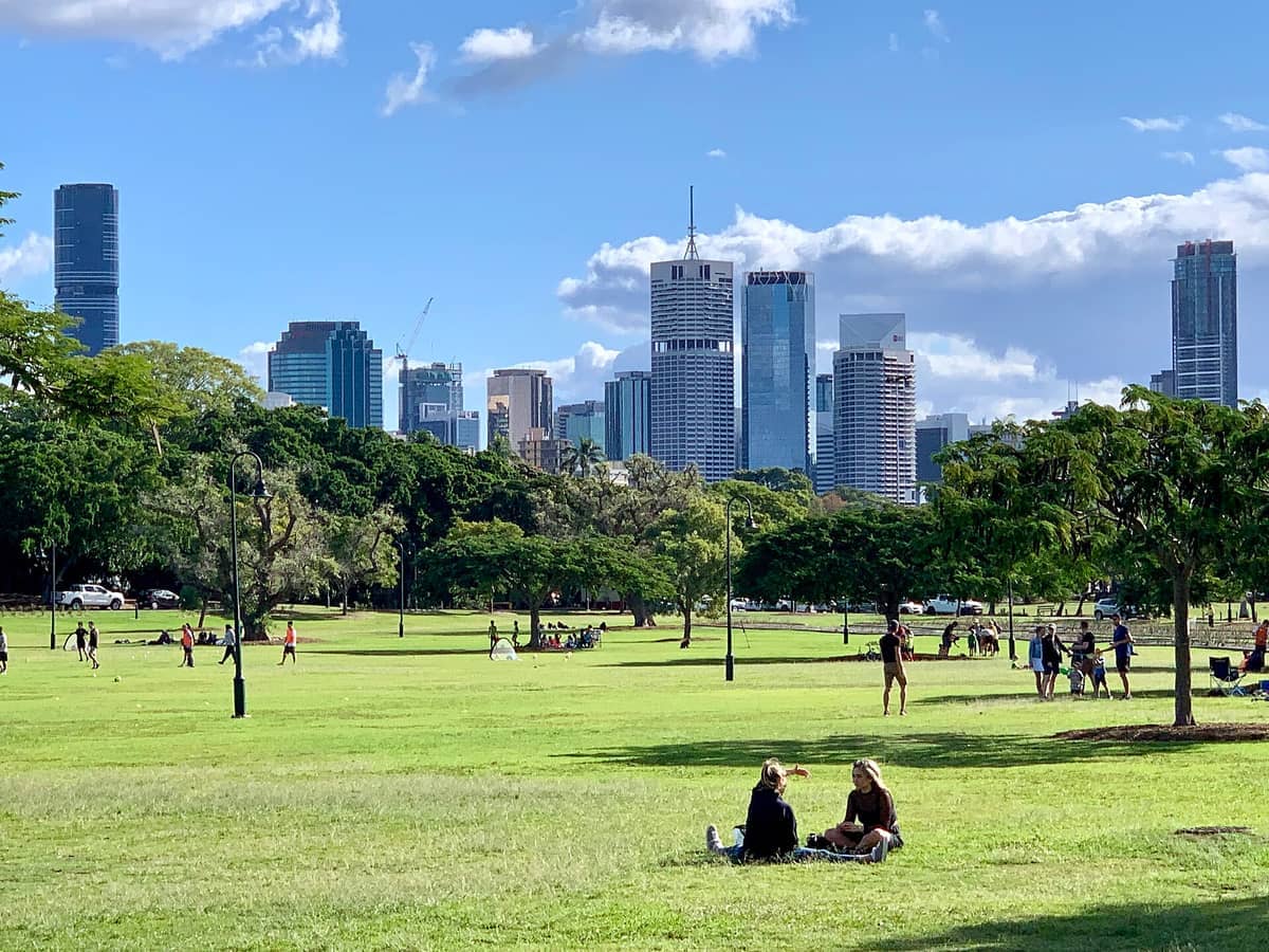
19. Stroll the Riverside Paths at New Farm Park
A beloved riverside park famous for jacaranda trees in November and a large rose garden. The perimeter path hugs the Brisbane River with views back toward Howard Smith Wharves and the Story Bridge. Connects directly to the Riverwalk for a longer out-and-back route.
Explore19. Stroll the Riverside Paths at New Farm Park
A beloved riverside park famous for jacaranda trees in November and a large rose garden. The perimeter path hugs the Brisbane River with views back toward Howard Smith Wharves and the Story Bridge. Connects directly to the Riverwalk for a longer out-and-back route.
Explore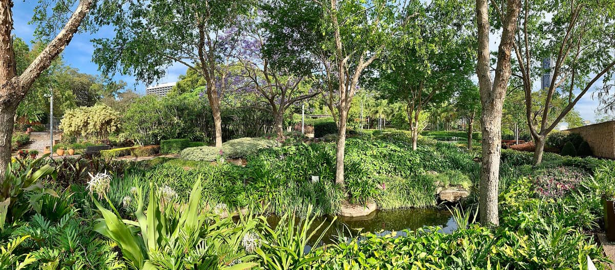
20. Explore the Garden Trails of Roma Street Parkland
One of the world's largest subtropical gardens in a city centre, with 16 hectares of themed plantings and a network of walking paths. The downhill sections toward the lake offer good skyline glimpses. Free to enter and well-signed, making it easy to navigate without a map.
Explore20. Explore the Garden Trails of Roma Street Parkland
One of the world's largest subtropical gardens in a city centre, with 16 hectares of themed plantings and a network of walking paths. The downhill sections toward the lake offer good skyline glimpses. Free to enter and well-signed, making it easy to navigate without a map.
Explore✨ Pro tip
For island hikes on Moreton Island or North Stradbroke, catch the first ferry of the day. Morning light is better for wildlife spotting, temperatures are lower, and you'll have the trails largely to yourself before day-trippers arrive mid-morning.
FAQ
What is the best hike near Brisbane for beginners?
The North Gorge Walk on North Stradbroke Island is the standout choice: it's only 2.5 km, mostly flat with some gentle undulation, and the coastal scenery is spectacular. In the city, the Mount Coot-tha Botanic Gardens walking loop is a relaxed 90-minute option with good shade and free parking.
Are the hikes at Mount Coot-tha suitable after rain?
Some are, but not all. Creek crossings on Mount Coot-tha's bushland tracks can become dangerous after heavy rain, and Simpson Falls is only impressive when there has been recent rainfall. Always check Brisbane City Council's track conditions page before heading out.
How do I get to the best walks near Brisbane without a car?
The riverside walks, South Bank promenade, City Botanic Gardens, and New Farm Park are all easily accessible by public transport or CityCat ferry. Mount Coot-tha is reachable on the 471 bus from the city. North Stradbroke Island requires a ferry from Cleveland, which is on the train network.
What is the best time of year to hike near Brisbane?
May to September offers the most comfortable hiking conditions: cooler temperatures (daily highs around 22-26°C), lower humidity, and lower rainfall. Summer hikes (December to February) are possible but require an early start, plenty of water, and sun protection due to heat and humidity.
Are there any walks near Brisbane where I can see wildlife?
Yes, several. D'Aguilar National Park and Toohey Forest Park offer wallabies, echidnas, and native birds on quiet mornings. Boondall Wetlands attracts migratory shorebirds between September and April. The North Gorge Walk on North Stradbroke Island is one of the best spots in Queensland to see humpback whales from shore between June and November.
Tickets & tours
Live prices and dates from our booking partner. If you book, we may earn a commission at no extra cost to you.
Planning a trip? Discover personalized activities with the Nomado app.