Mount Coot-tha Bushwalking Trails: Brisbane's Best Urban Forest Walks
Mt Coot-tha Reserve sits just 15 minutes from Brisbane's CBD yet feels a world away, with more than 1,600 hectares of eucalypt forest, seasonal waterfalls, and over 18.5 km of graded trails. Entry is free, the terrain suits everyone from casual walkers to serious hikers, and the birdlife alone is worth the trip.
Quick Facts
- Location
- Mt Coot-tha Reserve, Brisbane QLD — approx. 15-minute drive from CBD
- Getting There
- Bus routes serve the Mt Coot-tha area; check Translink for current services and stops
- Time Needed
- 1.5 hours (Summit Track) to a full day (multiple trail combinations)
- Cost
- Free — no trail admission fee
- Best for
- Hikers, nature lovers, families, early-morning exercisers, wildlife watchers
What Mt Coot-tha Reserve Actually Is
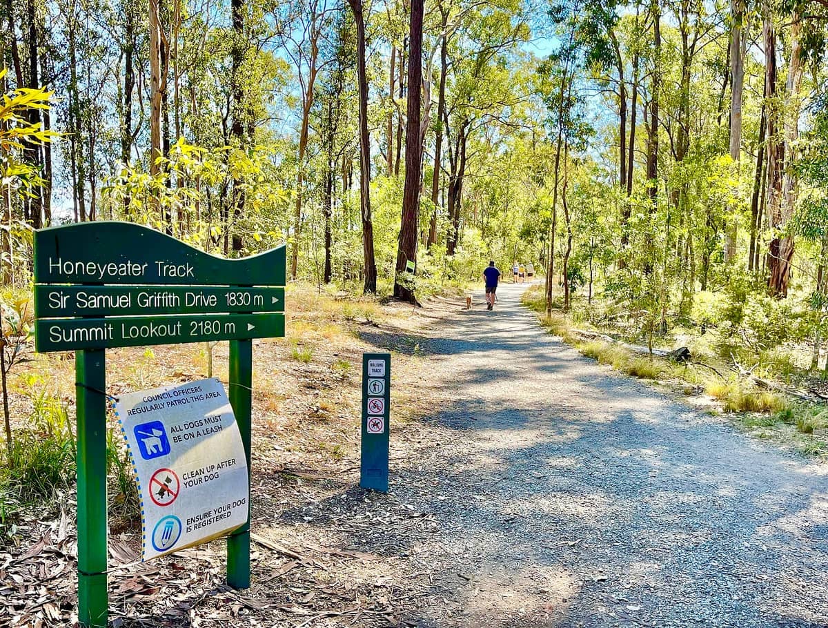
Mt Coot-tha Reserve, also known as Mt Coot-tha Forest, is a working piece of native bushland on Brisbane's western edge covering more than 1,600 hectares. That scale is easy to underestimate from the road. Once you step past the trailhead, the city noise drops away quickly, replaced by the scratch of brush-turkeys in the leaf litter and the sharp calls of kookaburras in the canopy above. The reserve contains more than 18.5 km of marked tracks graded from easy to difficult, with multiple picnic areas serving as natural start and finish points.
The network sits on the traditional lands of the Turrbal and Jagera peoples, whose connection to this landscape predates European settlement by tens of thousands of years. The name 'Coot-tha' is derived from the Turrbal word for 'place of honey,' a reference to the native bee habitat that once defined the area.
For visitors already exploring the area, the reserve connects logically with the Mt Coot-tha Lookout and the Brisbane Botanic Gardens Mt Coot-tha, making it easy to combine nature, views, and gardens into a single half-day or full-day itinerary.
The Trails: What to Expect on Each Grade
The Summit Track is the most-used route in the reserve. It runs 1.9 km from the base area to the summit and is largely paved, making it accessible to a wider range of fitness levels than most bushwalks in Brisbane. The gradient is steady rather than steep, and most walkers complete the ascent in around 30 minutes. At the top, the paved path connects to the lookout platform, where the city grid stretches out across the coastal plain to Moreton Bay on clear days.
💡 Local tip
Start the Summit Track before 8am on weekdays to have the path largely to yourself. On weekend mornings, particularly from around 7am onward, it fills with joggers, dog walkers, and families — still manageable, but the sense of solitude disappears quickly.
The moderate and difficult trails branch deeper into the forest and away from the paved summit route entirely. These tracks use compacted gravel and natural earth surfaces that turn slippery after rain. The J.C. Slaughter Falls track leads through a gully to a seasonal waterfall that runs after heavy rain. Outside the wet season, the falls may be dry or reduced to a trickle. The walk to the falls from J.C. Slaughter Falls Picnic Area takes roughly 20 to 30 minutes each way and passes through some of the densest tree fern growth in the reserve.
The Gold Mine Picnic Area provides access to a different set of trails that receive noticeably fewer visitors than the Slaughter Falls entry point. The historical reference in the name is genuine: small-scale gold prospecting occurred in this part of the reserve, and the terrain reflects that past in the uneven ground and old drainage channels you cross on some of the rougher paths.
⚠️ What to skip
Check onsite signage before heading onto the moderate or difficult tracks. Trail closures do occur after storms, and the Council website advises checking signs at the entry points for current access updates. Do not rely solely on trail maps downloaded before your visit.
Tickets & tours
Live prices and dates from our booking partner. If you book, we may earn a commission at no extra cost to you.
Luggage Storage in Brisbane
From 5 €Instant confirmationFree cancellationBrisbane's dark stories true crime tour
From 21 €Instant confirmationFree cancellationFull-day Mount Tamborine winery tour from Brisbane with lunch
From 140 €Instant confirmationFree cancellationNorth Stradbroke Island small groups day tour
From 79 €Instant confirmationFree cancellation
How the Experience Changes Through the Day
Early morning is the standout time to visit, full stop. The light filters through the eucalyptus canopy at a low angle, the air smells of damp bark and leaf mulch, and the bird activity peaks during the first hour after sunrise. Birdlife and other native wildlife can be seen throughout the reserve. Patient walkers on the quieter trails may spot koalas in the fork of a tall gum.
By mid-morning on weekends, the picnic areas begin filling with families and the main tracks get noticeably more crowded. Midday in summer is genuinely uncomfortable on the exposed sections of the summit trail, with temperatures regularly reaching 30°C or above between December and February. The forested gully tracks stay cooler but the humidity inside the canopy can be significant after rain. Afternoon visits in summer carry a real risk of afternoon thunderstorms, which can arrive fast.
Winter and autumn mornings, roughly May through September, offer the most reliable conditions. Temperatures sit in the low to mid-teens Celsius at dawn, warming to the mid-20s by late morning. Rain is less frequent in this period and the tracks tend to be firmer underfoot. This aligns with the broader pattern across Brisbane, where the cooler dry season consistently delivers more comfortable conditions for outdoor activity.
Getting There and Moving Around the Reserve
The reserve sits approximately 15 minutes by car from Brisbane's CBD. Parking is available at both the J.C. Slaughter Falls and Gold Mine picnic areas, though spaces fill quickly on weekend mornings by around 8am. A Translink bus service runs to the Mt Coot-tha area, but services and stop locations can change, so check the Translink website or app for current route numbers and timetables before travelling without a car.
Cyclists also use the reserve, and some trails are shared between walkers and mountain bikers. If you are planning a broader day out in the area, the Brisbane hikes and walks guide covers how Mt Coot-tha fits into a longer exploration of the city's green spaces.
The picnic areas at J.C. Slaughter Falls and Simpson Falls are open daily from 6am to 7pm according to Brisbane City Council. The J.C. Slaughter Falls and Simpson Falls picnic areas are open daily from 6am to 7pm according to Brisbane City Council. Trail access hours are not specified on the Council's trail page, so check onsite signage for current conditions.
What to Wear and Bring
The most common mistake visitors make is arriving in thongs or casual sneakers and heading onto the moderate or difficult tracks. The natural-surface paths have exposed roots, loose gravel on descents, and sections that hold moisture long after rain. Closed-toe shoes with grip are the minimum; trail runners or light hiking boots are better.
- Water: at least 750ml per person for the Summit Track; more for longer routes in warm weather
- Sun protection: the summit is fully exposed, and the approach track has limited shade in places
- Insect repellent: useful near the gully sections and around the falls picnic areas, particularly in summer
- A printed or offline trail map: mobile signal can be patchy on the deeper tracks
- Cash or card is not needed — there are no entry fees or on-site vendors on the trails
Photography and Wildlife Notes
The light quality on the forested tracks is best in the first two hours after sunrise when the sun is still low. Shafts of light through the canopy on the gully tracks near Slaughter Falls are the reserve's most photogenic feature, but they only appear when the sun angle is right, roughly between 7am and 9am depending on season. The falls themselves photograph best during the wet season when water volume is high, but the surrounding tree ferns are dense and green year-round.
Wildlife photography requires patience and quiet movement. Koalas, if present, are most often found in the taller eucalypts away from the busiest trails. Brush-turkeys are unconcerned by human presence and will walk directly across your path. The scrubwren and grey fantail are fast-moving small birds that reward slow walkers who pause and wait.
ℹ️ Good to know
Photography tip: the paved Summit Track offers very little in the way of intimate forest photography. If images of native bush are your goal, the natural-surface trails branching from the Gold Mine Picnic Area are more rewarding and receive far less foot traffic.
Honest Assessment: Who This Works For and Who It Doesn't
Mt Coot-tha's trail network is genuinely well worth the effort for anyone who wants to understand that Brisbane is not just a river city with cafes. The green rim visible from the Story Bridge or from the South Bank side of the river is this reserve, and walking inside it gives the city a different dimension entirely.
That said, international visitors with only one or two days in Brisbane may find the trail network hard to prioritise unless they specifically want a nature experience. The Summit Track is worthwhile if combined with a stop at the lookout, but walking a paved path to a commercial viewpoint is not the same as a genuine bushwalk. The real value is in the natural-surface trails, and those require more time, appropriate footwear, and a willingness to accept some navigational uncertainty.
Travellers with limited mobility will find the paved sections of the Summit Track and the flat areas around the picnic facilities more accessible. The natural-surface trails are unsuitable for wheelchairs and for those who have difficulty on uneven ground. Families with young children typically stick to the Slaughter Falls walk, which is achievable for most school-age kids and has a clear payoff at the end in the form of the falls and creek environment.
Insider Tips
- The Gold Mine Picnic Area trailheads are consistently quieter than Slaughter Falls on weekends. If the Slaughter Falls car park is full, drive around to Gold Mine — you will likely find parking and encounter far fewer people on the connecting trails.
- The J.C. Slaughter Falls are seasonal and may be completely dry outside the wet season (December to March). Do not plan your visit around seeing the falls unless recent significant rainfall has occurred. Check Brisbane's recent rainfall data on the Bureau of Meteorology website before visiting.
- Bring a physical map or download an offline version before entering the reserve. Mobile signal drops out on several of the deeper moderate and difficult tracks, and the trail junctions are not always self-explanatory from signage alone.
- The reserve connects to the Botanic Gardens at Mt Coot-tha via a trail link. Walking from the gardens into the bush tracks and back is a satisfying loop that most visitors miss entirely because they treat the two areas as separate stops.
- Koalas are occasionally spotted in the reserve but there are no guarantees. If spotting native wildlife in a managed setting matters to you, Lone Pine Koala Sanctuary offers reliable encounters without the trail conditions or uncertainty.
Who Is Mount Coot-tha Bushwalking Trails For?
- Early-morning runners and hikers wanting green space close to the city
- Families with older children looking for a half-day nature walk with a waterfall endpoint
- Wildlife photographers willing to move slowly and wait for birds and koalas
- Visitors combining a trail walk with the Mt Coot-tha Lookout and Botanic Gardens in a single day
- Budget-conscious travellers who want a full nature experience without any entry cost
Nearby Attractions
Other things to see while in Mount Coot-tha:
- Brisbane Botanic Gardens Mount Coot-tha
The Brisbane Botanic Gardens Mt Coot-tha spread across 56 hectares at the foot of one of Brisbane's most recognisable landmarks. With free admission, a tropical dome, a Japanese garden, and shaded walking paths that change character dramatically depending on the hour, this is one of the city's most rewarding green spaces for visitors who take the time to explore beyond the car park.
- Mount Coot-tha Lookout
Standing 226 metres above sea level, Mount Coot-tha Lookout delivers an unbroken sweep of Brisbane's skyline, river bends, and Moreton Bay beyond. It is free, open around the clock, and rewards visitors differently depending on whether you arrive at dawn, dusk, or deep into the night.
- Sir Thomas Brisbane Planetarium
Tucked inside the Brisbane Botanic Gardens at Mt Coot-tha, the Sir Thomas Brisbane Planetarium is the only public planetarium in Queensland. With a 12.5-metre projection dome, affordable Cosmic Skydome shows, and free general admission, it earns a place on any Brisbane itinerary that reaches beyond the typical.
Planning a trip? Discover personalized activities with the Nomado app.