Best Self-Guided Walking Tours in Beijing: Routes, Tips & Honest Advice
Beijing rewards walkers more than almost any major city on earth. From the UNESCO-listed Central Axis to centuries-old hutong alleyways and cutting-edge contemporary art districts, these self-guided walking tours cover the city's most compelling neighborhoods with practical logistics, frank warnings, and seasonal guidance.
Plan and book this trip
Tools from our partner Travelpayouts help you compare flights and hotels. If you book through them, we may earn a commission at no extra cost to you.
Flights
Hotels map
TL;DR
- Beijing's best self-guided walks span five distinct route types: the imperial Central Axis, hutong neighborhoods, historic parks, contemporary art districts, and food-focused streets.
- The Central Axis is now a UNESCO World Heritage cultural corridor, covering landmarks from Bell and Drum Towers in the north to Yongdingmen in the south.
- Self-guided does NOT mean free: museums, palaces, and many parks require separate tickets and advance reservations, especially the Forbidden City.
- Best walking conditions are April-May and September-October; summer (June-August) brings heat, humidity, and crowds, while winter is dry but cold, typically -5 to 5°C. See our guide on the best time to visit Beijing for full seasonal breakdowns.
- Comfortable shoes, a downloaded offline map (Baidu Maps or Amap for China), and a transit card (Yikatong) will cover almost every situation.
Why Beijing Is Built for Walking
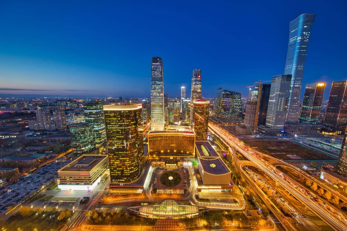
Beijing's urban grid follows a logic that dates back to the Yongle Emperor's reconstruction of the city in the early 15th century. The result is one of the world's most coherent planned capitals: a central north-south axis flanked by concentric ring roads, with historic neighborhoods, temples, and markets organized around it. Walking between major landmarks is not only possible but often the most rewarding way to understand the city's layered history.
The Beijing Subway is extensive and useful for covering large distances, but it bypasses the street-level detail that makes the city interesting. The getting around Beijing guide covers transit in full, but the practical advice for walkers is this: use the subway to reach your starting point, then walk. Most of the routes below are 3 to 7 kilometers and take 2 to 4 hours at a comfortable pace including stops.
⚠️ What to skip
Self-guided walking in Beijing is not uniformly free or open. The Forbidden City requires timed-entry tickets booked online in advance, often weeks ahead during peak season. Several temple-park complexes (Temple of Heaven, Summer Palace, Beihai Park) charge layered admission: one fee for the park gate, another for specific inner buildings. Always check each site's official page before setting out.
Route 1: The Central Axis, Beijing's UNESCO Spine
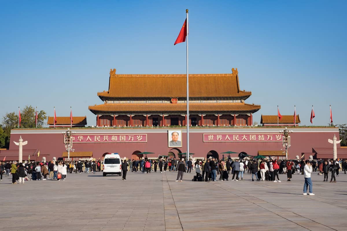
The Beijing Central Axis was inscribed as a UNESCO World Heritage Site in 2024, recognizing an approximately 7.8-kilometer cultural corridor that has defined the city's form for more than 600 years. Running from Yongdingmen Gate in the south to the Drum and Bell Towers in the north, it passes through Tiananmen Square, the Forbidden City, Jingshan Park, and the Shichahai lake district. This is Beijing's most historically dense walk, and it can be done in a single long day or split across two.
Start at the Drum Tower (Gulou) in the north and walk south. This direction puts the morning light behind you for better photography, and means you save the bigger, more ticket-intensive sites (Forbidden City, Tiananmen) for mid-morning when you're still fresh. From the Drum Tower, head down Dianmen West Street toward Shichahai lake, then continue south through Di'anmen toward Jingshan Park.
- Drum Tower to Jingshan Park About 2.5 km south through the lake district. Allow 60-90 minutes for stops and the Jingshan hilltop view.
- Jingshan to the Forbidden City north gate 5-minute walk. Forbidden City requires a pre-booked timed ticket; budget 2-3 hours inside.
- Forbidden City south exit to Tiananmen Square Pass through Tiananmen Gate. Photography restrictions apply near certain government structures.
- Tiananmen to Qianmen Continue south through the square to Zhengyangmen Gate Tower, then down Qianmen Street for food and shopping.
- Qianmen to Yongdingmen Another 2 km south to the restored outer-axis gate, passing through the quieter Yongdingmen Park area.
✨ Pro tip
Jingshan Park's hilltop pavilion gives a direct elevated view down the Central Axis, with the Forbidden City's yellow-roofed towers stretching south and the Drum Tower visible north. Arrive before 9am on weekdays to avoid tour groups at this vantage point. Check the official park page for current opening hours and admission pricing before setting out.
Route 2: Hutong Neighborhoods in Dongcheng and Xicheng
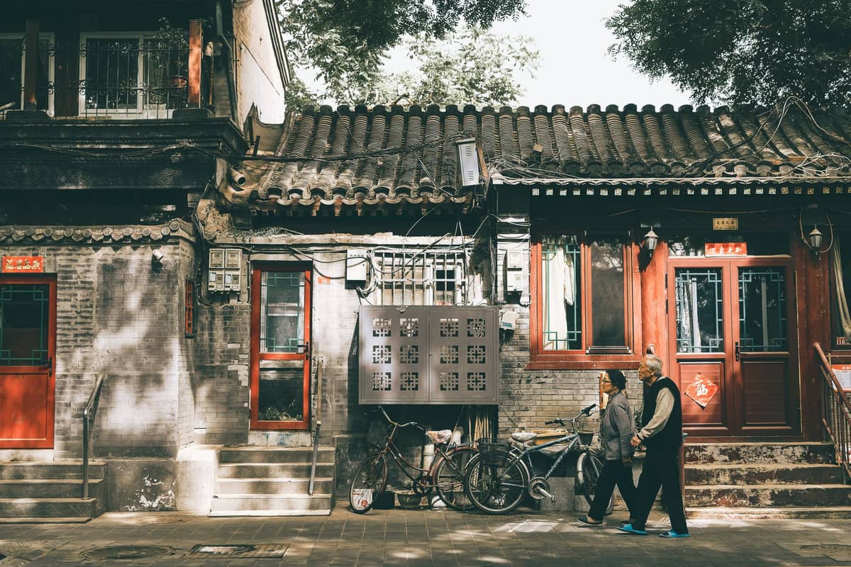
Beijing's hutong alleyways are the city's most atmospheric street experience, but they require some navigation sense. The most photogenic and walkable clusters sit between the Drum Tower and Di'anmen in the north, and around Nanluoguxiang and Wudaoying Hutong slightly to the east. Our full Beijing hutong guide goes deep on history and etiquette, but for walkers the key advice is: get off the main commercial lanes quickly.
Nanluoguxiang itself has become heavily commercialized, lined with snack stalls and souvenir shops targeting domestic tourists. It's worth walking through once for context, but the interesting hutong experience is in the parallel lanes: Mao'er Hutong, Ju'er Hutong, and Banchang Hutong, running east-west off the main strip. These residential alleys have traditional courtyard house gates (siheyuan), small neighborhood temples, and almost no tourist infrastructure.
For a western-city alternative, the hutong area around Yandaixie Street near Houhai is narrower and more photogenic, with antique and craft shops mixed in with local life. Walk the full length (about 250 meters), then continue north toward the Shichahai hutong district for a lakeside loop.
💡 Local tip
Weekday mornings between 8am and 10am are the best time to walk hutongs. You'll see neighborhood life: elderly residents doing tai chi, breakfast vendors with jianbing (savory crepes) griddles, kids heading to school. By 11am on weekends, the main lanes fill with crowds and the atmosphere shifts entirely.
Route 3: The Imperial Parks and Temple Circuit
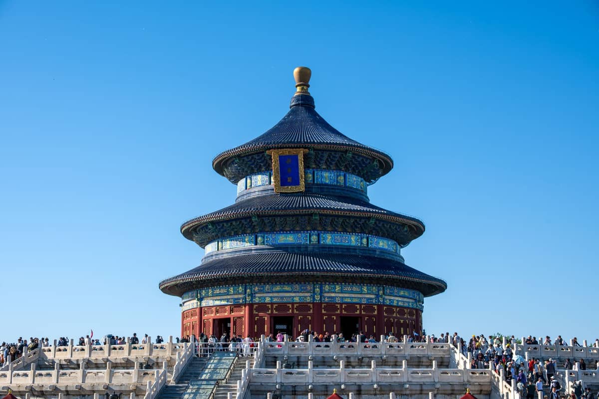
Beijing's imperial parks form a green circuit that can be walked independently or combined with other routes. The Temple of Heaven in the south is the most architecturally spectacular, with the Hall of Prayer for Good Harvests (Qinian Dian) one of the most recognizable structures in China. The park complex itself is enormous, roughly 273 hectares, and locals use the outer sections daily for morning exercise, card games, and group singing.
In the northwest, Beihai Park connects naturally with Shichahai and the hutong district, making it easy to combine with Route 2. The White Dagoba on Qionghua Island is the park's focal point, and the lakeside path around the island takes about 40 minutes. For those with more time, the Lama Temple (Yonghe Gong) and adjacent Confucius Temple and Guozijian make a compact 90-minute loop in Dongcheng, walkable from Nanluoguxiang.
- Temple of Heaven: Enter from the north gate (Beimen) for the most direct route to the Hall of Prayer. Budget at least 90 minutes.
- Beihai Park: Combine with the hutong district walk for a half-day loop starting at the Drum Tower.
- Lama Temple to Confucius Temple: A 10-minute walk connects both sites; visit Guozijian (Imperial Academy) between them for free on weekdays.
- Jingshan Park: Best visited as part of the Central Axis route; the hilltop is the route's geographic and visual midpoint.
Route 4: Contemporary Beijing, the 798 Art District and Chaoyang
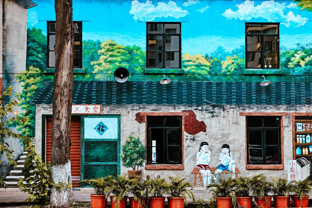
The 798 Art District in Chaoyang is a 1950s Bauhaus-era factory complex repurposed into galleries, studios, and design shops. It's a genuinely walkable area of about 1.5 square kilometers, and the best approach is unstructured: wander the main Jiu Xianqiao Road, then cut into the smaller lanes between the industrial buildings. Major galleries like UCCA Center for Contemporary Art anchor the district, but the smaller, unsigned project spaces are where the more experimental work appears.
Beijing's municipal government has also published a series of "Color Walk" urban routes that combine contemporary neighborhoods with traditional streets. One route runs Fuchengmen to White Pagoda Temple to Xisi, mixing Ming-dynasty religious architecture with indie bookshops. Another traces Chaoyangmen through Dongyue Temple to Shenlu Street and Parkview Green, giving a cross-section of how old-city texture sits next to upscale modern development. These routes are published on the official Beijing tourism portal and change periodically.
Practical Logistics Every Walker Needs to Know
Air quality in Beijing varies significantly by season and weather pattern. Spring sandstorms can reduce visibility and make outdoor walking uncomfortable for a day or two. Summer smog concentrates around July-August during stagnant weather. Autumn (September-October) and early winter often have Beijing's clearest skies. Check real-time AQI data from a recognized monitoring source the morning of a planned walk, particularly if you are sensitive to air pollution.
Payments in Beijing are almost entirely mobile-first. WeChat Pay and Alipay dominate, and many food vendors, parks, and small shops no longer accept cash or card. Visitors without a Chinese bank account can link international cards to WeChat Pay or Alipay with some limitations, or use the international tourist payment options both apps now offer. Cash (Chinese yuan, CNY/RMB) remains a legal right and is accepted by larger institutions, but street vendors increasingly do not carry change. For a detailed breakdown of money logistics, the Beijing on a budget guide covers this in full.
Navigation apps: Google Maps has limited functionality in mainland China due to map data restrictions. Use Amap (Gaode Maps, available in English) or Baidu Maps for accurate street-level navigation. Download offline sections before leaving your accommodation. The Beijing Subway app also has an English interface and covers most transit connections you'll need between walking routes.
- Footwear: Uneven stone paving in hutongs and at heritage sites means cushioned shoes with ankle support are worth it over a multi-day trip.
- Hydration: Tap water is treated but not recommended for drinking untreated; carry a refillable bottle and use hotel room dispensers or bottled water.
- Connectivity: A local SIM card or international roaming plan with data is essential for navigation, payments, and translation apps.
- Translation: Pleco or Google Translate's camera function helps decode menus, signs, and place names where English is unavailable.
- Dress code: Conservative clothing (covered shoulders and knees) is appropriate at temples and religious sites; security screening is standard at Tiananmen Square and major landmarks.
If you want to build these walks into a structured itinerary, the 3 days in Beijing itinerary and the 5-day Beijing itinerary both organize these routes by day with timing and transport connections. First-time visitors should also read the Beijing first-timer guide before heading out.
ℹ️ Good to know
The Beijing Central Axis routes and several Color Walk itineraries are officially published on the Beijing Municipal Government's English tourism portal (english.beijing.gov.cn) and updated periodically. Route maps and point-of-interest lists are available there as downloadable PDFs. These are free to use and do not require registration.
FAQ
Do I need to book anything in advance for self-guided walks in Beijing?
Yes, for several key sites. The Forbidden City requires timed-entry tickets booked online in advance through its official website, and these sell out weeks ahead during national holidays and summer. The National Museum of China also requires advance registration. Parks like Temple of Heaven, Beihai, and Jingshan generally do not require advance booking but do charge admission. Hutong walks and the public sections of the Central Axis (outside palace and museum gates) are free and open without reservation.
How long does it take to walk the Beijing Central Axis?
The full axis from Yongdingmen in the south to the Bell Tower in the north covers roughly 8 kilometers. Without stopping inside any attractions, it takes about 2 to 2.5 hours of walking. With visits to Jingshan Park, the Forbidden City, and Tiananmen Square, a full north-to-south or south-to-north walk is a full day (7-8 hours). Most visitors split it across two days.
Are hutong walking tours in Beijing safe for independent travelers?
Yes, central Beijing's hutong neighborhoods are safe for solo and group walkers at all hours. The main practical risks are getting disoriented in the unmarked side alleys (download an offline map before you go) and inadvertently entering a private residential compound. Gray courtyard gates that are slightly open are usually private homes; if a space looks residential rather than commercial, it is. Stick to public lanes and you'll have no issues.
What is the best walking route for first-time visitors to Beijing?
The Central Axis, walked north to south from the Drum Tower through Jingshan Park and the Forbidden City to Tiananmen Square and Qianmen, covers the greatest concentration of historically significant sites in one connected route. It also gives an intuitive sense of Beijing's urban structure that helps orient the rest of your trip. Follow it on day one, then use hutong and park walks on subsequent days.
Can I use Google Maps for self-guided walking in Beijing?
Google Maps works in Beijing but uses offset map data due to Chinese mapping regulations, which can make GPS positioning inaccurate by 50 to 500 meters in some areas. For reliable street-level navigation, use Amap (Gaode Maps), which is available in English and uses accurate local data. Download the area you need for offline use before leaving your hotel.