Best Self-Guided Walking Routes in Taipei: A District-by-District Guide
Taipei rewards walkers more than almost any other Asian capital. This guide breaks down the best self-guided walking routes by district, with realistic distances, timing advice, where to pick up free maps, and frank notes on what to skip.
TL;DR
- The best self-guided walking routes in Taipei cover historic Wanhua, the colonial core around National Taiwan Museum, the Xinyi skyline, and the Tamsui riverfront.
- Free printed maps and brochures are available at 11 Visitor Information Centers around the city — no guided tour needed.
- The National Taiwan Museum publishes an "Old Taipei Walking Tours Map" that traces old city gates and Japanese-era landmarks from its front steps.
- Summer walking is possible but rough: temperatures regularly hit 35°C with high humidity. October to April gives the most comfortable conditions.
- Most central routes connect directly to the MRT, so you can walk one direction and ride back. See getting around Taipei for transit details.
Why Taipei Works So Well on Foot
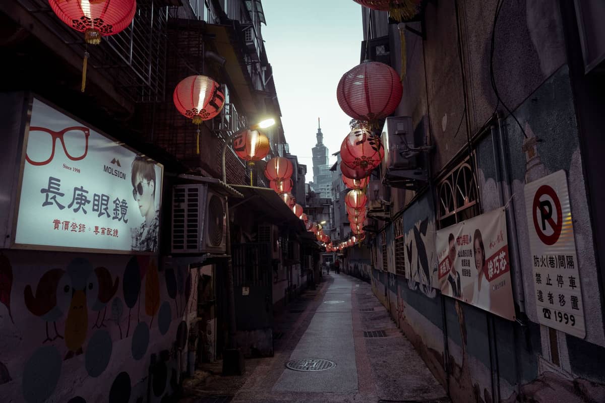
Taipei is a city that gets better the slower you move through it. The MRT is efficient, but it skips the temple courtyards, the red-lantern alleyways, the Japanese-era shophouses, and the covered market streets that define the place. Walking connects those gaps. Most central districts are flat, the street grid is legible, and convenience stores appear every few hundred metres when you need water or a rest stop.
The city actively supports independent walkers. The Department of Information and Tourism operates 11 Visitor Information Centers citywide, all stocked with free walkway maps and brochures. There are also multiple Information Stations in tourist-friendly shops that carry local route materials. For a historic overview, the National Taiwan Museum publishes its own "Old Taipei Walking Tours Map," tracing the original city walls, old gates, and Japanese colonial landmarks from its Zhongzheng District entrance.
💡 Local tip
Pick up a free walking map at the Taipei Main Station Visitor Information Center before you start. The bilingual maps show MRT exits, landmarks, and suggested route lines — far more useful than relying entirely on your phone in unfamiliar alleyways.
Route 1: The Historic Core (Wanhua to Zhongzheng)
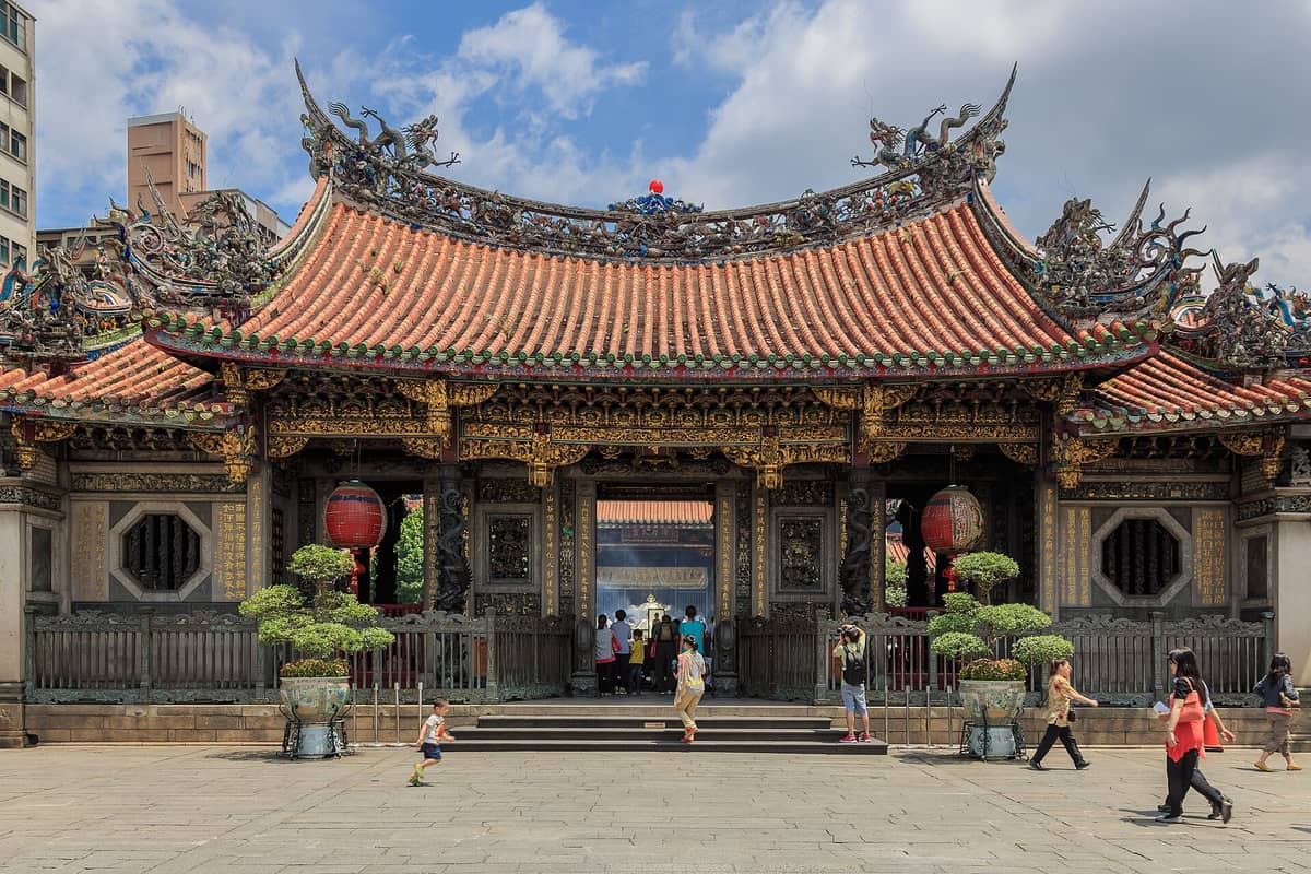
This is the most historically dense walking route in Taipei, covering the oldest settled parts of the city in a roughly linear path. Start at Longshan Temple in Wanhua, one of the oldest temples in the city and a genuine centre of local religious life rather than a tourist set piece. From there, walk north through Bopiliao Historic Block, a preserved Qing and Japanese-era street that most visitors walk straight past.
Continue north along Dihua Street into Dadaocheng, Taipei's old trading district. Dihua Street is lined with baroque-fronted shophouses selling dried goods, traditional medicines, textiles, and increasingly, specialty coffee and design boutiques. The street is at its most atmospheric in the weeks before Lunar New Year, when vendors spill onto the pavement with New Year goods. From the southern end of Dihua Street, the walk to Longshan Temple is about 2.5 km; allow 3 to 4 hours if you stop at both temples and browse the street.
The logical extension is to continue east into Zhongzheng District, passing through North Gate (Beimen), one of Taipei's original Qing-dynasty city gates, and the National Taiwan Museum Railway Department in the restored 1930s railway workshop. The full Wanhua-to-Zhongzheng route runs approximately 4 to 5 km and works best in the morning before heat builds.
Route 2: Japanese Colonial Taipei (Zhongzheng District)
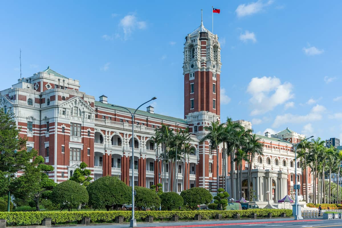
Taipei was the administrative capital of Japanese Taiwan from 1895 to 1945, and the colonial footprint is still legible in the Zhongzheng District street plan and architecture. This route is compact, roughly 3 km, and can be completed in 2 to 3 hours. Begin at the Presidential Office Building, a red-brick baroque structure built in 1919, then walk southeast along Ketagalan Boulevard to Liberty Square and the Chiang Kai-shek Memorial Hall.
From Liberty Square, walk through the Taipei Botanical Garden to the south — a flat, shaded detour that most walkers skip but which provides real relief on a warm day. The garden covers around 7 hectares and contains a diverse collection of plant species including a lotus pond that peaks in late June and July. Cap the route at the 228 Peace Memorial Park on the northeast corner, which connects the colonial and postwar histories of the city in a single space.
ℹ️ Good to know
The 228 Peace Memorial Park and Liberty Square area are shaded and well-maintained, but the Chiang Kai-shek Memorial Hall's main plaza offers very little shade. Visit before 10am or after 4pm in summer to avoid the worst of the heat exposure.
Route 3: Xinyi to Elephant Mountain
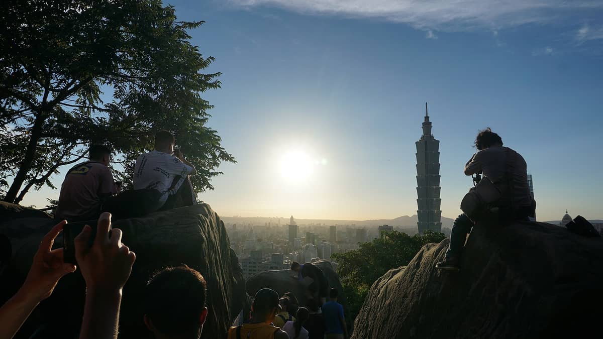
This route trades colonial history for contemporary Taipei, starting in the Xinyi commercial district near Taipei 101 and ending with a climb to the Xiangshan (Elephant Mountain) ridge for a skyline view. The walk from Taipei 101 to the Elephant Mountain MRT station trailhead is about 1.5 km through the Xinyi shopping district. From the trailhead, it is approximately 20 to 30 minutes of moderate uphill climbing on stone steps to reach the first good viewpoint.
The Elephant Mountain trail is genuinely popular and can feel crowded on weekends, particularly at the main viewpoint rock. Weekday mornings are significantly quieter. The trail itself is short but steep in sections, and the stone steps can be slippery after rain. Wear shoes with grip rather than sandals. The viewpoint at dusk, with Taipei 101 lit against the hills, is one of the more reliable photographic payoffs in the city — but arrive at least 30 minutes before sunset to get a good position.
Route 4: Yongkang Street and Da'an District
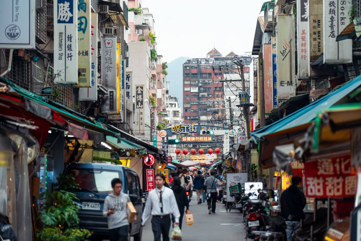
For a lower-intensity half-day route that still covers serious ground, the Da'an District walk centred on Yongkang Street is the most liveable of the central options. Yongkang is a pedestrian-friendly street known for independent restaurants, tea houses, and the original Din Tai Fung location. It connects south to Da'an Forest Park, a 26-hectare urban park that functions as the city's main green lung.
From the park, the walk west along Xinsheng South Road leads through a quiet stretch of Japanese-era residential streets before reaching the Shida Night Market area. This is not a route for landmark-checking but for understanding how Taipei actually functions as a city for the people who live in it. Allow 2 to 3 hours and prioritise lunch on Yongkang Street, where small restaurants serve beef noodle soup, scallion pancakes, and mango shaved ice within a few blocks of each other.
Route 5: Dadaocheng Riverfront and Tamsui
The Tamsui River bike and walking path runs along the western edge of the city and connects several neighbourhoods that are otherwise easy to miss. The riverside section through Dadaocheng is flat, shaded in parts, and can be extended north to Guandu or southwest toward the wetlands. For a focused half-day route, walk from Dadaocheng Wharf north along the riverside to Dajia Riverside Park, then return through the interior streets back toward Dihua Street. The full loop is approximately 10 to 12 km. For a longer day, take the MRT to the end of the Tamsui line and walk the Tamsui Old Street waterfront, which mixes Qing-era forts, Spanish colonial remnants, and a lively market promenade along the river estuary.
⚠️ What to skip
The riverside paths are exposed and offer minimal shade between late May and September. If you walk the Tamsui or Dadaocheng riverfront in summer, go early morning (before 9am) or in the evening. Bring a full water bottle — facilities on the path are spaced out.
Planning Tools, Apps, and Practical Logistics
The GPSmyCity platform offers several expert-designed walking tours for Taipei with downloadable offline maps and optional audio, including a city centre route of about 2 hours duration. The AI Tourguide route for Taipei traces a full-day itinerary from Longshan Temple through Ximending, 228 Peace Park, the CKS Memorial Hall, Huashan Creative Park, Da'an Forest Park, and up to Taipei 101 and Elephant Mountain — roughly 14.2 km, best split over two half-days unless you have a high tolerance for distance.
- Taipei Travel Net (travel.taipei) The official city tourism portal with multilingual information and audio guides for major sightseeing spots. Good starting point for route planning.
- National Taiwan Museum Walking Map A free printed map covering the Japanese colonial core and old city gates, available at the museum entrance on Xiangyang Road.
- GPSmyCity App Free to download with optional in-app purchases for audio guides. Covers multiple Taipei districts including Ximending, Da'an, and the city centre.
- Visitor Information Centers 11 locations citywide including Taipei Main Station, Xinyi, Ximending, and Tamsui. Free printed walkway maps available in English.
Most central walking routes connect directly to MRT stations, which means you can walk in one direction and ride back without backtracking. The Tamsui-Xinyi line alone strings together Xiangshan (for Elephant Mountain), Taipei 101/World Trade Center, Sun Yat-sen Memorial Hall via nearby transfers, and Tamsui station at the river estuary. For a full breakdown of transit options, see the guide to getting around Taipei. If you plan to walk multiple routes across several days, an EasyCard (rechargeable transit card) saves money on MRT fares and also works on city buses.
- Wear shoes you can walk 8 to 12 km in — cobblestones in Bopiliao and Dihua Street punish sandals.
- Carry cash in New Taiwan Dollars (TWD) for temple donations, small food stalls, and market vendors who don't take cards.
- Seven-Eleven and FamilyMart stores are every 200 to 400 metres in most central districts — reliable for water, snacks, and air-conditioned breaks.
- Google Maps works well in Taipei, but download an offline map before you start in case of poor signal in covered markets or underground passages.
- Modest attire (covered shoulders and knees) is appropriate if you plan to enter active temples along the route.
For the most comfortable Taiwan trip on foot, the months from October through April offer temperatures in the 15 to 25°C range with lower humidity. Spring (March to April) adds cherry blossoms in Yangmingshan, and the autumn months coincide with some of the city's best festivals. For a full seasonal breakdown, see the guide to the best time to visit Taipei.
FAQ
Are there free self-guided walking routes in Taipei?
Yes. The Taipei City Government provides free printed walking maps at 11 Visitor Information Centers, and the National Taiwan Museum publishes a free "Old Taipei Walking Tours Map" covering the colonial-era core. The GPSmyCity app is also free to download with basic route content, though audio guides cost extra.
How long does a self-guided walk of central Taipei take?
A focused historic core route (Wanhua to Zhongzheng) takes 3 to 4 hours at a comfortable pace with stops. The full Longshan Temple to Elephant Mountain itinerary covering around 14 km is better split across two half-days. Most single-district routes run 2 to 3 hours.
Is Taipei safe to walk around alone?
Taipei consistently ranks as one of the safest cities in Asia for solo walkers, including at night. Street crime targeting tourists is rare. Standard urban precautions apply: watch for scooters on pedestrian paths, be aware of traffic patterns at crossings, and keep an eye on your belongings in crowded night markets.
What is the best neighbourhood to walk in Taipei?
Dadaocheng (Dihua Street) offers the most concentrated mix of historic architecture, local culture, and street food in a compact area. For a more contemporary feel, the Da'an District route around Yongkang Street and Da'an Forest Park is the most liveable and less tourist-heavy option.
Can I walk between Taipei's major attractions?
Many central attractions are walkable from each other. Longshan Temple to the Chiang Kai-shek Memorial Hall is about 2.5 km. The Memorial Hall to Taipei 101 is roughly 3 km through Da'an District. However, some areas like Tamsui, Beitou, and the National Palace Museum are better reached by MRT and then explored on foot locally.