Best Self-Guided Walks in Shanghai: Neighbourhood Routes Worth Every Step
Shanghai rewards walkers more than almost any other megacity in Asia. From the colonial grandeur of the Bund promenade to the plane-tree canopy of the French Concession and the regenerated industrial banks of Suzhou Creek, these self-guided routes are free, fully walkable, and rich with architectural and cultural detail. This guide gives you the routes, the logistics, and the practical detail to make the most of them.
Plan and book this trip
Tools from our partner Travelpayouts help you compare flights and hotels. If you book through them, we may earn a commission at no extra cost to you.
Flights
Hotels map
TL;DR
- The Bund promenade is a free, 24/7 public walkway with no tickets or gates — the night light show on the Pudong skyline runs roughly 18:00–22:00, later on weekends.
- The Former French Concession self-guided walk (Wukang Road to Tianzifang) covers 3–7 km and is entirely free — these are ordinary public streets and parks.
- Metro access is cheap and direct: fares start at ¥3 for up to 6 km. Key stations for these walks include East Nanjing Road, Changshu Road, and Dapuqiao.
- Autumn (October–November) is the best season for walking: temperatures average 15–22°C, skies are clearer, and humidity drops sharply compared with summer.
- For broader trip planning around these routes, see the 3-day Shanghai itinerary and the guide to getting around Shanghai.
Why Shanghai Is One of the World's Great Walking Cities
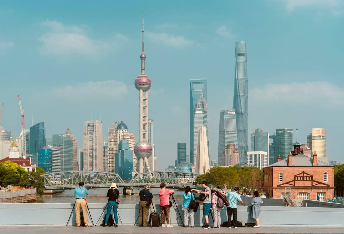
Shanghai is a provincial-level municipality of 24.8 million permanent residents spread across 6,340.5 km², but its walkable core is surprisingly compact. The central districts — Huangpu, Jing'an, Xuhui, and parts of Pudong — sit within a few kilometres of each other, connected by flat terrain (average elevation of 4–5 metres above sea level) and a metro system that makes reaching any starting point effortless. Unlike many Chinese cities where the best sights require a taxi, Shanghai's most architecturally significant neighbourhoods are designed to be explored on foot.
The city's layered history helps too. Shanghai was shaped by more than a century of foreign concessions, meaning European and Art Deco architecture sits alongside Shikumen (stone-gate) lane houses, 1990s supertowers, and contemporary design. Walking is the only way to feel how abruptly these eras collide. A single block on Wukang Road can take you from a 1924 French Renaissance mansion to a Shanghainese breakfast stall to a concept store in a converted shikumen. No guided tour moves slowly enough to absorb that.
ℹ️ Good to know
All routes in this guide use public streets and free-access areas. Optional paid attractions (temples, museums, observation decks) are noted separately. You can complete every core walk without spending a single yuan on entry fees.
Walk 1: The Bund Promenade and Nanjing Road
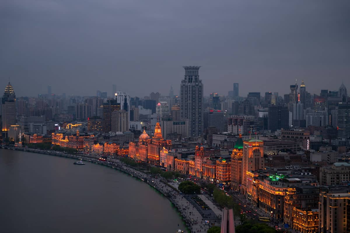
The Bund promenade along Zhongshan East 1st Road is the obvious starting point for any first visit to Shanghai, and it earns that status. The waterfront walkway is a free, public space open 24 hours a day with no tickets, no gates, and no booking required. The walk from Chen Yi Square (near the bronze statue of the former mayor, often called the 'Bund bull') north to Waibaidu Bridge covers roughly 1.5 km. Walking south to Shiliupu Wharf extends that to around 2.5 km. Both directions are flat, paved, and lined with some of China's most significant early 20th-century commercial buildings.
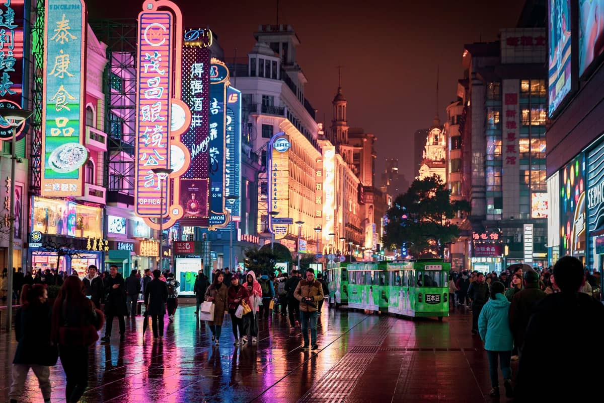
For the full experience, combine the Bund with Nanjing Road. Start at East Nanjing Road metro station (Lines 2 and 10), walk east to the waterfront (about 800 metres), then head north along the promenade before looping back west along Beijing East Road or Fuzhou Road to explore the side streets. The full loop is around 4–5 km and takes 2–3 hours at a relaxed pace with stops. Morning visits (before 9:00) give you the promenade nearly to yourself. Evenings from around 18:00 are when the Pudong skyline lights activate, and the atmosphere shifts completely.
- Best time to visit Early morning (07:00–09:00) for quiet photography; evenings from 18:00 for the light show, which typically runs until 22:00 on weekdays and 23:00 on weekends and public holidays.
- Metro access East Nanjing Road station (Lines 2/10) puts you at the western end of the pedestrian street. Alternatively, use Yuyuan Garden station (Line 10) to start from the south end near Shiliupu Wharf.
- Extend the walk Continue north past Waibaidu Bridge into Hongkou for a quieter stretch of riverfront along the North Bund, with views back across to the main Bund buildings.
- Honest note Nanjing Road pedestrian street (the section west of the waterfront) is heavily commercialised and crowded. It is worth walking once for context, but don't expect the architectural interest of the Bund itself.
⚠️ What to skip
Avoid the Bund on public holidays like National Day (first week of October) and Chinese New Year. Crowd management barriers are put in place, the promenade becomes extremely congested, and the experience is significantly diminished. If you're visiting during these periods, go very early in the morning before 08:00.
Walk 2: The French Concession, from Wukang Road to Tianzifang
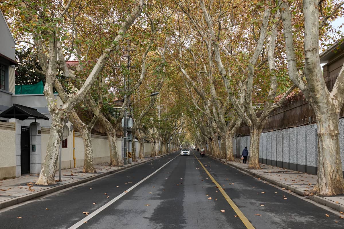
This is the walk that most impresses people who thought Shanghai was only about skyscrapers. The Former French Concession — roughly the area between Huaihai Middle Road, Fuxing Road, and the residential streets running south — is a district of plane-tree-lined avenues, 1920s–1930s villas, and shikumen lane houses now occupied by independent cafes, boutiques, and galleries. The route from Wukang Road down to Tianzifang covers around 4–5 km and takes 3–5 hours depending on how many stops you make.
Start at Jiaotong University metro station (Line 11) or Shanghai Library station (Line 10) and walk north-east up Wukang Road. The Normandie Apartments building at the junction with Huaihai Road is a useful landmark: its distinctive curved prow is one of Shanghai's most photographed pieces of architecture. From there, walk along Anfu Road (strong cafe culture, shaded pavement) to Fuxing Park for a break under the French-designed tree canopy. Continue east on Fuxing Road to Sinan Mansions, a restored complex of 1920s garden villas now hosting restaurants and occasional cultural events. The final stretch south to Tianzifang on Taikang Road takes around 20 minutes on foot.
Tianzifang itself is a warren of shikumen alleyways converted into craft shops and cafes. It is genuinely popular and worth the short visit, but expect crowds on weekends and afternoons. If shopping is not the priority, the surrounding Dapuqiao area on foot is just as interesting and far less congested. The whole French Concession route is entirely free to walk — Fuxing Park charges no entry fee, and the streets are ordinary public spaces.
- Wukang Road: start near Wukang Mansion (Normandie Apartments), walk the full length south to north (or reverse)
- Anfu Road: best street for independent cafes and bookshops; less tourist traffic than Wukang
- Fuxing Park: free entry, large plane trees, locals doing tai chi in the morning
- Sinan Mansions: open public area with heritage villas; good for architecture without crowds
- Tianzifang (Taikang Road): atmospheric lanes, best on weekday mornings
Walk 3: Suzhou Creek and M50 Creative Park
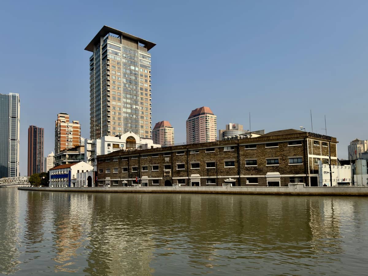
The Suzhou Creek walk is Shanghai's best-kept open secret for a self-guided afternoon. The creek runs east-west through the northern part of the central city, and the walkway along its southern bank between Wusong Road and Changhua Road passes through a corridor of converted early 20th-century warehouses and textile mills. Unlike the Bund or French Concession, this route sees far fewer international tourists and gives a more layered sense of how Shanghai's industrial heritage is being absorbed into its creative economy.
The anchor point is M50 Creative Park at 50 Moganshan Road — a cluster of contemporary art galleries occupying a former cotton mill complex. Entry to the precinct is free; individual galleries may charge for specific exhibitions. The park is open daily and most galleries operate from around 10:00 to 18:00, though hours vary by space. From M50, the creek-side path east toward the Bund offers around 3–4 km of walking past converted warehouses, new residential towers, and small bridges. This section is significantly quieter on weekday mornings.
✨ Pro tip
Combine the Suzhou Creek walk with a visit to the area north of the creek in Hongkou. The Jewish Refugees Museum on Changyang Road and the surrounding Tilanqiao neighbourhood offer a completely different historical perspective on Shanghai's past and are easily reached by metro (Dalian Road station, Lines 4 and 12). See the guide to Hongkou and the North Bund for a full itinerary.
Walk 4: Old Town (Nanshi) and the Yu Garden Area
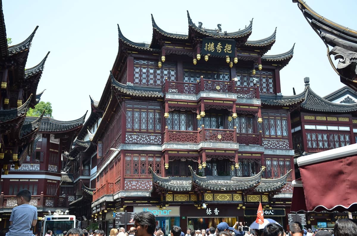
Shanghai's Old Town district, Nanshi, predates the concession era and occupies the southern section of Huangpu District. The walk around Yu Garden and the City God Temple area is shorter than the other routes here — around 2–3 km — but dense with detail. The garden itself charges admission (around ¥30–40 depending on season, verify current pricing before visiting), but the surrounding Yuyuan Bazaar streets and the lanes running south toward Fangbang Middle Road are free to explore.
Be honest with yourself about what to expect here: the immediate area around the bazaar is very heavily commercialised and targeted squarely at tourists. The value in walking this neighbourhood comes from heading one or two blocks away from the main commercial drag. The streets around Dajing Pavilion and the old city wall remnants, and the residential lanes south of Fuxing East Road, give a much more authentic sense of pre-modern Shanghai. Combine this walk with a ferry crossing from Shiliupu Wharf to Lujiazui for a view of the Bund from the Pudong side — the ferry costs around ¥2 as a standard current fare and runs frequently, making it one of the best-value short journeys in the city. The Lujiazui riverside promenade on the Pudong side is itself a good 2 km free walk with unobstructed Bund views.
Practical Logistics: Metro, Timing, and Seasonal Advice
All four routes described above are accessible by Shanghai Metro, which operates a distance-based fare: ¥3 for trips up to 6 km, plus ¥1 for each additional 10 km. A single journey between almost any two points in the central walking areas will cost ¥3–6. The metro runs from approximately 05:30 to 23:00 daily, with exact times varying by line and station. Stored-value transit cards (the Shanghai Public Transportation Card, available from metro service centres and convenience stores) make tap-in tap-out straightforward and avoid the need for cash at ticket machines.
- Spring (March–May) Temperatures of 10–20°C and flowering plane trees make this the second-best season for walking. Rain is possible, especially from late May, so carry a compact umbrella.
- Summer (June–August) Highs regularly exceed 32°C with high humidity. Walk before 09:00 or after 17:00. The plum rain (meiyu) season in June–early July brings sustained rainfall. Not recommended for long urban walks.
- Autumn (October–November) The best season. Temperatures of 15–22°C, lower humidity, and golden plane-tree foliage in the French Concession. October to mid-November is ideal. Avoid National Day week (first week of October) due to crowds.
- Winter (December–February) Daily means of 4–7°C. Walks are possible but cold and often damp. The Bund at dusk in winter fog has a particular atmosphere, but dress in proper layers. Some outdoor cafes close or reduce seating.
For a well-structured multi-day approach that weaves these walks into a broader itinerary, the best time to visit Shanghai guide goes deeper on seasonal trade-offs. If you want to extend beyond the city centre, the Shanghai water towns guide covers walkable day trips to places like Zhujiajiao that work well as a counterpoint to the urban routes here.
💡 Local tip
Download an offline map or navigation solution before you walk. Google Maps is not accessible in mainland China without a VPN. Use Apple Maps (works reliably with data but has limited offline support in China), Amap (Gaode Maps, the most accurate local option with an English interface), or Baidu Maps. Amap is the most reliable for street-level pedestrian navigation in Shanghai.
For travellers interested in the architectural detail along these routes, the Shanghai architecture guide provides context on the key building styles and periods you will encounter. If photography is a priority, the best photo spots in Shanghai guide identifies the specific viewpoints and timing that produce the strongest results on each of these routes.
FAQ
Is the Bund free to visit, or do you need a ticket?
The Bund promenade along Zhongshan East 1st Road is entirely free and open 24 hours a day with no tickets or entry gates. It is a public waterfront walkway. Some adjacent attractions — like observation decks in Pudong towers — charge admission, but the promenade itself has no cost.
How long does the French Concession walking route take?
The core route from Wukang Road to Tianzifang covers approximately 4–5 km. At a relaxed pace with stops for coffee or photos, expect 3–5 hours. If you add Fuxing Park and Sinan Mansions, budget the full afternoon. The route is entirely flat and manageable for most fitness levels.
What is the best time of day to walk the Bund?
Early morning (07:00–09:00) for calm, uncrowded photography with soft light on the colonial buildings. Evening from around 18:00 for the Pudong skyline light show, which runs until about 22:00 on weekdays and 23:00 on weekends. Midday in summer is the worst time: hot, humid, and very busy.
Do I need a VPN or special apps for navigation in Shanghai?
Google Maps does not function in mainland China without a VPN. Use Apple Maps (available with a full English interface but limited offline support), Amap (Gaode Maps — best local option with an English-language interface), or download offline maps via Maps.me before you arrive. Internet access to foreign services including many social media platforms may be restricted; check the current status of any app you rely on before travelling.
Can I link these walks into a single multi-day plan?
Yes. A logical sequence across two or three days would be: Day 1 — the Bund and Old Town (Nanshi), crossing to Lujiazui by ferry; Day 2 — the French Concession from Wukang Road to Tianzifang; Day 3 — Suzhou Creek and M50, with an optional extension into Hongkou. Each route is around 3–5 km and comfortably fills a half-day with stops. Use the metro to position yourself at the start of each walk.