Amsterdam's Canals: A Complete Guide to the Canal Ring
Amsterdam's Canal Ring is one of Europe's most ambitious feats of urban planning, a UNESCO World Heritage Site built during the Dutch Golden Age. This guide covers the history, the three main canals, how to explore by boat or on foot, seasonal conditions, and straightforward advice on what's worth your time.
Plan and book this trip
Tools from our partner Travelpayouts help you compare flights and hotels. If you book through them, we may earn a commission at no extra cost to you.
Flights
Hotels map
TL;DR
- The Canal Ring (Grachtengordel) is a UNESCO World Heritage Site built in the 17th century, not a natural waterway.
- The three main canals are Herengracht, Keizersgracht, and Prinsengracht; Amsterdam has over 100 km of canals total across roughly 90 islands.
- A canal cruise is the fastest way to see the ring, but walking the Jordaan side streets alongside the canals gives a completely different perspective.
- Crowds peak from April to September; canal skating is occasionally possible in deep winter but not guaranteed.
- The Canal Ring neighborhood is also one of Amsterdam's most expensive areas to stay in, so book accommodation early if you want to be central.
What the Canal Ring Actually Is
Amsterdam's canals are not the product of nature or accident. The Grachtengordel, which translates literally as 'canal girdle', is one of history's most deliberate urban planning exercises. In the late 16th and early 17th centuries, Amsterdam's city authorities designed a semicircular expansion around the medieval core, digging three concentric canals outward from the old town to accommodate the explosive growth of the Dutch Golden Age. The result was a network of canals, bridges, and narrow streets that still defines the city's shape today.
UNESCO inscribed the Canal Ring as a World Heritage Site in 2010, describing it as 'an outstanding example of the planned port city of the late 16th and early 17th centuries.' The designation covers the historic canal district west and south of the old city core. It is worth knowing this because many visitors assume the full city is protected, when in fact the UNESCO boundary is specific to the Grachtengordel and immediate surroundings.
ℹ️ Good to know
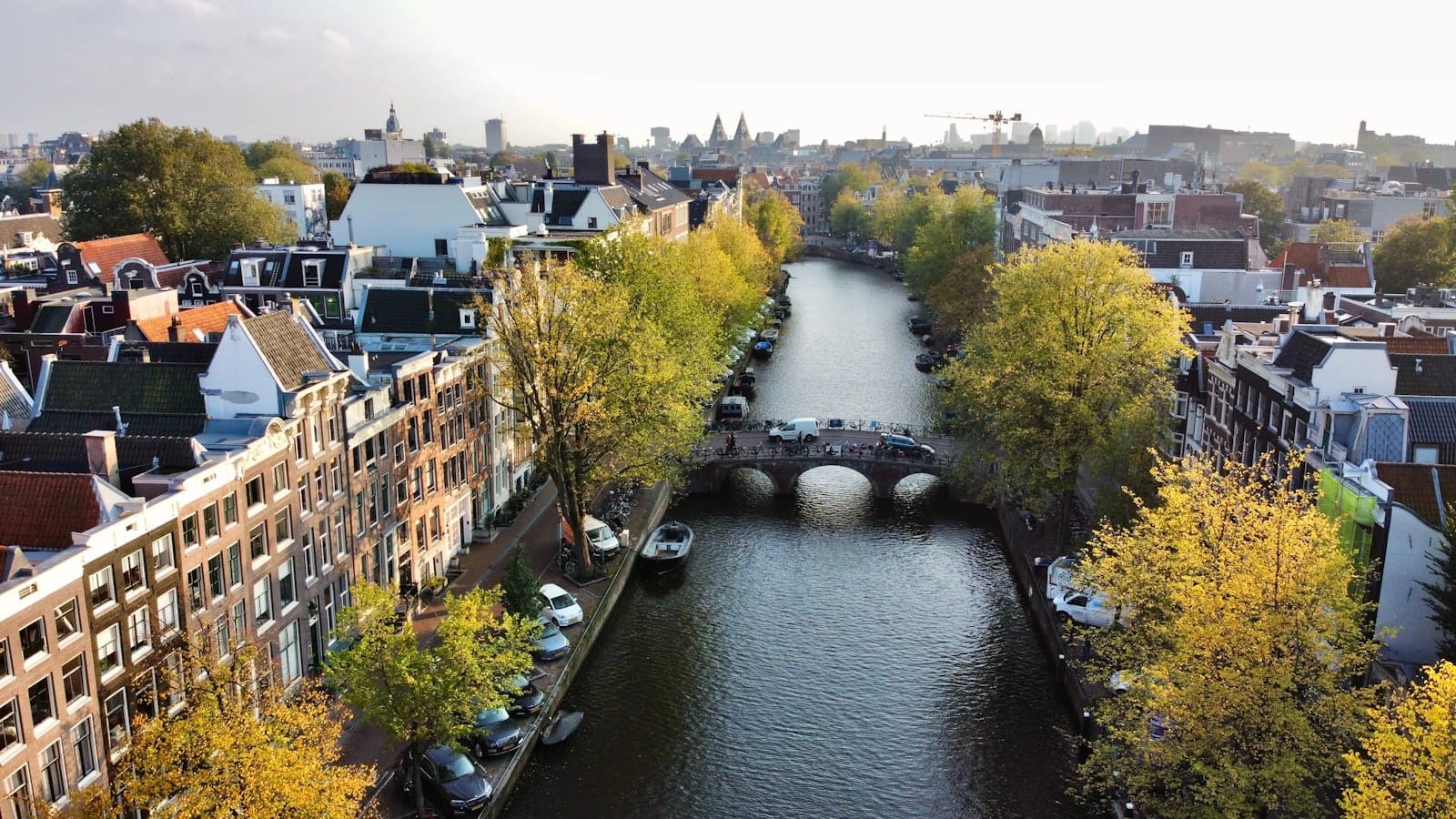
Amsterdam has more than 100 km of canals and around 90 islands connected by approximately 1,500 bridges. The Canal Ring is the most visited section, but the broader waterway network extends into every district of the city.
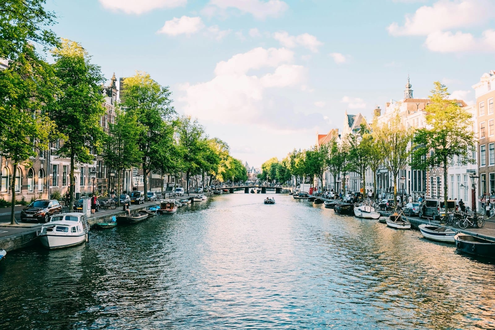
The Three Main Canals: Herengracht, Keizersgracht, and Prinsengracht
The Canal Ring is organized around three principal waterways, each with its own character and history.
- Herengracht (Gentlemen's Canal) The innermost and most prestigious of the three. This is where Amsterdam's wealthiest 17th-century merchants built their grandest canal houses. The stretch between Leidsestraat and Vijzelstraat is known as the 'Golden Bend' (Gouden Bocht) and contains some of the widest, most architecturally elaborate houses in the city. Several have been converted into museums, including the Willet-Holthuysen Museum, which gives you access to a period-furnished merchant house.
- Keizersgracht (Emperor's Canal) Named after Holy Roman Emperor Maximilian I, this is the widest of the three canals and sits in the middle ring. It is slightly less formal than Herengracht and mixes private homes, boutique hotels, and converted office spaces. The Anne Frank House sits just off Prinsengracht, but the walk along Keizersgracht from Brouwersgracht down to Leidsegracht is consistently one of the most photographed stretches of water in the Netherlands.
- Prinsengracht (Prince's Canal) The outermost of the three main canals, and arguably the most livable-feeling. Houseboats line its banks in greater numbers here, the streets feel less polished, and the Jordaan neighborhood runs directly alongside it. The Westerkerk tower and the Anne Frank House are both on Prinsengracht, making it the canal most tourists encounter first. The Noordermarkt and Lindengracht markets operate nearby on Saturdays and Mondays respectively.
Beyond the main three, the canal system includes Brouwersgracht at the northern end, widely regarded by Amsterdammers as the most beautiful single canal in the city. It connects the main ring canals at right angles and is lined with former warehouses converted into homes. For market lovers, Noordermarkt sits just a few minutes' walk from Brouwersgracht, adding a practical reason to explore this quieter northern section.
How to Explore the Canals: Boats, Bikes, and Walking
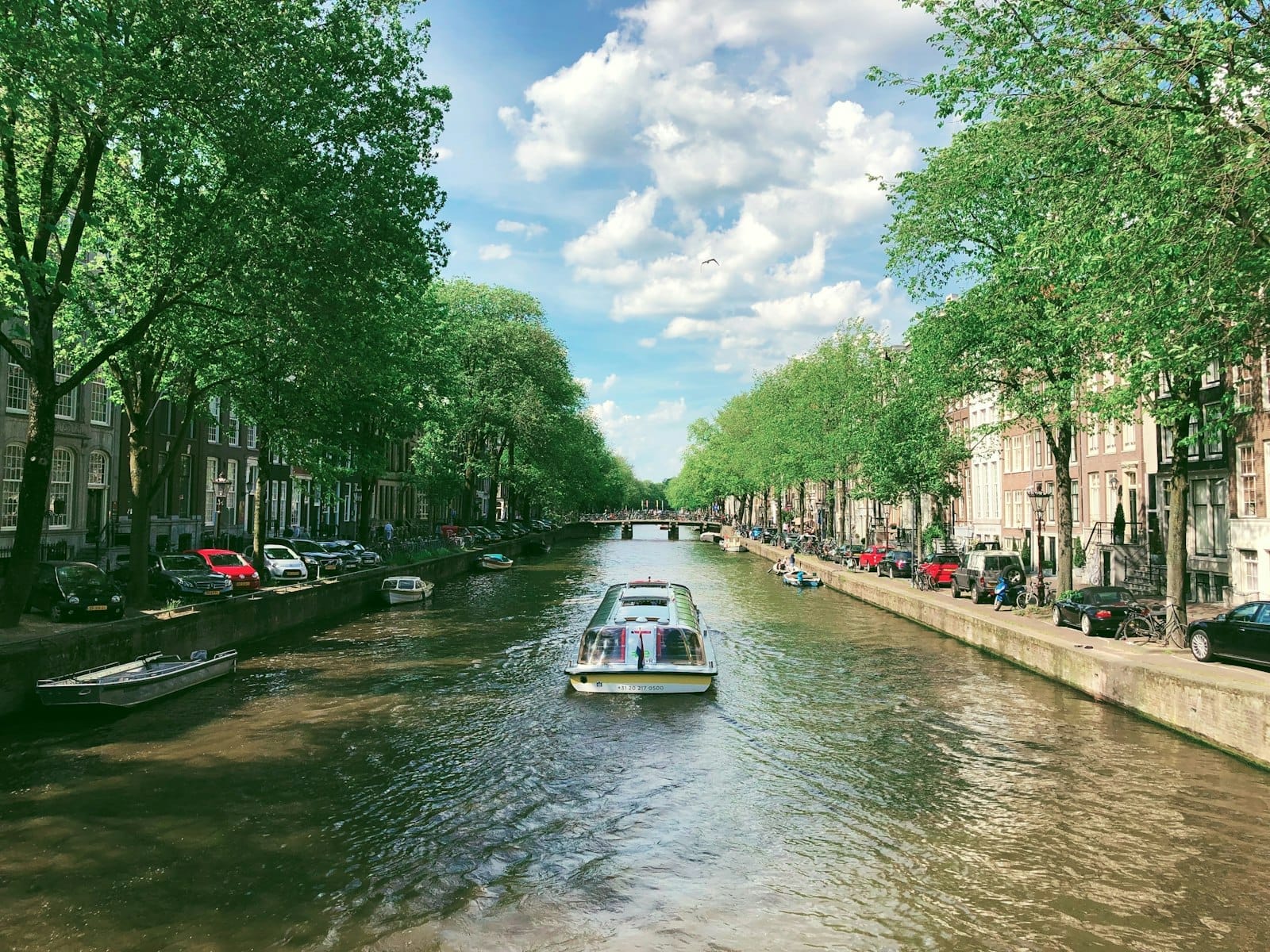
There are three practical ways to experience Amsterdam's canals: from the water, on a bicycle, or on foot. Each gives you something different, and the best visits combine at least two of them. For a structured introduction, canal cruises in Amsterdam range from basic one-hour loops to evening dinner boats. Standard daytime cruises cover the main ring in around 60-75 minutes with audio commentary in multiple languages. Prices vary by operator but typically fall in the €15-20 range per adult for a standard loop cruise.
Hop-on, hop-off canal buses are useful if you're combining the canals with specific attractions, since stops are positioned near major sites. They are more expensive per journey than a standard cruise and can feel crowded in peak months. For a quieter alternative, rent a small electric boat or pedal boat and navigate independently. Several rental operators are clustered around Amstel, Keizersgracht, and near the Jordaan. No license is required for boats under a certain size, but pay attention to the city's canal traffic rules and speed limits.
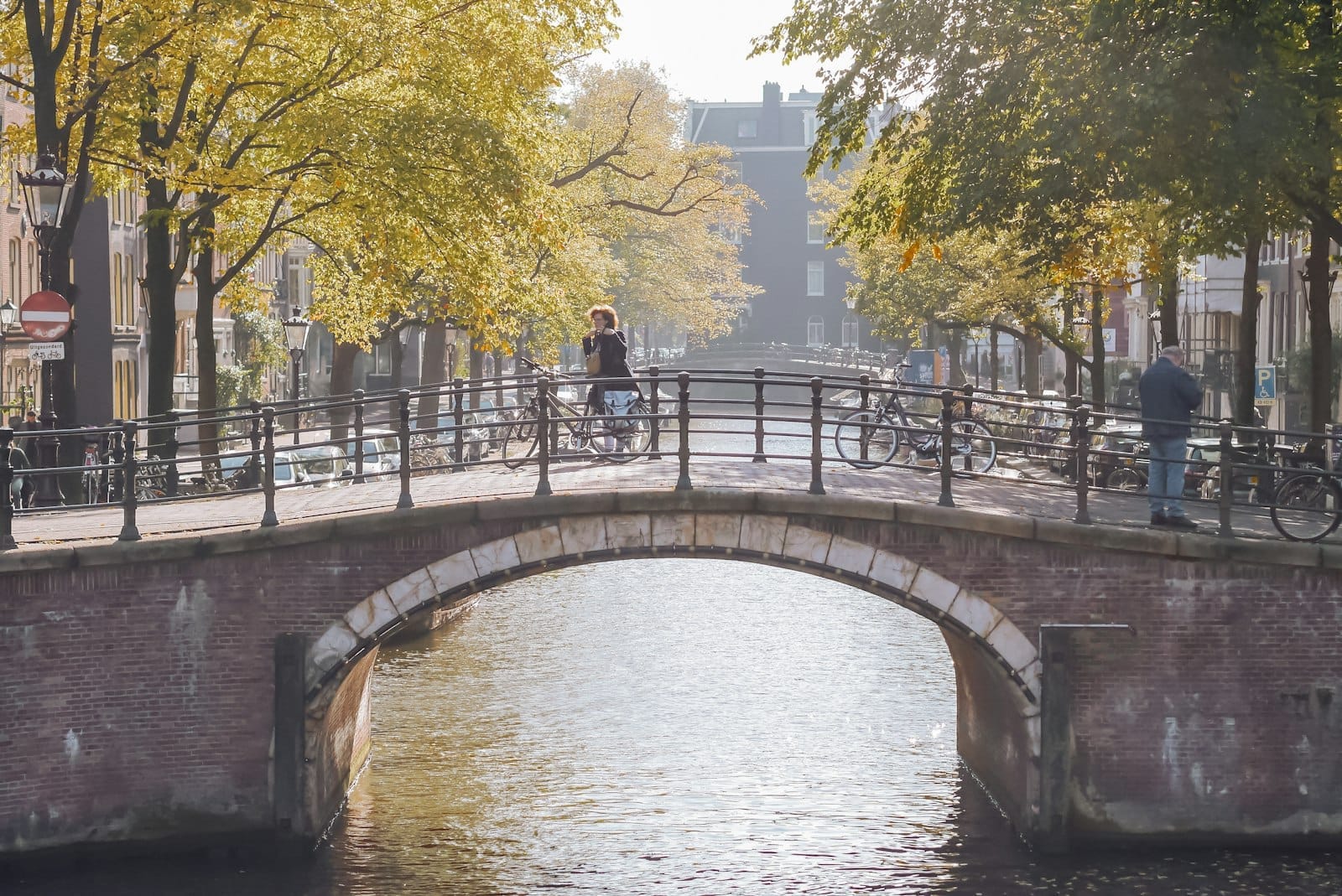
Cycling along the canals is the authentic Amsterdam experience. The city's flat terrain and dedicated cycling infrastructure make it possible to follow Prinsengracht from Brouwersgracht all the way south to Leidseplein in about 20 minutes at a relaxed pace. For a full overview of cycling logistics, Amsterdam's route maps, and bike rental options, the cycling in Amsterdam guide covers everything you need. Walking is slower but lets you stop at bridges, examine canal house facades up close, and step into the Jordaan side streets that run off Prinsengracht.
✨ Pro tip
The best canal photos are taken from bridges, not boats. Stand in the middle of a bridge and shoot along the canal toward the next bridge for the classic Amsterdam perspective. Early morning, before 8am in summer, gives you clean compositions without crowds or parked delivery vehicles.
Seasonal Conditions and When to Visit
The Canal Ring looks different in every season, and the honest answer is that each period has real advantages and real drawbacks.
- Spring (March to May) April and May are peak season for a reason: mild temperatures, long days, and the tulip fields in full bloom a short train ride away at Keukenhof. The canals are at their most photogenic when lined with flowering trees. Expect crowds and higher accommodation prices, especially around King's Day on 27 April.
- Summer (June to August) The busiest and most social period. Canal-side terraces are packed, boat traffic is heavy, and festivals run most weekends. Temperatures in the low-to-mid 20s Celsius are comfortable for walking. Book accommodation months in advance and expect queues at the Anne Frank House without a pre-booked timed ticket.
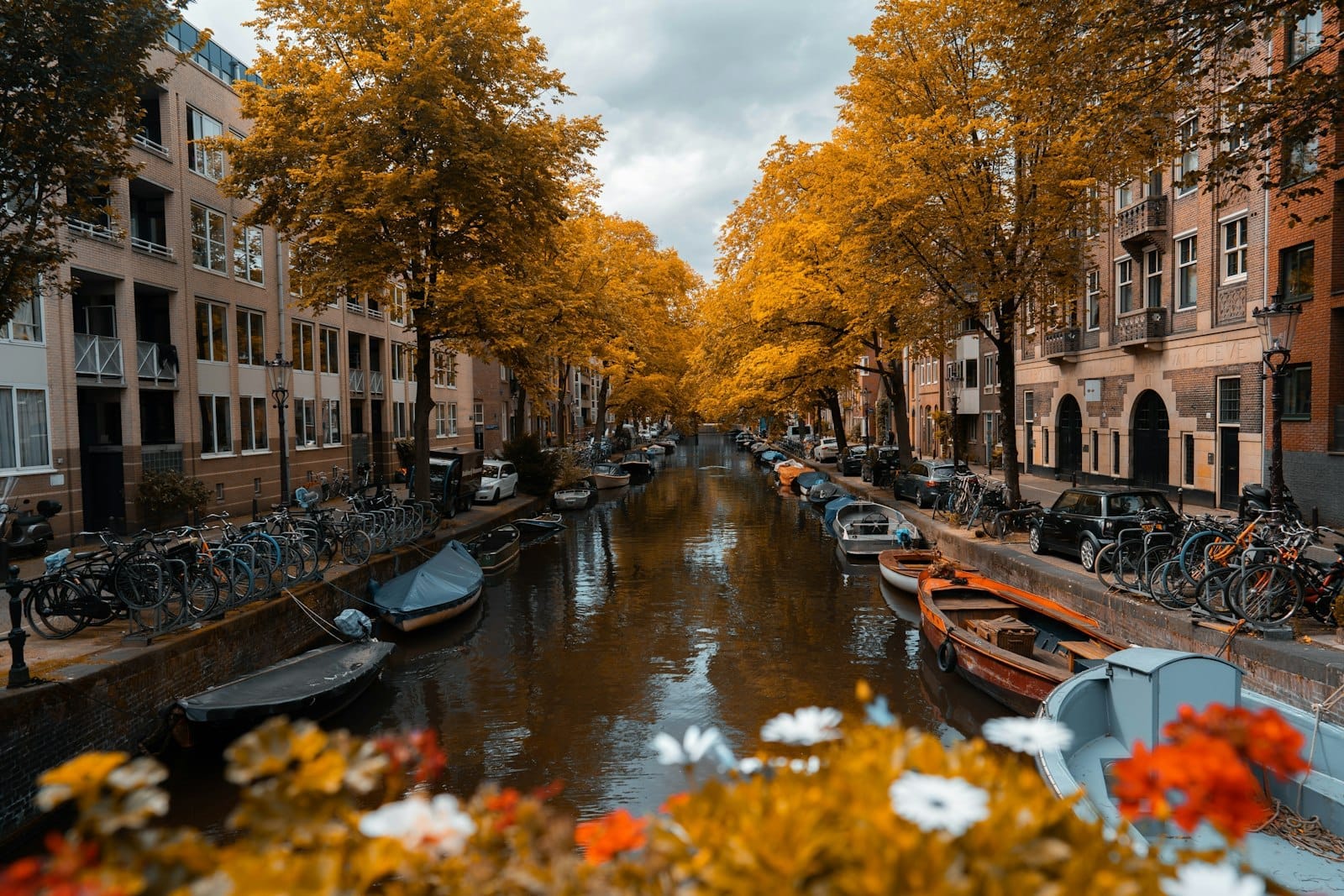
- Autumn (September to November) Crowds thin after mid-September and prices drop. The canal reflections of autumn foliage are genuinely striking. Rain increases through October and November, so a waterproof layer is essential. The Amsterdam Light Festival runs from late November into January, illuminating canal bridges and banks with large-scale light installations.
- Winter (December to February) Cold and quiet. On rare occasions when temperatures drop below zero for several days, the canals freeze and Amsterdammers skate on them, one of the city's most extraordinary sights. It is not predictable and cannot be planned around. The Light Festival makes winter evenings worth a canal walk. Boat cruise operators reduce schedules but typically run year-round.
For a full breakdown of what each month brings, the best time to visit Amsterdam guide goes into detail on pricing patterns, event calendars, and weather expectations.
What to See Along the Canals
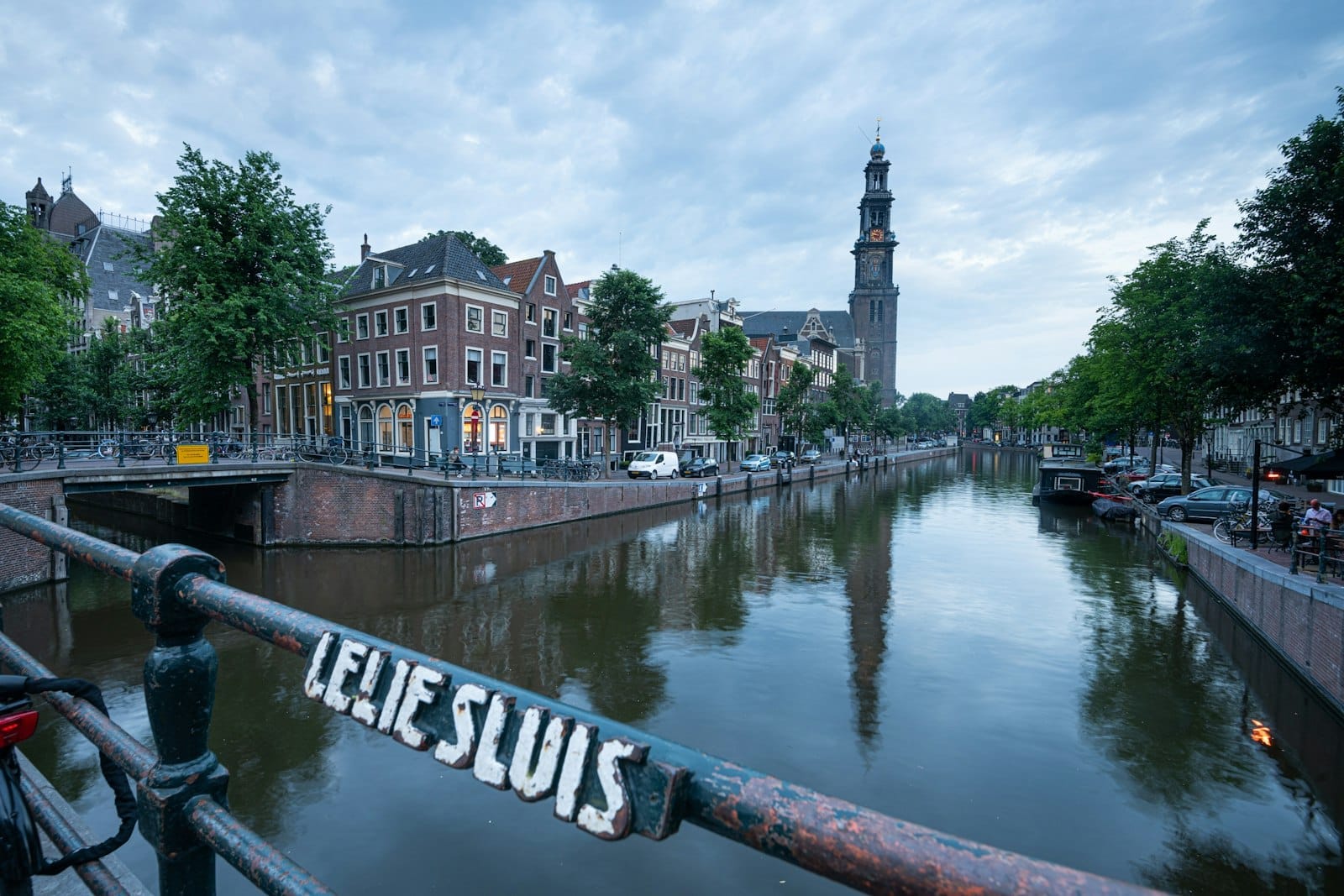
The Canal Ring is dense with specific sites worth seeking out beyond the view from the water. The Anne Frank House on Prinsengracht 263-267 is one of the most significant historical sites in Europe. Timed entry tickets must be booked online in advance; showing up without one almost always means not getting in. Nearby, the Westerkerk is the largest Protestant church in the Netherlands and its tower, the Westertoren, offers city views for those who climb it in summer months.
The Houseboat Museum on Prinsengracht gives an accurate picture of life on Amsterdam's approximately 2,500 registered houseboats. It is small and unpretentious, taking around 30-45 minutes. For architecture enthusiasts, the Grachtenpanden (canal house facades) along the Golden Bend on Herengracht between Vijzelstraat and Leidsestraat show the full range of 17th and 18th century Dutch architectural styles, from stepped gables to neck gables to bell gables. The Magere Brug (Skinny Bridge) over the Amstel river at the southeastern edge of the canal ring is Amsterdam's most photographed drawbridge, particularly at night when it is illuminated.
The De Negen Straatjes (the Nine Streets) cross-cut the three main canals in the western section of the ring and contain some of Amsterdam's best independent shops, bakeries, and brown cafes. This is also one of the least tourist-heavy sections of the canal ring to walk through on a weekday morning.
⚠️ What to skip
The canal ring has serious cycling traffic. If you are walking along the canal streets, stay aware of bike lanes, which often run directly alongside the canal with minimal separation. Stepping into a bike lane without looking is one of the most common causes of minor accidents for visitors in Amsterdam.
Practical Logistics for the Canal Ring
The Canal Ring is roughly a 20-minute walk or tram ride from Amsterdam Centraal station. Trams 2, 12, and 17 serve various points along the ring canals. The getting around Amsterdam guide covers public transport in detail, including the OV-chipkaart system used on GVB trams and buses. Amsterdam Airport Schiphol is approximately 17 km southwest of the city centre; the direct train to Amsterdam Centraal takes around 15-20 minutes.
Accommodation inside the Canal Ring is central but expensive, and rooms are typically small due to the constraints of historic canal house buildings. If you want canal views from your room, expect to pay a premium and accept that heritage buildings often mean narrow staircases and no elevator. Staying in the Jordaan just west of the main canals gives you proximity without the same price level.
- Book the Anne Frank House timed ticket as far in advance as possible, ideally 8 weeks ahead in summer.
- Canal cruise operators around Damrak, near Centraal Station, tend to be higher traffic and more touristic; operators further into the ring, near Leidseplein or Keizersgracht, often feel slightly less rushed.
- The Canal Ring streets are cobblestoned; sensible footwear matters more than people expect.
- Most canal bridges have a railing on one side but are open on the other. Keep children and bags away from the water edge.
- Free public toilets are rare in the canal area; plan accordingly or use cafe facilities.
FAQ
How many canals does Amsterdam have?
Amsterdam has more than 100 km of canals spread across the city. The Canal Ring (Grachtengordel) is the most visited section and centers on three main canals: Herengracht, Keizersgracht, and Prinsengracht. The full city network connects around 90 islands via approximately 1,500 bridges.
Is the Amsterdam Canal Ring a UNESCO World Heritage Site?
Yes. UNESCO inscribed the Canal Ring in 2010, recognizing it as an outstanding example of a planned port city from the late 16th and early 17th centuries. The designation covers the historic canal district west and south of the old town core, not the entire city.
What is the best way to see the Amsterdam canals?
A standard one-hour canal cruise covers the main ring efficiently and costs around €15-20 per adult. Walking along Prinsengracht and through the Jordaan side streets gives a more ground-level experience. Cycling alongside the canals is the most local approach. Combining a morning walk with an afternoon cruise gives you both perspectives.
Can you skate on the Amsterdam canals?
Occasionally, yes. When temperatures drop below freezing for several consecutive days in winter, the canals freeze sufficiently for skating. This happens rarely and unpredictably, perhaps once every few years. It cannot be reliably planned around, but if it happens during your visit, it is a genuinely extraordinary sight.
Are there free things to do around the Amsterdam canals?
Walking the canal streets, crossing the bridges, exploring De Negen Straatjes, and visiting the Begijnhof courtyard nearby are all free. The exterior of the Golden Bend on Herengracht and Brouwersgracht costs nothing to walk along. Canal-side brown cafes and the Saturday markets near Prinsengracht also require no entry fee.