Getting Around Adelaide: The Complete Transport Guide
Adelaide is one of Australia's most navigable cities, but knowing which services are free, when to walk versus drive, and how to reach the beaches and hills makes a real difference. This guide covers every transport option in practical detail.
Tickets & tours
Live prices and dates from our booking partner. If you book, we may earn a commission at no extra cost to you.
TL;DR
- Adelaide Metro runs buses, trains, and trams on a flat-fare system; a metroCARD or contactless payment covers all three.
- Several services are genuinely free: City Connector buses (routes 98A/98C and 99A/99C) and a defined free tram zone covering South Terrace to the Botanic Gardens.
- Adelaide Airport (ADL) is about 8 km from the CBD; the J1/J2 bus connects them, with roughly 15-minute weekday daytime frequency.
- The CBD grid is compact enough to walk or cycle; ride-hailing (Uber) fills gaps after hours or for cross-suburban trips.
- For day trips to the Barossa Valley or Adelaide Hills, a hire car is almost always the most practical option.
Understanding the Adelaide Metro Network
Adelaide Metro is the umbrella brand for the city's public transport: buses, suburban trains, and the tram line to Glenelg. The core advantage is a flat fare structure, meaning you pay the same amount regardless of how far you travel on the network. Transfers between services within a set time window are included in a single fare. Always check the Adelaide Metro website for current fare amounts, as these are updated periodically.
For payment, you have three main options. The metroCARD is a reloadable card with a small discount over single fares. Contactless tap-and-pay using a bank card or phone works on buses and trams, with transfers to trains departing Adelaide Railway Station. The free Adelaide Metro Buy & Go app functions similarly on buses and trams, with train transfers from Adelaide Railway Station. Single-use paper tickets are available at some outlets but cost more per trip. If you're spending more than a day or two using public transport, loading up a metroCARD or using tap-and-pay is straightforwardly the better deal.
⚠️ What to skip
The 'free tram zone' is frequently misunderstood. It only applies between defined endpoints: South Terrace, the Entertainment Centre, Festival Plaza, and the Botanic Gardens. Travel beyond those points requires a valid paid fare. Boarding the tram to Glenelg without a ticket outside the free zone will result in a fine.
Free Services Worth Knowing
Adelaide has a genuinely useful set of free public transport options that most visitors overlook. The City Connector buses are the most practical: routes 98A and 98C run a loop between the city centre and North Adelaide every day, while routes 99A and 99C run an inner-city loop on weekdays. These are free to board, no ticket or card required.
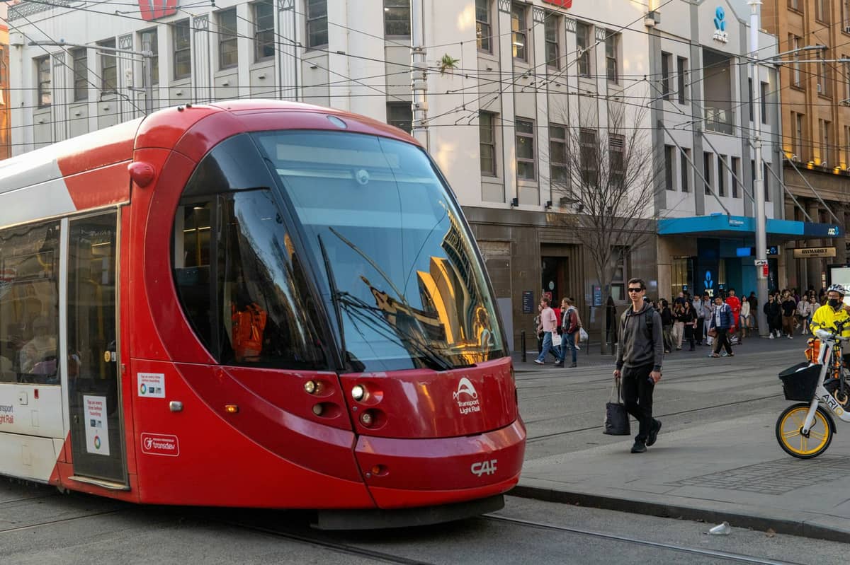
The free tram zone covers a substantial stretch of the city centre, running along North Terrace past the Art Gallery of South Australia and the South Australian Museum, continuing to the Botanic Gardens stop and in the other direction toward the Entertainment Centre. For short hops between city attractions, the tram costs nothing. On Jetty Road in Glenelg, the tram is also free — useful for moving between the beach end and the shops.
💡 Local tip
If you're staying in the CBD and only visiting city-centre attractions, you may not need to spend anything on transport at all. Combine the free tram zone with the City Connector buses and you can reach North Adelaide, the Botanic Gardens, and the Entertainment Centre precinct without touching a fare.
Getting from Adelaide Airport to the City
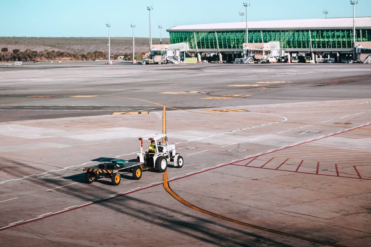
Adelaide Airport (ADL) sits about 8 kilometres west of the city centre, a short trip by most measures. The J1 and J2 bus routes connect the airport directly to the city, stopping at the central interchange. On weekday daytimes, these buses run approximately every 15 minutes; evenings, weekends, and public holidays drop to roughly every 30 minutes. The journey takes around 25-30 minutes depending on traffic. Standard Adelaide Metro fares apply, so a metroCARD or contactless payment covers it.
Taxis queue at the designated rank outside the terminal. Rideshare services including Uber operate from signposted pickup areas at the airport, separate from the taxi rank. A rideshare to the CBD typically runs cheaper than a taxi at standard times, though surge pricing during events or late at night can change that calculation. If you're arriving with significant luggage or late at night, either option is worth the extra cost over the bus.
✨ Pro tip
There is no train line to Adelaide Airport — a common assumption for visitors used to other Australian capital cities. The J1/J2 bus is the only public transport connection. Check the Adelaide Metro journey planner before you travel, as timetables are occasionally amended for events or service changes.
Walking, Cycling, and Getting Around the CBD

The Adelaide CBD was laid out in an exceptionally regular grid by Colonel William Light in 1836, and that geometry still makes it one of the most walkable city centres in Australia. From one end of Rundle Mall to the other is about 600 metres; the full length of the CBD from east to west is roughly 1.5 kilometres. Most visitors can cover the main central attractions on foot without planning a route.
Cycling is viable and improving. The River Torrens Linear Park offers a flat, off-road path running east-west through the city, connecting the CBD to the eastern suburbs. The Adelaide Park Lands ring road has dedicated cycling paths. Shared e-bikes and e-scooters are available through commercial operators (check current availability, as providers and service areas change). Helmets are legally required for all cyclists in South Australia — this is enforced.
- CBD to North Adelaide A 15-20 minute walk across the Torrens via King William Road bridge, or take the free 98A/98C City Connector bus.
- CBD to Glenelg Take the Glenelg tram south from the city free zone; a paid fare applies past South Terrace (roughly 25–30 minutes to Moseley Square). The Entertainment Centre spur is the opposite direction.
- CBD to Port Adelaide The train from Adelaide Railway Station runs to Outer Harbour and stops at Port Adelaide — around 25-30 minutes, standard Metro fare.
- CBD to Norwood/The Parade Multiple bus routes connect Rundle Street to Norwood's main strip; about 15 minutes by bus or a 30-minute walk.
Trains: Suburban Lines and Key Destinations
Adelaide's suburban rail network radiates out from the central Adelaide Railway Station on North Terrace. There are several lines covering key directions: the Gawler, Belair, Seaford, Outer Harbor, and Grange lines (note that not all run at all times; check current timetables). For visitors, the most relevant are the Outer Harbor line for Port Adelaide, and the Belair line for access to Belair National Park.
Trains run less frequently than the buses in inner-city areas, and services thin out significantly in the evenings and on weekends. The O-Bahn is worth a mention for visitors staying in the eastern suburbs: it's a guided busway using a dedicated track, connecting Tea Tree Plaza and the city at high speed. If you're heading to Port Adelaide to visit the maritime museum or the lighthouse precinct, the train is straightforwardly the easiest option.
Hire Cars and Day Trips Beyond the City

For everything beyond the inner suburbs, a hire car gives you a level of flexibility that public transport simply cannot match. All major car rental companies operate from Adelaide Airport, and rates are generally reasonable outside of peak school holiday and event periods. Driving in Adelaide is straightforward: roads are wide, traffic outside of morning and afternoon peak hours is light, and parking in most suburban destinations is free.
The Barossa Valley is about 70 kilometres north-east of the city, typically a 60-75 minute drive. McLaren Vale is around 40 kilometres south, roughly 45 minutes. Both wine regions are essentially inaccessible by public transport for a practical day trip. The Adelaide Hills villages, including Hahndorf, are about 30 kilometres from the CBD and reachable by a combination of bus and walking, but a car saves significant time.
For further afield, day trips from Adelaide to Victor Harbor, Kangaroo Island (via ferry from Cape Jervis), or the Fleurieu Peninsula all require either a hire car or a commercial tour. Public transport does not reach these destinations in any practical sense.
- Drive on the left; speed limits are posted in kilometres per hour.
- Blood alcohol limit for full licence holders is 0.05; for learner and provisional licence holders it is zero.
- Speed cameras and red light cameras operate throughout metropolitan Adelaide.
- Metered parking in the CBD; free parking is common in most suburban areas.
- Tolls: there are no tolls on Adelaide roads as of writing — verify before driving.
ℹ️ Good to know
Adelaide's Mediterranean climate means summer days (December to February) regularly exceed 35°C. If you're walking significant distances or cycling in summer, plan around heat: go out before 10am or after 5pm. Heat can also affect tram and bus air conditioning during extreme events. Winter (June to August) is mild but wet — keep a layer handy if using outdoor stops.
Practical Tips for Getting Around Efficiently
Adelaide rewards visitors who do a little planning upfront. The Adelaide Metro journey planner at adelaidemetro.com.au is accurate and includes real-time service alerts. For a broader picture of what's possible across the city and surrounds, our guide to things to do in Adelaide maps out attractions by area, which helps you cluster visits efficiently and avoid unnecessary cross-city travel.
During major events like the Adelaide Fringe or the AFL season at Adelaide Oval, services on key routes are augmented and park-and-ride options may operate. Check the Adelaide Metro alerts page before travelling on event days, as normal timetables can be suspended or modified at short notice. Late-night services are limited: the last trains and trams on most lines finish well before midnight on weeknights, so have a rideshare option ready if you're out late.
- metroCARD vs. tap-and-pay Both offer the same flat fare. metroCARD requires loading credit in advance; tap-and-pay is more flexible for shorter stays.
- Buy & Go app Free download; works like tap-and-pay for buses and trams, with train transfers from Adelaide Railway Station.
- Taxi vs. rideshare Rideshare is generally cheaper at standard times; taxis are preferable when demand surges after events or late at night.
- Accessibility Trams, most buses, and metropolitan train stations are accessible. The Adelaide Metro website lists accessibility features by route.
FAQ
Is public transport good enough in Adelaide to get around without a car?
Within the inner suburbs and CBD, yes. The free tram zone, City Connector buses, and frequent bus routes cover the main visitor areas well. But for beaches beyond Glenelg, wine regions like the Barossa or McLaren Vale, or most Adelaide Hills destinations, you will need either a hire car or a commercial tour. Adelaide's public transport is useful but not comprehensive by the standards of larger Australian cities.
How do I get from Adelaide Airport to the city centre?
The J1 and J2 buses connect the airport directly to the city on standard Adelaide Metro fares, running roughly every 15 minutes on weekdays from 7:30am to 6:30pm and every 30 minutes at night, weekends, and public holidays until 10pm. Taxis queue at the terminal, and Uber pickups are from a designated rideshare area. There is no train link to the airport.
Is the tram free in Adelaide?
Partially. There is a defined free zone covering the central city section of the tram line, from South Terrace to the Entertainment Centre, Festival Plaza, and the Botanic Gardens. Travel beyond those endpoints — including the Glenelg direction past the free zone boundary — requires a valid paid fare. On Jetty Road in Glenelg itself, the tram is also free.
What is the best way to get to Glenelg from the city?
The tram is the most convenient option. Board at any city-centre stop (free within the central zone) and travel toward Glenelg — a standard fare applies once you pass the free zone boundary. The journey from the city to Glenelg Beach takes around 25-30 minutes. Rideshare is also straightforward and takes roughly 20 minutes by road.
Do I need to validate my ticket on Adelaide public transport?
If you're using a metroCARD, you must tap on when boarding and tap off when exiting to ensure the correct fare is deducted. Tap-and-pay bank cards work the same way. Failure to tap on is treated as travelling without a valid ticket. On free services like the City Connector buses and within the free tram zone, no ticket or tapping is required.
Tickets & tours
Live prices and dates from our booking partner. If you book, we may earn a commission at no extra cost to you.
Planning a trip? Discover personalized activities with the Nomado app.