River Torrens Linear Park: Adelaide's Green Spine from Hills to Coast
River Torrens Linear Park stretches roughly 32 kilometres along Karrawirra Parri (the River Torrens), threading through the heart of Adelaide from the foothills at Athelstone to the coast near West Beach. It is free to access, open continuously, and works equally well as a leisurely stroll through the CBD's park belt or a serious cycling route across the city.
Quick Facts
- Location
- River Torrens corridor, Adelaide CBD and surrounds — multiple access points from Athelstone to West Beach/Henley Beach
- Getting There
- Adelaide Metro tram stops at Adelaide Entertainment Centre (western access) and Victoria Square (short walk to Elder Park riverbank); multiple bus routes reach access points along the route
- Time Needed
- 30 minutes for a riverside stroll through the CBD; 3–5 hours to cycle the full 32 km corridor
- Cost
- Free — no entry fee, no permits required
- Best for
- Cyclists, joggers, families with prams, anyone wanting green space without driving out of the city
What the River Torrens Linear Park Actually Is
River Torrens Linear Park is a continuous shared-path green corridor that follows Karrawirra Parri (the Kaurna name for the River Torrens) for approximately 32 kilometres across metropolitan Adelaide. The park runs from Athelstone in the eastern foothills down through the city centre and out to the coast near West Beach and Henley Beach. It crosses multiple local government areas — Campbelltown, Norwood Payneham and St Peters, the City of Adelaide, and others — which is why there is no single street address or central entry point. You simply join the path at the nearest access point and walk or ride in whichever direction suits you.
The scheme was approved by South Australia's Parliament in 1981, construction began in January 1982, and the final sections were completed in September 1997. What took 15 years to build is now one of Adelaide's most quietly effective pieces of public infrastructure: a near-unbroken line of green threading through a city that is otherwise shaped by car traffic. For visitors staying in the CBD, the most accessible stretch runs along the northern edge of the city centre, where the river separates Adelaide's central grid from North Adelaide.
💡 Local tip
The CBD riverbank section — from the Adelaide Festival Centre east through Elder Park to the Botanic Garden precinct — is easily the most scenic and well-serviced part of the corridor. If you only have an hour, start here.
What You See: The Character of the Corridor
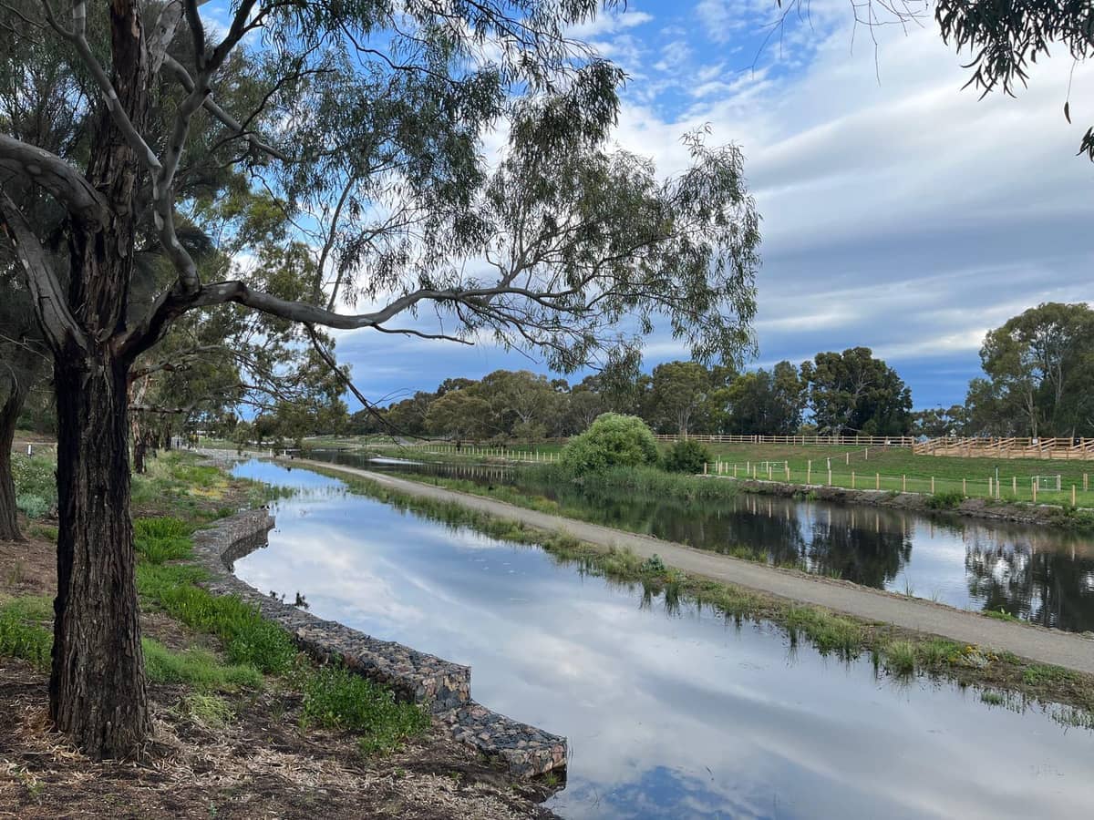
The park changes personality as it moves through different suburbs. Through the CBD and North Adelaide, the path is wide, paved, and flanked by weeping willows and river red gums, with the water visible through gaps in the vegetation. The river here is calm and relatively narrow, reflecting the Adelaide skyline from certain angles near the Festival Centre. On summer mornings the light hits the water at a low angle, and the eucalyptus canopy filters it into patches. The smell is that particular mix of river mud, grass, and warmed bark that belongs specifically to South Australian waterways.
Move east toward the Norwood section — which runs from Felixstow Reserve to Hackney — and the path becomes quieter and more residential, with overhanging trees narrowing the corridor and fewer cafes or facilities nearby. Move west past the Adelaide Festival Centre and the path opens up near Elder Park, with views across the water toward the footbridge and the rowing sheds that have sat on this stretch since the late 19th century.
Wildlife is consistently present. Ibis wade in the shallows at dawn. Cormorants dry their wings on half-submerged logs. In the quieter eastern reaches, you may hear the sharp crack of a kookaburra before you see it. The park is not a wilderness experience, but it does provide genuine ecological continuity across the urban fabric — a green passage that birds, reptiles, and waterbirds use as a corridor, not just a decorative strip.
Tickets & tours
Live prices and dates from our booking partner. If you book, we may earn a commission at no extra cost to you.
Ultimate Adelaide and Hahndorf full-day tour
From 94 €Instant confirmationFree cancellationHalf-day Lofty Descents tour by bike
From 89 €Instant confirmationFree cancellationAdelaide kayak tour with expert instructors
From 51 €Instant confirmationFree cancellationTrue Crime Tour in Adelaide
From 21 €Instant confirmationFree cancellation
Time of Day: How the Experience Changes
Early morning, roughly 6 to 8 am, is when the path belongs to locals. Joggers in small groups, dog walkers, cyclists commuting east-west through the city. The light is cool and flat, the path is never crowded, and the sound of the city has not yet arrived. This is the most peaceful window to walk the CBD stretch, and also when wildlife activity peaks near the water.
By mid-morning on weekends, the central section around Elder Park and the Festival Centre fills noticeably. Families with prams, tourists on rental bikes from city hire stations, and people using the grassy banks for picnics. The atmosphere is unhurried rather than crowded, but solitude is gone. Weekday middays are quieter: office workers cut through on foot, but the pleasure-use traffic thins.
Late afternoon in the warmer months, especially from October through April, brings long golden light across the water and a second surge of joggers. Sunset from the western stretch near the Entertainment Centre can be genuinely good, with the sky reflected in the water and the city's noise starting to drop. Summer afternoons are the one time the park can feel uncomfortable: Adelaide's Mediterranean climate means temperatures regularly exceed 35°C between December and February, and there is limited shade on some sections. Carry water and plan accordingly.
⚠️ What to skip
In summer heat (December to February), avoid the exposed western sections of the corridor during midday. The eastern, tree-covered stretches near Campbelltown offer more shade, but the CBD section has open grassy banks with limited cover for extended periods.
Historical and Cultural Context
The river's Kaurna name, Karrawirra Parri, translates roughly as 'red gum river forest.' The Kaurna people are the traditional custodians of the Adelaide Plains, and the river was a central part of their Country long before European settlement. The colonial name 'Torrens' was assigned by Governor John Hindmarsh in 1836, after Robert Torrens Sr. a British politician. Today both names are in use, with growing acknowledgment of the Kaurna name in signage and council communications.
Colonel William Light's 1836 plan for Adelaide deliberately placed the town site south of the river and established parklands on both banks, which is why the waterway retains a green corridor to this day rather than being developed to its edges. The Linear Park formalized and extended that vision into the outer suburbs across the 1980s and 1990s. If you want to understand how this cultural landscape connects to Adelaide's Aboriginal heritage, the Living Kaurna Cultural Centre at Warriparinga, further south along the Sturt River, provides deeper context, though it sits outside the Torrens corridor itself.
Practical Walkthrough: How to Use the Park
There are no tickets, no opening gates, and no admission fee. The path is open continuously, though the City of Adelaide notes that access to the river itself is prohibited when it is officially closed due to flooding or other safety events — check for signage if the river is running high after heavy rain.
For visitors based in the CBD, the most logical entry is through Elder Park off King William Road, or via the footpath that runs along the river's south bank near the Adelaide Festival Centre. From here you can walk east toward the Adelaide Botanic Garden (about 1.5 km) or west toward the Adelaide Entertainment Centre (about 2 km). Both directions are flat, paved, and suitable for prams and wheelchairs along the CBD stretch, though surface quality and gradient vary on sections further from the city centre.
Cyclists should note that the path is shared with pedestrians — keep speeds moderate through busy sections, especially on weekends near the central precinct. Bike hire is available through services operating in the CBD; verify current providers locally as these change. The full 32 km corridor from Athelstone to the coast is achievable in a day by fit cyclists, but requires route planning as some sections cross roads and pass through quieter suburban reserves with fewer facilities.
There are no formal toilets within the linear park itself on all sections, but public facilities exist at Elder Park, near the Adelaide Zoo, and at the Bonython Park area. Take this into account if you are walking with children or heading into the eastern reaches.
ℹ️ Good to know
The Norwood Payneham and St Peters council section runs from Felixstow Reserve to Hackney. The Campbelltown City Council manages the eastern foothills section. Each council's website provides the most current local information about conditions and facilities for their stretch of the corridor.
Photography and the Honest Assessment
The CBD stretch photographs well in early morning and late afternoon, particularly looking east from the footbridge near the Festival Centre or west from the zoo footbridge with North Adelaide's heritage streetscape behind. The river is not dramatically scenic in the way mountain or coastal landscapes are: it is a modest, green-banked urban waterway, pleasant rather than stunning. The value is cumulative — the experience of walking along it, the absence of traffic noise, the presence of birds and water — rather than a single visual payoff.
Visitors expecting a grand riverside promenade on the scale of European cities will be mildly underwhelmed. What the Linear Park offers instead is something rarer in an Australian city: a long, connected, free public space that allows genuine movement through the urban fabric without getting in a car. Paired with the attractions along its banks, it becomes the organizing thread of a very good day in Adelaide.
The park pairs naturally with a visit to the Adelaide Zoo, which sits directly on the north bank in the CBD section, and with the Adelaide Botanic Garden, whose eastern boundary meets the riverbank. Both are within comfortable walking distance of the central entry points. For those building a full day around the corridor, the walking tours of Adelaide guide includes routes that use the Linear Park as a connective thread.
Insider Tips
- The section between Elder Park and the Adelaide Zoo footbridge is the most photogenic in the CBD, especially looking back toward the Festival Centre from the northern bank. Arrive before 8 am on a clear morning for the best light and minimal foot traffic.
- If you are cycling the full corridor east to west, start at Athelstone and ride downhill toward the coast — the gentle gradient works in your favour. The return trip is slightly harder against any sea breeze.
- The grassy banks near Bonython Park, just west of the central precinct, are far less used than Elder Park and work well for a quiet picnic away from the central tourist flow.
- After significant rainfall, the river can rise quickly and some path sections are closed. If you arrive after rain, check the City of Adelaide's website or look for council closure signage before committing to a long walk.
- Several sections of the eastern corridor pass through quiet residential suburbs with no cafes for several kilometres. Carry water and snacks if you are heading east of the CBD, particularly in warm weather.
Who Is River Torrens Linear Park For?
- Cyclists wanting a traffic-free cross-city route connecting the hills to the coast
- Families with young children or prams looking for flat, accessible green space in the city centre
- Joggers and walkers who want a consistent morning or evening circuit without repeating urban streets
- Visitors who want to connect multiple CBD attractions (Zoo, Botanic Garden, Festival Centre) on foot
- Travellers on a budget who want a half-day experience with no entry cost
Nearby Attractions
Other things to see while in Adelaide CBD:
- Adelaide Arcade
Opened in December 1885, Adelaide Arcade is one of Australia's oldest and best-preserved Victorian-era shopping arcades. Free to enter and located opposite Rundle Mall's fountain, it offers a rare combination of architectural beauty, specialty retailers, and a genuine sense of Adelaide's commercial history.
- Adelaide Botanic Garden
Open daily and completely free, Adelaide Botanic Garden covers 50 hectares on the northern edge of the CBD. From a 19th-century palm house to a full-scale tropical rainforest glasshouse, it rewards a slow morning or a purposeful afternoon walk.
- Adelaide Central Market
Adelaide Central Market has operated continuously since 1869, making it one of the largest undercover fresh produce markets in the Southern Hemisphere. Spread across 5,720 square metres in the heart of the CBD, it draws locals, chefs, and curious visitors to its mix of produce stalls, specialty food traders, and casual eateries. This guide covers everything you need to plan a worthwhile visit.
- Adelaide Festival Centre
Opened in 1973, Adelaide Festival Centre is South Australia's flagship performing arts complex, anchoring the northern edge of the CBD along King William Road. From major theatre productions to intimate performances, it draws both locals and visitors year-round — and its riverside location makes it as much a place to linger as to attend a show.
Planning a trip? Discover personalized activities with the Nomado app.