Xlendi Bay, Gozo: The Fjord-Like Inlet Worth the Journey
Xlendi Bay is a narrow, cliff-framed inlet on Gozo's southwest coast where limestone meets deep turquoise water. Free to access and rich in history, it draws divers, swimmers, and anyone who wants a genuine slice of Gozitan character without the crowds of Malta's main island.
Quick Facts
- Location
- Xlendi, Island of Gozo, Malta
- Getting There
- Bus routes 301/303 from Victoria (Rabat), Gozo; taxi or car via Munxar/Kerċem roads
- Time Needed
- 2–4 hours for the bay; half-day if walking the cliff path to Wardija Point
- Cost
- Free public access
- Best for
- Divers, snorkelers, walkers, and travelers wanting authentic Gozitan atmosphere
What Kind of Place Is Xlendi Bay?
Xlendi Bay (Maltese: Bajja ta' Xlendi) is not a beach in the conventional sense. There is no wide strip of sand, no beach bar pumping music, and no rows of sun loungers stretching into the distance. What you get instead is a compact, fjord-like inlet carved into Gozo's southwest limestone coast, flanked by cliffs that reach up to 105 metres and backed by a small cluster of cafes, restaurants, and apartment blocks that have grown up over decades without entirely overwhelming the setting.
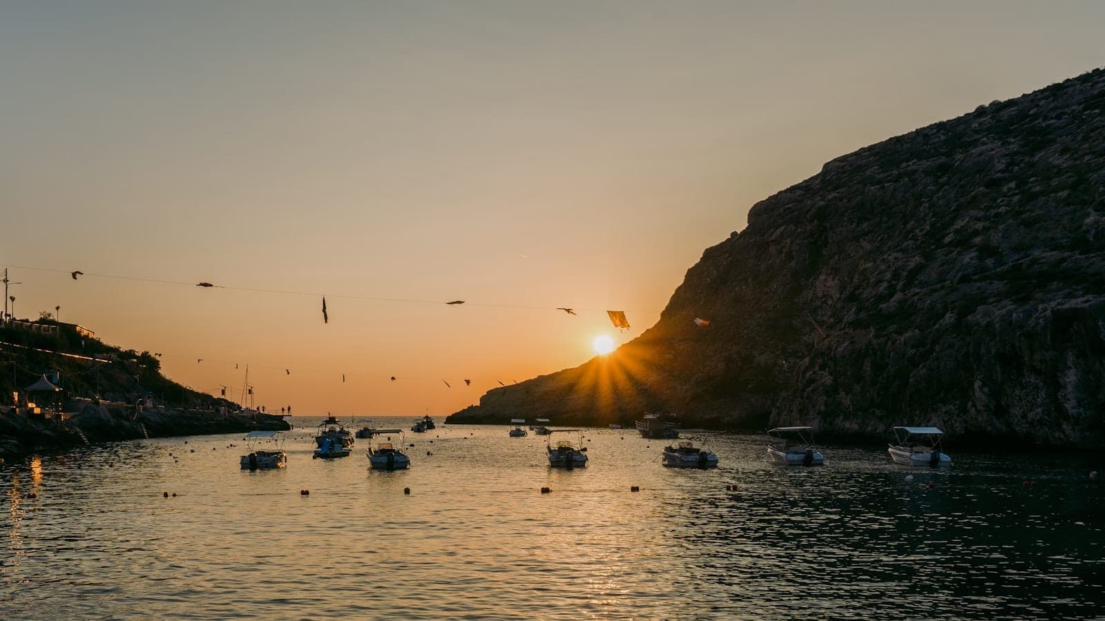
The bay is roughly symmetrical: cliffs rise steeply on both sides, the water colour shifts from pale aquamarine at the edges to a deep ink-blue at the centre, and the whole scene is anchored at the mouth of the inlet by the squat silhouette of Xlendi Tower. For a traveler who has already ticked off the obvious spots on Malta's main island, Xlendi offers a different register: quieter, more dramatic in geological terms, and carrying genuine historical weight.
ℹ️ Good to know
The name Xlendi derives from a Byzantine ship called Shilandi that sank near the bay. The bay was a sheltered anchorage long before the tower was built, and artifacts recovered from its waters date back more than 2,300 years.
The Water, the Rock, and the Tower
The shoreline at Xlendi is predominantly rocky and pebbly, with flat limestone ledges that serve as natural platforms for sunbathing and entry into the water. Metal ladders fixed to the rock face at several points allow swimmers to descend safely into the sea. The water clarity here is exceptional on calm days: you can watch the bottom drop away beneath you as you move toward the centre of the bay, and small fish are visible near the rocks even from the surface.
Xlendi Tower sits at the southwestern tip of the bay mouth, jutting into the water on a low promontory. Built in 1650 under Grand Master Juan de Lascaris-Castellar, the Knights of St John erected it as a coastal watchtower to guard against Ottoman raiding vessels that were a persistent threat across the Maltese archipelago throughout the 17th century. The tower is compact and functional in design, typical of the defensive coastal architecture the Knights scattered across Malta and Gozo during that era.
The tower is worth walking to even if you cannot enter, because the path along the base of the western cliff gives you a clear view back across the entire bay. For more context on the military network the Knights constructed across these islands, the Knights of Malta history guide provides useful background that makes sites like this feel far more than decorative.
Tickets & tours
Hand-picked options from our booking partner. Prices are indicative; availability and final rates are confirmed when you complete your booking.
City Sightseeing hop-on hop-off bus tour of Gozo
From 20 €Instant confirmationFree cancellationThe Malta Experience Audio-Visual Show and La Sacra Infermeria Tour
From 20 €Instant confirmationFree cancellationLuggage Storage in Malta
From 6 €Instant confirmationFree cancellation6-day heritage and attractions pass in Malta
From 80 €Instant confirmationFree cancellation
Underwater Xlendi: Diving and the Archaeological Park
Below the surface, Xlendi Bay carries a status that few recreational swimming spots can claim. In 1993, the waters were designated as an underwater archaeological park covering approximately 67,000 square metres, with depths reaching 105 metres. Artifacts recovered here span roughly 2,300 years of maritime history, from ancient pottery and amphorae to anchors and structural remains from vessels that found the bay a convenient, and sometimes fatal, shelter over the centuries.
A ship wreck discovered in the 1960s near the bay remains one of the most popular recreational dive sites in Gozo. Visibility is typically good in the summer months, and the combination of wall diving along the cliff faces, the wreck itself, and the ambient marine life (including octopus, grouper, and bream) means the site holds genuine interest for both beginner open-water divers and more experienced technical divers exploring the deeper sections. Several dive centres operate from the bay or are reachable within a short drive.
If diving forms a central part of your Gozo itinerary, the Malta diving guide covers the wider context of sites across both islands, including how Xlendi compares to locations like Dwejra on Gozo's west coast.
💡 Local tip
Snorkelers without dive certification still get a worthwhile experience close to the cliff bases on the eastern side of the bay. The rocks here shelter calmer water and the shallow reef zone supports enough marine life to make a mask and fins a worthwhile addition to your bag.
How Xlendi Changes Through the Day
Early morning at Xlendi, before 9am in summer, is a noticeably different place from the midday version. The light comes down over the eastern cliff in slabs, hitting the water at an angle that turns it almost luminescent. Local fishermen sometimes work the small quayside area, and the restaurants have not yet opened. At this hour the bay is quiet enough that you can hear the water moving against the limestone, a low repetitive sound amplified by the cliff walls on either side. The smell is salt and warm rock.
By late morning in July and August, the bay fills steadily. Day-trippers from Victoria and, increasingly, visitors who have crossed from Malta on the Gozo ferry arrive in groups. The flat rocks near the water become occupied, the restaurants begin filling their terrace tables, and the parking area at the top of the village reaches capacity relatively quickly. This is also when boat trips begin operating from the quayside, offering short excursions along the cliffs toward Wardija Point.
Late afternoon, roughly from 4pm onward, is the second good window. Many day visitors leave, the direct sun is off the water, and the cliffs cast long shadows across the western shore. The restaurants are at their best in the early evening: fresh fish, mostly sea bream and lampuki in season, served at outdoor tables within earshot of the water. Sunset from the path above the eastern cliff is worth timing a visit around.
⚠️ What to skip
In July and August, parking at Xlendi is severely limited. If you are driving, arrive before 9am or after 4pm. Buses from Victoria run regularly and drop you within a short walk of the bay, which is a far more practical option on peak-season days.
The Cliff Walk to Wardija Point
The stretch of coastline extending west from Xlendi Bay toward Wardija Point is one of the more rewarding short walks in Gozo. The cliffs in this section reach heights of around 105 metres and form part of a 32-hectare area designated as an Important Bird Area, particularly significant during spring and autumn migration. The path is not formally marked in places and involves uneven terrain, so appropriate footwear matters.
From the cliff edge, the views south across open Mediterranean are unobstructed, and the cliff face itself shows the layered limestone geology of Gozo in section: bands of coralline limestone above, Globigerina limestone below, the latter being the same warm-golden stone that gives Gozo's village churches and farmhouses their characteristic colour. On clear days you can see across to the Maltese coastline to the east and, in exceptional visibility, toward the Sicilian coast to the north.
The walk back from Wardija covers approximately 3 kilometres one way. Bring water, as there are no facilities along the route. If coastal walks interest you more broadly, Dingli Cliffs on Malta's main island offers a comparable clifftop experience, though the two sites have a very different character.
Getting There and Practical Logistics
Reaching Xlendi requires first getting to Gozo. The primary route is the Gozo Ferry from Cirkewwa on Malta's north coast, a short crossing of around 25 minutes that runs frequently throughout the day. From the Gozo ferry terminal at Mgarr, Victoria (also called Rabat, Gozo's capital) is the main transport hub, and buses on routes 301 and 303 connect Victoria to Xlendi village. The journey takes under 20 minutes. Taxis and rental cars are available from both Mgarr and Victoria for those who prefer flexibility.
Xlendi sits within easy reach of several other significant Gozo sites. The Citadella in Victoria is a logical pairing, as is a visit to the Ggantija Temples, one of the world's oldest freestanding structures, located near Xaghra on the other side of the island. If you are planning a full day on Gozo, Xlendi works well as an afternoon destination after inland sightseeing in the morning.
The bay itself is accessible 24 hours a day with no entry charge. The rocky shoreline is not suitable for wheelchair users or visitors with significant mobility limitations: the path from the village road to the water involves steps and uneven stone surfaces, and there is no gradual beach entry. The cliff walk to Wardija Point is similarly unsuitable for anyone who requires flat, paved surfaces.
For a broader framework on how to structure a day or multi-day trip around Gozo, the Gozo travel guide outlines the island's key sites and how they connect logistically.
Who Should Recalibrate Their Expectations
Travelers who arrive expecting a traditional Mediterranean beach with sand and shallow wading areas will be disappointed. There is no sandy floor here, no gentle slope into the sea for children to paddle safely without supervision. The water drops quickly, the entry points are via ladders or rock ledges, and the current can be unpredictable around the mouth of the bay when there is any swell.
In peak summer the small village of Xlendi can feel congested relative to its size: the single main road leading down to the water, the limited parking, and the concentration of restaurants along a short promenade all compress a lot of activity into a small footprint. Visitors hoping for isolated tranquility may find that the off-season, specifically October through early June, is a more genuine version of what the place promises.
Insider Tips
- The eastern cliff path above the bay has an unmarked viewpoint roughly 10 minutes on foot from the village that gives you the best top-down view of the water. Walk past the last apartment block on the left, follow the rough track uphill, and turn back toward the bay when the path plateaus.
- The restaurants closest to the water are not automatically the best value. The ones set back slightly from the promenade tend to have more competitive prices and equally good fresh fish. Ask what was caught that morning before ordering.
- For photography, the optimal position for shooting the full bay with Xlendi Tower in frame is from the eastern cliff, roughly 40 metres above sea level, in the two hours before sunset when the light falls directly onto the tower's western face.
- If you are diving or snorkeling, the western side of the bay, closer to the tower, tends to have stronger current than the eastern side. Beginners and snorkelers are better served staying on the eastern rocks.
- The bay is significantly less crowded from mid-October onward. The water temperature stays swimmable into November, and the village returns to a pace that is far more representative of ordinary Gozitan life.
Who Is Xlendi Bay For?
- Divers and snorkelers looking for high-quality underwater terrain without organised resort infrastructure
- Walkers who want a short but genuinely dramatic coastal route along the cliffs to Wardija Point
- Travelers interested in the Knights of Malta period who want to see defensive architecture in an undisturbed coastal setting
- Photographers after distinctive landscape shots combining sea, cliffs, and a historic tower in one frame
- Visitors to Gozo who want to extend a day of inland sightseeing with a late-afternoon swim and dinner by the water
Nearby Attractions
Other things to see while in Gozo:
- Citadella (Victoria)
Rising from a rocky promontory above Victoria, the Citadella is Gozo's most significant historical site. Inside its 17th-century bastions you'll find a cathedral with a famous trompe-l'oeil ceiling, small but thoughtful museums, and panoramic views stretching across the entire island. It rewards a half-day of exploration.
- Dwejra & Blue Hole
Dwejra on Gozo's west coast is the site of the Blue Hole, a natural limestone sinkhole that funnels divers into one of the Mediterranean's most celebrated underwater landscapes. Above water, the Inland Sea, surrounding cliffs, and the rubble of the lost Azure Window make this one of the most geologically dramatic corners of Malta.
- Ġgantija Temples
Standing on the Xagħra plateau in Gozo, the Ġgantija Temples are among the oldest freestanding structures on Earth, predating both Stonehenge and the Egyptian pyramids. This UNESCO World Heritage Site offers a rare encounter with Neolithic craftsmanship on a scale that continues to baffle archaeologists and awe visitors.
- Ramla Bay
Ramla Bay (Ir-Ramla l-Ħamra, meaning 'the red sands') is Gozo's largest and most distinctive beach, stretching 360 metres across the island's north-east coast. Its warm-toned sand, clear Blue Flag water, and surrounding dunes of endemic flora make it unlike anything on the main Malta island.