Island Hopping in the Oslofjord: The Complete Guide
The Oslofjord islands are one of Oslo's best-kept open secrets: reachable on a standard public transport ticket, dotted with beaches, ruins, and free camping spots. This guide covers every ferry route, the best islands for each type of visit, and exactly how to plan a day on the water.
Tickets & tours
Live prices and dates from our booking partner. If you book, we may earn a commission at no extra cost to you.
TL;DR
- Island hopping in the Oslofjord uses standard Ruter public transport tickets, not separate tourist fares — a single ticket costs around NOK 46 via the Ruter app.
- Ferries depart from Rådhusbrygge and Aker Brygge piers in central Oslo; the Oslo Pass covers all island ferry rides.
- The B1 route runs year-round to Hovedøya, Gressholmen, Bleikøya, Nakholmen, and Lindøya; the B2 to Langøyene runs summer only (roughly May–September).
- Summer crossings run every 20–30 minutes; winter service is less frequent and limited to the B1 loop.
- For broader Oslo planning, see the Oslofjord guide and the Oslo in summer guide.
Why the Oslofjord Islands Are Worth Your Time
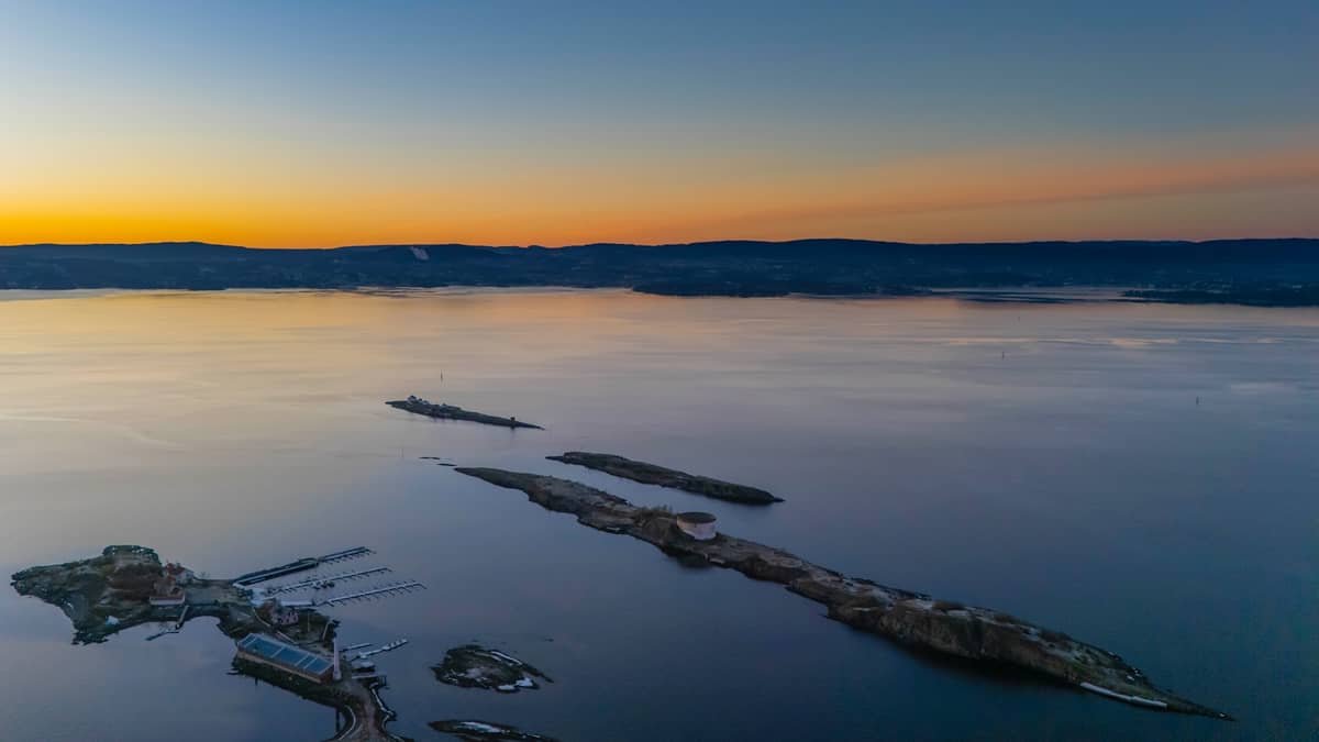
Most visitors to Oslo spend their days in museums and on waterfronts without ever realizing that a flotilla of small islands sits less than 30 minutes from the city center by regular public ferry. The inner Oslofjord islands — Hovedøya, Gressholmen, Langøyene, Lindøya, Bleikøya, and Nakholmen — are not resort islands. They have no hotels, no tourist restaurants, and no admission gates. What they do have is rocky shorelines, pine forest, medieval ruins, quiet swimming spots, and in summer, some of the most relaxed outdoor culture Oslo has to offer.
This is genuinely local Oslo life. On a warm July afternoon, the ferries fill with families carrying coolers, teenagers with kayaks strapped to rooftop racks, and retirees heading to their allotment cabins on Nakholmen. Island hopping fits naturally into a broader free and low-cost Oslo itinerary, and it pairs well with the waterfront neighbourhoods of Aker Brygge and Tjuvholmen where the ferries depart.
ℹ️ Good to know
The island ferries are operated by Ruter as standard public transport, not tourist cruises. This means you use the same ticket you'd use for a bus or metro ride. There are no dedicated tourist ticket counters at the island ferry pier — buy in advance via the Ruter app or at a Narvesen or 7-Eleven kiosk.
Ferry Routes, Schedules, and Tickets
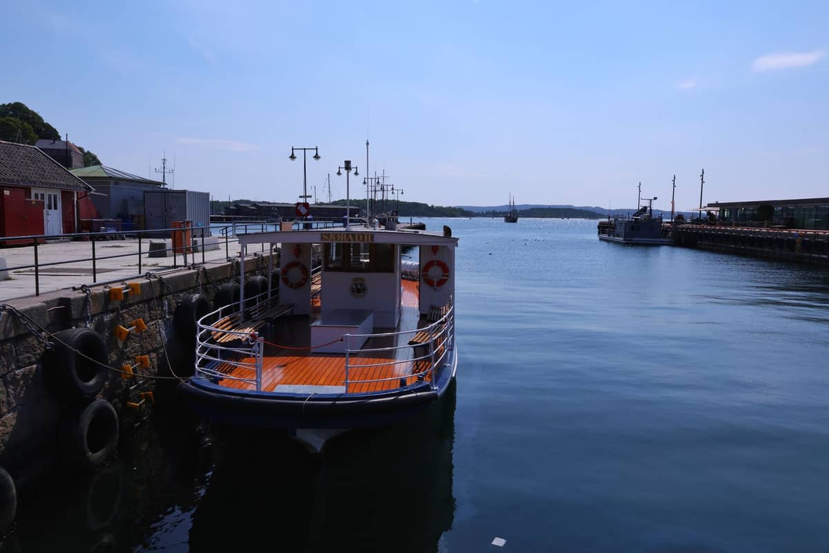
As of 2026, the Oslofjord inner-island network operates on two main routes. The B1 is the workhorse: a year-round circular loop departing from Rådhusbrygge (City Hall pier) that calls at Hovedøya, Lindøya øst, Gressholmen, Bleikøya, Nakholmen, and Lindøya vest before returning. The B1X is a summer-only direct express service to Hovedøya. The B2 connects central Oslo to Langøyene, the most popular beach island, and runs only during the main summer season (currently early July through late August; check Ruter for exact dates each year).
- B1 (year-round) Circular route: Rådhusbrygge → Hovedøya → Lindøya øst → Gressholmen → Bleikøya → Nakholmen → Lindøya vest → back. Departures every 20–30 minutes in summer, reduced frequency in winter.
- B1X (summer only) Direct ferry from Rådhusbrygge to Hovedøya. Useful if Hovedøya is your only destination and you want the quickest crossing (~7 minutes).
- B2 (summer only, ~May–September) Direct service to Langøyene, Oslo's main beach island. Journey time approximately 30 minutes from the city center. Check Ruter's timetable for exact start and end dates each year.
A single Ruter zone 1 ticket covers all inner-island ferry rides. The reported single-ride fare is around NOK 46 when purchased via the Ruter app. A 24-hour day pass unlocks unlimited travel across the entire Ruter network including island ferries, which makes sense if you plan to hop between two or more islands in a day. If you already have an Oslo Pass, island ferries are included at no extra cost. One practical note: the B1 ferries depart primarily from Rådhusbrygge, not from Aker Brygge's main quay — they are close together but check the pier number in the Ruter app before you walk down.
⚠️ What to skip
Older guides and travel blog posts often reference B2, B3, and B4 lines to the islands. These designations are outdated. The current 2026 network is organized around the year-round B1 loop and the summer B1X and B2 to Langøyene. Always check Ruter's official ferry timetable at ruter.no before your visit, as schedules shift between summer and winter operations.
The Islands: What Each One Offers

Not all the Oslofjord islands are equally interesting for first-time visitors. Here is a practical breakdown of what each major island actually delivers, so you can match them to what you want from a day out.
- Hovedøya The most historically rich island, with 12th-century Cistercian monastery ruins and a small beach on the south side. About 7 minutes by ferry. Good for a short visit combined with another island. The ruins are free to explore and well-signed.
- Langøyene Oslo's classic beach island. Sandy beaches on both sides of the island (one clothing-optional), shallow water suitable for children, and free tent camping for up to two consecutive nights. The only island where you can legally camp overnight. Busiest island on warm summer weekends — arrive early or mid-week for space.
- Gressholmen Quiet and forested, with rocky shoreline swimming and remnants of Norway's first commercial airport from the 1930s. Far fewer crowds than Langøyene. Good for a slow afternoon with a picnic.
- Bleikøya A small, almost entirely residential island with allotment cabins and little public infrastructure. Worth a brief stop on the B1 loop to see a slice of Oslo's distinctive hytte (cabin) culture, but limited for longer visits.
- Nakholmen Similar to Bleikøya — dominated by cabin communities and quiet paths through the trees. A genuine escape from the city, but not a destination for sunbathing or sightseeing.
- Lindøya The most densely settled of the inner islands, known for its colourful wooden cabins and gardens. Scenic to walk through, and the ferry stops at both the east and west piers on the B1 loop.
✨ Pro tip
If you only have time for one island and it's summer, go to Langøyene for the beach or Hovedøya for history. If you want a quieter experience away from crowds, take the B1 to Gressholmen on a weekday morning — you may have the rocky shoreline almost to yourself.
Seasonal Considerations: When to Go

The island experience changes substantially by season. Summer, specifically late June through August, is when the Oslofjord comes fully alive. Sea temperatures in the inner fjord typically reach 18–22°C in July, making swimming genuinely pleasant. The B2 to Langøyene and B1X to Hovedøya run at full frequency, ferries are packed on sunny weekends, and the islands are at their greenest. This is the prime window for island hopping, and it aligns with the best time to visit Oslo overall.
May and September offer a more relaxed version of the same experience. The B2 to Langøyene typically starts in late May, water temperatures are cooler, but the B1 loop to the inner islands is still running at reasonable frequency and the islands are far less crowded. These shoulder months are well-suited to walking and picnicking rather than swimming.
In winter, only the B1 operates to the inner islands, on a reduced timetable. The B2 to Langøyene does not run, and the designated camping grounds on Langøyene are closed. The islands themselves are accessible but quiet — genuinely deserted on weekdays. A winter walk on Hovedøya through frost and bare trees has its own appeal, but it is not for everyone, and you should check the Ruter ferry timetable carefully as departure gaps can be an hour or more.
How to Plan Your Island Hopping Day
A full island-hopping day works well as part of a longer Oslo trip. If you're using the 3-day Oslo itinerary, the islands fit naturally on day two alongside the Bygdøy museums or a waterfront walk. The Oslo Opera House and the Bjørvika waterfront are an easy morning pairing before catching a midday ferry.
For a practical itinerary: take the B1X directly to Hovedøya first (about 8 minutes), spend an hour exploring the monastery ruins and the south-facing beach, then catch the next B1 circular ferry onward to Gressholmen for a swim and lunch. From Gressholmen, the same B1 loop continues to Bleikøya and Nakholmen before returning to Rådhusbrygge — you can ride the full loop back without disembarking. On a separate trip or later the same afternoon, the B2 to Langøyene is a different experience: more open, sandier, and more social.
- Bring your own food and water — there are no shops on most islands and limited facilities even on Langøyene.
- Wear shoes suitable for rocky paths; the islands are not manicured parks.
- Check the Ruter app for real-time departure info at each pier before you step off the boat, especially on the last ferry of the evening.
- Camping on Langøyene requires no booking but is limited to two consecutive nights in the designated camping zones; bring your own tent and pack out all rubbish.
- For a swimming day, pack sun protection — Oslo's summer UV levels are stronger than many visitors expect, particularly when reflected off the water.
Getting to the departure piers is straightforward. Both Rådhusbrygge and Aker Brygge are in central Oslo, walkable from most accommodation in Sentrum or a short tram ride from further out. For full transport options across the city, the guide to getting around Oslo covers Ruter ticketing and zone rules in detail.
Practical Logistics and What to Know Before You Go
Oslo's currency is the Norwegian krone (NOK). Most transactions in Oslo are cashless, and the Ruter app accepts card payment directly. If you prefer to buy tickets in person, Narvesen and 7-Eleven convenience stores sell Ruter tickets at the same price as the app. There is no ticket machine at the island piers themselves.
Oslo operates on Central European Time (CET, UTC+1 in winter; UTC+2 in summer). Summer evenings are long: in June, it stays light until after 10pm, which means you can comfortably take a late afternoon ferry and still return in full daylight. Last ferries back from the islands in peak summer are usually scheduled up to around 10:30–11pm depending on the line, but confirm this in the current Ruter timetable. Missing the last boat and spending an unplanned night on a dark island is a genuine inconvenience.
English is widely spoken throughout Oslo and by ferry staff. Norwegian tap water is safe to drink, but there is no tap water access on most islands, so carry what you need. For everything else Oslo offers beyond the water, the complete Oslo things-to-do guide is a useful companion, and the Oslo on a budget guide has more tips on keeping costs low across your trip.
FAQ
Do I need a special ticket for the Oslofjord island ferries?
No. The island ferries are part of the Ruter public transport network and use the same zone 1 tickets as buses, trams, and the metro. A single ride costs around NOK 46 via the Ruter app. A 24-hour day pass is worth it if you plan to visit multiple islands or combine the ferry with city transport. The Oslo Pass also covers Ruter-operated island ferry rides.
Which Oslofjord island is best for swimming?
Langøyene is Oslo's most popular beach island, with sandy shores on both sides and shallow water that warms up well by July. It's reached by the B2 ferry (summer only). Gressholmen and Hovedøya also have rocky swimming spots that are quieter and less crowded, accessible via the year-round B1 route.
Can you camp on the Oslofjord islands?
Free tent camping is permitted on Langøyene for up to two consecutive nights in the designated camping zones. No booking is required, but facilities are basic. Bring everything you need including food, water, and waste bags. Other inner islands do not have designated public camping areas.
Where exactly do the island ferries depart from in Oslo?
The B1 and B1X ferries depart from Rådhusbrygge (by Oslo City Hall). The B2 to Langøyene also departs from Rådhusbrygge. These piers are distinct from Aker Brygge’s sightseeing and museum quays, so check the exact pier in the Ruter app, as there are multiple quays in that area. Do not confuse these ferries with the Bygdøy museum ferry, which uses its own tickets and departs from a separate pier at Rådhusbrygge 3.
Is island hopping in the Oslofjord worth doing in winter?
It's possible but limited. Only the B1 route operates in winter, on a reduced timetable with gaps of an hour or more between departures. Langøyene is closed. The islands are quiet and atmospheric in frost, but there is little to do beyond walking. For most visitors, the islands are a spring and summer activity.
Tickets & tours
Live prices and dates from our booking partner. If you book, we may earn a commission at no extra cost to you.
Planning a trip? Discover personalized activities with the Nomado app.