Punta La Marmora: Reaching the Roof of Sardinia
At 1,834 metres, Punta La Marmora is the highest point in Sardinia and the crown of the Gennargentu massif. The hike rewards those who make the effort with panoramic views across the island's rugged interior, a genuine sense of remoteness, and a perspective on Sardinia that most visitors never see.
Quick Facts
- Location
- Gennargentu range, communes of Desulo and Arzana, Nuoro province, Sardinia
- Getting There
- By car via SP7 (Fonni–Desulo road); closest airports are Cagliari (CAG) and Arbatax area. No public transit to trailhead.
- Time Needed
- 4–7 hours for a full return hike depending on route and fitness level
- Cost
- Free — open mountain with no admission fee
- Best for
- Hikers, landscape photographers, anyone wanting to see Sardinia's wild interior
What Punta La Marmora Actually Is
Punta La Marmora is the highest summit in Sardinia, rising to 1,834 metres (approximately 6,017 feet) within the Gennargentu range in the island's central-eastern interior. Known in Sardinian as Perdas Carpìas, it sits on the boundary between the communes of Desulo and Arzana in the province of Nuoro, in the Barbagia mountain area of inner Sardinia. The name in Italian honours Alberto La Marmora, the 19th-century military officer and naturalist who made detailed geographical studies of Sardinia.
This is not a visitor centre with a cable car and a café at the top. It is a proper mountain summit reached on foot, across open ridgelines and rocky terrain, through landscapes that feel remote. The Gennargentu massif covers a large area of central Sardinia, and its peaks, valleys, and cork-oak woodlands are a world apart from the coastal resorts that dominate most visitors' itineraries.
For context on where this fits into the broader island, Punta La Marmora lies within the territory covered by the Parco Nazionale del Gennargentu, which protects much of this highland zone. The surrounding region of Ogliastra is one of the least-touristed parts of Sardinia and one of the most rewarding for those willing to leave the coast behind.
The Approach: Getting to the Trailhead
A private vehicle is essentially non-negotiable for reaching the trailhead. There is no public bus service that goes anywhere near the mountain access roads. The standard approach uses the SP7 road between Fonni and Desulo, heading toward the Bruncu Spina area, where a ski station operates in winter. In summer, the ski infrastructure sits idle but the access road remains open and the car parks around the Rifugio S'Arena area provide a practical starting point for the hike.
From Cagliari Elmas Airport (CAG), the drive takes roughly two hours under normal conditions. From the Arbatax area in the east, the route follows the SS125d, SS198, SS389, and SP7 through increasingly spectacular mountain scenery. Be aware that some sections of road near the trailhead have been reported in poor condition; a vehicle with decent ground clearance is advisable, and checking local hiking forums for recent road conditions before departure is time well spent.
⚠️ What to skip
Do not rely on GPS navigation alone in this area. Mobile signal is unreliable across much of the Gennargentu, and some mapping apps route vehicles onto tracks unsuitable for standard cars. Download offline maps and a GPX trail file before leaving your accommodation.
Tickets & tours
Hand-picked options from our booking partner. Prices are indicative; availability and final rates are confirmed when you complete your booking.
Vineyard Guided Tour and 7 Wine Tasting in Palau
From 84 €Instant confirmationFree cancellationFull-Day Sailboat Tour in La Maddalena Archipelago from Cannigione
From 112 €Instant confirmationFree cancellationHiking excursion to the Devil's Saddle
From 35 €Instant confirmationFree cancellationExcursion to the Archaeological site of Nora
From 70 €Instant confirmationFree cancellation
The Hike: What the Trail Looks Like
The most commonly used route begins from the Bruncu Spina ski station area and follows a broad ridgeline southwest toward the summit. The terrain is open, grassy, and windswept in its upper sections, with rocky outcrops becoming more frequent as you gain elevation. The ridge walk itself is not technically demanding by alpine standards, but the altitude gain, exposed terrain, and absence of shade make physical fitness and proper preparation essential.
Below the upper ridge, the landscape shifts between patches of macchia scrub, boulder fields, and, in spring, bright wildflower coverage across the hillsides. The sounds up here are dominated by wind and occasional birdcalls rather than anything human-made. Golden eagles and griffon vultures are present in the Gennargentu, and sightings on the upper ridge are not unusual.
The summit itself is marked and offers, on clear days, views across much of Sardinia. To the east, the coastline of Ogliastra and the Gulf of Orosei are visible. To the west, the landscape rolls toward the Campidano plain. On exceptional days, with no haze, you can see most of the island’s coastline from a single point. That is the reward for the climb.
💡 Local tip
Start early. The summit plateau has no shade and the afternoon sun in summer is intense. An early start also gives you the best chance of clear air before heat haze builds. Aim to be at the summit before noon.
Conditions by Season: When to Go and What to Expect
Late spring and early autumn are the most reliable windows for this hike. From mid-May through June, the vegetation is at its richest, temperatures on the mountain are comfortable, and the risk of summer thunderstorms is lower than in July and August. September and October bring cooler, steadier air and often excellent visibility.
In the height of summer, July and August, the hike is entirely doable but demands an early start. Temperatures at the summit are substantially cooler than on the coast, but the exposed ridge gets direct sun for most of the day, and afternoon thunderstorms can develop quickly over the Gennargentu without much warning. If clouds are building by mid-morning, consider turning back.
Winter brings a different challenge entirely. Snow accumulates on the upper ridge and summit, and the Bruncu Spina area functions as a ski resort during this period. The mountain is not closed in winter, but the hike requires experience with snow and ice conditions and appropriate equipment. This is not a casual winter outing.
For a broader picture of when conditions across the island suit different activities, the best time to visit Sardinia guide breaks down the seasonal logic in detail.
What to Bring and Wear
The mountain indifference to underprepared visitors is consistent year-round. Even on warm summer days, a packable windproof layer is necessary because the ridge is exposed and the wind can be sharp. In spring and autumn, add a warm mid-layer. Waterproof boots or trail running shoes with ankle support are appropriate; the terrain is rocky and uneven in sections.
- Minimum 2 litres of water per person — there is no reliable water source on the upper trail
- Sun protection: hat, sunscreen, and sunglasses (UV intensity at altitude is significant)
- A windproof and waterproof jacket, even in summer
- Offline maps and a downloaded GPX route file
- Snacks or a packed lunch — there is no food or drink available on the mountain
- Fully charged phone with emergency contacts saved, including 112 (EU emergency number)
Photography and the Light on the Ridge
The early morning light on the Gennargentu is exceptional. In the first hour after sunrise, the ridgelines catch warm golden light while the valleys below are still in shadow, creating a layered landscape that is difficult to replicate at any other time of day. If you are driving to the trailhead for a dawn start, the mountain road itself offers some worthwhile pre-hike compositions.
At the summit, shooting west in the morning and east in the afternoon gives the best results. The coastal haze that builds in summer afternoons tends to flatten the distant views, so the clearest photographic conditions are earlier in the day. A wide-angle lens captures the breadth of the ridge well; a longer focal length pulls in the coastal details on clear days.
If the Gennargentu landscape interests you beyond this single summit, the dramatic hiking route known as the Selvaggio Blu traverses the coastal cliffs of Ogliastra to the east, and the Gola di Su Gorropu canyon sits within the same general territory.
Who This Hike Suits — and Who It Does Not
Punta La Marmora is rewarding, but it requires realistic self-assessment before you commit to it. The standard route from Bruncu Spina is accessible to reasonably fit hikers with basic trail experience. It is not a technical climb, and the path is clear in good conditions. However, the remoteness of the location, the absence of infrastructure on the mountain, and the real possibility of rapid weather changes mean this is not a suitable outing for beginners, young children, or anyone without appropriate footwear and supplies.
Travelers primarily focused on beaches and coastal towns may find the drive and the effort disproportionate to what the summit delivers compared to a morning at one of Sardinia's extraordinary coastal spots. The views are spectacular but not the kind that reward a passive visitor. If what you want is an easy panoramic viewpoint, this is not the right choice. If you want a real hike in a landscape that feels wild, this is one of the best options the island offers.
Travelers interested in exploring Sardinia's interior more broadly should also consider the Barbagia and Nuoro region, which surrounds the Gennargentu and combines mountain landscapes with cultural and gastronomic depth. The hiking in Sardinia guide covers the full range of options across the island if you are planning a walking-focused trip.
Insider Tips
- The Bruncu Spina ski station occasionally runs its chairlift for hikers and mountain bikers in summer, which can reduce the initial elevation gain significantly. Check locally whether it is operating before your visit, as this is not consistently advertised online.
- Fill water bottles before leaving Desulo or Fonni. Mountain springs in the Gennargentu do exist but should not be relied upon without local knowledge of current conditions.
- The approach road from the SP7 toward the summit area can be badly potholed after winter. Local hiking associations in Desulo sometimes post trail condition updates on social media in spring, which is worth checking a few days before your hike.
- On clear mornings in September and October, both the eastern and western coastlines of Sardinia are visible from the summit simultaneously. This is worth timing your visit for, as summer haze frequently obscures the distant coast.
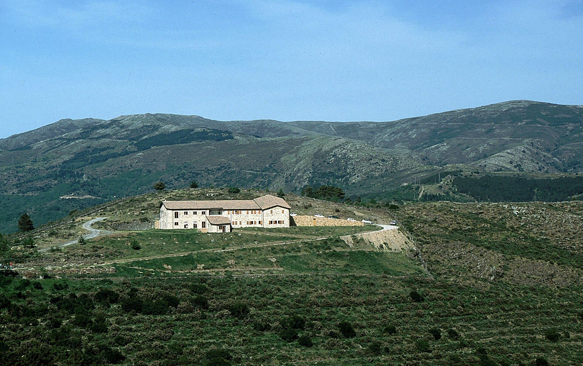
- The Rifugio S'Arena area near the Bruncu Spina ski station serves as a practical reference point for parking and orientation. Do not count on the rifugio being open for food or accommodation outside specific periods — confirm availability before treating it as a logistics resource.
Who Is Punta La Marmora For?
- Experienced day hikers seeking Sardinia's highest summit
- Landscape photographers wanting high-altitude views across the island's interior
- Travelers exploring Ogliastra and the Gennargentu beyond the coastline
- Nature enthusiasts interested in Sardinia's endemic mountain flora and fauna
- Road-trip itineraries through central Sardinia combining mountain and coast
Nearby Attractions
Other things to see while in Ogliastra:
- Capo Comino Dunes & Beach
A 3-kilometre stretch of white sand and wind-sculpted dunes on Sardinia's eastern coast, near Siniscola. The shallow sea, open access, and historic shipwrecks offshore make it one of the Nuoro province's most distinctive beaches.
- Grotte Su Marmuri (Ulassai)
Grotte Su Marmuri is a vast living limestone cave carved into the rocky highlands above the village of Ulassai in Ogliastra, eastern Sardinia. With chambers reaching up to around 50 metres high, active stalactite formations, and a constant interior temperature of 10°C, it offers one of the most impressive underground experiences on the island. Entry is by guided tour only, lasting approximately 1.5 hours.
- Parco Nazionale del Golfo di Orosei e del Gennargentu
Covering roughly 74,000 hectares of rugged mountain, gorge, and coastal wilderness in central-eastern Sardinia, the area commonly referred to as Gennargentu National Park is the island's most ambitious proposed protected landscape. From the island's highest peak to sheer sea cliffs dropping into the Golfo di Orosei, this is where Sardinia's raw geography is on full display.
- Rocce Rosse di Arbatax
The Rocce Rosse di Arbatax are a formation of deep vermillion porphyry cliffs rising up to about 15 metres from the Tyrrhenian Sea on Sardinia's Ogliastra coast. Free to visit year-round, they sit steps from the port and the Trenino Verde station, making them one of the more accessible natural landmarks on the island's eastern shore.