Best Hikes Near Perth: Trails for Every Level
Perth sits at the edge of one of the most biodiverse corners of the planet, with jarrah forests, granite gorges, coastal heathlands, and river trails within an hour of the CBD. Whether you want a 25-minute bushland loop or a full-day ascent through the Darling Range, this guide covers the best trails near Perth.
Tickets & tours
Live prices and dates from our booking partner. If you book, we may earn a commission at no extra cost to you.
Perth is a genuinely great hiking city, and it tends to surprise first-time visitors. The trails range from the flat, easy loops aroundKings Park to serious full-day walks in the Perth Hills. Most of the best hikes are accessible by car within an hour of the CBD, and many are reachable on public transport. Spring (September to November) is the best season: wildflowers are out, temperatures are mild, and the waterfalls in the hills are at their best after winter rain. Avoid planning long exposed walks in December through February when temperatures regularly exceed 35°C. Always carry water, check fire danger ratings before heading into the hills, and download trail maps before you go.
⚠️ What to skip
The Bibbulmun Track Foundation recommends autumn, winter, and spring for most trail walking near Perth. Summer walking is not recommended on hot days. Always check current fire danger ratings and track conditions before heading out.
Easy Walks: Under 5 km, Suitable for All Fitness Levels
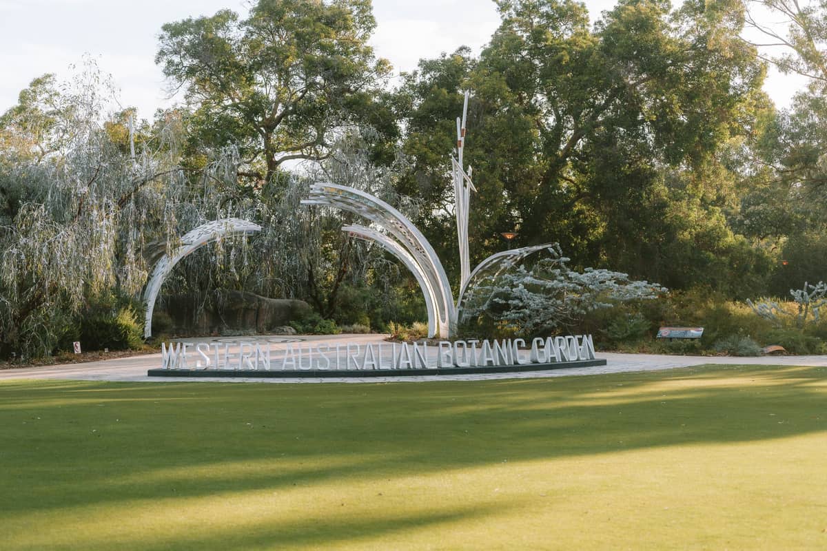
These shorter trails are ideal for families, first-time visitors, or anyone who wants to enjoy Perth's natural scenery without a full-day commitment. Kings Park is the obvious starting point — it's free to enter, open daily, and offers free guided Botanic Garden walks at 10 am and 1 pm with no booking required. For something wilder,families with kids will find the riverside loop at Heirisson Island hard to beat.
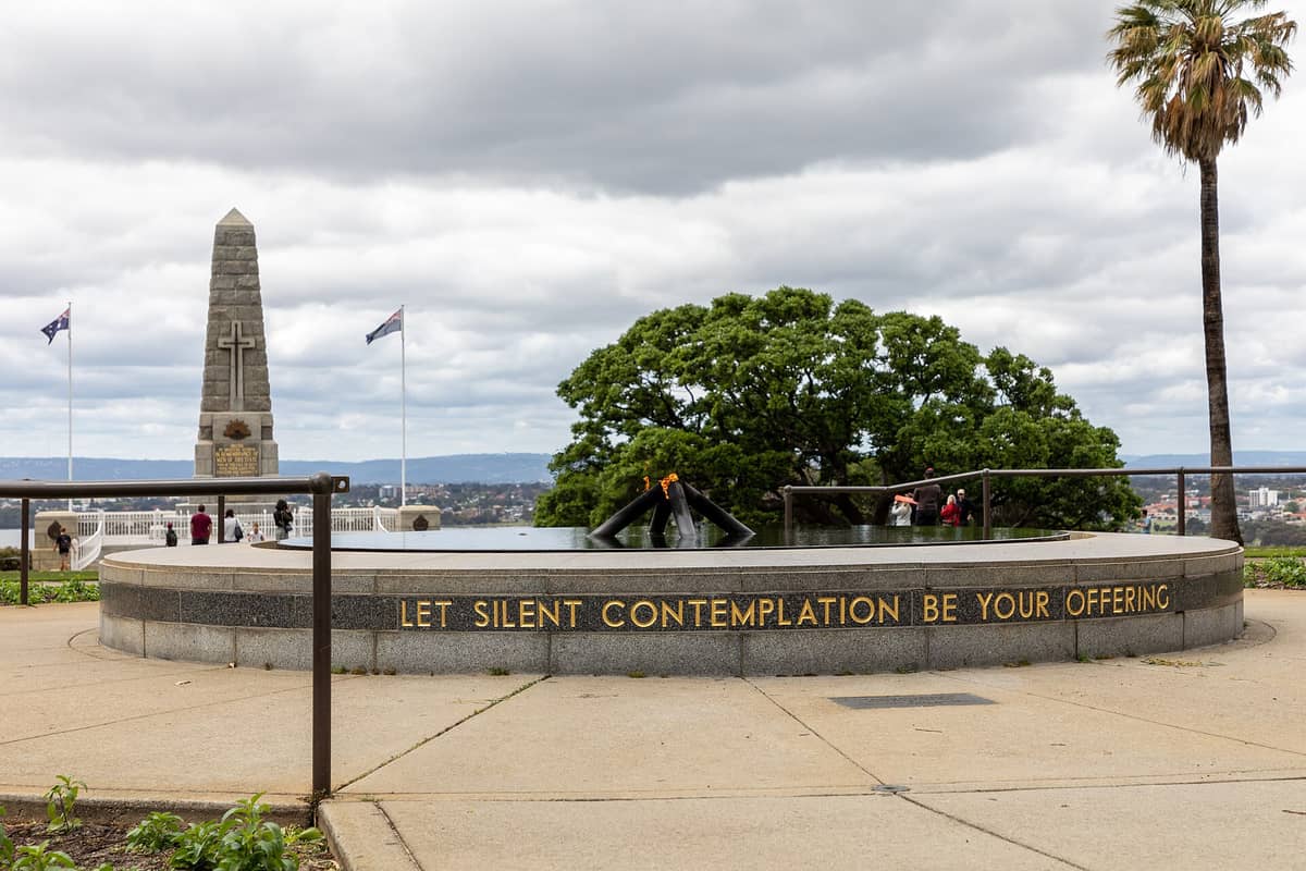
1. Walk the Bushland Nature Trail in Kings Park
Kings Park's 1 km Bushland Nature Trail takes around 25 minutes and winds through banksia woodland with interpretive signage on WA's native flora. Free guided walks depart twice daily at 10 am and 1 pm — no booking needed.
Explore1. Walk the Bushland Nature Trail in Kings Park
Kings Park's 1 km Bushland Nature Trail takes around 25 minutes and winds through banksia woodland with interpretive signage on WA's native flora. Free guided walks depart twice daily at 10 am and 1 pm — no booking needed.
Explore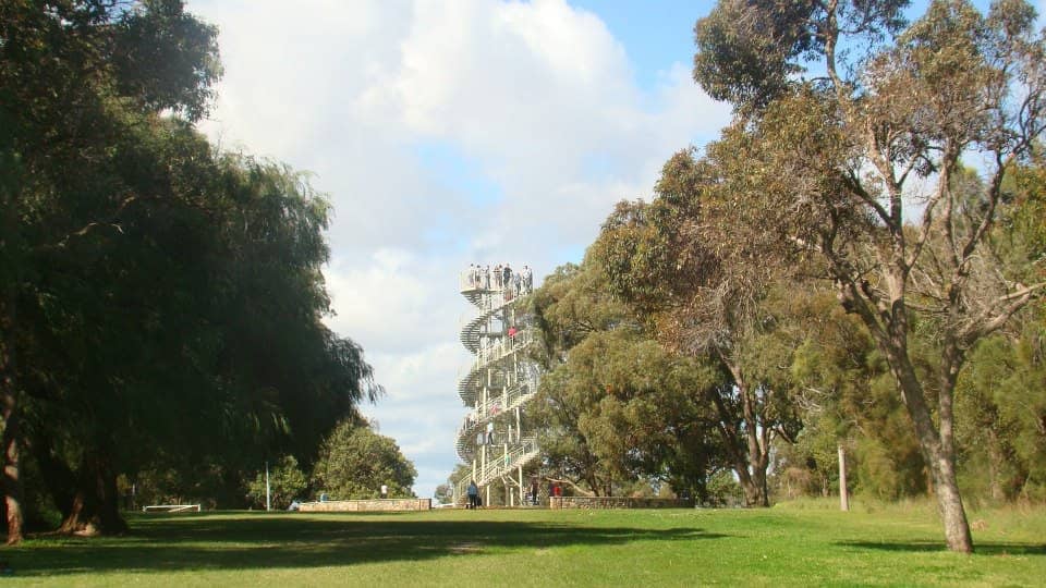
2. Cross the Federation Walkway and Climb the DNA Tower
The Lotterywest Federation Walkway is a 620-metre canopy bridge through the Kings Park botanic garden. The DNA Tower is a separate spiral lookout about 1.5 km away, not the end of the walkway. Together they are among the city's best elevated views over the Swan River and skyline.
Explore2. Cross the Federation Walkway and Climb the DNA Tower
The Lotterywest Federation Walkway is a 620-metre canopy bridge through the Kings Park botanic garden. The DNA Tower is a separate spiral lookout about 1.5 km away, not the end of the walkway. Together they are among the city's best elevated views over the Swan River and skyline.
Explore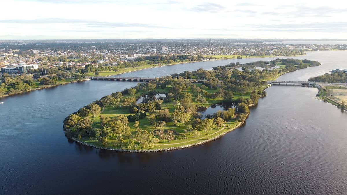
3. Stroll Around Heirisson Island's Kangaroo Reserve
This flat, peaceful loop around a small Swan River island takes under an hour and almost always includes sightings of free-roaming kangaroos. City skyline views from the eastern end make it one of Perth's most rewarding short walks.
Explore3. Stroll Around Heirisson Island's Kangaroo Reserve
This flat, peaceful loop around a small Swan River island takes under an hour and almost always includes sightings of free-roaming kangaroos. City skyline views from the eastern end make it one of Perth's most rewarding short walks.
Explore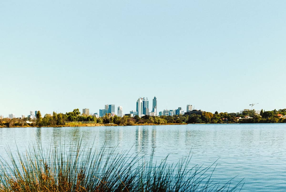
4. Walk the 3.5 km Black Swan Loop at Lake Monger
A flat 3.5 km path circles this urban wetland in Wembley, home to Perth's famous black swans, pelicans, and dozens of waterbird species. It's one of the city's most popular morning walks, best done at dawn when the birdlife is most active.
Explore4. Walk the 3.5 km Black Swan Loop at Lake Monger
A flat 3.5 km path circles this urban wetland in Wembley, home to Perth's famous black swans, pelicans, and dozens of waterbird species. It's one of the city's most popular morning walks, best done at dawn when the birdlife is most active.
Explore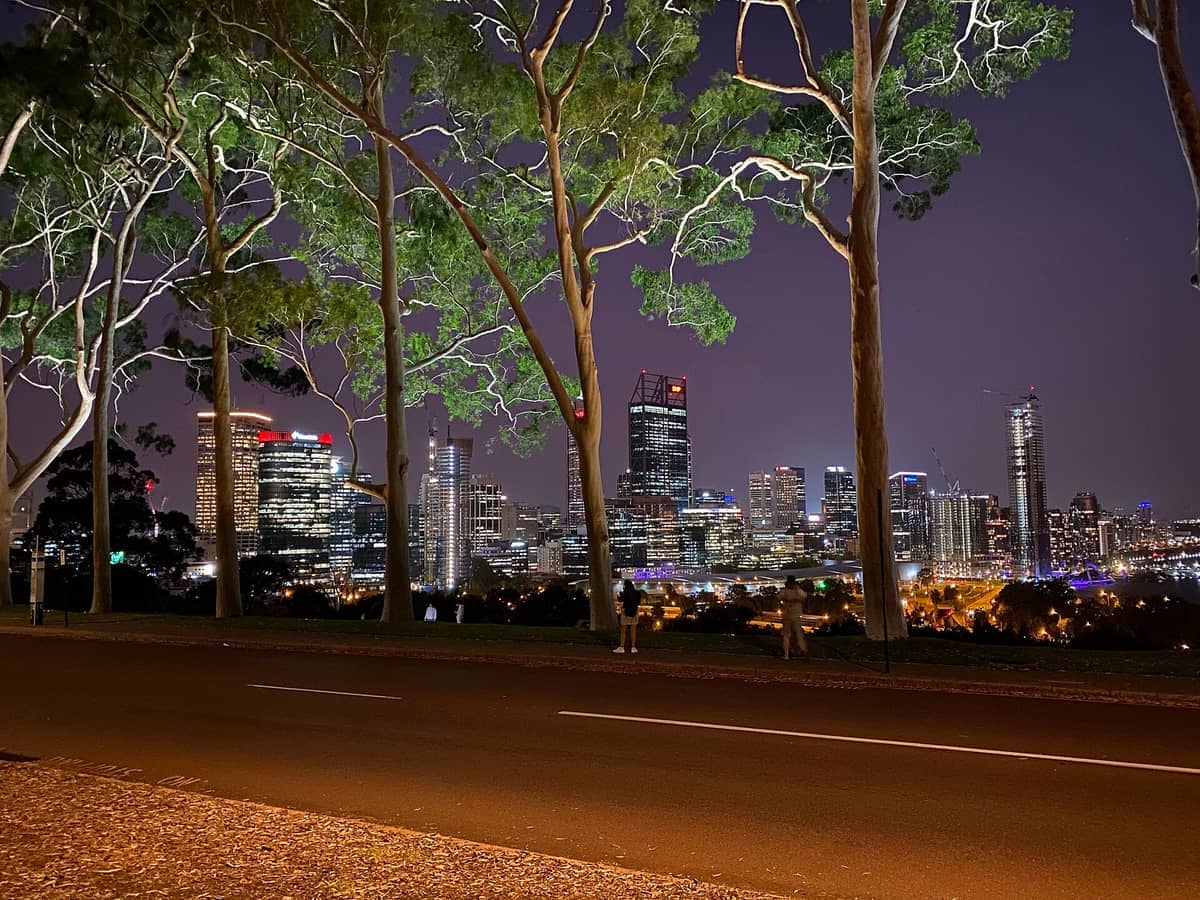
5. Walk Fraser Avenue for Kings Park's Best Skyline View
The 100-year-old lemon-scented gums lining Fraser Avenue frame a celebrated view of the Perth CBD skyline. It's a short, flat walk suitable for all abilities and is most atmospheric in the early morning light or at dusk.
Explore5. Walk Fraser Avenue for Kings Park's Best Skyline View
The 100-year-old lemon-scented gums lining Fraser Avenue frame a celebrated view of the Perth CBD skyline. It's a short, flat walk suitable for all abilities and is most atmospheric in the early morning light or at dusk.
ExploreModerate Trails: Half-Day Walks with Real Rewards
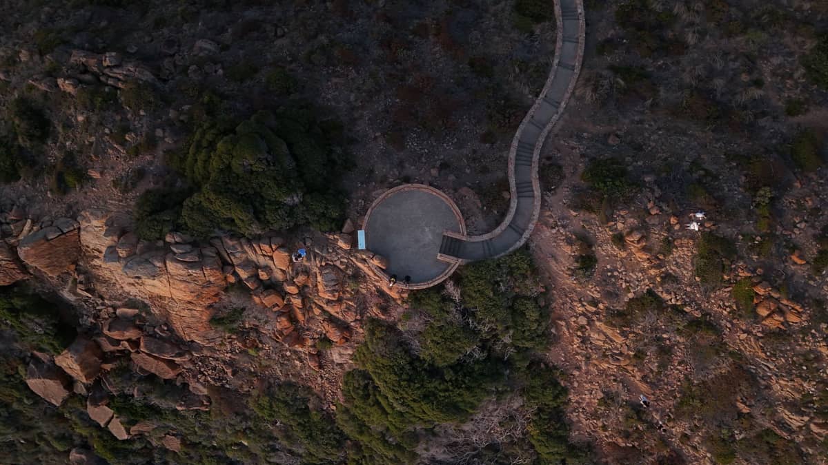
These trails require a reasonable fitness level but are accessible to most regular walkers. ThePerth Hillsoffer the best moderate hiking within easy reach of the city. Lesmurdie Falls and John Forrest National Park are both reachable in under 40 minutes from the CBD and deliver jarrah forest, granite country, and — after good winter rains — some genuinely dramatic scenery. Check trail conditions on the Trails WA website before setting out, particularly after bushfire seasons.
6. Hike to Lesmurdie Falls After Winter Rain
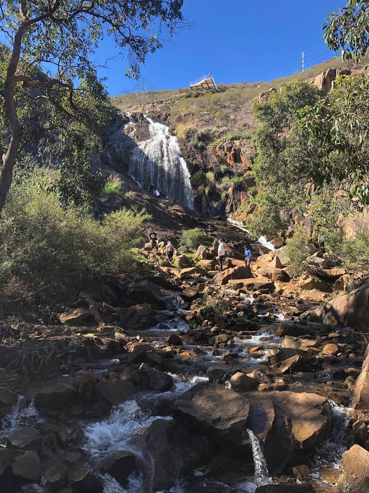
Perth's most dramatic waterfall drops 50 metres through a granite gorge in the Darling Range. The loop walk to the base and lookout takes 2 to 3 hours. Visit between July and October for peak flow; the falls are a trickle in summer.
Explore6. Hike to Lesmurdie Falls After Winter Rain
Perth's most dramatic waterfall drops 50 metres through a granite gorge in the Darling Range. The loop walk to the base and lookout takes 2 to 3 hours. Visit between July and October for peak flow; the falls are a trickle in summer.
Explore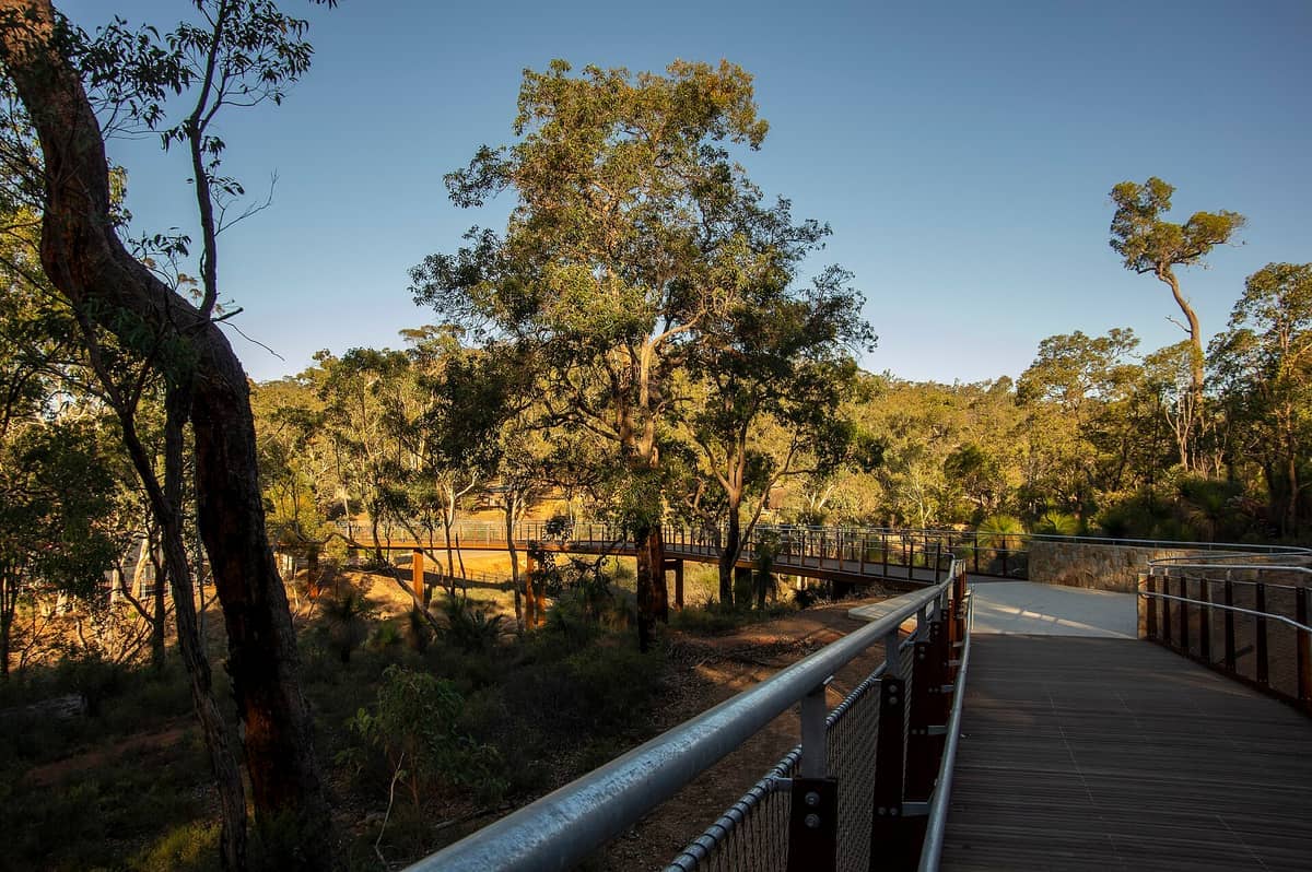
7. Explore Heritage Trails in John Forrest National Park
WA's oldest national park combines waterfalls, granite outcrops, and jarrah forest walking trails up to 8 km. The heritage swimming pool and Jane Brook add to the appeal. Spring wildflowers here are exceptional. Entry fees apply.
Explore7. Explore Heritage Trails in John Forrest National Park
WA's oldest national park combines waterfalls, granite outcrops, and jarrah forest walking trails up to 8 km. The heritage swimming pool and Jane Brook add to the appeal. Spring wildflowers here are exceptional. Entry fees apply.
Explore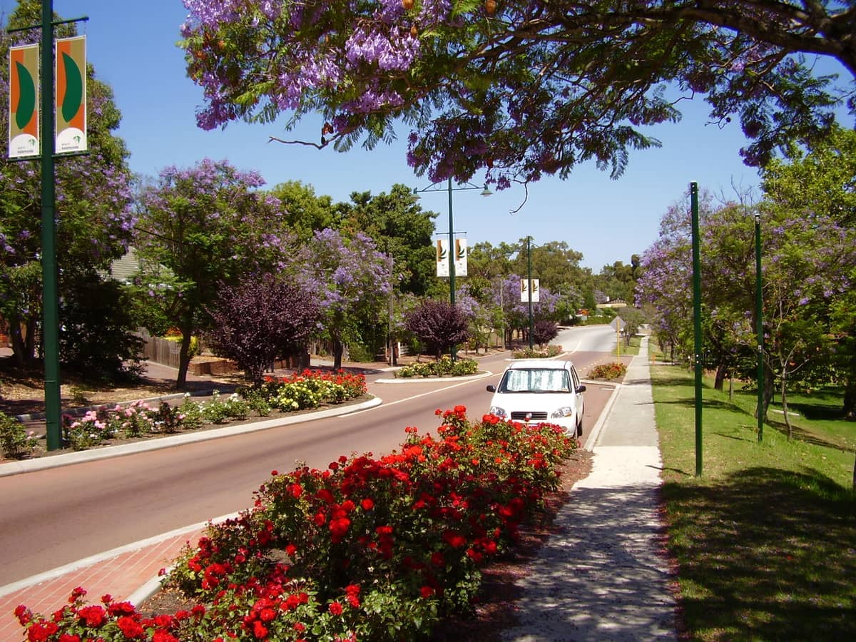
8. Descend the Kalamunda Zig Zag Trail Through Jarrah Forest
This historic trail drops steeply down the Darling Escarpment through dense jarrah forest on an old timber-getting route. The descent takes about 45 minutes one way; arrange transport at the bottom or return via the same path.
Explore8. Descend the Kalamunda Zig Zag Trail Through Jarrah Forest
This historic trail drops steeply down the Darling Escarpment through dense jarrah forest on an old timber-getting route. The descent takes about 45 minutes one way; arrange transport at the bottom or return via the same path.
Explore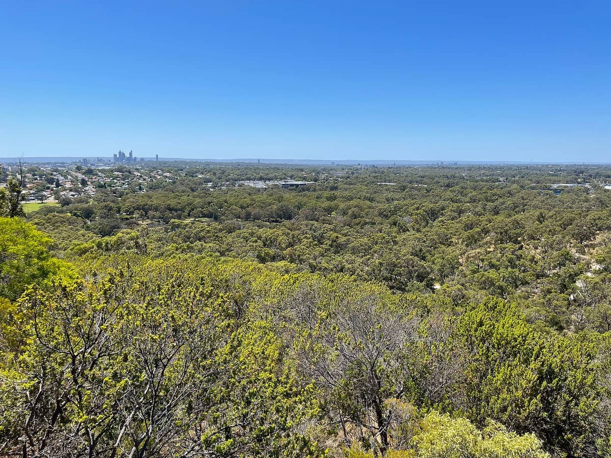
9. Summit Reabold Hill in Bold Park for Ocean-to-Range Views
Bold Park's trail network through 437 ha of banksia woodland leads to the Reabold Hill summit, where views stretch from the Indian Ocean to the Darling Range. Trails range from 1 to 6 km and are well-signed. Entry is free.
Explore9. Summit Reabold Hill in Bold Park for Ocean-to-Range Views
Bold Park's trail network through 437 ha of banksia woodland leads to the Reabold Hill summit, where views stretch from the Indian Ocean to the Darling Range. Trails range from 1 to 6 km and are well-signed. Entry is free.
Explore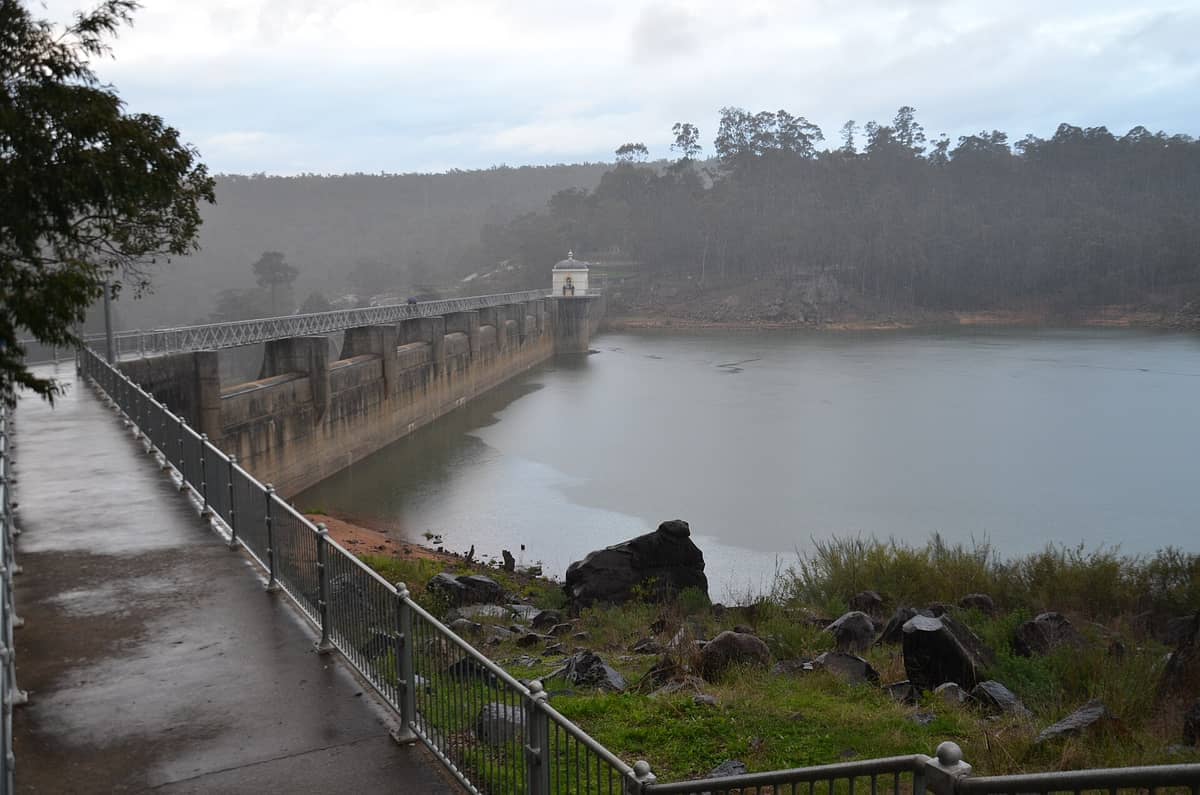
10. Walk Beelu National Park Trails from Mundaring Weir
The historic weir is the gateway to Beelu National Park's jarrah and marri forest trails. The Bibbulmun Track passes through here, and shorter day walks of 4 to 8 km suit most fitness levels. A heritage museum and café make a good start or finish.
Explore10. Walk Beelu National Park Trails from Mundaring Weir
The historic weir is the gateway to Beelu National Park's jarrah and marri forest trails. The Bibbulmun Track passes through here, and shorter day walks of 4 to 8 km suit most fitness levels. A heritage museum and café make a good start or finish.
Explore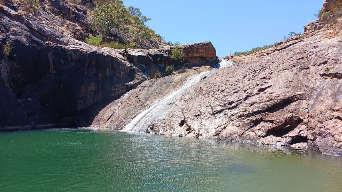
11. Swim at the End of the Serpentine Falls Trail
A 3 km return walk through jarrah forest leads to a granite waterfall and clear swimming hole about 60 km south of Perth. The payoff — a natural pool beneath cascading water — makes it one of the most popular summer hikes near the city.
Explore11. Swim at the End of the Serpentine Falls Trail
A 3 km return walk through jarrah forest leads to a granite waterfall and clear swimming hole about 60 km south of Perth. The payoff — a natural pool beneath cascading water — makes it one of the most popular summer hikes near the city.
Explore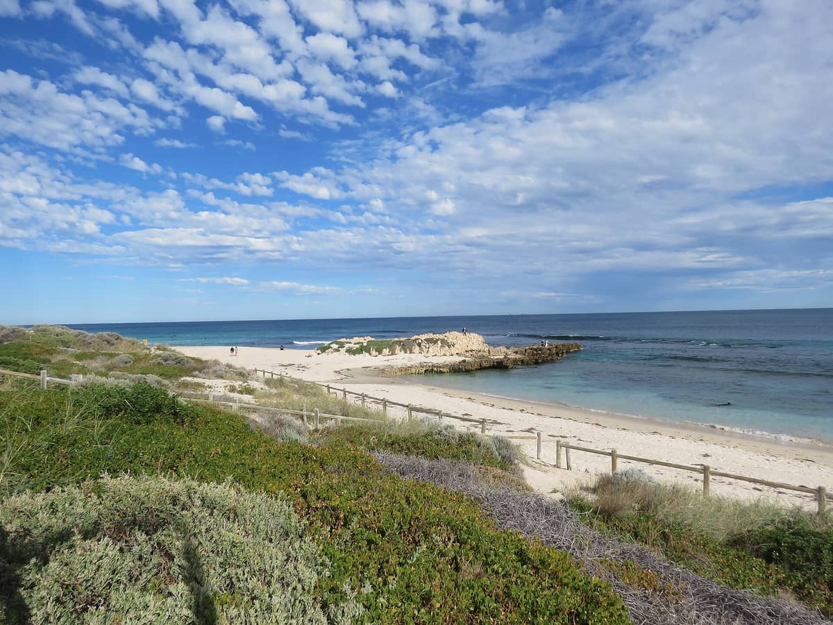
12. Walk the Trigg Bushland Reserve Coastal Trail
The Trigg Bushland Reserve backs a wild surf beach north of Scarborough, with short walking trails through coastal heath above dramatic Indian Ocean cliffs. Combine a bushland walk with a swim for a half-day outing. Best visited April through October.
Explore12. Walk the Trigg Bushland Reserve Coastal Trail
The Trigg Bushland Reserve backs a wild surf beach north of Scarborough, with short walking trails through coastal heath above dramatic Indian Ocean cliffs. Combine a bushland walk with a swim for a half-day outing. Best visited April through October.
ExploreThe Bibbulmun Track: Day Sections for Serious Walkers
The Bibbulmun Track is one of Australia's great long-distance trails, running roughly 1,000 km from Kalamunda to Albany. It starts in thePerth Hillsand several of its opening sections work well as day walks for fit hikers. Note that the track is linear and walkers-only, so you need to plan return transport in advance. The Bibbulmun Track Foundation recommends avoiding this route on days of high fire danger and in hot summer conditions. The Calamunnda to Hewett's Hill section — a 5 km return walk rated moderate — is a practical and rewarding entry point, with parking available by gold-coin donation.
13. Start the Bibbulmun Track at Kalamunda for a Day Section
Kalamunda is the northern terminus of the Bibbulmun Track. Day walkers can tackle the Calamunnda to Hewett's Hill section — 5 km return through Beelu National Park — rated moderate and recommended March through November. Plan return transport carefully.
Explore13. Start the Bibbulmun Track at Kalamunda for a Day Section
Kalamunda is the northern terminus of the Bibbulmun Track. Day walkers can tackle the Calamunnda to Hewett's Hill section — 5 km return through Beelu National Park — rated moderate and recommended March through November. Plan return transport carefully.
Explore14. Walk the Bibbulmun Track Through Mundaring Weir Reservoir Country
The Bibbulmun Track's early sections pass through the Mundaring Weir area, offering serious walkers a full day in jarrah forest with the reservoir as a visual anchor. Start from the weir car park and check track notes for current conditions before departing.
Explore✨ Pro tip
The Bibbulmun Track is a linear walkers-only route. To do a day section, you need to either retrace your steps or arrange a car shuttle. Don't assume you can connect sections as convenient day loops — some stretches have long gaps between access points.
Coastal & River Walks: Flat Trails with Great Scenery
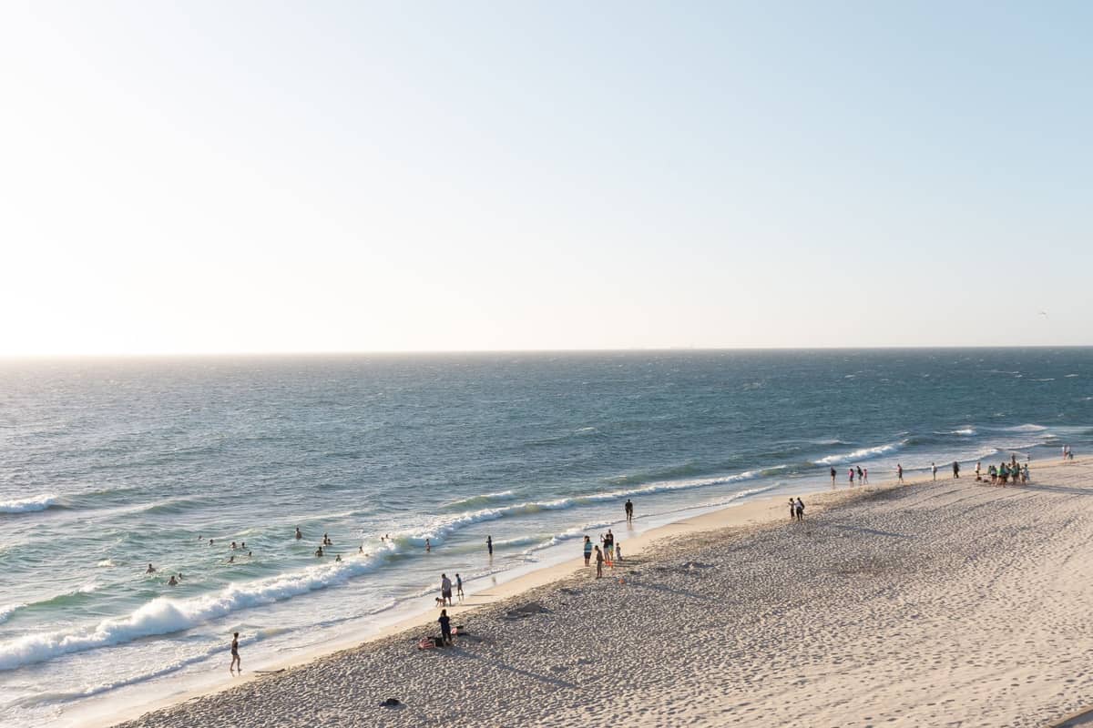
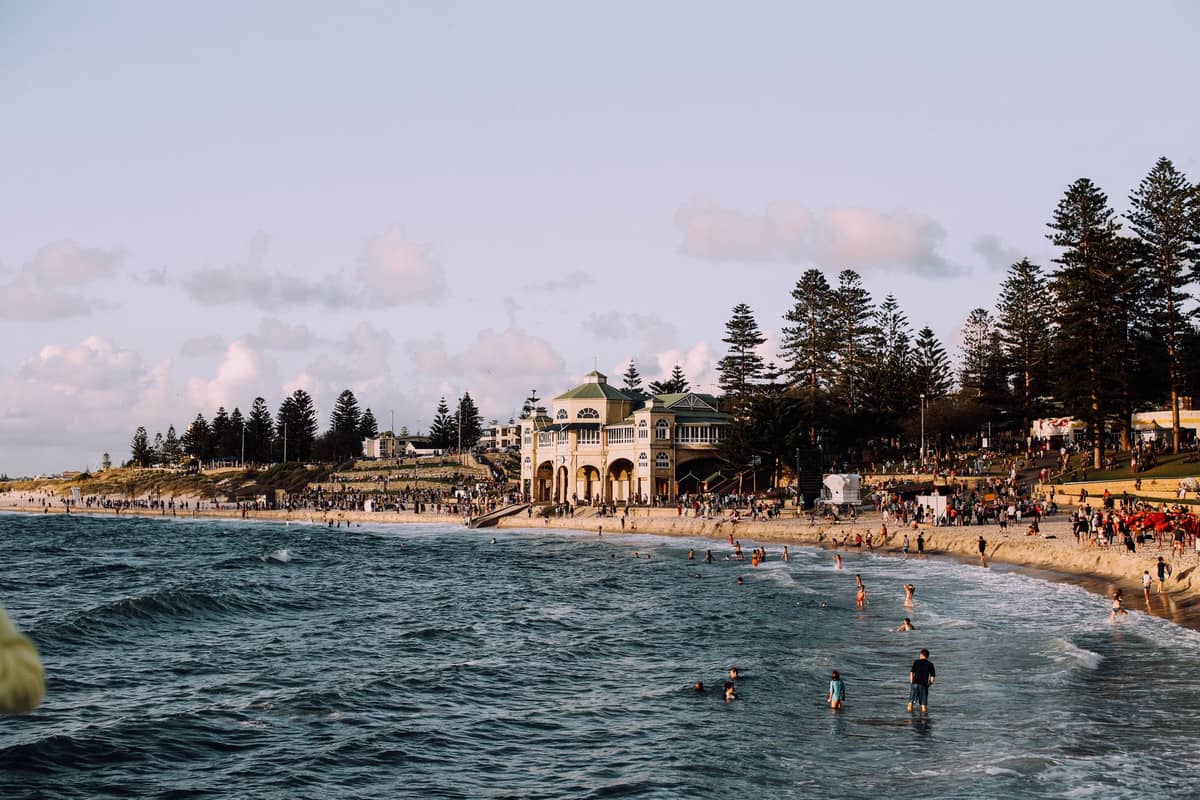
Perth's Indian Ocean coastline and the Swan River offer some of the most scenic flat walking in any Australian city. The stretch betweenCottesloeand Scarborough is particularly rewarding — an almost continuous beach and coastal path walk. For river walking, the foreshore trails between Elizabeth Quay and Matilda Bay are well-maintained and offer superb CBD skyline views. See ourPerth beaches guide for the best spots to combine a walk with a swim.
15. Walk the Coastal Strip from Cottesloe to City Beach
A flat, mostly paved path links Cottesloe Beach northward through Swanbourne and on to City Beach along Norfolk-pine-backed foreshore. The 5 km one-way walk passes quieter sections of coast rarely crowded even in peak season.
Explore15. Walk the Coastal Strip from Cottesloe to City Beach
A flat, mostly paved path links Cottesloe Beach northward through Swanbourne and on to City Beach along Norfolk-pine-backed foreshore. The 5 km one-way walk passes quieter sections of coast rarely crowded even in peak season.
Explore
16. Walk the Swan River Foreshore from Matilda Bay to Elizabeth Quay
This flat riverside path follows the northern Swan River bank from the iconic Blue Boat House at Matilda Bay past UWA, through Crawley and on to Elizabeth Quay. The 7 km one-way walk is shaded and paved, with city views throughout.
Explore16. Walk the Swan River Foreshore from Matilda Bay to Elizabeth Quay
This flat riverside path follows the northern Swan River bank from the iconic Blue Boat House at Matilda Bay past UWA, through Crawley and on to Elizabeth Quay. The 7 km one-way walk is shaded and paved, with city views throughout.
Explore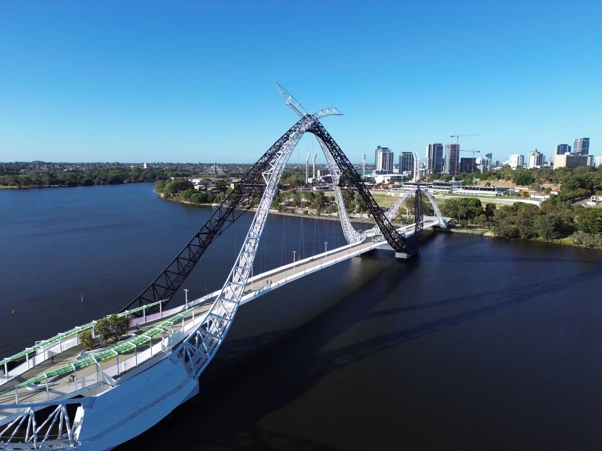
17. Cross the Matagarup Bridge for Swan River and Skyline Views
The cable-stayed pedestrian bridge connecting the CBD to Burswood Peninsula is a 1 km walk with outstanding views of the Perth skyline and Swan River. Combine it with the Burswood riverside path for a flat 4 to 6 km loop.
Explore17. Cross the Matagarup Bridge for Swan River and Skyline Views
The cable-stayed pedestrian bridge connecting the CBD to Burswood Peninsula is a 1 km walk with outstanding views of the Perth skyline and Swan River. Combine it with the Burswood riverside path for a flat 4 to 6 km loop.
Explore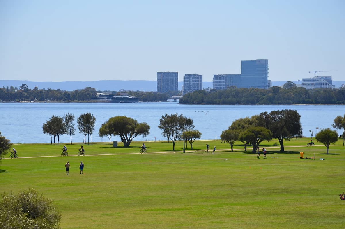
18. Walk the South Perth Foreshore for the Best CBD Skyline Views
The South Perth promenade along the Swan River is a wide, flat path with the most celebrated view of the Perth skyline. A 3 km stroll to the South Perth Jetty and back is easy for all levels and is best at sunrise or sunset.
Explore18. Walk the South Perth Foreshore for the Best CBD Skyline Views
The South Perth promenade along the Swan River is a wide, flat path with the most celebrated view of the Perth skyline. A 3 km stroll to the South Perth Jetty and back is easy for all levels and is best at sunrise or sunset.
ExploreDay Trip Hikes: Trails Worth the Drive from Perth
Some of the best hiking near Perth requires a 45-minute to two-hour drive but delivers landscapes far removed from the suburban trails closer to town. Thebest day trips from Perthfor hikers include Yanchep National Park to the north and the Pinnacles Desert for something completely different. For wildflower season walks, check ourPerth wildflower season guide for timing and the best locations.
19. Walk Yanchep's Wetland and Limestone Cave Trails
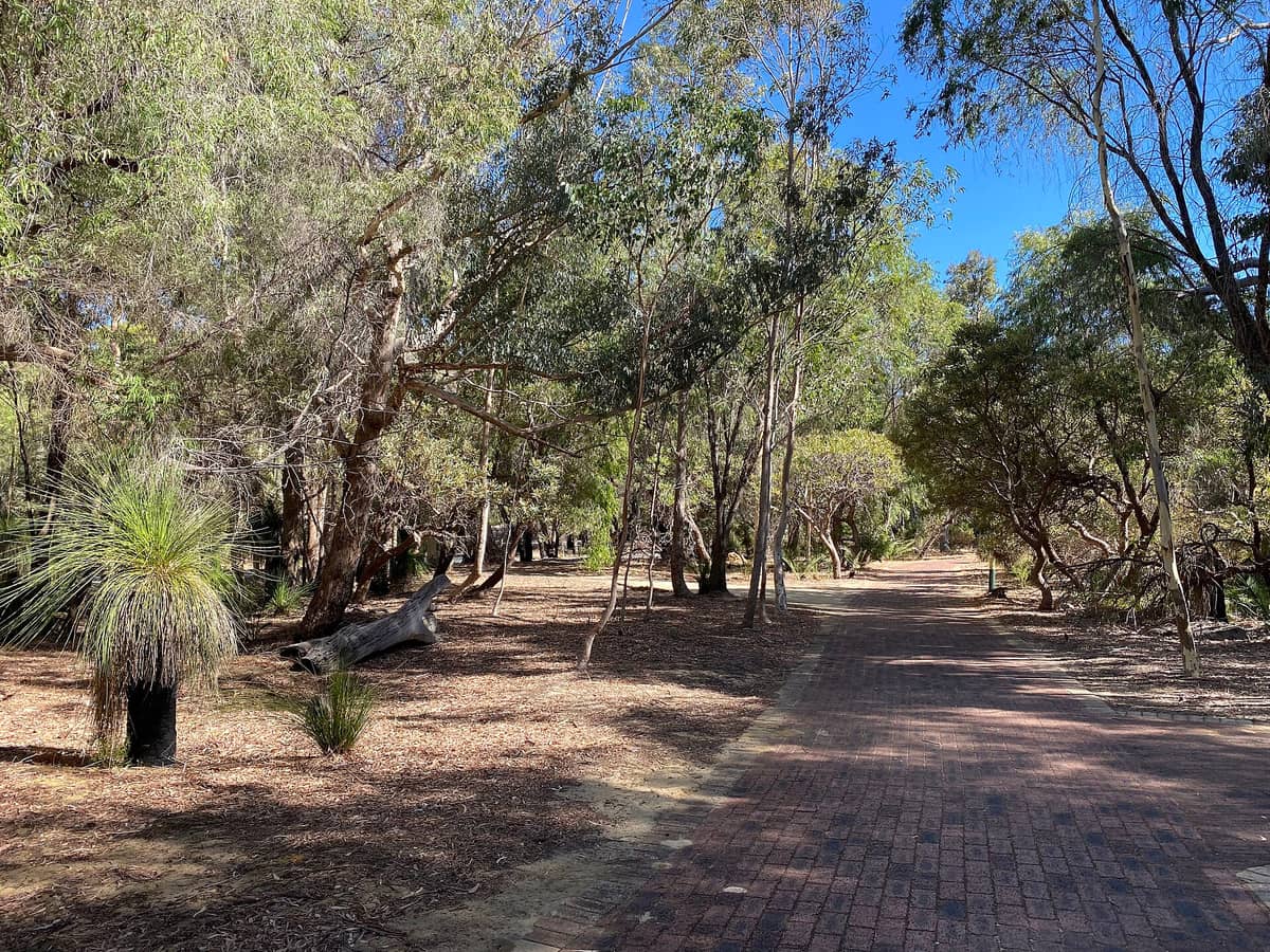
Yanchep, 51 km north of Perth, combines easy-to-moderate trails through wildflower-rich bushland with guided cave tours and koala sightings. Spring walks here are outstanding. The Loch McNess Loop is 4 km and takes around 90 minutes.
Explore19. Walk Yanchep's Wetland and Limestone Cave Trails
Yanchep, 51 km north of Perth, combines easy-to-moderate trails through wildflower-rich bushland with guided cave tours and koala sightings. Spring walks here are outstanding. The Loch McNess Loop is 4 km and takes around 90 minutes.
Explore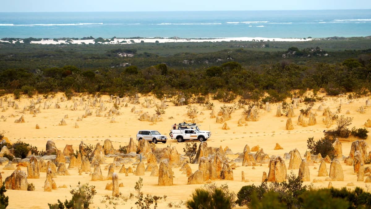
20. Walk Among the Limestone Pillars of the Pinnacles Desert
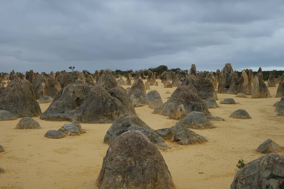
Nambung National Park's 4 km loop trail winds through thousands of ancient limestone pillars rising from golden sand, 245 km north of Perth. Visit at dawn or dusk for the best light. The landscape is unlike anything else in the southwest.
Explore20. Walk Among the Limestone Pillars of the Pinnacles Desert
Nambung National Park's 4 km loop trail winds through thousands of ancient limestone pillars rising from golden sand, 245 km north of Perth. Visit at dawn or dusk for the best light. The landscape is unlike anything else in the southwest.
Explore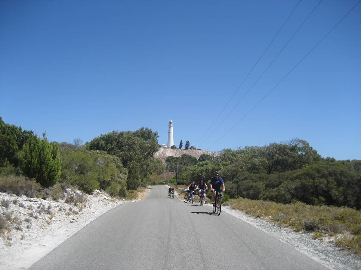
21. Cycle or Walk to Wadjemup Lighthouse on Rottnest Island
Rottnest Island's highest point offers panoramic Indian Ocean views and a historic 1849 lighthouse. Walk or cycle from Thomson Bay — around 5 km each way — through the island's interior, where quokkas are frequently seen along the trail.
Explore21. Cycle or Walk to Wadjemup Lighthouse on Rottnest Island
Rottnest Island's highest point offers panoramic Indian Ocean views and a historic 1849 lighthouse. Walk or cycle from Thomson Bay — around 5 km each way — through the island's interior, where quokkas are frequently seen along the trail.
Explore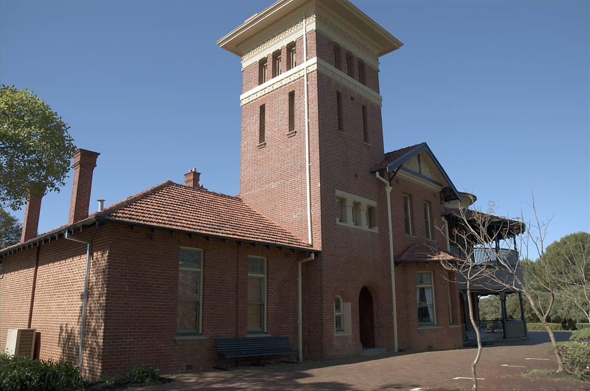
22. Walk to Perth Observatory in the Darling Range at Bickley
The road and surrounding bush trails to Perth Observatory in the Darling Range pass through jarrah woodland with excellent birdlife. The observatory's dark-sky site doubles as a peaceful hiking destination during the day, 35 km from the CBD.
Explore22. Walk to Perth Observatory in the Darling Range at Bickley
The road and surrounding bush trails to Perth Observatory in the Darling Range pass through jarrah woodland with excellent birdlife. The observatory's dark-sky site doubles as a peaceful hiking destination during the day, 35 km from the CBD.
ExploreFAQ
What is the best time of year to hike near Perth?
Spring (September to November) and autumn (March to May) are ideal. Wildflowers peak in September and October, and temperatures are comfortable for long walks. Avoid hiking exposed trails in summer (December to February) when temperatures regularly exceed 35°C. Winter walks are possible and the waterfalls in the Perth Hills are at their most spectacular after June to August rains.
Are there hiking trails I can reach from Perth without a car?
Yes. Kings Park is walkable from the CBD and served by bus. The Swan River foreshore trails from Elizabeth Quay through Matilda Bay are fully accessible by Transperth train and bus. Lake Monger in Wembley is reachable by bus. Heirisson Island is accessible by bus from the CBD. For Perth Hills trails, a car is generally necessary.
How do I access day sections of the Bibbulmun Track from Perth?
The track's northern terminus is at Kalamunda in the Perth Hills, accessible by bus to Kalamunda township then a short walk to the trailhead. Because the Bibbulmun Track is linear and walkers-only, you need to plan return transport or retrace your steps. The Bibbulmun Track Foundation website has detailed access notes and a trip planner.
What should I carry on Perth Hills hikes?
At minimum: 2 litres of water per person, sun protection (hat, sunscreen, sunglasses), a downloaded trail map (mobile coverage is patchy in the hills), and snacks. Check fire danger ratings before going — trails in the Perth Hills can be closed on days of extreme or catastrophic fire danger. Wear closed shoes; the granite trails are rough underfoot.
Are Perth's hiking trails suitable for young children and families?
Several are excellent for families. Kings Park's Bushland Nature Trail (1 km) is flat and stroller-friendly. Lake Monger's 3.5 km loop is paved and great for young walkers. Serpentine Falls has a short, easy walk to a swimming hole children love. Yanchep National Park's trails are easy and combine well with koala spotting and cave tours.
Tickets & tours
Live prices and dates from our booking partner. If you book, we may earn a commission at no extra cost to you.
Planning a trip? Discover personalized activities with the Nomado app.