Getting Around Vancouver: The Complete Transport Guide
Vancouver's transit network is one of the best in North America, but navigating zones, passes, and peak hours takes some planning. This guide covers every mode of transport, from the Canada Line SkyTrain to cycling the seawall, with current fares and practical tips on when to skip the car entirely.

TL;DR
- Vancouver's public transit is run by TransLink and covers SkyTrain, buses, SeaBus, and commuter rail across Metro Vancouver.
- Fares use a 3-zone system for SkyTrain and SeaBus; all bus trips are always 1-zone regardless of distance.
- The Canada Line SkyTrain connects Vancouver International Airport (YVR) to downtown in about 25 minutes. See our where to stay in Vancouver guide to pick a hotel close to a SkyTrain station.
- You do not need to buy a Compass Card: tap-to-pay with any contactless credit card or phone works at all fare gates and readers.
- Vancouver has no urban freeways, so driving during peak hours can be surprisingly slow. Transit and cycling are genuinely competitive options for most trips.
Getting from Vancouver Airport (YVR) to Downtown
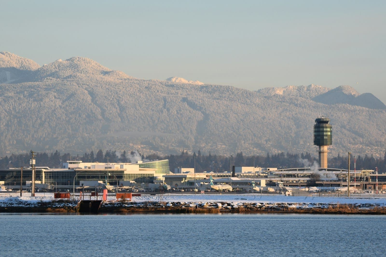
Vancouver International Airport sits on Sea Island in Richmond, about 12 km south of downtown. The connection is straightforward, and most travelers have four practical options depending on budget and luggage.
- Canada Line SkyTrain (best value) Runs from YVR-Airport station directly to Waterfront Station in approximately 25 minutes. Trains run frequently throughout the day. Note that departing from the airport adds an extra YVR AddFare on top of the standard zone fare, so the total cost is higher than a regular 2-zone trip. Confirm the current combined fare on the TransLink website before you travel, as fares are updated periodically.
- Taxi (flat zone rate) YVR operates a zone-based flat-rate taxi system from the arrivals level of both the Domestic and International terminals. This removes the uncertainty of metered fares to downtown. Current zone rates are posted at the airport and on the YVR website.
- Uber or Lyft Both are licensed in Metro Vancouver and operate from designated ride-hailing pickup zones at YVR. Pricing is dynamic and fluctuates with demand, especially during morning peaks and late-night arrivals. Check the app for an estimate before confirming.
- Rental car or hotel shuttle Multiple car rental companies operate from the airport's ground transportation level. Several downtown hotels offer private shuttle services; confirm directly with your hotel when booking.
💡 Local tip
If you are arriving with heavy luggage on a rainy evening, the taxi flat rate is often worth it for the simplicity. For solo travelers or those carrying only a backpack, the Canada Line is by far the most cost-effective and avoids any traffic on the Oak Street Bridge corridor.
TransLink: Vancouver's Public Transit Network
TransLink manages all public transit across Metro Vancouver, including the SkyTrain rapid transit system, the extensive bus network, the SeaBus passenger ferry, the West Coast Express commuter rail, and the HandyDART door-to-door service for riders with disabilities. For most visitors, SkyTrain and buses will cover the vast majority of trips.
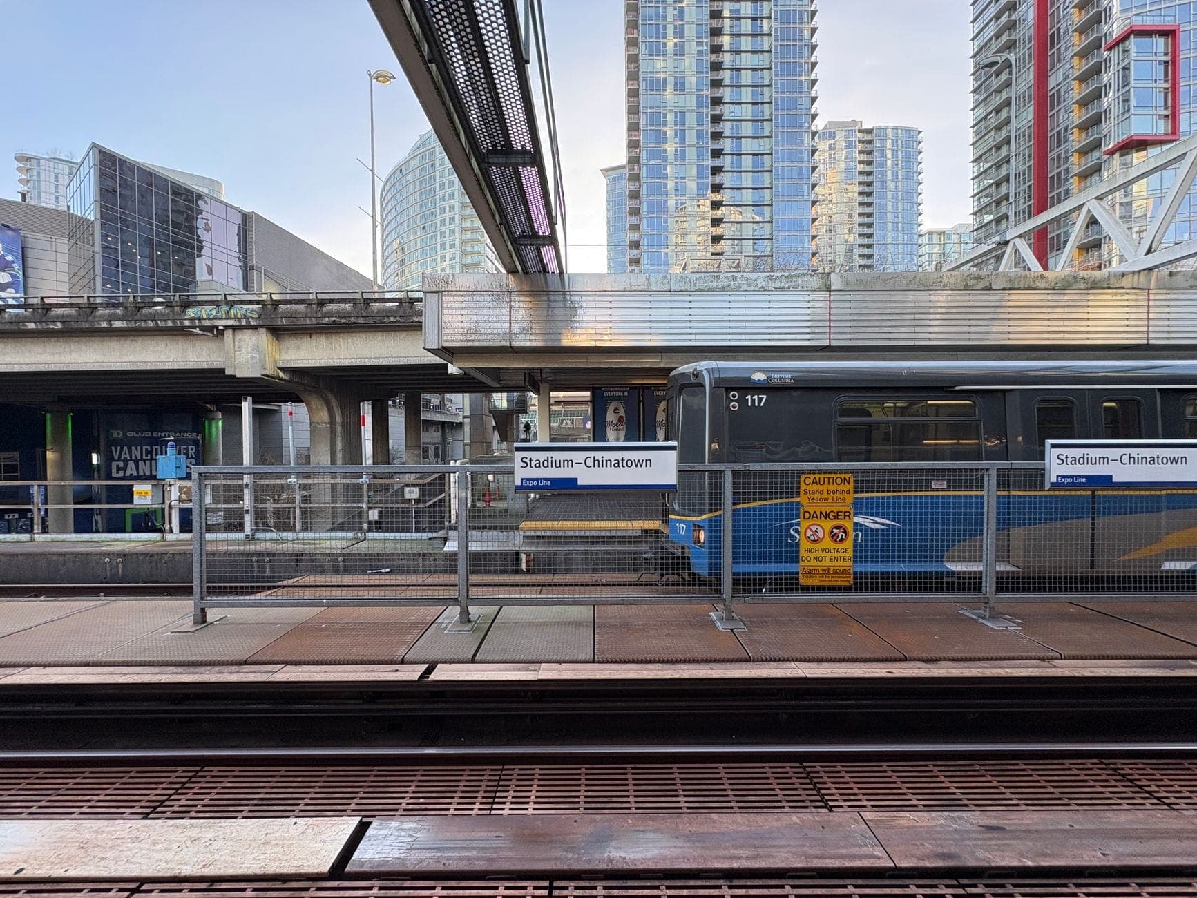
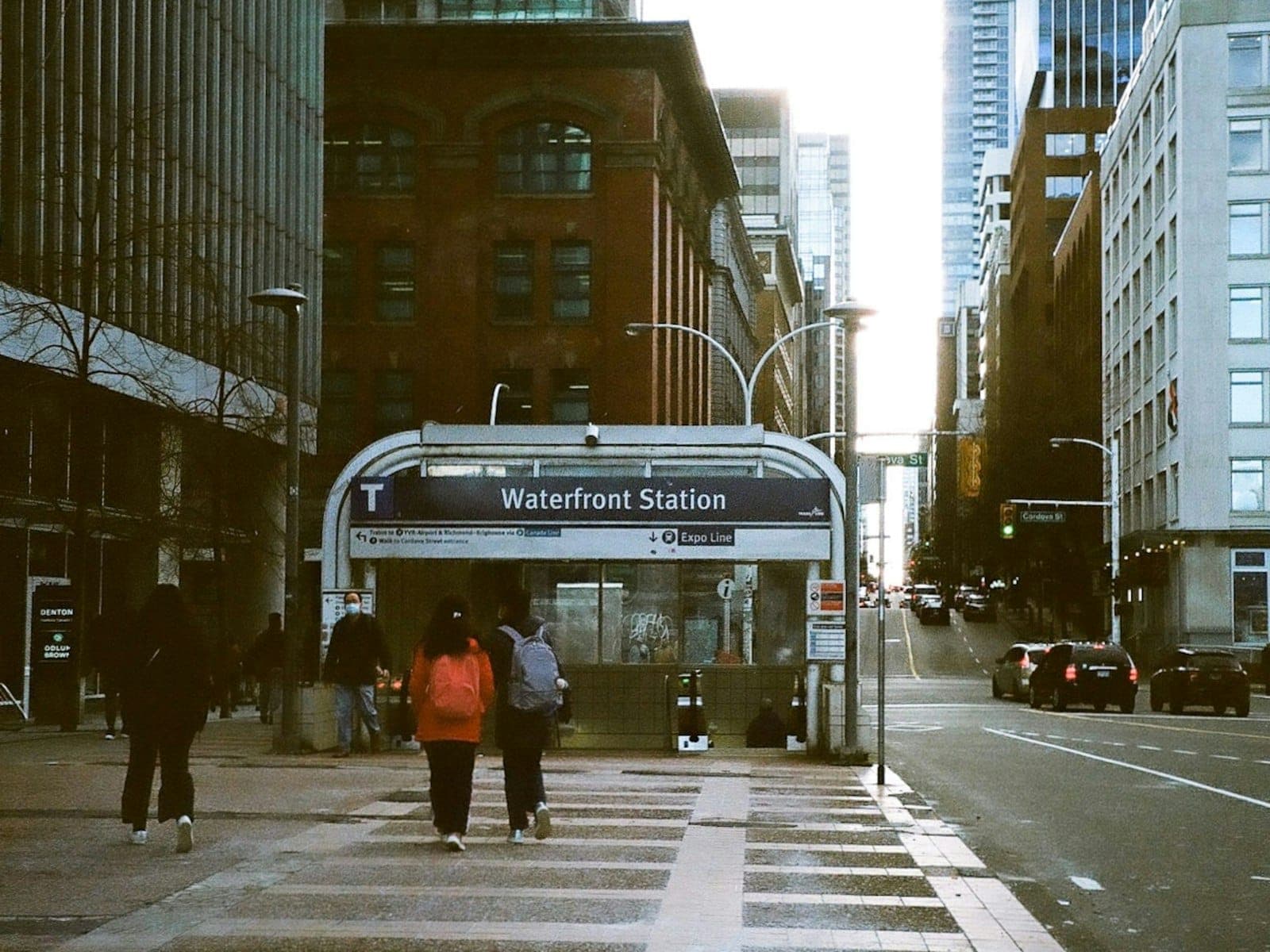
The SkyTrain system has three lines. The Waterfront Station near Canada Place is the main downtown hub where all three lines and the SeaBus converge. The Expo Line runs east through Burnaby to Surrey and New Westminster. The Millennium Line branches off toward Coquitlam. The Canada Line heads south through Richmond to YVR or southwest to the Olympic Village and Oakridge areas.
The bus network fills in everything the SkyTrain does not reach, including Kitsilano, the West End, Commercial Drive, and most residential neighborhoods. One important distinction for travelers: all bus trips are charged as a 1-zone fare regardless of how far you travel or which direction you head. There is no bus zone premium for crossing into surrounding municipalities.
ℹ️ Good to know
Vancouver has no urban freeway running through its core, which is unusual for a North American city of this size. This was the result of community opposition in the 1960s and 1970s. The practical effect: surface streets and bridges carry all vehicle traffic, and congestion on routes like the Granville Bridge and Cambie Bridge can be significant during morning and evening peaks.
Fares, Zones, and How to Pay
Metro Vancouver uses a 3-zone fare structure for SkyTrain and SeaBus trips. Zone 1 covers the City of Vancouver, Burnaby, New Westminster, and parts of the North Shore. Zone 2 adds Richmond, Surrey, the rest of the North Shore, and several other municipalities. Zone 3 reaches the outer edges of the transit network. The number of zones you cross determines your fare.
- 1-zone adult cash fare: $3.25 | Concession: $2.10
- 2-zone adult cash fare: $4.80 | Concession: $3.35
- 3-zone adult cash fare: $6.90 | Concession: $4.70
- All-zones DayPass: $12.75 adult | $10.00 concession
- After 18:30 on weekdays, and all day on weekends and statutory holidays, every trip is charged as 1-zone regardless of distance.
- A single fare covers unlimited transfers within 90 minutes across bus, SkyTrain, and SeaBus.
Payment is flexible. You can use a reloadable Compass Card, a single-use Compass ticket purchased at station vending machines, or simply tap a contactless credit card or mobile wallet (Apple Pay, Google Pay) directly at the fare gate readers or bus card readers. Visitors staying for a few days rarely need to buy a Compass Card unless they want to track spending or load a DayPass.
⚠️ What to skip
Fares and zone structures change periodically. The figures above were accurate at the time of writing but should be verified at translink.ca before you travel, especially if you are planning a longer trip and budgeting in advance. The YVR AddFare for airport departures is a separate charge on top of the zone fare.
Getting Around the City: Neighborhood by Neighborhood
Most of Vancouver's main visitor destinations are within a compact area that is very well served by transit and, in summer, by cycling. Downtown Vancouver, Gastown, and Yaletown are all walkable from each other and from multiple SkyTrain stations. The trip between Gastown and Yaletown on foot takes under 20 minutes.
Crossing False Creek to reach Kitsilano or the beaches on the south side of the inlet is where transit gets slightly less convenient. Buses on Burrard, Granville, and Cambie bridges connect downtown to these neighborhoods, but frequency varies. The False Creek Ferries service is a practical and enjoyable alternative for reaching Granville Island and Kitsilano from the downtown waterfront, running small passenger vessels across the creek.
For Stanley Park, the simplest approach from most downtown hotels is to walk or cycle west. The park is about 1.5 km from the edge of the downtown core. Bus routes also stop near the park entrance. Once inside, the Stanley Park Seawall is best explored on foot or by rental bike, not by transit.
Reaching the North Shore, including Grouse Mountain and Capilano, requires crossing Burrard Inlet. The SeaBus from Waterfront Station to Lonsdale Quay takes about 12 minutes and runs frequently. From Lonsdale Quay, local buses connect to Grouse Mountain and Capilano Suspension Bridge. The SeaBus is included in a standard TransLink fare, which makes the North Shore far more accessible than most visitors expect.
Cycling, Walking, and Getting Around Without Transit
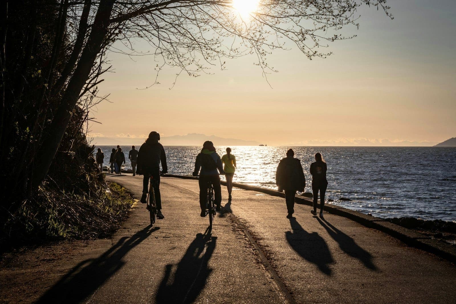
Vancouver has invested significantly in cycling infrastructure, and for visitors staying in or near downtown, a bike can genuinely replace transit for a large proportion of daytime trips. The seawall path runs continuously from Coal Harbour through Stanley Park and south to Kitsilano, giving cyclists and pedestrians a traffic-free route along the waterfront.
Mobi, Vancouver's public bike-share system, operates docking stations across downtown, the West End, Kitsilano, and other central neighborhoods. Day passes and per-trip rates are available through the Mobi app. For longer rides or hill climbing toward UBC, an e-bike rental may be worth considering. Several rental shops operate near English Bay and the Stanley Park entrance.
If you prefer to drive, be aware that downtown Vancouver has paid parking throughout most of the core, and bridge approaches can back up significantly during weekday peak hours (roughly 7:30-9:30 AM and 4:00-6:30 PM). For day trips to places like the North Shore or UBC, driving can save time, but for trips within the central core, transit or cycling will usually be faster.
✨ Pro tip
If you are visiting in July or August, cycling the seawall between Granville Island and Stanley Park and back is one of the best ways to see the city at ground level. Bike rentals near the Stanley Park entrance and at Granville Island are widely available, and the flat waterfront route is manageable for casual cyclists. Expect the path to be crowded on weekend afternoons; earlier morning rides before 9 AM are significantly quieter.
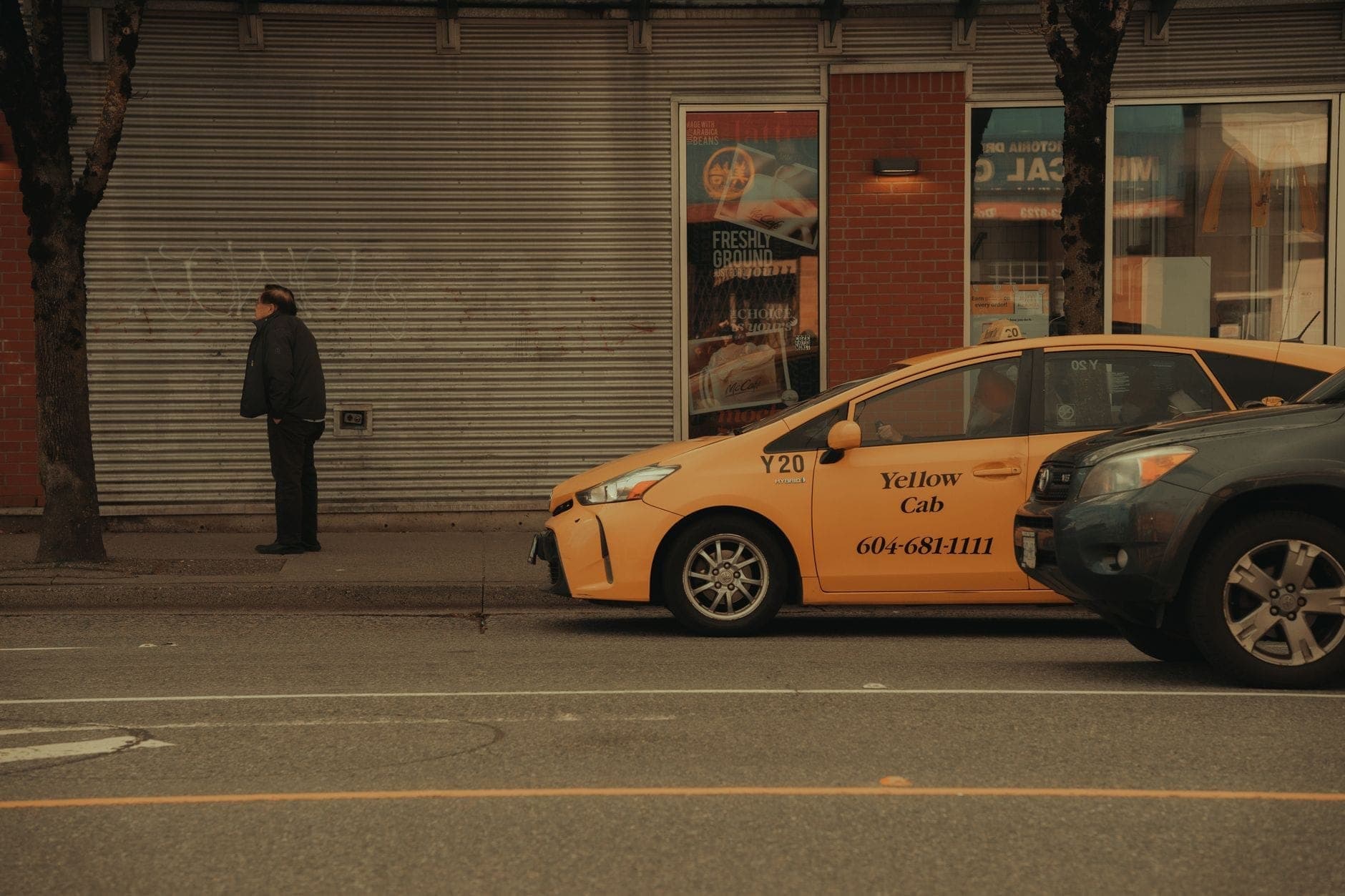
Taxis, Ride-Hailing, and When to Use Them
Uber and Lyft both operate across Metro Vancouver and are the most common ride-hailing options. They became available in the region in early 2020 after provincial approval. Both apps function as expected: request from the app, track the driver, pay through the app. Surge pricing applies during peak times, major events at BC Place or Rogers Arena, and late-night weekend hours.
Traditional taxis are still available and can be hailed on the street in busy areas or booked by phone. For airport pickups and late-night trips where transit is less frequent, taxis remain a reliable option. The key advantage of taxis for some travelers: no requirement for a smartphone or app account.
- Use ride-hailing or taxis late at night when SkyTrain service ends (around midnight on weekdays, slightly later on weekends).
- For trips with heavy luggage or multiple people, the per-person cost of a taxi or Uber often competes favorably with transit plus the YVR AddFare.
- During large events (Vancouver Canucks playoff games, major concerts), wait times and surge pricing on Uber and Lyft can be significant. TransLink often runs extended SkyTrain service for major events; check their website.
- Street taxis can be scarce outside the downtown core; the app-based services are more reliable in residential neighborhoods.
FAQ
Do I need a Compass Card to use Vancouver transit?
No. You can tap to pay directly with any contactless credit card or mobile wallet (Apple Pay, Google Pay) at SkyTrain fare gates and bus card readers. A Compass Card is useful if you want to load a DayPass, track spending, or take advantage of stored value discounts, but it is not required for visitors making a small number of trips.
How long does it take to get from YVR airport to downtown Vancouver?
The Canada Line SkyTrain takes approximately 25 minutes from YVR-Airport station to Waterfront Station in downtown. By taxi or ride-hailing, the trip is typically 20-35 minutes depending on traffic, but can be longer during peak hours or when there is congestion on the Oak Street or Knight Street bridge approaches.
Is Vancouver easy to get around without a car?
Yes, for most visitor itineraries. The SkyTrain network connects the airport, downtown, and major neighborhoods efficiently. Buses fill in the gaps. Walking and cycling are practical options for central areas. A car is most useful for day trips to Whistler, the Sunshine Coast, or areas not well-served by transit. For the city itself, the majority of top attractions are reachable without driving.
What is the cheapest way to use Vancouver transit as a visitor?
If you plan to make several trips in a single day, the all-zones DayPass ($12.75 for adults at time of writing) offers the best value. It covers unlimited travel across all zones for the full day. For shorter stays with fewer trips, tapping to pay per journey with a contactless card is convenient and avoids the need to buy a physical pass. Always verify current fares at translink.ca.
Can I get to the North Shore (Grouse Mountain, Capilano) by public transit?
Yes. Take the SeaBus from Waterfront Station to Lonsdale Quay in North Vancouver (about 12 minutes), then connect to local bus routes that serve both Grouse Mountain and Capilano Suspension Bridge. The SeaBus crossing is included in your standard TransLink fare. Bus frequency varies by route and time of day, so check the TransLink Trip Planner before heading out.