Hiking Baiyun Mountain: Trails, Cable Car & Summit Views
Baiyun Mountain is Guangzhou's best-known hiking destination, with marked trails, a cable car to the summit area, and panoramic views over the Pearl River Delta. This guide covers every trail option, gate access, transport logistics, and the best times to go.
Plan and book this trip
Tools from our partner Travelpayouts help you compare flights and hotels. If you book through them, we may earn a commission at no extra cost to you.
Flights
Hotels map
TL;DR
- Baiyun Mountain (白云山) has five official hiking routes ranging from a 6 km family path to a 21 km half-marathon route — it is a trail network, not a single hike. See the Baiyun Mountain attraction page for entrance and location details.
- The highest point is Moxing Ridge (摩星岭), Baiyun Mountain's official summit.
- The cable car is a practical option for first-timers or those with limited time.
- Opening hours are approximately in the morning to late afternoon daily, but the mountain is busiest on weekend mornings — arrive before 08:00 to beat the crowds.
- October to March is the most comfortable period for hiking; summer (June to August) is hot, humid, and prone to afternoon thunderstorms. Check the best time to visit Guangzhou guide for seasonal breakdown.
What Baiyun Mountain Actually Is (and Isn't)
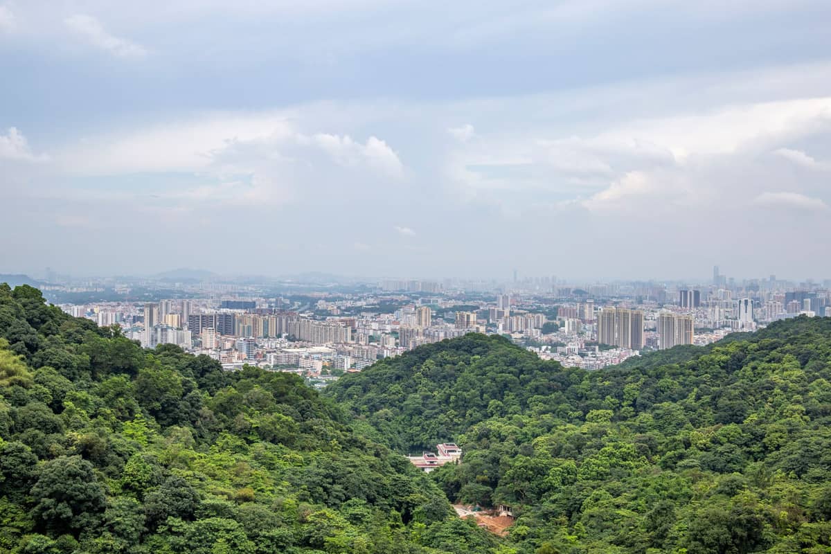
Baiyun Mountain, located in Baiyun District just north of Guangzhou's urban core, is one of the largest forested scenic areas attached to any major Chinese city. The mountain covers a significant area of protected green space and contains dozens of peaks, the tallest being Moxing Ridge at around 382 metres above sea level. Calling it a 'mountain' in the dramatic sense would be misleading — it is a forested hill range, pleasant to hike rather than technically demanding, but large enough to take several hours to cross properly.
The site is managed as a national scenic area (国家级风景名胜区) and functions simultaneously as a city park, hiking destination, and cultural landscape. You will share the trails with morning walkers in slippers, serious trail runners, families with small children, and elderly residents doing tai chi on the pavilion terraces. This is not a wilderness experience — it is a well-maintained urban escape, and that is precisely what makes it accessible and worth knowing in detail.
ℹ️ Good to know
Baiyun Mountain is sometimes confused with Baiyun District or Guangzhou Baiyun International Airport, which share the same name character. The mountain, the district, and the airport are three separate things. The mountain sits within Baiyun District but is not near the airport.
The Five Official Hiking Routes: Distances and What to Expect
Guangzhou's government and affiliated tourism bodies highlight several main hiking routes on Baiyun Mountain, each designed for a different fitness level and time commitment. Understanding the differences before you arrive will save considerable confusion at the gate.
- 6 km Family Path The shortest official route, designed for low-gradient walking with minimal elevation change. Suitable for children and older visitors. Typically begins at one of the lower gates and avoids the summit entirely.
- 10 km Fitness Trail A moderate loop combining forest paths and paved sections. Involves noticeable climbs but nothing that requires trekking poles. A reasonable target for a first visit with some hiking experience.
- 13 km Four-Seasons Trail Named for the year-round visual variety — blossoms in spring, dense canopy in summer, colour in autumn, misty mornings in winter. Passes through several garden areas and scenic overlooks.
- 15 km Trail-Run Route Designed with trail runners in mind, featuring a mix of ascent, descent, and technical path sections. Used for organized running events. Fit hikers can complete it, but allow 4–5 hours.
- 21 km Half-Marathon Route The full-length traverse of the mountain, roughly equivalent to a half-marathon in distance. Serious elevation gain involved. Used for competitive trail events. Not recommended as a casual first visit — treat it as a dedicated day out.
Most casual visitors and first-timers gravitate toward the shorter or moderate routes. The full-length route is a genuine undertaking — start before 07:00 if attempting it, carry water and snacks, and budget the full day.
💡 Local tip
Route signage on Baiyun Mountain is primarily in Chinese. Download an offline map or screenshot the official route diagrams from the Guangzhou tourism authority website before entering — mobile data coverage is uneven in the denser forest sections.
Gate Entry Points and How to Reach the Mountain
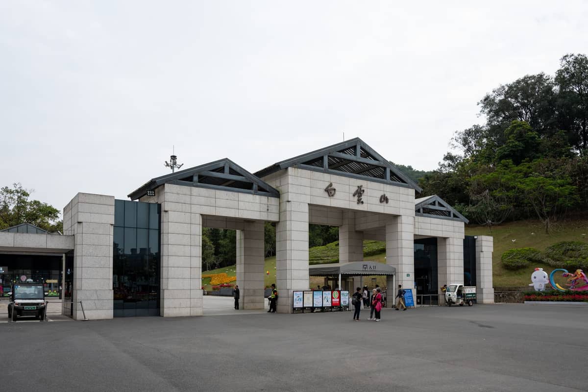
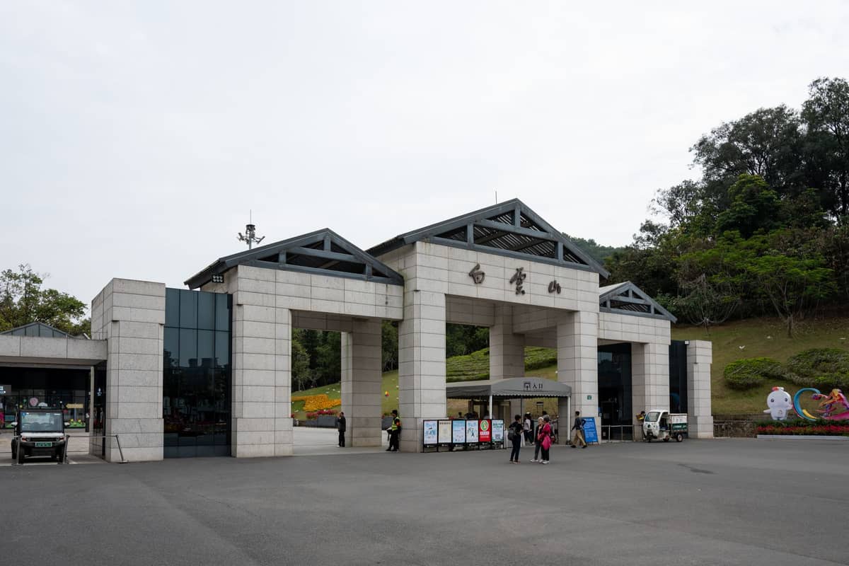
Baiyun Mountain has multiple entry gates, and choosing the right one for your planned route matters. Most routes published in official materials specify a starting gate and, where the route is not a loop, a different exit gate. Arriving at the wrong gate and then having to circle the perimeter on foot wastes time and energy.
The South Gate is the most commonly used entry for first-time visitors and for those accessing the cable car. It sits closest to the cable car lower station and the main visitor facilities. The Yuntai Garden, which is famous for its seasonal blooms and sits along several trail itineraries, is accessible from routes passing through the southern approach. From the South Gate, you can connect to the cable car, which takes you up to the Mountaintop Park (山顶公园) area, from where trails continue toward Moxing Ridge.
Getting to Baiyun Mountain by public transit is straightforward from central Guangzhou. The Guangzhou Metro (Line 2) stops at Baiyunshan (Dengfeng) station, from which buses run to the South Gate. Taxis and DiDi are a more convenient option if you are travelling from Tianhe or Yuexiu and want a direct ride. Fares from the city centre typically run 30–60 CNY depending on traffic and exact starting point. Confirm current metro fare structures and bus route numbers before your visit, as these details change periodically.
Cable Car vs Hiking Up: Which Makes More Sense
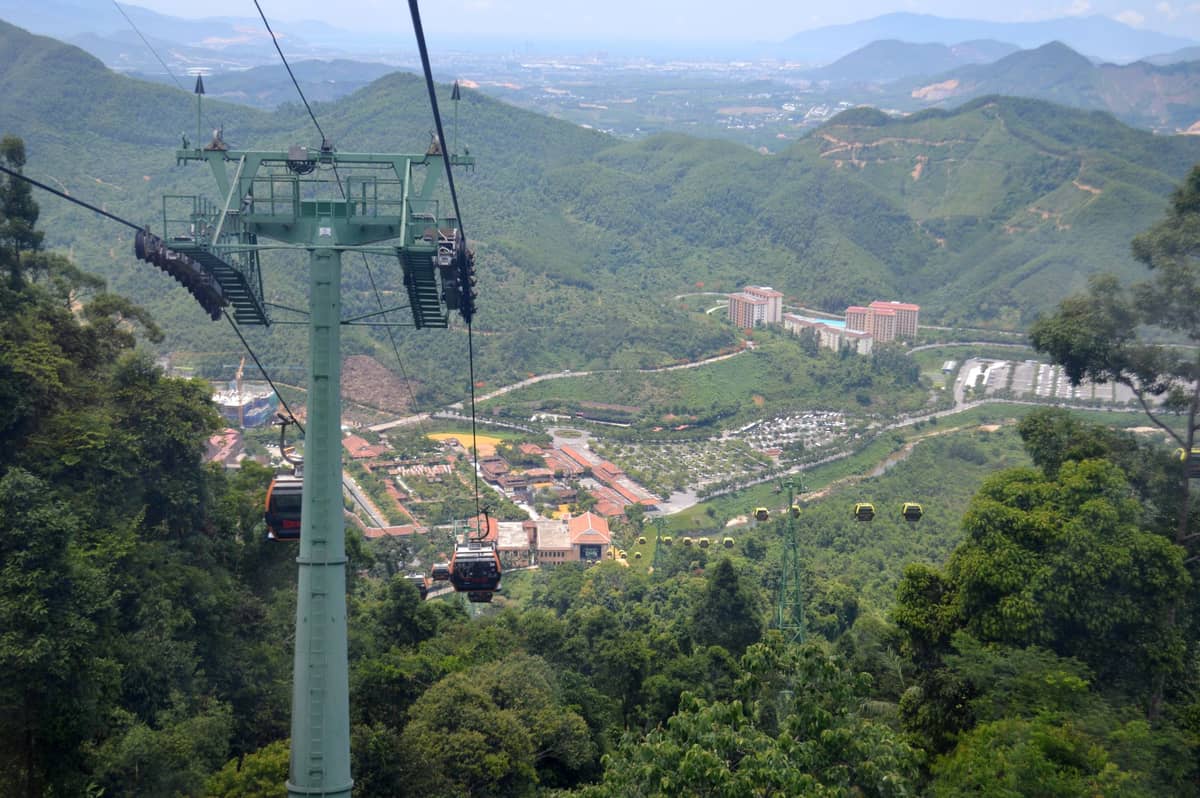
The cable car at Baiyun Mountain runs from the South Gate area up to the Mountaintop Park, near the upper trail network. The one-way fare for the uphill ride is separate from entrance admission, and the ride itself provides aerial views over the tree canopy, which is genuinely worthwhile on a clear day.
For most first-time visitors, the practical approach is to take the cable car up and then hike down via your preferred route to a lower gate. This gives you the summit views without exhausting your legs before reaching the best scenery. Alternatively, hike up via the South Gate approach (a climb of roughly 2–3 km to reach the Mountaintop Park area) and take the cable car or a sightseeing bus down. If you plan to tackle Moxing Ridge specifically, factor in an additional 20–30 minutes of hiking beyond the Mountaintop Park, as the ridge is a separate point from the cable car upper station.
⚠️ What to skip
The cable car operates within set hours and may close for maintenance, high winds, or during weather warnings. On busy public holidays (Golden Week in October, Spring Festival, and May Day), queues at the cable car lower station can exceed 45 minutes. On those days, hiking up is actually faster than waiting.
Moxing Ridge: The Summit Experience
Moxing Ridge (摩星岭) is the highest point on Baiyun Mountain at approximately 382 metres. It appears in official route documentation as the mountain's summit and is the destination most hikers are aiming for when they talk about 'climbing Baiyun Mountain'. The views from the ridge on a clear day extend south over the Pearl River plain and toward the skyscrapers of Zhujiang New Town and the broader Guangzhou metropolitan area. On a morning with low cloud, the ridge sits above the haze and the effect is markedly different from the views you get from city-level observation decks.
The ridge itself has pavilions, rest areas, and a small flagpole area that has become a popular photo spot. Weekday mornings before 09:00 are the quietest. Weekend afternoons in good weather are the most crowded, with the path to the ridge becoming quite congested around the final approach. The terrain on the upper section involves stone steps cut into the hillside, not loose trail, so standard sports shoes are fine for the summit push.
Seasonal Conditions and When to Go
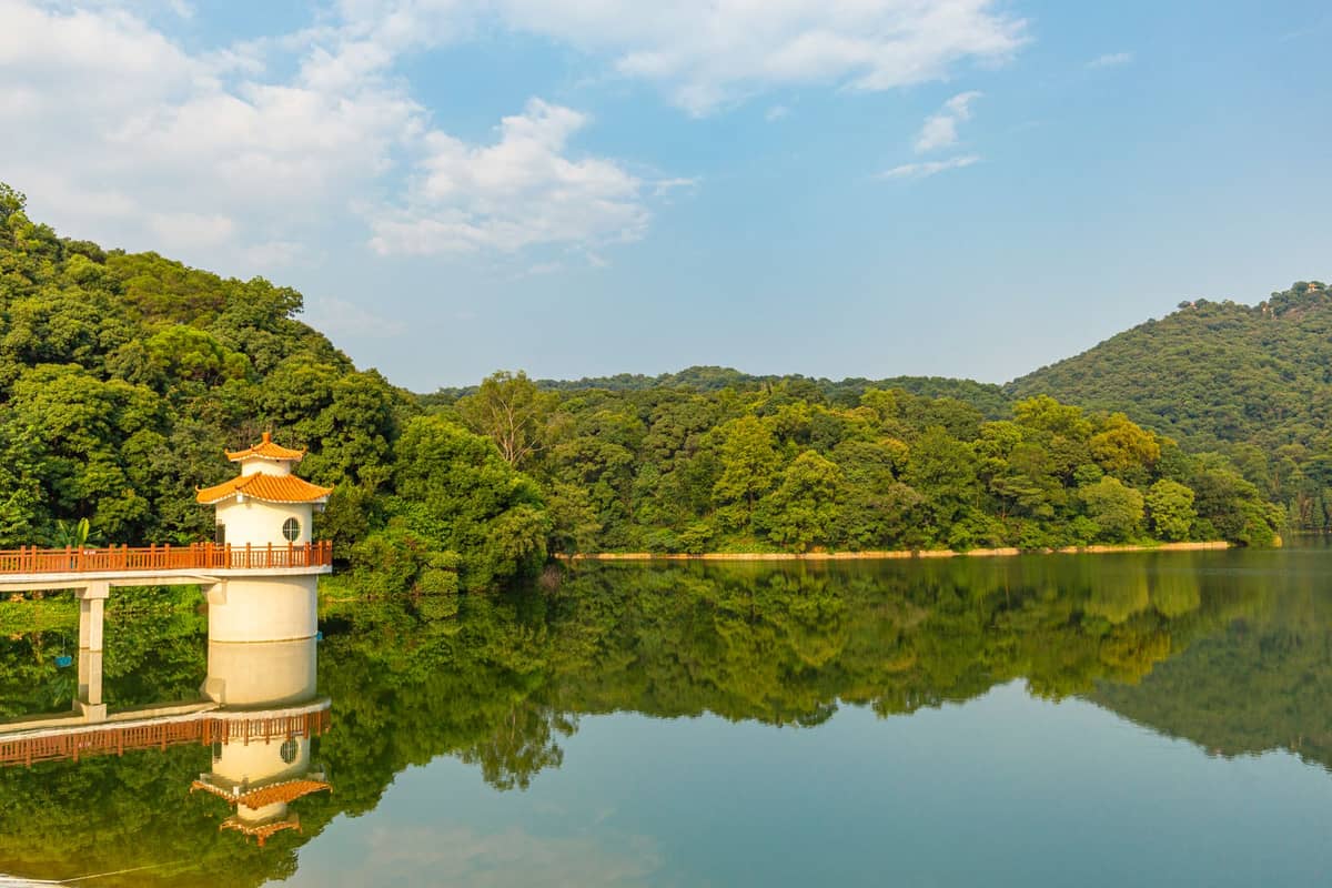
Guangzhou has a humid subtropical climate with hot, humid summers and mild winters. For hiking Baiyun Mountain, this has direct practical consequences. The best hiking months are October through March, when temperatures are comfortable (roughly 15–25°C), humidity drops significantly compared to summer, and the forest trails are dry. This window also overlaps with Guangzhou's autumn season, when the mountain's vegetation shows its most varied colours and the air quality is at its clearest.
April and May are acceptable for hiking but mark the beginning of the rainy season. Trails can become slippery on stepped stone sections, and afternoon downpours are common. June through September is technically manageable but genuinely uncomfortable: temperatures regularly exceed 33°C with high humidity, and the risk of afternoon thunderstorms is real. If you must hike in summer, start no later than 07:00 and plan to be off the upper ridge by 11:00.
- October to November: Best overall conditions. Cooler air, clear skies, comfortable for all route lengths.
- December to February: Cool and often misty. The mist can add atmospheric quality to the upper ridge. Dress in layers — mornings on the summit can feel cold by Guangzhou standards (around 10–15°C).
- March to April: Seasonal blooms draw more visitors than winter months. Rain begins.
- May to September: Hot, humid, storm-prone. Possible but demanding. Carry at least 1.5 litres of water per person.
- Public holidays (Golden Week, Spring Festival): All trail lengths see significantly higher traffic. Weekday visits are always preferable.
Practical Information Before You Go
Baiyun Mountain is open approximately 06:00–17:00 daily, though the upper areas and cable car have their own sub-schedules. There is an entrance fee for the scenic area; the cable car carries a separate charge of around 25 CNY one-way for the uphill route. Fees are paid in CNY (Chinese yuan, renminbi) — bring WeChat Pay or Alipay, as many ticket windows now favour mobile payment over cash, though cash is still accepted at most gates. For broader context on getting around the city to reach the mountain, the getting around Guangzhou guide covers metro, bus, and ride-hailing options in detail.
Baiyun Mountain fits naturally into a broader Guangzhou itinerary. Pair it with nearby attractions such as Canton Orchid Garden at the mountain's base, or combine it with a visit to Yuexiu Park in central Guangzhou on the same day, since the mountain is only about 5–6 km from Yuexiu's northern boundary. For a fuller day-by-day plan that incorporates Baiyun Mountain, the 3 days in Guangzhou itinerary is a useful starting point.
- Footwear: Closed-toe shoes with grip are essential. The stone steps get slippery when wet. Flip-flops are common on the lower paths but are genuinely unsafe on upper trails.
- Water: Vendors sell drinks at the Mountaintop Park and along major trail junctions, but prices increase with altitude. Bring at least 1 litre from the gate.
- Sun protection: The upper ridge and open pavilion areas have little shade. A hat and sunscreen matter more than most visitors expect.
- Connectivity: Mobile data on China Telecom, China Mobile, and China Unicom networks works adequately on most of the mountain. VPN users should ensure their VPN is active before entering the scenic area, as connecting in-mountain can be unreliable.
- Emergencies: China's emergency number for medical assistance is 120; police is 110. The scenic area has a management office with first-aid facilities near the main gates.
✨ Pro tip
The best photography window on the summit ridge is the 45 minutes around sunrise, when low cloud often sits in the valleys below Moxing Ridge and the city skyline is visible to the south. This requires arriving at the lower gate by 06:00 and moving quickly — achievable if you are fit and start from the South Gate on the direct ascent path rather than a scenic loop.
FAQ
How long does it take to hike Baiyun Mountain to the top?
From the South Gate to Moxing Ridge via the direct ascent path takes most fit adults about 1–2 hours of continuous walking. The total roundtrip on the fitness trail is typically several hours including time at the summit. The longest route requires a full day.
Is there an entrance fee for Baiyun Mountain?
Yes, Baiyun Mountain Scenic Area charges an entrance fee. The cable car carries a separate charge of around 25 CNY for the uphill ride. Verify current pricing at the gate or official Guangzhou tourism channels before visiting, as fees are subject to change.
Can beginners hike Baiyun Mountain?
Yes. The 6 km family path and the 10 km fitness trail are both suitable for people with average fitness and no hiking experience. The paths are well-maintained and mostly paved or stepped. The 21 km route is not recommended for beginners.
What is the best time of year to hike Baiyun Mountain?
October through March offers the most comfortable conditions: lower humidity, clearer skies, and cooler temperatures. Spring is also popular due to garden blooms, though rainfall increases. Avoid peak summer months if possible due to heat and afternoon thunderstorms.
How do I get to Baiyun Mountain by public transit?
Take Guangzhou Metro Line 2 to the Baiyun Mountain area, then connect by bus to the South Gate. Alternatively, use DiDi or a taxi for a direct ride from central Guangzhou. Confirm current bus route numbers locally or via a transit app, as these change.