Getting Around Bogotá: The Complete Transport Guide
Bogotá, D.C. has one of Latin America's most extensive urban transit networks, but navigating it takes some preparation. This guide covers TransMilenio, SITP buses, the TransMiCable, taxis, ride-hailing apps, and airport transfers — with current fares, practical tips, and clear notes on what works and what to avoid.
Plan and book this trip
Tools from our partner Travelpayouts help you compare flights and hotels. If you book through them, we may earn a commission at no extra cost to you.
Flights
Hotels map
TL;DR
- TransMilenio, TransMiZonal (SITP) buses, and TransMiCable all share a unified fare of COP 3,550 (as of January 2026) — one city, one card.
- Get a TuLlave smart card (around COP 8,000) at any TransMilenio station — cash is not accepted at turnstiles.
- Ride-hailing apps (Uber, Cabify, InDriver, Didi) are reliable and often faster than taxis for point-to-point trips.
- El Dorado International Airport (BOG) is roughly 10–15 km from central Bogotá — see the Bogotá airport guide for detailed transfer options.
- Rush hours (roughly 7–9am and 5–8pm on weekdays) turn TransMilenio into a very crowded experience — factor that into your plans.
Understanding Bogotá's Public Transport System
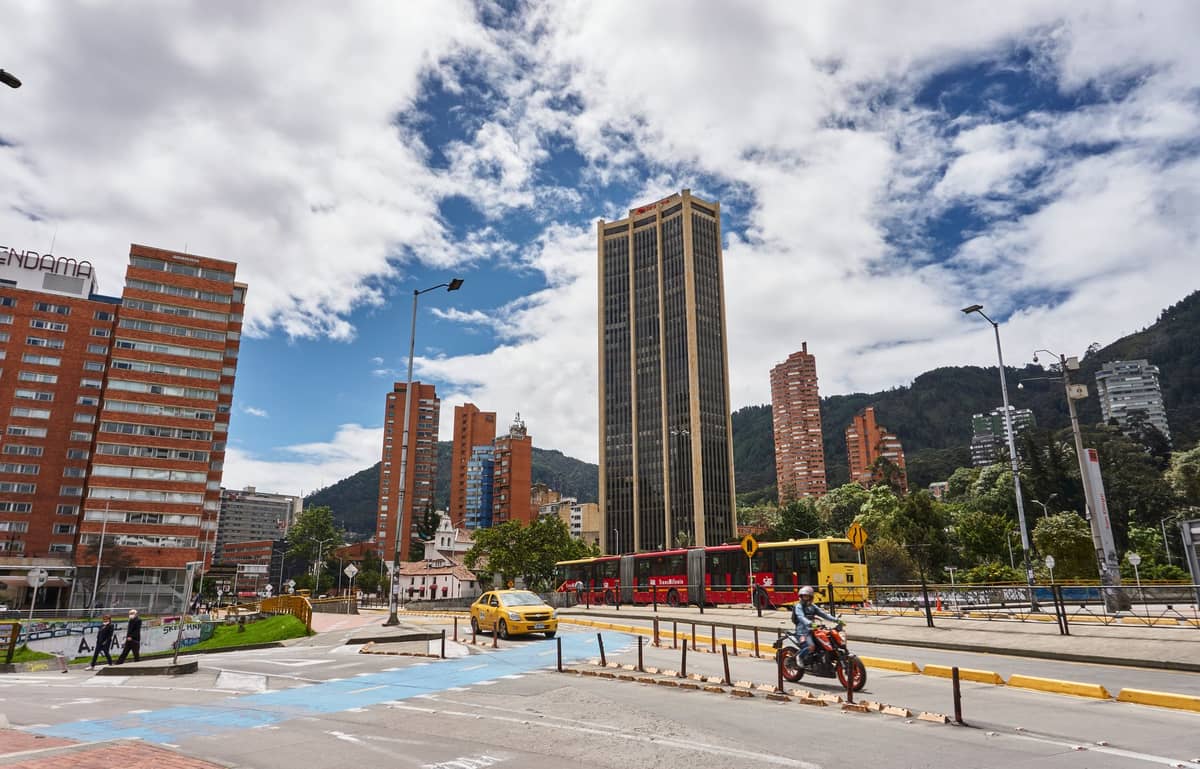
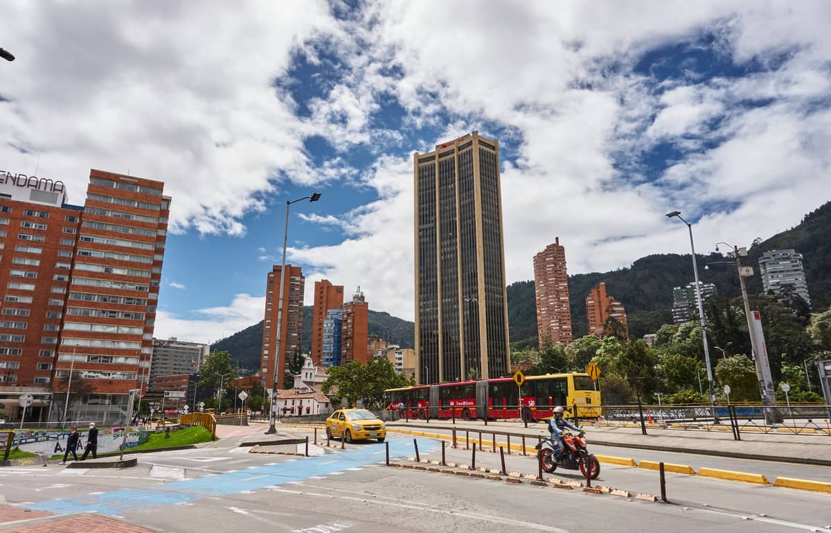
Getting around Bogotá, D.C. on public transport is entirely feasible, and for many trips it is the fastest and cheapest option available. The city's network has three interlocking components: TransMilenio (the red articulated buses running on dedicated trunk corridors), TransMiZonal buses (the blue SITP urban buses that serve neighborhoods away from trunk lines), and TransMiCable (a gondola cable system connecting hillside comunas to the main network). All three services operate under a unified fare policy — meaning one card, one fare, and one system regardless of which vehicle you board.
As of January 14, 2026, the standard integrated fare across all three services is COP 3,550 per trip. This figure is set annually by the Bogotá District government and tends to increase slightly each year in line with inflation. There is no peak-hour surcharge — the flat fare applies regardless of time of day — but the practical cost during rush hour is crowding and slower journey times, not extra money. Transfers between services within a set time window are included in the integrated fare system, though the exact transfer rules are worth checking on the official TransMilenio website before your trip.
ℹ️ Good to know
The TuLlave smart card is required for all TransMilenio, SITP, and TransMiCable trips. You can buy one at any TransMilenio station or portal for around COP 8,000 (card cost only, separate from credit loaded onto it). Top up at station machines or authorized vendors near major stops. Cash is not accepted at turnstiles.
TransMilenio: What to Expect on the Red Buses
TransMilenio is Bogotá's backbone transit system — a bus rapid transit (BRT) network with dedicated lanes on major arterials including Caracas, NQS (Avenida Carrera 30), Calle 26, and Autopista Norte. The red articulated buses can carry large numbers of passengers and run frequently, which makes them efficient in theory. In practice, the Caracas corridor and Portal del Norte are genuinely crowded during weekday peak hours, and boarding can be chaotic. Outside of rush hour, TransMilenio is comfortable enough and reaches most tourist-relevant parts of the city.
For visitors, the most useful trunk lines connect the historic center (La Candelaria) with Chapinero, the Zona Rosa corridor, and northern districts like Usaquén. The Calle 26 corridor links the city center with El Dorado Airport, making TransMilenio a viable low-cost airport connection — though luggage and crowds make this less comfortable than a taxi or app-based ride.
- Key corridors for visitors Caracas (north-south spine), Calle 26 (airport to center), NQS, Autopista Norte (toward Usaquén and Portal del Norte)
- Operating hours Roughly 4:30am to 12am on weekdays; reduced frequency on weekends and public holidays. Verify current schedules on transmilenio.gov.co.
- Rush hour reality Weekdays 7–9am and 5–8pm are significantly more crowded. Stations like Portal 80, Ricaurte, and Calle 72 can require multiple buses before boarding.
- Safety on board Pickpocketing does occur in crowded cars. Keep bags in front of you, phones in pockets, and stay aware at busy portal stations.
SITP Urban Buses (TransMiZonal): The Blue Network
The blue SITP buses — now officially called TransMiZonal within the unified system — fill the gaps that trunk TransMilenio lines cannot reach. They serve residential neighborhoods, secondary streets, and areas between corridors, which in a city as large as Bogotá's 1,587 km² footprint is essential. The same COP 3,550 unified fare applies, and the same TuLlave card is used. Routes are mapped in the official Bogotá Movilidad app and on Google Maps, which has reasonably accurate SITP route data.
For visitors staying in northern neighborhoods like Chapinero or the Zona Rosa area, SITP buses are often the most practical way to reach specific streets without walking far to a trunk station. They are also considerably less crowded than TransMilenio at most hours. The tradeoff is that routes can be confusing for first-time users, and bus stop signage is inconsistent. Google Maps works well for planning SITP trips once you understand that the blue bus icon is distinct from the red TransMilenio icon in the app.
💡 Local tip
Download the Moovit app or use Google Maps in transit mode before your trip. Both have reliable SITP and TransMilenio route data for Bogotá. Moovit tends to give more accurate real-time departure estimates for SITP buses.
TransMiCable: The Cable Car in Ciudad Bolívar
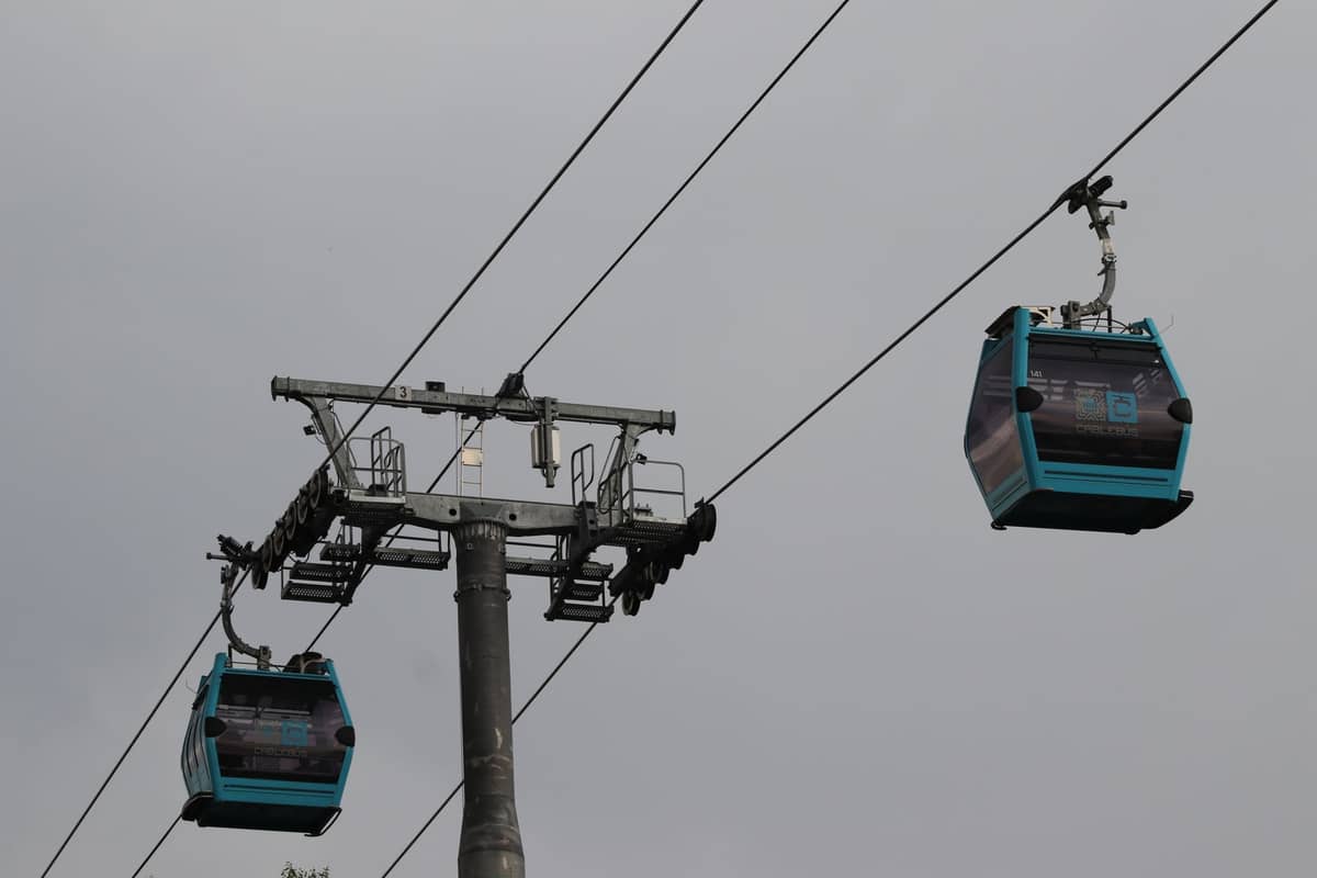
TransMiCable is one of Bogotá's more distinctive transit solutions: a gondola cable car system connecting the lower city to the hillside comunas of Ciudad Bolívar in the south. Since the 2026 unified fare reform, it is included in the same COP 3,550 integrated fare as all other public transport services, which means riding it is not an additional cost if you transfer from another service within the allowed time window. The cable car offers striking views over the city and is used daily by residents for whom it is a genuine commuting lifeline, not a tourist attraction. That said, visitors do ride it, and the views from the cabins looking back toward the Andes and the city sprawl are genuinely impressive.
If you are interested in Bogotá's geography and altitude dynamics, the cable car provides a quick sense of how dramatically the terrain rises east of the urban grid. For more on the city's relationship with its mountains, the Bogotá altitude guide covers acclimatization, the cerros orientales, and what the elevation of 2,640 m means for visitors.
Taxis and Ride-Hailing Apps
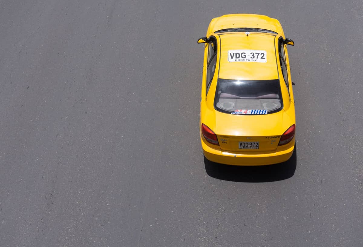
For most visitors, app-based ride-hailing will be the primary way to get around Bogotá beyond the public transit network. Uber, Cabify, InDriver, and Didi all operate in the city. The apps work reliably in most neighborhoods, prices are displayed upfront, and the rides are generally safe and straightforward. The key advantage over traditional yellow taxis is price transparency and the ability to share your ride details — both important considerations for navigating an unfamiliar city.
Traditional yellow taxis are metered and licensed. They are legitimate and widely used by locals, but the meter system (taxímetro) can be harder for first-time visitors to verify, and there have historically been reports of meter manipulation or inflated prices for tourists, particularly from the airport. If you take a yellow taxi, always confirm the meter is running from the start of the trip, or agree on a price beforehand. From El Dorado Airport, the official taxi dispatch service inside the terminal assigns a set, zone-based fare, which is generally the safer option if you prefer taxis over apps.
- Uber Widely used, reliable coverage across the city, standard international interface. Note that Uber's legal status in Colombia has historically been complex — it operates, but check current app availability on arrival.
- Cabify Fully licensed and regulated in Colombia, popular with business travelers and locals. Often slightly pricier than Uber but consistent quality.
- InDriver Allows fare negotiation between driver and passenger. Can get cheaper prices on standard city trips if you are willing to negotiate.
- Didi Growing presence in Bogotá. Similar model to Uber, competitive pricing.
⚠️ What to skip
Avoid accepting rides from unlicensed drivers who approach you outside the airport or near tourist areas. Always request your ride through a registered app or use the official airport taxi dispatch. Share your trip details with someone you trust when traveling at night.
Getting from El Dorado Airport to the City
El Dorado International Airport (IATA: BOG) sits in western Bogotá, roughly 10–15 km from the historic center of La Candelaria and somewhat closer to northern districts like Chapinero. Despite the relatively short distance, travel time varies considerably with traffic. During weekday rush hours, the journey to the north of the city can take 45–60 minutes or longer. At off-peak times — late evening, early morning, or weekends — 20–30 minutes is more realistic. The full Bogotá airport guide covers each transfer option in detail.
- Official airport taxis Available at the official dispatch desk inside arrivals. Zone-based fares are fixed and posted — this is the most transparent taxi option from BOG.
- Ride-hailing apps Uber, Cabify, and others pick up in designated app-taxi zones at the airport. Check the current pickup point on arrival as it can change. Generally competitive pricing.
- TransMilenio via Calle 26 The lowest-cost option. A feeder bus connects the airport to the SITP/TransMilenio network on Calle 26. Not recommended with large luggage during peak hours, but workable for light travelers on a budget.
- Hotel or private transfer Many hotels in the Zona Rosa and Parque 93 area offer pre-arranged airport transfers at fixed rates. Worth considering for late-night arrivals.
Cycling in Bogotá: Ciclovía and Everyday Biking
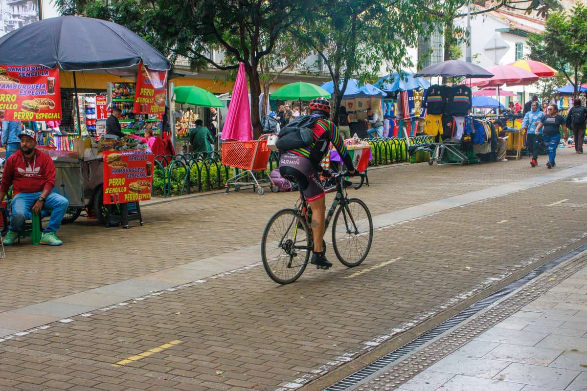
Bogotá has one of the most developed cycling cultures in Latin America. The city has an extensive permanent ciclovía (bike lane) network covering hundreds of kilometers, and every Sunday and public holiday, major streets are closed to cars for the famous Ciclovía event — when around 120 km of road opens exclusively to cyclists, skaters, and pedestrians from around 7am to 2pm. If your visit falls on a Sunday, riding the Ciclovía is one of the best free experiences the city offers. The full Bogotá Ciclovía guide has everything you need to know about routes, rental points, and what to expect.
For everyday cycling on weekdays, the permanent ciclovías are functional but require careful navigation — not all drivers respect the lanes, and intersections can be unpredictable. Bike-share systems and rental shops are available in northern and central neighborhoods. Cycling at altitude also takes more effort than expected: at about 2,640 m above sea level, hills that look mild can leave you breathless until you acclimatize. Plan shorter rides initially if you have just arrived.
✨ Pro tip
The Ciclovía on Sunday mornings is not just a cycling event — it is a social ritual. Locals bring families, street vendors set up along the route, and the atmosphere around Parque Simón Bolívar and the Zona Rosa stretch is genuinely lively. Rent a bike near Usaquén or Chapinero and ride south toward the historic center for the most interesting route.
Practical Tips for Getting Around Bogotá
One thing that surprises many visitors is how spread out Bogotá actually is. With a population of over 8 million and an urban area covering roughly 1,587 km², the city does not feel compact the way European capitals do. Planning your days around neighborhoods rather than individual sites helps enormously. If you are visiting the Museo del Oro and the Plaza de Bolívar in La Candelaria, combine them on the same day — getting between the historic center and northern neighborhoods like Usaquén can take 45 minutes each way in traffic.
Weather is a factor worth planning around. Bogotá's altitude means temperatures stay in the high teens to low 20s °C during the day but can drop sharply at night or when rain arrives. The rainy seasons (April–May and September–November) bring afternoon downpours that slow traffic and make walking between stops uncomfortable. The Bogotá weather guide breaks down seasonal patterns in detail — useful if you are deciding when to book.
FAQ
What is the cheapest way to get around Bogotá?
TransMilenio and SITP buses are by far the cheapest option at COP 3,550 per trip (2026 unified rate). A TuLlave card (around COP 8,000 to purchase) is required. For airport transfers, taking the bus connection from Calle 26 to the TransMilenio network is the most budget-friendly option, though it is not ideal with large bags.
Is Uber available in Bogotá?
Yes, Uber operates in Bogotá, along with Cabify, InDriver, and Didi. App-based ride-hailing is widely used by locals and visitors. Cabify is fully licensed and regulated in Colombia. Check app availability and local rules on arrival as the regulatory environment can shift.
How do I get from El Dorado Airport to central Bogotá?
The main options are: official airport taxis (fixed zone-based fares from the dispatch desk inside arrivals), ride-hailing apps (designated pickup zones in the airport), or TransMilenio via the Calle 26 corridor (cheapest but less practical with luggage). Journey time ranges from about 20 minutes off-peak to over an hour in rush hour traffic.
How do I use TransMilenio as a tourist?
Buy a TuLlave smart card at any TransMilenio station portal (around COP 8,000 for the card, loaded separately with credit). Tap the card at the turnstile to enter. Use Google Maps or the Moovit app to navigate routes — both have accurate TransMilenio and SITP data. Avoid peak hours (7–9am and 5–8pm on weekdays) if possible, especially on the Caracas corridor.
Is Bogotá's public transport safe for tourists?
TransMilenio and SITP buses are used by millions of Bogotanos daily and are generally safe, though pickpocketing does occur in crowded conditions. Keep valuables secured, avoid displaying phones or cameras in packed cars, and stay alert at busy portal stations. For late-night travel, ride-hailing apps are a better option than public transit.