Bygdøy Coastal Path: Oslo's Finest Waterfront Walk
The Bygdøy Coastal Path traces roughly 10 kilometres of shoreline around one of Oslo's most storied peninsulas, connecting fjord beaches, royal farmland, and quiet coves. It is free to walk year-round, easily reached by bus or seasonal ferry, and one of the few places in Oslo where the city completely disappears behind the treeline.
Quick Facts
- Location
- Bygdøy peninsula, Oslo, Norway (part of Frogner district)
- Getting There
- Bus 30 to Huk; Bygdøyfergen ferry from Aker Brygge/Rådhuskaia (seasonal); 10–12 min walk from Skøyen Station
- Time Needed
- 2–4 hours for the full loop (approx. 10 km); shorter sections possible
- Cost
- Free — no permit or entrance fee required
- Best for
- Joggers, walkers seeking fjord views, summer swimmers, families, photographers
- Official website
- www.visitoslo.com/no/aktiviteter-og-attraksjoner/omraader/bygdoy
What the Bygdøy Coastal Path Actually Is
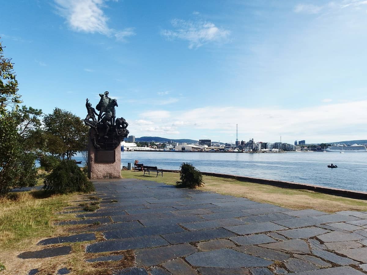
The Bygdøy Coastal Path, known in Norwegian as Bygdøy kyststi or Kyststien på Bygdøy, is a waymarked shoreline trail that circles the Bygdøy peninsula on the western edge of Oslo. The full loop covers approximately 10 kilometres, linking a string of landmarks that most visitors to Bygdøy never connect: the calm inlet of Frognerkilen, the swimming beach at Bygdøy Sjøbad, the sheltered cove of Paradisbukta, and the open-water bathing area at Huk, where the peninsula meets the Oslofjord.
Unlike a formal park or ticketed attraction, the coastal path is simply a public right of way. The trail was formalised as part of a Norwegian coastal path initiative, with the Bygdøy section established in the 2010s and continuously improved since. Waymarking signs and nature information boards appear at intervals through Bygdøy Folkepark, so navigation is straightforward even without a map application.
What separates this walk from a generic urban trail is the landscape it passes through. Around half of the peninsula is occupied by Bygdøy Kongsgård, a royal farm with documented roots stretching back to the Middle Ages and now protected as a cultural monument. The farmland creates long, open stretches of meadow and forest that buffer the path from city noise in a way you do not expect this close to central Oslo. The peninsula also neighbours Bygdøy, Oslo's primary museum district, so it is easy to combine the walk with a visit to the area's world-class museums.
How the Path Changes Through the Day
Early morning is the most rewarding time on the Bygdøy Coastal Path. Between 7 and 9 a.m. on summer weekdays, the trail belongs almost entirely to local joggers and dog walkers. The light arrives low across the Oslofjord from the southeast, turning the water a flat copper colour and throwing long shadows across the birch and oak forest that borders much of the northern section. The smell of salt and damp bark is strong at this hour, particularly near Frognerkilen where the water is shallow and still.
By mid-morning on sunny summer days, the character shifts noticeably. Families with bicycles and prams begin arriving at Huk from Bus 30, and the southern beaches start filling up. The section between Bygdøy Sjøbad and Paradisbukta sees the most foot traffic from around 11 a.m. onward, with swimmers spreading towels on the smooth rocks and the smell of sunscreen replacing the earlier salt air. This stretch is also where you hear the most noise: children, kayaks landing, the occasional motorboat passing offshore.
Late afternoon, from around 4 p.m., brings a second wave of visitors after work and school, but the northern sections near Kongsgård and Frognerkilen tend to stay quieter throughout the day. If you want the best combination of light, manageable crowds, and cooler temperatures, aim for 8 a.m. in summer or any dry morning in May or September.
💡 Local tip
Practical timing tip: Walk the path clockwise, starting from Frognerkilen (accessible via Skøyen Station) and finishing at Huk. This means the most scenic fjord-facing sections come in the second half of the walk when you have settled into the pace, and you end near the bus stop for an easy return into the city.
Tickets & tours
Live prices and dates from our booking partner. If you book, we may earn a commission at no extra cost to you.
Oslo Fjord sightseeing audio-guided electrical boat tour
From 35 €Instant confirmationFree cancellationFjord cruise with live jazz music
From 64 €Instant confirmationFree cancellationLuggage Storage in Oslo
From 6 €Instant confirmationFree cancellationPicturesque dinner cruise in Oslo
From 137 €Instant confirmationFree cancellation
The Route Section by Section
The northern edge of the peninsula, between Frognerkilen and Bygdøy Sjøbad, is the most forested part of the walk. The path here is wide, fairly flat, and comfortable underfoot — compacted gravel and dirt through mixed woodland. You pass benches facing the inlet and occasional viewpoints where the water appears between the trees. This section also skirts the edge of Kongsgård's farmland, and in early summer the meadows visible through the fence line are full of long grass and wildflowers.
Bygdøy Sjøbad is the first beach you reach on the western shore, a managed bathing area with changing facilities and a pier. The water quality in this part of the Oslofjord is monitored by Oslo municipality. From the beach, the path continues south through progressively more open terrain, with the fjord widening to the left and the rooftops of the Kongsgård buildings occasionally visible to the right.
Paradisbukta (Paradise Bay) is the natural midpoint of the coastal walk and lives up to its name on calm days: a small, sheltered bay with smooth rocks sloping into clear water, surrounded by birch trees that cut the wind. It is one of the most photographed spots on the route. The rocks here are pale grey granite, polished by weather, and warm quickly in the sun — ideal for sitting even when you do not intend to swim.
The final section leads south and then east to Huk, the largest and most open beach on the peninsula. The path broadens here and the vegetation thins, giving an unobstructed view across the Oslofjord toward the islands. On clear days you can see boats heading toward Drøbak and, further south, the faint outlines of the outer fjord. Huk has public toilets, a cafe, and parking, making it the most practical place to finish if you have arranged to be picked up or are catching the bus.
Historical and Natural Context
Bygdøy has been shaped by centuries of royal ownership, which is part of why the peninsula retains so much undeveloped land within a capital city of over 700,000 people. Bygdøy Kongsgård, the royal farm that occupies much of the interior, has existed in some form since the Middle Ages. Its protected status as a cultural monument means the landscape around the path is legally preserved, giving the walk a stability that urban trails in other cities rarely have.
The coastline itself tells a quieter geological story. The exposed bedrock along the shore is part of the Oslo Rift, a geological depression formed roughly 250–300 million years ago when the earth's crust stretched and fractured, creating the valley now occupied by the city and the fjord. The smooth, rounded rock formations at Paradisbukta and Huk are the direct result of glacial scouring during the last ice age, which ended roughly 11,000 years ago. What you are walking on is, in geological terms, a very recent landscape.
For context on the broader Oslofjord environment and the islands visible from Huk, the Oslo fjord guide covers the ecology, ferry routes, and history of the fjord in detail.
Getting There and Practical Notes
Bus 30 from Oslo city centre runs to Huk year-round, making it the most straightforward access point. Journey time from the city centre is roughly 20 minutes depending on traffic. From Skøyen Station (served by trains from Oslo Central Station and several suburban lines), it is a 10 to 12 minute walk to the trailhead near Frognerkilen, which is useful if you want to start the walk from the northern end rather than Huk.
From late spring through summer, the Bygdøyfergen seasonal ferry runs from Aker Brygge and Rådhuskaia to Bygdøy, docking near the peninsula's museum cluster. This is one of the most enjoyable ways to arrive: a roughly 15-minute boat ride across the fjord that already puts you in the right mindset for a coastal walk. Note that the ferry operates on a seasonal schedule, so check current timetables before planning around it.
ℹ️ Good to know
Accessibility note: The full 10 km loop is not suitable for wheelchairs or prams throughout. Several sections have uneven or narrow terrain, particularly on the rougher stretches between Paradisbukta and Huk. Families with young children in strollers should plan for the smoother northern sections or use the beach areas at Huk as a base rather than attempting the full circuit.
Footwear matters more here than on a typical city walk. Much of the coastal section involves walking on uneven rock and root-crossed earth paths. Trainers or light hiking shoes work well in dry conditions; waterproof footwear is advisable after rain or in autumn, when leaf fall makes the rock surfaces slippery. There are no facilities along the route itself outside of the beaches, so bring water, particularly if you plan the full loop on a warm day.
Parking is available near Huk, Bygdøy Sjøbad, and Rodeløkken kafé for those arriving by car. However, summer weekends see the Huk parking areas fill early, often before 10 a.m. on sunny days. If you are visiting between June and August, public transport or the ferry is strongly preferable. For a fuller picture of getting around the city's outdoor attractions, the guide to getting around Oslo covers transport options clearly.
Photography and Best Conditions
The Bygdøy Coastal Path rewards photographers in a very specific set of conditions: calm mornings in late May or early September, when the light is golden, the water is still, and the crowds are thin. The reflections on Frognerkilen in early morning light are exceptional, and Paradisbukta from above the rocks at low tide gives a clean, minimalist composition of water and granite that photographs well in both colour and black and white.
In winter, the path takes on a completely different quality. Snow on the rocks and bare birch branches against a grey fjord make for stark, atmospheric images, and on cold clear days the air is sharp enough that the water takes on an intense blue-green colour. The path is passable in winter but requires caution: wet rock and ice patches appear without warning, particularly on the sections directly above the waterline.
For broader inspiration on Oslo's viewpoints and photography locations, Oslo's best viewpoints includes several perspectives on the fjord and surrounding landscape that complement the coastal path experience.
Who This Walk Is For — and Who Should Skip It
The Bygdøy Coastal Path is one of the few free outdoor experiences in Oslo that genuinely delivers across a wide range of expectations. Joggers use it daily. Families come for the beaches. Architecture and museum visitors use it as a way to decompress after a morning at the nearby Norsk Folkemuseum or Fram Museum. The combination of accessible public transport, no admission cost, and varied terrain makes it an easy addition to any Oslo itinerary.
That said, travellers with very limited time in Oslo who are prioritising major city attractions may find the full 10 km loop more of a commitment than they want to make. The walk does not contain a single dramatic set piece in the way that the Oslo Opera House or the Vigeland Sculpture Park do. Its value is cumulative: small coves, shifting light, quiet stretches of shoreline, the sense of being in a coastal landscape minutes from a capital city. If that kind of experience appeals to you, this walk will exceed expectations. If you need a clear highlight or talking point, the full circuit may feel understated.
Visitors with significant mobility limitations will find the full loop impractical, as noted above. The beach areas at Huk and Bygdøy Sjøbad are more accessible and can be reached directly by bus, offering the fjord setting without the rough trail sections.
Insider Tips
- The small cove just south of Paradisbukta is easily missed because it sits below the main path behind a low ridge. Scramble down to the rocks and you will find a flat ledge above the water that is almost always empty, even when the main beach is full — ideal for a quiet lunch.
- If you arrive via the Bygdøyfergen ferry, disembark and walk west immediately rather than following the main museum road. Within five minutes you are on the northern section of the coastal path with no crowds and a completely different atmosphere from the museum area.
- On warm summer evenings after 6 p.m., the light on the western shore of the peninsula — between Bygdøy Sjøbad and Paradisbukta — is extraordinary. Most visitors have left by then, and the low sun turns the rock faces amber. This is the best time for photography and for a quiet swim.
- Rodeløkken kafé near the Kongsgård area is a low-key stop that many visitors walk past without noticing. It opens seasonally and is primarily used by locals. Prices are noticeably lower than the cafe at Huk, and the setting is quieter.
- In autumn, the beech and oak forest on the northern section of the path turns a deep copper-orange, making October walks visually striking despite the cooler temperatures. Bring a waterproof layer — the path gets slick quickly after rain — but do not skip this stretch in the autumn months.
Who Is Bygdøy Coastal Path For?
- Joggers and walkers who want a green, traffic-free route away from the city centre
- Families looking for a free half-day that combines walking with swimming at Huk or Bygdøy Sjøbad
- Museum visitors using Bygdøy who want to extend their visit with fresh air and fjord views
- Photographers seeking early morning light, still water, and coastal rock formations
- Budget-conscious travellers looking for a full half-day outdoor experience at no cost
Nearby Attractions
Other things to see while in Bygdøy Peninsula:
- Fram Museum
The Fram Museum on Oslo's Bygdøy peninsula houses the actual polar exploration ship Fram, the vessel that carried Nansen, Sverdrup, and Amundsen on their most ambitious expeditions. This is not a replica. It is the real thing, and you can walk its decks.
- Holocaust Center (HL-senteret)
Housed in the former wartime residence of Nazi collaborator Vidkun Quisling, the Holocaust Center (HL-senteret) on Bygdøy is one of Oslo's most historically charged sites. The permanent exhibition confronts Norway's role in the Holocaust with clarity and care, making it essential for anyone serious about understanding 20th-century Norwegian history.
- Huk Beach
Huk Beach (Huk badeplass) sits at the southern tip of the Bygdøy peninsula, offering sandy coves, grassy sunbathing lawns, and direct access to the Oslofjord. It is free to visit, served by bus from central Oslo, and gets seriously busy on warm summer afternoons — so timing your visit matters.
- Kon-Tiki Museum
The Kon-Tiki Museum on Oslo's Bygdøy peninsula houses the original balsa-wood raft that Thor Heyerdahl sailed 8,000 kilometres across the Pacific in 1947. Beyond the raft, the museum tells the full story of Heyerdahl's lifetime of expeditions through original vessels, artifacts, and film. It is compact, well-curated, and quietly gripping.
Planning a trip? Discover personalized activities with the Nomado app.