Bosque de La Primavera: Guadalajara's Protected Forest Escape
Just 12 km west of Guadalajara, Bosque de La Primavera is a 30,500-hectare protected forest area offering hiking, birdwatching, hot springs, and rare ecological zones. It is one of the few places near a major Mexican city where you can genuinely disconnect from urban noise within 30 minutes.
Quick Facts
- Location
- West of Guadalajara, spanning Tala, El Arenal, Zapopan, and Tlajomulco de Zúñiga municipalities, Jalisco
- Getting There
- Car recommended: approx. 12 km west via Highway 15 toward Nogales. Public buses serve outer zones but routes vary — verify locally before traveling
- Time Needed
- 2 to 6 hours depending on trail choice; a full-day visit suits those combining hiking with the hot springs
- Cost
- No confirmed general admission fee; individual activity areas (hot springs, certain trails) may charge separately — verify on site
- Best for
- Hikers, birdwatchers, families wanting outdoor time, photography, and day-trippers escaping the city
- Official website
- bosquelaprimavera.jalisco.gob.mx
What Bosque de La Primavera Actually Is
Bosque de La Primavera is the official shorthand for the Área de Protección de Flora y Fauna La Primavera, a federally protected natural area that wraps around the western edge of the Guadalajara metropolitan zone. At approximately 30,500 hectares, it is not a groomed park with paved paths and gift shops. It is a working ecological reserve, formally protected in 1980 and reclassified under its current federal protection category in 2000. That history matters because it explains why the forest has survived this long despite being surrounded by one of Mexico's largest urban areas.
The terrain is volcanic in origin, shaped by a caldera that gives the area its thermal character, including natural hot springs that many visitors come specifically to use. The forest itself is dominated by oak and pine species typical of the Trans-Mexican Volcanic Belt, and the canopy provides habitat for a notably diverse range of birds, reptiles, and mammals rarely encountered inside the city limits.
ℹ️ Good to know
The forest spans four municipalities (Tala, El Arenal, Zapopan, and Tlajomulco de Zúñiga), so entry points, rules, and facilities can differ depending on which section you enter. The main administrative office is located at Avenida Vallarta 6503 in Concentro, Zapopan.
The Experience: What You'll Find When You Arrive
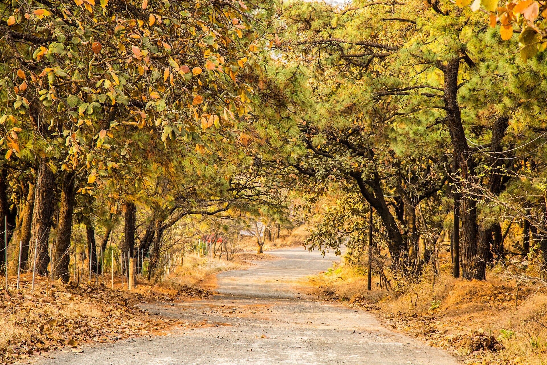
Arriving from the city, the shift is abrupt. Highway 15 heading toward Nogales cuts through outer suburban development before the vegetation thickens and the road starts tracking the edge of the protected zone. The air cools noticeably, the smell of dry oak leaves and volcanic soil replaces exhaust, and the background noise of the city fades faster than you'd expect.
Morning visits, roughly from 7:00 to 10:00, offer the clearest wildlife activity. Birdsong is loudest in the early hours, and the low-angle light through the canopy makes for strong photography conditions. By midday, particularly in the dry season months from November through April, the trails get warm and dust rises on unpaved paths. Afternoon visits in the rainy season, June through September, bring dramatic cloud formations over the ridgelines and a greener, more saturated forest, but trails can become muddy and slippery quickly after a downpour.
Weekends bring noticeably more visitors, especially families and groups of cyclists who treat the forest roads as training routes. If solitude is the goal, a weekday morning in the dry season is the most reliable option. Sundays near the hot spring zones can feel crowded by early afternoon.
Trails, Terrain, and the Hot Springs
The forest has marked hiking and mountain biking trails of varying difficulty, though trail conditions and signage can be inconsistent. Easier routes follow flatter terrain through oak woodland near access roads, while more demanding paths climb into higher ground with views back over the metropolitan area. Footwear matters: the soil is loose and volcanic in places, and solid-soled shoes or proper hiking boots are worth wearing regardless of how easy the route looks on a map.
The thermal hot springs within the forest are among the most-visited features. Several balnearios (bathing establishments) operate within or adjacent to the protected zone, using the naturally heated water. These are separate commercial facilities and typically charge their own entry fees. Check current operating status and prices directly before your visit, as hours and fees change seasonally.
💡 Local tip
Bring more water than you think you need. The trails are shaded in parts but the volcanic terrain retains heat, and distances between reliable water sources can be significant. A minimum of 1.5 liters per person for a half-day hike is a sensible baseline.
Ecology and Why This Forest Matters
La Primavera is not ecologically generic. The forest sits atop a volcanic caldera, which creates a patchwork of microhabitats: dry pine-oak woodland, riparian gallery forest along seasonal streams, and open grassland patches on the higher slopes. This variety compresses a surprising amount of biodiversity into a relatively small area.
The forest functions as a critical green lung and watershed for the Guadalajara metropolitan area, which by 2020 census data housed over 5.2 million people in its metropolitan area. Without La Primavera absorbing rainfall and recharging groundwater, the aquifer pressure on the region would be significantly worse. This makes it more than a recreation space: it is active environmental infrastructure. The 1980 and 2000 protection upgrades were partly a response to development pressure that, without intervention, would likely have consumed large portions of the forest.
Birdwatchers specifically find the forest rewarding. The oak-pine transition zones attract both resident and migratory species. If birding is your main interest, pairing La Primavera with other green spaces in the region gives a fuller picture of Jalisco's avian diversity. For more context on how the city's natural and cultural spaces connect, the things to do in Guadalajara guide covers the broader range of outdoor and cultural options.
Getting There and Navigating the Area
A private vehicle gives the most flexibility and is the practical choice for most visitors. The main access route is Highway 15 westbound from Guadalajara toward Nogales, with the forest boundary beginning around 12 km from the city center. From the Glorieta Minerva area, the drive typically takes 20 to 30 minutes outside of peak traffic hours.
Public transport options exist but require planning. City buses on certain routes serve the outer edges of the forest zone, but service frequency, exact stops, and current routing should be verified with Jalisco's Mi Transporte network before relying on them. Ride-hailing apps including Uber and DiDi operate in Guadalajara and can reach trailhead areas, though getting a return ride from remote sections of the forest may require advance arrangement or a reliable signal.
If you are combining a La Primavera visit with a broader western route, it is worth knowing that the forest lies roughly in the direction of the Guachimontones pyramids at Teuchitlán, which are about 50 km further west. A single day trip combining both is feasible with a car and an early start.
Photography, Seasons, and What to Realistically Expect
The forest photographs best in the early rainy season, late June and July, when the vegetation is at its most saturated and afternoon storm clouds build dramatically over the ridgelines. The tradeoff is that trails can become difficult after rain and the forest feels less open. The dry season from November through February offers cleaner, drier conditions with better visibility on the upper trails, though the vegetation looks more muted and some streams dry up.
Wide-angle lenses work well in the open woodland sections. The volcanic rock formations and natural pools near thermal areas reward macro photography. For wildlife shots, patience near water sources in the early morning is more productive than walking fast on main trails.
⚠️ What to skip
Wildfires are a real seasonal risk in the dry months. During prolonged dry spells, sections of the forest may be temporarily closed. Check with the official administration (bosquelaprimavera.jalisco.gob.mx) or local news before visiting in April or May, when fire risk peaks.
Visitors expecting manicured infrastructure, detailed English signage, or guaranteed facilities at every trailhead will be disappointed. This is a protected natural area managed for conservation first. Facilities are basic, and the experience is proportionally more raw than a state or national park in North America or Europe. For some visitors, that is exactly the point.
Combining La Primavera With the Rest of Guadalajara
La Primavera works well as a standalone day trip, but it also pairs naturally with western Guadalajara attractions. After returning from the forest, the Glorieta Minerva area is a logical re-entry point into the city, and from there Avenida Vallarta connects toward Colonia Americana with its restaurants and coffee shops. If you want a more structured overview of how to sequence the city's highlights, the Guadalajara walking tour guide covers the downtown core well as a contrast to a day spent in nature.
Insider Tips
- The thermal water at balneario establishments inside and near the forest varies in temperature by pool and season. Ask staff which pools are fed directly from the thermal source versus those that cool significantly by midday.
- Mountain bikes are available for rent near some entry points on weekends, but quality varies widely. If cycling is the main goal, bringing your own or renting from a reputable shop in the city before heading out is more reliable.
- Cell signal drops to near zero in the deeper sections of the forest. Download an offline map of the trail network before you leave, or carry a printed route. Getting turned around without navigation tools is more common than the easygoing entrance would suggest.
- The administrative main office at Avenida Vallarta 6503 is useful for current trail condition updates and any special event restrictions. A quick call or stop before your visit can save a wasted trip if sections are closed.
- Early November is a quiet period with pleasant temperatures (lows around 6-8°C at night, manageable daytime highs) and minimal crowds, making it one of the most comfortable windows for longer hikes.
Who Is Bosque de La Primavera For?
- Day-trippers from Guadalajara who want meaningful time in nature without leaving the metro area
- Birdwatchers and wildlife observers, especially those visiting during the early morning dry-season window
- Cyclists looking for trail riding with genuine terrain changes
- Travelers who want to combine a forest hike with a soak in natural thermal hot springs
- Photographers working with landscape and ecological subjects
Nearby Attractions
Combine your visit with:
- Ajijic (Lake Chapala Village)
Ajijic sits on the north shore of Lake Chapala, about an hour south of Guadalajara. With pre-conquest roots, cobblestone streets lined with art galleries, and one of Mexico's largest expat communities, it offers a completely different pace from the city. There is no admission fee to visit, and the town is accessible year-round.
- Bosque Los Colomos
Spanning roughly 92 hectares in northwestern Guadalajara, Bosque Los Colomos is a protected urban forest with ponds, pine-scented trails, and a Japanese garden donated by the city of Kyoto. Admission is free, and the park draws everyone from pre-dawn joggers to Sunday families.
- Japanese Garden — Bosque Los Colomos
Tucked inside the 93-hectare urban forest of Bosque Los Colomos, the Jardín Japonés is a formal Japanese-style garden donated by the people of Kyoto in 1994. It offers koi ponds, stone lanterns, arched bridges, and the kind of deliberate stillness that is genuinely hard to find in a city of over 1.5 million people.
- Agave Fields of Tequila (UNESCO Landscape)
The Agave Landscape and Ancient Industrial Facilities of Tequila is one of Mexico's most significant UNESCO World Heritage Sites, covering 34,658 hectares of blue agave fields, volcanic foothills, pre-Columbian terraces, and historic distilleries in Jalisco. Located roughly 67 km (about 42 km as the crow flies) northwest of Guadalajara, it is both a working agricultural landscape and a layered record of 2,000 years of human culture.