Wicklow Mountains National Park: Ireland's Wild Upland Escape from Dublin
Stretching across almost 23,000 hectares of blanket bog, granite peaks, and glacial valleys south of Dublin, Wicklow Mountains National Park is the largest national park in Ireland and the only one on the island's eastern side. Entry is free, the landscape shifts dramatically with the seasons, and the monastic ruins at Glendalough give it a historical depth that few natural areas can match.
Quick Facts
- Location
- County Wicklow, south of Dublin — Information Office at Glendalough Upper Lake Car Park
- Getting There
- St. Kevin's Bus (route 181) from Dublin city centre to Glendalough; Local Link routes 183 and 895 also serve the valley
- Time Needed
- Half day minimum for Glendalough; full day for longer trails
- Cost
- Free entry; parking charges may apply at car parks
- Best for
- Hikers, nature lovers, history seekers, and anyone needing distance from the city
- Official website
- www.nationalparks.ie/wicklow
What Wicklow Mountains National Park Actually Is
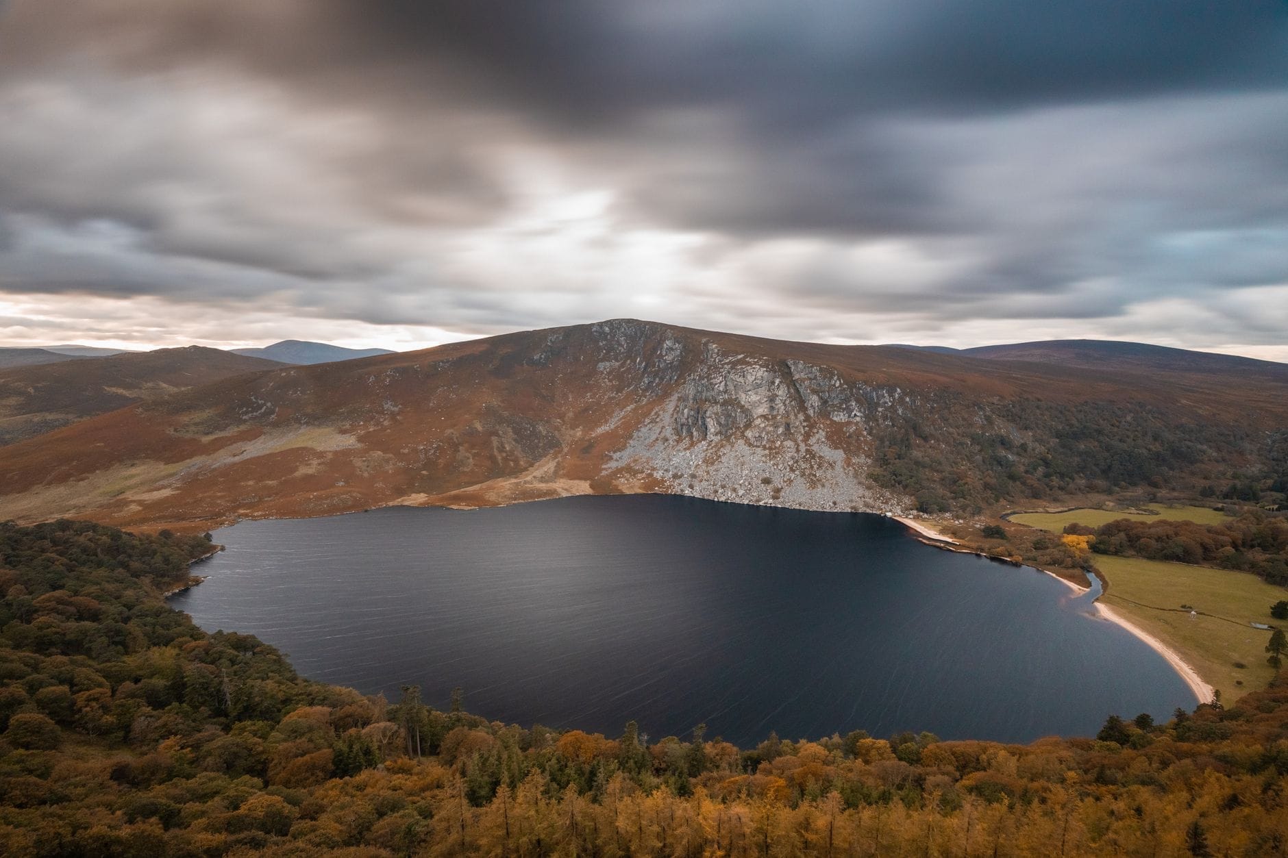
Wicklow Mountains National Park (Páirc Náisiúnta Shléibhte Cill Mhantáin in Irish) covers almost 23,000 hectares of upland terrain in County Wicklow, beginning roughly 30 kilometres south of Dublin city centre. It is the largest national park in Ireland and, crucially, the only one located in the east of the island, which makes it the most accessible wilderness area for anyone based in the capital. The landscape is defined by granite moorland, glacially carved valleys, blanket bog, and scattered conifer plantations, with elevations reaching above 900 metres at Lugnaquilla, the highest peak in the province of Leinster.
The park's centrepiece for most visitors is the valley of Glendalough, where sixth-century monastic ruins, two glacial lakes, and a network of well-marked walking trails converge in a single compact valley. But the park extends far beyond Glendalough: the Sally Gap, Glenmalure, Powerscourt Waterfall (just outside the official park boundary), and the upper Glencree valley all fall within or immediately adjacent to the protected area. If you arrive expecting a manicured nature reserve, recalibrate. This is open, exposed, and genuinely wild terrain.
ℹ️ Good to know
The National Park Information Office, located 200 metres from the Upper Lake Car Park in Glendalough, is open 10:00–17:30 from March to October and 09:30–16:30 from November to February. Staff can advise on current trail conditions, closures, and wildlife activity.
The Glendalough Valley: What You Will Actually See
Most visitors enter the park through Glendalough. The approach through the wooded Wicklow Gap road delivers an immediate tonal shift from suburban Dublin: the air smells of damp oak and pine, ravens call overhead, and the road narrows to single-track widths in places. The valley floor holds two lakes, the Lower Lake and the Upper Lake, separated by a short wooded path. The monastic site, established by St. Kevin in the sixth century, clusters near the Lower Lake: a round tower rising approximately 30 metres, the roofless Cathedral of Sts. Peter and Paul, the intact Priest's House, and several smaller stone churches. The round tower is almost entirely original and has survived largely intact for over a thousand years.
The Upper Lake is quieter and, for most visitors, more visually striking. Its north-facing cliffs hold the cave known as St. Kevin's Bed, a small rock ledge cut into the cliff face roughly 9 metres above the waterline that the saint reportedly used as a hermit's cell. You cannot access it without a boat or climbing gear, so it is best observed from the lakeside path. The water is dark and still in the early morning, reflecting the treeline so precisely that photographs often look inverted. By midday in summer, particularly on weekends, the valley receives very large crowds, with coach parties from Dublin arriving continuously from around 10:00 onward.
💡 Local tip
Arrive before 9:30 on any day between May and September to experience the valley in near-silence. The car park fills quickly, and the monastic site becomes crowded by 10:30 on busy days. Arriving early also gives you the mist on the lakes, which is genuinely atmospheric and disappears by mid-morning.
Tickets & tours
Hand-picked options from our booking partner. Prices are indicative; availability and final rates are confirmed when you complete your booking.
Wicklow and Glendalough day trip from Dublin with Powerscourt Gardens
From 65 €Instant confirmationFree cancellationTrails and Tombs tour in the Dublin mountains
From 45 €Instant confirmationFree cancellationWicklow and Glendalough day trip from Dublin with guided walk
From 75 €Instant confirmationFree cancellationWicklow, Glendalough, waterfall and sheepdog demo
From 40 €Instant confirmationFree cancellation
How the Experience Changes by Time of Day and Season
The park is open year-round, and the experience varies enormously across seasons. In May and June, the gorse on the upper moorland turns a sharp, almost artificial yellow that contrasts against the grey granite. The rhododendron, now largely classified as invasive in this ecosystem, produces dense purple-pink blooms along the valley edges that are visually striking even as park management works to control its spread. Days are long, with useful light stretching past 21:00 in mid-June, which allows for evening walks with almost no other visitors present.
Autumn brings the most dramatic colour. The oakwoods above the Upper Lake shift through gold and amber from late September into October, and the bracken on the open hillsides turns rust-red and copper. Rainfall increases, and the waterfalls that thread down from the Camaderry ridge run with real force. Conditions underfoot on the bog trails become soft and often saturated after heavy rain, so footwear requirements are not a minor consideration. In winter, the higher ground occasionally carries snow and ice, and daylight is compressed to around 8 hours. The valley is almost always quieter between November and February, though the Information Office keeps slightly reduced hours.
Spring and early summer are generally considered favourable for combining decent weather with manageable crowds, aligning with what the best time to visit Dublin guides typically recommend for outdoor activity. That said, Wicklow weather does not follow a reliable script: conditions can change from warm sunshine to horizontal rain within an hour at altitude, in any month.
Trails: Which Ones to Choose and What to Expect
The park maintains a range of waymarked trails, most radiating from the Glendalough visitor area. The Green Road Walk is a flat, surfaced track that runs along the southern shore of the Upper Lake to the Miners' Village, the ruins of a nineteenth-century lead and zinc mining settlement. It is wide enough for a buggy or wheelchair for much of its length and takes around 40 minutes return. The Spinc and Glenealo Valley trail, by contrast, is a full-day circuit that climbs steeply from the valley floor to the ridge of the Spinc, giving views directly down onto both lakes and across the moorland toward Lugnaquilla. It requires reasonable fitness, proper boots, and weather-appropriate layers. The boardwalk sections across the upper bog can be slippery when wet.
For those not based in the Glendalough section, the Wicklow Way long-distance trail crosses the park from north to south, running approximately 130 kilometres from Clonegall to Rathfarnham on the southern edge of Dublin. Day sections of the Wicklow Way, particularly the stretch from Luggala to Roundwood or the approach to the Wicklow Gap, give access to the open moorland character of the upper park without the Glendalough crowds. These sections require private transport to reach trailheads.
⚠️ What to skip
If you are relying on the St. Kevin's Bus (route 181) from Dublin, plan your itinerary around the Glendalough valley specifically. Check current timetables and booking requirements with the operator before travel, as services may be seasonal or require advance reservation.
Getting There from Dublin
The most practical public transport option is the St. Kevin's Bus service (route 181), which runs from Dublin city centre to Glendalough. Local Link routes 183 (Arklow to Glendalough) and 895 (Sallins to Glendalough) also serve the valley, though schedules are more limited. Verify current timetables and fares directly with the operators before travel, as services change. For those with a car, the R115 from Rathfarnham through the Sally Gap is one of the most scenic mountain roads in Ireland, though it has no central barrier, narrow sections, and can be treacherous in ice. Parking at Glendalough Upper Lake Car Park and the main visitor centre car park is subject to charges. For a broader view of how to move around the Dublin region, the getting around Dublin guide covers transit options in detail.
Wicklow Mountains National Park is frequently included in day trips from Dublin, and organised tours depart regularly from the city. If you want to combine it with other County Wicklow sights, the day trips from Dublin guide outlines practical combinations including Powerscourt Estate and Avoca.
Ecology, Wildlife, and Conservation Context
The park is a designated Special Area of Conservation and contains habitats of European importance, including blanket bog, upland heath, and old oak woodland. The upland areas are core habitat for the Greenland white-fronted goose, which overwinters on the bogs in significant numbers, and for red grouse, merlin, and peregrine falcon. The valley woodlands support red squirrels, though sightings require patience and early-morning timing. Red deer are present in the park, descended from reintroduced populations, and are most visible at dawn and dusk on the open moorland.
The invasive rhododendron (Rhododendron ponticum) is a significant conservation challenge across the park. While the flowers attract visitors in spring, the species forms dense canopy shade that prevents regeneration of native woodland. Park management conducts ongoing removal programmes, and visitors will notice cleared areas on valley slopes where stumps and root systems have been treated. This is an active, working landscape from a conservation standpoint, not a frozen heritage site.
Practical Details: What to Bring and Who Should Think Twice
The single most common mistake visitors make is arriving in inadequate footwear. The trails close to the visitor centre are surfaced and manageable in trainers. The moment you step onto any upland or moorland trail, conditions change: wet peat, exposed rock, and boggy ground are consistent features in almost all weather. Waterproof, ankle-supporting boots are not cautious over-preparation; they are genuinely necessary for anything beyond the valley floor paths.
Pack a waterproof layer regardless of the forecast. An extra layer for the ridge sections is advisable even in summer, as temperatures at 600 metres are noticeably lower than in the valley and wind chill is a real factor. Water is available at the visitor centre facilities, but not reliably on the trail, so carrying at least one litre per person per half-day is sensible. Photography is excellent throughout the valley, with the combination of water, stone, and woodland offering strong compositional options. Morning light from the east illuminates the round tower well before 10:00 in summer.
Visitors who find walking on uneven terrain difficult, or who cannot manage a 20-30 minute walk between the main car park and the Upper Lake, will find the upper valley largely inaccessible. The monastic site near the Lower Lake is more compact and reachable with less physical effort. If you are travelling with young children, the valley floor paths are suitable and the ruins are naturally engaging, but the upper trails require age-appropriate physical capacity.
Insider Tips
- The Glendalough valley is included in many coach tour itineraries from Dublin, so the period between 10:30 and 15:00 on Saturdays and Sundays in summer brings peak congestion. Arriving before 09:30 or after 15:30 changes the experience significantly.
- The Green Road to the Miners' Village is surfaced and relatively flat, making it the best option for visitors who want the Upper Lake scenery without committing to a full mountain trail.
- If you have a car, the drive over the Sally Gap on the R115 from Rathfarnham is itself worth the journey: the road crosses open moorland above 500 metres with wide views toward the coast on clear days, and there is almost no traffic on weekday mornings.
- The National Park Information Office staff can advise on seasonal wildlife activity, current trail closures, and the best spots for red deer sightings, which rotate with the seasons. This is free specialist knowledge that most visitors walk past without stopping.
- Mobile signal is unreliable above the valley floor in most sections of the park. Download offline maps before leaving Dublin, and do not rely on navigation apps updating in real time above 400 metres.
Who Is Wicklow Mountains National Park For?
- Hikers and trail walkers looking for a full-day mountain itinerary within an hour of Dublin
- History and archaeology visitors drawn to the exceptional early medieval monastic site at Glendalough
- Nature and wildlife enthusiasts interested in upland ecology, bog habitats, and rare bird species
- Photographers seeking landscape and architectural subjects across different lighting conditions
- Travellers on a budget who want a full-day outdoor experience at no admission cost
Nearby Attractions
Combine your visit with:
- Abbey Theatre
Founded in 1904 by W.B. Yeats and Lady Gregory, the Abbey Theatre is Ireland's National Theatre and one of the most historically significant stages in the English-speaking world. Sitting on Lower Abbey Street in the heart of Dublin city centre, it continues to produce new Irish work alongside classic plays that shaped a nation's identity.
- Blessington Street Basin
Once the Royal George Reservoir supplying water to Dublin's north side, Blessington Street Basin is now a free public park in Phibsborough. The central lake, Tudor gate lodge, and resident wildfowl make it one of the most quietly rewarding green spaces within walking distance of Dublin city centre.
- Casino Marino
Casino Marino is an 18th-century Neo-Classical pleasure house in north Dublin, designed by Sir William Chambers for the Earl of Charlemont. Despite its compact exterior, the building conceals 16 rooms across three floors — a feat of architectural illusion that continues to astonish visitors. Access is by guided tour only, with admission from €3 for children and students and €5 for adults.
- Clontarf Promenade
Clontarf Promenade stretches 4.5 kilometres along Dublin Bay from Fairview to the Bull Wall at Dollymount, offering open sea views, public art, and a marked cycle route along much of its length. It costs nothing to visit, runs along a flat sea wall path, and delivers some of the most expansive coastal scenery accessible from Dublin city centre.