Spiaggia di Biderosa: Sardinia's Protected Beach
Spiaggia di Biderosa, also written Bidderosa, is a protected coastal oasis of roughly 860 hectares near Orosei on Sardinia's eastern coast. Access is strictly regulated, vehicles are counted in, and the five quiet coves reward the effort with shallow turquoise water and limited commercial infrastructure.
Quick Facts
- Location
- Orosei, Province of Nuoro, Ogliastra — SS125 km 236.5, eastern Sardinia
- Getting There
- Car or motorbike via SS125 (access May–Oct); foot or bicycle year-round. Shuttle bus operates inside the oasis to reach some coves.
- Time Needed
- Half-day minimum; a full day if you plan to explore more than one cove
- Cost
- Vehicle entry is ticketed and number-controlled; secondary sources report approx. €15–20/car and €1/person — verify current prices at oasibiderosa.it before visiting
- Best for
- Nature lovers, families seeking calm shallow water, photography, and travelers who prefer wild coastline over serviced lidos
- Official website
- www.oasibiderosa.it
What Biderosa Actually Is — and Why Access Works Differently Here
Spiaggia di Biderosa is not a beach you simply drive to and park at. The Oasi di Biderosa is a protected natural reserve covering approximately 860 hectares of Mediterranean macchia, pine woodland, and five coastal coves along Sardinia's eastern shoreline. It sits within the municipality of Orosei, roughly 13 kilometres from the town centre, and the entrance is marked off the SS125 at kilometre 236.5.
What makes this place structurally different from almost every other beach in Sardinia is that vehicle numbers are controlled. Cars and motorcycles are admitted from May to the end of October, and only in limited quantities. Outside that window, the roads into the oasis are closed to motor traffic, though you can walk or cycle in freely. Inside the reserve, an internal path runs approximately 7 kilometres through the woodland to reach the coves, and a shuttle bus operates to reach some coves.
💡 Local tip
Book your vehicle entry in advance, especially for weekends in July and August. Daily capacity is capped, and the site fills up earlier than most visitors expect. Check oasibiderosa.it for current booking procedures and pricing.
The structure of the reserve is managed partly through Italy's Ministry of Culture (it appears on the national IDESE register of protected landscapes), and the FAI (Fondo Ambiente Italiano) has also recognised it as one of its Luoghi del Cuore. This is not simply a marketing designation — the limits on access are enforced.
The Five Coves: What Each One Offers
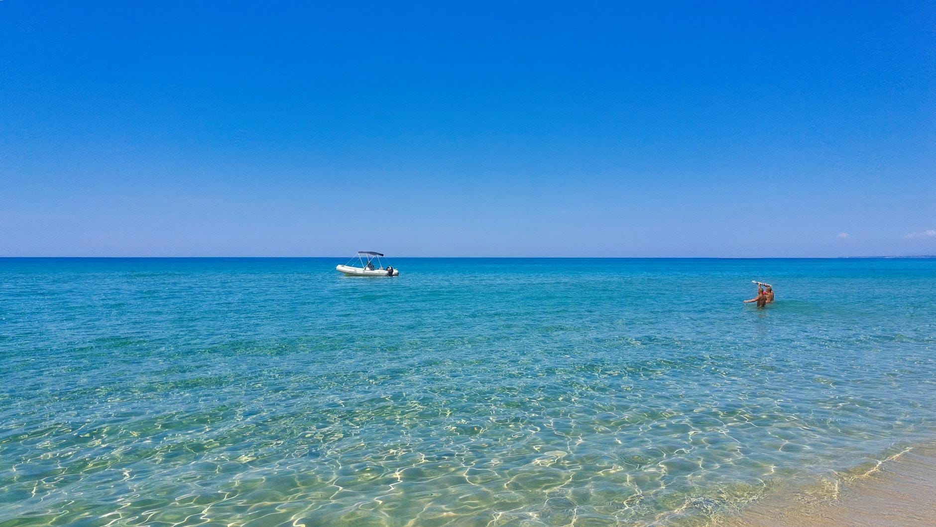
Biderosa is not a single beach but a sequence of five distinct coves, each separated by low rocky headlands and patches of Mediterranean pine that come almost to the water's edge. The main and most visited cove stretches around 316 metres and is one of the coves served most directly by the shuttle. Its sand is fine and pale, closer to white than gold, and the seabed slopes very gently, which keeps the water shallow for a considerable distance from shore — a meaningful advantage if you're with children or prefer to wade rather than swim.
The other four coves require more walking along the internal track, and that short extra effort is usually rewarded with noticeably fewer people. The water colour shifts from a clear pale green close to shore to deep turquoise further out, and the rocky headlands between coves are good for snorkelling where the sand gives way to posidonia seagrass meadows.
The broader Ogliastra coast has a reputation for spectacular underwater scenery. If you're planning to explore the area's sea caves and submerged passages, the Sardinia snorkelling and diving guide covers the key sites within reach of this stretch of coastline.
There are no beach bars or food kiosks inside the oasis. This is a firm policy, not an oversight. Bring everything you need: water, food, shade equipment if you want it, and bags to carry out your rubbish. The complete absence of commercial facilities is precisely what keeps the sand and water in the condition they're in.
Tickets & tours
Hand-picked options from our booking partner. Prices are indicative; availability and final rates are confirmed when you complete your booking.
Kayak tour in the Oasis of Biderosa
From 48 €Instant confirmationFree cancellationVineyard Guided Tour and 7 Wine Tasting in Palau
From 84 €Instant confirmationFree cancellationFull-Day Sailboat Tour in La Maddalena Archipelago from Cannigione
From 112 €Instant confirmationFree cancellationHiking excursion to the Devil's Saddle
From 35 €Instant confirmationFree cancellation
How the Experience Changes Through the Day
Arriving early on a summer morning, before 9am, the light is still low and golden across the water, and the main cove can feel almost private. By 10:30 on a July weekend, the parking area near the entrance begins to fill, and the shuttle bus operates a steady rotation. The peak density on the main beach is between 11am and 3pm. If your priority is a quiet experience, arriving at the start of the day or staying past 4pm, when day visitors begin leaving, makes a real difference.
In September and October, the dynamic shifts entirely. Access controls remain in place, but the overall numbers are lower. The sea temperature stays comfortable through October (Sardinia's coastal waters are typically still swimmable well into autumn), the vegetation takes on drier, more aromatic qualities, and the angle of light in the afternoon is markedly better for photography of the coves.
ℹ️ Good to know
May and early June offer the sharpest water clarity and the coolest air temperatures, though the sea will feel cooler for swimming. September is generally considered the best balance of warm water, lower crowds, and good light.
Getting There and Practical Logistics
The oasis entrance is on the SS125, one of Sardinia's main east-coast roads. If you're coming from Nuoro or Olbia, follow the SS125 toward Orosei and Dorgali; the entrance is signed before you reach Orosei town. From the south, coming up through Ogliastra from Arbatax or Tortolì, you'll pass through the Golfo di Orosei stretch of the SS125 and reach the entrance on the left.
There is no direct public transport connection to the oasis entrance. Renting a car is the realistic option for most visitors, and Sardinia's road network means you'll want one for this part of the island regardless. The SS125 itself is a scenic road with views of the Orosei Gulf, and it connects several other worthwhile stops.
Sardinia's eastern coast is one of the more rewarding stretches to explore independently. If you're planning a longer stay in the area, the Sardinia road trip guide covers practical routing and the key stops between Olbia, the Ogliastra coast, and the south.
Once inside the gate, you drive or are shuttled along an internal track for several kilometres through the macchia and pine forest before reaching the beach area. Walking the full length of this track in summer midday heat is manageable but warm — wear shoes rather than flip-flops, and carry water from the start.
The Natural and Ecological Setting
The 860-hectare Oasi di Biderosa is a well-preserved example of coastal Mediterranean macchia on Sardinia's eastern coast. The vegetation corridor between the road and the sea — predominantly Aleppo pine, juniper, rosemary, mastic, and strawberry tree — acts as a genuine buffer that keeps the beach feeling remote even when visitor numbers are at their peak.
The seagrass meadows (Posidonia oceanica) offshore contribute to the exceptional water clarity that this part of Sardinia is known for. Posidonia is a protected species under Italian and EU law, and its presence here is a direct indicator of water quality. The absence of motorised watersports within the reserve protects both the seagrass and the nesting birds that use the more secluded sections of coastline.
The broader Golfo di Orosei coastline, which extends south from here through some of Sardinia's most dramatic sea cliffs, is worth understanding as a whole before you plan your visit. The Golfo di Orosei area guide explains how the different access points and beaches relate to each other.
Photography at Biderosa
The combination of pale sand, dark green pine canopy, and the specific turquoise-to-cobalt gradient of the water makes Biderosa one of the more photogenic beaches on the eastern coast. The best light for wide shots of the coves is in the morning, when the sun is to the east and the water catches the angle directly. By midday the light is harsh and flattens the colour gradients that make the beach distinctive.
The pine trees along the shoreline create natural framing opportunities, and the headlands between coves work well as foreground elements for shots across the bay. For underwater photography or snorkelling video, the northern end of the main cove where sand transitions to rock and seagrass has the best visibility and the most diverse subjects.
⚠️ What to skip
Drone use is restricted within protected natural reserves in Italy. Do not fly a drone inside the Oasi di Biderosa without checking current regulations and obtaining any required authorisations in advance.
Who Will Love This — and Who Won't
Biderosa is one of the beaches in Sardinia that rewards a particular kind of visitor: someone who is willing to plan ahead, accept some inconvenience (the booking process, the shuttle, the absence of any services), and carry everything they need. For that visitor, the payoff is a beach that has resisted the commercial development that has changed so many other beautiful coves in the Mediterranean.
If you need a parasol and sun bed service, cold drinks delivered to the sand, or reliable phone signal, this is the wrong beach. The infrastructure simply does not exist inside the reserve, and that is the point. Visitors who prefer serviced lidos or who find the logistics of protected reserves frustrating will be better suited to the beaches around Cala Gonone or the resorts further north.
Families with young children tend to find the shallow seabed and the calm water of the main cove ideal, provided they come prepared with snacks, sun protection, and enough water for the day. For an overview of Sardinia's beach options across different styles and price points, the best beaches in Sardinia guide provides a broader comparison.
Insider Tips
- The second and third coves to the north of the main beach are often quieter and require about 10 to 15 minutes of additional walking along the internal path. The sand quality and water colour are equivalent to the main cove.
- If you're arriving by car on a July or August weekend, be at the entrance early. The daily vehicle quota fills quickly and there is no overflow parking nearby.
- The internal track through the pine forest provides useful natural shade on the walk to the beach — start your return journey before late afternoon if you want to avoid the warmest part of the afternoon walk back.
- Water shoes are worth packing. The entry points to the water on the smaller coves are sometimes rocky, and the fine sand of the main beach gives way to stones at the waterline in some sections.
- Visiting in late September or early October, the crowds drop sharply while sea temperatures remain comfortable. The pine and macchia vegetation is also more aromatic in the drier autumn air, and the light on the water in the afternoon is noticeably warmer.
Who Is Spiaggia di Biderosa For?
- Nature-oriented travellers who value ecological integrity over beach facilities
- Families with young children who need shallow, calm, gently sloping water
- Photographers working in the morning when the light angle is optimal for the coves
- Snorkellers looking for clear water over seagrass meadows without motorised watersports traffic
- Visitors in September or October who want a genuine beach experience outside peak-season crowds
Nearby Attractions
Other things to see while in Ogliastra:
- Capo Comino Dunes & Beach
A 3-kilometre stretch of white sand and wind-sculpted dunes on Sardinia's eastern coast, near Siniscola. The shallow sea, open access, and historic shipwrecks offshore make it one of the Nuoro province's most distinctive beaches.
- Grotte Su Marmuri (Ulassai)
Grotte Su Marmuri is a vast living limestone cave carved into the rocky highlands above the village of Ulassai in Ogliastra, eastern Sardinia. With chambers reaching up to around 50 metres high, active stalactite formations, and a constant interior temperature of 10°C, it offers one of the most impressive underground experiences on the island. Entry is by guided tour only, lasting approximately 1.5 hours.
- Parco Nazionale del Golfo di Orosei e del Gennargentu
Covering roughly 74,000 hectares of rugged mountain, gorge, and coastal wilderness in central-eastern Sardinia, the area commonly referred to as Gennargentu National Park is the island's most ambitious proposed protected landscape. From the island's highest peak to sheer sea cliffs dropping into the Golfo di Orosei, this is where Sardinia's raw geography is on full display.
- Punta La Marmora
At 1,834 metres, Punta La Marmora is the highest point in Sardinia and the crown of the Gennargentu massif. The hike rewards those who make the effort with panoramic views across the island's rugged interior, a genuine sense of remoteness, and a perspective on Sardinia that most visitors never see.