Stockholm Archipelago: How to Actually Explore Sweden's 24,000-Island Wilderness
The Stockholm Archipelago stretches roughly 60–80 km east of the city into the Baltic Sea, encompassing over 24,000 islands, islets, and bare rock skerries. Ferries depart from central Stockholm's waterfront, making it possible to be swimming off a quiet island within two hours of leaving your hotel. There is no admission fee to the archipelago itself — you pay only for the ferry.
Quick Facts
- Location
- Extends ~60–80 km east of Stockholm into the Baltic Sea; ferries depart from Strömkajen and Nybroplan in central Stockholm
- Getting There
- Waxholmsbolaget public ferries from Strömkajen (near the Royal Palace); private archipelago tours also depart from Nybroplan
- Time Needed
- Half-day for the closest islands; full day or overnight for the outer archipelago. Most visitors spend 6–10 hours
- Cost
- No entry fee to the archipelago. Ferry fares vary by route and season — check Waxholmsbolaget directly for current prices (payable in SEK)
- Best for
- Nature lovers, kayakers, swimmers, hikers, anyone wanting genuine Swedish landscape away from the city
What the Stockholm Archipelago Actually Is
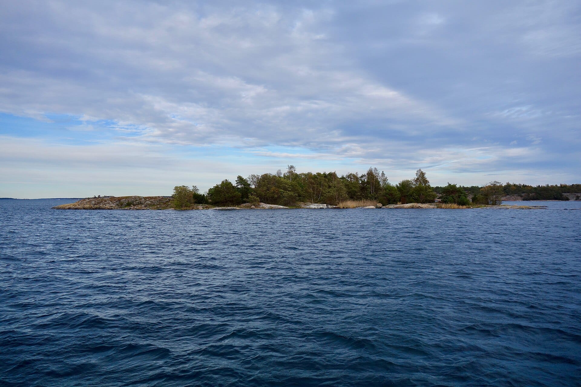
The Stockholm Archipelago is the largest archipelago in Sweden and the second-largest in the Baltic Sea. It contains slightly over 24,000 islands, islets, and skerries — flat, wave-polished outcrops of granite that emerge from the water like the backs of whales — covering approximately 1,700 km², of which around 530 km² is land. The rest is water: channels, inlets, and open stretches of the Baltic that shift from steel grey in November to a clear, shallow green in July.
This is not a park with an entrance gate. The archipelago is a living geographical region, home to around 5,000 year-round residents spread across its inhabited islands, with ferry connections functioning as the primary road network. In summer, that population swells dramatically as Stockholmers open their summer cottages and tourists from across Europe arrive by ferry. In winter, many smaller islands go quiet, the ferry schedule thins, and the archipelago returns to its residents and the birds.
Since 1974, part of the archipelago has held Ramsar designation as a wetland of international importance, recognizing its ecological significance for breeding and migratory birds. If you are already planning time on the water, the archipelago pairs naturally with a visit to Ekoparken, Stockholm's protected royal park, which occupies the western edge of Djurgården island and signals the beginning of the protected green corridor that eventually opens into archipelago waters.
Inner, Middle, and Outer: Three Very Different Experiences
The archipelago divides naturally into three zones, and your choice between them shapes everything — the journey time, the landscape, the crowds, and the kind of day you have.
Inner Archipelago (30–60 Minutes from Stockholm)
Islands like Vaxholm sit in the inner zone, still sheltered by the mainland, covered in pine and birch, and lined with the distinctive red-and-white wooden houses (röd stugor) that define Swedish island architecture. Vaxholm is the most straightforward day trip in the entire archipelago: it has a 16th-century fortress, a main street of bakeries and craft shops, and regular ferry connections that make it easy to arrive, explore on foot for three hours, eat a proper lunch, and be back in Stockholm by late afternoon. It is not remote, but it earns its reputation as a good introduction to archipelago culture.
Middle Archipelago (1.5–3 Hours from Stockholm)
As the ferry moves east, the islands become lower, more exposed, and more sparsely wooded. The middle archipelago is where most serious day-trippers and weekenders go. Grinda is a favorite: a car-free island with walking trails, a hostel and guesthouse, swimming spots off smooth granite ledges, and a small restaurant. In July, the ferry from Strömkajen to Grinda takes around two hours and arrives at a wooden pier surrounded by boats at anchor. The smell coming off the rocks on a warm afternoon is specific and memorable — sun-heated granite, pine resin, and salt water.
Outer Archipelago (3–5 Hours from Stockholm)
The outer archipelago is where the Baltic opens up and the landscape becomes severe. Islands like Sandhamn — the traditional finishing point of major Baltic sailing races — sit at the far eastern edge of the archipelago, roughly 3 hours by public ferry from Stockholm. Out here, trees shrink and flatten under the prevailing wind. The skerries are bare rock. Landsort, the southernmost point of the archipelago, has a working lighthouse and a population that can be counted in dozens. These islands reward overnight stays; trying to do them as a rushed day trip means spending most of your waking hours on the ferry.
💡 Local tip
Practical split: If you have one day, go to Vaxholm or Grinda and keep it manageable. If you have two days, take a ferry to Sandhamn and stay overnight. The outer islands are genuinely different in character — do not try to cram them into a long day trip from the city.
Tickets & tours
Live prices and dates from our booking partner. If you book, we may earn a commission at no extra cost to you.
2-hour archipelago tour on a RIB speedboat
From 122 €Instant confirmationFree cancellationGuided boat tour of the Stockholm Archipelago
From 35 €Instant confirmationFree cancellationSailing around Stockholms archipelago
From 261 €Instant confirmationFree cancellationFull-day kayaking tour of Stockholm archipelago
From 166 €Instant confirmationFree cancellation
How to Get There: Ferries and the Waxholmsbolaget Network
The main public ferry operator is Waxholmsbolaget, which runs scheduled services from Strömkajen (the quay directly in front of the Royal Palace and the Grand Hotel, in central Stockholm) to islands across the archipelago. Ferries also depart from Nybroplan, a short walk away. Waxholmsbolaget tickets are sold at the quayside or via the operator's app; prices vary by route and season, so check the current schedule and fares directly on their website before you go.
In summer, services are frequent and some routes run multiple departures per day. In winter, the schedule contracts significantly — some smaller islands drop to a few services per week. If you are traveling outside of May to September, always check the current timetable before committing to a specific island.
Private tour boats and RIB speedboats depart from Nybroplan and offer guided archipelago excursions. These are faster and more expensive than the public ferry, and some include a naturalist or guide. They make sense if your time is short and you want to cover more islands in a half-day. For a longer, more immersive experience, the slow public ferry is the better choice — the journey itself, threading between forested islands with Stockholm's skyline slowly receding, is part of what makes the trip worthwhile.
⚠️ What to skip
Accessibility note: Not all island piers and ferry boats are fully step-free. If you have mobility requirements, contact Waxholmsbolaget or the specific island accommodation directly before booking. Conditions vary by route and pier.
Best Time to Visit and How Weather Changes Everything
The main visitor season runs from late May through August. June and July bring the longest daylight hours — Stockholm's northern latitude (around 59°N) means light well past 10 pm in midsummer, and the islands stay warm enough for swimming in July and early August when the sea temperature rises to around 18–20°C in sheltered bays. The granite retains heat through the afternoon and into the evening, and sitting on the rocks watching the light change at 9 pm is one of the genuinely unrepeatable experiences this region offers.
Late August and September bring cooler temperatures and noticeably thinner crowds. The light turns amber and low, the foliage begins to shift, and the ferries feel far less urgent. For photographers, September is excellent. If you are visiting Stockholm in summer specifically for the archipelago, the summer in Stockholm guide covers the wider seasonal picture, including the Midsommar celebrations that some outer-island communities host in late June.
Winter visits are possible but limited. Ferry schedules are sparse, many island businesses close entirely from October through April, and the Baltic can be genuinely rough. On the other hand, a clear winter day in the archipelago — ice on the inner channels, bare rock dusted with frost, total quiet — has a bleakness that some travelers find compelling. Do not expect facilities.
ℹ️ Good to know
Weather reality: The archipelago is exposed. Even in July, a strong southwest wind can make a ferry crossing choppy and a swim uncomfortable. Check the Swedish Meteorological and Hydrological Institute (SMHI) forecast before you go. Pack a windproof layer regardless of the season.
What to Do Once You Arrive
The archipelago does not have a single 'main attraction.' The point is the landscape itself and the pace it imposes. That said, there are specific activities that define what most visitors actually do with their time.
- Swimming off granite ledges: the granite warms in summer and the water in sheltered inlets is far calmer than the open Baltic. Most islands have recognized swimming spots; locals know the best ones and are generally happy to point you in the right direction.
- Kayaking: self-guided kayak rental is available on several inner and middle archipelago islands. Kayaking between islands on a calm morning, with the water glassy and the only sound oar dips and seabirds, is the format many return visitors prefer.
- Walking island trails: most larger inhabited islands have marked walking paths. Grinda, Sandhamn, and Utö (one of the larger outer islands) all have trail networks that take 1–3 hours to walk.
- Fishing: the archipelago waters hold perch, pike, and sea trout. Day fishing licenses are available through local operators on several islands.
- Eating and drinking: the archipelago has a small but genuine food culture. Fish soup, smoked herring, crisp bread, and local shrimp are served at island restaurants and small kiosks. On Sandhamn, the Sandhamns Värdshus inn has been operating in some form since the 18th century.
- Cycling: a few larger islands, including Utö, have bikes available for rent. The flat terrain and car-free (or low-traffic) environment make cycling an unusually pleasant way to cover ground.
Practical Details: What to Bring and What to Know
Pack for a full day outdoors, not for sightseeing. That means sunscreen (the reflected light off water is stronger than most people expect), a windproof jacket, sturdy footwear for uneven granite, and water. On smaller islands, shops are limited and ATMs are rare or nonexistent — carry cash in Swedish kronor (SEK) or confirm that card payment is accepted at your specific destination.
If you plan to stay overnight, book well in advance for July. Island guesthouses and youth hostels sell out weeks ahead in peak season. The Stockholm accommodation guide focuses on the city, but overnight options on islands like Grinda, Sandhamn, and Utö are listed directly on their respective tourism pages. Budget travelers should note that overnight island stays are generally not cheap.
Photography is excellent throughout the archipelago, but the light is best in the first two hours after sunrise and in the two hours before sunset. The low-angle light catches the texture of granite and the surface of the water in ways that midday flat light completely flattens. If you are on an island overnight, set an alarm.
The archipelago is managed under Sweden's Allemansrätten (right of public access), which grants the legal right to walk, camp, and swim on most land as long as you respect nature and do not disturb residents. This means you can pitch a tent on most uninhabited skerries — but the rules around campfires are strict, especially in dry summers, and must be checked against current local advisories. For broader context on outdoor travel from the city, the day trips from Stockholm guide covers the archipelago alongside other regional options.
Who Will Not Enjoy This
The Stockholm Archipelago is not for everyone, and it is worth being honest about that. Travelers who want dense sightseeing — museums, monuments, guided tours of historic interiors — will find the islands thin on content. There are no world-class art collections out here, no famous churches, no major historical sites beyond Vaxholm Fortress. What the archipelago offers is space, quiet, and natural landscape, and if that does not sound like a compelling way to spend a day, it probably will not be.
Travelers with significant mobility limitations may find the physical environment challenging. Granite is uneven and often steep. Ferry piers are not uniformly accessible. The infrastructure is built for the conditions, not for wheelchair access, and while some routes and facilities are better than others, the archipelago as a whole is not well-suited for visitors who need fully step-free environments.
Finally, anyone visiting in bad weather without flexibility should lower expectations. Rain and wind in the archipelago can close swimming, make ferry decks uncomfortable, and strip the landscape of the light that makes it special. A grey, choppy day on a small island with limited indoor shelter is a very different experience from a July afternoon on warm granite. Build flexibility into your schedule.
Insider Tips
- Buy your outbound and return ferry tickets before you board, not at the island pier. On busy summer weekends, return sailings on popular routes fill up, and being stuck on Grinda waiting three hours for the next boat is not how most people want to end their day.
- The public ferry is not just transport — position yourself on the upper open deck for the journey outward. The view of Stockholm receding behind you, with the water opening up around forested islands, is genuinely one of the better approaches to any city in northern Europe.
- If you want swimming without crowds, avoid the ferry-accessible main beaches on sunny Saturday afternoons in July. Walk 15–20 minutes from the pier in any direction and you will typically find granite ledges with no one on them.
- Bring more food than you think you need. Island shops and kiosks run out of popular items by early afternoon on peak summer days, and prices are higher than in Stockholm. A packed lunch from a city supermarket before you board the ferry is the practical choice.
- For the outer archipelago, consider traveling out on a weekday and returning on a weekend. The direction of weekend traffic is heavily city-bound on Sunday afternoons, meaning the incoming boats are packed while the outbound ones are half-empty.
Who Is Stockholm Archipelago For?
- Nature and outdoor travelers who want Swedish landscape in its most direct, unmediated form
- Families with children old enough to manage uneven terrain — the combination of ferries, swimming, and open space works very well for kids aged 6 and up
- Swimmers, kayakers, and cyclists looking for calm water and car-free or low-traffic island roads
- Photographers, particularly those willing to be on the water at dawn or dusk when the Baltic light is extraordinary
- Travelers already staying in Stockholm for several days who want a full contrast to the city, without taking a long-distance trip
Nearby Attractions
Combine your visit with:
- Birka Viking Town
Founded around AD 750 on a remote island in Lake Mälaren, Birka was one of Scandinavia's earliest true urban trading centers. Today it survives as part of the UNESCO World Heritage Site Birka and Hovgården, reached only by seasonal boat from Stockholm, where around 2,000 Viking-age graves still dot the surrounding landscape. It is one of the most historically significant half-day excursions available from the Swedish capital.
- Drottningholm Palace
Drottningholm Palace is Sweden's most complete royal domain, a UNESCO World Heritage Site on Lovön island just about 10 km west of Stockholm. The baroque complex includes the palace, a working 18th-century theatre, a Chinese Pavilion, and formal gardens that shift in character across every season.
- Royal National City Park (Ekoparken)
The Royal National City Park, known locally as Ekoparken, is the world's first national urban park and one of Stockholm's most remarkable features. Stretching around 27 km² from Djurgården in the south to Ulriksdal in the north, it wraps around the city in a continuous arc of ancient oak forests, royal palaces, museum islands, and open waterways. Entry is free and the park never closes.
- Hagaparken
Hagaparken is a 144-hectare English landscape park just north of central Stockholm, laid out for King Gustav III in the late 18th century. Free to enter year-round, it offers a rare combination of royal history, open meadows, and waterside walking paths within easy reach of the city. Individual attractions inside the park, including the Butterfly House and royal pavilions, charge their own fees.
Planning a trip? Discover personalized activities with the Nomado app.