Mission Trails Regional Park: San Diego's Vast Urban Wilderness
One of the largest municipally owned parks in the United States, Mission Trails Regional Park spans about 60 miles of trails, chaparral, granite ridges, and San Diego River corridor in eastern San Diego. Entry is free, trails range from flat riverside walks to strenuous summit climbs, and the on-site Visitor and Interpretive Center gives essential context before you head out.
Quick Facts
- Location
- One Father Junipero Serra Trail, San Diego, CA 92119
- Getting There
- Primarily by car via I-8 to Mission Gorge Road; MTS Route 115 serves the Cowles Mountain Trailhead — verify current routes at sdmts.com
- Time Needed
- 2 hours for a single trail; full day if combining multiple routes and the Visitor Center
- Cost
- Free — park entry and Visitor Center admission are free to the public
- Best for
- Hikers, trail runners, birdwatchers, families seeking free outdoor space, photography enthusiasts
- Official website
- mtrp.org
What Mission Trails Regional Park Actually Is
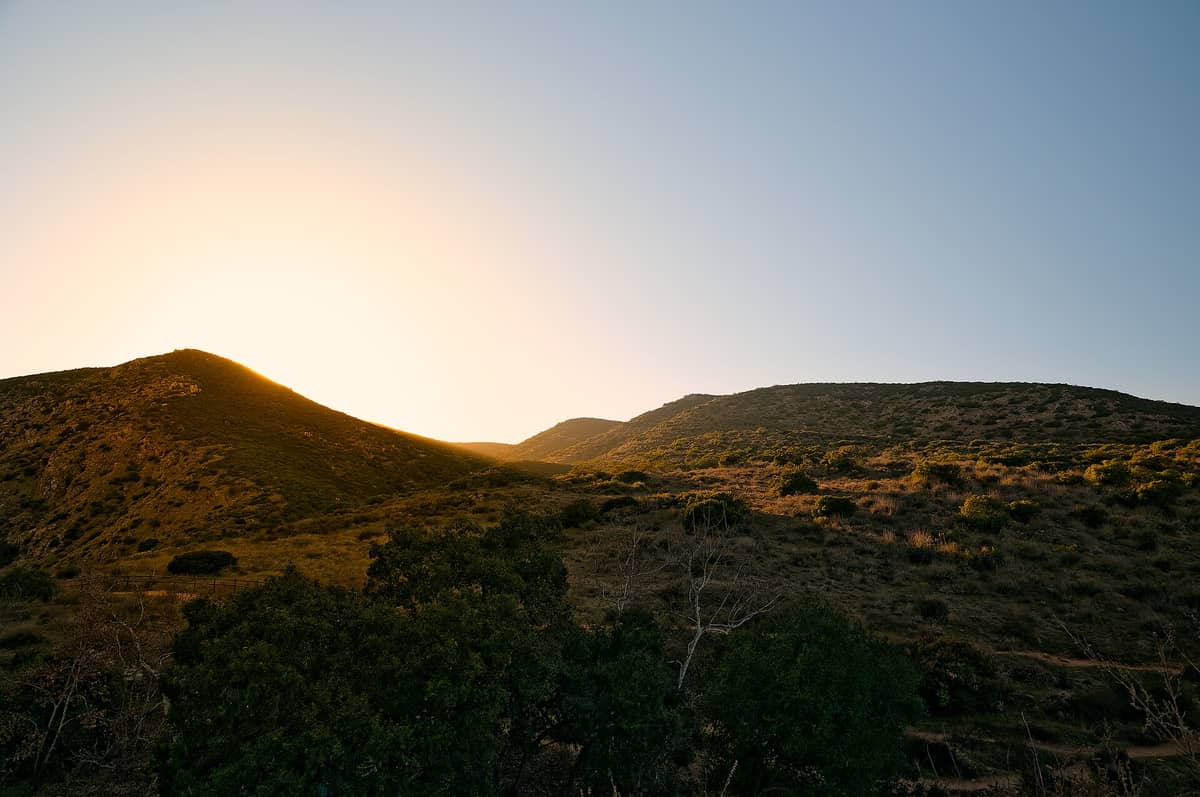
Mission Trails Regional Park is a more than 8,000-acre open-space preserve sitting roughly eight miles northeast of downtown San Diego — close enough to feel convenient, large enough to feel genuinely wild. It is consistently cited as one of the largest municipally owned urban parks in the United States, and that scale is the first thing that surprises first-time visitors. This is not a manicured city park with paved paths and picnic shelters at every turn. It is chaparral-covered terrain, granite boulders, and a living river corridor, threaded by about 60 miles of trails.
The park preserves landscape tied directly to San Diego's founding history. The San Diego River runs through the gorge at its center, and the surrounding land once formed part of the mission grazing territory associated with Mission San Diego de Alcalá, the first of California's 21 Spanish missions, established in 1769. The preserved open space connects ecological and cultural history in a way few urban parks manage.
ℹ️ Good to know
Entry to Mission Trails Regional Park and its Visitor and Interpretive Center is completely free. The Visitor Center is open daily from 9:00 a.m. to 5:00 p.m., closed Thanksgiving, Christmas Day, and New Year's Day. Trailhead gate hours vary: the Father Junipero Serra Trail gates open at 8:00 a.m. and close at 5:00 p.m. from November through March, and at 7:00 p.m. from April through October.
The Terrain and What You Will Actually See
The park divides broadly into two zones separated by Mission Gorge Road. To the north and east lies the more rugged terrain, including Cowles Mountain — at 1,591 feet, the highest point within the City of San Diego limits. The southern section encompasses the Old Mission Dam, the San Diego River floodplain, and a series of interconnected ridge and canyon trails. Elevation change across the park gives hikers genuine vertical gain options rather than just flat walking.
Vegetation is dominated by California coastal sage scrub and chamise chaparral: low, aromatic, and dense enough to line trails on both sides so that you feel enclosed in a green corridor even while climbing open ridges. In late winter and early spring, after sufficient rain, the hillsides produce blooms of black sage, wild cucumber, and scattered patches of prickly pear cactus in flower. By midsummer the landscape dries to gold and grey-green, and the air carries a dry, resinous scent that is characteristic of Southern California's inland hills.
The San Diego River portion of the park attracts a different ecology entirely. Willows and cottonwoods crowd the bank in the wetter sections, and the riparian corridor draws a disproportionate share of the park's birdlife: great blue herons wade in the shallows, red-tailed hawks circle the canyon walls, and migrating warblers move through the willows in spring and fall. The Old Mission Dam, built between 1809 and 1816 by Native American laborers under mission direction, is one of the oldest surviving European-built water structures in California and warrants a walk even if you have no interest in hiking.
How the Park Changes Through the Day
The difference between arriving at 7:00 a.m. and 11:00 a.m. on a weekend is substantial. Early morning hikers share the trailheads with trail runners and dog walkers who know the rhythms of this place; the parking areas at the main Cowles Mountain trailhead at Golfcrest Drive and Navajo Road and at the Visitor Center fill quickly on weekend mornings, and by 9:30 a.m. in spring the lots can be capacity-full. Getting there before the gates have been open an hour gives you cooler temperatures and noticeably quieter trails.
Midday is when the terrain earns its reputation for being demanding. Inland San Diego heats up faster than the coast, and Mission Trails sits several miles from any marine influence. Summer midday temperatures in the park regularly reach the low-to-mid 90s Fahrenheit (low 30s Celsius) on exposed ridges with minimal shade. The chaparral does little to block solar radiation on climbs, and granite outcrops radiate heat back at you. This is not a place to underestimate sun and hydration.
⚠️ What to skip
Water is not available on most trails. Carry more than you think you need — at least one liter per person per hour of hiking in summer. The Visitor Center has water and restrooms, but once you leave the trailhead, you are on your own.
Late afternoon and early evening visits, especially in the longer daylight months when gates stay open until 7:00 p.m., offer some of the best light for photography and more manageable temperatures. The granite summit boulders of Cowles Mountain glow orange-pink in the last hour before sunset, and the view west over the Mission Valley development to the coast and ocean beyond is the clearest reward for the climb.
Trails: A Practical Overview
With about 60 miles of trails across more than 8,000 acres, Mission Trails can overwhelm first-time visitors trying to plan a route. The trails are well-signed but not always intuitive in their connections, and cell signal can drop in the deeper canyon sections. Downloading an offline map before arrival is not optional — it is practical.
- Cowles Mountain Main Trail: 3 miles round trip, 950 feet of elevation gain — the most popular summit hike in San Diego. Expect company on weekends.
- Father Junipero Serra Trail: A flat, paved road (closed to most vehicles) running through Mission Gorge. Suitable for walking, cycling, and usable in sections for wheelchair access. Good river access points along the way.
- Oak Canyon and Climbers Loop: Moderate, less-trafficked canyon routes with more shade than the exposed ridge trails.
- Old Mission Dam Trail: Short, flat walk to the historic dam site. Combines well with a river walk and works for families with young children.
- Kwaay Paay Peak Trail: A shorter but steep alternative summit to Cowles Mountain, with fewer crowds and a similarly rewarding view.
The Visitor and Interpretive Center distributes free trail maps and has staff available to suggest routes based on fitness level and available time. The center also houses exhibits on the park's natural history, geology, and the cultural heritage connecting the land to the Kumeyaay people, California's original inhabitants in this region, and later to Spanish mission history. If you are planning a longer outing in the park, the trails page at our guide to the best hikes in San Diego gives additional context on how Mission Trails trails compare to other options across the city.
The Visitor and Interpretive Center
The Visitor and Interpretive Center at One Father Junipero Serra Trail is more substantive than the word 'visitor center' typically implies. The building itself is designed to blend with the landscape, and inside, the interpretive exhibits cover the park's geology, the plants and wildlife of the chaparral ecosystem, the history of the Kumeyaay people, and the story of the Spanish missions and Old Mission Dam. It is a genuinely useful 30 minutes before hitting the trails, particularly if you have children who benefit from context before they are asked to walk uphill.
Accessible parking is available near the center, and the immediate surroundings — paved paths leading toward the river and the start of the Father Junipero Serra Trail — are usable by visitors with mobility limitations. The deeper backcountry trails are natural surface and generally not accessible for wheelchairs or strollers. The staff at the center can advise on which sections of the park are most manageable for different needs.
Getting There and Practical Logistics
The park is located in eastern San Diego, accessible from Interstate 8 via Mission Gorge Road heading north, or from State Route 125 and Jackson Drive from the east. The Visitor Center and the primary trailheads have dedicated parking areas, but the main Cowles Mountain trailhead at Golfcrest Drive and Navajo Road and the Visitor Center lot both fill on weekend mornings. Arriving before 8:00 a.m. on weekends in spring or fall reliably secures parking. Weekday visits rarely have the same pressure.
For those without a car, the San Diego Metropolitan Transit System (MTS) serves the Mission Gorge Road corridor, including Route 115 to the Cowles Mountain Trailhead, but service frequency and stop proximity to trailheads vary — check current routes and schedules at sdmts.com before relying on transit. For visitors combining Mission Trails with a broader San Diego outdoor itinerary, the guide to getting around San Diego covers transit options in detail.
What to wear depends heavily on season. In winter and early spring, layers and waterproof footwear are sensible — the trails become muddy after rain, and exposed ridges get cold wind. In summer, light and breathable clothing, a sun hat, and sunscreen are essential. Trail shoes with grip outperform sneakers on the rockier summit approaches. Dogs are welcome on most trails on a leash no longer than six feet.
Weather and Seasonal Considerations
San Diego's Mediterranean climate means Mission Trails is usable year-round, but each season has different trade-offs. Winter (December through February) brings the possibility of rain — the park's wet season concentrates most of its annual rainfall in these months. After significant rain, trails can be slippery and the river runs higher; some crossings become impractical. However, winter also brings green hillsides, wildflower beginnings in late February, and the most comfortable temperatures for strenuous hiking.
September and October are arguably the best months for Mission Trails: summer heat has moderated, and rainfall is essentially absent. The landscape is dry but the air is clear, long views reach the coast, and the trails are less crowded than the peak spring season. Early spring (March and April) offers the most dramatic wildflower display but also the busiest trail conditions.
Summer hiking at Mission Trails is realistic only in the early morning hours. The park sits inland and heats significantly above coastal San Diego temperatures; midday summer visits to the ridge trails are genuinely risky for people who underestimate sun exposure and dehydration. If your San Diego trip falls in summer, the summer in San Diego guide outlines how to pace outdoor activities around the heat.
Who Should Think Twice
Mission Trails is not the right choice for every visitor. Travelers who want a short, easy outdoor experience with guaranteed shade, water fountains along the route, and minimal exertion will find most of the park's popular trails more demanding than expected. The Cowles Mountain summit is the most common instance of this mismatch: it looks approachable on paper but is a genuine workout on exposed terrain, and people regularly turn back after underestimating it.
Visitors primarily interested in San Diego's cultural institutions or waterfront will get more from Balboa Park or the Embarcadero than from an inland wilderness park. And anyone visiting between June and August who cannot start hiking before 8:00 a.m. should honestly weigh whether the midday heat makes the experience worthwhile.
Insider Tips
- The main Cowles Mountain trailhead at Golfcrest Drive and Navajo Road gets most of the weekend crowds. The Kwaay Paay Peak trailhead, accessed from the Visitor Center side of the park, offers a shorter summit experience with a more interesting approach through the gorge.
- The Old Mission Dam is at its most atmospheric in the morning when the light hits the stone face directly and the river is quiet. It is one of the oldest surviving Spanish colonial-era structures in California, and most visitors walk past it without stopping to read the interpretive panels.
- If you are visiting on a weekday, the park operates at a fraction of weekend capacity. Trails that feel crowded on Saturday mornings feel genuinely solitary on a Tuesday.
- The Visitor Center staff are typically very knowledgeable about the park's ecology and trail conditions. Asking them which trails have been affected by recent rain or which areas have active wildlife sightings will improve your visit more than any map.
- Cell coverage drops significantly in the canyon sections between the Visitor Center and the Old Mission Dam. Screenshot your trail map or download it offline before you leave the parking area.
Who Is Mission Trails Regional Park For?
- Hikers of all experience levels looking for genuine backcountry feel without leaving the city
- Trail runners seeking varied terrain and elevation with free access
- Birdwatchers and naturalists, especially along the San Diego River riparian corridor
- Families with older children ready for a real summit hike (Cowles Mountain) or a flat river walk (Old Mission Dam trail)
- Budget-conscious visitors wanting a full-day outdoor experience at zero cost
Nearby Attractions
Combine your visit with:
- Anza-Borrego Desert State Park
Anza-Borrego Desert State Park stretches across more than 600,000 acres of Colorado Desert in eastern San Diego County, making it one of the largest state parks in the United States. From spring wildflower carpets to ancient slot canyons and some of the darkest skies in Southern California, it rewards visitors who plan carefully and respect the terrain.
- Border Field State Park
Border Field State Park occupies the southwestern corner of the continental United States, where Pacific surf meets the U.S.–Mexico border fence. It offers coastal wetlands, a historic marble boundary monument, and views toward Friendship Park — the U.S.-side gathering space has been closed since 2020, so confirm current access before you go.
- Cedar Creek Falls
Cedar Creek Falls is a backcountry waterfall deep inside Cleveland National Forest, reached by a strenuous 6-mile round-trip hike from Ramona. A mandatory day-use permit keeps crowds manageable, but you'll earn every step of the descent into this rugged gorge. This guide covers the permit process, trail conditions, safety warnings, and what to realistically expect.
- Chicano Park
Chicano Park is a National Historic Landmark tucked beneath the San Diego–Coronado Bridge in Barrio Logan, where more than 80 monumental murals cover the concrete pillars of a freeway overpass. Free to enter and open daily, it is one of the most culturally layered outdoor spaces in the American Southwest.