Fire Wave Trail: Nevada's Striped Sandstone Wonder Near Las Vegas
Fire Wave Trail leads hikers across open desert to a swirling formation of red, pink, and white Aztec Sandstone bands inside Valley of Fire State Park. At roughly 1.5 miles round trip, the hike itself is short, but the landscape it crosses is severe and spectacular. Located about 50 miles northeast of Las Vegas, this is one of the most visually arresting short hikes within reach of the city.
Quick Facts
- Location
- Valley of Fire State Park, Overton, Nevada (Parking Lot P3 on White Domes Road)
- Getting There
- Car only. Approx. 50 miles northeast of Las Vegas via I-15 and Valley of Fire Highway. No public transit serves the park.
- Time Needed
- 1.5–2.5 hours total including drive from the visitor center and time at the formation
- Cost
- Park entry: $15 per vehicle for non-Nevada residents (verify current rates at Nevada State Parks)
- Best for
- Geology lovers, photographers, day-trippers from Las Vegas seeking dramatic desert scenery
- Official website
- parks.nv.gov/parks/valley-of-fire
What Fire Wave Trail Actually Is
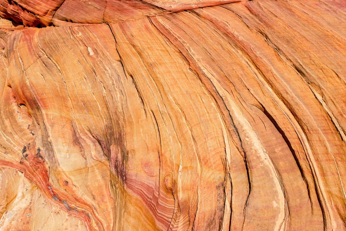
Fire Wave Trail is a short, designated hiking route inside Valley of Fire State Park in southern Nevada that leads to one of the most photogenic geological formations in the American Southwest. The trail covers roughly 1.5 miles round trip across open, sandy desert terrain, ending at a broad expanse of Aztec Sandstone sculpted into layered, wave-like curves of red, pink, and white. The striped pattern is the result of iron oxide variations within ancient sand dunes, compressed over millions of years into sedimentary rock and then slowly exposed by erosion.
The formation is sometimes compared to The Wave in Arizona, and while it lacks that site's permit-controlled exclusivity, Fire Wave has its own scale and character. The bands are wider and more assertively colored, with deep red dominating in direct sunlight. The rock surface itself is smooth and undulating, which makes standing at its center feel genuinely disorienting in the best way.
Originally a social trail worn down by unofficial visitors, Fire Wave was later formalized as an official park route. It now appears in Nevada State Parks publications alongside the Seven Wonders Loop, a longer option that connects several of the park's major sandstone landmarks for hikers who want more than the out-and-back experience.
⚠️ What to skip
Seasonal Closure: Fire Wave Trail and other exposed routes at Valley of Fire are typically closed from May 15 through September 30 due to extreme heat. Summer temperatures regularly exceed 110°F (43°C) on open sandstone. Plan your visit for October through early May.
The Experience: From Trailhead to Formation
The trail begins at Parking Lot P3 on White Domes Road, about five miles north of the Valley of Fire visitor center. The lot itself is unremarkable, but the landscape surrounding it sets the tone immediately: red and orange sandstone fins rise on either side, and the desert air carries a dry, mineral smell that has no equivalent in urban environments.
The first section of the trail crosses sandy flats marked by cairns and low stakes. There is no shade at any point. The route threads between sandstone outcrops before a gentle rise reveals the Fire Wave itself, which comes into view without much warning. The formation is larger than most photographs suggest, wide enough that groups of hikers spread across it comfortably. The surface feels cool and slightly rough underfoot in early morning, warming rapidly once the sun climbs.
In the cooler months, the silence here is one of the most striking things about the place. Wind moves across the rock in audible pulses. Aside from other hikers, the main sounds are the crunch of sand, occasional bird calls, and the distant echo of wind channeled through narrow rock corridors nearby. At peak midday on a busy weekend, that solitude disappears as the parking lot fills and groups move in and out continuously.
Tickets & tours
Hand-picked options from our booking partner. Prices are indicative; availability and final rates are confirmed when you complete your booking.
Valley of Fire small-group tour from Las Vegas
From 93 €Instant confirmationFree cancellationValley of Fire tour from Las Vegas with visit to the Lost City Museum
From 114 €Instant confirmationFree cancellationValley of Fire State Park wedding package
From 939 €Instant confirmationFree cancellationLas Vegas Valley of Fire tour
From 153 €Instant confirmationFree cancellation
Light, Color, and the Best Time of Day
The color of Fire Wave changes dramatically depending on when you arrive. In the hour after sunrise, the reds shift toward amber and copper, with long shadows cutting across the wave's ridges and making every stripe legible. The rock practically glows. This is the window most photographers aim for, and it is genuinely worth the effort of an early departure from Las Vegas.
By mid-morning, the light flattens and the colors cool toward a more uniform rust. Midday is the least interesting time visually and the most punishing physically, even in cooler months when temperatures can still climb past 75°F (24°C) with full sun on bare rock. Late afternoon brings back warm tones, and the rock takes on a deeper crimson quality in the final hour before sunset, though the formation faces roughly southwest, so you lose direct light earlier than you might expect.
💡 Local tip
Photography tip: Arrive at the trailhead at least 45 minutes before sunrise to catch the golden hour at the formation itself. Bring a headlamp for the walk in. The cairned trail is straightforward but harder to follow in full darkness without a light source.
For a broader sense of how desert light works across the region, the Valley of Fire State Park guide covers other formations and viewpoints within the same park that reward different times of day.
Geology and Scale: Why This Formation Exists
The rock at Fire Wave belongs to the Aztec Sandstone formation, a geologic unit that covers large parts of southern Nevada and was laid down roughly 180 million years ago during the Jurassic period. At that time, the region was a vast desert of windblown dunes, similar in scale to the modern Sahara. As those dunes were buried under successive layers of sediment and compressed over geological time, the iron minerals within them oxidized at varying rates depending on groundwater chemistry and oxygen exposure. The result is the banded color pattern visible today: iron-rich layers ran red, iron-poor or bleached zones ran pink to white.
The wave shape itself is caused by differential erosion. Softer, more porous bands erode faster under wind and occasional rain, carving concave channels while the harder bands resist and remain as ridges. The overall effect is a series of parallel curves that from above look like topographic contour lines brought to life in three dimensions.
This same Aztec Sandstone geology, formed under identical conditions, is visible at Red Rock Canyon closer to Las Vegas, though the coloration and erosion patterns differ significantly between the two sites.
Getting There and Practical Logistics
Fire Wave Trail is only accessible by private vehicle. There is no public transit to Valley of Fire State Park, and rideshare services do not reliably serve the area. From the Las Vegas Strip, the drive takes approximately 60 to 75 minutes under normal conditions, heading north on I-15, then east on Nevada State Route 169 (the Valley of Fire Highway), and into the park toward White Domes Road. GPS works for most of the route but can be unreliable once inside the park. Download an offline map or use the Nevada State Parks brochure map as a backup.
The park entry fee is collected at the entrance station. As of recent reporting, non-Nevada residents pay $15 per vehicle for day use, though rates have been adjusted in recent years and visitors should confirm current pricing at the Nevada State Parks website before arriving. There is no fee for the trail itself beyond the park entry charge.
The trailhead at Parking Lot P3 has a small informational sign and restrooms nearby at the White Domes area. The lot can fill on weekends between November and March. If you arrive after 9 a.m. on a clear Saturday in February, expect a wait for a space. Weekday visits are noticeably quieter.
ℹ️ Good to know
Accessibility: Fire Wave Trail is not paved and is not wheelchair-accessible. The sandy terrain and uneven sandstone surface make it unsuitable for most mobility devices. The formation is also not visible from any accessible parking area.
If you are planning a broader itinerary around this region, the day trips from Las Vegas guide covers how to combine Valley of Fire with other destinations in the same general direction, including Lake Mead.
What to Bring and Wear
The trail is short, but the environment is unforgiving even in the cool season. Water is the non-negotiable item: carry at least one liter per person even for the out-and-back route, and more if you plan to explore the wider area. There is no water available at the trailhead or along the route. Sun protection is equally critical: broad-spectrum sunscreen, a wide-brimmed hat, and UV-blocking sunglasses are appropriate even in November and December when the sun angle is low and air temperatures feel comfortable.
Footwear should have closed toes and a firm sole. The sandy sections are manageable in sturdy sneakers, but flip-flops or sandals become uncomfortable quickly on the rougher sandstone near the formation. Trekking poles are unnecessary for most visitors given the low elevation gain.
Mornings in October and November can be cold at the trailhead, dropping below 50°F (10°C) before sunrise. Layering is practical: a light jacket peeled off within the first twenty minutes of walking is the standard approach.
Who This Trail Is For, and Who Should Skip It
Fire Wave is well-suited to first-time visitors to the American desert who want a high visual payoff from a manageable physical commitment. Families with children who can walk 1.5 miles on uneven terrain will find the scale and colors genuinely engaging for kids old enough to understand that staying on the marked route matters. The rock surface is tempting to scramble on, and while the park does not prohibit it at the formation itself, visitors should stay on trail in the approach sections to protect biological soil crusts.
Experienced hikers who have already visited places like Horseshoe Bend or the Escalante canyon country may find Fire Wave impressive but brief. It is worth combining with the White Domes Loop, a separate trail in the same area that adds about two miles and passes through a narrow sandstone slot canyon.
Travelers who want more significant elevation and a longer day in the desert might consider the Calico Hills area at Red Rock Canyon, which is closer to Las Vegas and offers a wider range of trail lengths. Those looking for longer wilderness experiences should consult the hiking near Las Vegas guide for a fuller comparison of options.
People with limited mobility, those who cannot tolerate direct sun exposure for extended periods, and anyone visiting between May and September should skip this trail entirely. The seasonal closure exists for good reason: desert heat at these elevations can become dangerous within minutes for unprepared hikers, and there is genuinely nowhere to shelter along the route.
Insider Tips
- The park's White Domes Loop trailhead is in the same parking lot as Fire Wave. Completing both trails in the same morning adds about two miles and passes through a narrow sandstone slot canyon that most Fire Wave visitors never see.
- Cell service is absent throughout most of Valley of Fire State Park. Download the Nevada State Parks map PDF and an offline map (such as AllTrails or Maps.me) before leaving Las Vegas.
- The cairns marking the approach to Fire Wave can be difficult to spot in the first flat section if the light is low. Follow the trail stakes, not other hikers, who sometimes shortcut off-route and damage desert soil crusts.
- Weekday visits in January and February offer the best combination of cool temperatures, decent light, and manageable crowd levels. Arriving at 7 a.m. on a Tuesday in February, you may have the formation to yourself for twenty minutes or more.
- If you reach the formation and want the best wide-angle composition, position yourself at the lowest point of the wave and shoot upward toward the ridgeline rather than straight across. This emphasizes the curvature and color contrast more effectively than the standard straight-on shot.
Who Is Fire Wave Trail For?
- Geology and landscape photography enthusiasts seeking dramatic color and texture
- Las Vegas visitors wanting a half-day desert excursion with high visual impact
- Families with older children comfortable on sandy, uneven terrain
- Travelers combining Valley of Fire with a Lake Mead or Hoover Dam day trip
- Anyone who missed permitting for Arizona's The Wave and wants a comparable sandstone experience
Nearby Attractions
Combine your visit with:
- Antelope Canyon
Antelope Canyon is a series of sculpted slot canyons carved into Navajo Sandstone near Page, Arizona, and one of the most visually striking natural formations in the American Southwest. Accessible only on guided tours led by licensed Navajo guides, it requires advance planning but rewards visitors with an experience unlike anywhere else within day-trip range of Las Vegas.
- Area 51 & Extraterrestrial Highway
Nevada State Route 375, officially designated the Extraterrestrial Highway in 1996, is a 98-mile desert drive skirting the perimeter of the most famous restricted military installation on Earth. It costs nothing to drive, demands serious preparation, and delivers a genuinely remote American landscape that few Strip visitors ever see.
- AREA15 Immersive Entertainment Complex
AREA15 is a 35-acre immersive entertainment and events district just off the Las Vegas Strip, packed with art installations, bizarre interactive experiences, bars, and ticketed attractions like Omega Mart. Daytime entry is free, but the real substance costs extra — and it's worth understanding the pass tiers before you arrive.
- Death Valley National Park
Just two hours from the Las Vegas Strip, Death Valley National Park is the hottest, driest, and lowest national park in the United States. From the salt flats of Badwater Basin to the sculpted dunes of Mesquite Flat, it rewards early risers and well-prepared visitors with landscapes found nowhere else on Earth.