Hiking Near Zurich: Best Trails & Mountain Walks
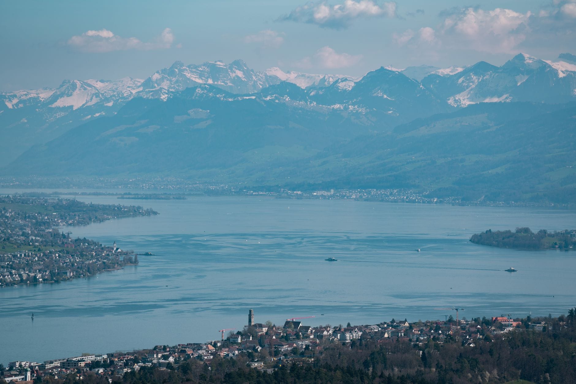
Zurich sits at the edge of one of Switzerland's most walkable landscapes. With over 3,000 km of signposted trails in the region, serious day hikes are reachable entirely by public transport. This guide covers the best routes, seasonal timing, and everything you need to plan a hike from the city.
Tickets & tours
Live prices and dates from our booking partner. If you book, we may earn a commission at no extra cost to you.
TL;DR
- The Zurich region has over 3,000 km of signposted hiking paths, most reachable by S-Bahn, train, or bus.
- Uetliberg is the closest proper ridge walk, 20-30 minutes from Zurich HB on the S10, with panoramic views over the city and Lake Zurich.
- You do not need a car or cable car for most top hikes near Zurich.
- Full mountain experiences like Rigi are under an hour away by train and cogwheel railway.
- Summer and early autumn are peak hiking season; check the best time to visit Zurich for seasonal conditions.
Why the Zurich Region Is Better for Hiking Than Most Visitors Expect
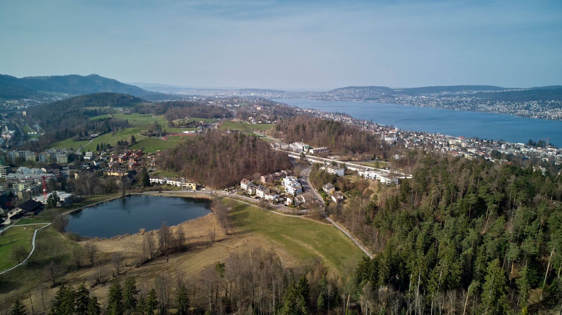
Zurich sits at 409 metres above sea level at the northwestern tip of Lake Zurich, with forested ridges rising immediately to the west and south of the city. The terrain within the canton is hilly rather than Alpine, which means trails are genuinely accessible year-round at lower altitudes, with proper mountain terrain (Rigi, Pilatus, Säntis) reachable in under 90 minutes by public transport. The Swiss hiking network in this region is among the best maintained in Europe, with yellow waymarkers guiding walkers on over 3,000 km of signposted paths.
The common assumption that you need to travel deep into the Alps for a satisfying hike is simply wrong here. Zurich's own backyard, from the Uetliberg ridge to the Greifensee nature loop, offers real walking with real views. For those who want to push further, the day trips from Zurich options expand the range considerably.
ℹ️ Good to know
Switzerland's hiking trails use a universal colour-coding system. Yellow signs indicate standard walking paths (Wanderweg) for all fitness levels. White-red-white markers signal mountain paths requiring sure-footedness. White-blue-white routes are alpine terrain for experienced hikers with proper equipment. Almost all trails near Zurich city are yellow-marked.
The Best Hikes Within or Just Outside Zurich City
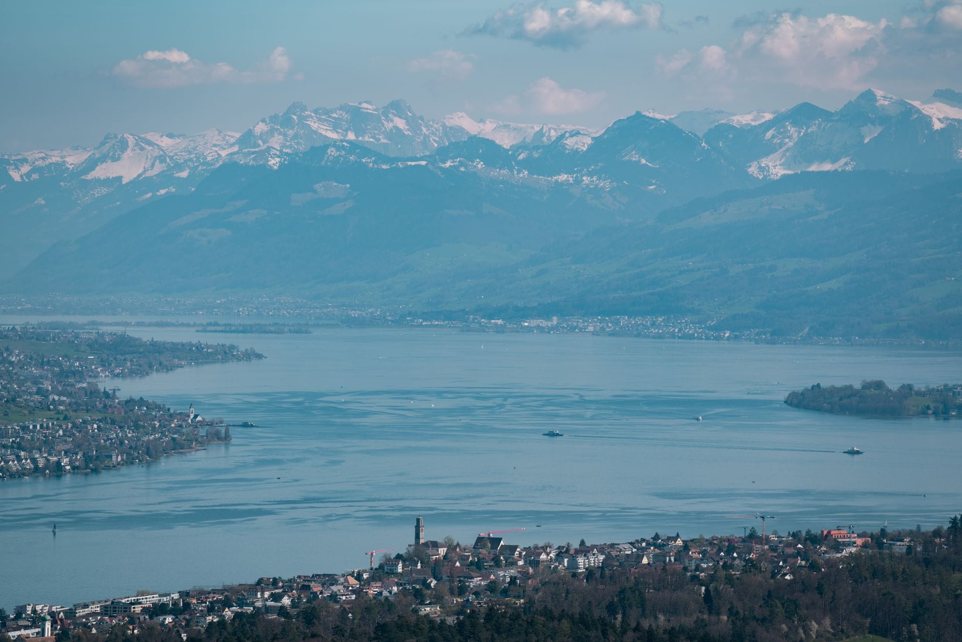
The Uetliberg summit is the most popular hike directly from Zurich, and for good reason. At 871 metres, it is the highest point within the city limits. The S10 S-Bahn line from Zurich HB reaches Uetliberg station in around 20-30 minutes, dropping you almost at the trailhead. From the summit, on a clear day, you can see across Lake Zurich to the Alps and north toward the Jura hills.
The Planetenweg (Planet Trail) extends the Uetliberg experience into a genuine ridge walk. The route runs from Uetliberg south to Felsenegg, around 6 km, with scale models of the solar system placed at intervals along the path corresponding to actual distances. The trail ends at Felsenegg, where a cable car descends to Adliswil and connects back to Zurich by tram. The full Uetliberg-to-Felsenegg walk takes roughly 2 to 2.5 hours at a moderate pace and is accessible to anyone in reasonable shape.
- Uetliberg Summit Loop Distance: 4-6 km depending on route variant. Access: S10 from Zurich HB to Uetliberg station (20-30 min). Difficulty: Easy to moderate. Best for: City views, first-time hikers, half-day outings.
- Planetenweg (Planet Trail: Uetliberg to Felsenegg) Distance: approx. 6 km one-way. Access: S10 to Uetliberg; return via Felsenegg cable car to Adliswil then tram. Difficulty: Easy to moderate. Best for: Families, ridgeline scenery, avoiding a return on the same trail.
- Greifensee Circular Walk Distance: approx. 18 km for the full lake circuit. Access: S-Bahn to Uster or Greifensee. Difficulty: Easy. Best for: Nature lovers, bird-watching, lakeside scenery in a quieter setting than Lake Zurich.
- Albis Ridge Walk (Albiskamm) Distance: variable, typically 10-15 km sections. Access: Bus or S-Bahn to trailhead villages. Difficulty: Moderate. Best for: Longer ridge days with continuous panoramic views and forest cover.
- Zurich to Baden Ridge Route Distance: roughly 25-30 km full route, hikeable in sections. Access: Train from Zurich HB to Baden for one-way walks. Difficulty: Moderate. Best for: Experienced day hikers wanting a proper cross-country trail.
💡 Local tip
For the Felsenegg cable car return on the Planetenweg, check current operating hours before you go. The cable car does not run all year and has seasonal schedules. Returning to Uetliberg on foot adds around 2 hours to your day if it is closed.
Mountain Day Hikes From Zurich: Rigi and Beyond
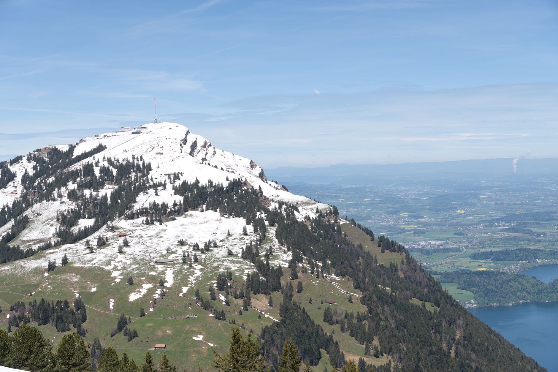
When walkers want proper Alpine terrain without an overnight, Rigi is the benchmark. Known historically as the 'Queen of the Mountains', Rigi sits between Lake Lucerne, Lake Zug, and Lake Lauerz, and the panorama from Rigi Kulm (1,797 m) on a clear day is genuinely exceptional. The standard approach from Zurich is by train to Arth-Goldau (around 45-60 minutes from Zurich HB), then cogwheel railway operated by Rigi Bahnen up to Rigi Kulm. Current timetables and ticket prices are available directly through Rigi Bahnen and SBB.
The smart approach is not to just ride up and ride back. Rigi has a well-developed hiking network across its ridges and through its pastures. A popular option is to take the cogwheel train up, hike for 2-4 hours across the ridge to a lower station like Rigi Kaltbad or Rigi Staffel, then descend by a different railway line to Vitznau and return to Zurich via the lake steamers to Lucerne and train back. This turns a simple excursion into a full circular day. Factor in around 5-7 hours total including transport.
Other mountain destinations within a 90-minute radius include Pilatus (accessible from Lucerne), Säntis in Appenzell, and the peaks above Toggenburg. These require more planning and are best suited to hikers with specific goals. The Zurich to Lucerne train is the natural starting point for Pilatus access, with a one-way journey of around 50 minutes to Lucerne.
⚠️ What to skip
Swiss mountain railways are popular and can be crowded on summer weekends, particularly from late June through August. If you plan a Rigi trip on a Saturday in July or August, buy tickets in advance and aim for an early departure from Zurich (before 8:30 am). Afternoon crowds at Rigi Kulm can be substantial.
Getting to Trailheads: Public Transport Is the Default
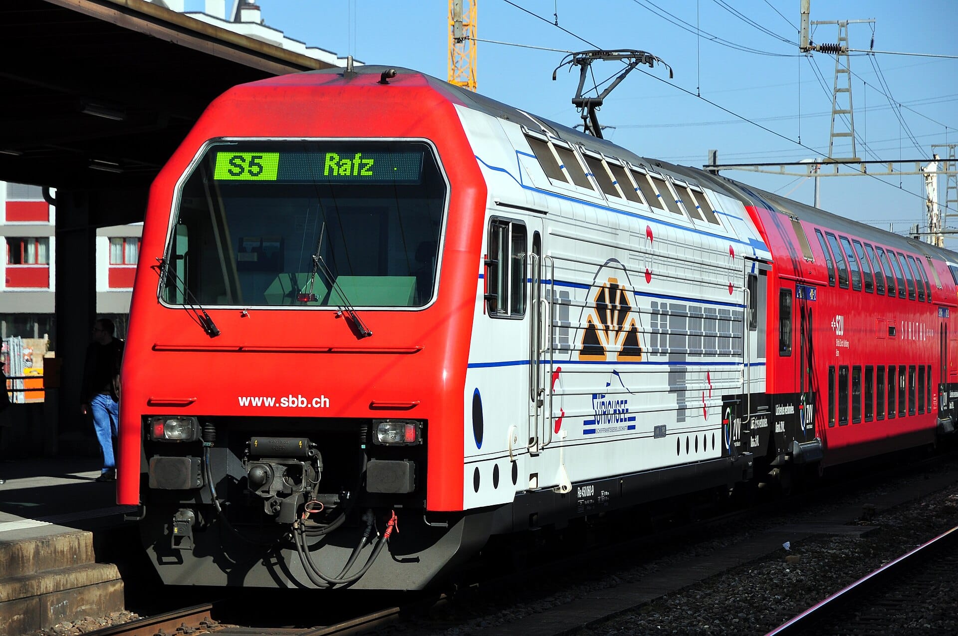
One of the genuine advantages of hiking near Zurich is that a car is not needed for the vast majority of routes. The ZVV (Zürcher Verkehrsverbund) network of S-Bahn trains, regional trains, trams, and buses covers the canton thoroughly. For trail access, the relevant services include the S10 for Uetliberg, S-Bahn lines to Uster and Greifensee for lakeside walks, and national rail (SBB) for longer day trips like Rigi. Current fares and timetables are available at the SBB and ZVV websites. If you are already using public transport around the city, check getting around Zurich for zone and ticket guidance.
For day trips to Rigi or Lucerne, the Swiss Travel Pass (if you are visiting Switzerland for multiple days) covers most of the transport including some mountain railways at reduced rates. For single-day excursions, point-to-point tickets via SBB are often the most cost-effective option. Prices fluctuate and should always be checked directly with the transport operator before your trip.
- S10 S-Bahn: Zurich HB to Uetliberg, every 30 minutes, approx. 20-30 min journey
- S-Bahn to Uster or Greifensee: for the Greifensee loop, from Zurich HB via S7 or S14
- Train to Arth-Goldau: for Rigi, direct trains from Zurich HB, approx. 45-60 min
- Train to Lucerne: around 50 minutes from Zurich HB, connects to Pilatus routes
- Bus connections: many Albis ridge trailheads served by PostBus and regional buses from nearby S-Bahn stations
Seasonal Conditions and When to Go
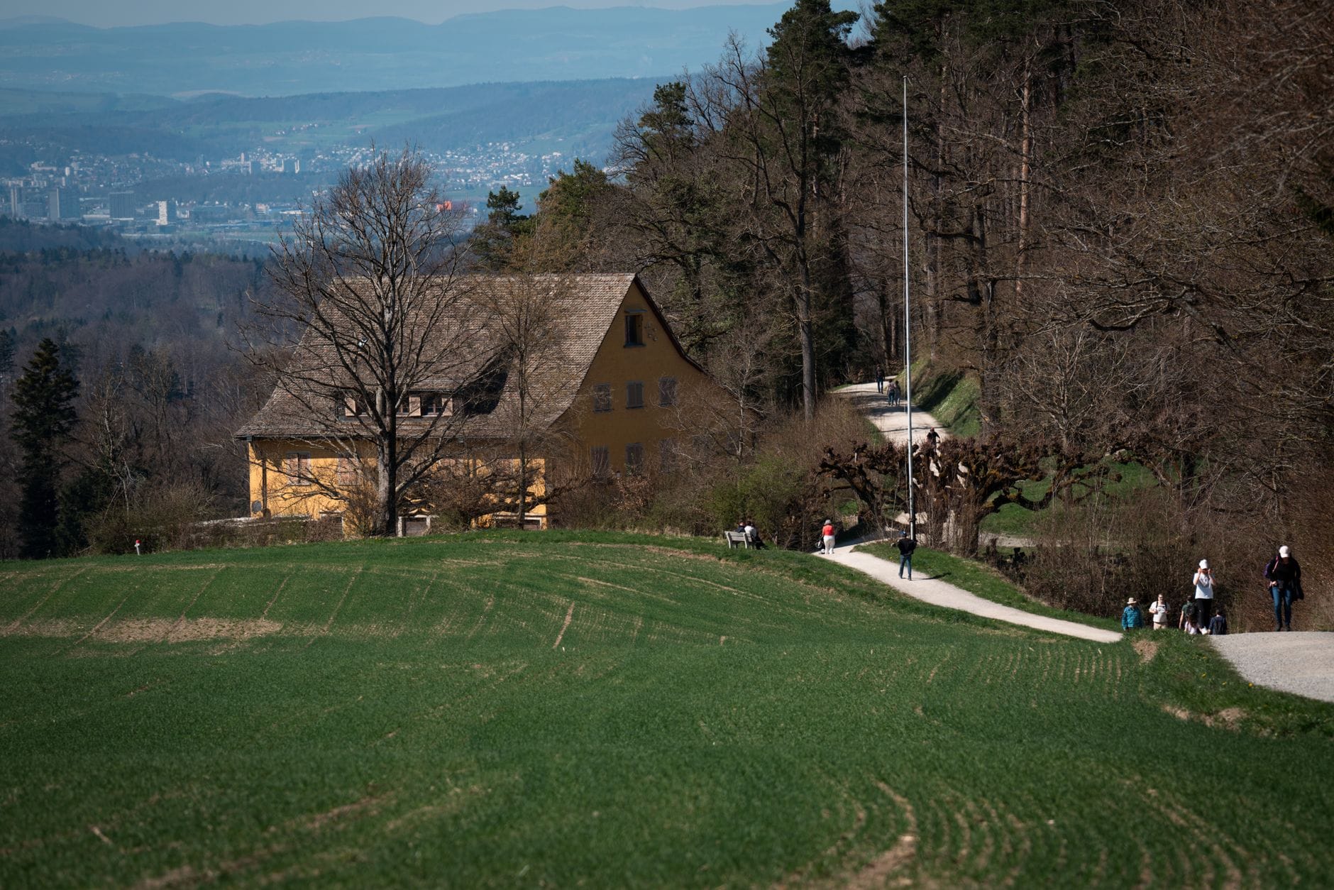
The main hiking season in the Zurich region runs from April through October. Trails at lower altitudes around the city, including the Uetliberg, Greifensee, and Albis routes, are accessible for most of the year. Higher routes toward Rigi and beyond may carry snow into April and from November onwards, though Rigi Bahnen marks specific winter hiking routes that remain open with reduced trail coverage. The summer in Zurich guide covers general conditions from June through August.
Late spring (May-June) offers a combination of mild temperatures, green landscapes, and fewer visitors than peak summer. Early autumn (September-October) brings clearer air than the hazy days of July and August, making it arguably the best season for long-range views from ridges and summits. The Voralpen and pre-Alpine hills around Zurich are particularly beautiful in October when forest colours are at their peak.
Winter hiking is possible but requires more care. Low-altitude forest paths around Zurich and the lakeside circuits remain usable in mild winters. Frost and ice on shaded sections of ridge trails can make standard footwear inadequate from December through February. If conditions look uncertain, the Swiss hiking portal (wandern.ch) and Zürich Tourism's hiking page carry current trail status updates.
✨ Pro tip
Autumn fog (Hochnebel) is a real factor in the Zurich lowlands from October through February. When the city is under a grey fog layer, Uetliberg and other ridges above 600-700 metres are often in brilliant sunshine above the cloud. Checking the MeteoSwiss forecast for the inversion layer before heading out can turn a grey city day into a spectacular above-the-clouds hike.
Practical Gear, Safety, and Planning Notes
For the yellow-marked trails around Zurich, standard walking shoes or trail runners are adequate in dry conditions. The Planetenweg and Greifensee circuit are well-surfaced enough for sturdy trainers. For ridge walks and longer routes, proper hiking boots with ankle support are recommended, particularly on the Albis ridge which has some uneven and rooty sections. For Rigi and other mountain terrain, proper hiking footwear is essential.
Water is available at fountains in Swiss villages along most routes, and Swiss tap water is safe to drink. Carry at least 1 litre per person for routes without guaranteed midpoint stops. Most hikes near Zurich pass through or near small villages with restaurants or Beizli (simple Swiss inns) where you can refuel. Prices at mountain restaurants tend to be higher than in the city, reflecting the transport costs. For more context on costs across the city, see the Zurich on a budget guide.
Switzerland's emergency number is 112, and mountain rescue can be reached through the general emergency system. For hiking-specific incidents in the Alps, Rega (Swiss Air Rescue) operates a dedicated app with GPS location sharing. Signal coverage in the Zurich pre-Alpine region is generally good, but expect gaps in deep valley sections. Download offline maps via apps like Swisstopo (the official Swiss federal mapping platform) or maps.me before you leave the city.
FAQ
Can I hike near Zurich without a car?
Yes, and this is actually the norm. The S-Bahn and regional bus network covers almost every major trailhead in the canton. Uetliberg is reachable directly from Zurich HB by S-Bahn in 20-30 minutes. Greifensee, the Albis ridge, and most other local routes also have public transport access. For mountain day trips like Rigi, national rail connections from Zurich HB are direct and frequent.
What is the easiest hike near Zurich for beginners?
The Greifensee circular walk is the most accessible option for beginners, covering mostly flat terrain around a lake nature reserve with excellent bird life. It is around 18 km for the full circuit but can be shortened by starting or ending at different S-Bahn stations. For a shorter outing with a rewarding view, the Uetliberg summit walk from the S10 station is around 30-45 minutes of uphill walking on a clear path.
Is Rigi worth the trip from Zurich?
Yes, on a clear day Rigi is one of the best mountain excursions in central Switzerland. The panorama from Rigi Kulm takes in multiple lakes and the full chain of Alpine peaks from the Bernese Oberland to the Glarus Alps. The practical advantage over other mountains is the train connection from Zurich to Arth-Goldau, which is under an hour, making it a comfortable full day trip without needing an early start. Weekends in summer are busy, so either go early or plan a weekday trip.
When is the best time of year to hike near Zurich?
May-June and September-October are the strongest months. Late spring offers green scenery and fewer crowds. Early autumn brings clearer air and better long-range views than the hazy peak summer period. The city-level trails like Uetliberg are usable year-round in mild weather, and winter fog inversions can actually make ridge hikes on clear winter days spectacular. Avoid scheduling mountain hikes (Rigi and above) without checking snow conditions from November through April.
Do I need special equipment for hiking near Zurich?
For most trails around the city itself, sturdy walking shoes or trail runners are fine in dry conditions. For longer ridge routes and anything in the mountains, proper hiking boots with grip and ankle support are recommended. Layers are important as ridge temperatures are lower than in the city, and afternoon thunderstorms are possible in summer. Download the Swisstopo app for offline maps, carry at least 1 litre of water per person, and check the MeteoSwiss forecast before departure.
Tickets & tours
Live prices and dates from our booking partner. If you book, we may earn a commission at no extra cost to you.
Planning a trip? Discover personalized activities with the Nomado app.