Mount Charleston (Charleston Peak): Las Vegas's High-Altitude Escape
Rising to 11,916 feet just 35 miles from the Las Vegas Strip, Mount Charleston is Clark County's highest peak and one of the most dramatic climate contrasts in the American West. Whether you come to hike to the summit, play in the snow, or simply breathe cooler air, the Spring Mountains National Recreation Area rewards every level of visitor.
Quick Facts
- Location
- Spring Mountains National Recreation Area, ~35 miles northwest of Las Vegas via US-95 and NV-157 (Kyle Canyon Road)
- Getting There
- Private car or rental only — no public transit serves the mountain. Drive north on US-95, then west on NV-157 approximately 16–17 miles to the Visitor Gateway.
- Time Needed
- 2–3 hours for a scenic drive and short walk; full day for summit hike (Charleston Peak South Loop is approximately 17.6 miles round-trip)
- Cost
- Most trails: free. Cathedral Rock Picnic Area parking: ~US$12–18 per vehicle depending on day of week. Visitor Gateway group sites: US$85–$120 depending on season.
- Best for
- Hikers, families escaping summer heat, photographers, snow-day seekers, and anyone needing a break from the Strip
- Official website
- www.gomtcharleston.com
What Mount Charleston Actually Is
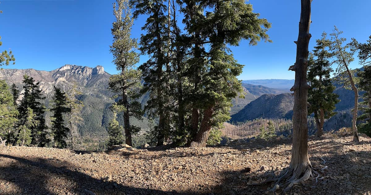
Mount Charleston, formally known as Charleston Peak, is the highest point in both the Spring Mountains range and all of Clark County, Nevada, standing at 11,916 feet (3,632 meters). It sits inside the Mount Charleston Wilderness, itself part of the Spring Mountains National Recreation Area managed by the U.S. Forest Service. From the Las Vegas Valley floor at roughly 2,000 feet, the drive up gains nearly 10,000 feet of elevation, passing through desert scrub, pinyon-juniper woodland, ponderosa pine, and finally subalpine bristlecone pine forest — a complete ecological journey compressed into about 45–60 minutes of driving.
The Southern Paiute people called this peak Nuvagantu, meaning 'where snow sits,' an accurate description even in modern times. Snow covers the upper slopes for more than half the year, and on clear winter days the white summit is visible from parts of the Las Vegas Strip, a jarring contrast to the neon below. This geographic relationship is the whole story of the place: extreme proximity to a major city, yet an entirely different world once you arrive.
ℹ️ Good to know
The Spring Mountains Visitor Gateway (2525 Kyle Canyon Road) is open daily 9:00–16:00, closed on December 25 (Christmas Day). Check current conditions and closures before any visit at gomtcharleston.com — weather at the summit can change in under an hour.
How the Mountain Feels at Different Times of Day
Arrive in Kyle Canyon before 8:00 a.m. on a summer weekend and the air is already 20–25 degrees Fahrenheit cooler than the Las Vegas Valley. The canyon smells of pine resin and damp soil, a smell so foreign to a desert city that it catches some visitors off guard. Birdsong — chickadees, nuthatches, Steller's jays — replaces the casino soundscape. Parking at Cathedral Rock Picnic Area and the main trailheads fills up quickly on summer Saturdays; by 10:00 a.m. on a holiday weekend, overflow cars line the canyon road.
Midday brings the most crowds to the picnic areas, which hum with families who drove up specifically to escape triple-digit heat in the valley. The pine canopy keeps these spots shaded and comfortable even at peak summer temperatures. By early afternoon in monsoon season (roughly July through September), cumulus clouds build over the summit with speed. If you are hiking above treeline, this is not a hypothetical concern: afternoon lightning at elevation is a real and documented hazard. Summit hikers should plan to descend well before noon during monsoon months.
Evening visits are quieter and, in spring and fall, genuinely cold at the trailheads. Sunset turns the limestone ridgelines orange, and the canyon darkens quickly once the sun drops. The drive back to Las Vegas at night has its own reward: the valley lights spread across the basin below as you descend, one of the better views of the city available without a paid observation deck.
Tickets & tours
Hand-picked options from our booking partner. Prices are indicative; availability and final rates are confirmed when you complete your booking.
Go City | Las Vegas All-Inclusive Pass
From 140 €Instant confirmationFree cancellationGolden Eagle West Rim helicopter tour with Hoover Dam and Lake Mead
From 401 €Instant confirmationFree cancellationGrand Canyon 6-in-1 tour
From 417 €Instant confirmationFree cancellationHighlights Over the Grand Canyon air tour from Las Vegas
From 195 €Instant confirmationFree cancellation
The Hikes: From Easy Walks to the Summit
The Spring Mountains National Recreation Area maintains a range of trails for different fitness levels. The Acastus Trail near the Visitor Gateway is a paved, wheelchair-accessible loop suitable for families with strollers or visitors with mobility limitations. It gives a genuine sense of the forest without any significant elevation gain.
For those comfortable with moderate terrain, trails like the Cathedral Rock Trail and Echo Trail offer meaningful elevation gain, canyon views, and exposure to the mountain's limestone formations without committing to a full-day effort. These are where most casual hikers end up, and they deliver solid scenery for 2–4 hours of effort.
The Charleston Peak South Loop is the main route to the summit, covering approximately 17.6 miles round-trip with around 4,000 feet of elevation gain from the Cathedral Rock Picnic Area trailhead. Parking at this trailhead costs approximately US$8 per vehicle. This is a strenuous full-day hike: experienced hikers in good condition typically complete it in 8–12 hours. The upper section passes through ancient bristlecone pine groves, some of the oldest living trees in the world, before breaking into open ridge terrain with views across the Mojave Desert. On a clear day you can identify the Spring Mountains' ridgeline extending south. For broader context on the region's outdoor options, the hiking near Las Vegas guide covers the full range of trails accessible from the city.
⚠️ What to skip
Altitude matters here. Las Vegas sits at ~2,000 feet; the Charleston Peak summit is at 11,916 feet. Visitors not acclimated to elevation may experience headaches, fatigue, or shortness of breath. Ascending too quickly — which a car-to-summit hike essentially forces — increases this risk. Drink extra water, pace yourself, and turn back if you feel unwell.
Winter and Snow Play
Mount Charleston is where Las Vegas locals go when they want snow without a flight to Utah. In a good snow year, the upper canyon road and designated snow-play areas see genuine accumulation from November through March, sometimes into April. Families arrive with sleds and tire tubes, and the roadside transforms into an impromptu winter park. The atmosphere is loose and informal, more neighborhood snowday than resort experience.
Lee Canyon, on the mountain's north side via NV-156 (a separate road from Kyle Canyon), operates a small ski and snowboard resort — Lee Canyon Ski Resort — with lifts, rentals, and terrain suitable for beginners and intermediate skiers. It is not a destination resort by any measure, but for Strip visitors who want to ski on a whim, it is genuinely convenient. Check Lee Canyon's official site for current lift operations and conditions before driving up, as closures for insufficient snowpack are common in dry years.
During winter weekends after a fresh snowfall, traffic on NV-157 and NV-156 can back up significantly. Nevada Department of Transportation sometimes requires chain controls or restricts access entirely during severe storms. Checking road conditions via the Nevada 511 system before departure is not optional in winter — it is the difference between a great day and a long, cold wait in your car.
Practical Logistics: Getting There and What to Bring
There is no public transit to Mount Charleston. A rental car or personal vehicle is the only practical option. From the Strip, take I-15 North to US-95 North, then exit onto NV-157 (Kyle Canyon Road) and follow it approximately 16–17 miles into the canyon. Total drive time from the Strip is 45–60 minutes under normal conditions, longer on busy weekends when canyon road traffic slows.
Dress in layers regardless of the season. Summer temperatures at the summit can be 30–40 degrees Fahrenheit cooler than Las Vegas, and afternoon thunderstorms can drop temperatures further with no warning. In spring and fall, sub-freezing temperatures at the trailheads are possible. Sturdy, closed-toe footwear is appropriate for any trail beyond the paved Acastus loop; the limestone terrain on upper trails is uneven and loose in places. Bring more water than you think you need — a general minimum of half a liter per hour of hiking — and note that water is not available at most trailheads.
Cell coverage is unreliable above the lower canyon. Download offline maps before leaving Las Vegas and leave a trip plan with someone who is not going with you. The Spring Mountains Visitor Gateway staff can advise on current trail conditions — it is worth a stop before heading to trailheads, especially for first-time visitors. For those planning a broader desert day trip, the day trips from Las Vegas guide situates Mount Charleston alongside other options like Red Rock Canyon and Valley of Fire.
Photography and Viewing
The peak is photogenic at multiple scales. From the Las Vegas Valley, the snow-capped summit makes a striking backdrop for Strip photography in winter — position yourself on an elevated west-facing deck and you can frame the mountain against the resort skyline. Closer in, the canyon's limestone cliffs catch golden light in the hour after sunrise and before sunset, with the North Loop and Cathedral Rock areas offering particularly defined ridgelines.
On the summit itself, the 360-degree panorama takes in the Mojave Desert, the Las Vegas Valley, and on clear days, the Sierra Nevada to the northwest. Midday light is flat and harsh above treeline; early morning starts — required anyway to avoid afternoon storms — produce far better summit photography. Wildflower blooms in the subalpine zone typically occur in July and early August, with locoweed, penstemon, and columbine adding color to otherwise rocky terrain. The Spring Mountains are also home to the endemic Charleston Mountain pricklypear and several plant species found nowhere else on Earth, a detail worth noting for nature photographers. Those interested in more structured scenic drives through the surrounding region might look at Red Rock Canyon Scenic Drive, accessible from the south side of the Spring Mountains.
Honest Assessment: What Mount Charleston Is and Isn't
This is not a polished national park experience with interpretive exhibits at every turn, smooth paved trails, and ranger-led programs every hour. The infrastructure is functional but modest: some trailheads have pit toilets, most do not have water, and the canyon road's amenities are limited to a few picnic areas and the visitor center. The appeal is the mountain itself — the ecology, the elevation, the contrast with the desert city below.
Visitors expecting a curated, resort-style outdoor experience will be underwhelmed. Visitors who want genuine wilderness within an hour of a major city, including real wildlife (mule deer, wild horses near the lower slopes, and the endemic Palmer's chipmunk found only in the Spring Mountains), real weather, and real elevation, will find Mount Charleston one of the more surprising outdoor destinations in the American Southwest. It pairs well with a Las Vegas trip for anyone interested in outdoor contrast — see the things to do in Las Vegas guide for how to integrate outdoor days into a broader itinerary.
People who should skip the summit hike: those with heart or respiratory conditions not adapted to elevation, young children who cannot sustain a full-day effort, and anyone visiting in a multi-day group where hiking is a minority interest. The scenic drive and picnic areas work for those groups. The summit is for hikers who have done their homework.
Insider Tips
- Start summit hikes no later than 5:00–6:00 a.m. in summer and monsoon season. This gets you above treeline and descending before the afternoon lightning window opens. Most parties that turn back due to weather started too late.
- The Cathedral Rock Picnic Area parking lot (US$12–18/vehicle depending on day) fills completely by mid-morning on summer weekends. Arrive before 8:00 a.m. or plan to walk a significant distance from roadside overflow parking. Weekday visits are dramatically quieter.
- The Spring Mountains Visitor Gateway is a genuinely useful stop, not just a formality. Staff post current trail conditions, recent wildlife sightings, and snow or fire closure updates on a board inside the entrance — information not always reflected on websites.
- For snow days in winter, NV-157 is the scenic canyon road experience; NV-156 (Lee Canyon Road) gets you to the ski area. They connect via NV-158 (Deer Creek Road) in some seasons, but this connector road is often closed in winter due to snow — verify before planning a loop route.
- The bristlecone pine groves on the upper Charleston Peak trail are among the oldest living organisms on Earth, some exceeding 3,000 years. Slow down when you reach them. These trees look dead and tortured; that is what 3,000 years of alpine survival looks like.
Who Is Mount Charleston (Charleston Peak) For?
- Experienced hikers looking for a serious day hike within driving distance of a major city
- Las Vegas visitors in summer who want to spend a day somewhere that is not 108°F
- Families with older children looking for pine forest, picnic areas, and seasonal snow play
- Photographers seeking dramatic landscape contrast: desert, forest, and limestone ridgelines in one location
- Nature and ecology enthusiasts interested in endemic species and Great Basin mountain ecosystems
Nearby Attractions
Combine your visit with:
- Antelope Canyon
Antelope Canyon is a series of sculpted slot canyons carved into Navajo Sandstone near Page, Arizona, and one of the most visually striking natural formations in the American Southwest. Accessible only on guided tours led by licensed Navajo guides, it requires advance planning but rewards visitors with an experience unlike anywhere else within day-trip range of Las Vegas.
- Area 51 & Extraterrestrial Highway
Nevada State Route 375, officially designated the Extraterrestrial Highway in 1996, is a 98-mile desert drive skirting the perimeter of the most famous restricted military installation on Earth. It costs nothing to drive, demands serious preparation, and delivers a genuinely remote American landscape that few Strip visitors ever see.
- AREA15 Immersive Entertainment Complex
AREA15 is a 35-acre immersive entertainment and events district just off the Las Vegas Strip, packed with art installations, bizarre interactive experiences, bars, and ticketed attractions like Omega Mart. Daytime entry is free, but the real substance costs extra — and it's worth understanding the pass tiers before you arrive.
- Death Valley National Park
Just two hours from the Las Vegas Strip, Death Valley National Park is the hottest, driest, and lowest national park in the United States. From the salt flats of Badwater Basin to the sculpted dunes of Mesquite Flat, it rewards early risers and well-prepared visitors with landscapes found nowhere else on Earth.