Doi Inthanon Summit: Standing at the Top of Thailand
At 2,565 metres above sea level, the Doi Inthanon summit is the highest point in Thailand. The peak sits inside Doi Inthanon National Park, roughly 70 kilometres southwest of Chiang Mai, and draws visitors for its cloud forest ecology, dramatically cooler temperatures, and the sense of standing above everything else in the country.
Quick Facts
- Location
- Doi Inthanon National Park, ~70 km southwest of Chiang Mai
- Getting There
- Car or scooter via Route 108 to Hwy 1009; songthaew from Chom Thong market or private tour
- Time Needed
- 1–2 hours at the summit; 5–8 hours for a full park day trip
- Cost
- National park entrance: 300 THB for foreign adults (150 THB children), 60 THB for Thai adults (30 THB children)
- Best for
- Nature lovers, birdwatchers, photographers, cold-weather seekers
What the Summit Actually Is
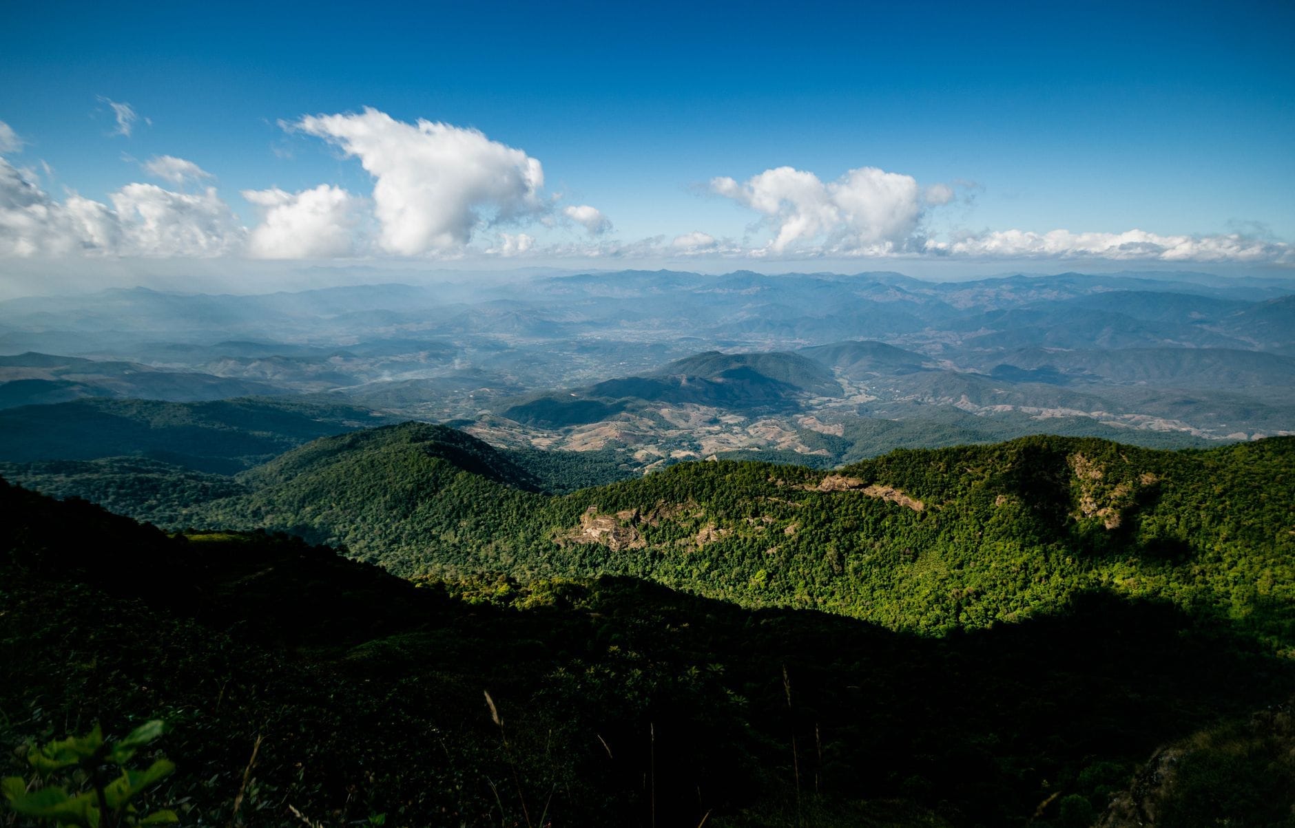
The Doi Inthanon summit is not a dramatic cliff edge or a sweeping panorama viewpoint. At 2,565 metres, it is the roof of Thailand: a rounded, heavily forested peak where the trees are shorter and stranger than anything you will see in the lowlands, draped in moss so thick it muffles sound. The air here carries a damp, woody coolness that feels genuinely alpine, not just refreshing. On most mornings, cloud drifts through the tree trunks at eye level.
The centrepiece of the summit area is a small chedi, or stupa, built to enshrine the ashes of King Inthawichayanon, a 19th‑century ruler of Chiang Mai, who died in 1897. He was said to have loved this mountain deeply and requested that his remains be placed here. The stupa is modest in scale but carries real historical weight, and it gives the summit a quiet ceremonial atmosphere that distinguishes it from a purely scenic stop.
ℹ️ Good to know
Doi Inthanon National Park is open daily from approximately 05:30 to 18:30. The summit road is accessible by vehicle. The park entrance fee is 300 THB for foreign adults (150 THB for children) and 60 THB for Thai adults (30 THB for children).
How the Summit Changes Through the Day
Arriving before 09:00 gives you the best chance of seeing the cloud forest in full atmospheric mode: mist pooling between the trees, the sound of the Rufous-bellied Niltava or the Gould's Sunbird somewhere overhead, and very few other visitors on the short boardwalk loop around the stupa. The boardwalk, roughly 250 metres long, circles through the moss forest and is one of the most ecologically distinctive short walks in all of northern Thailand.
By late morning, especially on weekends and during the November to February cool season, the summit can become genuinely crowded. The car park fills, selfie sticks emerge at the altitude marker sign, and the meditative quality dissolves. This is not necessarily a dealbreaker, but it is worth knowing. If you are arriving on a tour bus schedule and reaching the summit around 10:30 or 11:00, manage your expectations.
Afternoons often bring cloud cover that obscures rather than enhances. Rain is possible at almost any time of year due to the altitude. By 14:00, the temperature, already the coldest in Thailand by a wide margin, can feel genuinely biting in wind-exposed spots. A packable rain jacket and an extra layer are not optional here.
💡 Local tip
Aim to reach the summit between 07:00 and 09:00 for mist, birdsong, and minimal crowds. Leaving Chiang Mai by 05:30 makes this achievable.
Tickets & tours
Hand-picked options from our booking partner. Prices are indicative; availability and final rates are confirmed when you complete your booking.
Doi Inthanon National Park small group guided tour
From 34 €Instant confirmationFree cancellationPrivate day trip with professional driver in Doi Inthanon
From 146 €Instant confirmationFree cancellationChiang Mai - Doi Inthanon full day tour
From 41 €Instant confirmationFree cancellationPrivate van with driver for 1 day, Pha Chor and Doi Inthanon
From 151 €Instant confirmationFree cancellation
The Cloud Forest Ecology: What Makes This Place Unusual
Below 2,000 metres, Doi Inthanon is hill forest, unremarkable to the casual visitor. The summit zone is different. The vegetation belongs to a plant community called upper montane forest, sometimes called elfin forest, where the constant moisture and lower oxygen levels stunt tree growth. Oaks, laurels, and rhododendrons rarely grow taller than six metres, and almost every surface, trunk, branch, and root, is coated in liverworts, ferns, and cushion mosses. The effect is slightly surreal, as if the forest is upholstered.
Doi Inthanon National Park records over 380 bird species, and the summit zone holds several that are found nowhere else in Thailand. The Green-tailed Sunbird, the Ashy-throated Warbler, and various flycatchers concentrate here because the habitat exists nowhere lower in the country. Birdwatchers treat this as one of Southeast Asia's premier birding locations, and spending an hour on the boardwalk in the early morning with binoculars will usually reward patience.
The summit also records the coldest temperature ever measured in Thailand: -8°C, in January 1974. That extreme is rare, but temperatures below 5°C are not unusual on winter nights, and even during the day in December and January, 8 to 12°C is standard at the peak.
The Boardwalk and Summit Stupa: A Practical Walkthrough
From the car park at the summit, a short paved path leads to the King Inthawichayanon stupa. The stupa sits in a cleared area where visitors can walk around it freely. It is a working religious site, and shoes can be left on. The atmosphere is low-key, more contemplative rest stop than active temple, but the location makes it genuinely moving: the highest point in the country, the ashes of a king who loved this mountain, and cloud moving through the trees on all sides.
The boardwalk loop departs from near the stupa and winds through the upper montane forest. The boards can be slippery when wet, which is frequently. Wear shoes with grip. The walk is flat and takes about 20 minutes at a relaxed pace, with interpretive signs explaining the ecology at intervals. This is one of the few places in Thailand where you can experience genuine cloud forest on foot without technical hiking.
⚠️ What to skip
The boardwalk can be extremely slippery after rain. Flip-flops or flat-soled sandals are genuinely dangerous here. Bring closed shoes with rubber soles.
Getting to the Summit from Chiang Mai
The most flexible option is self-driving. Take Route 108 south from Chiang Mai toward Chom Thong, then turn onto Highway 1009, which climbs the mountain through the national park. The drive from Chiang Mai takes roughly 90 minutes to 2 hours depending on traffic, and the road past the park entrance continues all the way to the summit car park. The switchbacks in the upper section are tight but manageable for most vehicles and experienced scooter riders.
For those without a vehicle, joining an organised day trip from Chiang Mai is the most practical solution. These typically include transport, the park entrance fee, and stops at other park highlights such as the Royal Twin Pagodas, Wachirathan Waterfall, and sometimes the Kew Mae Pan nature trail. See the complete Doi Inthanon day trip guide for tour operators and self-drive logistics.
A songthaew from Chom Thong market to the summit is theoretically possible but requires coordination and is rarely practical for independent travellers without Thai language ability. Motorcycle taxis operate on the lower sections but not to the peak.
What to Wear and Bring
This sounds obvious but is genuinely underestimated by visitors arriving from Chiang Mai's heat: pack for cold and wet conditions. Even in March or April, the summit sits 15 to 20 degrees cooler than the city. In January, the difference can be 25 degrees. A fleece or down layer, a waterproof jacket, and long trousers are practical, not excessive.
A small stall near the summit car park sells simple food and hot drinks, and there is a warming area with electric heaters that fills up fast on cold mornings. Do not rely on this as your primary source of warmth.
💡 Local tip
Photography at the summit is best during the misty early morning hours. A polarising filter helps cut glare on the moss. The altitude marker sign is a popular photo spot, but lines form quickly after 09:00.
Who Should Temper Their Expectations
If you are expecting a summit viewpoint with sweeping 360-degree views across Thailand, the Doi Inthanon summit will disappoint. The forest is too dense, and cloud cover is too frequent for long-distance visibility. The appeal here is ecological and atmospheric, not panoramic. Travellers who need a dramatic visual payoff to justify the drive may find the Royal Twin Pagodas, a few kilometres below the summit, more photogenic.
People with mobility constraints should know that the boardwalk has uneven boards and no handrails in most sections. The area around the stupa is accessible, but the full loop is not ideal for wheelchairs or walkers. For a broader look at accessible nature experiences in the park, the Chiang Mai parks and green spaces guide covers terrain grades across the region.
Insider Tips
- The altitude marker sign (the white post marking 2,565m) is what most visitors photograph. To avoid queues, walk past it on arrival and return when the crowds thin around 15:00, when many tour groups have already left.
- The summit area is one of the few places in Thailand where you can reliably see your breath in the morning air, even in October. This surprises visitors from tropical lowlands more than almost anything else.
- Birdwatchers should bring binoculars and arrive as early as the park opens. The first 90 minutes of daylight produce the most bird activity along the boardwalk. A local birding guide from Chom Thong can identify species by call.
- The small warming station near the car park sometimes sells Doi Inthanon coffee, grown on the mountain slopes by hill tribe communities. It is worth trying on site rather than buying packaged versions in Chiang Mai city.
- If you are combining the summit with the Royal Twin Pagodas and a waterfall, visit the summit first before the cloud breaks. By midday, the pagodas and lower park areas are usually clearer and sunnier.
Who Is Doi Inthanon Summit For?
- Nature and ecology enthusiasts who appreciate cloud forest environments over scenic overlooks
- Birdwatchers targeting upper montane species found nowhere else in Thailand
- Photographers seeking mist, moss, and soft morning light rather than big views
- Visitors who want to experience genuine cold weather, a novelty in tropical Thailand
- Travellers on a Doi Inthanon full-day itinerary combining the summit with waterfalls and the Twin Pagodas
Nearby Attractions
Other things to see while in Doi Inthanon National Park Area:
- Doi Inthanon Royal Twin Pagodas
Set high on the slopes of Thailand's tallest mountain, the Royal Twin Pagodas are two elaborately decorated chedis surrounded by manicured gardens and often wreathed in mist. Built to honor King Bhumibol Adulyadej and Queen Sirikit, they represent some of the finest contemporary Lanna Buddhist craftsmanship in northern Thailand.
- Kew Mae Pan Nature Trail
The Kew Mae Pan Nature Trail is a 3-kilometre loop at the summit zone of Doi Inthanon National Park, winding through cloud forest and open ridgelines above 2,200 metres. On clear days, the views stretch across layered mountain ranges into Myanmar. This is one of northern Thailand's finest short hikes, and one of the coldest places you will stand in the country.
- Wachirathan Waterfall
Wachirathan Waterfall is the largest and loudest waterfall in Doi Inthanon National Park, dropping over 80 metres in a wide curtain of white water that generates a constant cool mist. Set deep in montane forest roughly 21 kilometres from the park entrance, it rewards visitors with raw natural power rather than picture-perfect serenity.