Bloomingdale Trail (The 606): Chicago's Elevated Greenway Above the Northwest Side
Built on a former elevated railway line, the Bloomingdale Trail threads 2.7 miles through some of Chicago's most dynamic northwest-side neighborhoods. Completely free and open daily, it offers a car-free corridor above street level for walking, running, and cycling, with sweeping city views and ground-level parks at every access point.
Quick Facts
- Location
- Bloomingdale Ave (~1800 N), from Ashland Ave (1600 W) to Ridgeway Ave (3750 W), Chicago
- Getting There
- CTA Blue Line: Damen or Western stations
- Time Needed
- 1–3 hours depending on pace and stops
- Cost
- Free
- Best for
- Joggers, cyclists, dog walkers, architecture fans, photographers
- Official website
- www.the606.org
What Is the Bloomingdale Trail?
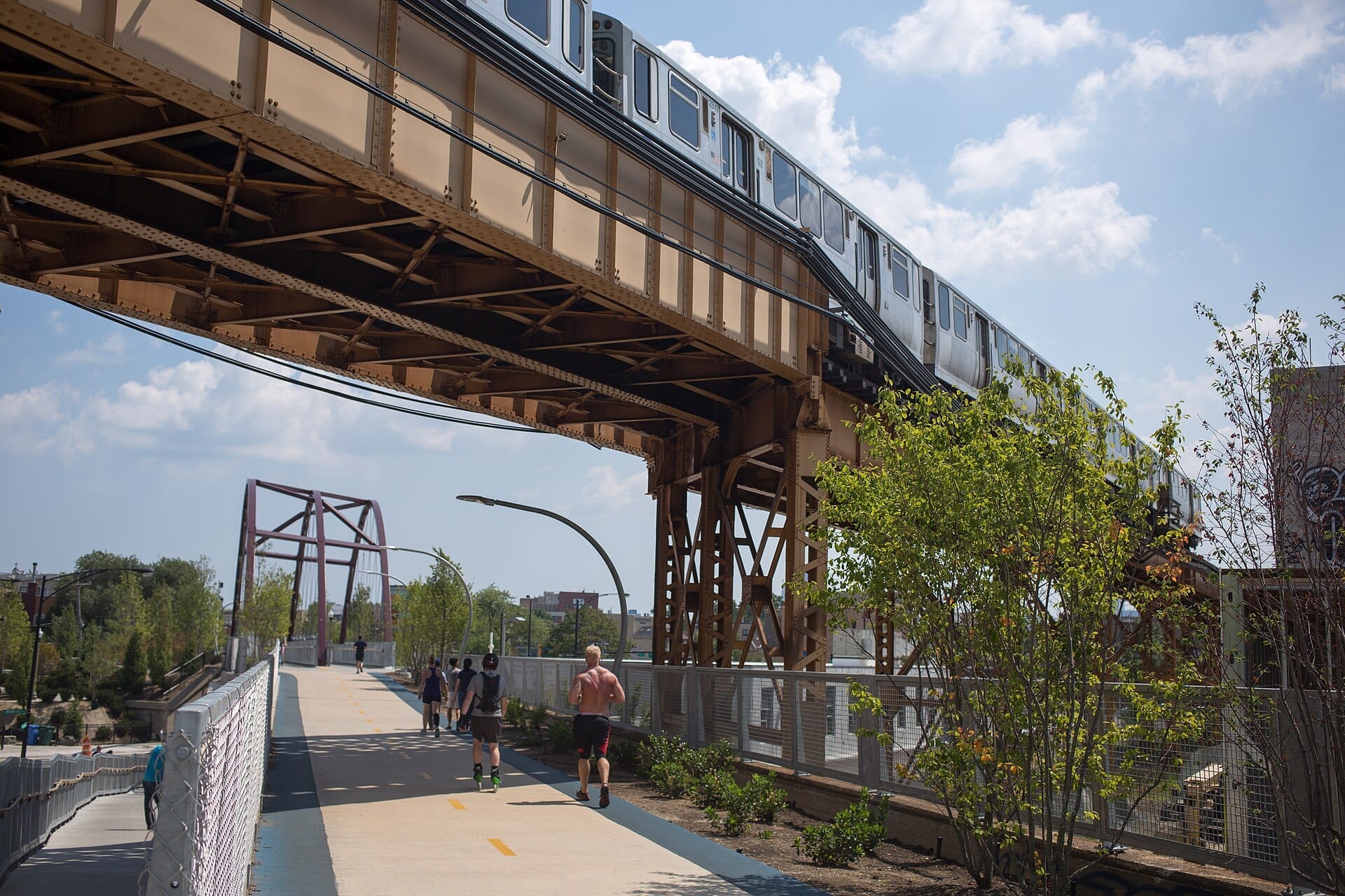
The Bloomingdale Trail, the elevated centerpiece of Chicago's The 606 park system, is a 2.7-mile (4.3 km) linear greenway running along a former elevated freight railway above Bloomingdale Avenue on Chicago's Northwest Side. Opened in 2015, it passes through four distinct neighborhoods: Logan Square, Humboldt Park, and West Town, and links into adjacent Wicker Park and Bucktown. The trail sits roughly 17 feet above street level for much of its length, giving users a perspective on the city that is simply not available from the sidewalk.
The park covers about 15.6 acres and is recognized as the longest greenway on a former elevated rail line in the Western Hemisphere, second globally only to Paris's Promenade plantée René-Dumont. That comparison is apt in more ways than one: like its Parisian counterpart, the trail creates an unexpected layer of green above an otherwise dense urban grid, with plantings, benches, and art installations woven along its 10-foot-wide paved path.
ℹ️ Good to know
The 606 is open daily 6:00 a.m. to 11:00 p.m., year-round. No ticket or registration is required. No motorized vehicles are permitted on the trail itself.
The Sensory Experience: What a Walk Actually Feels Like
Step up onto the trail via one of the 12 access points (spaced roughly every quarter-mile) and the sound of Chicago changes immediately. Traffic noise drops to a low ambient murmur, replaced by wind, birdsong, and the rhythmic thud of running shoes. Below you, the city carries on in full: delivery trucks negotiate narrow side streets, corner stores prop their doors open in summer, and two- and three-flat apartments crowd right up to the old rail embankment.
In spring and early summer, the planted edges of the trail bloom with native grasses, coneflowers, and sedums selected for the thin, elevated growing conditions. The palette shifts from green-gold in May to a deeper, wilder texture by August. In October, the grasses turn rust and amber, and the trail offers some of the best foliage views in the city precisely because you are looking at roof-level treetops rather than trunks.
Winter is a different proposition. Snow accumulation on the elevated path can make surfaces icy and uneven, and the exposed position means wind chill is noticeably sharper here than on street-level routes. The Chicago Park District does not guarantee snow clearance across all sections. That said, a clear winter morning on the 606, with fresh snow on the plantings and the city spread out to the south and east, is genuinely arresting for anyone willing to layer up.
Tickets & tours
Hand-picked options from our booking partner. Prices are indicative; availability and final rates are confirmed when you complete your booking.
Go City | Chicago All-Inclusive Pass
From 127 €Instant confirmationFree cancellationiFLY Chicago Lincoln Park indoor skydiving experience
From 126 €Instant confirmationFree cancellationiFLY Chicago Rosemont indoor skydiving tickets
From 117 €Instant confirmationFree cancellationChicago lakefront neighbourhood bike tour
From 18 €Instant confirmationFree cancellation
History: From Freight Line to Public Greenway
The Bloomingdale Line was built in the 1870s as a Chicago & Pacific Railroad freight corridor, elevated to eliminate the grade crossings that were causing constant accidents on the flat Chicago grid. For over a century it carried industrial freight along the northwestern edge of the city's densely packed residential neighborhoods. By the 1990s, freight use had declined to almost nothing, and the rusting elevated structure sat dormant while community groups debated what to do with it.
The conversion project began taking shape in the 2000s through a coalition of neighborhood advocacy groups, the Chicago Park District, and the City of Chicago, with significant funding from the federal Department of Transportation and private donors. The trail opened on June 6, 2015. The name 'The 606' refers to the first three digits of Chicago's ZIP codes, a nod to the idea that the trail belongs to every part of the city rather than any single neighborhood.
The trail's legacy is not without complexity. Shortly after opening, urban researchers noted a measurable acceleration in property value increases in the adjacent blocks, a pattern that raised gentrification concerns in Humboldt Park and Logan Square. That context is worth knowing as you walk the trail: the tension between public investment and neighborhood displacement is part of the story. For more on how Chicago neighborhoods are shifting, the Chicago neighborhoods guide offers useful background.
How to Walk the Trail: A Practical Orientation
The trail runs roughly east to west. The eastern terminus at Ashland Avenue (the Walsh Park access point) is the most convenient entry for visitors arriving via the CTA Blue Line from Damen station, about a 10-minute walk north. The western terminus near Ridgeway Avenue on the city’s Northwest Side is less visited and quieter. Most people walk or run the full out-and-back length (5.4 miles total) or combine a one-way traverse with a CTA bus return.
Cyclists share the main 10-foot-wide paved surface with pedestrians; the rubberized running tracks on each side are designated for runners. On busy weekend afternoons, this can feel slightly crowded near the eastern end, where Wicker Park and Bucktown foot traffic is highest. Heading west past the Humboldt Boulevard access, the trail thins out considerably. The width is enough to accommodate comfortable passing, but cyclists should signal before overtaking pedestrians.
💡 Local tip
The Damen Blue Line station drops you at the corner of Damen and Milwaukee, roughly equidistant from two trail access ramps. Walk north about 10 minutes to reach the trail. From Western station, head north on Western Avenue to the trail entrance at the 606 Trail & Park.
There are no cafes or food vendors on the trail itself. However, the ground-level parks at each major access point often have water fountains (operational spring through fall), and the surrounding streets are dense with coffee shops and takeaway spots in the Wicker Park and Bucktown sections. The Damen and Milwaukee corridor, just south of the trail's eastern section, is one of the more concentrated stretches of independent food and drink in Chicago.
If you are combining this visit with other nearby attractions, Wicker Park, Bucktown, and Logan Square are all walkable from trail access points, and each has a distinct street-level character worth exploring before or after your walk.
Time of Day and Seasonal Considerations
Early mornings, particularly on weekdays, are when the trail feels most contemplative. Joggers move in clusters, dogs pull at leads, and the low-angle light comes in from the east across the plantings. By 9 a.m. on a Saturday in June or July, the Wicker Park end fills with weekend energy: families with strollers, cyclists in groups, people pausing to photograph the skyline sightlines to the southeast.
Midday in summer is the least comfortable stretch: the trail's elevation and relatively sparse canopy mean full sun exposure with limited shade. Bring water and sunscreen if you plan to walk the full length on a hot day. Late afternoon in September is arguably the sweetest time: the summer crowds thin, the light turns golden, and the native plantings are at their most textured and colorful.
⚠️ What to skip
The trail offers very little shade for most of its length. On hot summer days above 85°F (29°C), visit early morning or late afternoon. The trail is fully exposed to wind in winter; dress in proper layers if visiting between December and February.
Photography and Views
The Chicago skyline is visible from several points along the trail, particularly from the eastern section near Ashland and from elevated bends near Damen Avenue. The view is not the panoramic sweep of the Willis Tower or Navy Pier, but it is distinct: a mid-distance cityscape glimpsed between rooftops and above tree canopy, with the elevated track geometry framing the image. This is a photographic perspective you cannot replicate from street level.
The trail's infrastructure itself is photogenic: the steel railing and concrete parapet of the old railway, now softened by plantings, creates a repeating geometric frame along each straightaway. The access ramps, designed with clear sightlines and gentle curves, photograph well in both directions. Early morning light from the east is best for the western sections; the eastern section near Walsh Park photographs better in the softer light of late afternoon.
For broader context on Chicago's elevated infrastructure and architectural legacy, the Chicago architecture guide covers the city's elevated rail tradition and its influence on neighborhood form.
Accessibility, Rules, and Practical Notes
All 12 access ramps along the trail are designed to be accessible to people with disabilities, meeting ADA compliance standards. The paved surface is consistent and maintained. Cyclists, skateboarders, and inline skaters are permitted; e-bikes are allowed. No motorized vehicles and no commercial use are permitted on the trail surface.
Dogs are welcome on leash. The ground-level parks at each access point typically have space for pets, though waste stations are the user's responsibility to locate. The park has no permanent restroom facilities on the elevated trail itself; restroom access depends on the ground-level park areas, and availability varies by access point. Plan accordingly, especially for longer walks with children.
The 606 is managed by the Chicago Park District in partnership with the City of Chicago. For the most current trail conditions, closures, and programming updates, check free things to do in Chicago for context on other no-cost public spaces in the city, many of which connect naturally to a 606 visit.
Insider Tips
- Enter from the western Ridgeway Avenue terminus if you want a quiet, uncrowded experience. Most visitors start at the Ashland or Damen end; the western half of the trail carries a fraction of the foot traffic.
- The ground-level parks at each access ramp are separate attractions in their own right, with benches, native plantings, and community art. Allow time to drop down and explore at least one or two rather than staying on the elevated path the whole way.
- The trail's native plant palette was designed to support pollinators; late June and July bring noticeably more butterfly activity than most Chicago parks, particularly in the mid-trail sections near Humboldt Boulevard.
- For the clearest skyline sightlines from the trail, position yourself at the bend near the Damen Avenue access and look southeast. On clear mornings in autumn, the downtown towers are sharp and unobstructed.
- If you are cycling and want to extend the ride, the trail connects at street level to the Milwaukee Avenue bike lane corridor heading southeast toward downtown and north toward Logan Square, making it an efficient piece of a longer route.
Who Is Bloomingdale Trail (The 606) For?
- Runners and cyclists looking for a car-free, traffic-free route through the Northwest Side
- Travelers who want to experience Chicago neighborhood life at close range without a tour group
- Photographers interested in urban landscape and architectural geometry
- Families with strollers seeking accessible, flat outdoor space with room to move
- Anyone visiting Wicker Park, Bucktown, or Logan Square who wants an elevated perspective on the neighborhoods